Gorton Lower Reservoir

Lake, Pool, Pond, Freshwater Marsh in Lancashire

England

Gorton Lower Reservoir

Marmalade and the Orangery at the Jam Factory Taylor Wimpey new homes going up on site of former Robertson's Jam factory
Marmalade and the Orangery at the Jam Factory Credit: Chris Morgan

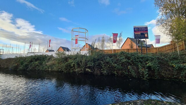
Gorton Lower Reservoir is a man-made body of water located in Gorton, a district in the city of Manchester, Lancashire, England. Originally built in the 19th century as a source of drinking water for the growing population of Manchester, the reservoir now serves as a recreational area and wildlife habitat.

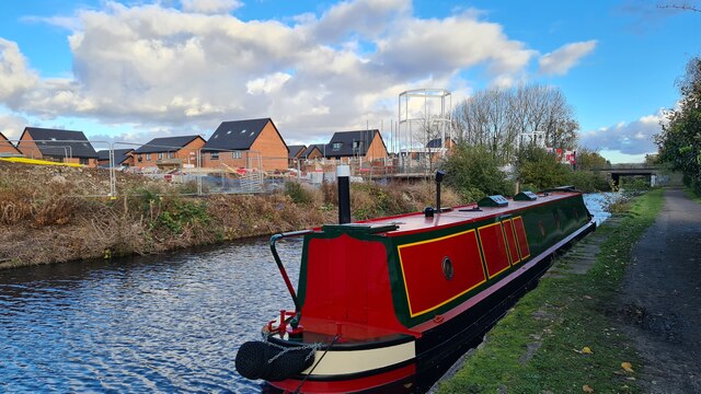
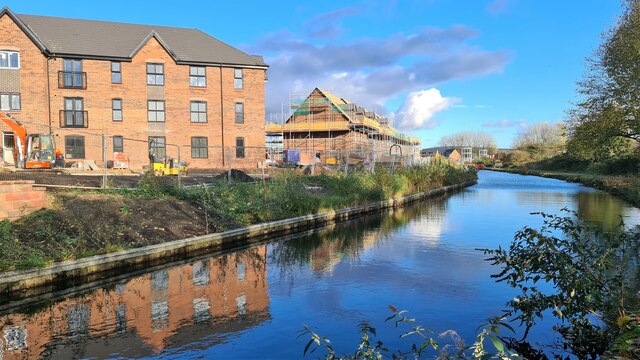
Covering an area of approximately 10 hectares, Gorton Lower Reservoir is surrounded by lush greenery and offers a tranquil escape from the bustling city. The reservoir is primarily fed by rainfall and runoff from the surrounding land, ensuring a constant supply of freshwater. The water is relatively calm and still, making it suitable for activities such as fishing and boating.

The reservoir is home to a variety of aquatic species, including fish, waterfowl, and amphibians. Anglers can find a diverse range of fish species in the waters, including carp, bream, perch, and roach. The abundance of vegetation around the reservoir provides an ideal habitat for various bird species, such as ducks, swans, and herons.

The surrounding area of Gorton Lower Reservoir features well-maintained walking paths and picnic areas, making it a popular spot for locals and visitors to enjoy a leisurely stroll or have a relaxing picnic. The reservoir also offers opportunities for nature enthusiasts and birdwatchers to observe the diverse wildlife that inhabits the area.

Overall, Gorton Lower Reservoir combines natural beauty with recreational amenities, providing a peaceful retreat where visitors can enjoy the tranquility of a freshwater environment and immerse themselves in the natural splendor of Lancashire.

If you have any feedback on the listing, please let us know in the comments section below.

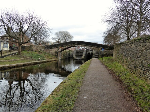
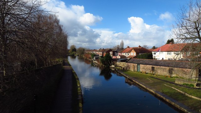
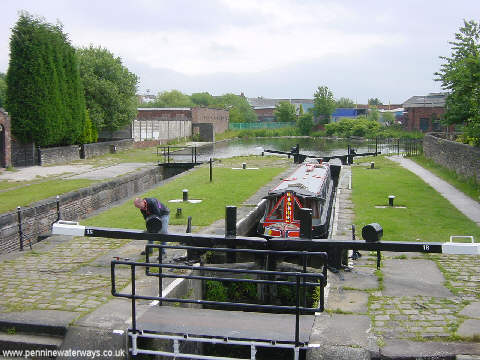
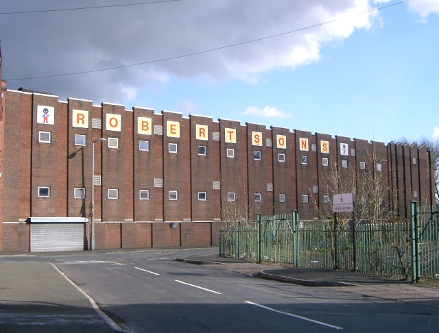
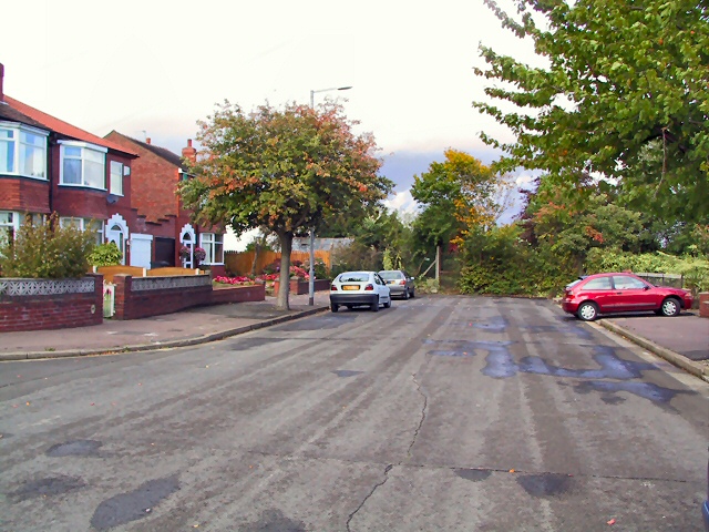
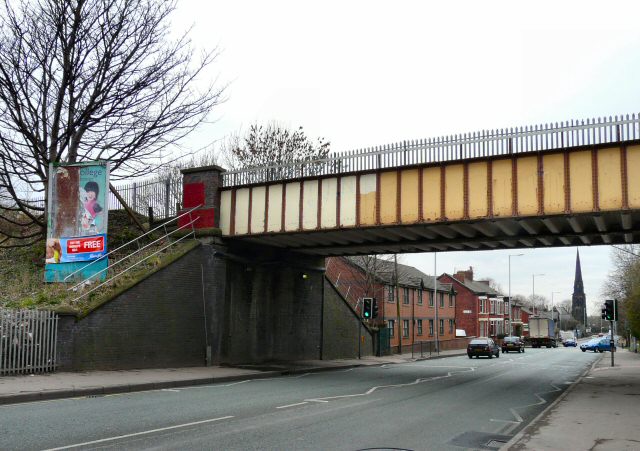
Gorton Lower Reservoir Images

Images are sourced within 2km of 53.461811/-2.1587255 or Grid Reference SJ8996. Thanks to Geograph Open Source API. All images are credited.

Marmalade and the Orangery at the Jam Factory Taylor Wimpey new homes going up on site of former Robertson's Jam factory
Marmalade and the Orangery at the Jam Factory
Taylor Wimpey new homes going up on site of former Robertson's Jam factory
Marmalade and the Orangery at the Jam Factory Taylor Wimpey new homes going up on site of former Robertson's Jam factory beside the Ashton Canal
Marmalade and the Orangery at the Jam Factory
Taylor Wimpey new homes going up on site of former Robertson's Jam factory beside the Ashton Canal
New build housing at Fairfield Beside Ashton Canal
New build housing at Fairfield
Beside Ashton Canal
Old District Bank branch? Looks like their old shield eroding above the door
Old District Bank branch?
Looks like their old shield eroding above the door
Jamaica Footbridge Over the Ashton Canal and in front of Lock No.18
Jamaica Footbridge
Over the Ashton Canal and in front of Lock No.18
Ashton Canal west of Fairfield Junction, Droylsden
Fairfield Locks, Droylsden At one time, the locks on the Ashton Canal were so busy that a pair of locks was necessary here. Above the locks, the canal turns to the right at the former junction with the Hollinwood Branch Canal.
Fairfield Locks, Droylsden
At one time, the locks on the Ashton Canal were so busy that a pair of locks was necessary here. Above the locks, the canal turns to the right at the former junction with the Hollinwood Branch Canal.
Robertsons Jam Factory - Ashton Hill The home of Robertsons Jam in Droylsden
Robertsons Jam Factory - Ashton Hill
The home of Robertsons Jam in Droylsden
Audenshaw Reservoir
Audenshaw Reservoir
Fairfield Locks - Droylsden
St Anne, Higher Openshaw - Roman Catholic
Audenshaw Trough Bears the inscription -"THE RIGHTEOUS MAN REGARDETH THE LIFE OF HIS BEAST"
This trough was placed at the junction of Manchester Road and Audenshaw Road, Audenshaw in 1879 and is made of polished granite. At that time cattle and horses were still regular users of the highways and a Miss M Asworth had the trough installed for their well-being.
Adjacent to it is an old passenger tram electricity transformer.
Audenshaw Trough
Bears the inscription -"THE RIGHTEOUS MAN REGARDETH THE LIFE OF HIS BEAST" This trough was placed at the junction of Manchester Road and Audenshaw Road, Audenshaw in 1879 and is made of polished granite. At that time cattle and horses were still regular users of the highways and a Miss M Asworth had the trough installed for their well-being. Adjacent to it is an old passenger tram electricity transformer.
Cul-de-Sac Beyond the gate in the hedge at the bottom of Kingsdale Road lies Allot Gardens, at the edge of Denton Golf Club.
Cul-de-Sac
Beyond the gate in the hedge at the bottom of Kingsdale Road lies Allot Gardens, at the edge of Denton Golf Club.
Gorton Upper Reservoir One of the reservoirs at Gorton built by Manchester Corporation to store water for the city. Looking north from SJ90219646.
Gorton Upper Reservoir
One of the reservoirs at Gorton built by Manchester Corporation to store water for the city. Looking north from SJ90219646.
Pill Box A pill box from the time of the Second World War by the side of Gorton Upper Reservoir. SJ90218642.
Pill Box
A pill box from the time of the Second World War by the side of Gorton Upper Reservoir. SJ90218642.
Fore! A golfer tees off on Fairfield Golf Course, close to the Gorton Reservoirs. SJ90329654.
Fore!
A golfer tees off on Fairfield Golf Course, close to the Gorton Reservoirs. SJ90329654.
Ashton Hill Lane, Droylsden. A view along Ashton Hill Lane, Droylsden. The Lazy Toad public house in the distance. SJ90428791.
Ashton Hill Lane, Droylsden.
A view along Ashton Hill Lane, Droylsden. The Lazy Toad public house in the distance. SJ90428791.
Fairfield Station, Tameside. Looking east along the line at Fairfield Station, Audenshaw, Tameside. SJ90439717.
Fairfield Station, Tameside.
Looking east along the line at Fairfield Station, Audenshaw, Tameside. SJ90439717.
Show me another place!

Gorton Lower Reservoir is located at Grid Ref: SJ8996 (Lat: 53.461811, Lng: -2.1587255)

Unitary Authority: Manchester

Police Authority: Greater Manchester

What 3 Words

///ballots.goes.ruins. Near Droylsden, Manchester

Related Wikis

Gorton Reservoirs

Gorton Reservoirs are two reservoirs on the boundary of Tameside and Manchester in the North West of England. They are Gorton Upper Reservoir and Gorton...
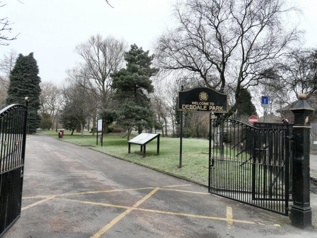
Debdale Park

Debdale Park is an inner-city park, located in the Gorton area of Manchester, England. At around 45 acres (18 ha), it is one of the largest inner-city...

Hyde Road railway station

Hyde Road was a railway station in Gorton, Manchester, England, on the Fallowfield Loop Line. It opened in 1892 and closed in 1958, when local passenger...

Gorton Heritage Trail

Gorton Heritage Trail is located approximately 3 miles from the centre of Manchester, England. The trail has been designed to promote and conserve the...

Wright Robinson College

Wright Robinson College is a coeducational secondary school in Abbey Hey, Gorton, Manchester, England.The college caters to pupils of all socio-economic...

Brookfield Unitarian Church

Brookfield Unitarian Church, Gorton, Manchester, England is a Victorian Gothic church. It is a member of the General Assembly of Unitarian and Free Christian...

Peacock Mausoleum

The Peacock Mausoleum is a Victorian Gothic memorial to Richard Peacock (1820–1889), engineer and Liberal MP for Manchester, and to his son, Joseph Peacock...

Limehurst Rural District

Limehurst was, from 1894 to 1954, a rural district in the administrative county of Lancashire, England. == History == Ashton-under-Lyne Rural Sanitary...

Nearby Amenities

Located within 500m of 53.461811,-2.1587255
Pub
Friendship Tavern
Lat/Long: 53.459198/-2.1633894
Telephone
Booth: KXPlus
Covered: booth
Operator: British Telecom
Lat/Long: 53.4583282/-2.1612686
Post Box
Brand: Royal Mail
Brand Wikidata: Q638098
Brand Wikipedia: en:Royal Mail
Operator: Royal Mail
Operator Wikidata: Q638098
Post Box Type: lamp
Lat/Long: 53.4581155/-2.161017
Bus Stop
Abbey Hey, Abbey Hey Lane / opposite High Bank
Bus: yes
Naptan AtcoCode: 1800EB34841
Naptan Bearing: E
Naptan CommonName: Abbey Hey Lane/High Bank
Naptan Indicator: Maisonettes
Naptan Landmark: FLATS
Naptan NaptanCode: manajgpj
Naptan PlusbusZoneRef: MNCRPIC
Naptan ShortCommonName: High Bank
Naptan Street: ABBEY HEY LANE
Naptan Verified: no
Network: TfGM
Operator: TfGM
Public Transport: platform
Source: naptan_import
Lat/Long: 53.4644394/-2.1646682
Bus Stop
Reddish Bridge, Hyde Road / Reddish Lane (Stop A)
Bus: yes
Local Ref: A
Naptan AtcoCode: 1800EB36981
Naptan Bearing: NW
Naptan CommonName: Hyde Road/Reddish Lane (Stop A)
Naptan Indicator: Stop A
Naptan Landmark: DRYCLEANERS
Naptan NaptanCode: manajmpa
Naptan PlusbusZoneRef: MNCRPIC
Naptan ShortCommonName: Reddish Lane
Naptan Street: HYDE ROAD
Naptan Verified: no
Network: TfGM
Operator: TfGM
Public Transport: platform
Ref: A
Source: naptan_import
Lat/Long: 53.4584654/-2.1615095
Bus Stop
Debdale Park, Hyde Road / near Tanyard Brow
Bus: yes
Naptan AtcoCode: 1800EB36991
Naptan Bearing: SE
Naptan CommonName: Hyde Road/Tanyard Brow
Naptan Indicator: Opp House 774
Naptan Landmark: GYM
Naptan NaptanCode: manajmpd
Naptan Notes: INDICATOR AMENDED
Naptan PlusbusZoneRef: MNCRPIC
Naptan ShortCommonName: Tanyard Brow
Naptan Street: HYDE ROAD
Naptan Verified: no
Network: TfGM
Operator: TfGM
Public Transport: platform
Source: naptan_import
Lat/Long: 53.4593775/-2.1632435
Bus Stop
Reddish Bridge, Hyde Road / Debdale Park (Stop B)
Bus: yes
Local Ref: B
Naptan AtcoCode: 1800EB38631
Naptan Bearing: E
Naptan CommonName: Hyde Road/Debdale Park (Stop B)
Naptan Indicator: Stop B
Naptan Landmark: DEBDALE PARK
Naptan NaptanCode: manajmpt
Naptan PlusbusZoneRef: MNCRPIC
Naptan ShortCommonName: Debdale Park
Naptan Street: HYDE ROAD
Naptan Verified: no
Network: TfGM
Operator: TfGM
Public Transport: platform
Ref: B
Source: naptan_import
Lat/Long: 53.4580916/-2.1593724
Bus Stop
Debdale Park, Hyde Road / opposite Clumber Road
Bench: yes
Bin: yes
Bus: yes
Naptan AtcoCode: 1800EB38651
Naptan Bearing: W
Naptan CommonName: Hyde Road/Clumber Road
Naptan Indicator: Adj House 886
Naptan Landmark: HOUSE 886
Naptan NaptanCode: manajmta
Naptan PlusbusZoneRef: MNCRPIC
Naptan ShortCommonName: Clumber Road
Naptan Street: HYDE ROAD
Naptan Verified: no
Network: TfGM
Operator: TfGM
Public Transport: platform
Shelter: yes
Source: naptan_import
Tactile Paving: no
Lat/Long: 53.4577714/-2.1567657
Traffic Signals
Lat/Long: 53.4580859/-2.1600048
Turning Circle
Lat/Long: 53.4648505/-2.1631603
Turning Circle
Lat/Long: 53.463592/-2.1619207
Turning Circle
Lat/Long: 53.465264/-2.1609051
Turning Circle
Lat/Long: 53.4647974/-2.1609674
Turning Circle
Lat/Long: 53.458648/-2.1539648
Turning Circle
Lat/Long: 53.4589512/-2.1531067
Barrier: bollard
Bollard: fixed
Lat/Long: 53.4599199/-2.1612385
Leisure: slipway
Lat/Long: 53.4600381/-2.1607659
Barrier: kissing_gate
Bicycle: no
Foot: yes
Horse: no
Motor Vehicle: no
Lat/Long: 53.4591677/-2.1608573
Turning Circle
Source: Bing
Lat/Long: 53.4620102/-2.1631963
Traffic Signals
Lat/Long: 53.4578463/-2.1602719
Traffic Signals
Lat/Long: 53.4579308/-2.160017
Traffic Signals
Lat/Long: 53.4583161/-2.1605089
Traffic Signals
Lat/Long: 53.4583797/-2.1602025
Barrier: cycle_barrier
Bicycle: no
Foot: yes
Horse: no
Motor Vehicle: no
Lat/Long: 53.4589478/-2.1605938
Hyde Road Junction
Railway: junction
Lat/Long: 53.4633916/-2.160722
The Donkey Sanctuary
Addr City: Manchester
Addr Housename: Donkey Assisted Therapy Centre
Addr Postcode: M18 8RJ
Addr Street: Greenfold, Abbey Hey
Tourism: attraction
Lat/Long: 53.464761/-2.1562777
Holiday Inn Express Manchester East
Brand: Holiday Inn Express
Brand Wikidata: Q5880423
Brand Wikipedia: en:Holiday Inn Express
Tourism: hotel
Lat/Long: 53.4602803/-2.1625829
Barrier: bollard
Lat/Long: 53.4622064/-2.1621663
Barrier: cycle_barrier
Bicycle: dismount
Lat/Long: 53.4662168/-2.1602335
Access: no
Barrier: cycle_barrier
Bicycle: yes
Foot: yes
Lat/Long: 53.4633921/-2.1609577
Barrier: cycle_barrier
Bicycle: yes
Foot: yes
Motor Vehicle: no
Lat/Long: 53.463297/-2.1610482
Clyde Mount Guest House
Addr City: Manchester
Addr Country: GB
Addr Housenumber: 866
Addr Place: Debdale Park
Addr Postcode: M18 7LH
Addr Street: Hyde Road
Source: survey
Tourism: guest_house
Lat/Long: 53.457745/-2.1586585
Reddish Bridge
Is In: Gorton
Place: neighbourhood
Lat/Long: 53.4580134/-2.1602604
Traffic Signals
Crossing: traffic_signals
Traffic Signals: signal
Lat/Long: 53.4583977/-2.1604686
Traffic Signals
Traffic Signals: signal
Lat/Long: 53.4578433/-2.1603593
Traffic Signals
Traffic Signals: signal
Lat/Long: 53.4581165/-2.1603118
Traffic Signals
Traffic Signals: signal
Lat/Long: 53.4580189/-2.1602087
Barrier: kerb
Kerb: sidewalk
Tactile Paving: no
Wheelchair: no
Lat/Long: 53.4589099/-2.1606847
Barrier: cycle_barrier
Bicycle: yes
Foot: yes
Horse: no
Motor Vehicle: no
Lat/Long: 53.4574924/-2.1607223
Crossing
Crossing: marked
Lat/Long: 53.4578576/-2.1576453
Crossing
Crossing: marked
Lat/Long: 53.4577779/-2.1555009
Crossing
Crossing: marked
Lat/Long: 53.4581162/-2.1600954
Barrier: yes
Fixme: type of barrier
Lat/Long: 53.4579922/-2.1608217
Hyde Road
Historic Railway: station
Railway: site
Wikidata: Q5953738
Wikipedia: en:Hyde Road railway station
Lat/Long: 53.4596333/-2.1639674
Waste Basket
Lat/Long: 53.4630765/-2.163881
Barrier: bollard
Lat/Long: 53.4630317/-2.1638755
Bicycle Parking
Bicycle Parking: stands
Capacity: 6
Covered: no
Lat/Long: 53.4591264/-2.1616293
Charging Station
Ionity Manchester East
Access: yes
Brand: Ionity
Brand Wikidata: Q42717773
Capacity: 12
Fee: yes
Network: Ionity
Opening Hours: 24/7
Operator: Ionity
Socket Type2 Combo: 12
Socket Type2 Combo Output: 350 kW
Lat/Long: 53.4595306/-2.1621926
The data included in this document is from www.openstreetmap.org. The data is made available under ODbL.

Have you been to Gorton Lower Reservoir?

Leave your review of Gorton Lower Reservoir below (or comments, questions and feedback).