Trentham Lake

Lake, Pool, Pond, Freshwater Marsh in Staffordshire Stafford

England

Trentham Lake

New Road A new road under construction on the A53 near Tittensor
New Road Credit: Andy and Hilary

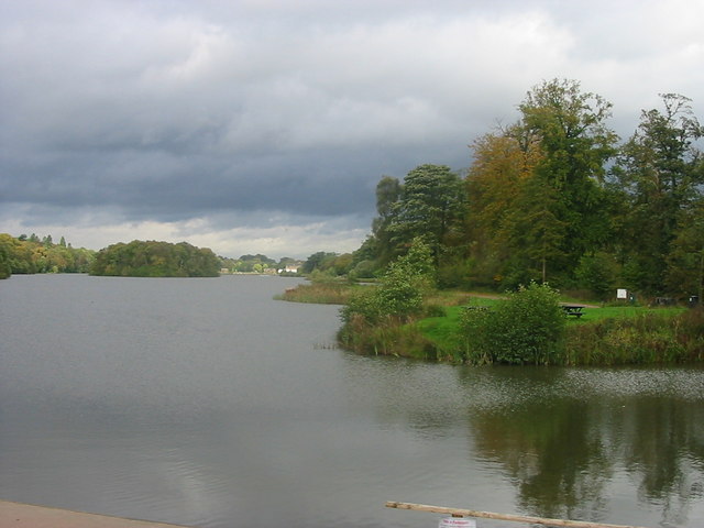
Trentham Lake is a picturesque freshwater body located in Staffordshire, England. With an area of approximately 120 acres, it is a prominent feature of the Trentham Estate, which is a popular tourist destination known for its stunning gardens and historical architecture.

The lake is believed to have originated in the 18th century when the landscape was redesigned by the renowned landscape architect Capability Brown. It was originally created as a decorative feature to enhance the beauty of the surrounding gardens and has since become a cherished natural attraction.

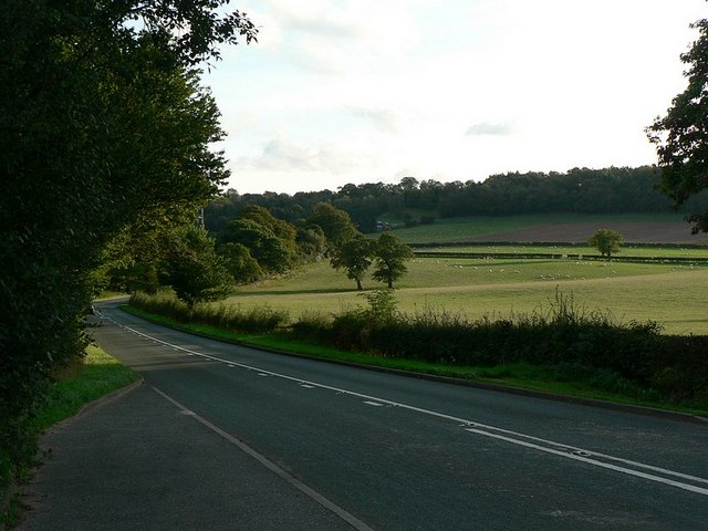
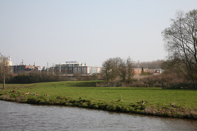
Trentham Lake is fed by the River Trent and is home to a diverse range of flora and fauna. The surrounding area consists of lush greenery, including trees, shrubs, and various water-loving plants. The lake's calm, crystal-clear waters provide a tranquil environment that attracts numerous bird species, including swans, ducks, geese, and herons. It is a popular spot for birdwatchers and wildlife enthusiasts.

Visitors can enjoy a leisurely stroll along the lakeside, taking in the serene views and observing the wildlife. Boating and fishing activities are also available, allowing visitors to engage more actively with the lake's offerings. A small pier provides a starting point for boat trips and serves as a convenient spot for fishing enthusiasts.

In summary, Trentham Lake is a captivating freshwater body nestled within the Trentham Estate. Its natural beauty, diverse wildlife, and recreational opportunities make it a must-visit destination for nature lovers and those seeking tranquility amidst Staffordshire's picturesque surroundings.

If you have any feedback on the listing, please let us know in the comments section below.

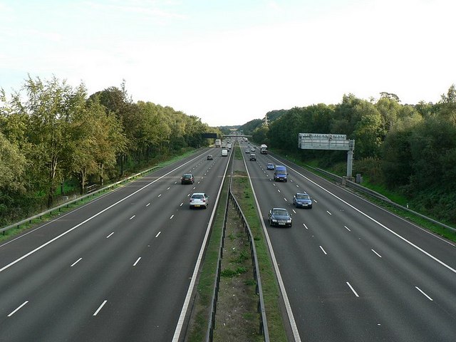
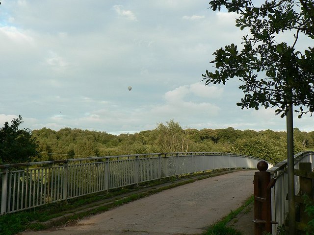
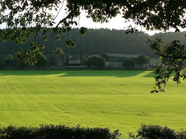
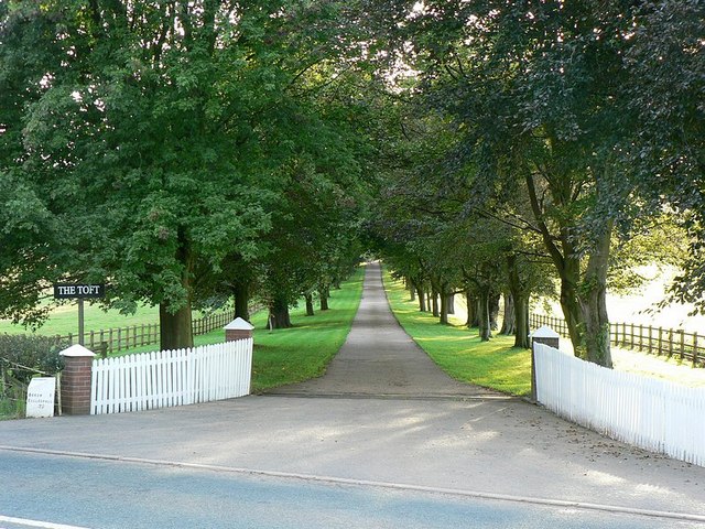
Trentham Lake Images

Images are sourced within 2km of 52.957187/-2.1991885 or Grid Reference SJ8639. Thanks to Geograph Open Source API. All images are credited.

New Road A new road under construction on the A53 near Tittensor
New Road
A new road under construction on the A53 near Tittensor
St Luke's Church St Luke's church Tittensor.
St Luke's Church
St Luke's church Tittensor.
Plenty more to harrow Looking across this field towards Kingswood Bank. The tractor is harrowing the field, working towards the camera.
Plenty more to harrow
Looking across this field towards Kingswood Bank. The tractor is harrowing the field, working towards the camera.
Bridge over the M6 This is the bridge just over a mile south of junction 15. It carries a track from the A519 towards Kings Wood.
Bridge over the M6
This is the bridge just over a mile south of junction 15. It carries a track from the A519 towards Kings Wood.
M6 looking south From the bridge <a href="https://www.geograph.org.uk/photo/250344">SJ8539 : Bridge over the M6</a>
M6 looking south
From the bridge SJ8539 : Bridge over the M6
Bridge over M6, with hot air balloon The bridge carries a lane from the A519 near The Toft towards Kings Wood
Bridge over M6, with hot air balloon
The bridge carries a lane from the A519 near The Toft towards Kings Wood
Stile to nowhere The bridge over the M6 has a gate which could swing across the entrance, the post is by the opposite rail. This stile should meet up with it, but the hinges seem to have seized up when I tried to move it.
See <a href="https://www.geograph.org.uk/photo/250670">SJ8539 : Bridge over M6, with hot air balloon</a>
Stile to nowhere
The bridge over the M6 has a gate which could swing across the entrance, the post is by the opposite rail. This stile should meet up with it, but the hinges seem to have seized up when I tried to move it. See SJ8539 : Bridge over M6, with hot air balloon
View across the fields to The Toft Late September afternoon. Taken from the A519 by the bridge over the M6.
View across the fields to The Toft
Late September afternoon. Taken from the A519 by the bridge over the M6.
Entrance to The Toft By the A519.
Entrance to The Toft
By the A519.
The A519 From Eccleshall to Newcastle-under-Lyme
The A519
From Eccleshall to Newcastle-under-Lyme
Trentham Lake From the southern tip of Trentham Gardens lake close to the Monkey Park. In the distance can be seen the recently refurbished Italien Gardens and what remains of Trentham Hall.
Trentham Lake
From the southern tip of Trentham Gardens lake close to the Monkey Park. In the distance can be seen the recently refurbished Italien Gardens and what remains of Trentham Hall.
Wedgwood Factory
Wedgwood Factory
Wedgwood Factory Buildings
Canal Bridge at Wedgwood.
Canal Bridge No. 104
Canalside View. A canalside view of the factory at Wedgwood.
Canalside View.
A canalside view of the factory at Wedgwood.
Canalside View of Wedgwood Factory.
Show me another place!

Trentham Lake is located at Grid Ref: SJ8639 (Lat: 52.957187, Lng: -2.1991885)

Administrative County: Staffordshire

District: Stafford

Police Authority: Staffordshire

What 3 Words

///deflection.crew.march. Near Barlaston, Staffordshire

Related Wikis

Trentham Estate

The Trentham Estate, in the village of Trentham, is a visitor attraction located on the southern fringe of the city of Stoke-on-Trent in Staffordshire...
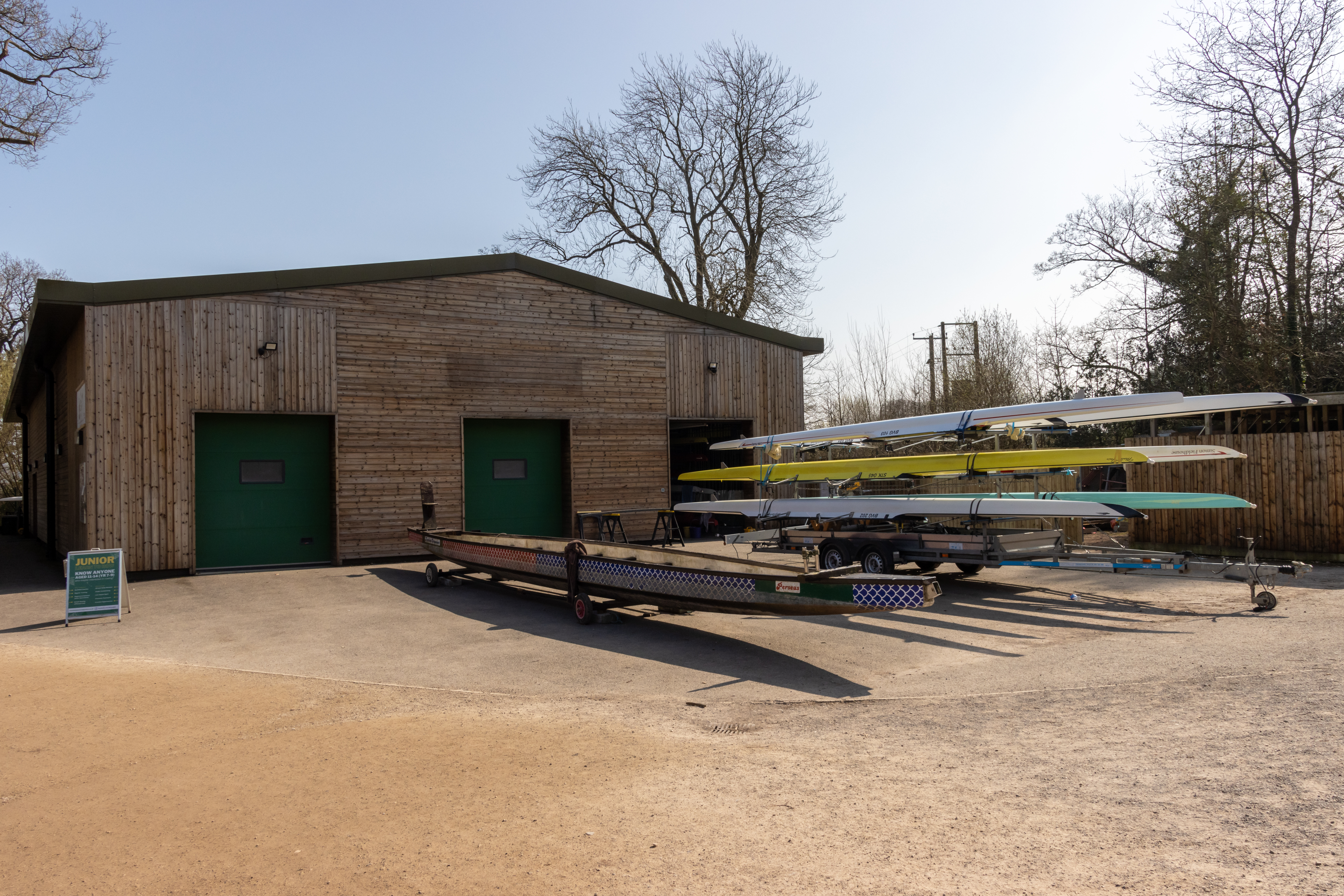
Trentham Boat Club

Trentham Boat Club is a rowing club based on Trentham Lake next to the River Trent, at Trentham Gardens Estate, Stone Road, Trentham, Stoke-on-Trent, Staffordshire...

Trentham Mausoleum

The Trentham Mausoleum is a Grade I listed mausoleum in Trentham, Stoke-on-Trent, built as the final resting place of the Dukes of Sutherland from the...

Trentham, Staffordshire

Trentham () is a suburb of the city of Stoke-on-Trent in North Staffordshire, England, south-west of the city centre and south of the neighbouring town...

Hem Heath

Hem Heath is a district of Stoke-on-Trent just south of the Bet365 Stadium. The nature reserve Hem Heath Woods is nearby.

Trentham Gardens railway station

Trentham Gardens railway station (originally named Trentham Park) was the last station built by the North Staffordshire Railway (NSR) and was the terminus...

Hanford, Staffordshire

Hanford is an area in Stoke-on-Trent near to Trent Vale. == References ==

Trentham Academy

Trentham Academy (formerly Trentham High School) is a coeducational secondary school located in the village of Trentham in Stoke-on-Trent, Staffordshire...

Nearby Amenities

Located within 500m of 52.957187,-2.1991885
Railway: turntable
Lat/Long: 52.9560847/-2.1972954
Bench
Lat/Long: 52.9603939/-2.1990233
Railway: switch
Lat/Long: 52.9609098/-2.1990203
Railway: switch
Lat/Long: 52.9608286/-2.1989459
Railway: switch
Lat/Long: 52.9609797/-2.1992044
Railway: switch
Lat/Long: 52.961022/-2.1992961
Railway: buffer_stop
Lat/Long: 52.9560313/-2.1972731
Railway: crossing
Lat/Long: 52.9608126/-2.1989432
Power: pole
Lat/Long: 52.9548431/-2.1946482
Power: pole
Lat/Long: 52.9568146/-2.1966698
Power: pole
Lat/Long: 52.9561972/-2.1960373
Power: pole
Lat/Long: 52.9554218/-2.1952222
Milestone
Trentham
Direction: both
Historic: milestone
Lat/Long: 52.9590169/-2.1941218
Power: pole
Lat/Long: 52.9541081/-2.1939131
Historic Barrier: gate
Lat/Long: 52.959398/-2.2038426
Noexit: yes
Lat/Long: 52.9564855/-2.2057656
Historic Barrier: gate
Lat/Long: 52.9587039/-2.2054786
Historic Barrier: gate
Lat/Long: 52.9572467/-2.204237
Ferry Terminal
Lat/Long: 52.9607887/-2.1997668
Bench
Lat/Long: 52.9541831/-2.2000123
Power: pole
Transformer: distribution
Lat/Long: 52.9595742/-2.1963854
Bench
Lat/Long: 52.96159/-2.1988029
Bench
Lat/Long: 52.9577908/-2.1980398
Bench
Lat/Long: 52.9576956/-2.1979783
Tourism: picnic_site
Lat/Long: 52.9546339/-2.1968614
Bench
Lat/Long: 52.9551229/-2.2006431
Bench
Lat/Long: 52.9546554/-2.2003297
Stag Bettles
Tourism: artwork
Lat/Long: 52.9550533/-2.2007409
Bench
Lat/Long: 52.9597741/-2.2038624
Acorn
Artwork Type: sculpture
Tourism: artwork
Lat/Long: 52.9596222/-2.2041639
Barrier: kissing_gate
Lat/Long: 52.9590227/-2.2058718
Barrier: cattle_grid
Lat/Long: 52.9590321/-2.2058396
Tourism: information
Lat/Long: 52.9607289/-2.1993326
Toilets
Access: private
Lat/Long: 52.9609389/-2.1995217
Power: pole
Lat/Long: 52.9574009/-2.197333
Power: pole
Lat/Long: 52.9582055/-2.1970121
Bench
Lat/Long: 52.9614372/-2.1997989
Operator: Trentham Leisure
Public Transport: station
Railway: station
Usage: tourism
Lat/Long: 52.9607275/-2.1989333
Tourism: artwork
Lat/Long: 52.9577221/-2.198242
Public Transport: station
Railway: station
Usage: tourism
Lat/Long: 52.956173/-2.1973282
Bench
Lat/Long: 52.9547402/-2.1969102
Bench
Lat/Long: 52.9549428/-2.1970083
Power: pole
Lat/Long: 52.9592232/-2.1965461
Noexit: yes
Lat/Long: 52.9604617/-2.1970523
Noexit: yes
Lat/Long: 52.9615454/-2.1978295
Waste Basket
Lat/Long: 52.9535411/-2.1954745
Snowdrops
Artwork Type: sculpture
Tourism: artwork
Lat/Long: 52.9534366/-2.1954603
Waste Basket
Lat/Long: 52.9536337/-2.1991535
Leisure: picnic_table
Lat/Long: 52.9536196/-2.1991161
Waste Basket
Lat/Long: 52.9556186/-2.2008627
Bench
Lat/Long: 52.958635/-2.2054956
Man Made: utility_pole
Utility: telecom
Lat/Long: 52.958845/-2.2056928
Bench
Fairy
Artwork Type: sculpture
Material: metal
Tourism: artwork
Lat/Long: 52.9599164/-2.2045224
Lounger
Material: wood
Lat/Long: 52.9598439/-2.2040049
Lounger
Material: wood
Lat/Long: 52.9598348/-2.2039815
Lounger
Material: wood
Lat/Long: 52.9598268/-2.2039673
Street Lamp
Lat/Long: 52.956883/-2.1937739
Street Lamp
Lat/Long: 52.9565867/-2.1936288
Street Lamp
Lat/Long: 52.956285/-2.1934908
Street Lamp
Lat/Long: 52.9563553/-2.1931015
Street Lamp
Lat/Long: 52.958708/-2.1939721
Street Lamp
Lat/Long: 52.9584192/-2.1939686
Street Lamp
Lat/Long: 52.9584128/-2.1943207
Street Lamp
Lat/Long: 52.9587134/-2.1943172
Street Lamp
Lat/Long: 52.9580908/-2.1942906
Street Lamp
Lat/Long: 52.9577859/-2.1942004
Street Lamp
Lat/Long: 52.9574821/-2.1940783
Street Lamp
Lat/Long: 52.9575376/-2.1936907
Street Lamp
Lat/Long: 52.9578328/-2.193781
Street Lamp
Lat/Long: 52.9581132/-2.1938783
Street Lamp
Lat/Long: 52.959014/-2.1939633
Street Lamp
Lat/Long: 52.9590278/-2.1943083
Street Lamp
Lat/Long: 52.9596365/-2.193919
Street Lamp
Lat/Long: 52.959645/-2.194257
Direction: 185
Traffic Sign: yes
Lat/Long: 52.9597282/-2.1940712
Street Lamp
Lat/Long: 52.9593293/-2.1939324
Street Lamp
Lat/Long: 52.959342/-2.1942709
Street Lamp
Lat/Long: 52.9550909/-2.1928758
Marker: post
Utility: gas
Lat/Long: 52.9542618/-2.2034371
Marker: yes
Utility: gas
Lat/Long: 52.9550384/-2.20425
Bench
Lat/Long: 52.9530621/-2.2017322
Crossing
Crossing: unmarked
Tactile Paving: no
Lat/Long: 52.9614599/-2.1969331
Crossing
Crossing: unmarked
Tactile Paving: no
Lat/Long: 52.9607021/-2.1966299
The data included in this document is from www.openstreetmap.org. The data is made available under ODbL.

Have you been to Trentham Lake?

Leave your review of Trentham Lake below (or comments, questions and feedback).