Hurcott Pool

Lake, Pool, Pond, Freshwater Marsh in Worcestershire Wyre Forest

England

Hurcott Pool

Open farmland, east of Kidderminster. Picture taken from the minor road at SO8513 76982, looking south-east towards Offmore Farm, visible on the right of the photograph. Lack of public access limits the scope of recording geographical features within this square.
Open farmland, east of Kidderminster. Credit: Martyn B

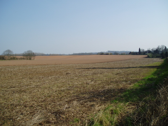
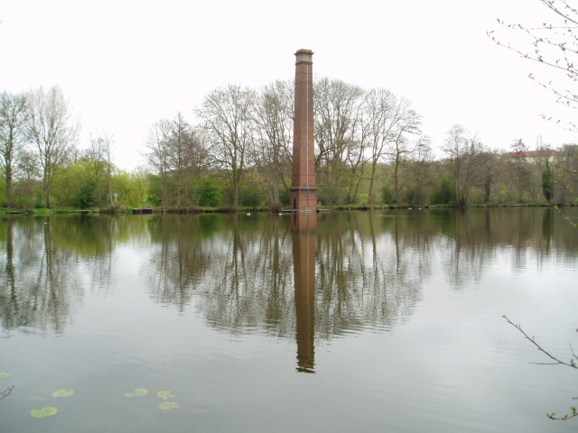
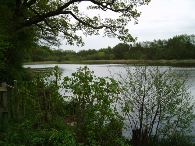
Hurcott Pool is a picturesque freshwater lake located in the county of Worcestershire, England. Situated near the village of Hurcott, the pool covers an area of approximately 5 acres and is a popular destination for both locals and tourists alike.

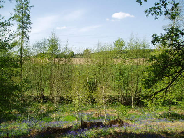
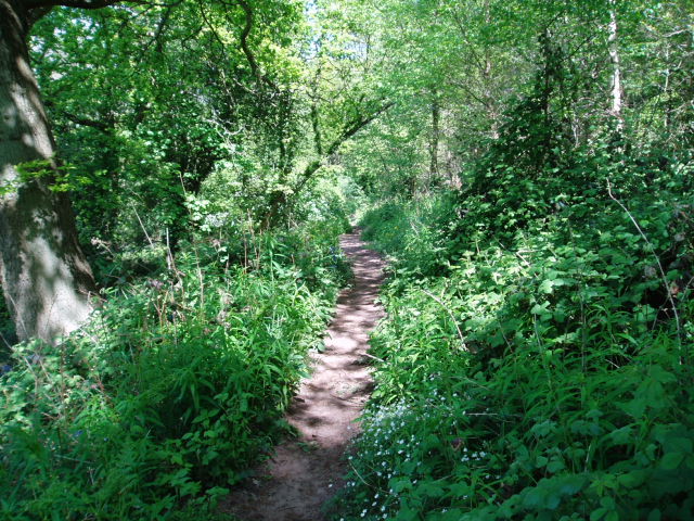
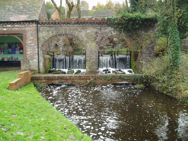
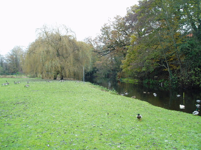
Surrounded by lush greenery and tranquil countryside, Hurcott Pool offers a serene and peaceful atmosphere. The pool is nestled within a natural landscape, encompassing a diverse range of habitats including marshes, woodlands, and meadows. This makes it an important site for biodiversity and a haven for various species of flora and fauna.

The clear, freshwater of Hurcott Pool attracts a wide array of bird species, making it a paradise for birdwatchers. Visitors can spot a variety of waterfowl such as mallards, coots, and swans, as well as rarer species like herons and kingfishers. The pool also serves as a breeding ground for amphibians, including frogs and newts, which can be seen during certain seasons.

Aside from its ecological significance, Hurcott Pool offers recreational activities for visitors. Anglers are drawn to the pool for its abundance of fish, including carp, perch, and pike. Fishing permits are available for those interested in trying their hand at catching a prize specimen.

Overall, Hurcott Pool provides a harmonious blend of natural beauty and wildlife. Its idyllic surroundings make it a perfect spot for nature lovers, photographers, and those seeking a tranquil retreat in the heart of Worcestershire.

If you have any feedback on the listing, please let us know in the comments section below.

Hurcott Pool Images

Images are sourced within 2km of 52.398896/-2.2175904 or Grid Reference SO8577. Thanks to Geograph Open Source API. All images are credited.

Open farmland, east of Kidderminster. Picture taken from the minor road at SO8513 76982, looking south-east towards Offmore Farm, visible on the right of the photograph. Lack of public access limits the scope of recording geographical features within this square.
Open farmland, east of Kidderminster.
Picture taken from the minor road at SO8513 76982, looking south-east towards Offmore Farm, visible on the right of the photograph. Lack of public access limits the scope of recording geographical features within this square.
Stack Pool, Kidderminster The chimney built at the edge of the pool can be identified on the 1:25,000 map as the small dot on the north bank of the main pool. Picture taken from SO 83389 77754.
Stack Pool, Kidderminster
The chimney built at the edge of the pool can be identified on the 1:25,000 map as the small dot on the north bank of the main pool. Picture taken from SO 83389 77754.
Hurcott Pool Picture taken from SO 85164 77937, the car park at the west end of the pool, looking east.
Hurcott Pool
Picture taken from SO 85164 77937, the car park at the west end of the pool, looking east.
Around Dunclent, Mount Segg Public access is limited to a footpath across the south-east corner of this square, thus limiting photographic opportunities. The picture is taken from the public footpath at SO 86912 76245, looking north across the farmland towards the southern tip of Bissell Wood.
Around Dunclent, Mount Segg
Public access is limited to a footpath across the south-east corner of this square, thus limiting photographic opportunities. The picture is taken from the public footpath at SO 86912 76245, looking north across the farmland towards the southern tip of Bissell Wood.
Mount Segg Taken from the same location as the main picture at SO 86912 76245, looking north-east along the footpath through woodland at Mount Segg
Mount Segg
Taken from the same location as the main picture at SO 86912 76245, looking north-east along the footpath through woodland at Mount Segg
Broadwaters Mill Broadwaters Mill is situated immediately adjacent to the A449 trunk road, at the foot of the grid square. Picture taken from SO 84138 78036.
Broadwaters Mill
Broadwaters Mill is situated immediately adjacent to the A449 trunk road, at the foot of the grid square. Picture taken from SO 84138 78036.
Broadwaters Mill pool The picture shows the feeder pool situated to the east of Broadwaters Mill. Taken from SO 84166 78026.
Broadwaters Mill pool
The picture shows the feeder pool situated to the east of Broadwaters Mill. Taken from SO 84166 78026.
Kidderminster  Victoria cricket club Tickets were sold for matches through this hole.
Kidderminster Victoria cricket club
Tickets were sold for matches through this hole.
Lea Hall Castle or maybe just a gatehouse? This gatehouse was the entrance to Lea Castle. The mansion was built by local ironmaster Edward Knight in 1818 but was sadly pulled down in 1945. It is a prominent landmark for users of the A449 between Wolverhampton and Kidderminster.
Lea Hall Castle or maybe just a gatehouse?
This gatehouse was the entrance to Lea Castle. The mansion was built by local ironmaster Edward Knight in 1818 but was sadly pulled down in 1945. It is a prominent landmark for users of the A449 between Wolverhampton and Kidderminster.
Park Hall, Blakedown
Ploughed field near Blakedown This ploughed field is opposite Woodhouse Farm.
Ploughed field near Blakedown
This ploughed field is opposite Woodhouse Farm.
Waggon Lane Waggon Lane goes to Churchill.
Waggon Lane
Waggon Lane goes to Churchill.
Field of Oil Seed Rape near Cookley The last day of March and the Oil Seed Rape crop is starting to blossom.
Field of Oil Seed Rape near Cookley
The last day of March and the Oil Seed Rape crop is starting to blossom.
Staffordshire and Worcestershire Canal near Kidderminster
Hurcott and pool, Worcestershire
Hurcott Wood, Worcestershire
Trees, Greenhill My attention was drawn to these interlocking trees.
Trees, Greenhill
My attention was drawn to these interlocking trees.
Show me another place!

Hurcott Pool is located at Grid Ref: SO8577 (Lat: 52.398896, Lng: -2.2175904)

Administrative County: Worcestershire

District: Wyre Forest

Police Authority: West Mercia

What 3 Words

///librarian.safe.frock. Near Kidderminster, Worcestershire

Related Wikis

Chester Road North Ground, Kidderminster

The Chester Road North Ground, often referred to simply as Chester Road or Kidderminster, is a cricket ground in Kidderminster, Worcestershire, England...

The Shrubbery, Kidderminster

The Shrubbery is a former military installation in Kidderminster, Worcestershire. It is a Grade II listed building. == History == The building is an early...

Axborough

Axborough is a low wooded hill east of Cookley in north Worcestershire, England. == History == Its Saxon name meant hassock grass barrow. This does not...

Holy Trinity School, Kidderminster

Holy Trinity School is a co-educational free school located in Kidderminster, Worcestershire, England, offering education to children from 4 years up to...
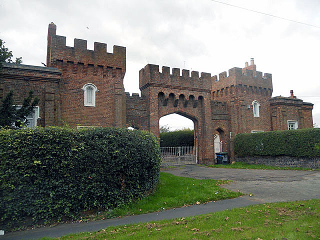
Lea Castle, England

Lea Castle is a ruined Grade II listed Neo Gothic mock castle mansion near Wolverley, England. == History == Lea Castle was built by Edward Knight in 1762...

Heathfield Knoll School

Heathfield Knoll School and First Steps Day Nursery is a small, independent, non-denominational day school and day nursery in Wolverley, near Kidderminster...

St George's Church, Kidderminster

St George's Church, Kidderminster is a Church of England parish church in Kidderminster, Worcestershire, England. The church is a Grade II* listed building...

Wyre Forest (UK Parliament constituency)

Wyre Forest is a county constituency represented in the House of Commons of the Parliament of the United Kingdom. It elects one Member of Parliament...

Nearby Amenities

Located within 500m of 52.398896,-2.2175904
Post Box
Postal Code: DY10
Ref: DY10 231
Source: GPS Survey
Lat/Long: 52.398063/-2.2212825
Board Type: wildlife
Description: About Grebes birds
Information: board
Tourism: information
Lat/Long: 52.3996755/-2.216492
Barrier: kissing_gate
Foot: yes
Source: gps_survey
Lat/Long: 52.3993414/-2.2193032
Bicycle Parking
Capacity: 10
Source: gps_survey
Lat/Long: 52.3994097/-2.2197742
Board Type: nature
Description: Map of area
Information: board
Source: gps_survey
Tourism: information
Lat/Long: 52.3993577/-2.2195064
Bench
Backrest: yes
Material: wood
Lat/Long: 52.3997351/-2.2163024
Bench
Backrest: yes
Material: wood
Lat/Long: 52.3997506/-2.2163651
Waterway: weir
Lat/Long: 52.3991141/-2.2198355
The data included in this document is from www.openstreetmap.org. The data is made available under ODbL.

Have you been to Hurcott Pool?

Leave your review of Hurcott Pool below (or comments, questions and feedback).