Stack Pools

Lake, Pool, Pond, Freshwater Marsh in Worcestershire Wyre Forest

England

Stack Pools

Stack Pool, Kidderminster The chimney built at the edge of the pool can be identified on the 1:25,000 map as the small dot on the north bank of the main pool. Picture taken from SO 83389 77754.
Stack Pool, Kidderminster Credit: Martyn B

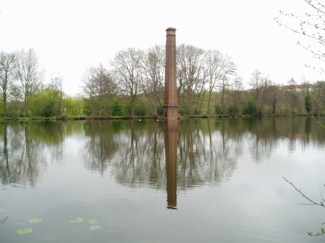
Stack Pools, located in Worcestershire, is a captivating area featuring a combination of lakes, pools, ponds, and freshwater marshes. Situated amidst picturesque surroundings, this natural habitat is renowned for its diverse ecosystem and scenic beauty.

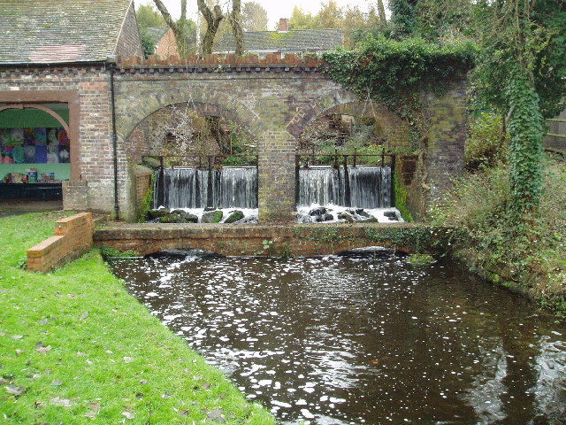
The main attraction of Stack Pools is its series of interconnected bodies of water. The area encompasses several lakes, ranging in size from small to medium, which are intermingled with shallow pools and ponds. This variety of water bodies creates a unique environment that supports a wide range of flora and fauna.

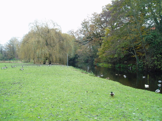
The lakes in Stack Pools are known for their crystal-clear, freshwater. They are home to various species of fish, including perch, pike, and roach, making it an ideal spot for anglers. Additionally, the lakes attract a plethora of birdlife, such as swans, ducks, and herons, making it a popular destination for birdwatchers and nature enthusiasts.

The pools and ponds in Stack Pools provide a habitat for amphibians, including frogs and newts. These smaller water bodies are also frequented by dragonflies and other insects, adding to the biodiversity of the area.

The freshwater marshes in Stack Pools are teeming with aquatic plants and provide a sanctuary for numerous species of waterfowl. These marshes are characterized by their lush vegetation, including reeds, rushes, and water lilies, creating a serene and tranquil atmosphere.

Visitors to Stack Pools can enjoy various outdoor activities, such as fishing, birdwatching, and walking along the scenic trails that traverse the area. The peaceful ambiance, coupled with the stunning natural scenery, make Stack Pools a favored destination for both locals and tourists alike, seeking to immerse themselves in the beauty of Worcestershire's natural landscapes.

If you have any feedback on the listing, please let us know in the comments section below.
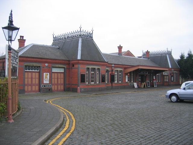
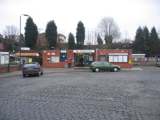
Stack Pools Images

Images are sourced within 2km of 52.398097/-2.2448345 or Grid Reference SO8377. Thanks to Geograph Open Source API. All images are credited.

Stack Pool, Kidderminster The chimney built at the edge of the pool can be identified on the 1:25,000 map as the small dot on the north bank of the main pool. Picture taken from SO 83389 77754.
Stack Pool, Kidderminster
The chimney built at the edge of the pool can be identified on the 1:25,000 map as the small dot on the north bank of the main pool. Picture taken from SO 83389 77754.
Kidderminster Kidderminster Lock on the Staffordshire and Worcestershire Canal.
Kidderminster
Kidderminster Lock on the Staffordshire and Worcestershire Canal.
Wolverley Lock A picturesque spot by the lock on the Staffordshire and Worcestershire Canal
Wolverley Lock
A picturesque spot by the lock on the Staffordshire and Worcestershire Canal
Limekiln Bridge, Staffs & Worcs. Canal, Kidderminster Any evidence of a Limekiln has long since vanished, and clearly, the bridge has enjoyed better days. Some of the upper brickwork on both sides has been replaced by the rather unattractive metal sheeting.
Limekiln Bridge, Staffs & Worcs. Canal, Kidderminster
Any evidence of a Limekiln has long since vanished, and clearly, the bridge has enjoyed better days. Some of the upper brickwork on both sides has been replaced by the rather unattractive metal sheeting.
Kidderminster Lock 2005 It is interesting to compare this shot with David's, taken some 15 years earlier. A great deal of time and money has been recently been spent improving the overall condition of the canal and towpath in this area. The electricity sub-station looks uncannily similar to how it did all those years ago.
Kidderminster Lock 2005
It is interesting to compare this shot with David's, taken some 15 years earlier. A great deal of time and money has been recently been spent improving the overall condition of the canal and towpath in this area. The electricity sub-station looks uncannily similar to how it did all those years ago.
Kidderminster Taken from the minor road at SO 83515 76309, the photograph depicts the view looking north-west across the town centre of Kidderminster. This is a view which has changed considerably over the past four years during which time some of the former carpet factories have made way for new retail developments. Much of the town’s layout  differs from its current representation on the OS map : the bus station and law courts now occupy different sites, and the river has been re-routed in order to accommodate a super-market car park.
Kidderminster
Taken from the minor road at SO 83515 76309, the photograph depicts the view looking north-west across the town centre of Kidderminster. This is a view which has changed considerably over the past four years during which time some of the former carpet factories have made way for new retail developments. Much of the town’s layout differs from its current representation on the OS map : the bus station and law courts now occupy different sites, and the river has been re-routed in order to accommodate a super-market car park.
Brookside Cottages in Wolverley
Dilapidated warehouse Situated just outside the newly developed part of Kidderminster, this dilapidated warehouse patiently awaits its fate. Refurbishment perhaps, a renovated exterior housing state of the art offices, or the final death knell, demolition, to make way for housing ? Watch this space !
Dilapidated warehouse
Situated just outside the newly developed part of Kidderminster, this dilapidated warehouse patiently awaits its fate. Refurbishment perhaps, a renovated exterior housing state of the art offices, or the final death knell, demolition, to make way for housing ? Watch this space !
Kidderminster Magistrates Court The new Magistrates Court building is situated in Comberton Place, just below the Severn Valley Railway station.
Kidderminster Magistrates Court
The new Magistrates Court building is situated in Comberton Place, just below the Severn Valley Railway station.
Broadwaters Mill Broadwaters Mill is situated immediately adjacent to the A449 trunk road, at the foot of the grid square. Picture taken from SO 84138 78036.
Broadwaters Mill
Broadwaters Mill is situated immediately adjacent to the A449 trunk road, at the foot of the grid square. Picture taken from SO 84138 78036.
Broadwaters Mill pool The picture shows the feeder pool situated to the east of Broadwaters Mill. Taken from SO 84166 78026.
Broadwaters Mill pool
The picture shows the feeder pool situated to the east of Broadwaters Mill. Taken from SO 84166 78026.
Kidderminster Town Station This is the southern terminus of the Severn Valley Railway <span class="nowrap"><a title="http://www.svr.org.uk" rel="nofollow ugc noopener" href="http://www.svr.org.uk">Link</a><img style="margin-left:2px;" alt="External link" title="External link - shift click to open in new window" src="https://s1.geograph.org.uk/img/external.png" width="10" height="10"/></span> , not to be confused with the more modest affair next door <a href="https://www.geograph.org.uk/photo/118927">SO8376 : Kidderminster (Network Rail) Station</a> .  Despite appearances the station building was only constructed in 1986 and is a classic Great Western Railway design modelled on the now closed Ross on Wye station <span class="nowrap"><a title="http://www.ross-on-wye.com/index.php?page=ross_541-Old_pictures_and_photos_from_Ross&pg=1" rel="nofollow ugc noopener" href="http://www.ross-on-wye.com/index.php?page=ross_541-Old_pictures_and_photos_from_Ross&pg=1">Link</a><img style="margin-left:2px;" alt="External link" title="External link - shift click to open in new window" src="https://s1.geograph.org.uk/img/external.png" width="10" height="10"/></span> on the former Gloucester to Hereford line. Details such as the roof crestings and the porte cochere (the canopy over the entrance) have been added over the years through the work of The Friends of Kidderminster Station <span class="nowrap"><a title="http://www.kfriends.org.uk" rel="nofollow ugc noopener" href="http://www.kfriends.org.uk">Link</a><img style="margin-left:2px;" alt="External link" title="External link - shift click to open in new window" src="https://s1.geograph.org.uk/img/external.png" width="10" height="10"/></span> .  Extension work is currently in progress by the SVR to extend the station building with another wing and a canopy over the concourse <a href="https://www.geograph.org.uk/photo/118931">SO8376 : Building work at Kidderminster Town Station</a>.
Kidderminster Town Station
This is the southern terminus of the Severn Valley Railway LinkExternal link , not to be confused with the more modest affair next door SO8376 : Kidderminster (Network Rail) Station . Despite appearances the station building was only constructed in 1986 and is a classic Great Western Railway design modelled on the now closed Ross on Wye station LinkExternal link on the former Gloucester to Hereford line. Details such as the roof crestings and the porte cochere (the canopy over the entrance) have been added over the years through the work of The Friends of Kidderminster Station LinkExternal link . Extension work is currently in progress by the SVR to extend the station building with another wing and a canopy over the concourse SO8376 : Building work at Kidderminster Town Station.
Kidderminster (Network Rail) Station The small modern building on the main line at Kidderminster.  This replaced a grand black and white timber framed building which was demolished in the 1960s as being beyond repair. Looking at the modern replacement building it is hardly surprising that it is not unknown for intending passengers to mistakenly go to the much more traditional Severn Valley Railway station <a href="https://www.geograph.org.uk/photo/118920">SO8376 : Kidderminster Town Station</a> next door to try and by their main line tickets!
Kidderminster (Network Rail) Station
The small modern building on the main line at Kidderminster. This replaced a grand black and white timber framed building which was demolished in the 1960s as being beyond repair. Looking at the modern replacement building it is hardly surprising that it is not unknown for intending passengers to mistakenly go to the much more traditional Severn Valley Railway station SO8376 : Kidderminster Town Station next door to try and by their main line tickets!
Building work at Kidderminster Town Station Work in progress to build a second wing to the SVR <span class="nowrap"><a title="http://www.svr.org.uk" rel="nofollow ugc noopener" href="http://www.svr.org.uk">Link</a><img style="margin-left:2px;" alt="External link" title="External link - shift click to open in new window" src="https://s1.geograph.org.uk/img/external.png" width="10" height="10"/></span> station building (seen from the front in <a href="https://www.geograph.org.uk/photo/118920">SO8376 : Kidderminster Town Station</a>) and to add a traditional Great Western Railway style canopy covering the concourse area within. The next stage of construction can be seen in <a href="https://www.geograph.org.uk/photo/134319">SO8376 : New Canopy at Kidderminster Town Station</a>
Building work at Kidderminster Town Station
Work in progress to build a second wing to the SVR LinkExternal link station building (seen from the front in SO8376 : Kidderminster Town Station) and to add a traditional Great Western Railway style canopy covering the concourse area within. The next stage of construction can be seen in SO8376 : New Canopy at Kidderminster Town Station
Kidderminster Town Station forecourt A few of the incidental items in the forecourt of <a href="https://www.geograph.org.uk/photo/118920">SO8376 : Kidderminster Town Station</a>.  The blue shed was a coal merchant's office as a reminder that until the new station was constructed in the early 1980s, this was actually the goods & coalyard of Kidderminster main line station.  The green Bundy time clock was originally used on the Birmingham Tramways for accurate time recording and was once a common sight at strategic points on the streets around the network.  The example was moved here and recommissioned on this site by The Friends of Kidderminster Station <span class="nowrap"><a title="http://www.kfriends.org.uk/" rel="nofollow ugc noopener" href="http://www.kfriends.org.uk/">Link</a><img style="margin-left:2px;" alt="External link" title="External link - shift click to open in new window" src="https://s1.geograph.org.uk/img/external.png" width="10" height="10"/></span> in 2001.
Kidderminster Town Station forecourt
A few of the incidental items in the forecourt of SO8376 : Kidderminster Town Station. The blue shed was a coal merchant's office as a reminder that until the new station was constructed in the early 1980s, this was actually the goods & coalyard of Kidderminster main line station. The green Bundy time clock was originally used on the Birmingham Tramways for accurate time recording and was once a common sight at strategic points on the streets around the network. The example was moved here and recommissioned on this site by The Friends of Kidderminster Station LinkExternal link in 2001.
Wrangaton Signal Box The signal box formerly at Wrangaton SX680574 on the ex-GWR West of England main line was carefully dismantled after closure and is now being faithfully reconstructed at the Kidderminster Railway Museum as an example of a typical GWR signal box.
Wrangaton Signal Box
The signal box formerly at Wrangaton SX680574 on the ex-GWR West of England main line was carefully dismantled after closure and is now being faithfully reconstructed at the Kidderminster Railway Museum as an example of a typical GWR signal box.
New Canopy at Kidderminster Town Station Erection work in progress on the new canopy over the SVR station concourse.  See <a href="https://www.geograph.org.uk/photo/118931">SO8376 : Building work at Kidderminster Town Station</a>
New Canopy at Kidderminster Town Station
Erection work in progress on the new canopy over the SVR station concourse. See SO8376 : Building work at Kidderminster Town Station
Chapel, Kidderminster cemetery
Show me another place!

Stack Pools is located at Grid Ref: SO8377 (Lat: 52.398097, Lng: -2.2448345)

Administrative County: Worcestershire

District: Wyre Forest

Police Authority: West Mercia

What 3 Words

///ticket.onions.jams. Near Kidderminster, Worcestershire

Related Wikis

Wyre Forest (UK Parliament constituency)

Wyre Forest is a county constituency represented in the House of Commons of the Parliament of the United Kingdom. It elects one Member of Parliament...

St George's Church, Kidderminster

St George's Church, Kidderminster is a Church of England parish church in Kidderminster, Worcestershire, England. The church is a Grade II* listed building...

St Mary and All Saints' Church, Kidderminster

St Mary and All Saints’ Church, Kidderminster is a Grade I listed Major Parish Church in the Church of England in Kidderminster, Worcestershire, England...

The Shrubbery, Kidderminster

The Shrubbery is a former military installation in Kidderminster, Worcestershire. It is a Grade II listed building. == History == The building is an early...

Holy Trinity School, Kidderminster

Holy Trinity School is a co-educational free school located in Kidderminster, Worcestershire, England, offering education to children from 4 years up to...

Heathfield Knoll School

Heathfield Knoll School and First Steps Day Nursery is a small, independent, non-denominational day school and day nursery in Wolverley, near Kidderminster...
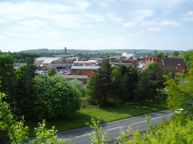
Kidderminster

Kidderminster is a market and historic minster town and civil parish in Worcestershire, England, 20 miles (32 km) south-west of Birmingham and 12 miles...

Municipal Borough of Kidderminster

The Municipal Borough of Kidderminster was a local government district in Worcestershire, that existed from 1835 to 1974. It was abolished in 1974 under...

Nearby Amenities

Located within 500m of 52.398097,-2.2448345
Bus Stop
Upton Road
Bus: yes
Naptan AtcoCode: 2000G108298
Naptan Bearing: N
Naptan CommonName: Upton Road
Naptan Indicator: adj
Naptan NaptanCode: wocdgjgd
Naptan PlusbusZoneRef: KDRMNST
Naptan Street: Upton Road
Naptan Verified: no
Public Transport: platform
Source: naptan_import
Lat/Long: 52.4015132/-2.2403921
Sion Hill
Naptan AtcoCode: 2000G198298
Naptan Bearing: E
Naptan BusStopType: CUS
Naptan CommonName: Sion Hill
Naptan Crossing: Usmere Road
Naptan Indicator: opp
Naptan NaptanCode: wocgpdpd
Naptan PlusbusZoneRef: KDRMNST
Naptan Street: Upton Road
Naptan Verified: no
Source: naptan_import
Lat/Long: 52.4006443/-2.2388293
Bus Stop
Springfield Lane
Bus: yes
Naptan AtcoCode: 2000G502368
Naptan Bearing: N
Naptan CommonName: Springfield Lane
Naptan Crossing: Springfield Lane
Naptan Indicator: adj
Naptan NaptanCode: wocdmdgd
Naptan PlusbusZoneRef: KDRMNST
Naptan Street: Stourbridge Road
Naptan Verified: no
Public Transport: platform
Source: naptan_import
Lat/Long: 52.3965355/-2.2433338
Bus Stop
Springfield Lane
Bus: yes
Naptan AtcoCode: 2000G502369
Naptan Bearing: S
Naptan CommonName: Springfield Lane
Naptan Crossing: Springfield Lane
Naptan Indicator: opp
Naptan NaptanCode: wocdmdgj
Naptan PlusbusZoneRef: KDRMNST
Naptan Street: Stourbridge Road
Naptan Verified: no
Public Transport: platform
Source: naptan_import
Lat/Long: 52.3966354/-2.242864
Bus Stop
Sladen Middle School
Bench: no
Bin: yes
Bus: yes
Lit: yes
Naptan AtcoCode: 2000G610006
Naptan Bearing: E
Naptan CommonName: Sladen Middle School
Naptan Indicator: Adj
Naptan Landmark: School Entrance
Naptan NaptanCode: wocdjwdj
Naptan PlusbusZoneRef: KDRMNST
Naptan Street: Hurcott Road
Naptan Verified: no
Public Transport: platform
Shelter: no
Source: naptan_import
Tactile Paving: no
Lat/Long: 52.3940485/-2.2417329
Mini Roundabout
Direction: clockwise
Lat/Long: 52.395909/-2.2480766
Post Box
Operator: Royal Mail
Source: gps_survey
Lat/Long: 52.3971596/-2.2427598
Post Box
Operator: Royal Mail
Source: gps_survey
Lat/Long: 52.3963136/-2.248254
Barrier: kissing_gate
Source: gps_survey
Lat/Long: 52.398253/-2.2432596
Ford: yes
Lat/Long: 52.398968/-2.2434755
Theatre
The Rose Theatre
Source: survey
Wheelchair: yes
Lat/Long: 52.3984677/-2.2374933
Larkhill
Place: village
Source: NPTG
Lat/Long: 52.3958366/-2.2451777
Foxholes
Place: village
Source: NPTG
Lat/Long: 52.3964097/-2.2391989
Grit Bin
Access: private
Note: Number 135
Source: GPS Survey
Lat/Long: 52.3970817/-2.2396705
Grit Bin
Access: private
Source: GPS Survey
Lat/Long: 52.3974644/-2.2383323
Barrier: bollard
Bicycle: permissive
Foot: yes
Source: survey
Lat/Long: 52.3951576/-2.2441754
Grit Bin
Note: Number 144
Source: GPS Survey
Lat/Long: 52.3962073/-2.2433333
Fast Food
Eurasia
Cuisine: indian
Source: GPS Survey
Lat/Long: 52.3936566/-2.2456729
Horsefair Supermarket
Shop: convenience
Source: GPS Survey
Lat/Long: 52.3938543/-2.2455467
Grit Bin
Access: private
Note: Number 140
Lat/Long: 52.3953876/-2.2482718
Barrier: bollard
Bicycle: yes
Foot: yes
Horse: yes
Lat/Long: 52.3948973/-2.2446018
Grit Bin
Access: private
Source: gps_survey
Lat/Long: 52.3949059/-2.2445939
Turning Circle
Source: gps_survey
Lat/Long: 52.3965542/-2.2404801
Power: substation
Source: GPS Survey
Lat/Long: 52.3957051/-2.2413696
Waterway: turning_point
Lat/Long: 52.3985436/-2.2462664
Generator Method: photovoltaic
Generator Output Electricity: yes
Generator Source: solar
Generator Type: solar_photovoltaic_panel
Location: roof
Power: generator
Lat/Long: 52.3956077/-2.245196
Bench
Lat/Long: 52.3998207/-2.2468755
Generator Method: photovoltaic
Generator Output Electricity: yes
Generator Source: solar
Generator Type: solar_photovoltaic_panel
Location: roof
Power: generator
Lat/Long: 52.3972769/-2.2421631
Generator Method: photovoltaic
Generator Output Electricity: yes
Generator Source: solar
Generator Type: solar_photovoltaic_panel
Location: roof
Power: generator
Lat/Long: 52.3973931/-2.2442016
Generator Method: photovoltaic
Generator Output Electricity: yes
Generator Source: solar
Generator Type: solar_photovoltaic_panel
Location: roof
Power: generator
Lat/Long: 52.3963341/-2.2456527
Generator Method: photovoltaic
Generator Output Electricity: yes
Generator Source: solar
Generator Type: solar_photovoltaic_panel
Location: roof
Power: generator
Lat/Long: 52.3965027/-2.2450465
Generator Method: photovoltaic
Generator Output Electricity: yes
Generator Source: solar
Generator Type: solar_photovoltaic_panel
Location: roof
Power: generator
Lat/Long: 52.395362/-2.2457278
Generator Method: photovoltaic
Generator Output Electricity: yes
Generator Source: solar
Generator Type: solar_photovoltaic_panel
Location: roof
Power: generator
Lat/Long: 52.3953947/-2.2456259
Generator Method: photovoltaic
Generator Output Electricity: yes
Generator Source: solar
Generator Type: solar_photovoltaic_panel
Location: roof
Power: generator
Lat/Long: 52.3972196/-2.2499067
Generator Method: photovoltaic
Generator Output Electricity: yes
Generator Source: solar
Generator Type: solar_photovoltaic_panel
Location: roof
Power: generator
Lat/Long: 52.3952998/-2.2406423
Generator Method: photovoltaic
Generator Output Electricity: yes
Generator Source: solar
Generator Type: solar_photovoltaic_panel
Location: roof
Power: generator
Lat/Long: 52.3953423/-2.2406825
Generator Method: photovoltaic
Generator Output Electricity: yes
Generator Source: solar
Generator Type: solar_photovoltaic_panel
Location: roof
Power: generator
Lat/Long: 52.3953439/-2.240586
Generator Method: photovoltaic
Generator Output Electricity: yes
Generator Source: solar
Generator Type: solar_photovoltaic_panel
Location: roof
Power: generator
Lat/Long: 52.3947907/-2.240999
Generator Method: photovoltaic
Generator Output Electricity: yes
Generator Source: solar
Generator Type: solar_photovoltaic_panel
Location: roof
Power: generator
Lat/Long: 52.3948006/-2.2408944
Fountain
Lat/Long: 52.3981496/-2.244031
Entrance: main
Lat/Long: 52.3965475/-2.2434965
Playground: swing
Lat/Long: 52.3970944/-2.2476107
Material: steel
Playground: slide
Lat/Long: 52.396587/-2.2481069
Material: wood
Playground: climbingframe
Lat/Long: 52.3968759/-2.2483858
Waste Basket
Lat/Long: 52.3998533/-2.24678
Bench
Lat/Long: 52.399117/-2.2462279
Waterway: weir
Lat/Long: 52.398961/-2.2440945
The data included in this document is from www.openstreetmap.org. The data is made available under ODbL.

Have you been to Stack Pools?

Leave your review of Stack Pools below (or comments, questions and feedback).