Trimpley Reservoir

Lake, Pool, Pond, Freshwater Marsh in Worcestershire Wyre Forest

England

Trimpley Reservoir

Upper Arley village and the river Severn Seen across the River Severn. The ramp on the far bank was the slipway to the former ferry, now replaced by a footbridge just out of shot to the right.
Upper Arley village and the river Severn Credit: David Stowell

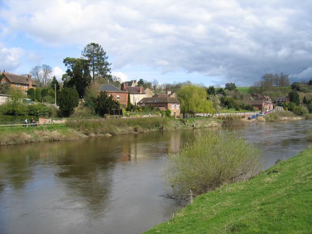
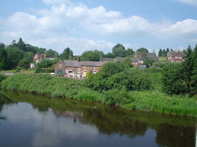
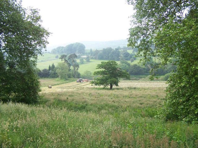
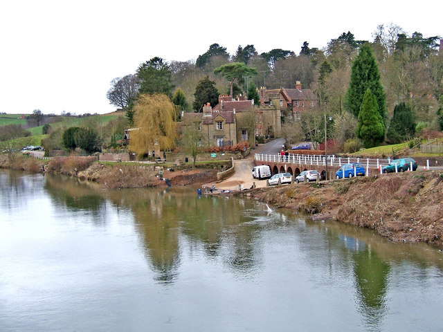
Trimpley Reservoir, located in Worcestershire, England, is a picturesque freshwater body known for its scenic beauty and recreational opportunities. This reservoir is situated within the Severn Valley, just south of the village of Trimpley, and covers an area of approximately 84 acres.

Originally constructed in the 1960s, Trimpley Reservoir was built to supply water to the nearby River Severn and its surrounding areas. The reservoir is fed by several natural springs and streams that flow into its waters, ensuring a constant supply of freshwater. It serves as a vital source of drinking water for the local community.

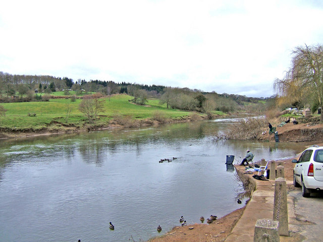
The reservoir is surrounded by lush greenery and offers stunning views of the surrounding countryside. It is a popular spot for outdoor activities such as fishing, boating, and birdwatching. Anglers can find a variety of fish species, including pike, perch, roach, and bream, making it a prime location for fishing enthusiasts.

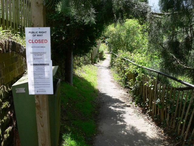
Trimpley Reservoir is also home to an array of wildlife, making it a haven for nature lovers. The surrounding marshes provide a suitable habitat for various bird species, including herons, kingfishers, and ducks. Visitors often enjoy taking leisurely walks along the reservoir's scenic trails, immersing themselves in the peaceful surroundings and spotting the diverse flora and fauna.

Overall, Trimpley Reservoir offers a tranquil escape from the bustling city life, providing a serene environment for outdoor enthusiasts and nature lovers alike. With its natural beauty and recreational opportunities, it continues to be a cherished destination in Worcestershire.

If you have any feedback on the listing, please let us know in the comments section below.

Trimpley Reservoir Images

Images are sourced within 2km of 52.406577/-2.338445 or Grid Reference SO7778. Thanks to Geograph Open Source API. All images are credited.

Upper Arley village and the river Severn Seen across the River Severn. The ramp on the far bank was the slipway to the former ferry, now replaced by a footbridge just out of shot to the right.
Upper Arley village and the river Severn
Seen across the River Severn. The ramp on the far bank was the slipway to the former ferry, now replaced by a footbridge just out of shot to the right.
Upper Arley Taken from the bridge over the river Severn
Upper Arley
Taken from the bridge over the river Severn
St. Peter, Upper Arley
Upper Arley
Upper Arley
Severn Valley Near Upper Arley
Village Store, Upper Arley
Upper Arley and River Severn The view from the footbridge, with the slipway from the former ferry.
Upper Arley and River Severn
The view from the footbridge, with the slipway from the former ferry.
Upper Arley Flood damage from the River Severn is visible next to the road. Viewed from the footbridge across the river.
Upper Arley
Flood damage from the River Severn is visible next to the road. Viewed from the footbridge across the river.
Closed due to flood damage This is the Severn Way public footpath at Upper Arley, closed due to part of the path being washed away at: <a href="https://www.geograph.org.uk/photo/493484">SO7679 : Severn Way flood damage</a>
Closed due to flood damage
This is the Severn Way public footpath at Upper Arley, closed due to part of the path being washed away at: SO7679 : Severn Way flood damage
Footbridge Crossing the River Severn at Upper Arley.
Footbridge
Crossing the River Severn at Upper Arley.
Severn Way at Upper Arley Public footpath as it enters Upper Arley.
Severn Way at Upper Arley
Public footpath as it enters Upper Arley.
Upper Arley from the SVR station
Upper Arley (1980)
Upper Arley (1980)
Upper Arley village road on embankment The unclassified road which serves the small village of Upper Arley is carried along a raised embankment at this point where it passes the small harbour.  Today the village is in Worcestershire but a long time ago it was actually in Staffordshire.
Upper Arley village road on embankment
The unclassified road which serves the small village of Upper Arley is carried along a raised embankment at this point where it passes the small harbour. Today the village is in Worcestershire but a long time ago it was actually in Staffordshire.
Footbridge over the River Severn There is no longer a ferry across the river at Upper Arley but instead the river can be crossed by foot using this bridge.  You can also wheel a cycle over it, but it is too narrow for 4 wheeled vehicles.  The bridge usefully links the picturesque village of Upper Arley to both Arley station on the Severn Valley Railway and to The Harbour Inn, there being no public house in the village itself.
Footbridge over the River Severn
There is no longer a ferry across the river at Upper Arley but instead the river can be crossed by foot using this bridge. You can also wheel a cycle over it, but it is too narrow for 4 wheeled vehicles. The bridge usefully links the picturesque village of Upper Arley to both Arley station on the Severn Valley Railway and to The Harbour Inn, there being no public house in the village itself.
Upper Arley village seen from the river footbridge This view shows the village of Upper Arley and the River Severn as seen from the nearby footbridge crossing the river.
Upper Arley village seen from the river footbridge
This view shows the village of Upper Arley and the River Severn as seen from the nearby footbridge crossing the river.
River Severn seen from village of Upper Arley This view shows the River Severn, complete with a few anglers, as seen from the village of Upper Arley.
River Severn seen from village of Upper Arley
This view shows the River Severn, complete with a few anglers, as seen from the village of Upper Arley.
Show me another place!

Trimpley Reservoir is located at Grid Ref: SO7778 (Lat: 52.406577, Lng: -2.338445)

Administrative County: Worcestershire

District: Wyre Forest

Police Authority: West Mercia

What 3 Words

///crackled.carpets.clubbing. Near Bewdley, Worcestershire

Related Wikis

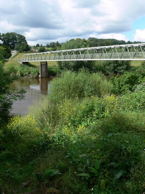
Victoria Bridge, Worcestershire

The Victoria Bridge crosses the River Severn between Arley and Bewdley in Worcestershire, England. At the time of its construction, the 200-foot railway...

Shatterford Hill

Shatterford Hill is an English geographical feature that extends from Bewdley in north Worcestershire to Birdsgreen near Alveley, just over the border...

Arley railway station

Arley railway station is a station on the Severn Valley Railway heritage line in Worcestershire, situated just over the River Severn from the village of...

Pound Green

Pound Green is a hamlet in Upper Arley, Worcestershire, England. It has a number of tourist landmarks such as Ye Olde New Inn and a village hall that also...

Northwood Halt railway station

Northwood Halt is an unstaffed request stop on the Severn Valley Railway in Worcestershire, situated a little to the north of Bewdley on the outskirts...

Upper Arley

Upper Arley (grid reference SO765805) is a village and civil parish near Kidderminster in the Wyre Forest District of Worcestershire, England. Historically...

Arley House and Gardens

Arley House and Gardens are situated at Upper Arley, about 4 miles (6.4 km) north-west of Bewdley, in Worcestershire, England. The gardens, arboretum and...

Button Oak

Button Oak is a small village in the English county of Shropshire, England. It is 3 miles north west of Bewdley. Button Oak is very similar to nearby...

Related Videos

Walking the Severn Way - Arley to Highley 7.5 mile loop.

A 7.5 mile riverside walk following the Severn Way from Arley. The route follows the river upstream to Highley where you can take ...

Our Family Day Out 👨‍👩‍👦 | How we spent our Bank Holiday Long Weekend 🙂

This is how we spent our day at Arley, Worcestershire. We did garden walk, picnic, play and train spotting. #TheMogosanus ...

Nearby Amenities

Located within 500m of 52.406577,-2.338445
Trimpley Reservoir Site
Naptan AtcoCode: 2000G610004
Naptan Bearing: W
Naptan BusStopType: CUS
Naptan CommonName: Trimpley Reservior
Naptan Indicator: adj
Naptan Landmark: Trimpley Reservior
Naptan NaptanCode: wocdpmdp
Naptan Street: Road End
Naptan Verified: no
Source: naptan_import
Lat/Long: 52.4103241/-2.3343994
Railway: crossing
Lat/Long: 52.4066117/-2.3329162
Bench
Backrest: yes
Lat/Long: 52.4065703/-2.3357876
Bench
Backrest: yes
Lat/Long: 52.4054289/-2.3382767
Information: map
Tourism: information
Lat/Long: 52.4075269/-2.3437398
Bench
Source: survey;gps
Lat/Long: 52.4053668/-2.3335567
The data included in this document is from www.openstreetmap.org. The data is made available under ODbL.

Have you been to Trimpley Reservoir?

Leave your review of Trimpley Reservoir below (or comments, questions and feedback).