Milk Pot

Lake, Pool, Pond, Freshwater Marsh in Roxburghshire

Scotland

Milk Pot

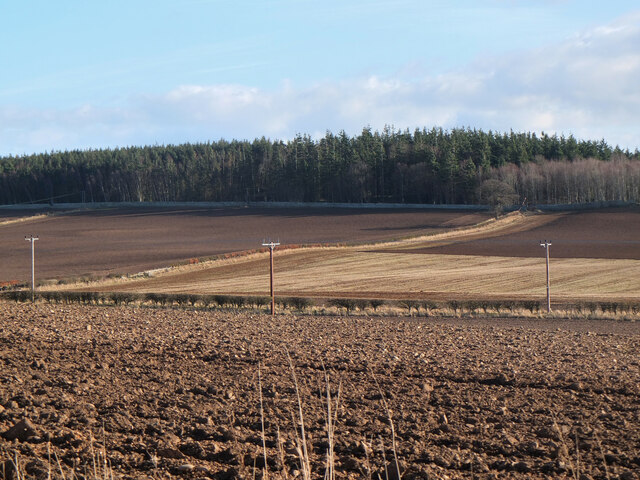
Minor road from Sprouston A minor road up through farmland to meet the B6396. Even after midday, there was still some frost on the road in the shadow of the woodland.
Minor road from Sprouston Credit: Jim Barton

Milk Pot is a picturesque freshwater marsh located in Roxburghshire, Scotland. Nestled amidst lush greenery and rolling hills, this enchanting natural formation is a true gem for nature enthusiasts and visitors seeking tranquility.

Covering an area of approximately 5 acres, Milk Pot is predominantly characterized by its calm and serene waters. It can be classified as a combination of a lake, pool, pond, and freshwater marsh due to its unique ecosystem. The marshy surroundings are home to a vast array of plant and animal species, making it a haven for biodiversity.

The water in Milk Pot is sourced from natural springs and rainwater, ensuring its pristine quality. The marshland is abundant with aquatic vegetation such as reeds, rushes, and water lilies, providing an ideal habitat for numerous species of birds, amphibians, and insects. Birdwatchers will be delighted to spot a variety of waterfowl including swans, ducks, and herons that frequent the area.

Visitors can explore Milk Pot by foot along the designated pathways that wind through the marsh, offering stunning views of the surrounding landscape. The area is well-maintained, with benches strategically placed for visitors to relax and immerse themselves in the tranquil ambiance.

Milk Pot is also a popular spot for recreational activities such as fishing and boating. Anglers can try their luck in catching brown trout, perch, and pike that inhabit the waters. However, it is important to adhere to local fishing regulations and obtain the necessary permits.

In conclusion, Milk Pot in Roxburghshire is a captivating freshwater marsh that showcases the beauty of Scotland's natural landscapes. Its lush vegetation, diverse wildlife, and serene waters make it a must-visit destination for those seeking a peaceful retreat in the heart of nature.

If you have any feedback on the listing, please let us know in the comments section below.

Milk Pot Images

Images are sourced within 2km of 55.612387/-2.393085 or Grid Reference NT7535. Thanks to Geograph Open Source API. All images are credited.

Minor road from Sprouston A minor road up through farmland to meet the B6396. Even after midday, there was still some frost on the road in the shadow of the woodland.
Minor road from Sprouston
A minor road up through farmland to meet the B6396. Even after midday, there was still some frost on the road in the shadow of the woodland.
Minor road from Sprouston (2) A straight road between neat hedges in the farmland rising to the south of the Tweed near Kelso.
Minor road from Sprouston (2)
A straight road between neat hedges in the farmland rising to the south of the Tweed near Kelso.
Minor road from Sprouston (3) The view across the Tweed valley opens out, here including the monument to James Thomson, author of the words of 'Rule Britannia', visible as the stone obelisk above the trees L of centre.
Minor road from Sprouston (3)
The view across the Tweed valley opens out, here including the monument to James Thomson, author of the words of 'Rule Britannia', visible as the stone obelisk above the trees L of centre.
Road to Kersquarter At the junction with the minor road up from Sprouston.
Road to Kersquarter
At the junction with the minor road up from Sprouston.
Farmland above the Tweed A glimpse of the river from the road to Windywalls.
Farmland above the Tweed
A glimpse of the river from the road to Windywalls.
Farmland at Ferneyhill Ploughed fields to the NE of Kelso with the plantation on Tan Law beyond.
Farmland at Ferneyhill
Ploughed fields to the NE of Kelso with the plantation on Tan Law beyond.
Minor  road  junction  on  A698  east  of  Kelso The stone wall to the left is the Hendersyde Park Estate. The minor road goes up to Hendersyde Farm, with the brown tourist sign advertising Self Catering
Minor road junction on A698 east of Kelso
The stone wall to the left is the Hendersyde Park Estate. The minor road goes up to Hendersyde Farm, with the brown tourist sign advertising Self Catering
Hendersyde  Park  East  Lodge  entrance on A698 The East Lodge was built c1840 using stone from the Hendersyde quarry
Hendersyde Park East Lodge entrance on A698
The East Lodge was built c1840 using stone from the Hendersyde quarry
Sprouston Parish Church The church was built in 1781 on the site of a previous building. The external harled walls have recently been repainted.
Sprouston Parish Church
The church was built in 1781 on the site of a previous building. The external harled walls have recently been repainted.
Great mullein (Verbascum thapsus) This tall erect biennial plant with light yellow flowers is also known as Aaron’s Rod. This photo was taken in Sprouston Parish Churchyard.
Great mullein (Verbascum thapsus)
This tall erect biennial plant with light yellow flowers is also known as Aaron’s Rod. This photo was taken in Sprouston Parish Churchyard.
Great mullein (Verbascum thapsus) For a wider view of the plant in Sprouston Parish Churchyard; see <a href="https://www.geograph.org.uk/photo/7532227">NT7535 : Great mullein (Verbascum thapsus)</a>.
Great mullein (Verbascum thapsus)
For a wider view of the plant in Sprouston Parish Churchyard; see NT7535 : Great mullein (Verbascum thapsus).
Inside Sprouston Parish Church This is a view down a central aisle with pews either side towards the chancel. The church is usually closed but I was lucky when someone arrived to put a notice up inside the vestibule and I was kindly allowed in.
Inside Sprouston Parish Church
This is a view down a central aisle with pews either side towards the chancel. The church is usually closed but I was lucky when someone arrived to put a notice up inside the vestibule and I was kindly allowed in.
A stained glass window at Sprouston Parish Church This window on the south wall is dedicated to John Agnew Findlay, a former minister of the church between 1891 and 1901.
A stained glass window at Sprouston Parish Church
This window on the south wall is dedicated to John Agnew Findlay, a former minister of the church between 1891 and 1901.
A symbolic gravestone at Sprouston Parish Churchyard This 18th century stone displays symbols of mortality and immortality. The skull, crossed bones and horizontal hourglass are symbols of mortality, while the winged soul at the head of the stone and the flower at the lower right are symbols of immortality.
A symbolic gravestone at Sprouston Parish Churchyard
This 18th century stone displays symbols of mortality and immortality. The skull, crossed bones and horizontal hourglass are symbols of mortality, while the winged soul at the head of the stone and the flower at the lower right are symbols of immortality.
Inside Sprouston Parish Church This is a view from the chancel towards the gallery.
Inside Sprouston Parish Church
This is a view from the chancel towards the gallery.
A war grave in Sprouston Parish Churchyard The inscription reads:

7353 PRIVATE
J. PATTERSON
K.O. SCOTTISH BORDERERS
3RD OCTOBER 1916

BELOVED SON
OF WILLIAM & AGNES PATTERSON
SPROUSTON
A war grave in Sprouston Parish Churchyard
The inscription reads: 7353 PRIVATE J. PATTERSON K.O. SCOTTISH BORDERERS 3RD OCTOBER 1916 BELOVED SON OF WILLIAM & AGNES PATTERSON SPROUSTON
Island in the Tweed. Island made of shingle washed down the river. These river islands move about a bit and of course are vulnerable to flooding. Even so they are relatively predator free environments for ground nesting birds.
Island in the Tweed.
Island made of shingle washed down the river. These river islands move about a bit and of course are vulnerable to flooding. Even so they are relatively predator free environments for ground nesting birds.
Sprouston Parish Church This rectangular four-bay church dates back to 1781, is harled and white painted, and has round headed main windows. It has a stone bellcote with ball finial.
(Source: Borders and Berwick, An Architectural Guide by Charles Alexander Strang)
Sprouston Parish Church
This rectangular four-bay church dates back to 1781, is harled and white painted, and has round headed main windows. It has a stone bellcote with ball finial. (Source: Borders and Berwick, An Architectural Guide by Charles Alexander Strang)
Show me another place!

Milk Pot is located at Grid Ref: NT7535 (Lat: 55.612387, Lng: -2.393085)

Unitary Authority: The Scottish Borders

Police Authority: The Lothians and Scottish Borders

What 3 Words

///enveloped.defensive.afterglow. Near Kelso, Scottish Borders

Related Wikis

Sprouston

Sprouston is a village, parish and former feudal barony in the Scottish Borders area of Scotland, as well as the historic county of Roxburghshire, located...

Sprouston railway station

Sprouston railway station served the village of Sprouston, Scottish Borders, Scotland, from 1849 to 1965 on the Kelso Branch. == History == The station...

Ednam

Ednam is a small village near Kelso in the Scottish Borders area of Scotland. Places nearby include Stichill, Sprouston, Nenthorn, Eccles, Gordon, Greenlaw...

Ednam Church

Ednam Church is a member church (Scots: kirk) of the Church of Scotland and is co–joined with Kelso North Church in Kelso. Ednam is in the old county of...

Nearby Amenities

Located within 500m of 55.612387,-2.393085
Sprouston
Place: village
Wikidata: Q23463534
Wikipedia: en:Sprouston
Lat/Long: 55.6097544/-2.389233
Post Box
Operator: Royal Mail
Operator Wikidata: Q638098
Post Box Type: wall
Ref: TD5 27
Lat/Long: 55.6100872/-2.388276
Noexit: yes
Lat/Long: 55.6104025/-2.3883456
Noexit: yes
Lat/Long: 55.6104954/-2.3883341
Bus Stop
Sprouston Village Green
Bench: no
Bin: no
Bus: yes
Check Date Shelter: 2021-10-30
Naptan AtcoCode: 6900774
Naptan Bearing: N
Naptan CommonName: Village Green
Naptan Indicator: at
Naptan Landmark: Village Green
Naptan NaptanCode: 72723949
Naptan Street: B6350
Operator: Scottish Borders Council
Public Transport: platform
Ref: 6900774
Shelter: yes
Source: NaPTAN
Lat/Long: 55.6102423/-2.38861
Bench
Lat/Long: 55.6099175/-2.3885838
Bench
Backrest: yes
Lat/Long: 55.6102584/-2.3882733
Historic: memorial
Lat/Long: 55.6104098/-2.3885564
Telephone
Booth: KX100
Covered: booth
Mapillary: 185825356637879
Operator: BT
Payment Coins: yes
Survey Date: 2020-08-20
Lat/Long: 55.6104003/-2.3888587
Power: pole
Lat/Long: 55.6104684/-2.386346
Power: pole
Lat/Long: 55.6107959/-2.3864632
Power: pole
Lat/Long: 55.6113125/-2.3856489
Power: pole
Lat/Long: 55.6079988/-2.3927116
Power: pole
Lat/Long: 55.6086538/-2.3931571
Power: pole
Lat/Long: 55.6093329/-2.3935963
Power: pole
Lat/Long: 55.6101277/-2.3949222
Power: pole
Lat/Long: 55.6151989/-2.3977043
The data included in this document is from www.openstreetmap.org. The data is made available under ODbL.

Have you been to Milk Pot?

Leave your review of Milk Pot below (or comments, questions and feedback).