Butterwash Stream

Lake, Pool, Pond, Freshwater Marsh in Roxburghshire

Scotland

Butterwash Stream

Minor road from Sprouston A minor road up through farmland to meet the B6396. Even after midday, there was still some frost on the road in the shadow of the woodland.
Minor road from Sprouston Credit: Jim Barton

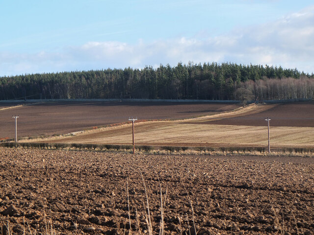
Butterwash Stream is a picturesque freshwater marsh located in Roxburghshire, Scotland. Situated amidst rolling hills and lush greenery, it is a popular destination for nature enthusiasts and birdwatchers alike.

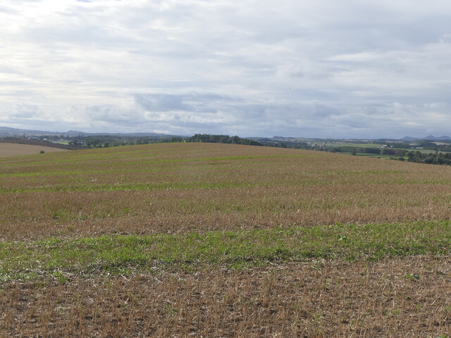
Covering a vast area of approximately 50 acres, Butterwash Stream is renowned for its diverse ecosystem and abundant wildlife. The stream itself gently meanders through the marsh, creating a tranquil and serene atmosphere. The water is crystal clear and teeming with various species of fish, making it an ideal spot for fishing enthusiasts.

The marshland surrounding the stream is characterized by its rich vegetation, including reeds, rushes, and water lilies. These provide a perfect habitat for an array of bird species, such as herons, ducks, and swans. The area is particularly famous for its large population of nesting lapwings, which can be observed during the breeding season.

Visitors to Butterwash Stream can explore the marshland by following well-maintained walking trails that wind through the area. The trails offer breathtaking views of the surrounding landscape, with opportunities to spot rare plants and wildlife along the way.

For those seeking a peaceful and serene retreat, Butterwash Stream provides an idyllic setting. Whether it's a leisurely stroll, birdwatching, or simply enjoying the tranquility of nature, this freshwater marsh offers a unique and unforgettable experience for all who visit.

If you have any feedback on the listing, please let us know in the comments section below.

Butterwash Stream Images

Images are sourced within 2km of 55.615389/-2.3899874 or Grid Reference NT7535. Thanks to Geograph Open Source API. All images are credited.

Minor road from Sprouston A minor road up through farmland to meet the B6396. Even after midday, there was still some frost on the road in the shadow of the woodland.
Minor road from Sprouston
A minor road up through farmland to meet the B6396. Even after midday, there was still some frost on the road in the shadow of the woodland.
Minor road from Sprouston (2) A straight road between neat hedges in the farmland rising to the south of the Tweed near Kelso.
Minor road from Sprouston (2)
A straight road between neat hedges in the farmland rising to the south of the Tweed near Kelso.
Minor road from Sprouston (3) The view across the Tweed valley opens out, here including the monument to James Thomson, author of the words of 'Rule Britannia', visible as the stone obelisk above the trees L of centre.
Minor road from Sprouston (3)
The view across the Tweed valley opens out, here including the monument to James Thomson, author of the words of 'Rule Britannia', visible as the stone obelisk above the trees L of centre.
Road to Kersquarter At the junction with the minor road up from Sprouston.
Road to Kersquarter
At the junction with the minor road up from Sprouston.
Farmland above the Tweed A glimpse of the river from the road to Windywalls.
Farmland above the Tweed
A glimpse of the river from the road to Windywalls.
Farmland at Ferneyhill Ploughed fields to the NE of Kelso with the plantation on Tan Law beyond.
Farmland at Ferneyhill
Ploughed fields to the NE of Kelso with the plantation on Tan Law beyond.
Ednam Hill Drumlin summit.
Ednam Hill
Drumlin summit.
South side of Ednam Hill
Minor  road  junction  on  A698  east  of  Kelso The stone wall to the left is the Hendersyde Park Estate. The minor road goes up to Hendersyde Farm, with the brown tourist sign advertising Self Catering
Minor road junction on A698 east of Kelso
The stone wall to the left is the Hendersyde Park Estate. The minor road goes up to Hendersyde Farm, with the brown tourist sign advertising Self Catering
Hendersyde  Park  East  Lodge  entrance on A698 The East Lodge was built c1840 using stone from the Hendersyde quarry
Hendersyde Park East Lodge entrance on A698
The East Lodge was built c1840 using stone from the Hendersyde quarry
Sprouston Parish Church The church was built in 1781 on the site of a previous building. The external harled walls have recently been repainted.
Sprouston Parish Church
The church was built in 1781 on the site of a previous building. The external harled walls have recently been repainted.
Great mullein (Verbascum thapsus) This tall erect biennial plant with light yellow flowers is also known as Aaron’s Rod. This photo was taken in Sprouston Parish Churchyard.
Great mullein (Verbascum thapsus)
This tall erect biennial plant with light yellow flowers is also known as Aaron’s Rod. This photo was taken in Sprouston Parish Churchyard.
Great mullein (Verbascum thapsus) For a wider view of the plant in Sprouston Parish Churchyard; see <a href="https://www.geograph.org.uk/photo/7532227">NT7535 : Great mullein (Verbascum thapsus)</a>.
Great mullein (Verbascum thapsus)
For a wider view of the plant in Sprouston Parish Churchyard; see NT7535 : Great mullein (Verbascum thapsus).
Inside Sprouston Parish Church This is a view down a central aisle with pews either side towards the chancel. The church is usually closed but I was lucky when someone arrived to put a notice up inside the vestibule and I was kindly allowed in.
Inside Sprouston Parish Church
This is a view down a central aisle with pews either side towards the chancel. The church is usually closed but I was lucky when someone arrived to put a notice up inside the vestibule and I was kindly allowed in.
A stained glass window at Sprouston Parish Church This window on the south wall is dedicated to John Agnew Findlay, a former minister of the church between 1891 and 1901.
A stained glass window at Sprouston Parish Church
This window on the south wall is dedicated to John Agnew Findlay, a former minister of the church between 1891 and 1901.
A symbolic gravestone at Sprouston Parish Churchyard This 18th century stone displays symbols of mortality and immortality. The skull, crossed bones and horizontal hourglass are symbols of mortality, while the winged soul at the head of the stone and the flower at the lower right are symbols of immortality.
A symbolic gravestone at Sprouston Parish Churchyard
This 18th century stone displays symbols of mortality and immortality. The skull, crossed bones and horizontal hourglass are symbols of mortality, while the winged soul at the head of the stone and the flower at the lower right are symbols of immortality.
Inside Sprouston Parish Church This is a view from the chancel towards the gallery.
Inside Sprouston Parish Church
This is a view from the chancel towards the gallery.
A war grave in Sprouston Parish Churchyard The inscription reads:

7353 PRIVATE
J. PATTERSON
K.O. SCOTTISH BORDERERS
3RD OCTOBER 1916

BELOVED SON
OF WILLIAM & AGNES PATTERSON
SPROUSTON
A war grave in Sprouston Parish Churchyard
The inscription reads: 7353 PRIVATE J. PATTERSON K.O. SCOTTISH BORDERERS 3RD OCTOBER 1916 BELOVED SON OF WILLIAM & AGNES PATTERSON SPROUSTON
Show me another place!

Butterwash Stream is located at Grid Ref: NT7535 (Lat: 55.615389, Lng: -2.3899874)

Unitary Authority: The Scottish Borders

Police Authority: The Lothians and Scottish Borders

What 3 Words

///readers.clockwork.remembers. Near Kelso, Scottish Borders

Related Wikis

Sprouston

Sprouston is a village, parish and former feudal barony in the Scottish Borders area of Scotland, as well as the historic county of Roxburghshire, located...

Sprouston railway station

Sprouston railway station served the village of Sprouston, Scottish Borders, Scotland, from 1849 to 1965 on the Kelso Branch. == History == The station...

Ednam

Ednam is a small village near Kelso in the Scottish Borders area of Scotland. Places nearby include Stichill, Sprouston, Nenthorn, Eccles, Gordon, Greenlaw...

Ednam Church

Ednam Church is a member church (Scots: kirk) of the Church of Scotland and is co–joined with Kelso North Church in Kelso. Ednam is in the old county of...

Eden Water

Eden Water is a tributary of the River Tweed in the Scottish Borders of Scotland. "Water" is the Lowland Scots term for a small river. The Eden Burn rises...

Kelso Racecourse

Kelso Racecourse is a thoroughbred horse racing venue located in Kelso, Scotland. Frequently described as "Britain's Friendliest Racecourse", the racecourse...

Battle of Haddon Rig

The Battle of Hadden Rig was a battle fought about three miles east of Kelso, in the Scottish Borders, between Scotland and England on 24 August 1542,...

Kelso Hospital

Kelso Hospital, also known as Inch Hospital, is a health facility at Inch Road in Kelso, Scotland. It is managed by NHS Borders. == History == The hospital...

Nearby Amenities

Located within 500m of 55.615389,-2.3899874
Whitmuirhaugh
Place: hamlet
Lat/Long: 55.6157015/-2.3857016
Power: pole
Lat/Long: 55.6126682/-2.3848473
Power: pole
Lat/Long: 55.6134665/-2.385165
Power: pole
Lat/Long: 55.6141298/-2.3854378
Power: pole
Lat/Long: 55.6147451/-2.3856659
Power: pole
Lat/Long: 55.6153458/-2.385909
Power: pole
Lat/Long: 55.6159731/-2.3861307
Power: pole
Lat/Long: 55.6151989/-2.3977043
The data included in this document is from www.openstreetmap.org. The data is made available under ODbL.

Have you been to Butterwash Stream?

Leave your review of Butterwash Stream below (or comments, questions and feedback).