Spear Pond

Lake, Pool, Pond, Freshwater Marsh in Somerset South Somerset

England

Spear Pond

Gnarled Trees observed from the Old Coach Road A public footpath follows tightly against the hedgerow in a northerly direction. The coach road passes this scene east to west
Gnarled Trees observed from the Old Coach Road Credit: Chris Heaton

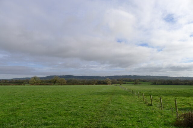
Spear Pond is a small freshwater marsh located in Somerset, England. It is often referred to as a pond due to its size, but it encompasses characteristics of a lake, pool, and pond. The pond is situated in a serene and picturesque setting, surrounded by lush greenery and rolling hills.

Spear Pond is fed by various sources, including rainwater runoff and underground springs. It is relatively shallow, with an average depth of around 2 meters. The water in the pond is clear and clean, making it an ideal habitat for a diverse range of aquatic plants and animals.

The pond is home to a variety of freshwater species, including fish, amphibians, and insects. Common species found in Spear Pond include carp, perch, and roach. The vegetation surrounding the pond provides shelter and food for these organisms, creating a thriving ecosystem.

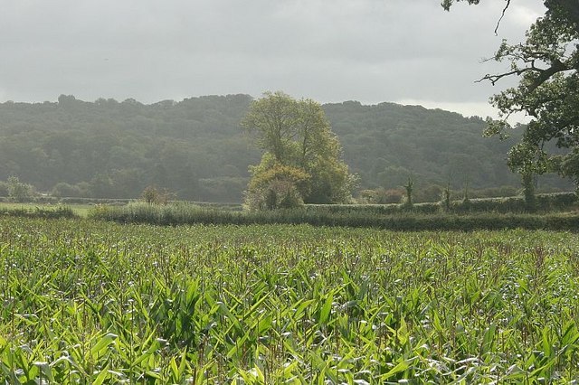
Visitors to Spear Pond can enjoy a tranquil and peaceful atmosphere, perfect for relaxation and observing nature. The surrounding area offers several walking trails, allowing visitors to explore the diverse flora and fauna. Birdwatchers will also find the pond a haven, as it attracts various waterfowl species throughout the year.

Spear Pond is a popular spot for recreational activities such as fishing and picnicking. Anglers can try their luck at catching the abundant fish species, while families can enjoy a leisurely picnic by the water's edge.

Overall, Spear Pond in Somerset offers a beautiful natural habitat and a range of recreational opportunities, making it a cherished destination for both locals and tourists alike.

If you have any feedback on the listing, please let us know in the comments section below.

Spear Pond Images

Images are sourced within 2km of 51.088121/-2.423388 or Grid Reference ST7032. Thanks to Geograph Open Source API. All images are credited.

Gnarled Trees observed from the Old Coach Road A public footpath follows tightly against the hedgerow in a northerly direction. The coach road passes this scene east to west
Gnarled Trees observed from the Old Coach Road
A public footpath follows tightly against the hedgerow in a northerly direction. The coach road passes this scene east to west
Leland Trail outside Brewhamfields Farm The Leland Trail and Macmillan Way long distance footpaths on a section of the old coach road between Stourhead and Redlynch.
It is a sloppy mess at this point, resembling the consistency of thick custard.
Leland Trail outside Brewhamfields Farm
The Leland Trail and Macmillan Way long distance footpaths on a section of the old coach road between Stourhead and Redlynch. It is a sloppy mess at this point, resembling the consistency of thick custard.
Redlynch Farm Farmhouse at Redlynch Cross, passed by on the Leland Trail/MacMillan Way long distance footpaths
Redlynch Farm
Farmhouse at Redlynch Cross, passed by on the Leland Trail/MacMillan Way long distance footpaths
Leland Trail in Moor Wood Adopting the old coach road that once stretched between Redlynch and the Stourhead Estate.
Leland Trail in Moor Wood
Adopting the old coach road that once stretched between Redlynch and the Stourhead Estate.
Water trough near Brewhamfields Farm
The Leland Trail following the old coach road to the east Heading towards the Stourhead Estate woods on the escarpment in the distance. King Alfred's Tower is visible on the left horizon
The Leland Trail following the old coach road to the east
Heading towards the Stourhead Estate woods on the escarpment in the distance. King Alfred's Tower is visible on the left horizon
Old oak near Moor Wood Dead wood at the top, but new buds emerging lower down
Old oak near Moor Wood
Dead wood at the top, but new buds emerging lower down
View east from Moor Wood Cottage Looking east along the line of the Leland Trail, which follows the old coach road towards the Stourhead Estate escarpment in the distance. King Alfred's Tower is visible on the left horizon.
View east from Moor Wood Cottage
Looking east along the line of the Leland Trail, which follows the old coach road towards the Stourhead Estate escarpment in the distance. King Alfred's Tower is visible on the left horizon.
Redlynch Farm House Grade II listed, early 19th century <span class="nowrap"><a title="https://historicengland.org.uk/listing/the-list/list-entry/1307899?section=official-list-entry" rel="nofollow ugc noopener" href="https://historicengland.org.uk/listing/the-list/list-entry/1307899?section=official-list-entry">Link</a><img style="margin-left:2px;" alt="External link" title="External link - shift click to open in new window" src="https://s1.geograph.org.uk/img/external.png" width="10" height="10"/></span>
Redlynch Farm House
Grade II listed, early 19th century LinkExternal link
Stoney Stoke: Entrance to Knowlerock Farm
REDLYNCH, Somerset St Peter's Church - an unusual late C18 design.
REDLYNCH, Somerset
St Peter's Church - an unusual late C18 design.
Chapel at Redlynch
Chapel at Redlynch
Knowle Park Farm
Knowle Park Farm
St. Peter's church, Redlynch That "Christmas" tree is growing nicely (compare other pictures in this square).
St. Peter's church, Redlynch
That "Christmas" tree is growing nicely (compare other pictures in this square).
Which way? The footpath north from Redlynch crosses this field, with a slight confusion about whether to go left or right of this patch of marshy ground (i.e. which gate beyond?).  Left is the correct decision.
Which way?
The footpath north from Redlynch crosses this field, with a slight confusion about whether to go left or right of this patch of marshy ground (i.e. which gate beyond?). Left is the correct decision.
Maize near Redlynch Formerly part of Redlynch Park.
Hope the farmer is pleased with his crop, I've seen better.
Maize near Redlynch
Formerly part of Redlynch Park. Hope the farmer is pleased with his crop, I've seen better.
2007 : Lower Barn On the byroad between Redlynch and Shepton Montague, this was once one of a group of barns now partly converted to dwellings.
2007 : Lower Barn
On the byroad between Redlynch and Shepton Montague, this was once one of a group of barns now partly converted to dwellings.
2007 : Entry to ... ? There is a poster type of sign just behind the camera that says "The Aviaries" but it does not say if the road goes there. The OS map is no help either. (unusual for OS)
2007 : Entry to ... ?
There is a poster type of sign just behind the camera that says "The Aviaries" but it does not say if the road goes there. The OS map is no help either. (unusual for OS)
Show me another place!

Spear Pond is located at Grid Ref: ST7032 (Lat: 51.088121, Lng: -2.423388)

Administrative County: Somerset

District: South Somerset

Police Authority: Avon and Somerset

What 3 Words

///trying.readjust.fermented. Near Redlynch, Somerset

Related Wikis

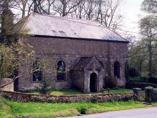
Church of St Peter, Redlynch

The Anglican Church of St Peter in Redlynch, Somerset, England was built in about 1750. It is a Grade II* listed building. == History == The church was...
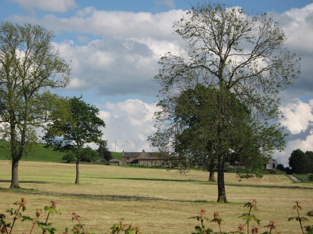
Redlynch, Somerset

Redlynch is a village and former manor in the civil parish of Bruton, in the South Somerset district of Somerset, England. The 18th-century church and...

Shepton Montague Railway Cutting

Shepton Montague Railway Cutting (grid reference ST686316) is a 1.61 hectare geological Site of Special Scientific Interest at Shepton Montague in Somerset...

Charlton Musgrove

Charlton Musgrove is a village and civil parish in Somerset, England, situated 1 mile (1.6 km) north east of Wincanton in the South Somerset district....

Nearby Amenities

Located within 500m of 51.088121,-2.423388
The data included in this document is from www.openstreetmap.org. The data is made available under ODbL.

Have you been to Spear Pond?

Leave your review of Spear Pond below (or comments, questions and feedback).