Lady's Pot

Lake, Pool, Pond, Freshwater Marsh in Aberdeenshire

Scotland

Lady's Pot

Forest roads of Bennachie
Forest roads of Bennachie Credit: Ralph Greig

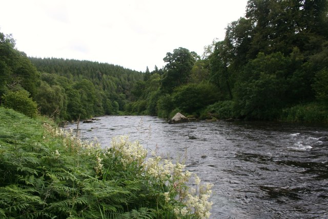
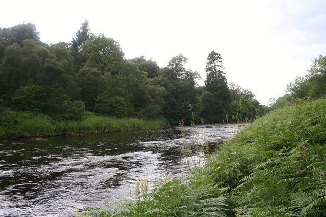
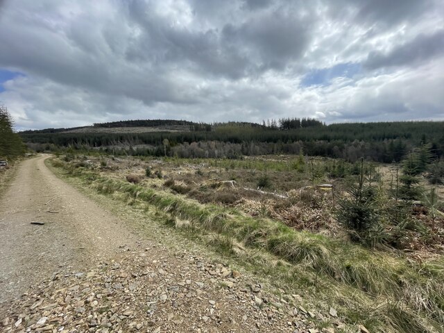
Lady's Pot is a picturesque freshwater marsh located in Aberdeenshire, Scotland. Nestled amidst the scenic countryside, this natural marvel is often referred to as a lake, pool, pond, or freshwater marsh due to its unique characteristics.

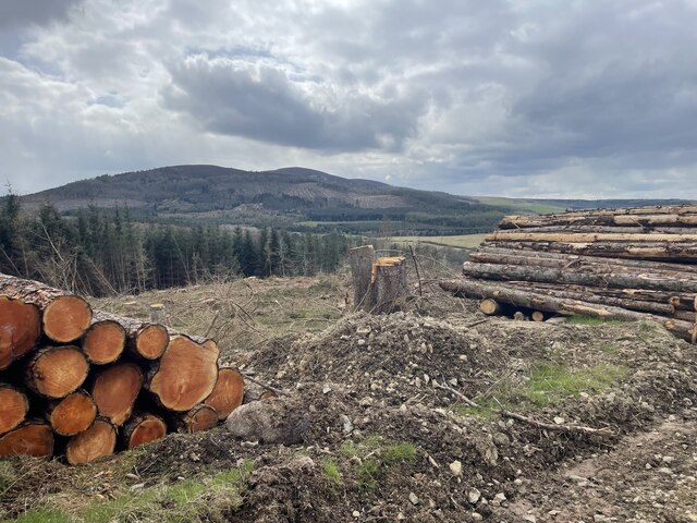
Spanning approximately 5 acres, Lady's Pot is surrounded by lush greenery and is home to a diverse range of flora and fauna. The marsh is teeming with various species of aquatic plants such as water lilies, reeds, and rushes, creating a vibrant and colorful ecosystem. Additionally, the calm and still waters of the pot offer a perfect habitat for numerous aquatic creatures, including fish, amphibians, and invertebrates.

Visitors to Lady's Pot are enchanted by its tranquil ambiance and stunning natural beauty. The serene atmosphere makes it an ideal spot for nature enthusiasts, bird watchers, and photographers. The pot attracts a wide array of bird species, including ducks, swans, herons, and various migratory birds, making it a haven for birdwatchers throughout the year.

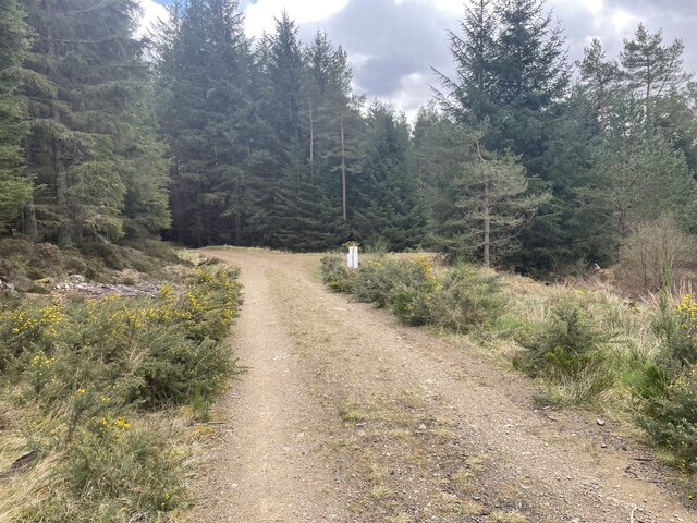
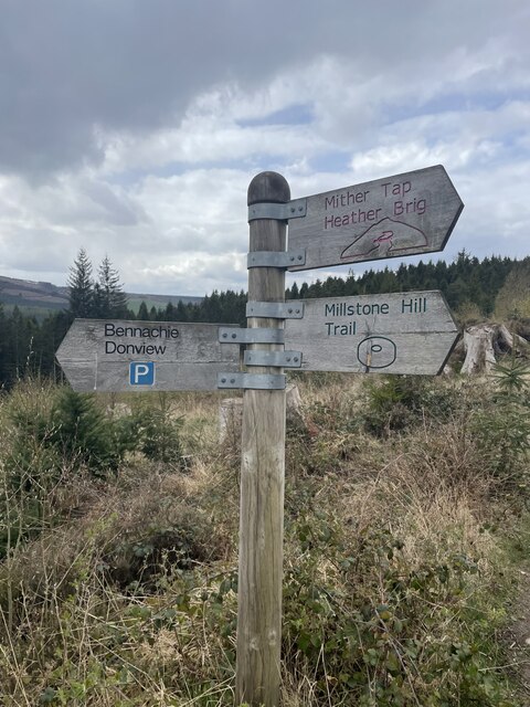
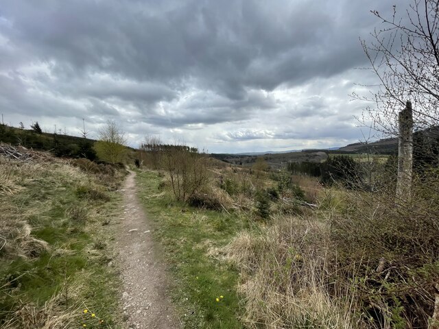
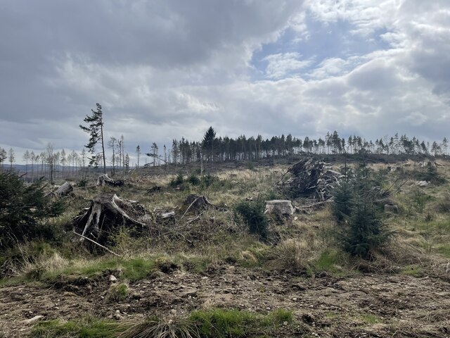
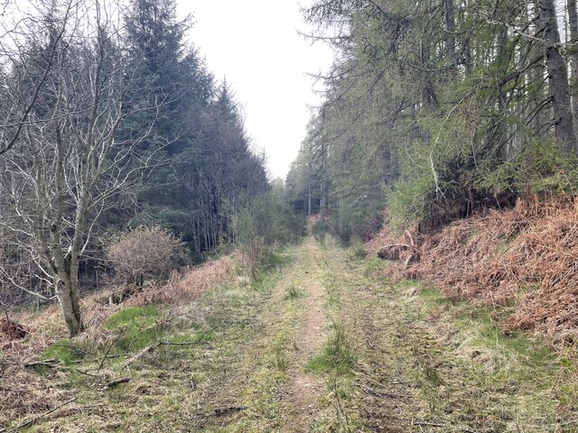
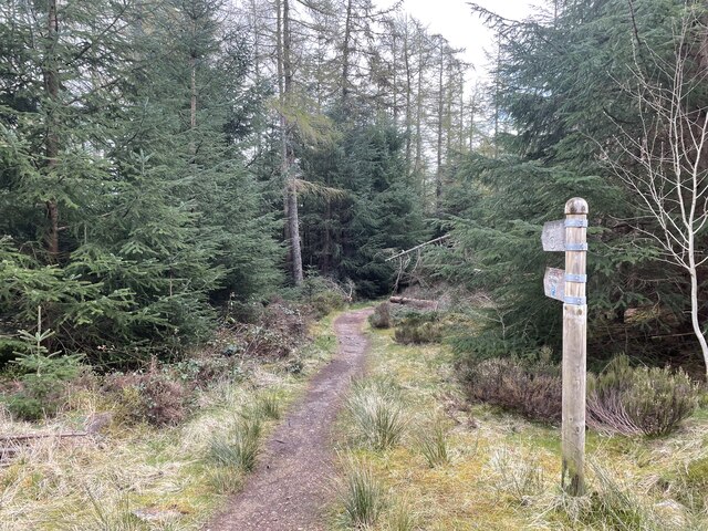
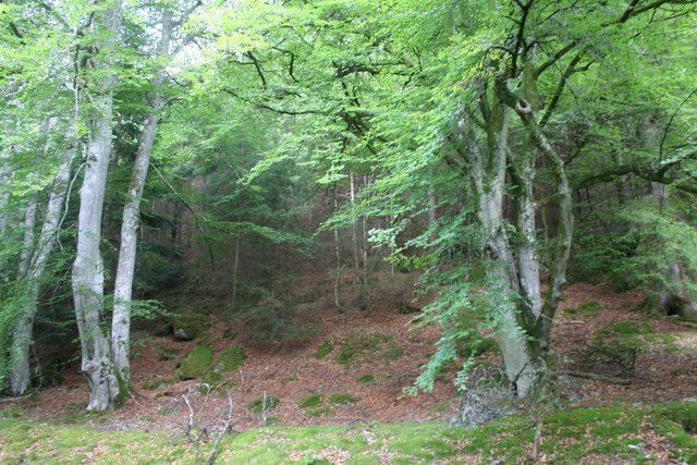
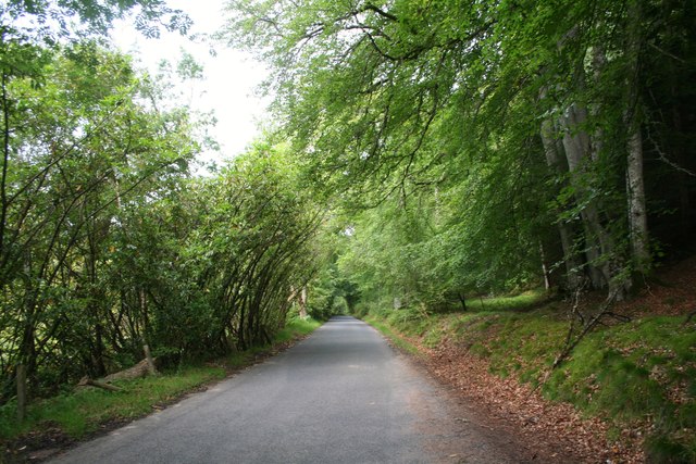
The surrounding area offers several walking trails and picnic spots, allowing visitors to immerse themselves in the serene environment and enjoy a peaceful day out. The scenic beauty of Lady's Pot, along with its rich biodiversity, makes it a popular destination for both locals and tourists alike.

Overall, Lady's Pot in Aberdeenshire is a captivating freshwater marsh that offers a unique and serene experience for nature lovers. With its diverse flora and fauna, tranquil waters, and stunning surroundings, it truly is a hidden gem in the Scottish countryside.

If you have any feedback on the listing, please let us know in the comments section below.

Lady's Pot Images

Images are sourced within 2km of 57.259657/-2.5459212 or Grid Reference NJ6718. Thanks to Geograph Open Source API. All images are credited.

Forest roads of Bennachie
Which way? Bennachie is a range of hills in Aberdeenshire, Scotland.It has several tops, the highest of which, Oxen Craig, has a height of 528 metres (1,732 ft). Though not particularly high, compared to other peaks within Scotland, the mountain is very prominent, owing to its isolation and the relative flatness of the surrounding terrain, and dominates the skyline from several viewpoints.
Which way?
Bennachie is a range of hills in Aberdeenshire, Scotland.It has several tops, the highest of which, Oxen Craig, has a height of 528 metres (1,732 ft). Though not particularly high, compared to other peaks within Scotland, the mountain is very prominent, owing to its isolation and the relative flatness of the surrounding terrain, and dominates the skyline from several viewpoints.
A path on Bennachie Bennachie is a range of hills in Aberdeenshire, Scotland.It has several tops, the highest of which, Oxen Craig, has a height of 528 metres (1,732 ft). Though not particularly high, compared to other peaks within Scotland, the mountain is very prominent, owing to its isolation and the relative flatness of the surrounding terrain, and dominates the skyline from several viewpoints.
A path on Bennachie
Bennachie is a range of hills in Aberdeenshire, Scotland.It has several tops, the highest of which, Oxen Craig, has a height of 528 metres (1,732 ft). Though not particularly high, compared to other peaks within Scotland, the mountain is very prominent, owing to its isolation and the relative flatness of the surrounding terrain, and dominates the skyline from several viewpoints.
Harvest time for trees Bennachie is a range of hills in Aberdeenshire, Scotland.It has several tops, the highest of which, Oxen Craig, has a height of 528 metres (1,732 ft). Though not particularly high, compared to other peaks within Scotland, the mountain is very prominent, owing to its isolation and the relative flatness of the surrounding terrain, and dominates the skyline from several viewpoints.
Harvest time for trees
Bennachie is a range of hills in Aberdeenshire, Scotland.It has several tops, the highest of which, Oxen Craig, has a height of 528 metres (1,732 ft). Though not particularly high, compared to other peaks within Scotland, the mountain is very prominent, owing to its isolation and the relative flatness of the surrounding terrain, and dominates the skyline from several viewpoints.
Where the trees used to be
Storm damaged trees
Storm damaged trees
Around the back of Scare hill Bennachie is a range of hills in Aberdeenshire, Scotland.It has several tops, the highest of which, Oxen Craig, has a height of 528 metres (1,732 ft). Though not particularly high, compared to other peaks within Scotland, the mountain is very prominent, owing to its isolation and the relative flatness of the surrounding terrain, and dominates the skyline from several viewpoints.
Around the back of Scare hill
Bennachie is a range of hills in Aberdeenshire, Scotland.It has several tops, the highest of which, Oxen Craig, has a height of 528 metres (1,732 ft). Though not particularly high, compared to other peaks within Scotland, the mountain is very prominent, owing to its isolation and the relative flatness of the surrounding terrain, and dominates the skyline from several viewpoints.
Only one way to go
Only one way to go
Don by Tilliehashlach The River Don with the Paradise Wood on the right side. Tilliehashlach translates as the knoll of the rapid ford.
Don by Tilliehashlach
The River Don with the Paradise Wood on the right side. Tilliehashlach translates as the knoll of the rapid ford.
Don Upstream The River Don flowing towards the camera from Woodhead, Paradise Wood on the far bank.
Don Upstream
The River Don flowing towards the camera from Woodhead, Paradise Wood on the far bank.
Forest Edge The edge of the Bennachie Forest from the roadside.
Forest Edge
The edge of the Bennachie Forest from the roadside.
Bennachie Road The road bordering the Bennachie forest between Ramstone and Tilliehashlach.
Bennachie Road
The road bordering the Bennachie forest between Ramstone and Tilliehashlach.
Don and Paradise The River Don and Paradise Wood.
Don and Paradise
The River Don and Paradise Wood.
River Don by Paradise Wood Scenic reach of the Don upstream from Pitfichie.
<span class="nowrap"><a title="http://en.wikipedia.org/wiki/River_Don,_Aberdeenshire" rel="nofollow ugc noopener" href="http://en.wikipedia.org/wiki/River_Don,_Aberdeenshire">Link</a><img style="margin-left:2px;" alt="External link" title="External link - shift click to open in new window" src="https://s1.geograph.org.uk/img/external.png" width="10" height="10"/></span>
River Don by Paradise Wood
Scenic reach of the Don upstream from Pitfichie. LinkExternal link
River Don at Paradise Wood
Forest roads around Bennachie Bennachie is a range of hills in Aberdeenshire, Scotland.It has several tops, the highest of which, Oxen Craig, has a height of 528 metres (1,732 ft). Though not particularly high, compared to other peaks within Scotland, the mountain is very prominent, owing to its isolation and the relative flatness of the surrounding terrain, and dominates the skyline from several viewpoints.
Forest roads around Bennachie
Bennachie is a range of hills in Aberdeenshire, Scotland.It has several tops, the highest of which, Oxen Craig, has a height of 528 metres (1,732 ft). Though not particularly high, compared to other peaks within Scotland, the mountain is very prominent, owing to its isolation and the relative flatness of the surrounding terrain, and dominates the skyline from several viewpoints.
Forestry Operations on Millstone Hill
Rorandle Northward view of Cairn William
Rorandle
Northward view of Cairn William
Show me another place!

Lady's Pot is located at Grid Ref: NJ6718 (Lat: 57.259657, Lng: -2.5459212)

Unitary Authority: Aberdeenshire

Police Authority: North East

What 3 Words

///amplifier.drawn.skimmers. Near Kemnay, Aberdeenshire

Related Wikis

Blairdaff

Blairdaff is a parish in Garioch, Aberdeenshire, Scotland, next to the villages of Kemnay and Monymusk. Blairdaff had a grocery store, a post office, and...

Bograxie

Bograxie is a farm in Aberdeenshire, Scotland. == References ==

Bennachie

Bennachie ( ben-ə-HEE; Scottish Gaelic: Beinn na Cìche) is a range of hills in Aberdeenshire, Scotland. It has several tops, the highest of which, Oxen...

House of Monymusk

The House of Monymusk is located on the outskirts of the Scottish village of Monymusk, in the Marr region of Aberdeenshire. The house is located near the...

Monymusk

Monymusk (Scottish Gaelic: Monadh Musga) is a planned village in the Marr area of Aberdeenshire, Scotland. == History == Malcolm Canmore first established...

Monymusk Parish Church

Monymusk Parish Church (also known as the Church of the Blessed Mary) is located in Monymusk, Aberdeenshire, Scotland. It is of Church of Scotland denomination...

The Colony (Bennachie)

The Colony was a squatters' community on "commonty", or common land, on one side of Bennachie, a range of hills near Aberdeen, in Scotland.From the beginning...

Monymusk railway station

Monymusk railway station was a station on the Alford Valley Railway in Monymusk, Aberdeenshire, Scotland. The station opened on 25 March 1859 and closed...

Nearby Amenities

Located within 500m of 57.259657,-2.5459212
Parking
Donview
Access: yes
Capacity: 10
Fee: no
Operator: Forestry Commission
Park Ride: no
Parking: surface
Supervised: no
Surface: unpaved
Lat/Long: 57.2604034/-2.5449145
Power: pole
Lat/Long: 57.2582947/-2.5507225
Power: pole
Lat/Long: 57.2587638/-2.55146
Power: pole
Lat/Long: 57.2591484/-2.5520787
Power: pole
Lat/Long: 57.2597295/-2.5529835
Power: pole
Lat/Long: 57.2600058/-2.5534393
Power: pole
Lat/Long: 57.2604439/-2.5541042
Power: pole
Lat/Long: 57.2579124/-2.5526533
Power: pole
Lat/Long: 57.2581363/-2.5515371
Power: pole
Lat/Long: 57.2582089/-2.5498814
Power: pole
Lat/Long: 57.2580839/-2.5487608
Power: pole
Lat/Long: 57.2580565/-2.5475015
Power: pole
Lat/Long: 57.2580434/-2.5465086
Power: pole
Lat/Long: 57.2599343/-2.5458305
Power: pole
Lat/Long: 57.2593163/-2.5460506
Power: pole
Lat/Long: 57.2585257/-2.546306
Power: pole
Lat/Long: 57.2572581/-2.5464403
Power: pole
Lat/Long: 57.2565865/-2.5464007
Power: pole
Lat/Long: 57.2559083/-2.5463445
Power: pole
Lat/Long: 57.2553826/-2.546317
Power: pole
Lat/Long: 57.2598635/-2.5429783
Power: pole
Lat/Long: 57.2594598/-2.541818
Power: pole
Lat/Long: 57.2590478/-2.5406512
Power: pole
Lat/Long: 57.2586442/-2.5394975
Power: pole
Lat/Long: 57.2583155/-2.5382052
The data included in this document is from www.openstreetmap.org. The data is made available under ODbL.

Have you been to Lady's Pot?

Leave your review of Lady's Pot below (or comments, questions and feedback).