Toad Hole
Lake, Pool, Pond, Freshwater Marsh in Berwickshire
Scotland
Toad Hole

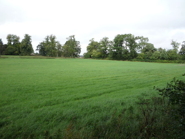
Toad Hole is a small but significant freshwater marsh located in the beautiful region of Berwickshire, Scotland. This unique ecosystem is often referred to as a combination of a lake, pool, pond, and marsh due to its diverse characteristics. Covering an area of approximately 10 acres, Toad Hole is a haven for various plant and animal species, making it an important part of the local biodiversity.
The marsh itself is characterized by its shallow, still waters that are rich in nutrients, supporting a wide range of aquatic vegetation. These plants, such as reeds, rushes, and water lilies, provide shelter and food for numerous animal species. Toad Hole is particularly renowned for its population of amphibians, including its namesake, the common toad. These amphibians are drawn to the marsh for its ample supply of insects and other invertebrates.
The water in Toad Hole is predominantly sourced from rainwater and natural springs, ensuring a constant flow that maintains the marsh's unique ecosystem. Due to its relatively small size and shallow depth, the water remains calm and peaceful throughout the year, attracting a variety of bird species. Visitors to Toad Hole may be lucky enough to spot waterfowl such as ducks, geese, and herons, as well as other wetland birds like kingfishers and reed warblers.
Toad Hole is not only a natural treasure but also a valuable educational resource. It offers a chance for researchers, students, and nature enthusiasts to study the intricate relationships between various organisms and their environment. Moreover, its picturesque beauty and serene atmosphere make it a popular destination for leisurely walks and wildlife observation, providing a peaceful retreat for visitors seeking solace in nature.
If you have any feedback on the listing, please let us know in the comments section below.
Toad Hole Images
Images are sourced within 2km of 55.58359/-2.6620172 or Grid Reference NT5832. Thanks to Geograph Open Source API. All images are credited.


Toad Hole is located at Grid Ref: NT5832 (Lat: 55.58359, Lng: -2.6620172)
Unitary Authority: The Scottish Borders
Police Authority: The Lothians and Scottish Borders
What 3 Words
///horseshoe.towels.sweated. Near Newtown St Boswells, Scottish Borders
Nearby Locations
Related Wikis
Dryburgh Abbey Bridge
Dryburgh Abbey Bridge was a cable-stayed footbridge of significant historical interest erected near Dryburgh Abbey, in the Borders of Scotland. It connected...

Statue of William Wallace, Bemersyde
The William Wallace Statue near the grounds of the Bemersyde estate, near Melrose in the Scottish Borders is a statue commemorating William Wallace. It...

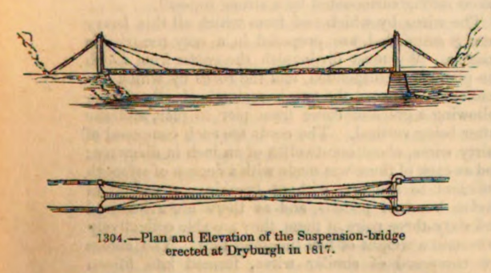
Dryburgh Suspension Bridge
Dryburgh Suspension Bridge is a suspension bridge erected near Dryburgh Abbey, Scottish Borders. == History == The footbridge across the River Tweed...

Dryburgh Abbey Hotel
Dryburgh Abbey Hotel is a baronial country house, located on the banks of the River Tweed, in Dryburgh about 5 km south east of Melrose in the Scottish...

Dryburgh
Dryburgh is a village in the Borders region of Scotland, within the county of Berwickshire. It is most famous for the ruined Dryburgh Abbey. Dryburgh Abbey...
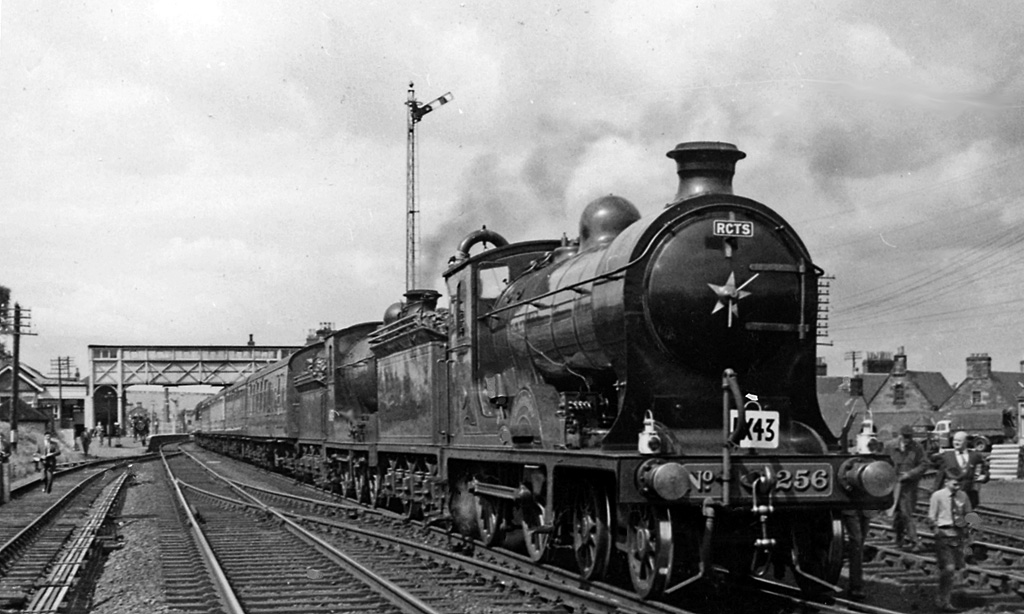
St. Boswells railway station
St Boswells railway station was a railway station that served the villages of Newtown St Boswells and St Boswells, Scottish Borders, Scotland from 1849...

Council Headquarters, Newtown St Boswells
The Council Headquarters is a municipal building in Newtown St Boswells, in the Scottish Borders council area in Scotland. It serves as the headquarters...

Fat Lips
Fat Lips (or Fatlips) is the name given to a legendary spirit dwelling in Dryburgh Abbey in Berwickshire, Scotland. The spirit was associated with a hermit...
Nearby Amenities
Located within 500m of 55.58359,-2.6620172Have you been to Toad Hole?
Leave your review of Toad Hole below (or comments, questions and feedback).