Bridge Stream

Lake, Pool, Pond, Freshwater Marsh in Roxburghshire

Scotland

Bridge Stream

Fishing as a spectator sport! Walkers on St Cuthbert's Way watch a lady fishing in the River Tweed.
Fishing as a spectator sport! Credit: Russel Wills

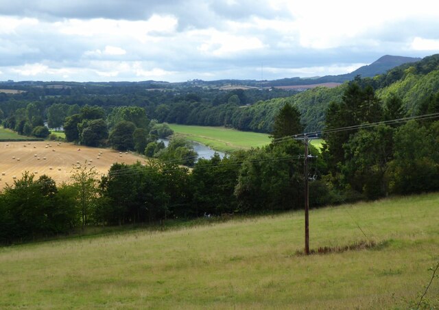
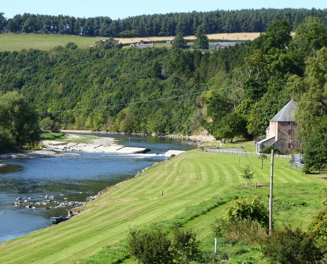
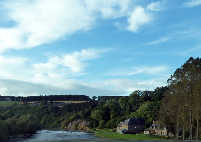
Bridge Stream is a picturesque freshwater ecosystem located in Roxburghshire, a historic region in Scotland. Situated amidst rolling hills and lush greenery, this stream serves as an important water body in the area. The stream originates from natural springs and meanders its way through the landscape, providing a vital habitat for various flora and fauna.

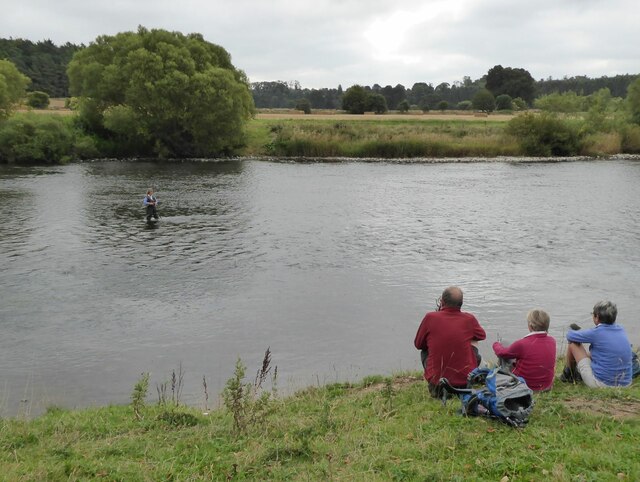
The stream is characterized by its clear, cool waters, which are rich in oxygen and support a diverse range of aquatic life. It is a popular spot for recreational activities such as fishing, as it is home to several species of fish, including brown trout and Atlantic salmon. Anglers flock to Bridge Stream to test their skills and enjoy the tranquility of the surroundings.

Alongside the stream, there are several small pools and ponds, adding to the charm of the area. These bodies of water are teeming with aquatic plants, such as water lilies and pondweed, which provide shelter and food for numerous aquatic insects, amphibians, and waterfowl.

The stream also flows through a freshwater marsh, a unique and important ecosystem. This marshland is characterized by its waterlogged soil, which supports a variety of marsh plants like reeds, sedges, and rushes. The marsh provides a breeding ground for many bird species, including ducks, swans, and herons, making it a haven for birdwatchers and nature enthusiasts.

Bridge Stream, with its diverse aquatic life, stunning scenery, and abundance of wildlife, is a precious natural resource in Roxburghshire. It not only serves as an important water source but also offers a sanctuary for numerous species, contributing to the overall biodiversity and ecological balance of the region.

If you have any feedback on the listing, please let us know in the comments section below.

Bridge Stream Images

Images are sourced within 2km of 55.580429/-2.6533348 or Grid Reference NT5832. Thanks to Geograph Open Source API. All images are credited.

Fishing as a spectator sport! Walkers on St Cuthbert's Way watch a lady fishing in the River Tweed.
Fishing as a spectator sport!
Walkers on St Cuthbert's Way watch a lady fishing in the River Tweed.
Clint Lodge Clint Lodge country house was built in 1869 by Lord Polwarth as the family’s shooting home, Clint Lodge is owned by the Duke of Sutherland. After extensive and careful refurbishment, Clint Lodge opened in August ’97.  <span class="nowrap"><a title="https://clintlodge.co.uk/" rel="nofollow ugc noopener" href="https://clintlodge.co.uk/">Link</a><img style="margin-left:2px;" alt="External link" title="External link - shift click to open in new window" src="https://s1.geograph.org.uk/img/external.png" width="10" height="10"/></span>
Clint Lodge
Clint Lodge country house was built in 1869 by Lord Polwarth as the family’s shooting home, Clint Lodge is owned by the Duke of Sutherland. After extensive and careful refurbishment, Clint Lodge opened in August ’97. LinkExternal link
River Tweed Near Clintmains.
Pity about the electricity pole!
River Tweed
Near Clintmains. Pity about the electricity pole!
Mill at Clintmains With adjacent weir on the River Tweed.
There is a fisherman in the river above the weir.
Mill at Clintmains
With adjacent weir on the River Tweed. There is a fisherman in the river above the weir.
River Tweed
River Tweed
Footbridge over Benrig Dean
Benrig Dean
Benrig Dean
St Cuthbert's Way Raised walkway
St Cuthbert's Way
Raised walkway
Old toll house Built of fine dressed red sandstone blocks, the old tollhouse at Mertoun bridge over the River Tweed has a protruding bay window for a view of wheeled vehicles and animals approaching.   There is a door beyond the bay.   The part at the rear is a later addition.
Old toll house
Built of fine dressed red sandstone blocks, the old tollhouse at Mertoun bridge over the River Tweed has a protruding bay window for a view of wheeled vehicles and animals approaching. There is a door beyond the bay. The part at the rear is a later addition.
Old Mill on the River Tweed Viewed from the bridge on the B6404.
Old Mill on the River Tweed
Viewed from the bridge on the B6404.
Fishing on the River Tweed This angler has waded well out into this stretch of the river between St Boswells Golf Course and Mertoun Mill.
Fishing on the River Tweed
This angler has waded well out into this stretch of the river between St Boswells Golf Course and Mertoun Mill.
Walking by the River Tweed A family is out on a beautiful April afternoon on a riverside path by the northwest bank of the River Tweed near St Boswells Golf Course.
Walking by the River Tweed
A family is out on a beautiful April afternoon on a riverside path by the northwest bank of the River Tweed near St Boswells Golf Course.
Clinthill Farm This is an early January view from the B6356.
Clinthill Farm
This is an early January view from the B6356.
St Cuthbert's Way alongside the Tweed Any more rain and the path will be flooded
St Cuthbert's Way alongside the Tweed
Any more rain and the path will be flooded
Mertoun Mill Flour mill, probably early 19th century, listed category C.
Mertoun Mill
Flour mill, probably early 19th century, listed category C.
Clint Lodge A fine country house B&B east of Dryburgh.
Clint Lodge
A fine country house B&B east of Dryburgh.
Mertoun Mill and River Tweed Viewed from Mertoun Bridge.
Mertoun Mill and River Tweed
Viewed from Mertoun Bridge.
Mertoun Mill and Cauld The River Tweed in full flow.
Mertoun Mill and Cauld
The River Tweed in full flow.
Show me another place!

Bridge Stream is located at Grid Ref: NT5832 (Lat: 55.580429, Lng: -2.6533348)

Unitary Authority: The Scottish Borders

Police Authority: The Lothians and Scottish Borders

What 3 Words

///mended.volcano.rollover. Near Newtown St Boswells, Scottish Borders

Related Wikis

Nearby Amenities

Located within 500m of 55.580429,-2.6533348
Dryburgh Abbey
Historic: ruins
Tourism: attraction
Lat/Long: 55.5772812/-2.6494608
Toilets
Fee: yes
Lat/Long: 55.5783702/-2.6466675
Bench
Backrest: yes
Material: wood
Lat/Long: 55.5804781/-2.6509336
Telephone
Booth: K6
Covered: booth
Listed Status: Category B
Lat/Long: 55.5805206/-2.6493946
Post Box
Collection Times: Mo-Fr 12:00; Sa 09:00
Post Box Type: wall
Postal Code: TD6
Ref: TD6 65
Royal Cypher: GR
Royal Cypher Wikidata: Q33102273
Source: survey
Lat/Long: 55.5805481/-2.6494176
Grave Yard
Lat/Long: 55.5776253/-2.6492827
Dryburgh
Place: village
Wikidata: Q5309649
Wikipedia: en:Dryburgh
Lat/Long: 55.5803851/-2.6494132
Bass Hill
Natural: peak
Lat/Long: 55.5814335/-2.6541942
Dryburgh Mains
Place: hamlet
Lat/Long: 55.5814216/-2.6528198
Newmains
Place: isolated_dwelling
Lat/Long: 55.5825741/-2.6481219
Noexit: yes
Lat/Long: 55.5826201/-2.6478553
Power: pole
Lat/Long: 55.578751/-2.6560673
Power: pole
Lat/Long: 55.5789474/-2.6547904
Power: pole
Lat/Long: 55.5790523/-2.654138
Power: pole
Lat/Long: 55.5793547/-2.6531574
Power: pole
Lat/Long: 55.5796174/-2.6523004
Power: pole
Lat/Long: 55.5800006/-2.6507421
Power: pole
Lat/Long: 55.5781437/-2.6600154
Power: pole
Lat/Long: 55.5783063/-2.6589687
Power: pole
Lat/Long: 55.5784787/-2.6580435
Power: pole
Lat/Long: 55.57851/-2.6478855
The data included in this document is from www.openstreetmap.org. The data is made available under ODbL.

Have you been to Bridge Stream?

Leave your review of Bridge Stream below (or comments, questions and feedback).