Whinfell Tarn

Lake, Pool, Pond, Freshwater Marsh in Westmorland South Lakeland

England

Whinfell Tarn

Beck Docker Bridge Enters the River Mint before it leaves the square
Beck Docker Bridge Credit: Michael Graham

Whinfell Tarn is a picturesque body of water located in Westmorland, Cumbria, England. Nestled amidst the stunning landscape of the Lake District National Park, it is considered one of the hidden gems of the region. This natural freshwater tarn is often described as a lake, pool, pond, or freshwater marsh due to its varied characteristics.

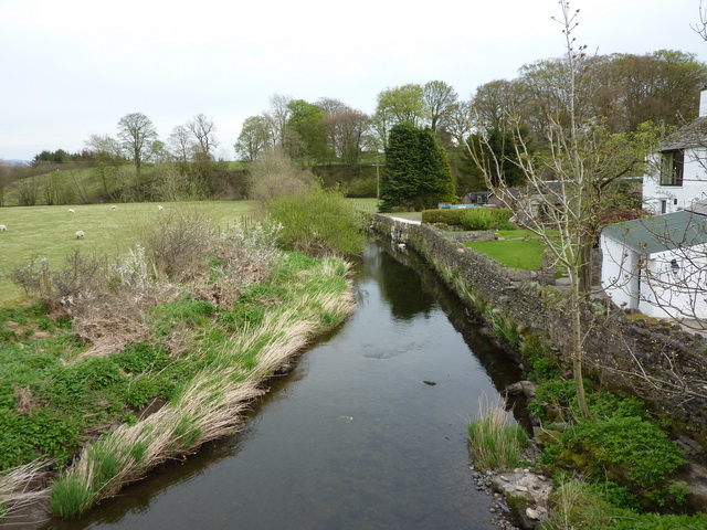
Covering an area of approximately 50 acres, Whinfell Tarn has a tranquil and idyllic setting. Surrounded by rolling hills and dense woodlands, it offers a serene and secluded atmosphere, making it a popular destination for nature enthusiasts and photographers. The tarn is fed by rainwater and natural springs, ensuring its pristine quality.

The shoreline of Whinfell Tarn is lined with a mix of vegetation, including reeds, grasses, and shrubs, creating a diverse habitat for various species of birds, insects, and small mammals. The tarn is home to a rich and diverse ecosystem, with several species of fish, including perch and pike, inhabiting its waters.

Visitors to Whinfell Tarn can enjoy a range of activities such as fishing, birdwatching, and leisurely walks around its shores. The tarn also serves as a starting point for many scenic trails and hikes, offering breathtaking views of the surrounding countryside.

With its stunning natural beauty and peaceful ambiance, Whinfell Tarn is a haven for those seeking a respite from the hustle and bustle of everyday life. Whether it's exploring the diverse flora and fauna, capturing the perfect photograph, or simply enjoying the tranquility of the surroundings, Whinfell Tarn offers a truly memorable experience for all who visit.

If you have any feedback on the listing, please let us know in the comments section below.

Whinfell Tarn Images

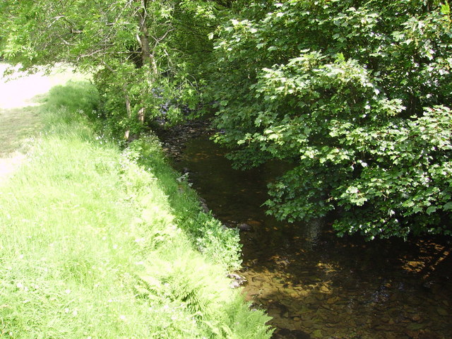
Images are sourced within 2km of 54.375422/-2.6801563 or Grid Reference SD5597. Thanks to Geograph Open Source API. All images are credited.

Beck Docker Bridge Enters the River Mint before it leaves the square
Beck Docker Bridge
Enters the River Mint before it leaves the square
Country Road Near Crake Hall Crake Hall in the trees
Country Road Near Crake Hall
Crake Hall in the trees
Sheep and Lamb From the crossroads near Browfoot
Sheep and Lamb
From the crossroads near Browfoot
Patton Bridge Over the River Mint
Patton Bridge
Over the River Mint
The Joys of the Single Track Road Go for the ones with grass down the middle. Near Patton Bridge
The Joys of the Single Track Road
Go for the ones with grass down the middle. Near Patton Bridge
Wall Field End Above the farm. Howgills in the distance
Wall Field End
Above the farm. Howgills in the distance
River Mint From the bridge near Kit Crag
River Mint
From the bridge near Kit Crag
Kit Crag Farm From the bridge over the Mint
Kit Crag Farm
From the bridge over the Mint
Track, Evattsike Near Whinfell Beacon
Track, Evattsike
Near Whinfell Beacon
Whinhowe Gill Surprisingly desert like on the hottest day of the year so far.
Whinhowe Gill
Surprisingly desert like on the hottest day of the year so far.
Bowthwaite Bridge Small bridge which carries a minor road over Light Water
Bowthwaite Bridge
Small bridge which carries a minor road over Light Water
Light Water It eventually flows into the River Mint N of Patton Bridge
Light Water
It eventually flows into the River Mint N of Patton Bridge
Sheep Sheep NE of The Borrans with Moorbank Farm in the distance
Sheep
Sheep NE of The Borrans with Moorbank Farm in the distance
Gate Just N of The Borrans on the way to Howestone.
Gate
Just N of The Borrans on the way to Howestone.
Whinfell Tarn Whinfell Beacon can be seen dominating the skyline in this photo of Whinfell Tarn.
Whinfell Tarn
Whinfell Beacon can be seen dominating the skyline in this photo of Whinfell Tarn.
Whinfell Tarn
Whinfell Tarn
Road by Howestone Looking north
Road by Howestone
Looking north
Howestone Drive entrance from the road running north south
Howestone
Drive entrance from the road running north south
Show me another place!

Whinfell Tarn is located at Grid Ref: SD5597 (Lat: 54.375422, Lng: -2.6801563)

Administrative County: Cumbria

District: South Lakeland

Police Authority: Cumbria

What 3 Words

///rice.bagels.confident. Near Burneside, Cumbria

Related Wikis

Patton Bridge

Patton Bridge is a small rural hamlet approximately 5 miles from the outskirts of Kendal, Cumbria, England. Its post code region is LA8.

Whinfell

Whinfell is a civil parish in South Lakeland, Cumbria, England. It does not have a parish council but a parish meeting. The parish lies north east of Kendal...

Selside

Selside is a small village in rural Cumbria, England, about 6 miles (9.7 km) north of Kendal, close to the A6 road. It is now in the civil parish of Selside...

Grayrigg

Grayrigg is a small village and civil parish in the South Lakeland district of Cumbria, England. In the 2001 census the parish had a population of 223...

Nearby Amenities

Located within 500m of 54.375422,-2.6801563
Created By: Merkaartor 0.13
Lat/Long: 54.3728545/-2.6862036
Created By: Merkaartor 0.13
Lat/Long: 54.3731239/-2.6862036
Barrier: stile
Bicycle: no
Foot: yes
Horse: no
Motor Vehicle: no
Lat/Long: 54.3729014/-2.6863546
Barrier: stile
Lat/Long: 54.3773325/-2.6766369
Barrier: stile
Lat/Long: 54.3772991/-2.6765467
Barrier: stile
Lat/Long: 54.3737681/-2.685414
Power: pole
Lat/Long: 54.3791906/-2.6769201
Power: pole
Lat/Long: 54.3782878/-2.6767402
Power: pole
Lat/Long: 54.3774344/-2.6765838
Power: pole
Lat/Long: 54.3774052/-2.6778028
Power: pole
Lat/Long: 54.3774615/-2.6754578
Power: pole
Lat/Long: 54.3776239/-2.6743281
Power: pole
Lat/Long: 54.3768802/-2.6758966
Power: pole
Lat/Long: 54.3762929/-2.6764695
Power: pole
Lat/Long: 54.3756041/-2.6769462
Power: pole
Lat/Long: 54.3750995/-2.6773082
Power: pole
Lat/Long: 54.374117/-2.6781058
Power: pole
Lat/Long: 54.3732494/-2.6787933
Power: pole
Lat/Long: 54.3722161/-2.6796229
Power: pole
Lat/Long: 54.3717008/-2.6800812
Power: pole
Lat/Long: 54.3710734/-2.6805441
Power: pole
Lat/Long: 54.37735/-2.6797191
Power: pole
Lat/Long: 54.3773634/-2.6805304
Barrier: cattle_grid
Lat/Long: 54.3746922/-2.6818903
Barrier: cattle_grid
Lat/Long: 54.3772557/-2.6812099
Power: pole
Lat/Long: 54.3767513/-2.6817601
Power: pole
Lat/Long: 54.376045/-2.6831869
Power: pole
Lat/Long: 54.3729966/-2.686533
Power: pole
Lat/Long: 54.3726399/-2.6857218
Power: pole
Lat/Long: 54.3722047/-2.6847234
Power: pole
Lat/Long: 54.3717626/-2.6837637
Power: pole
Lat/Long: 54.3713971/-2.682971
The data included in this document is from www.openstreetmap.org. The data is made available under ODbL.

Have you been to Whinfell Tarn?

Leave your review of Whinfell Tarn below (or comments, questions and feedback).