Black Strand

Lake, Pool, Pond, Freshwater Marsh in Selkirkshire

Scotland

Black Strand

Winter trees by the River Tweed Freezing fog was beginning to form in this dusk shot taken from Tweed Bridge.
Winter trees by the River Tweed Credit: Walter Baxter

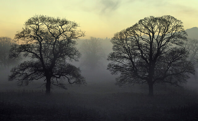
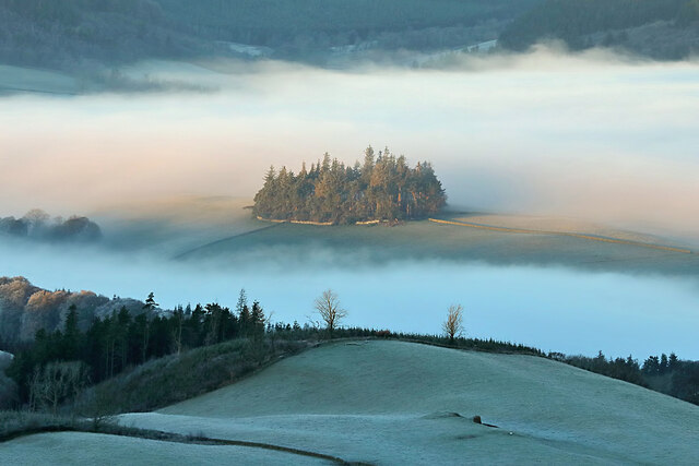
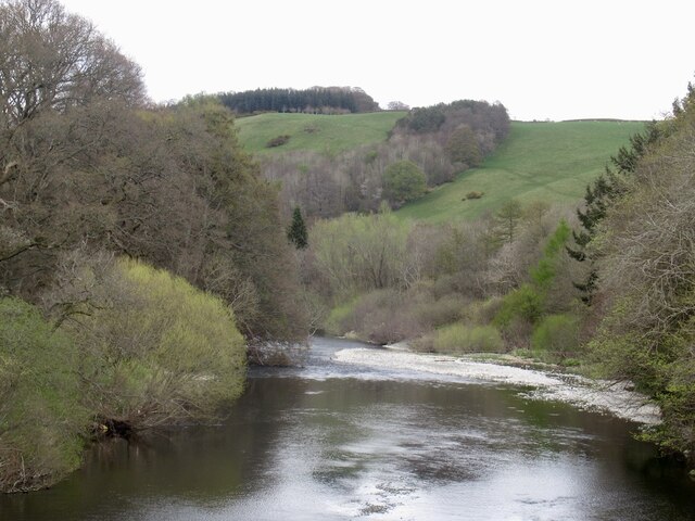
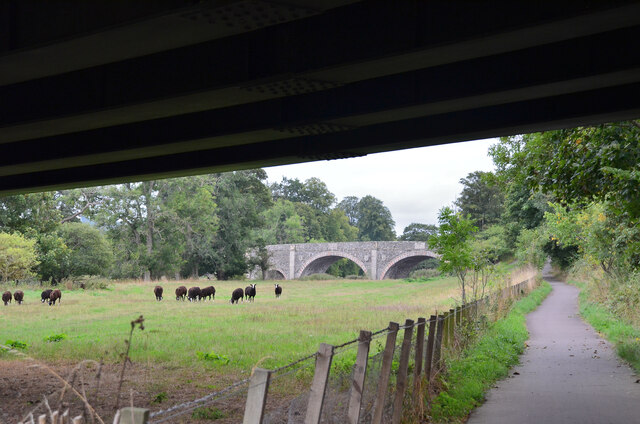
Black Strand is a picturesque freshwater marsh located in Selkirkshire, Scotland. This natural wonder boasts a combination of a lake, pool, pond, and marsh, offering a diverse ecosystem that attracts various species of flora and fauna.

The main attraction of Black Strand is its tranquil lake, which stretches over a vast area and provides a serene environment for visitors to enjoy. The crystal-clear waters of the lake are fed by numerous natural springs, ensuring a constant flow of fresh water throughout the year. This makes it an ideal habitat for a wide range of aquatic plants and animals.

Surrounding the lake, there are several smaller pools and ponds that add to the beauty of Black Strand. These smaller bodies of water are interconnected and create a dynamic habitat for various amphibians, such as frogs and newts, as well as a variety of insects and water-dwelling plants.

The area also features a sprawling freshwater marsh that borders the lake and extends into the surrounding wetlands. This marshland is characterized by its lush vegetation, including reeds, cattails, and water lilies. It provides a vital habitat for numerous bird species, including ducks, herons, and swans, which are often seen gracefully gliding across the water.

Black Strand is a haven for nature enthusiasts, offering a unique opportunity to observe and appreciate the intricate ecosystems that thrive in a freshwater environment. Whether it's birdwatching, exploring the diverse plant life, or simply enjoying the peaceful ambiance, a visit to Black Strand is a truly enriching experience.

If you have any feedback on the listing, please let us know in the comments section below.
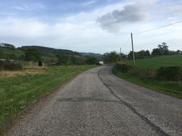
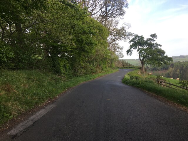
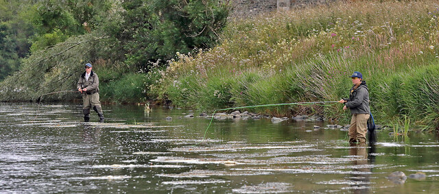
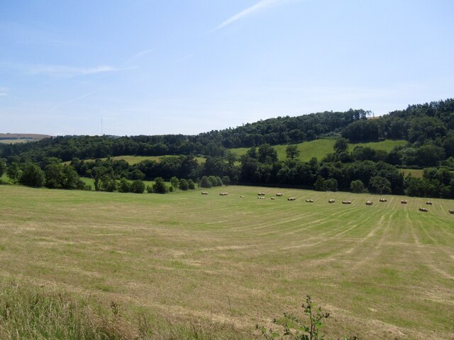
Black Strand Images

Images are sourced within 2km of 55.579313/-2.8182974 or Grid Reference NT4832. Thanks to Geograph Open Source API. All images are credited.

Winter trees by the River Tweed Freezing fog was beginning to form in this dusk shot taken from Tweed Bridge.
Winter trees by the River Tweed
Freezing fog was beginning to form in this dusk shot taken from Tweed Bridge.
Rink Hill from Eildon Mid Hill The small circular plantation on Rink Hill is the site of an Iron Age hillfort. This telephoto shot was taken from the summit of Eildon Mid Hill during a December sunrise. For two closer views of the small plantation on Rink Hill, see <a href="https://www.geograph.org.uk/photo/2347041">NT4832 : The Rink Hill Fort</a> and <a href="https://www.geograph.org.uk/photo/1758293">NT4732 : Rink Hill</a>.
Rink Hill from Eildon Mid Hill
The small circular plantation on Rink Hill is the site of an Iron Age hillfort. This telephoto shot was taken from the summit of Eildon Mid Hill during a December sunrise. For two closer views of the small plantation on Rink Hill, see NT4832 : The Rink Hill Fort and NT4732 : Rink Hill.
Bridgelands Road, Selkirk Looking south-westward.
Bridgelands Road, Selkirk
Looking south-westward.
Lane leading to St Helens, Selkirk Looking south-eastward.
Lane leading to St Helens, Selkirk
Looking south-eastward.
Minor road approaching Lindean Hall Looking north-westward.
Minor road approaching Lindean Hall
Looking north-westward.
A7 and cycle path, Lindean Linking Selkirk and Galashiels by use of path beside the A7 and redundant road alignments.
A7 and cycle path, Lindean
Linking Selkirk and Galashiels by use of path beside the A7 and redundant road alignments.
Ettrick Water View downstream from Ettrick Bridge, a redundant alignment of the A7.
Ettrick Water
View downstream from Ettrick Bridge, a redundant alignment of the A7.
Tweed Bridge Once it carried the A7 it has now been refurbished as a cycle path.
Tweed Bridge
Once it carried the A7 it has now been refurbished as a cycle path.
Pipeline construction Between Galshiels and Selkirk
Pipeline construction
Between Galshiels and Selkirk
Pipeline construction
B6360 near Faldonside
B7060 towards Yair
B7060 towards Yair
B7060 near Yair
B7060 near Yair
Anglers on the River Tweed This stretch of the river is just upstream from Tweed Bridge and the junction with the Ettrick Water.
Anglers on the River Tweed
This stretch of the river is just upstream from Tweed Bridge and the junction with the Ettrick Water.
Field, Fairnielee
Field, Fairnielee
Sheep above the Tweed
Old Tweed Bridge from the A7 bridge The cyclepath alongside the Tweed between Selkirk and Galashiels passes under the A7 bridge here with the Old Tweed Bridge or Rink Bridge in view. Sir Walter Scott laid the foundation stone for the latter in 1831.
Old Tweed Bridge from the A7 bridge
The cyclepath alongside the Tweed between Selkirk and Galashiels passes under the A7 bridge here with the Old Tweed Bridge or Rink Bridge in view. Sir Walter Scott laid the foundation stone for the latter in 1831.
River Tweed, Sunderland
Show me another place!

Black Strand is located at Grid Ref: NT4832 (Lat: 55.579313, Lng: -2.8182974)

Unitary Authority: The Scottish Borders

Police Authority: The Lothians and Scottish Borders

What 3 Words

///minds.ventures.manicured. Near Selkirk, Scottish Borders

Related Wikis

Ettrick Water

The Ettrick Water is a river in Ettrick, by the village of Ettrickbridge and the historic town of Selkirk, in the Scottish Borders area of Scotland. The...

Boleside

Boleside is a village in the Scottish Borders area of Scotland, on the B7060, south of Galashiels. It is very close to the place where the Ettrick Water...

Lindean railway station

Lindean railway station served the village of Lindean, Scottish Borders, Scotland, from 1856 to 1964 on the Selkirk and Galashiels Railway. == History... ==

Abbotsford Ferry railway station

Abbotsford Ferry railway station was a small railway station on the branch line from Galashiels to Selkirk railway station at Selkirk in the Scottish county...

Lindean

Lindean is a village north of Selkirk and the Ettrick Water, in the Scottish Borders area of Scotland. In 1590 the parishioners of Lindean had permission...

Bridgelands

Bridgelands is a village and an 18th-century house in the Scottish Borders area of Scotland, in the parish of Selkirk. Sir Henry Raeburn's wife came from...

Selkirk transmitting station

The Selkirk transmitting station is a telecommunications facility located next to Lindean Loch, near Selkirk in the Scottish Borders. It includes a 229...

Abbotsford, Scottish Borders

Abbotsford is a historic country house in the Scottish Borders, near Galashiels, on the south bank of the River Tweed. Now open to the public, it was built...

Nearby Amenities

Located within 500m of 55.579313,-2.8182974
Barrier: bollard
Bicycle: yes
Bollard: fixed
Foot: yes
Horse: yes
Motor Vehicle: no
Lat/Long: 55.5813545/-2.8136168
Barrier: bollard
Bicycle: yes
Foot: yes
Horse: yes
Motor Vehicle: no
Lat/Long: 55.5807749/-2.8132689
The Rink
Place: hamlet
Lat/Long: 55.5820946/-2.8236323
Barrier: stile
Lat/Long: 55.5810362/-2.8126173
Barrier: stile
Lat/Long: 55.58075/-2.8137405
Barrier: stile
Lat/Long: 55.5809871/-2.8126329
Power: pole
Lat/Long: 55.579874/-2.8246039
Power: pole
Lat/Long: 55.5795057/-2.8254234
Power: pole
Lat/Long: 55.5791533/-2.8262302
Material: wood
Power: pole
Lat/Long: 55.5820751/-2.8233186
Power: pole
Lat/Long: 55.5812378/-2.8237589
Power: pole
Lat/Long: 55.5804365/-2.8241916
Power: pole
Lat/Long: 55.5790281/-2.8252198
The data included in this document is from www.openstreetmap.org. The data is made available under ODbL.

Have you been to Black Strand?

Leave your review of Black Strand below (or comments, questions and feedback).