Cheddar Rising

Lake, Pool, Pond, Freshwater Marsh in Somerset Sedgemoor

England

Cheddar Rising

North Street Chapel, Cheddar
North Street Chapel, Cheddar Credit: PAUL FARMER

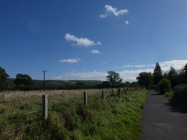
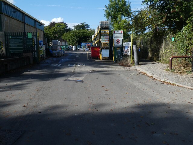
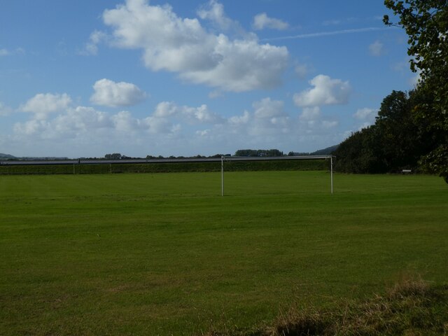
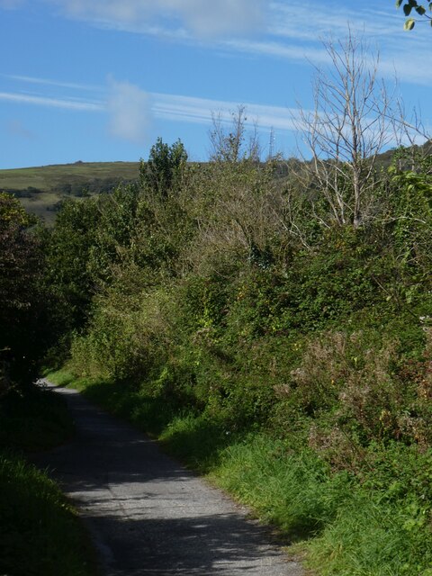
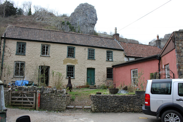
Cheddar Rising is a picturesque region located in Somerset, England, known for its stunning natural landscape and various bodies of water. Situated in the heart of the Mendip Hills, this area is home to a diverse range of aquatic habitats including lakes, pools, ponds, and freshwater marshes.

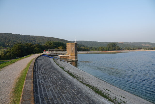
The centerpiece of Cheddar Rising is the Cheddar Reservoir, a large man-made lake that spans over 135 acres. This reservoir was originally created in the 1930s to supply water to the Bristol area and has since become a popular spot for various water activities such as sailing, windsurfing, and fishing. Surrounded by rolling hills and lush greenery, the lake offers a truly serene and tranquil atmosphere.

In addition to the Cheddar Reservoir, the region is also dotted with smaller pools and ponds, which provide important habitats for a wide array of aquatic plants and animals. These bodies of water are often teeming with life, attracting numerous bird species, amphibians, and insects, making it a haven for nature enthusiasts and wildlife photographers.

Furthermore, Cheddar Rising boasts a unique freshwater marsh, a wetland area characterized by its shallow water and diverse vegetation. This marsh serves as a vital ecosystem, supporting a variety of bird species and acting as a breeding ground for amphibians and insects.

Overall, Cheddar Rising is a haven for water lovers and nature enthusiasts alike, offering a stunning array of lakes, pools, ponds, and freshwater marshes that showcase the natural beauty and biodiversity of this charming region in Somerset.

If you have any feedback on the listing, please let us know in the comments section below.

Cheddar Rising Images

Images are sourced within 2km of 51.282041/-2.7681784 or Grid Reference ST4653. Thanks to Geograph Open Source API. All images are credited.

North Street Chapel, Cheddar
Intake tower at Cheddar reservoir
Strawberry Line north-west of Cheddar The National Cycle Network is a network of cycle routes. It was created by the charity Sustrans <span class="nowrap"><a title="http://www.sustrans.org.uk/what-we-do/national-cycle-network" rel="nofollow ugc noopener" href="http://www.sustrans.org.uk/what-we-do/national-cycle-network">Link</a><img style="margin-left:2px;" alt="External link" title="External link - shift click to open in new window" src="https://s1.geograph.org.uk/img/external.png" width="10" height="10"/></span>  (Sustainable Transport), aided by a National Lottery grant.

Many routes aim to minimise contact with motor traffic, though 70% of them are on roads. In some cases the NCN uses pedestrian routes, disused railways, minor roads, canal towpaths, or traffic-calmed routes in towns and cities.
Strawberry Line north-west of Cheddar
The National Cycle Network is a network of cycle routes. It was created by the charity Sustrans LinkExternal link (Sustainable Transport), aided by a National Lottery grant. Many routes aim to minimise contact with motor traffic, though 70% of them are on roads. In some cases the NCN uses pedestrian routes, disused railways, minor roads, canal towpaths, or traffic-calmed routes in towns and cities.
Bridge for Lower New Road, Cheddar over Strawberry Line The National Cycle Network is a network of cycle routes. It was created by the charity Sustrans <span class="nowrap"><a title="http://www.sustrans.org.uk/what-we-do/national-cycle-network" rel="nofollow ugc noopener" href="http://www.sustrans.org.uk/what-we-do/national-cycle-network">Link</a><img style="margin-left:2px;" alt="External link" title="External link - shift click to open in new window" src="https://s1.geograph.org.uk/img/external.png" width="10" height="10"/></span>  (Sustainable Transport), aided by a National Lottery grant.

Many routes aim to minimise contact with motor traffic, though 70% of them are on roads. In some cases the NCN uses pedestrian routes, disused railways, minor roads, canal towpaths, or traffic-calmed routes in towns and cities.
Bridge for Lower New Road, Cheddar over Strawberry Line
The National Cycle Network is a network of cycle routes. It was created by the charity Sustrans LinkExternal link (Sustainable Transport), aided by a National Lottery grant. Many routes aim to minimise contact with motor traffic, though 70% of them are on roads. In some cases the NCN uses pedestrian routes, disused railways, minor roads, canal towpaths, or traffic-calmed routes in towns and cities.
Workshops, Wedmore Road, Cheddar
The edge of Cheddar and woodland in Cheddar Gorge Cheddar Gorge is a limestone gorge in the Mendip Hills, west of the village of Cheddar. The gorge is the site of the Cheddar show caves, where Britain's oldest complete human skeleton, Cheddar Man, estimated to be over 9,000 years old, was found in 1903. Older remains from the Upper Late Palaeolithic era (12,000–13,000 years ago) have been found. The caves, produced by the activity of an underground river, contain stalactites and stalagmites.

Extract from Wikipedia <span class="nowrap"><a title="http://en.wikipedia.org/wiki/Cheddar_Gorge" rel="nofollow ugc noopener" href="http://en.wikipedia.org/wiki/Cheddar_Gorge">Link</a><img style="margin-left:2px;" alt="External link" title="External link - shift click to open in new window" src="https://s1.geograph.org.uk/img/external.png" width="10" height="10"/></span>
The edge of Cheddar and woodland in Cheddar Gorge
Cheddar Gorge is a limestone gorge in the Mendip Hills, west of the village of Cheddar. The gorge is the site of the Cheddar show caves, where Britain's oldest complete human skeleton, Cheddar Man, estimated to be over 9,000 years old, was found in 1903. Older remains from the Upper Late Palaeolithic era (12,000–13,000 years ago) have been found. The caves, produced by the activity of an underground river, contain stalactites and stalagmites. Extract from Wikipedia LinkExternal link
Cheddar Methodist Chapel
Prickles Charity Shop, Cheddar
Builders' merchants, Wedmore Road, Cheddar The Strawberry Line runs to the right of the gate
Builders' merchants, Wedmore Road, Cheddar
The Strawberry Line runs to the right of the gate
Sharpham Road playing fields, Cheddar
Hedge by Strawberry Line, north-west of Cheddar The National Cycle Network is a network of cycle routes. It was created by the charity Sustrans <span class="nowrap"><a title="http://www.sustrans.org.uk/what-we-do/national-cycle-network" rel="nofollow ugc noopener" href="http://www.sustrans.org.uk/what-we-do/national-cycle-network">Link</a><img style="margin-left:2px;" alt="External link" title="External link - shift click to open in new window" src="https://s1.geograph.org.uk/img/external.png" width="10" height="10"/></span>  (Sustainable Transport), aided by a National Lottery grant.

Many routes aim to minimise contact with motor traffic, though 70% of them are on roads. In some cases the NCN uses pedestrian routes, disused railways, minor roads, canal towpaths, or traffic-calmed routes in towns and cities.
Hedge by Strawberry Line, north-west of Cheddar
The National Cycle Network is a network of cycle routes. It was created by the charity Sustrans LinkExternal link (Sustainable Transport), aided by a National Lottery grant. Many routes aim to minimise contact with motor traffic, though 70% of them are on roads. In some cases the NCN uses pedestrian routes, disused railways, minor roads, canal towpaths, or traffic-calmed routes in towns and cities.
Rose Cottage, The Cliffs, Cheddar Grade II Listed early 19th century cottage previously Cheddar Toy and Model Museum, the pink south wing containing Cheddar Models. In 2015 sales particulars it was described as “The interior space offers some 1,473 sq.ft. of floor space and requires total renovation. It is divided into the residential area which is two storey – some floors are missing. The shop premises are single storey and have been modernised with sash windows and new rendered walls and a separate door onto the street”. The museum opened in May 1996 under the famous Lion Rock. In August 2011 the museum website was offering the business for sale and by June 2012 its website was reporting it closed. The building appears to have sold in May 2015 and in January 2020 it was reported Listed Building Consent had been granted for renovation work. A search of my directories only locates one entry for Rose Cottage, 1914 Miss Sarah Stephens, refreshment rooms, Rose Cottage, Cliff Road. From what I can make out there seems to be no business here in the 1890s but in the 1920s and 1940s photos seem to show a shop.
Rose Cottage, The Cliffs, Cheddar
Grade II Listed early 19th century cottage previously Cheddar Toy and Model Museum, the pink south wing containing Cheddar Models. In 2015 sales particulars it was described as “The interior space offers some 1,473 sq.ft. of floor space and requires total renovation. It is divided into the residential area which is two storey – some floors are missing. The shop premises are single storey and have been modernised with sash windows and new rendered walls and a separate door onto the street”. The museum opened in May 1996 under the famous Lion Rock. In August 2011 the museum website was offering the business for sale and by June 2012 its website was reporting it closed. The building appears to have sold in May 2015 and in January 2020 it was reported Listed Building Consent had been granted for renovation work. A search of my directories only locates one entry for Rose Cottage, 1914 Miss Sarah Stephens, refreshment rooms, Rose Cottage, Cliff Road. From what I can make out there seems to be no business here in the 1890s but in the 1920s and 1940s photos seem to show a shop.
Information centre, former National Trust Shop, The Cliffs, Cheddar Sedgemoor District Council built the information centre in the 1980s and was more recently leased by the National Trust. Late 2020 the Trust announced it would not be renewing its lease. Cheddar Vision Group (established 2014) decided to take on the building as a community project and it reopened on 23rd October 2021 through the half term week. Opening at weekends over winter it was intended to open weekdays in Spring 2022.
Information centre, former National Trust Shop, The Cliffs, Cheddar
Sedgemoor District Council built the information centre in the 1980s and was more recently leased by the National Trust. Late 2020 the Trust announced it would not be renewing its lease. Cheddar Vision Group (established 2014) decided to take on the building as a community project and it reopened on 23rd October 2021 through the half term week. Opening at weekends over winter it was intended to open weekdays in Spring 2022.
Rose Cottage and Lily Cottage, The Cliffs, Cheddar On the left, Grade II Rose Cottage, (see <a href="https://www.geograph.org.uk/photo/7121338">ST4653 : Rose Cottage, The Cliffs, Cheddar</a>). Nestled in the background is Grade II Listed early 19th century Lily Cottage along with the small shop in front previously the Leather Shop that appears to have closed between 2011-2015. The small shop at the front was a gift shop for a while that probably closed 2017. Planning was approved in late 2017 for a change of use of the cottage to a dwelling.
Rose Cottage and Lily Cottage, The Cliffs, Cheddar
On the left, Grade II Rose Cottage, (see ST4653 : Rose Cottage, The Cliffs, Cheddar). Nestled in the background is Grade II Listed early 19th century Lily Cottage along with the small shop in front previously the Leather Shop that appears to have closed between 2011-2015. The small shop at the front was a gift shop for a while that probably closed 2017. Planning was approved in late 2017 for a change of use of the cottage to a dwelling.
Lion Rock Tea Rooms, The Cliffs, Cheddar Claimed to have been trading since 1908 prior to at least 2014 the well regarded tea room's was known as Derrick's Tea Rooms and Shop.
Lion Rock Tea Rooms, The Cliffs, Cheddar
Claimed to have been trading since 1908 prior to at least 2014 the well regarded tea room's was known as Derrick's Tea Rooms and Shop.
The White Hart, The Bays, Cheddar Unusually for a pub, I can find very little information about the building on line. Directory entries include; 1842-1852 Cheddar not listed; 1889-1902 Frank House, White Hart; 1914-1919 Henry Durbin, White Hart P.H., The Cliffs; 1932 Emma Durbin.
The White Hart, The Bays, Cheddar
Unusually for a pub, I can find very little information about the building on line. Directory entries include; 1842-1852 Cheddar not listed; 1889-1902 Frank House, White Hart; 1914-1919 Henry Durbin, White Hart P.H., The Cliffs; 1932 Emma Durbin.
Cliff Road, Cheddar Gorge A quiet morning with plenty of shade
Cliff Road, Cheddar Gorge
A quiet morning with plenty of shade
Cheddar Gorge Catching the early morning sun viewed from a Cliff Road lay-by
Cheddar Gorge
Catching the early morning sun viewed from a Cliff Road lay-by
Show me another place!

Cheddar Rising is located at Grid Ref: ST4653 (Lat: 51.282041, Lng: -2.7681784)

Administrative County: Somerset

District: Sedgemoor

Police Authority: Avon and Somerset

What 3 Words

///nicely.taxi.prowling. Near Bradley Cross, Somerset

Related Wikis

Cox's Cave

Cox's Cave is in Cheddar Gorge on the Mendip Hills, in Somerset, England. It is open to the public as a show cave. The cave is named after mill owner George...

Cheddar Complex

The Cheddar Complex is a 441.3-hectare (1,090-acre) biological Site of Special Scientific Interest near Cheddar around the Cheddar Gorge and north east...
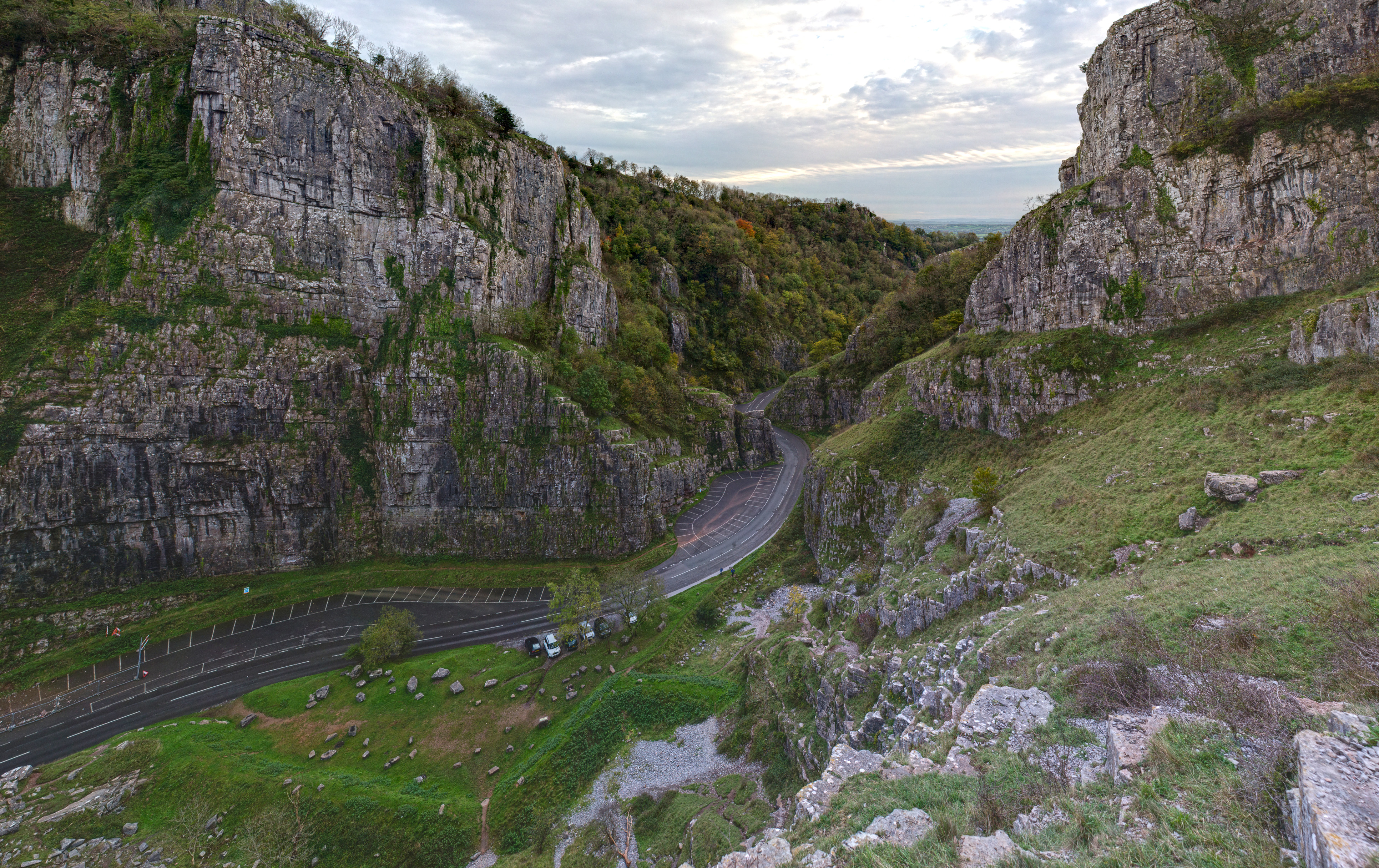
Cheddar Gorge

Cheddar Gorge is a limestone gorge in the Mendip Hills, near the village of Cheddar, Somerset, England. The gorge is the site of the Cheddar show caves...

Gough's Cave

Gough's Cave ( GOF) is located in Cheddar Gorge on the Mendip Hills, in Cheddar, Somerset, England. The cave is 115 m (377 ft) deep and is 3.405 km (2...

Nearby Amenities

Located within 500m of 51.282041,-2.7681784
Cheddar Viewing Tower
Alt Name: Jacob's Tower
Tourism: viewpoint
Lat/Long: 51.280493/-2.7702623
Natural: cave_entrance
Lat/Long: 51.2830084/-2.7633018
Gough's Cave
Name Zh: 高夫洞
Natural: cave_entrance
Tourism: attraction
Wikidata: Q4274798
Wikipedia: en:Gough's Cave
Lat/Long: 51.2819621/-2.765395
Toilets
Lat/Long: 51.2821284/-2.7657645
Cox's Cave and The Crystal Quest
Natural: cave_entrance
Tourism: attraction
Wikidata: Q5179851
Wikipedia: en:Cox's Cave
Lat/Long: 51.2817353/-2.7689256
Toilets
Lat/Long: 51.281486/-2.7706213
Pub
The Galleries Inn
Lat/Long: 51.2806908/-2.7717171
Post Box
Operator: Royal Mail
Operator Wikidata: Q638098
Post Box Type: wall
Ref: BS27 21D
Royal Cypher: EIIR
Royal Cypher Wikidata: Q33102113
Source: survey
Lat/Long: 51.2796545/-2.7736281
Cheddar Cheese Co
Tourism: attraction
Lat/Long: 51.2806362/-2.7722307
Cheddar Man and the Cannibals
Tourism: museum
Lat/Long: 51.282064/-2.7662445
Barrier: turnstile
Toll: yes
Lat/Long: 51.281396/-2.7697541
Fast Food
Lat/Long: 51.2820591/-2.7658599
Cheddar Caves & Gorge Tickets
Opening Hours: Mo-Su 10:00-17:00
Tourism: information
Lat/Long: 51.2814744/-2.7695417
Bicycle Parking
Bicycle Parking: stands
Capacity: 8
Covered: no
Lat/Long: 51.2818628/-2.7664907
Post Box
Brand: Royal Mail
Brand Wikidata: Q638098
Collection Times: Mo-Fr 16:15; Sa 08:15
Operator: Royal Mail
Operator Wikidata: Q638098
Post Box Type: wall
Ref: BS27 92
Lat/Long: 51.2817941/-2.7671535
Cheddar Gorge & Caves
Addr City: Cheddar
Addr Housename: Cheddar Gorge & Caves
Addr Postcode: BS27 3QF
Alt Name: Cheddar Gorge
Email: info@cheddargorge.co.uk
Name Zh: 切达峡谷和岩洞
Opening Hours: Mo-Su 10:00-17:30
Owner: Longleat Enterprises Limited
Phone: +44 1934 742343
Tourism: attraction
Website: https://www.cheddargorge.co.uk/
Wikidata: Q1068812
Wikipedia: en:Cheddar Gorge
Lat/Long: 51.2825942/-2.7656541
Fast Food
Cheddar Fish Bar
Addr City: Cheddar
Addr Postcode: BS27 3PX
Addr Street: Cliff Street
Cuisine: fish_and_chips
Fhrs Id: 145411
Lat/Long: 51.2797774/-2.7737609
Barrier: stile
Lat/Long: 51.2854402/-2.7638561
Bench
Lat/Long: 51.2797887/-2.7734431
Waste Basket
Waste: trash
Lat/Long: 51.2797432/-2.7734257
Tourism: picnic_site
Lat/Long: 51.2813364/-2.7704773
Bench
Lat/Long: 51.2813635/-2.7705074
Lion Rock
Natural: rock
Tourism: attraction
Lat/Long: 51.2825011/-2.7664344
Information: board
Tourism: information
Lat/Long: 51.2824172/-2.7611424
Access: customers
Leisure: playground
Lat/Long: 51.2792416/-2.7733959
Bake Hole
Ele: 111
Natural: cave_entrance
Lat/Long: 51.2845674/-2.7665198
Waste Basket
Waste: trash
Lat/Long: 51.2796846/-2.7733699
The Cheddar Cakery
Addr Postcode: BS27 3PX
Addr Street: Cliff Street
Cuisine: cake
Phone: +44 1934 707879
Shop: bakery
Lat/Long: 51.2796949/-2.7735543
Shop: gift
Lat/Long: 51.279555/-2.7739001
Shop: pet_grooming
Lat/Long: 51.2796928/-2.7739585
Bench
Lat/Long: 51.281473/-2.7733764
Waste Basket
Lat/Long: 51.2814552/-2.7733502
St John Ambulance (Cheddar Division)
Ambulance Station
Emergency: ambulance_station
Operator: St John Ambulance
Operator Wikidata: Q7593637
Lat/Long: 51.2808423/-2.7731555
Restaurant
Franks Restaurant
Cuisine: international
Lat/Long: 51.2810724/-2.7722027
Power: pole
Lat/Long: 51.2820476/-2.7737571
Post Box
Lat/Long: 51.2820462/-2.7737542
Power: pole
Lat/Long: 51.2820804/-2.7751347
Power: pole
Lat/Long: 51.2820704/-2.7743687
Power: pole
Lat/Long: 51.2822762/-2.7731376
Power: pole
Lat/Long: 51.2817374/-2.7735667
Power: pole
Lat/Long: 51.2815309/-2.7733181
Power: pole
Lat/Long: 51.2816828/-2.7730315
Power: pole
Lat/Long: 51.2818875/-2.7725152
Power: pole
Lat/Long: 51.2820559/-2.7720478
Power: pole
Lat/Long: 51.2813037/-2.7738991
Power: pole
Lat/Long: 51.2813995/-2.7742342
Power: pole
Lat/Long: 51.282616/-2.7729397
Power: pole
Lat/Long: 51.2830477/-2.7728747
Power: pole
Lat/Long: 51.2832624/-2.7729437
Power: substation
Lat/Long: 51.2807726/-2.7717413
Power: substation
Lat/Long: 51.2820946/-2.7671104
Power: pole
Lat/Long: 51.2792126/-2.771133
Power: pole
Lat/Long: 51.2794344/-2.7705974
Power: pole
Lat/Long: 51.2788133/-2.7711808
Natural: cave_entrance
Lat/Long: 51.281523/-2.7663097
Restaurant
Zen Thai
Cuisine: thai
Lat/Long: 51.2799728/-2.7725311
Cheddar Cliffs Gift Co.
Shop: gift
Lat/Long: 51.2798277/-2.7726518
Restaurant
Rasoi
Cuisine: indian
Phone: +44 1934 744 230
Lat/Long: 51.2796876/-2.7728006
Motorcycle Parking
Lat/Long: 51.2789603/-2.773325
Cheddar Gorge Cheese Shop
Addr Postcode: BS27 3QA
Addr Street: The Cliffs
Email: info@cheddargorgecheese.com
Name En: Cheddar Gorge Cheese Company
Opening Hours: Mo-Su 10:00-17:00
Phone: +44 1934 742810
Shop: cheese
Website: https://www.cheddargorgecheese.com/
Lat/Long: 51.2804299/-2.7723825
Cheddar Visitor Information Centre
Information: office
Tourism: information
Website: https://discovercheddar.co.uk/vic/
Lat/Long: 51.2817696/-2.7666054
The data included in this document is from www.openstreetmap.org. The data is made available under ODbL.

Have you been to Cheddar Rising?

Leave your review of Cheddar Rising below (or comments, questions and feedback).