Laing's Pot

Lake, Pool, Pond, Freshwater Marsh in Banffshire

Scotland

Laing's Pot

River Dee
River Dee Credit: thejackrustles

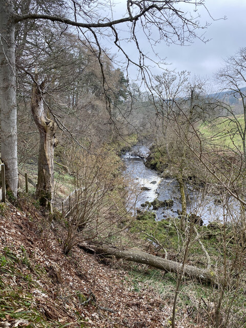
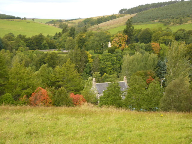
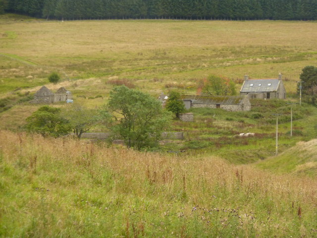
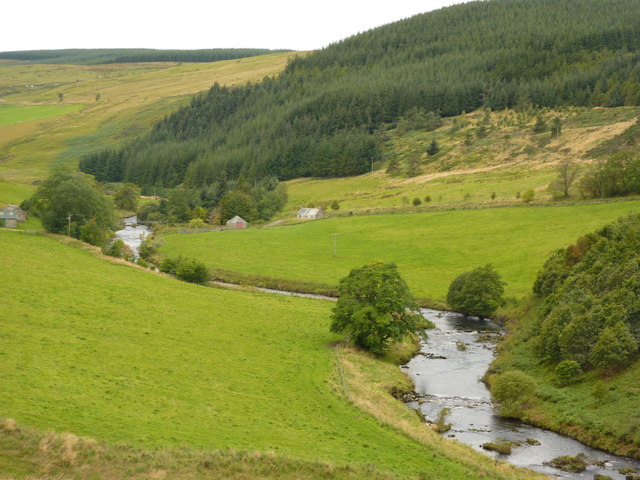
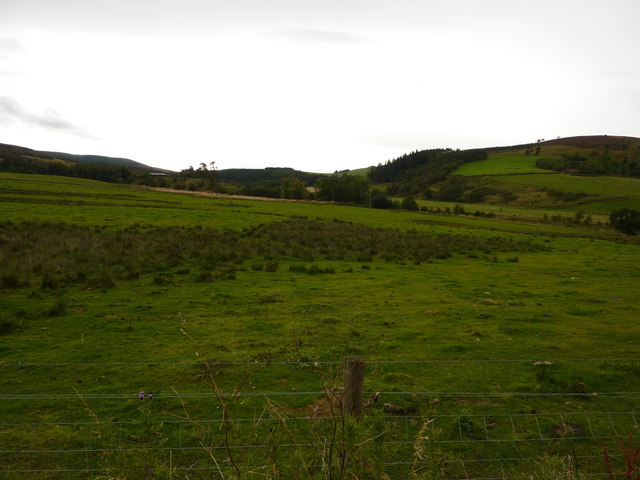
Laing's Pot, situated in Banffshire, is a stunning freshwater marshland encompassing a lake, pool, pond, and a variety of captivating natural features. This picturesque landscape offers an idyllic setting for nature enthusiasts and wildlife lovers alike.

The centerpiece of Laing's Pot is a serene lake, characterized by its crystal-clear waters reflecting the surrounding lush greenery. The lake serves as a habitat for numerous aquatic species, including fish, amphibians, and waterfowl. Its tranquil ambiance makes it an ideal spot for fishing or simply enjoying the peaceful atmosphere.

Adjacent to the lake, a pool and pond can be found, each possessing its own unique charm. The pool is a small, shallow body of water, often forming during the rainy season, attracting various bird species for bathing and feeding. The pond, on the other hand, is a deeper water body, featuring an abundance of aquatic plants and serving as a haven for frogs, newts, and other amphibians.

Laing's Pot also boasts a thriving freshwater marsh, characterized by its rich biodiversity and vibrant vegetation. The marshland is home to an array of plant species, including reeds, sedges, and water lilies, creating a visually captivating landscape. This ecosystem supports a diverse range of wildlife, such as dragonflies, butterflies, and numerous bird species.

Overall, Laing's Pot in Banffshire offers a captivating natural setting, combining a picturesque lake, pool, pond, and freshwater marshland. It provides a haven for a variety of flora and fauna, making it a must-visit destination for nature enthusiasts seeking to immerse themselves in the beauty of the Scottish countryside.

If you have any feedback on the listing, please let us know in the comments section below.

Laing's Pot Images

Images are sourced within 2km of 57.415919/-2.9587126 or Grid Reference NJ4236. Thanks to Geograph Open Source API. All images are credited.

River Dee
River Dee
Netherton, a house by the River Deveron
Rooftop of Auchinhandoch A house by the River Deveron, Strathbogie, opposite Beldorney Castle, the tennis courts and grounds of which can be glimpsed through the trees.
Rooftop of Auchinhandoch
A house by the River Deveron, Strathbogie, opposite Beldorney Castle, the tennis courts and grounds of which can be glimpsed through the trees.
Young plantation near Howiemill Looking south west, up the valley of the River Deveron. The hill in the centre distance is Craig Dorney.
Young plantation near Howiemill
Looking south west, up the valley of the River Deveron. The hill in the centre distance is Craig Dorney.
Shed and waste bins for Succoth Farm
Wrightstone, farm buildings in Deveron valley
River Deveron at Waterside A footbridge crosses the river between the building with the green roof and the small red-doored building, at Mill of Lynebain. Conifer plantation covers the slopes of Craig Dorney.
River Deveron at Waterside
A footbridge crosses the river between the building with the green roof and the small red-doored building, at Mill of Lynebain. Conifer plantation covers the slopes of Craig Dorney.
Rough pasture land, Strathbogie Looking south west, up the valley of the River Deveron.
Rough pasture land, Strathbogie
Looking south west, up the valley of the River Deveron.
Nether Dumeath Recumbent Stone Circle (1) Approaching the circle, which is in an enclosure in a field, it is obvious that most of the stones are no longer standing. See <span class="nowrap"><a title="https://canmore.org.uk/site/17280/nether-dumeath" rel="nofollow ugc noopener" href="https://canmore.org.uk/site/17280/nether-dumeath">Link</a><img style="margin-left:2px;" alt="External link" title="External link - shift click to open in new window" src="https://s1.geograph.org.uk/img/external.png" width="10" height="10"/></span> for more details. <a href="https://www.geograph.org.uk/photo/4838828">NJ4237 : Nether Dumeath Recumbent Stone Circle (2)</a>
Nether Dumeath Recumbent Stone Circle (1)
Approaching the circle, which is in an enclosure in a field, it is obvious that most of the stones are no longer standing. See LinkExternal link for more details. NJ4237 : Nether Dumeath Recumbent Stone Circle (2)
Nether Dumeath Recumbent Stone Circle (2) A general view of the circle, with the Hill of Dumeath in the background.  See <span class="nowrap"><a title="https://canmore.org.uk/site/17280/nether-dumeath" rel="nofollow ugc noopener" href="https://canmore.org.uk/site/17280/nether-dumeath">Link</a><img style="margin-left:2px;" alt="External link" title="External link - shift click to open in new window" src="https://s1.geograph.org.uk/img/external.png" width="10" height="10"/></span> for more details. <a href="https://www.geograph.org.uk/photo/4838833">NJ4237 : Nether Dumeath Recumbent Stone Circle (3)</a>
Nether Dumeath Recumbent Stone Circle (2)
A general view of the circle, with the Hill of Dumeath in the background. See LinkExternal link for more details. NJ4237 : Nether Dumeath Recumbent Stone Circle (3)
Nether Dumeath Recumbent Stone Circle (3) The circle from the south-east, showing that most of the stones have fallen or nearly fallen.  See <span class="nowrap"><a title="https://canmore.org.uk/site/17280/nether-dumeath" rel="nofollow ugc noopener" href="https://canmore.org.uk/site/17280/nether-dumeath">Link</a><img style="margin-left:2px;" alt="External link" title="External link - shift click to open in new window" src="https://s1.geograph.org.uk/img/external.png" width="10" height="10"/></span> for more details. <a href="https://www.geograph.org.uk/photo/4838838">NJ4237 : Nether Dumeath Recumbent Stone Circle (4)</a>
Nether Dumeath Recumbent Stone Circle (3)
The circle from the south-east, showing that most of the stones have fallen or nearly fallen. See LinkExternal link for more details. NJ4237 : Nether Dumeath Recumbent Stone Circle (4)
Nether Dumeath Recumbent Stone Circle (4) The large stone closets to the camera, is the recumbent, which has fallen on its face, and may not be in its exact original position. Behind it is one of the two remaining orthostats, leaning over at a steep angle. See <span class="nowrap"><a title="https://canmore.org.uk/site/17280/nether-dumeath" rel="nofollow ugc noopener" href="https://canmore.org.uk/site/17280/nether-dumeath">Link</a><img style="margin-left:2px;" alt="External link" title="External link - shift click to open in new window" src="https://s1.geograph.org.uk/img/external.png" width="10" height="10"/></span> for more details. <a href="https://www.geograph.org.uk/photo/4838847">NJ4237 : Nether Dumeath Recumbent Stone Circle (5)</a>
Nether Dumeath Recumbent Stone Circle (4)
The large stone closets to the camera, is the recumbent, which has fallen on its face, and may not be in its exact original position. Behind it is one of the two remaining orthostats, leaning over at a steep angle. See LinkExternal link for more details. NJ4237 : Nether Dumeath Recumbent Stone Circle (5)
Nether Dumeath Recumbent Stone Circle (5) The long stone nearest the camera is the west flanker, and behind it is the remaining stone of the western arc.  See <span class="nowrap"><a title="https://canmore.org.uk/site/17280/nether-dumeath" rel="nofollow ugc noopener" href="https://canmore.org.uk/site/17280/nether-dumeath">Link</a><img style="margin-left:2px;" alt="External link" title="External link - shift click to open in new window" src="https://s1.geograph.org.uk/img/external.png" width="10" height="10"/></span> for more details. <a href="https://www.geograph.org.uk/photo/4838853">NJ4237 : Nether Dumeath Recumbent Stone Circle (6)</a>
Nether Dumeath Recumbent Stone Circle (5)
The long stone nearest the camera is the west flanker, and behind it is the remaining stone of the western arc. See LinkExternal link for more details. NJ4237 : Nether Dumeath Recumbent Stone Circle (6)
Nether Dumeath Recumbent Stone Circle (6) On the left is the fallen west flanker, and on the right is the fallen and displaced recumbent. Between them is an assortment of boulders, some from field clearance and some being fragments of the east flanker and other stones of the circle.  See <span class="nowrap"><a title="https://canmore.org.uk/site/17280/nether-dumeath" rel="nofollow ugc noopener" href="https://canmore.org.uk/site/17280/nether-dumeath">Link</a><img style="margin-left:2px;" alt="External link" title="External link - shift click to open in new window" src="https://s1.geograph.org.uk/img/external.png" width="10" height="10"/></span> for more details. <a href="https://www.geograph.org.uk/photo/4838856">NJ4237 : Nether Dumeath Recumbent Stone Circle (7)</a>
Nether Dumeath Recumbent Stone Circle (6)
On the left is the fallen west flanker, and on the right is the fallen and displaced recumbent. Between them is an assortment of boulders, some from field clearance and some being fragments of the east flanker and other stones of the circle. See LinkExternal link for more details. NJ4237 : Nether Dumeath Recumbent Stone Circle (7)
Nether Dumeath Recumbent Stone Circle (7) The stone with the slope is the only stone on the western arc of the circle that has not completely fallen.  See <span class="nowrap"><a title="https://canmore.org.uk/site/17280/nether-dumeath" rel="nofollow ugc noopener" href="https://canmore.org.uk/site/17280/nether-dumeath">Link</a><img style="margin-left:2px;" alt="External link" title="External link - shift click to open in new window" src="https://s1.geograph.org.uk/img/external.png" width="10" height="10"/></span> for more details. <a href="https://www.geograph.org.uk/photo/4838860">NJ4237 : Nether Dumeath Recumbent Stone Circle (8)</a>
Nether Dumeath Recumbent Stone Circle (7)
The stone with the slope is the only stone on the western arc of the circle that has not completely fallen. See LinkExternal link for more details. NJ4237 : Nether Dumeath Recumbent Stone Circle (8)
Nether Dumeath Recumbent Stone Circle (8) This is the last stone standing, though from this angle it looks much more upright than it really is!  See <span class="nowrap"><a title="https://canmore.org.uk/site/17280/nether-dumeath" rel="nofollow ugc noopener" href="https://canmore.org.uk/site/17280/nether-dumeath">Link</a><img style="margin-left:2px;" alt="External link" title="External link - shift click to open in new window" src="https://s1.geograph.org.uk/img/external.png" width="10" height="10"/></span> for more details. <a href="https://www.geograph.org.uk/photo/4838865">NJ4237 : Nether Dumeath Recumbent Stone Circle (9)</a>
Nether Dumeath Recumbent Stone Circle (8)
This is the last stone standing, though from this angle it looks much more upright than it really is! See LinkExternal link for more details. NJ4237 : Nether Dumeath Recumbent Stone Circle (9)
Nether Dumeath Recumbent Stone Circle (9) This is the only stone of the western arc which has not completely fallen. To its left are some of the smaller boulders and stone fragments piled up between the west flanker and the recumbent.  See <span class="nowrap"><a title="https://canmore.org.uk/site/17280/nether-dumeath" rel="nofollow ugc noopener" href="https://canmore.org.uk/site/17280/nether-dumeath">Link</a><img style="margin-left:2px;" alt="External link" title="External link - shift click to open in new window" src="https://s1.geograph.org.uk/img/external.png" width="10" height="10"/></span> for more details. <a href="https://www.geograph.org.uk/photo/4838869">NJ4237 : Nether Dumeath Recumbent Stone Circle (10)</a>
Nether Dumeath Recumbent Stone Circle (9)
This is the only stone of the western arc which has not completely fallen. To its left are some of the smaller boulders and stone fragments piled up between the west flanker and the recumbent. See LinkExternal link for more details. NJ4237 : Nether Dumeath Recumbent Stone Circle (10)
Nether Dumeath Recumbent Stone Circle (10) The leaning stone is on the east arc of the circle. It's a moot point whether it can still be described as standing!  See <span class="nowrap"><a title="https://canmore.org.uk/site/17280/nether-dumeath" rel="nofollow ugc noopener" href="https://canmore.org.uk/site/17280/nether-dumeath">Link</a><img style="margin-left:2px;" alt="External link" title="External link - shift click to open in new window" src="https://s1.geograph.org.uk/img/external.png" width="10" height="10"/></span> for more details. <a href="https://www.geograph.org.uk/photo/4838824">NJ4237 : Nether Dumeath Recumbent Stone Circle (1)</a>
Nether Dumeath Recumbent Stone Circle (10)
The leaning stone is on the east arc of the circle. It's a moot point whether it can still be described as standing! See LinkExternal link for more details. NJ4237 : Nether Dumeath Recumbent Stone Circle (1)
Show me another place!

Laing's Pot is located at Grid Ref: NJ4236 (Lat: 57.415919, Lng: -2.9587126)

Unitary Authority: Aberdeenshire

Police Authority: North East

What 3 Words

///variances.delay.tasks. Near Dufftown, Moray

Related Wikis

Beldorney Castle

Beldorney Castle is a Z-plan castle dating from the mid-16th century, about two miles south of Glass, in hilly country in the valley of the Deveron, in...

Glass, Aberdeenshire

Glass is a parish about 8 miles west of Huntly, Aberdeenshire, Scotland. It is now wholly located in Aberdeenshire but before the reorganisation of Scottish...

Blairmore School

Blairmore School was an independent boarding preparatory school in Glass near Huntly, Aberdeenshire until its closure in 1993. The site is now owned and...

Torry Burn, Huntly

Torry Burn is a burn which marks the boundary of the parish of Huntly, Aberdeenshire, Scotland. == References ==

Kye Hill

Kye Hill is a hill by Huntly, Aberdeenshire, Scotland. It lies southwest of The Clashmach hill and is nearly the same height. There is a former limestone...

Wormy Hillock Henge

Wormy Hillock Henge, also known as The Dragon's Grave, is a small henge in Aberdeenshire, Scotland. It is a Scheduled Ancient Monument located in the Clashindarroch...

Auchindoun Castle

Auchindoun Castle is a 15th-century L-Plan tower castle located in Auchindoun near Dufftown in Moray, Scotland. == History == While there is evidence of...

Ardonald

Ardonald is a rural area near Cairnie in Aberdeenshire, Scotland. == References ==

Nearby Amenities

Located within 500m of 57.415919,-2.9587126
Power: pole
Lat/Long: 57.4119048/-2.9554656
Power: pole
Lat/Long: 57.4182549/-2.9582634
Power: pole
Lat/Long: 57.4188258/-2.9586759
Power: pole
Lat/Long: 57.4195255/-2.9591462
Power: pole
Lat/Long: 57.4198774/-2.9593913
Howemill
Place: isolated_dwelling
Lat/Long: 57.4123192/-2.9554298
Auchinhandoch
Place: isolated_dwelling
Lat/Long: 57.4179354/-2.9577902
Beldorney
Name Gd: Baile Dòrnaich
Place: hamlet
Lat/Long: 57.4192758/-2.9640558
The data included in this document is from www.openstreetmap.org. The data is made available under ODbL.

Have you been to Laing's Pot?

Leave your review of Laing's Pot below (or comments, questions and feedback).