Birchen Brae

Wood, Forest in Banffshire

Scotland

Birchen Brae

River Dee
River Dee Credit: thejackrustles

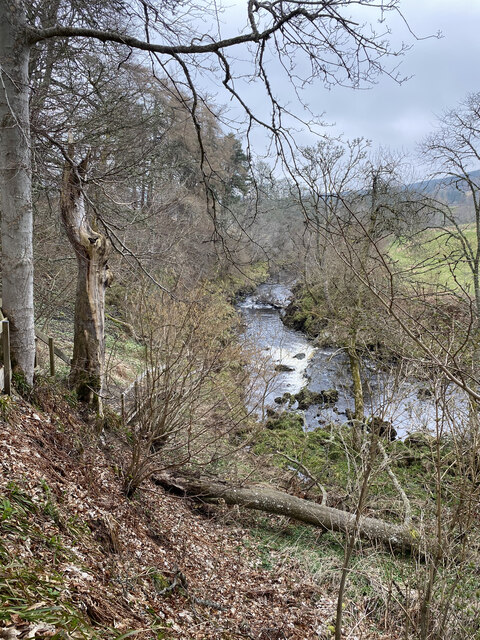
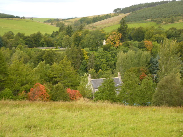
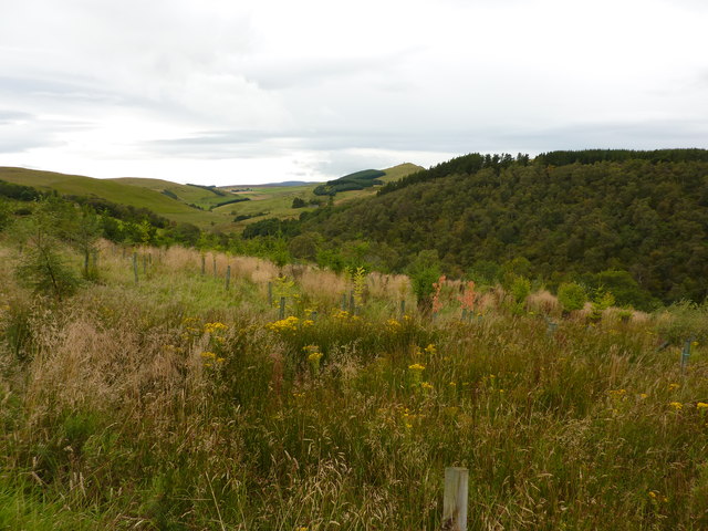
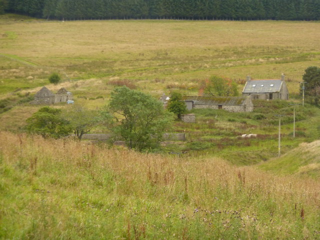
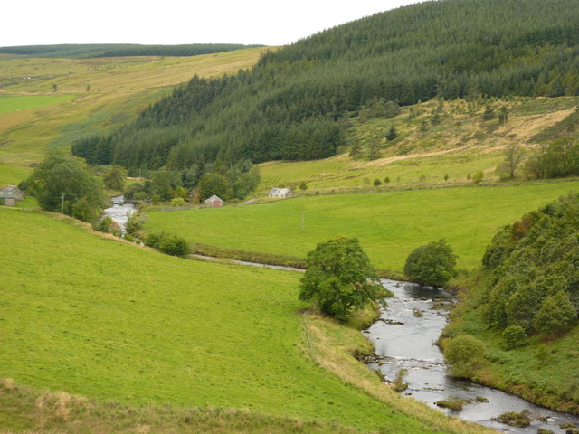
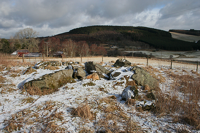
Birchen Brae, located in Banffshire, Scotland, is a picturesque woodland area renowned for its natural beauty and diverse ecosystem. Spread across several acres, this forested region is characterized by its dense growth of birch trees, giving it its name and adding to its charm.

The woodland is home to a rich variety of flora and fauna, making it a haven for nature enthusiasts and wildlife lovers. The forest floor is carpeted with a lush carpet of moss, ferns, and wildflowers, creating a vibrant and colorful landscape throughout the year. The birch trees tower over the undergrowth, creating a leafy canopy that provides shade and shelter to an array of bird species.

Visitors to Birchen Brae can enjoy a range of activities, such as hiking along the well-maintained trails that crisscross the forest. The paths offer an opportunity to explore the area's natural wonders, including small streams, hidden waterfalls, and charming glades. Birdwatchers can delight in spotting various feathered inhabitants, including woodpeckers, owls, and songbirds.

The forest also plays an important role in conservation efforts, with local authorities actively protecting the diverse ecosystem by implementing sustainable management practices. This ensures the longevity and preservation of the area's unique biodiversity.

Birchen Brae, with its tranquil ambiance and stunning natural surroundings, offers a serene escape for those seeking solace in nature. Whether it's a leisurely stroll, a birdwatching expedition, or simply an opportunity to connect with the great outdoors, this woodland in Banffshire provides an enchanting experience for all who visit.

If you have any feedback on the listing, please let us know in the comments section below.

Birchen Brae Images

Images are sourced within 2km of 57.411852/-2.960787 or Grid Reference NJ4236. Thanks to Geograph Open Source API. All images are credited.

River Dee
River Dee
Netherton, a house by the River Deveron
Rooftop of Auchinhandoch A house by the River Deveron, Strathbogie, opposite Beldorney Castle, the tennis courts and grounds of which can be glimpsed through the trees.
Rooftop of Auchinhandoch
A house by the River Deveron, Strathbogie, opposite Beldorney Castle, the tennis courts and grounds of which can be glimpsed through the trees.
Young plantation near Howiemill Looking south west, up the valley of the River Deveron. The hill in the centre distance is Craig Dorney.
Young plantation near Howiemill
Looking south west, up the valley of the River Deveron. The hill in the centre distance is Craig Dorney.
Shed and waste bins for Succoth Farm
Wrightstone, farm buildings in Deveron valley
River Deveron at Waterside A footbridge crosses the river between the building with the green roof and the small red-doored building, at Mill of Lynebain. Conifer plantation covers the slopes of Craig Dorney.
River Deveron at Waterside
A footbridge crosses the river between the building with the green roof and the small red-doored building, at Mill of Lynebain. Conifer plantation covers the slopes of Craig Dorney.
Nether Dumeath Recumbent Stone Circle (1) Approaching the circle, which is in an enclosure in a field, it is obvious that most of the stones are no longer standing. See <span class="nowrap"><a title="https://canmore.org.uk/site/17280/nether-dumeath" rel="nofollow ugc noopener" href="https://canmore.org.uk/site/17280/nether-dumeath">Link</a><img style="margin-left:2px;" alt="External link" title="External link - shift click to open in new window" src="https://s1.geograph.org.uk/img/external.png" width="10" height="10"/></span> for more details. <a href="https://www.geograph.org.uk/photo/4838828">NJ4237 : Nether Dumeath Recumbent Stone Circle (2)</a>
Nether Dumeath Recumbent Stone Circle (1)
Approaching the circle, which is in an enclosure in a field, it is obvious that most of the stones are no longer standing. See LinkExternal link for more details. NJ4237 : Nether Dumeath Recumbent Stone Circle (2)
Nether Dumeath Recumbent Stone Circle (2) A general view of the circle, with the Hill of Dumeath in the background.  See <span class="nowrap"><a title="https://canmore.org.uk/site/17280/nether-dumeath" rel="nofollow ugc noopener" href="https://canmore.org.uk/site/17280/nether-dumeath">Link</a><img style="margin-left:2px;" alt="External link" title="External link - shift click to open in new window" src="https://s1.geograph.org.uk/img/external.png" width="10" height="10"/></span> for more details. <a href="https://www.geograph.org.uk/photo/4838833">NJ4237 : Nether Dumeath Recumbent Stone Circle (3)</a>
Nether Dumeath Recumbent Stone Circle (2)
A general view of the circle, with the Hill of Dumeath in the background. See LinkExternal link for more details. NJ4237 : Nether Dumeath Recumbent Stone Circle (3)
Nether Dumeath Recumbent Stone Circle (3) The circle from the south-east, showing that most of the stones have fallen or nearly fallen.  See <span class="nowrap"><a title="https://canmore.org.uk/site/17280/nether-dumeath" rel="nofollow ugc noopener" href="https://canmore.org.uk/site/17280/nether-dumeath">Link</a><img style="margin-left:2px;" alt="External link" title="External link - shift click to open in new window" src="https://s1.geograph.org.uk/img/external.png" width="10" height="10"/></span> for more details. <a href="https://www.geograph.org.uk/photo/4838838">NJ4237 : Nether Dumeath Recumbent Stone Circle (4)</a>
Nether Dumeath Recumbent Stone Circle (3)
The circle from the south-east, showing that most of the stones have fallen or nearly fallen. See LinkExternal link for more details. NJ4237 : Nether Dumeath Recumbent Stone Circle (4)
Nether Dumeath Recumbent Stone Circle (4) The large stone closets to the camera, is the recumbent, which has fallen on its face, and may not be in its exact original position. Behind it is one of the two remaining orthostats, leaning over at a steep angle. See <span class="nowrap"><a title="https://canmore.org.uk/site/17280/nether-dumeath" rel="nofollow ugc noopener" href="https://canmore.org.uk/site/17280/nether-dumeath">Link</a><img style="margin-left:2px;" alt="External link" title="External link - shift click to open in new window" src="https://s1.geograph.org.uk/img/external.png" width="10" height="10"/></span> for more details. <a href="https://www.geograph.org.uk/photo/4838847">NJ4237 : Nether Dumeath Recumbent Stone Circle (5)</a>
Nether Dumeath Recumbent Stone Circle (4)
The large stone closets to the camera, is the recumbent, which has fallen on its face, and may not be in its exact original position. Behind it is one of the two remaining orthostats, leaning over at a steep angle. See LinkExternal link for more details. NJ4237 : Nether Dumeath Recumbent Stone Circle (5)
Nether Dumeath Recumbent Stone Circle (5) The long stone nearest the camera is the west flanker, and behind it is the remaining stone of the western arc.  See <span class="nowrap"><a title="https://canmore.org.uk/site/17280/nether-dumeath" rel="nofollow ugc noopener" href="https://canmore.org.uk/site/17280/nether-dumeath">Link</a><img style="margin-left:2px;" alt="External link" title="External link - shift click to open in new window" src="https://s1.geograph.org.uk/img/external.png" width="10" height="10"/></span> for more details. <a href="https://www.geograph.org.uk/photo/4838853">NJ4237 : Nether Dumeath Recumbent Stone Circle (6)</a>
Nether Dumeath Recumbent Stone Circle (5)
The long stone nearest the camera is the west flanker, and behind it is the remaining stone of the western arc. See LinkExternal link for more details. NJ4237 : Nether Dumeath Recumbent Stone Circle (6)
Nether Dumeath Recumbent Stone Circle (6) On the left is the fallen west flanker, and on the right is the fallen and displaced recumbent. Between them is an assortment of boulders, some from field clearance and some being fragments of the east flanker and other stones of the circle.  See <span class="nowrap"><a title="https://canmore.org.uk/site/17280/nether-dumeath" rel="nofollow ugc noopener" href="https://canmore.org.uk/site/17280/nether-dumeath">Link</a><img style="margin-left:2px;" alt="External link" title="External link - shift click to open in new window" src="https://s1.geograph.org.uk/img/external.png" width="10" height="10"/></span> for more details. <a href="https://www.geograph.org.uk/photo/4838856">NJ4237 : Nether Dumeath Recumbent Stone Circle (7)</a>
Nether Dumeath Recumbent Stone Circle (6)
On the left is the fallen west flanker, and on the right is the fallen and displaced recumbent. Between them is an assortment of boulders, some from field clearance and some being fragments of the east flanker and other stones of the circle. See LinkExternal link for more details. NJ4237 : Nether Dumeath Recumbent Stone Circle (7)
Nether Dumeath Recumbent Stone Circle (7) The stone with the slope is the only stone on the western arc of the circle that has not completely fallen.  See <span class="nowrap"><a title="https://canmore.org.uk/site/17280/nether-dumeath" rel="nofollow ugc noopener" href="https://canmore.org.uk/site/17280/nether-dumeath">Link</a><img style="margin-left:2px;" alt="External link" title="External link - shift click to open in new window" src="https://s1.geograph.org.uk/img/external.png" width="10" height="10"/></span> for more details. <a href="https://www.geograph.org.uk/photo/4838860">NJ4237 : Nether Dumeath Recumbent Stone Circle (8)</a>
Nether Dumeath Recumbent Stone Circle (7)
The stone with the slope is the only stone on the western arc of the circle that has not completely fallen. See LinkExternal link for more details. NJ4237 : Nether Dumeath Recumbent Stone Circle (8)
Nether Dumeath Recumbent Stone Circle (8) This is the last stone standing, though from this angle it looks much more upright than it really is!  See <span class="nowrap"><a title="https://canmore.org.uk/site/17280/nether-dumeath" rel="nofollow ugc noopener" href="https://canmore.org.uk/site/17280/nether-dumeath">Link</a><img style="margin-left:2px;" alt="External link" title="External link - shift click to open in new window" src="https://s1.geograph.org.uk/img/external.png" width="10" height="10"/></span> for more details. <a href="https://www.geograph.org.uk/photo/4838865">NJ4237 : Nether Dumeath Recumbent Stone Circle (9)</a>
Nether Dumeath Recumbent Stone Circle (8)
This is the last stone standing, though from this angle it looks much more upright than it really is! See LinkExternal link for more details. NJ4237 : Nether Dumeath Recumbent Stone Circle (9)
Nether Dumeath Recumbent Stone Circle (9) This is the only stone of the western arc which has not completely fallen. To its left are some of the smaller boulders and stone fragments piled up between the west flanker and the recumbent.  See <span class="nowrap"><a title="https://canmore.org.uk/site/17280/nether-dumeath" rel="nofollow ugc noopener" href="https://canmore.org.uk/site/17280/nether-dumeath">Link</a><img style="margin-left:2px;" alt="External link" title="External link - shift click to open in new window" src="https://s1.geograph.org.uk/img/external.png" width="10" height="10"/></span> for more details. <a href="https://www.geograph.org.uk/photo/4838869">NJ4237 : Nether Dumeath Recumbent Stone Circle (10)</a>
Nether Dumeath Recumbent Stone Circle (9)
This is the only stone of the western arc which has not completely fallen. To its left are some of the smaller boulders and stone fragments piled up between the west flanker and the recumbent. See LinkExternal link for more details. NJ4237 : Nether Dumeath Recumbent Stone Circle (10)
Nether Dumeath Recumbent Stone Circle (10) The leaning stone is on the east arc of the circle. It's a moot point whether it can still be described as standing!  See <span class="nowrap"><a title="https://canmore.org.uk/site/17280/nether-dumeath" rel="nofollow ugc noopener" href="https://canmore.org.uk/site/17280/nether-dumeath">Link</a><img style="margin-left:2px;" alt="External link" title="External link - shift click to open in new window" src="https://s1.geograph.org.uk/img/external.png" width="10" height="10"/></span> for more details. <a href="https://www.geograph.org.uk/photo/4838824">NJ4237 : Nether Dumeath Recumbent Stone Circle (1)</a>
Nether Dumeath Recumbent Stone Circle (10)
The leaning stone is on the east arc of the circle. It's a moot point whether it can still be described as standing! See LinkExternal link for more details. NJ4237 : Nether Dumeath Recumbent Stone Circle (1)
Doggy Bags? Sadly, I have become accustomed to little plastic bags with unpleasant contents being abandoned by filthy scum on trees and fences along the routes of popular dog walks. I am very glad that I did not meet whatever is big enough to have produced the contents of these bags, especially if it was in a bad mood.
Doggy Bags?
Sadly, I have become accustomed to little plastic bags with unpleasant contents being abandoned by filthy scum on trees and fences along the routes of popular dog walks. I am very glad that I did not meet whatever is big enough to have produced the contents of these bags, especially if it was in a bad mood.
Show me another place!

Birchen Brae is located at Grid Ref: NJ4236 (Lat: 57.411852, Lng: -2.960787)

Unitary Authority: Aberdeenshire

Police Authority: North East

What 3 Words

///recorders.crab.bungalows. Near Dufftown, Moray

Related Wikis

Beldorney Castle

Beldorney Castle is a Z-plan castle dating from the mid-16th century, about two miles south of Glass, in hilly country in the valley of the Deveron, in...

Glass, Aberdeenshire

Glass is a parish about 8 miles west of Huntly, Aberdeenshire, Scotland. It is now wholly located in Aberdeenshire but before the reorganisation of Scottish...

Blairmore School

Blairmore School was an independent boarding preparatory school in Glass near Huntly, Aberdeenshire until its closure in 1993. The site is now owned and...

Torry Burn, Huntly

Torry Burn is a burn which marks the boundary of the parish of Huntly, Aberdeenshire, Scotland. == References ==

Nearby Amenities

Located within 500m of 57.411852,-2.960787
Ford: yes
Lat/Long: 57.4095405/-2.9557256
Power: pole
Lat/Long: 57.4088029/-2.9554935
Power: pole
Lat/Long: 57.4092645/-2.9554855
Power: pole
Lat/Long: 57.4097539/-2.9554935
Power: pole
Lat/Long: 57.4102509/-2.9554676
Power: pole
Lat/Long: 57.4106373/-2.9554596
Power: pole
Lat/Long: 57.411278/-2.9554656
Power: pole
Lat/Long: 57.4119048/-2.9554656
Wrightstone
Place: locality
Lat/Long: 57.4089907/-2.9668024
Howemill
Place: isolated_dwelling
Lat/Long: 57.4123192/-2.9554298
The data included in this document is from www.openstreetmap.org. The data is made available under ODbL.

Have you been to Birchen Brae?

Leave your review of Birchen Brae below (or comments, questions and feedback).