Mortimere

Lake, Pool, Pond, Freshwater Marsh in Lancashire South Lakeland

England

Mortimere

Skelwith Bridge Community Centre A former school, now a community centre for the residents of Skelwith Bridge and nearby.
Skelwith Bridge Community Centre Credit: Graham Robson

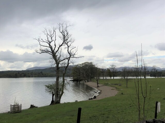
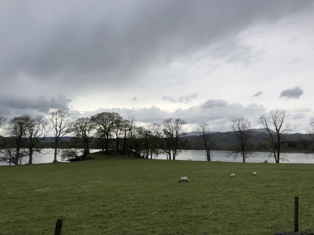
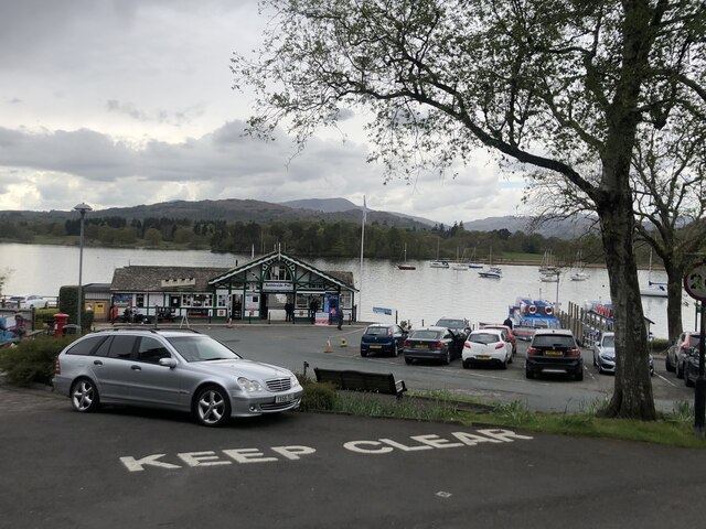
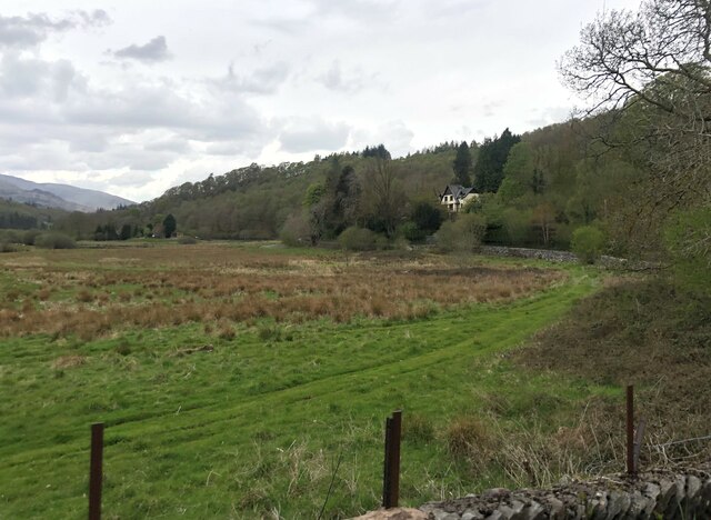
Mortimere, located in the county of Lancashire, is a picturesque region known for its stunning natural features, including its lakes, pools, ponds, and freshwater marshes. Nestled amidst rolling hills and lush greenery, Mortimere offers a haven for nature enthusiasts and those seeking tranquility.

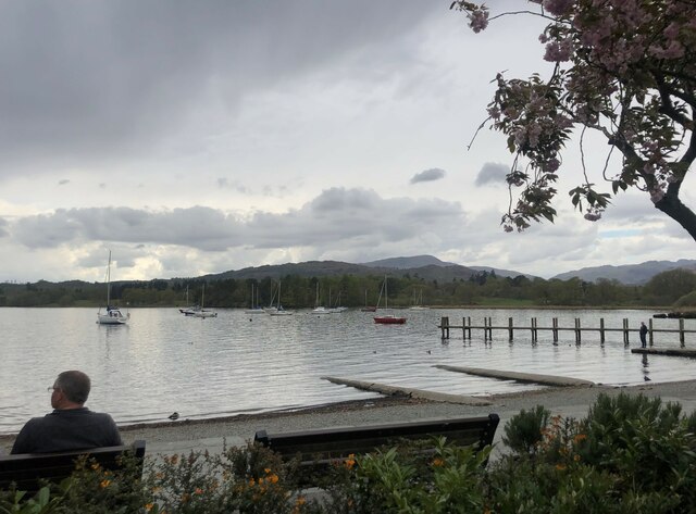
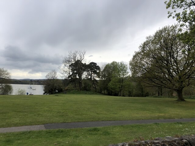
One of the highlights of Mortimere is its pristine lake, which serves as the centerpiece of the area. The lake spans a significant area and is surrounded by dense vegetation, providing a habitat for numerous species of flora and fauna. Visitors can enjoy activities such as boating, fishing, or simply taking a leisurely stroll along its shores, taking in the breathtaking views.

In addition to the lake, Mortimere boasts several smaller pools and ponds scattered throughout the region. These bodies of water often attract a variety of bird species, making it a popular spot for birdwatchers. The serene ambiance and diverse ecosystem create a perfect environment for both migratory and resident avian species.

Mortimere is also home to a freshwater marsh, which further enhances the area's natural beauty. This marshland is characterized by its abundant vegetation, including reeds, rushes, and water lilies. It serves as a vital habitat for numerous amphibians, insects, and other water-dwelling creatures.

Visitors to Mortimere can expect to be captivated by its idyllic landscapes, rich biodiversity, and the sense of tranquility it offers. Whether exploring its lakes, pools, ponds, or freshwater marshes, Mortimere is a haven for those seeking a true escape into nature.

If you have any feedback on the listing, please let us know in the comments section below.
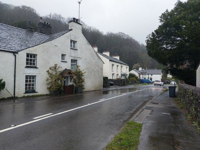
Mortimere Images

Images are sourced within 2km of 54.417761/-2.9818073 or Grid Reference NY3602. Thanks to Geograph Open Source API. All images are credited.

Skelwith Bridge Community Centre A former school, now a community centre for the residents of Skelwith Bridge and nearby.
Skelwith Bridge Community Centre
A former school, now a community centre for the residents of Skelwith Bridge and nearby.
Road junction in Skelwith Fold A junction of minor road in the small hamlet of Skelwith Fold.
Road junction in Skelwith Fold
A junction of minor road in the small hamlet of Skelwith Fold.
Houses, Skelwith Fold Roadside houses in the small settlement of Skelwith Fold.
Houses, Skelwith Fold
Roadside houses in the small settlement of Skelwith Fold.
Fields at Skelwith Fold Sodden grassland at Skelwith Fold.
Fields at Skelwith Fold
Sodden grassland at Skelwith Fold.
Minor road at Skelwith Fold A narrow minor road near Skelwith Fold.
Minor road at Skelwith Fold
A narrow minor road near Skelwith Fold.
Flooded fields beside the River Brathay Following persistent rain over many days the low lying ground beside the River Brathay was holding plenty of water.
Flooded fields beside the River Brathay
Following persistent rain over many days the low lying ground beside the River Brathay was holding plenty of water.
River Brathay upstream of Clappersgate A lot of water in the River Brathay following persistent heavy rain.
River Brathay upstream of Clappersgate
A lot of water in the River Brathay following persistent heavy rain.
Passing through Clappersgate The busy road passing through the small settlement of Clappersgate.
Passing through Clappersgate
The busy road passing through the small settlement of Clappersgate.
View north towards Fairfield - from Barngates
Windermere under a darkening sky
Windermere, sandy bay  Near the northern end of the lake
Windermere, sandy bay
Near the northern end of the lake
Rain clouds over Windermere
Waterhead Pier, Ambleside For lake cruises and refreshments
Waterhead Pier, Ambleside
For lake cruises and refreshments
Waterhead, Windermere At the northern end of the lake near Ambleside
Waterhead, Windermere
At the northern end of the lake near Ambleside
Borrans Park, Waterhead Borrans Park is a large open green space, with picnic tables and parking nearby.
Borrans Park, Waterhead
Borrans Park is a large open green space, with picnic tables and parking nearby.
Slate barn in Borrans Field
Crossing over the River Rothay
Flood plain of the River Brathay West of Clappersgate
Flood plain of the River Brathay
West of Clappersgate
Show me another place!

Mortimere is located at Grid Ref: NY3602 (Lat: 54.417761, Lng: -2.9818073)

Administrative County: Cumbria

District: South Lakeland

Police Authority: Cumbria

What 3 Words

///bottom.sonic.curve. Near Ambleside, Cumbria

Related Wikis

Holy Trinity Church, Brathay

Holy Trinity Church is in Bog Lane in the village of Brathay, Cumbria, England. It is an active Anglican parish church in the deanery of Windermere, the...

Clappersgate

Clappersgate is a village in the South Lakeland district, in the county of Cumbria, England. Clappersgate is located on the B5286 road and on the River...

Ambleside Roman Fort

Ambleside Roman Fort is the modern name given to the remains of a fort of the Roman province of Britannia. The ruins have been tentatively identified as...

Rothay Manor

Rothay Manor is a country house near Ambleside in Cumbria. It is a Grade II listed building. == History == The house was built for John Crosfield, a merchant...

Nearby Amenities

Located within 500m of 54.417761,-2.9818073
Brathay
Place: hamlet
Source: survey
Wikidata: Q4958013
Lat/Long: 54.4209276/-2.9785595
Give Way
Direction: forward
Lat/Long: 54.4213955/-2.9800462
Give Way
Direction: backward
Lat/Long: 54.4138785/-2.9841512
Give Way
Direction: forward
Lat/Long: 54.4135281/-2.9843146
Community Centre
Holy Trinity Church Hall
Website: http://www.holytrinitybrathay.org.uk/hall.html
Lat/Long: 54.4215382/-2.9838641
Bench
Backrest: yes
Material: wood
Seats: 3
Lat/Long: 54.4217229/-2.9835814
Barrier: bollard
Bollard: fixed
Horse: yes
Material: wood
Motor Vehicle: no
Lat/Long: 54.4220422/-2.9833168
The data included in this document is from www.openstreetmap.org. The data is made available under ODbL.

Have you been to Mortimere?

Leave your review of Mortimere below (or comments, questions and feedback).