Brathay Bay

Bay in Westmorland South Lakeland

England

Brathay Bay

View from Wray Castle Looking over the parkland towards Windermere.
View from Wray Castle Credit: DS Pugh

Brathay Bay is a picturesque village located in the historic county of Westmorland, England. Situated on the eastern shore of Lake Windermere, it offers stunning views of the surrounding Cumbrian countryside. The village is part of the larger Brathay Estate, which spans over 4,000 acres of pristine woodland and meadows.

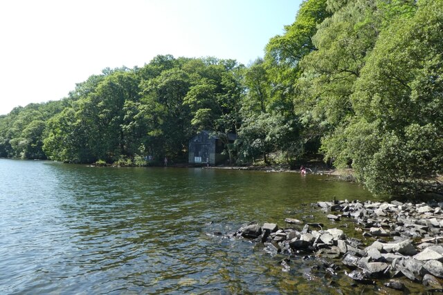
Bay, as it is commonly known, is renowned for its tranquil atmosphere and natural beauty. The bay itself is a peaceful stretch of shoreline, with pebble beaches and crystal-clear waters. It is a popular spot for swimming, kayaking, and other water activities. The bay is also frequented by sailing enthusiasts, with several boat clubs and facilities available.

The village of Bay is small but charming, with a handful of traditional cottages and a quaint village green. It has a close-knit community and a friendly, welcoming atmosphere. There is a small local shop and a pub, where visitors can enjoy a traditional meal or a pint of locally brewed ale.

Nature lovers will be delighted by the abundance of wildlife in the area. The bay and its surrounding woodlands are home to a variety of birds, including herons, ducks, and swans. It is not uncommon to spot deer and other woodland creatures during a leisurely stroll through the estate.

Overall, Brathay Bay offers a peaceful retreat for those seeking a break from the hustle and bustle of modern life. With its stunning natural scenery and friendly community, it is a hidden gem in the heart of Westmorland.

If you have any feedback on the listing, please let us know in the comments section below.

Brathay Bay Images

Images are sourced within 2km of 54.41754/-2.972417 or Grid Reference NY3602. Thanks to Geograph Open Source API. All images are credited.

View from Wray Castle Looking over the parkland towards Windermere.
View from Wray Castle
Looking over the parkland towards Windermere.
Parkland at Wray Castle Looking across some of the grounds from the castle.
Parkland at Wray Castle
Looking across some of the grounds from the castle.
Parkland and Windermere Looking towards Windermere from Wray Castle with Fairfield Horseshoe beyond.
Parkland and Windermere
Looking towards Windermere from Wray Castle with Fairfield Horseshoe beyond.
Wray Castle Looking across the front of Wray Castle waiting for it to open.
Wray Castle
Looking across the front of Wray Castle waiting for it to open.
Path in Woodland Looking along a path in woodland at Wray Castle.
Path in Woodland
Looking along a path in woodland at Wray Castle.
Playground at Wray Castle Looking across part of the play area near the castle.
Playground at Wray Castle
Looking across part of the play area near the castle.
Windermere from Watbarrow Wood Looking onto Windermere in the grounds of Wray Castle.
Windermere from Watbarrow Wood
Looking onto Windermere in the grounds of Wray Castle.
Across Windermere from Watbarrow Woods Looking onto the lake from the grounds of Wray Castle.
Across Windermere from Watbarrow Woods
Looking onto the lake from the grounds of Wray Castle.
Waves breaking on the shore Looking onto Windermere from Watbarrow Wood.
Waves breaking on the shore
Looking onto Windermere from Watbarrow Wood.
Stones in Low Wray Bay Looking across Windermere from the grounds of Wray Castle.
Stones in Low Wray Bay
Looking across Windermere from the grounds of Wray Castle.
Boathouse in Low Wray Bay Looking across the bay to the newer boathouse in the grounds of Wray Castle.
Boathouse in Low Wray Bay
Looking across the bay to the newer boathouse in the grounds of Wray Castle.
Low Wray Bay Looking onto Windermere from the grounds of Wray Castle.
Low Wray Bay
Looking onto Windermere from the grounds of Wray Castle.
Jetty at Wray Castle Looking along the jetty in the grounds of Wray Castle.
Jetty at Wray Castle
Looking along the jetty in the grounds of Wray Castle.
Windermere from Wray Castle Jetty Looking out onto the lake from the grounds of Wray Castle.
Windermere from Wray Castle Jetty
Looking out onto the lake from the grounds of Wray Castle.
Wray Castle Jetty The landing point on Windermere for Wray Castle.
Wray Castle Jetty
The landing point on Windermere for Wray Castle.
Wray Crag Looking at Wray Crag in Calf Parrock Coppice.
Wray Crag
Looking at Wray Crag in Calf Parrock Coppice.
Shore by Calf Parrock Coppice Looking across Windermere.
Shore by Calf Parrock Coppice
Looking across Windermere.
Building in Calf Parrock Coppice Looking through the woods on the shore of Windermere.
Building in Calf Parrock Coppice
Looking through the woods on the shore of Windermere.
Show me another place!

Brathay Bay is located at Grid Ref: NY3602 (Lat: 54.41754, Lng: -2.972417)

Administrative County: Cumbria

District: South Lakeland

Police Authority: Cumbria

What 3 Words

///oiled.cans.downcast. Near Ambleside, Cumbria

Related Wikis

Ambleside Roman Fort

Ambleside Roman Fort is the modern name given to the remains of a fort of the Roman province of Britannia. The ruins have been tentatively identified as...

Clappersgate

Clappersgate is a village in the South Lakeland district, in the county of Cumbria, England. Clappersgate is located on the B5286 road and on the River...

Holy Trinity Church, Brathay

Holy Trinity Church is in Bog Lane in the village of Brathay, Cumbria, England. It is an active Anglican parish church in the deanery of Windermere, the...
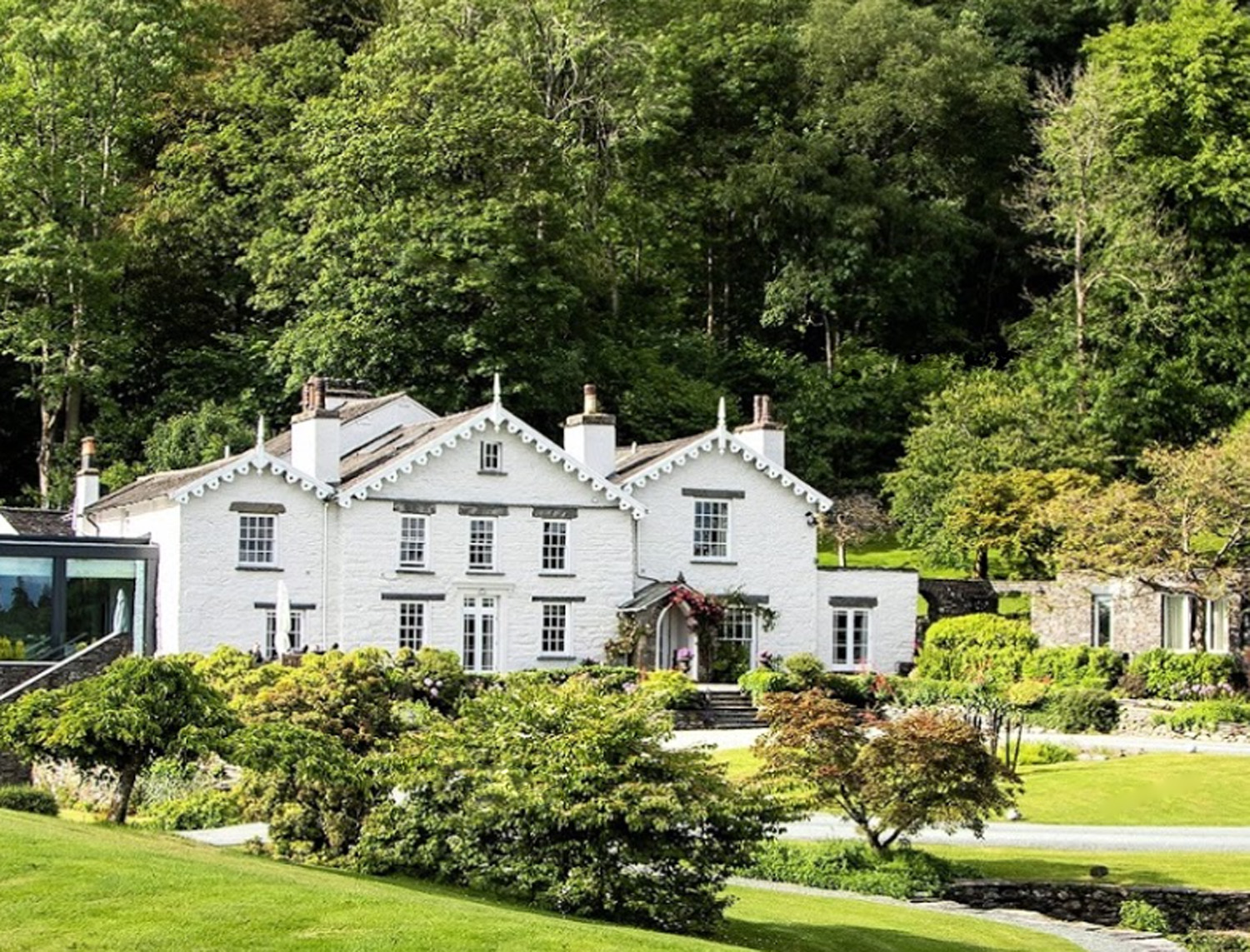
Rothay Manor

Rothay Manor is a country house near Ambleside in Cumbria. It is a Grade II listed building. == History == The house was built for John Crosfield, a merchant...

Stagshaw Garden

Stagshaw Garden is a woodland garden situated south of Ambleside, in Cumbria, England, and in the ownership of the National Trust.The garden is noted for...

The Samling Hotel

The Samling Hotel (previously known as Dove Nest) near Windermere is a building of historical significance and is listed on the English Heritage. It was...
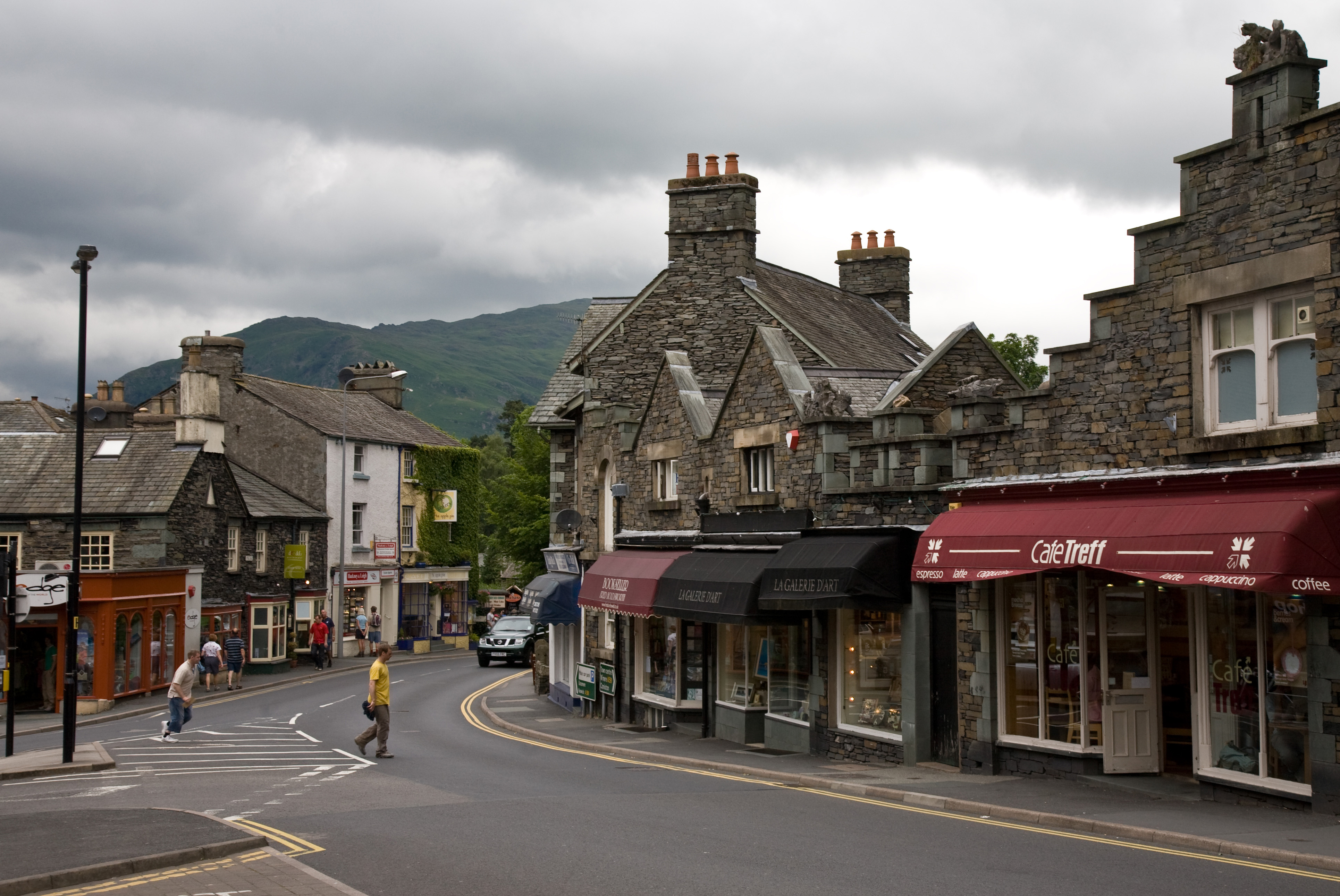
Ambleside

Ambleside is a town and former civil parish (now in the parish of Lakes) in the Westmorland and Furness district of Cumbria, England. Within the boundaries...

Stock Ghyll

Stock Ghyll, also known as Stock Gill, Stock Gill Beck and Stock Beck, is a stream in South Lakeland, in the ceremonial county of Cumbria and the historic...

Nearby Amenities

Located within 500m of 54.41754,-2.972417
Source: Landsat photo
Lat/Long: 54.413863/-2.9739238
Source: Landsat photo
Lat/Long: 54.414119/-2.973795
Source: Landsat photo
Lat/Long: 54.4141895/-2.9735363
Source: Landsat photo
Lat/Long: 54.4160731/-2.9727436
Source: Landsat photo
Lat/Long: 54.4164352/-2.9726041
Source: Landsat photo
Lat/Long: 54.4184828/-2.9723493
Source: Landsat photo
Lat/Long: 54.4176962/-2.9733766
Source: Landsat photo
Lat/Long: 54.417921/-2.9713703
Source: Landsat photo
Lat/Long: 54.4174965/-2.9712819
Source: Landsat photo
Lat/Long: 54.4179349/-2.9703534
Source: Landsat photo
Lat/Long: 54.4186514/-2.9711879
Source: Landsat photo
Lat/Long: 54.4188761/-2.9717458
Source: Landsat photo
Lat/Long: 54.4194398/-2.970878
Source: Landsat photo
Lat/Long: 54.4183393/-2.9692889
Source: Landsat photo
Lat/Long: 54.418564/-2.9692353
Source: Landsat photo
Lat/Long: 54.4187825/-2.9694069
Source: Landsat photo
Lat/Long: 54.4194469/-2.9691899
Source: Landsat photo
Lat/Long: 54.419567/-2.969106
Source: Landsat photo
Lat/Long: 54.4195432/-2.9684544
Source: Landsat photo
Lat/Long: 54.4207757/-2.967453
Brathay Bay
Natural: bay
Lat/Long: 54.4175436/-2.9723809
Brathay Rocks
Place: locality
Lat/Long: 54.4174834/-2.9708592
Gale Naze Crag
Place: locality
Lat/Long: 54.4183964/-2.9696917
The data included in this document is from www.openstreetmap.org. The data is made available under ODbL.

Have you been to Brathay Bay?

Leave your review of Brathay Bay below (or comments, questions and feedback).