Kiln Pot

Lake, Pool, Pond, Freshwater Marsh in Aberdeenshire

Scotland

Kiln Pot

Meadows by Water of Carvie Stroin is the house on the far side.
Meadows by Water of Carvie Credit: Alan Reid

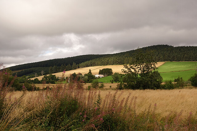
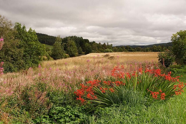
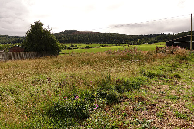
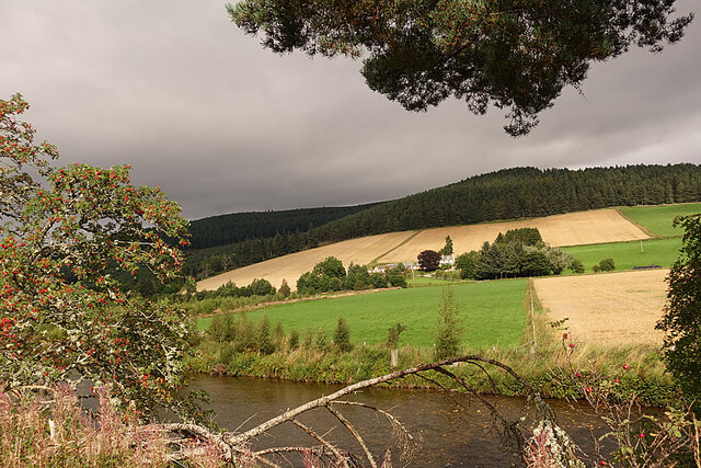
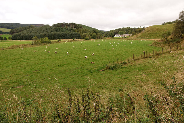
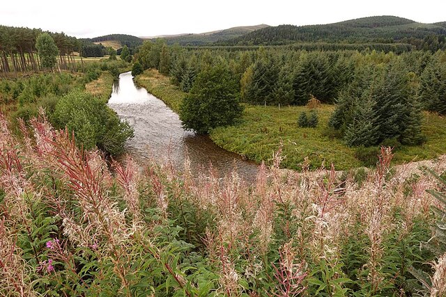
Kiln Pot is a picturesque freshwater marsh located in Aberdeenshire, Scotland. Spanning across a significant area, it encompasses a lake, pool, pond, and freshwater marsh, making it a diverse and ecologically rich habitat. The site is known for its tranquil surroundings and stunning natural beauty.

The lake at Kiln Pot is a prominent feature, characterized by its calm and glassy surface. It provides a habitat for a variety of aquatic flora and fauna, including water lilies, reeds, and various species of fish. The lake is also a popular spot for anglers, who come to enjoy the peacefulness and try their luck at catching trout or perch.

Adjacent to the lake, there is a pool that serves as a breeding ground for amphibians such as frogs and newts. This pristine pool is surrounded by lush vegetation and provides a safe haven for these creatures to lay their eggs and complete their life cycles.

Furthermore, Kiln Pot boasts a smaller pond, which is home to a diverse range of aquatic plants and invertebrates. These include pondweed, water fleas, and damselflies, making it a haven for nature enthusiasts and photographers seeking to capture the exquisite beauty of these delicate organisms.

Lastly, the freshwater marsh area is a crucial part of Kiln Pot's ecosystem. It is characterized by its wet and marshy conditions, supporting a wide array of plant species such as sedges, rushes, and marsh marigolds. This habitat is an essential breeding ground for wetland birds, including ducks, herons, and occasionally, rare species like the bittern.

Overall, the Kiln Pot area in Aberdeenshire offers a wealth of natural wonders, from its serene lake to its diverse aquatic habitats. It is a haven for wildlife, providing a peaceful retreat for both nature lovers and those seeking respite from the bustling city life.

If you have any feedback on the listing, please let us know in the comments section below.
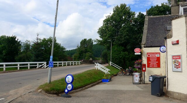
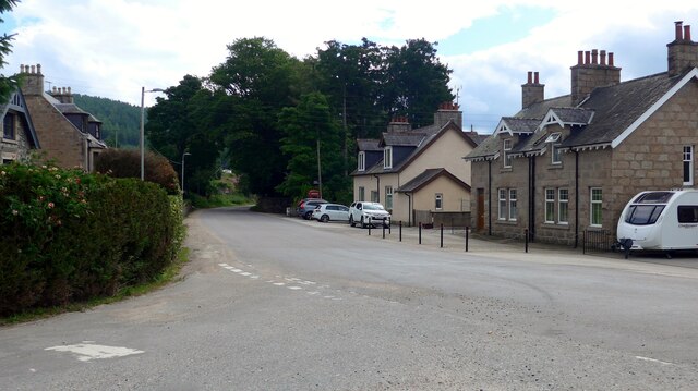
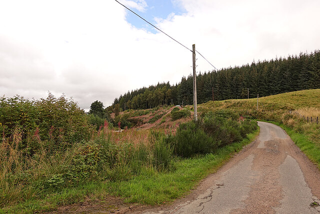
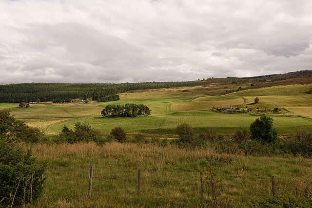
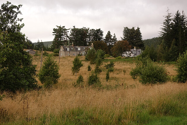
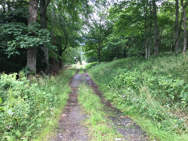
Kiln Pot Images

Images are sourced within 2km of 57.189614/-3.0769052 or Grid Reference NJ3511. Thanks to Geograph Open Source API. All images are credited.

Meadows by Water of Carvie Stroin is the house on the far side.
Meadows by Water of Carvie
Stroin is the house on the far side.
The valley of Water of Carvie
The Spar shop at Bellabeg And the proprietor is a fount of local knowledge - very helpful to the tourist!  There is even a "Tourist Information" sign on the leaning pole - it must have had 'an incident'!
The Spar shop at Bellabeg
And the proprietor is a fount of local knowledge - very helpful to the tourist! There is even a "Tourist Information" sign on the leaning pole - it must have had 'an incident'!
Quiet Bellabeg street
Strathdon Looking across the River Don to the Colquhonnie Hotel, which stands on the northern slope above the strath.
Strathdon
Looking across the River Don to the Colquhonnie Hotel, which stands on the northern slope above the strath.
Haugh Land in Strathdon A haugh is an area of flat land beside a river, the equivalent of a flood plain or water meadow in England.
Haugh Land in Strathdon
A haugh is an area of flat land beside a river, the equivalent of a flood plain or water meadow in England.
Looking towards Bluefold Bluefold is the farm at the top of the fields, just below the edge of the forest on Tom a' Chaorainn.
Looking towards Bluefold
Bluefold is the farm at the top of the fields, just below the edge of the forest on Tom a' Chaorainn.
Looking towards Colquhonnie The River Don is in the foreground, and Colquhonnie is part-way up the sunlit fields on the far side.
Looking towards Colquhonnie
The River Don is in the foreground, and Colquhonnie is part-way up the sunlit fields on the far side.
Strathdon Parish Kirk This surprisingly elaborate Gothic kirk in a very rural parish was opened in 1852. It was funded by Charles Forbes of Newe and designed by James Matthews not long after his return from working with George Gilbert Scott in London. It occupies the same site as at least two earlier kirks, separated from the hamlet of Bellabeg by the River Don.
Strathdon Parish Kirk
This surprisingly elaborate Gothic kirk in a very rural parish was opened in 1852. It was funded by Charles Forbes of Newe and designed by James Matthews not long after his return from working with George Gilbert Scott in London. It occupies the same site as at least two earlier kirks, separated from the hamlet of Bellabeg by the River Don.
Sheep in Strathdon A flock of sheep grazes in a field beside the River Don. The house is at Brughs, in the next grid square.
Sheep in Strathdon
A flock of sheep grazes in a field beside the River Don. The house is at Brughs, in the next grid square.
River Don The river turns about 90º to the left here. This is looking upstream from above the bend.
River Don
The river turns about 90º to the left here. This is looking upstream from above the bend.
River Don Looking downstream from the road above where the river turns 90º to the left.
River Don
Looking downstream from the road above where the river turns 90º to the left.
Minor Road on Coulick Hill This is a very narrow minor road that gives access to various farms on the south side of Strathdon.
Minor Road on Coulick Hill
This is a very narrow minor road that gives access to various farms on the south side of Strathdon.
Camping Site A brightly coloured tent has been pitched on the camp site at Cairngorms Glamping <span class="nowrap"><a title="https://cairngormsglamping.com" rel="nofollow ugc noopener" href="https://cairngormsglamping.com">Link</a><img style="margin-left:2px;" alt="External link" title="External link - shift click to open in new window" src="https://s1.geograph.org.uk/img/external.png" width="10" height="10"/></span>.
Camping Site
A brightly coloured tent has been pitched on the camp site at Cairngorms Glamping LinkExternal link.
Glen Carvie The farm on the right is Stroin, and higher up on the left is Belnagauld.
Glen Carvie
The farm on the right is Stroin, and higher up on the left is Belnagauld.
Fields on Donside The River Don flows along this side of the smooth green field, its course marked by sporadic trees.
Fields on Donside
The River Don flows along this side of the smooth green field, its course marked by sporadic trees.
Knocklea The houses at Knocklea from the minor road along south Donside.
Knocklea
The houses at Knocklea from the minor road along south Donside.
Farm track near Milton
Show me another place!

Kiln Pot is located at Grid Ref: NJ3511 (Lat: 57.189614, Lng: -3.0769052)

Unitary Authority: Aberdeenshire

Police Authority: North East

What 3 Words

///squeaking.totals.unions. Near Ballater, Aberdeenshire

Related Wikis

Strathdon

Strathdon (; Gaelic: Srath Dheathain) is an area in Aberdeenshire, Scotland. It is situated in the strath of the River Don, 45 miles west of Aberdeen in...

Bellabeg

Bellabeg (an anglicisation of Scottish Gaelic: Am Baile Beag, 'the small farmtown') is a small roadside settlement in Strathdon, Aberdeenshire, Scotland...

Doune of Invernochty

The Doune of Invernochty is a 12th-century castle in the Cairngorms National Park in Scotland, of which only earthworks survive. The Royal Commission on...

Lost, Aberdeenshire

Lost (Lòsda in Scottish Gaelic; population: less than 24; grid reference NJ349132 or on 1869 map) is a hamlet in Aberdeenshire, Scotland. It lies 40 miles...

Colquhonnie Castle

Colquhonnie Castle is a ruined 16th-century tower house, about 10.5 miles (16.9 km) north of Ballater, Aberdeenshire, Scotland, around 1.0 mile (1.6 km...

Castle Newe

Castle Newe was a castellated mansion house, situated in Aberdeenshire, and designed in 1831 by Archibald Simpson. It was based on an existing Z-plan castle...

Glenbuchat Castle

Glenbuchat Castle is a historic Z plan Scottish castle built in 1590 for John Gordon of Cairnbarrow to mark his wedding. It is located above the River...

Grampian

Grampian (Scottish Gaelic: Roinn a' Mhonaidh) was one of nine former local government regions of Scotland created in 1975 by the Local Government (Scotland...

Related Videos

Lonach Highlanders march out of Candacraig House in Strathdon Scotland during 2022 Lonach Gathering

The Lonach Highlanders begin their return march through Strathdon in the Cairngorms National Park, Aberdeenshire, Scotland.

The Lonach Gathering 2003

A flavour of the great Lonach Gathering at Bellabeg Park in Strathdon accompanied by the sound of the pipes and drums of ...

Lonach Highlanders start their 2023 march through Strathdon in Scotland during the Lonach Gathering

The Lonach Highlanders setting out on their march through Strathdon for the 2023 Lonach Gathering and Highland Games.

The 2020 Virtual March of the Lonach Highlanders through Strathdon in Aberdeenshire, Scotland

The march of the Lonach Highlanders through Strathdon in Aberdeenshire, Scotland, a historic part of the annual Lonach ...

Nearby Amenities

Located within 500m of 57.189614,-3.0769052
Power: pole
Lat/Long: 57.1853063/-3.074746
Power: pole
Lat/Long: 57.185841/-3.0752414
Power: pole
Lat/Long: 57.1863843/-3.0757467
Power: pole
Lat/Long: 57.1870293/-3.0763844
Power: pole
Lat/Long: 57.1872798/-3.0774713
Power: pole
Lat/Long: 57.1874917/-3.0783536
Power: pole
Lat/Long: 57.1876949/-3.0792099
Power: pole
Lat/Long: 57.1879046/-3.0800742
Power: pole
Lat/Long: 57.1881513/-3.081119
Power: pole
Lat/Long: 57.1884088/-3.0821838
Power: pole
Lat/Long: 57.1886555/-3.0832406
Power: pole
Lat/Long: 57.1889163/-3.0843235
Roadside
Place: locality
Lat/Long: 57.1868461/-3.0757146
The data included in this document is from www.openstreetmap.org. The data is made available under ODbL.

Have you been to Kiln Pot?

Leave your review of Kiln Pot below (or comments, questions and feedback).