Canal Junction

Lake, Pool, Pond, Freshwater Marsh in Monmouthshire

Wales

Canal Junction

South Street Bridge over Monmouthshire and Brecon Canal The Monmouthshire and Brecon Canal (popularly referred to as the Mon & Brec) was originally two separate canals: the Brecknock & Abergavenny Canal, and the Monmouthshire Canal. The 35-mile navigable section seen today is mostly the former. Following discussions in the 1790s, it was decided to link the two canals at Pontymoile. The Monmouthshire Canal, including a branch from Malpas to Crumlin, was opened in 1799 with the Brecknock & Abergavenny extending from Brecon to Gilwern by 1800, finally reaching Pontymoile by 1812.

Though originally constructed to transport coal, lime and agricultural products the canal was used extensively by ironmasters and industrialists as their main transport network, bringing the raw iron ore up the canal from Newport to Llanfoist Wharf and thence by tramroads to the iron works and returning with trams loaded with iron, the finished product. 

In 1880 the Monmouthshire & Brecon Canals were taken over by the Great Western Railway. Within 35 years, commercial carrying had all but ceased. Throughout the 20th century various parts of the Monmouthshire Canal were filled in for road construction. Both canals were abandoned by the early 1960s but restoration work from Brecon to Pontymoile began in 1968 following vigorous campaigning by canal enthusiasts. Recent developments have included a complete regeneration of the terminus at Brecon, and various works continue to reclaim the navigation between Pontymoile and Newport. The Blaenavon area and a section of the canal were granted World Heritage status in 2000 in recognition of its historical significance. 
<span class="nowrap"><a title="https://canalrivertrust.org.uk/enjoy-the-waterways/canal-and-river-network/monmouthshire-and-brecon-canal" rel="nofollow ugc noopener" href="https://canalrivertrust.org.uk/enjoy-the-waterways/canal-and-river-network/monmouthshire-and-brecon-canal">Link</a><img style="margin-left:2px;" alt="External link" title="External link - shift click to open in new window" src="https://s1.geograph.org.uk/img/external.png" width="10" height="10"/></span>  Canal and River Trust
South Street Bridge over Monmouthshire and Brecon Canal Credit: David Smith

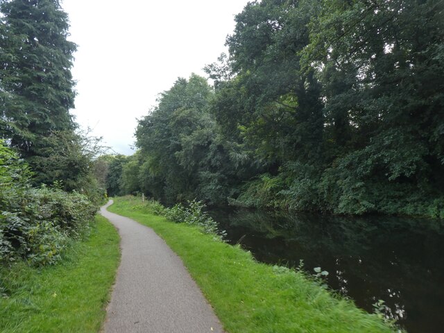
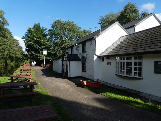
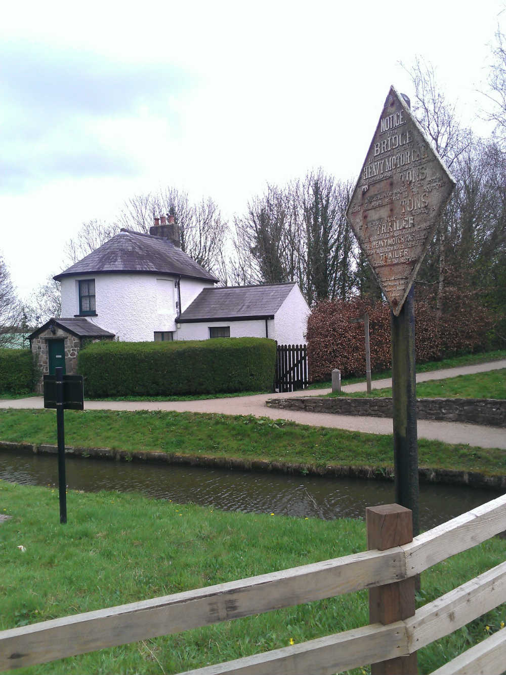
Canal Junction is a picturesque area located in Monmouthshire, Wales, known for its beautiful lake, pool, pond, and freshwater marsh. Situated amidst lush greenery and surrounded by rolling hills, this natural haven offers a serene and tranquil environment for visitors and wildlife alike.

The main attraction of Canal Junction is its stunning lake, which spans several acres and is a haven for water enthusiasts. Its crystal-clear waters provide the perfect setting for activities such as boating, fishing, and swimming. The lake is also home to a variety of aquatic life, including fish, waterfowl, and amphibians.

Adjacent to the lake is a pool, which is a smaller water body that is often used for recreational purposes. It is an ideal spot for families and children to enjoy a refreshing swim or simply relax by the water's edge.

Moreover, Canal Junction boasts a charming pond, which is a smaller body of water that is rich in biodiversity. This pond is teeming with various species of aquatic plants, insects, and small fish, making it a favorite spot for nature enthusiasts and birdwatchers.

In addition to these water bodies, Canal Junction is also home to a freshwater marsh, characterized by its spongy ground and abundance of reeds and other marsh plants. This marsh ecosystem provides a vital habitat for numerous species of birds, insects, and small mammals, creating an ideal environment for birdwatching and nature photography.

Overall, Canal Junction in Monmouthshire is a natural oasis that offers a diverse range of aquatic landscapes, from the expansive lake to the charming pool, pond, and freshwater marsh. It is a haven for nature lovers and a place where visitors can immerse themselves in the beauty and tranquility of the Welsh countryside.

If you have any feedback on the listing, please let us know in the comments section below.

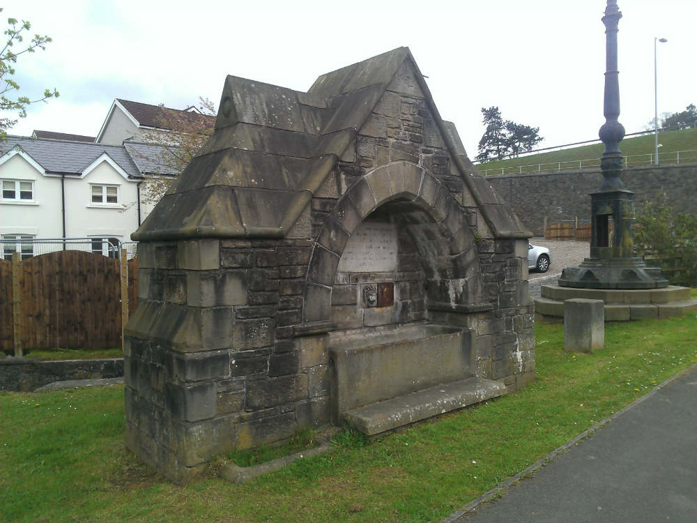
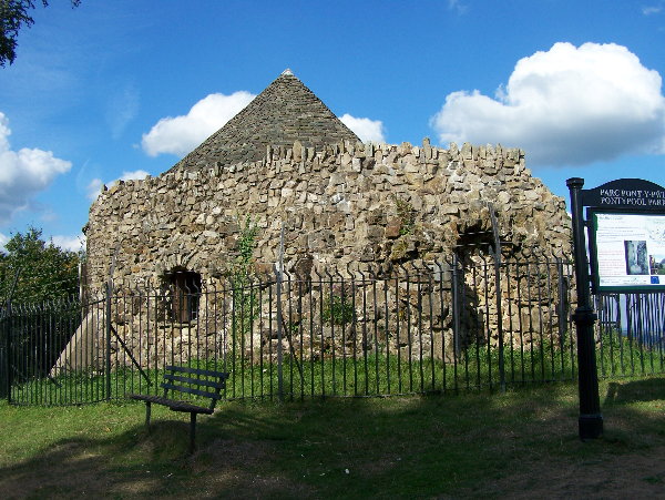
Canal Junction Images

Images are sourced within 2km of 51.695792/-3.0259653 or Grid Reference SO2900. Thanks to Geograph Open Source API. All images are credited.

South Street Bridge over Monmouthshire and Brecon Canal The Monmouthshire and Brecon Canal (popularly referred to as the Mon & Brec) was originally two separate canals: the Brecknock & Abergavenny Canal, and the Monmouthshire Canal. The 35-mile navigable section seen today is mostly the former. Following discussions in the 1790s, it was decided to link the two canals at Pontymoile. The Monmouthshire Canal, including a branch from Malpas to Crumlin, was opened in 1799 with the Brecknock & Abergavenny extending from Brecon to Gilwern by 1800, finally reaching Pontymoile by 1812.

Though originally constructed to transport coal, lime and agricultural products the canal was used extensively by ironmasters and industrialists as their main transport network, bringing the raw iron ore up the canal from Newport to Llanfoist Wharf and thence by tramroads to the iron works and returning with trams loaded with iron, the finished product. 

In 1880 the Monmouthshire & Brecon Canals were taken over by the Great Western Railway. Within 35 years, commercial carrying had all but ceased. Throughout the 20th century various parts of the Monmouthshire Canal were filled in for road construction. Both canals were abandoned by the early 1960s but restoration work from Brecon to Pontymoile began in 1968 following vigorous campaigning by canal enthusiasts. Recent developments have included a complete regeneration of the terminus at Brecon, and various works continue to reclaim the navigation between Pontymoile and Newport. The Blaenavon area and a section of the canal were granted World Heritage status in 2000 in recognition of its historical significance. 
<span class="nowrap"><a title="https://canalrivertrust.org.uk/enjoy-the-waterways/canal-and-river-network/monmouthshire-and-brecon-canal" rel="nofollow ugc noopener" href="https://canalrivertrust.org.uk/enjoy-the-waterways/canal-and-river-network/monmouthshire-and-brecon-canal">Link</a><img style="margin-left:2px;" alt="External link" title="External link - shift click to open in new window" src="https://s1.geograph.org.uk/img/external.png" width="10" height="10"/></span>  Canal and River Trust
South Street Bridge over Monmouthshire and Brecon Canal
The Monmouthshire and Brecon Canal (popularly referred to as the Mon & Brec) was originally two separate canals: the Brecknock & Abergavenny Canal, and the Monmouthshire Canal. The 35-mile navigable section seen today is mostly the former. Following discussions in the 1790s, it was decided to link the two canals at Pontymoile. The Monmouthshire Canal, including a branch from Malpas to Crumlin, was opened in 1799 with the Brecknock & Abergavenny extending from Brecon to Gilwern by 1800, finally reaching Pontymoile by 1812. Though originally constructed to transport coal, lime and agricultural products the canal was used extensively by ironmasters and industrialists as their main transport network, bringing the raw iron ore up the canal from Newport to Llanfoist Wharf and thence by tramroads to the iron works and returning with trams loaded with iron, the finished product. In 1880 the Monmouthshire & Brecon Canals were taken over by the Great Western Railway. Within 35 years, commercial carrying had all but ceased. Throughout the 20th century various parts of the Monmouthshire Canal were filled in for road construction. Both canals were abandoned by the early 1960s but restoration work from Brecon to Pontymoile began in 1968 following vigorous campaigning by canal enthusiasts. Recent developments have included a complete regeneration of the terminus at Brecon, and various works continue to reclaim the navigation between Pontymoile and Newport. The Blaenavon area and a section of the canal were granted World Heritage status in 2000 in recognition of its historical significance. LinkExternal link Canal and River Trust
Monmouthshire and Brecon Canal passing houses in Wern Road The houses in Wern Road have long front gardens and back onto the canal and the canal path
Monmouthshire and Brecon Canal passing houses in Wern Road
The houses in Wern Road have long front gardens and back onto the canal and the canal path
Monmouthshire and Brecon Canal in Griffithstown The Monmouthshire and Brecon Canal (popularly referred to as the Mon & Brec) was originally two separate canals: the Brecknock & Abergavenny Canal, and the Monmouthshire Canal. The 35-mile navigable section seen today is mostly the former. Following discussions in the 1790s, it was decided to link the two canals at Pontymoile. The Monmouthshire Canal, including a branch from Malpas to Crumlin, was opened in 1799 with the Brecknock & Abergavenny extending from Brecon to Gilwern by 1800, finally reaching Pontymoile by 1812.

Though originally constructed to transport coal, lime and agricultural products the canal was used extensively by ironmasters and industrialists as their main transport network, bringing the raw iron ore up the canal from Newport to Llanfoist Wharf and thence by tramroads to the iron works and returning with trams loaded with iron, the finished product. 

In 1880 the Monmouthshire & Brecon Canals were taken over by the Great Western Railway. Within 35 years, commercial carrying had all but ceased. Throughout the 20th century various parts of the Monmouthshire Canal were filled in for road construction. Both canals were abandoned by the early 1960s but restoration work from Brecon to Pontymoile began in 1968 following vigorous campaigning by canal enthusiasts. Recent developments have included a complete regeneration of the terminus at Brecon, and various works continue to reclaim the navigation between Pontymoile and Newport. The Blaenavon area and a section of the canal were granted World Heritage status in 2000 in recognition of its historical significance. 
<span class="nowrap"><a title="https://canalrivertrust.org.uk/enjoy-the-waterways/canal-and-river-network/monmouthshire-and-brecon-canal" rel="nofollow ugc noopener" href="https://canalrivertrust.org.uk/enjoy-the-waterways/canal-and-river-network/monmouthshire-and-brecon-canal">Link</a><img style="margin-left:2px;" alt="External link" title="External link - shift click to open in new window" src="https://s1.geograph.org.uk/img/external.png" width="10" height="10"/></span>  Canal and River Trust
Monmouthshire and Brecon Canal in Griffithstown
The Monmouthshire and Brecon Canal (popularly referred to as the Mon & Brec) was originally two separate canals: the Brecknock & Abergavenny Canal, and the Monmouthshire Canal. The 35-mile navigable section seen today is mostly the former. Following discussions in the 1790s, it was decided to link the two canals at Pontymoile. The Monmouthshire Canal, including a branch from Malpas to Crumlin, was opened in 1799 with the Brecknock & Abergavenny extending from Brecon to Gilwern by 1800, finally reaching Pontymoile by 1812. Though originally constructed to transport coal, lime and agricultural products the canal was used extensively by ironmasters and industrialists as their main transport network, bringing the raw iron ore up the canal from Newport to Llanfoist Wharf and thence by tramroads to the iron works and returning with trams loaded with iron, the finished product. In 1880 the Monmouthshire & Brecon Canals were taken over by the Great Western Railway. Within 35 years, commercial carrying had all but ceased. Throughout the 20th century various parts of the Monmouthshire Canal were filled in for road construction. Both canals were abandoned by the early 1960s but restoration work from Brecon to Pontymoile began in 1968 following vigorous campaigning by canal enthusiasts. Recent developments have included a complete regeneration of the terminus at Brecon, and various works continue to reclaim the navigation between Pontymoile and Newport. The Blaenavon area and a section of the canal were granted World Heritage status in 2000 in recognition of its historical significance. LinkExternal link Canal and River Trust
Coedygric Road bridge over Monmouthshire and Brecon Canal The Monmouthshire and Brecon Canal (popularly referred to as the Mon & Brec) was originally two separate canals: the Brecknock & Abergavenny Canal, and the Monmouthshire Canal. The 35-mile navigable section seen today is mostly the former. Following discussions in the 1790s, it was decided to link the two canals at Pontymoile. The Monmouthshire Canal, including a branch from Malpas to Crumlin, was opened in 1799 with the Brecknock & Abergavenny extending from Brecon to Gilwern by 1800, finally reaching Pontymoile by 1812.

Though originally constructed to transport coal, lime and agricultural products the canal was used extensively by ironmasters and industrialists as their main transport network, bringing the raw iron ore up the canal from Newport to Llanfoist Wharf and thence by tramroads to the iron works and returning with trams loaded with iron, the finished product. 

In 1880 the Monmouthshire & Brecon Canals were taken over by the Great Western Railway. Within 35 years, commercial carrying had all but ceased. Throughout the 20th century various parts of the Monmouthshire Canal were filled in for road construction. Both canals were abandoned by the early 1960s but restoration work from Brecon to Pontymoile began in 1968 following vigorous campaigning by canal enthusiasts. Recent developments have included a complete regeneration of the terminus at Brecon, and various works continue to reclaim the navigation between Pontymoile and Newport. The Blaenavon area and a section of the canal were granted World Heritage status in 2000 in recognition of its historical significance. 
<span class="nowrap"><a title="https://canalrivertrust.org.uk/enjoy-the-waterways/canal-and-river-network/monmouthshire-and-brecon-canal" rel="nofollow ugc noopener" href="https://canalrivertrust.org.uk/enjoy-the-waterways/canal-and-river-network/monmouthshire-and-brecon-canal">Link</a><img style="margin-left:2px;" alt="External link" title="External link - shift click to open in new window" src="https://s1.geograph.org.uk/img/external.png" width="10" height="10"/></span>  Canal and River Trust
Coedygric Road bridge over Monmouthshire and Brecon Canal
The Monmouthshire and Brecon Canal (popularly referred to as the Mon & Brec) was originally two separate canals: the Brecknock & Abergavenny Canal, and the Monmouthshire Canal. The 35-mile navigable section seen today is mostly the former. Following discussions in the 1790s, it was decided to link the two canals at Pontymoile. The Monmouthshire Canal, including a branch from Malpas to Crumlin, was opened in 1799 with the Brecknock & Abergavenny extending from Brecon to Gilwern by 1800, finally reaching Pontymoile by 1812. Though originally constructed to transport coal, lime and agricultural products the canal was used extensively by ironmasters and industrialists as their main transport network, bringing the raw iron ore up the canal from Newport to Llanfoist Wharf and thence by tramroads to the iron works and returning with trams loaded with iron, the finished product. In 1880 the Monmouthshire & Brecon Canals were taken over by the Great Western Railway. Within 35 years, commercial carrying had all but ceased. Throughout the 20th century various parts of the Monmouthshire Canal were filled in for road construction. Both canals were abandoned by the early 1960s but restoration work from Brecon to Pontymoile began in 1968 following vigorous campaigning by canal enthusiasts. Recent developments have included a complete regeneration of the terminus at Brecon, and various works continue to reclaim the navigation between Pontymoile and Newport. The Blaenavon area and a section of the canal were granted World Heritage status in 2000 in recognition of its historical significance. LinkExternal link Canal and River Trust
Mileage marker by Monmouthshire and Brecon Canal Another picture is at <a href="https://www.geograph.org.uk/photo/6863152">ST2999 : Milestone, Griffithsrown</a>
Mileage marker by Monmouthshire and Brecon Canal
Another picture is at ST2999 : Milestone, Griffithsrown
Bridge and pipe across Monmouthshire and Brecon Canal The Coed-y-Grib bridge and the disused railway bridge above it
Bridge and pipe across Monmouthshire and Brecon Canal
The Coed-y-Grib bridge and the disused railway bridge above it
Monmouthshire and Brecon Canal The Monmouthshire and Brecon Canal (popularly referred to as the Mon & Brec) was originally two separate canals: the Brecknock & Abergavenny Canal, and the Monmouthshire Canal. The 35-mile navigable section seen today is mostly the former. Following discussions in the 1790s, it was decided to link the two canals at Pontymoile. The Monmouthshire Canal, including a branch from Malpas to Crumlin, was opened in 1799 with the Brecknock & Abergavenny extending from Brecon to Gilwern by 1800, finally reaching Pontymoile by 1812.

Though originally constructed to transport coal, lime and agricultural products the canal was used extensively by ironmasters and industrialists as their main transport network, bringing the raw iron ore up the canal from Newport to Llanfoist Wharf and thence by tramroads to the iron works and returning with trams loaded with iron, the finished product. 

In 1880 the Monmouthshire & Brecon Canals were taken over by the Great Western Railway. Within 35 years, commercial carrying had all but ceased. Throughout the 20th century various parts of the Monmouthshire Canal were filled in for road construction. Both canals were abandoned by the early 1960s but restoration work from Brecon to Pontymoile began in 1968 following vigorous campaigning by canal enthusiasts. Recent developments have included a complete regeneration of the terminus at Brecon, and various works continue to reclaim the navigation between Pontymoile and Newport. The Blaenavon area and a section of the canal were granted World Heritage status in 2000 in recognition of its historical significance. 
<span class="nowrap"><a title="https://canalrivertrust.org.uk/enjoy-the-waterways/canal-and-river-network/monmouthshire-and-brecon-canal" rel="nofollow ugc noopener" href="https://canalrivertrust.org.uk/enjoy-the-waterways/canal-and-river-network/monmouthshire-and-brecon-canal">Link</a><img style="margin-left:2px;" alt="External link" title="External link - shift click to open in new window" src="https://s1.geograph.org.uk/img/external.png" width="10" height="10"/></span>  Canal and River Trust
Monmouthshire and Brecon Canal
The Monmouthshire and Brecon Canal (popularly referred to as the Mon & Brec) was originally two separate canals: the Brecknock & Abergavenny Canal, and the Monmouthshire Canal. The 35-mile navigable section seen today is mostly the former. Following discussions in the 1790s, it was decided to link the two canals at Pontymoile. The Monmouthshire Canal, including a branch from Malpas to Crumlin, was opened in 1799 with the Brecknock & Abergavenny extending from Brecon to Gilwern by 1800, finally reaching Pontymoile by 1812. Though originally constructed to transport coal, lime and agricultural products the canal was used extensively by ironmasters and industrialists as their main transport network, bringing the raw iron ore up the canal from Newport to Llanfoist Wharf and thence by tramroads to the iron works and returning with trams loaded with iron, the finished product. In 1880 the Monmouthshire & Brecon Canals were taken over by the Great Western Railway. Within 35 years, commercial carrying had all but ceased. Throughout the 20th century various parts of the Monmouthshire Canal were filled in for road construction. Both canals were abandoned by the early 1960s but restoration work from Brecon to Pontymoile began in 1968 following vigorous campaigning by canal enthusiasts. Recent developments have included a complete regeneration of the terminus at Brecon, and various works continue to reclaim the navigation between Pontymoile and Newport. The Blaenavon area and a section of the canal were granted World Heritage status in 2000 in recognition of its historical significance. LinkExternal link Canal and River Trust
Monmouthshire and Brecon Canal path at the Open Hearth Inn
NCN49 by Monmouthshire and Brecon Canal The Monmouthshire and Brecon Canal (popularly referred to as the Mon & Brec) was originally two separate canals: the Brecknock & Abergavenny Canal, and the Monmouthshire Canal. The 35-mile navigable section seen today is mostly the former. Following discussions in the 1790s, it was decided to link the two canals at Pontymoile. The Monmouthshire Canal, including a branch from Malpas to Crumlin, was opened in 1799 with the Brecknock & Abergavenny extending from Brecon to Gilwern by 1800, finally reaching Pontymoile by 1812.

Though originally constructed to transport coal, lime and agricultural products the canal was used extensively by ironmasters and industrialists as their main transport network, bringing the raw iron ore up the canal from Newport to Llanfoist Wharf and thence by tramroads to the iron works and returning with trams loaded with iron, the finished product. 

In 1880 the Monmouthshire & Brecon Canals were taken over by the Great Western Railway. Within 35 years, commercial carrying had all but ceased. Throughout the 20th century various parts of the Monmouthshire Canal were filled in for road construction. Both canals were abandoned by the early 1960s but restoration work from Brecon to Pontymoile began in 1968 following vigorous campaigning by canal enthusiasts. Recent developments have included a complete regeneration of the terminus at Brecon, and various works continue to reclaim the navigation between Pontymoile and Newport. The Blaenavon area and a section of the canal were granted World Heritage status in 2000 in recognition of its historical significance. 
<span class="nowrap"><a title="https://canalrivertrust.org.uk/enjoy-the-waterways/canal-and-river-network/monmouthshire-and-brecon-canal" rel="nofollow ugc noopener" href="https://canalrivertrust.org.uk/enjoy-the-waterways/canal-and-river-network/monmouthshire-and-brecon-canal">Link</a><img style="margin-left:2px;" alt="External link" title="External link - shift click to open in new window" src="https://s1.geograph.org.uk/img/external.png" width="10" height="10"/></span>  Canal and River Trust
NCN49 by Monmouthshire and Brecon Canal
The Monmouthshire and Brecon Canal (popularly referred to as the Mon & Brec) was originally two separate canals: the Brecknock & Abergavenny Canal, and the Monmouthshire Canal. The 35-mile navigable section seen today is mostly the former. Following discussions in the 1790s, it was decided to link the two canals at Pontymoile. The Monmouthshire Canal, including a branch from Malpas to Crumlin, was opened in 1799 with the Brecknock & Abergavenny extending from Brecon to Gilwern by 1800, finally reaching Pontymoile by 1812. Though originally constructed to transport coal, lime and agricultural products the canal was used extensively by ironmasters and industrialists as their main transport network, bringing the raw iron ore up the canal from Newport to Llanfoist Wharf and thence by tramroads to the iron works and returning with trams loaded with iron, the finished product. In 1880 the Monmouthshire & Brecon Canals were taken over by the Great Western Railway. Within 35 years, commercial carrying had all but ceased. Throughout the 20th century various parts of the Monmouthshire Canal were filled in for road construction. Both canals were abandoned by the early 1960s but restoration work from Brecon to Pontymoile began in 1968 following vigorous campaigning by canal enthusiasts. Recent developments have included a complete regeneration of the terminus at Brecon, and various works continue to reclaim the navigation between Pontymoile and Newport. The Blaenavon area and a section of the canal were granted World Heritage status in 2000 in recognition of its historical significance. LinkExternal link Canal and River Trust
Footbridge over the railway at Panteg
Electricity sub-station at Panteg
Railhead treatment train at Panteg Colas Rail class 66 locomotives No. 66849 and 66849 top-and-tail a 'leafbuster' train at the site of Panteg station.
Railhead treatment train at Panteg
Colas Rail class 66 locomotives No. 66849 and 66849 top-and-tail a 'leafbuster' train at the site of Panteg station.
Tornado at Panteg A1-class 4-6-2 No 60163 Tornado passes Panteg with the Railway Touring Company's Cheshireman railtour from Bristol to Chester.
Tornado at Panteg
A1-class 4-6-2 No 60163 Tornado passes Panteg with the Railway Touring Company's Cheshireman railtour from Bristol to Chester.
The Open Hearth inn, by Monmouthshire and Brecon Canal
Former railway bridge over Monmouthshire and Brecon Canal The Monmouthshire and Brecon Canal (popularly referred to as the Mon & Brec) was originally two separate canals: the Brecknock & Abergavenny Canal, and the Monmouthshire Canal. The 35-mile navigable section seen today is mostly the former. Following discussions in the 1790s, it was decided to link the two canals at Pontymoile. The Monmouthshire Canal, including a branch from Malpas to Crumlin, was opened in 1799 with the Brecknock & Abergavenny extending from Brecon to Gilwern by 1800, finally reaching Pontymoile by 1812.

Though originally constructed to transport coal, lime and agricultural products the canal was used extensively by ironmasters and industrialists as their main transport network, bringing the raw iron ore up the canal from Newport to Llanfoist Wharf and thence by tramroads to the iron works and returning with trams loaded with iron, the finished product. 

In 1880 the Monmouthshire & Brecon Canals were taken over by the Great Western Railway. Within 35 years, commercial carrying had all but ceased. Throughout the 20th century various parts of the Monmouthshire Canal were filled in for road construction. Both canals were abandoned by the early 1960s but restoration work from Brecon to Pontymoile began in 1968 following vigorous campaigning by canal enthusiasts. Recent developments have included a complete regeneration of the terminus at Brecon, and various works continue to reclaim the navigation between Pontymoile and Newport. The Blaenavon area and a section of the canal were granted World Heritage status in 2000 in recognition of its historical significance. 
<span class="nowrap"><a title="https://canalrivertrust.org.uk/enjoy-the-waterways/canal-and-river-network/monmouthshire-and-brecon-canal" rel="nofollow ugc noopener" href="https://canalrivertrust.org.uk/enjoy-the-waterways/canal-and-river-network/monmouthshire-and-brecon-canal">Link</a><img style="margin-left:2px;" alt="External link" title="External link - shift click to open in new window" src="https://s1.geograph.org.uk/img/external.png" width="10" height="10"/></span>  Canal and River Trust
Former railway bridge over Monmouthshire and Brecon Canal
The Monmouthshire and Brecon Canal (popularly referred to as the Mon & Brec) was originally two separate canals: the Brecknock & Abergavenny Canal, and the Monmouthshire Canal. The 35-mile navigable section seen today is mostly the former. Following discussions in the 1790s, it was decided to link the two canals at Pontymoile. The Monmouthshire Canal, including a branch from Malpas to Crumlin, was opened in 1799 with the Brecknock & Abergavenny extending from Brecon to Gilwern by 1800, finally reaching Pontymoile by 1812. Though originally constructed to transport coal, lime and agricultural products the canal was used extensively by ironmasters and industrialists as their main transport network, bringing the raw iron ore up the canal from Newport to Llanfoist Wharf and thence by tramroads to the iron works and returning with trams loaded with iron, the finished product. In 1880 the Monmouthshire & Brecon Canals were taken over by the Great Western Railway. Within 35 years, commercial carrying had all but ceased. Throughout the 20th century various parts of the Monmouthshire Canal were filled in for road construction. Both canals were abandoned by the early 1960s but restoration work from Brecon to Pontymoile began in 1968 following vigorous campaigning by canal enthusiasts. Recent developments have included a complete regeneration of the terminus at Brecon, and various works continue to reclaim the navigation between Pontymoile and Newport. The Blaenavon area and a section of the canal were granted World Heritage status in 2000 in recognition of its historical significance. LinkExternal link Canal and River Trust
Clun Castle at Panteg Ex-Great Western Castle-class No. 7029 Clun Castle heads Vintage Trains' Welsh Marches Express railtour towards Panteg.
Clun Castle at Panteg
Ex-Great Western Castle-class No. 7029 Clun Castle heads Vintage Trains' Welsh Marches Express railtour towards Panteg.
Clun Castle at Panteg Ex-Great Western Castle-class No. 7029 Clun Castle heads Vintage Trains' Welsh Marches Express railtour towards the site of Panteg station.
Clun Castle at Panteg
Ex-Great Western Castle-class No. 7029 Clun Castle heads Vintage Trains' Welsh Marches Express railtour towards the site of Panteg station.
Britannia at Panteg BR Standard 4-6-2 No. 70000 Britannia heads south through Panteg with Saphos Trains' Welsh Marches Express railtour.
Britannia at Panteg
BR Standard 4-6-2 No. 70000 Britannia heads south through Panteg with Saphos Trains' Welsh Marches Express railtour.
Show me another place!

Canal Junction is located at Grid Ref: SO2900 (Lat: 51.695792, Lng: -3.0259653)

Unitary Authority: Torfaen

Police Authority: Gwent

What 3 Words

///palace.stored.tricky. Near New Inn, Torfaen

Related Wikis

Pontymoile Basin

Pontymoile Basin is a mooring point and canal junction on the Monmouthshire & Brecon Canal. == Location == The basin lies on the Pontypool stretch of the...

Griffithstown Railway Museum

Griffithstown Railway Museum was a railway memorabilia museum located in Griffithstown, Torfaen, South Wales. It was housed in a former Great Western Railway...

Pontymoile

Pontymoile (Welsh: Pont-y-moel) is a suburb of Pontypool in Torfaen, South Wales. It is all but merged with the nearby suburbs of Cwmynyscoy and Upper...

Blaendare Road Halt railway station

Blaendare Road Halt railway station served Pontymoile and Cwmynyscoy to the south of Pontypool town centre in Torfaen, South Wales, UK. == History == The...

County Hospital, Torfaen

County Hospital (Welsh: Ysbyty'r Sir) is a community hospital in Griffithstown in the county borough of Torfaen, Wales. It is often referred to locally...

Pontypool Clarence Street railway station

Pontypool Clarence Street railway station was a station on the former Taff Vale Extension (TVE) of the Newport, Abergavenny and Hereford Railway. The TVE...

West Monmouth School

West Monmouth School (Welsh: Ysgol Gorllewin Mynwy; colloquially: West Mon) is a state-funded and non-selective secondary school in Pontypool, Torfaen...

Shell Grotto, Pontypool

The Shell Grotto - (Welsh: Groto Cregyn) - (sometimes called the Shell Hermitage) is a Grade II* listed (as of 7 February 1962) late-18th-century stone...

Nearby Amenities

Located within 500m of 51.695792,-3.0259653
Mini Roundabout
Direction: clockwise
Lat/Long: 51.6946784/-3.028548
Traffic Signals
Lat/Long: 51.698029/-3.0300019
Traffic Signals
Traffic Signals: signal
Lat/Long: 51.6985687/-3.0315793
Traffic Signals
Lat/Long: 51.6977832/-3.0298993
Noexit: yes
Lat/Long: 51.6971248/-3.0327172
Pontymoile
Is In: Pontypool
Place: suburb
Lat/Long: 51.6963685/-3.0263921
Parking
Lat/Long: 51.6944307/-3.0230875
Fuel
Esso
Brand: Esso
Brand Wikidata: Q867662
Compressed Air: yes
Operator: Rontec
Operator Website: http://www.rontec-servicestations.co.uk/ss_results-id.cfm?id=7145
Operator Wikidata: Q107439152
Wheelchair: yes
Lat/Long: 51.6985625/-3.0289082
Traffic Signals
Lat/Long: 51.6973427/-3.030438
Traffic Signals
Lat/Long: 51.6973941/-3.0299094
Traffic Signals
Lat/Long: 51.6975364/-3.0300127
Traffic Signals
Lat/Long: 51.6980634/-3.0292844
B53
Note: Pontypool Road Bridge
Lat/Long: 51.6980992/-3.0208572
Cafe
The Boat Yard Tea Room
Addr City: Pontymoile
Addr Postcode: NP4 0RF
Addr Street: Fountain Road
Diet Vegetarian: yes
Indoor Seating: yes
Outdoor Seating: yes
Payment Credit Cards: yes
Payment Debit Cards: yes
Lat/Long: 51.6961141/-3.0260266
Crossing
Crossing: traffic_signals
Lat/Long: 51.6976078/-3.0305217
Crossing
Crossing: uncontrolled
Crossing Island: no
Crossing Ref: zebra
Tactile Paving: yes
Lat/Long: 51.6983843/-3.0286874
Bus Stop
Maesderwen (N)
Bus: yes
Naptan AtcoCode: 5340AWB30899
Naptan NaptanCode: toramdt
Public Transport: platform
Shelter: yes
Lat/Long: 51.6960654/-3.0304594
Bus Stop
Stafford Rd Top (N)
Bus: yes
Naptan AtcoCode: 5340AWB30898
Naptan NaptanCode: tordjga
Public Transport: platform
Shelter: no
Lat/Long: 51.6942226/-3.0285739
Bus Stop
Stafford Rd Top (S)
Bus: yes
Naptan AtcoCode: 5340AWB30897
Naptan NaptanCode: tordjdw
Public Transport: platform
Shelter: no
Lat/Long: 51.6938198/-3.0284123
Bus Stop
Maesderwen
Bus: yes
Naptan AtcoCode: 5340AWB30900
Naptan NaptanCode: toramdw
Public Transport: platform
Shelter: yes
Lat/Long: 51.696066/-3.0301635
Bus Stop
Builder's Yard
Bus: yes
Public Transport: platform
Lat/Long: 51.698098/-3.030355
Fast Food
KFC
Addr City: Pontypool
Addr Housename: Lower Mill Field
Addr Postcode: NP4 0XB
Alt Name: Kentucky Fried Chicken
Brand: KFC
Brand Wikidata: Q524757
Brand Wikipedia: en:KFC
Contact Website: https://www.kfc.co.uk/kfc-near-me/pontypool-lower-mill-field
Cuisine: chicken
Drive Through: yes
Email: delivery@kfc.co.uk
Fhrs Id: 1020129
Opening Hours: Mo-Su 10:00-22:00
Phone: +44 8444 096 467
Takeaway: yes
Lat/Long: 51.6922138/-3.0216486
Shell Store
Addr City: Pontypool
Addr Housename: Lower Mill Field
Addr Postcode: NP4 0XB
Brand: Shell Select
Brand Wikidata: Q154950
Brand Wikipedia: en:Royal Dutch Shell
Opening Hours: 24/7
Phone: +44 1495 764983
Ref Navads: NVDS353_12038576
Shop: convenience
Website: https://find.shell.com/gb/fuel/12038576-eg-folly-tower-service-station
Lat/Long: 51.6927791/-3.0212774
Fast Food
McDonald's
Addr City: Pontypool
Addr Housename: Lower Mill Field
Addr Postcode: NP4 0XB
Brand: McDonald's
Brand Wikidata: Q38076
Brand Wikipedia: en:McDonald's
Contact Website: https://www.mcdonalds.com/gb/en-gb/location/pontypool/pontypool/new-inn/8260527.html
Cuisine: burger
Drive Through: yes
Takeaway: yes
Lat/Long: 51.693352/-3.0206812
Fuel
Shell Fuel
Addr City: Pontypool
Addr Housename: Lower Mill Field
Addr Postcode: NP4 0XB
Brand: Shell
Brand Wikidata: Q110716465
Brand Wikipedia: en:Royal Dutch Shell
Opening Hours: 24/7
Phone: +44 1495 764 983
Ref Navads: NVDS353_12038576
Website: https://find.shell.com/gb/fuel/12038576-eg-folly-tower-service-station
Lat/Long: 51.6927322/-3.0210308
Premier Inn
Brand: Premier Inn
Brand Wikidata: Q2108626
Brand Wikipedia: en:Premier Inn
Tourism: hotel
Lat/Long: 51.6947691/-3.0234822
Restaurant
Harvester
Addr City: Pontypool
Addr Country: GB
Addr Postcode: NP4 0RH
Addr Street: Lower Mill Field
Brand: Harvester
Brand Wikidata: Q5676915
Brand Wikipedia: en:Harvester (restaurant)
Contact Website: https://www.harvester.co.uk/restaurants/wales/harvesterpontypooltorfaen
Cuisine: american
Fhrs Id: 98876
Lat/Long: 51.6945259/-3.0223987
Pontypool West Junction
Historic Railway: junction
Railway: site
Lat/Long: 51.693974/-3.0234881
Taff Vale Extension Junction
Historic Railway: junction
Railway: site
Lat/Long: 51.6940792/-3.0195962
Pontypool North Junction
Historic Railway: junction
Railway: site
Lat/Long: 51.6939946/-3.0198103
Direction: 265
Generator Method: photovoltaic
Generator Output Electricity: yes
Generator Solar Modules: 6
Generator Source: solar
Generator Type: solar_photovoltaic_panel
Location: roof
Power: generator
Lat/Long: 51.6953794/-3.0189013
Direction: 175
Generator Method: photovoltaic
Generator Output Electricity: yes
Generator Solar Modules: 8
Generator Source: solar
Generator Type: solar_photovoltaic_panel
Location: roof
Power: generator
Lat/Long: 51.6953548/-3.0188591
Direction: SW
Generator Method: photovoltaic
Generator Output Electricity: yes
Generator Solar Modules: 10
Generator Source: solar
Generator Type: solar_photovoltaic_panel
Location: roof
Power: generator
Lat/Long: 51.6954733/-3.0193801
Direction: 195
Generator Method: photovoltaic
Generator Output Electricity: yes
Generator Solar Modules: 8
Generator Source: solar
Generator Type: solar_photovoltaic_panel
Location: roof
Power: generator
Lat/Long: 51.6976645/-3.0235255
Direction: SE
Generator Method: photovoltaic
Generator Output Electricity: yes
Generator Solar Modules: 14
Generator Source: solar
Generator Type: solar_photovoltaic_panel
Location: roof
Power: generator
Lat/Long: 51.6965996/-3.0215192
Bus Stop
Bench: no
Bus: yes
Naptan AtcoCode: 5340AWB30835
Naptan NaptanCode: tordjgp
Public Transport: platform
Shelter: no
Lat/Long: 51.6982193/-3.0292252
Donovans
Shop: car_repair
Lat/Long: 51.6965819/-3.0257576
ALDI
Addr Place: Skewfields
Addr Postcode: NP4 0XZ
Brand: ALDI
Brand Wikidata: Q41171672
Opening Hours: Mo-Sa 08:00-22:00; Su 10:00-16:00
Shop: supermarket
Website: https://stores.aldi.co.uk/wales/pontypool/skewfields
Lat/Long: 51.6922054/-3.0241156
The data included in this document is from www.openstreetmap.org. The data is made available under ODbL.

Have you been to Canal Junction?

Leave your review of Canal Junction below (or comments, questions and feedback).