Grange-Over-Sands

Settlement in Lancashire South Lakeland

England

Grange-Over-Sands

Bracken covered slope The fence and wall marks the edge of the open common and access land on Hampsfell.
Bracken covered slope Credit: Adrian Taylor

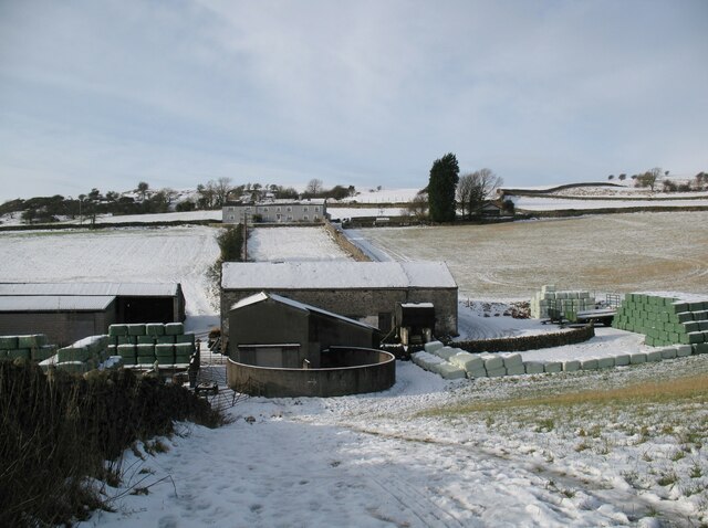
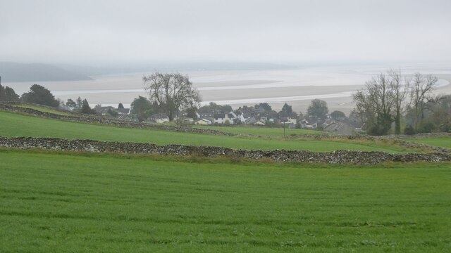
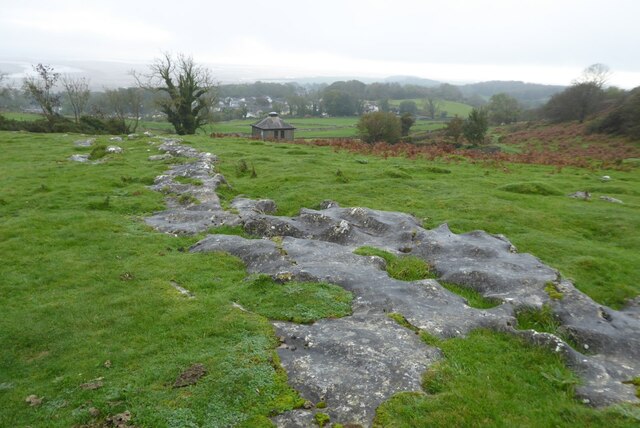
Grange-Over-Sands is a charming town located in the southern region of Cumbria, England. Despite being situated in Cumbria, it is often associated with Lancashire due to historical boundaries. Nestled on the northwestern coast of Morecambe Bay, this seaside resort town offers stunning views of the bay and the distant Lake District fells.

Known for its mild climate and extensive gardens, Grange-Over-Sands attracts visitors seeking a peaceful and tranquil escape. The town's beautifully maintained promenade, lined with colorful flowerbeds, provides an ideal spot for leisurely walks and breathtaking sunsets. The expansive sandy beach is a popular spot for families and nature enthusiasts alike, with its picturesque vistas and diverse wildlife.

Grange-Over-Sands boasts a wealth of impressive Victorian and Edwardian architecture that adds to its timeless appeal. Many of the town's attractive buildings have been converted into charming guesthouses and bed-and-breakfast establishments, accommodating the steady stream of tourists who flock to the area.

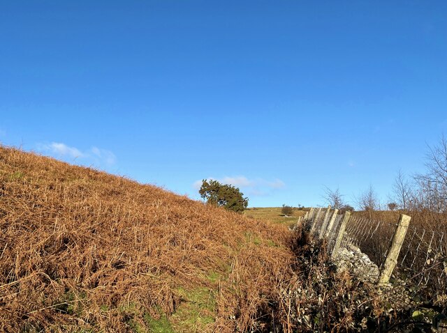
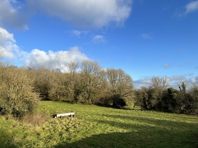
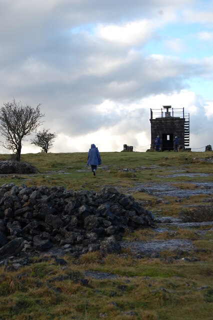
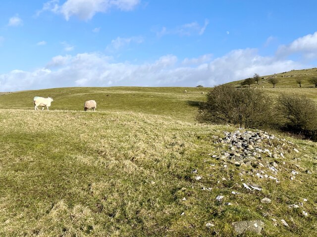
For those seeking recreational activities, Grange-Over-Sands offers a range of options. The town's golf course, set against a backdrop of rolling hills, is a favorite among golf enthusiasts. Additionally, visitors can explore the nearby Grange Fell, an elevated woodland area ideal for hiking and birdwatching.

With its idyllic setting and peaceful ambiance, Grange-Over-Sands is a hidden gem that offers a delightful escape from the bustling cities and tourist hotspots of the region. Whether one seeks a relaxing stroll along the promenade, a scenic round of golf, or a peaceful retreat surrounded by natural beauty, this charming town has something to offer every visitor.

If you have any feedback on the listing, please let us know in the comments section below.

Grange-Over-Sands Images

Images are sourced within 2km of 54.193186/-2.9111218 or Grid Reference SD4077. Thanks to Geograph Open Source API. All images are credited.

Bracken covered slope The fence and wall marks the edge of the open common and access land on Hampsfell.
Bracken covered slope
The fence and wall marks the edge of the open common and access land on Hampsfell.
Rock with carved cross This limestone rock beside the footpath from Spring Bank to Hampsfell Hospice bears a carved cross, seemingly of some antiquity.
Rock with carved cross
This limestone rock beside the footpath from Spring Bank to Hampsfell Hospice bears a carved cross, seemingly of some antiquity.
Gate near High Farm Beside a public footpath and looking very much like a footpath gate, the no entry sign beyond indicates that this is private land.  Frustratingly, the public access land of Hampsfell and one of the southernmost points of the Lake District National Park is less than 20m beyond the gate behind the dry stone wall, but a long detour is required to reach it.
Gate near High Farm
Beside a public footpath and looking very much like a footpath gate, the no entry sign beyond indicates that this is private land. Frustratingly, the public access land of Hampsfell and one of the southernmost points of the Lake District National Park is less than 20m beyond the gate behind the dry stone wall, but a long detour is required to reach it.
Field with water trough
Field edge near High Farm A public footpath from Hampsfell to Grange-over-Sands follows the edge of the field.
The buildings of High Farm can be seen in the background.
Field edge near High Farm
A public footpath from Hampsfell to Grange-over-Sands follows the edge of the field. The buildings of High Farm can be seen in the background.
Cartmel Road Near High Fellgate
Cartmel Road
Near High Fellgate
Hampsfell Hospice
Hampsfell Hospice
Hempsfell plateau The edge of the plateau falling away to more fertile lands below.
Hempsfell plateau
The edge of the plateau falling away to more fertile lands below.
Triangulation point, Hospice of Hampsfell Detail of the Ordnance Survey triangulation point near the south east corner of the roof of Hampsfell Hospice.
The brass bolt, well worn by passing feet, marks a height of 727.3 feet above sea level (Ordnance Datum Newlyn) and it is no longer used (location photographs at <a href="https://www.geograph.org.uk/photo/7078094">SD3979 : Triangulation point, Hampsfell Hospice</a>) and <a href="https://www.geograph.org.uk/photo/6769956">SD3979 : Hampsfell Hospice</a>).
Triangulation point, Hospice of Hampsfell
Detail of the Ordnance Survey triangulation point near the south east corner of the roof of Hampsfell Hospice. The brass bolt, well worn by passing feet, marks a height of 727.3 feet above sea level (Ordnance Datum Newlyn) and it is no longer used (location photographs at SD3979 : Triangulation point, Hampsfell Hospice) and SD3979 : Hampsfell Hospice).
Triangulation point, Hampsfell Hospice There is an Ordnance Survey triangulation point near the south east corner of the roof of Hampsfell Hospice, marked by a brass bolt set into the limestone slab (location photograph <a href="https://www.geograph.org.uk/photo/6769956">SD3979 : Hampsfell Hospice</a> and detail photograph <a href="https://www.geograph.org.uk/photo/7078069">SD3979 : Triangulation point, Hospice of Hampsfell</a>).
The base of the topograph is to the left.
Triangulation point, Hampsfell Hospice
There is an Ordnance Survey triangulation point near the south east corner of the roof of Hampsfell Hospice, marked by a brass bolt set into the limestone slab (location photograph SD3979 : Hampsfell Hospice and detail photograph SD3979 : Triangulation point, Hospice of Hampsfell). The base of the topograph is to the left.
Sheep pasture on Wart Barrow The ridge of stones in the foreground is the remains of a field boundary.
Sheep pasture on Wart Barrow
The ridge of stones in the foreground is the remains of a field boundary.
Spring Bank The public footpath, visible in the foreground, from Eden Mount to Hampsfell passes to the right of the farm buildings and up the track to the cottages beyond.
Spring Bank
The public footpath, visible in the foreground, from Eden Mount to Hampsfell passes to the right of the farm buildings and up the track to the cottages beyond.
Hospice of Hampsfell
Footpath approaching High Gate Footpath crossing a field of pasture and approaching High Gate.
Footpath approaching High Gate
Footpath crossing a field of pasture and approaching High Gate.
Country road passing a caravan park Country road passing a caravan park at High Gate.
Country road passing a caravan park
Country road passing a caravan park at High Gate.
Road closed for pipe laying Country road near Allithwaite closed for pipe laying.
Road closed for pipe laying
Country road near Allithwaite closed for pipe laying.
Above Grange-over-Sands Fields above Grange-over-Sands with parts of the estuary just visible in the background.
Above Grange-over-Sands
Fields above Grange-over-Sands with parts of the estuary just visible in the background.
Limestone paving Limestone paving on Far End above Grange-over-Sands.
Limestone paving
Limestone paving on Far End above Grange-over-Sands.
Show me another place!

Grange-Over-Sands is located at Grid Ref: SD4077 (Lat: 54.193186, Lng: -2.9111218)

Administrative County: Cumbria

District: South Lakeland

Police Authority: Cumbria

What 3 Words

///conjured.emperor.gobblers. Near Grange-over-Sands, Cumbria

Related Wikis

St Paul Parish Church, Grange-over-Sands

St Paul's Church is in Crown Hill, Grange-over-Sands, Cumbria, England. It is an active Anglican parish church in the deanery of Windermere, the archdeaconry...

Grange-over-Sands

Grange-over-Sands is a town and civil parish on the north side of Morecambe Bay in Cumbria, England, a few miles south of the Lake District National Park...

Grange-over-Sands railway station

Grange-over-Sands is a railway station on the Furness Line, which runs between Barrow-in-Furness and Lancaster. The station, situated 15+1⁄2 miles (25...

Grange Lido

Grange Lido is an open-air 50 m sea-water swimming pool, or lido, in Grange-over-Sands, Cumbria, England. It opened in 1932 and closed in 1993, but campaigners...

Nearby Amenities

Located within 500m of 54.193186,-2.9111218
Grange-over-Sands
Is In Country Code: GB
Is In County: Cumbria
Is In Historic County: Lancashire
Loc Name: Grange
Place: town
Wikidata: Q1477163
Wikipedia: en:Grange-over-Sands
Lat/Long: 54.1930633/-2.9094791
Mini Roundabout
Crown Hill Roundabout
Direction: clockwise
Lat/Long: 54.1929527/-2.9094376
Source: PGS
Lat/Long: 54.1931288/-2.9076562
Post Box
Collection Times: Mo-Fr 09:00; Sa 07:00
Image: https://www.geograph.org.uk/photo/6892038
Post Box Type: wall
Postal Code: LA11
Ref: LA11 114D
Royal Cypher: GVIR
Royal Cypher Wikidata: Q33102169
Lat/Long: 54.1942275/-2.9078314
Bus Stop
Westcliffe Gardens
Local Ref: AT
Naptan AtcoCode: 090079114219
Naptan Bearing: E
Naptan CommonName: Westcliffe Gardens
Naptan Indicator: at
Naptan Landmark: Flats
Naptan NaptanCode: cumdpwgm
Naptan Street: Grange Fell Road
Naptan Verified: no
Source: naptan_import
Lat/Long: 54.1925232/-2.9165477
Bus Stop
Hampsfell Road
Local Ref: AT
Naptan AtcoCode: 090079250771
Naptan Bearing: S
Naptan CommonName: Hampsfell Road
Naptan Indicator: at
Naptan Landmark: Church
Naptan NaptanCode: cumdjadj
Naptan Street: Hampsfell Road
Naptan Verified: no
Source: naptan_import
Lat/Long: 54.193309/-2.9101123
Bus Stop
Tourist Information Centre
Naptan AtcoCode: 090079250774
Naptan Bearing: S
Naptan CommonName: Tourist Information Centre
Naptan Indicator: opp
Naptan Landmark: Tourist Information
Naptan NaptanCode: cumdjadm
Naptan Street: Main Street
Naptan Verified: no
Shelter: no
Source: naptan_import
Lat/Long: 54.1940044/-2.9079409
Bus Stop
Main Street
Naptan AtcoCode: 090079250775
Naptan Bearing: N
Naptan CommonName: Main Street
Naptan Indicator: o/s
Naptan Landmark: Tourist Information Centre
Naptan NaptanCode: cumdjadp
Naptan Street: Main Street
Naptan Verified: no
Shelter: no
Source: naptan_import
Lat/Long: 54.1941713/-2.9078898
Bus Stop
Post Office stop
Naptan AtcoCode: 090079252110
Naptan Bearing: W
Naptan CommonName: Post Office
Naptan Indicator: opp
Naptan Landmark: The Post Office
Naptan NaptanCode: cumdjajd
Naptan Street: Crown Hill One Way System
Naptan Verified: no
Source: naptan_import
Lat/Long: 54.1929443/-2.9105017
Birchleigh Terrace (N bound)
Naptan AtcoCode: 090079252121
Naptan Bearing: N
Naptan BusStopType: CUS
Naptan CommonName: Birchleigh Terrace (N bound)
Naptan Indicator: opp
Naptan Landmark: United Reformed Church
Naptan NaptanCode: cumdjajg
Naptan Street: Birchleigh Terrace
Naptan Verified: no
Source: naptan_import
Lat/Long: 54.1907642/-2.9126465
Birchleigh Terrace (S bound)
Naptan AtcoCode: 090079252859
Naptan Bearing: S
Naptan BusStopType: CUS
Naptan CommonName: Birchleigh Terrace (S bound)
Naptan Indicator: o/s
Naptan Landmark: United Reformed Church
Naptan NaptanCode: cumdjamt
Naptan Street: Birchleigh Terrace
Naptan Verified: no
Source: naptan_import
Lat/Long: 54.1907018/-2.9125685
Crown Hill Post Office
Naptan AtcoCode: 090079323786
Naptan Bearing: E
Naptan BusStopType: CUS
Naptan CommonName: Crown Hill Post Office
Naptan Indicator: o/s
Naptan Landmark: The Post Office
Naptan NaptanCode: cumdjdtj
Naptan Street: Thornfield Place
Naptan Verified: no
Source: naptan_import
Lat/Long: 54.1930718/-2.9105669
Turning Circle
Lat/Long: 54.1916106/-2.9171626
Cafe
Costa
Addr City: Grange-over-Sands
Addr Postcode: LA11 6BA
Addr Street: Main Street
Brand: Costa
Brand Wikidata: Q608845
Brand Wikipedia: en:Costa Coffee
Cuisine: coffee_shop
Fhrs Id: 1210175
Not Addr Postcode: LA11 6DD
Outdoor Seating: yes
Source Addr: FHRS Open Data
Takeaway: yes
Lat/Long: 54.1932515/-2.9109352
Toilets
Access: yes
Charge: 0.30 GBP
Fee: yes
Payment Cash: no
Payment Contactless: yes
Wheelchair: yes
Lat/Long: 54.1934206/-2.9104702
Parking
Lat/Long: 54.1943513/-2.9093007
The Paragon
Addr City: Grange-over-Sands
Addr Postcode: LA11 6ED
Addr Street: Yewbarrow Terrace
Fhrs Id: 299900
Shop: gift
Lat/Long: 54.1959077/-2.9053822
Restaurant
The Estuary
Addr City: Grange-over-Sands
Addr Postcode: LA11 6DY
Addr Street: Main Street
Cuisine: regional;breakfast;lunch;seafood
Diet Vegetarian: yes
Fhrs Id: 1418410
Opening Hours: Mo-Th, Su 10:00-18:00; Fr-Sa 10:00-22:00
Website: https://www.estuary-grange.co.uk/
Lat/Long: 54.1941329/-2.9076106
The Treatment Rooms
Addr City: Grange-over-Sands
Addr Street: Main Street
Shop: beauty
Lat/Long: 54.1943189/-2.9074899
Bench
Lat/Long: 54.1915531/-2.9092642
Bench
Lat/Long: 54.1900292/-2.911139
Bench
Lat/Long: 54.1917469/-2.9091421
Bench
Lat/Long: 54.1895388/-2.9115172
Bench
Lat/Long: 54.1893089/-2.9116781
Bench
Lat/Long: 54.1904624/-2.9106951
Bench
Lat/Long: 54.1916433/-2.9091797
Bench
Lat/Long: 54.1915735/-2.9092843
Bench
Lat/Long: 54.1903965/-2.9107809
Bench
Lat/Long: 54.1914157/-2.909417
Barrier: bollard
Bicycle: dismount
Foot: yes
Lat/Long: 54.1936165/-2.9074681
Shelter
Lat/Long: 54.1913805/-2.9096437
Bench
Lat/Long: 54.1916574/-2.9092199
Bench
Lat/Long: 54.1914495/-2.9094278
Bench
Lat/Long: 54.1912949/-2.9095713
Bench
Lat/Long: 54.1906633/-2.9104685
Bench
Lat/Long: 54.1905393/-2.9105945
Bench
Lat/Long: 54.1891912/-2.9117559
Bench
Lat/Long: 54.1909308/-2.9100635
Bench
Lat/Long: 54.1908359/-2.9102606
Spar
Addr Postcode: LA11 6BA
Addr Street: Main Street
Alt Name: Lawrence Hunt & Co Ltd.
Brand: Spar
Brand Wikidata: Q610492
Brand Wikipedia: en:Spar (retailer)
Fhrs Id: 299409
Opening Hours: Mo-Sa 07:00-21:00; Su 08:00-21:00
Shop: convenience
Website: https://www.spar.co.uk/store-locator/hal35548-spar-grange-over-sands/
Lat/Long: 54.1932193/-2.9108028
Atm
Lat/Long: 54.1922135/-2.9119826
Restaurant
Thyme Out
Addr City: Grange-over-Sands
Addr Postcode: LA11 6DP
Addr Street: Main Street
Fhrs Id: 328891
Lat/Long: 54.1939941/-2.9083229
Fee: yes
Leisure: telescope
Lat/Long: 54.1910577/-2.9097332
Life Ring
Emergency: life_ring
Lat/Long: 54.1921465/-2.9086514
Fee: yes
Leisure: telescope
Lat/Long: 54.1923222/-2.9085416
Crossing
Crossing: uncontrolled
Crossing Island: no
Crossing Markings: zebra
Crossing Ref: zebra
Kerb: lowered
Tactile Paving: yes
Lat/Long: 54.1939258/-2.9082042
Bench
Lat/Long: 54.1954364/-2.9081151
Bench
Lat/Long: 54.1957992/-2.9073585
Life Ring
Emergency: life_ring
Lat/Long: 54.1897739/-2.9112143
Bench
Source: survey;gps
Lat/Long: 54.1923374/-2.9086723
Higginson's Butchers
Addr City: Grange-over-Sands
Addr Housename: Keswick House
Addr Postcode: LA11 6AB
Addr Street: Main Street
Contact Facebook: Higginsonsbutchers
Fhrs Id: 299789
Shop: butcher
Lat/Long: 54.1930277/-2.910943
Bargain Booze
Brand: Bargain Booze
Brand Wikidata: Q16971315
Brand Wikipedia: en:Bargain Booze
Shop: alcohol
Lat/Long: 54.1915293/-2.9119051
Robinsons Electric
Brand: Euronics
Shop: electronics
Website: https://www.euronics.co.uk/store/robinsons%20electric%20grange%2023100
Lat/Long: 54.1910178/-2.9122358
Wilson Robinson
Addr Housenumber: 2
Addr Postcode: LA11 7EY
Addr Street: Birchleigh Terrace
Shop: carpet
Website: http://www.wilsonrobinson.co.uk/
Lat/Long: 54.1909772/-2.9122519
Cromptons Furniture
Shop: furniture
Website: https://www.cromptonsofgrange.co.uk/
Lat/Long: 54.1908654/-2.9123367
Grange Laundry
Shop: laundry
Lat/Long: 54.1900404/-2.9130762
J. Procter
Addr City: Grange-over-Sands
Addr Housename: Devonshire Place
Addr Housenumber: 1
Addr Postcode: LA11 7HF
Addr Street: Kent Banks Road
Fhrs Id: 328695
Shop: butcher
Lat/Long: 54.1901295/-2.9129853
Pub
Keg & Kitchen
Addr City: Grange-over-Sands
Addr Postcode: LA11 6AB
Addr Street: Main Street
Fhrs Id: 328697
Food: yes
Lat/Long: 54.1929106/-2.9105691
Bank
Furness Building Society
Lat/Long: 54.1927924/-2.9118384
Scissor Sisters
Addr City: Grange-over-Sands
Addr Housename: 1 Lowther Gardens
Addr Postcode: LA11 7EX
Addr Street: Kents Bank Road
Old Name: Lloyds Bank
Shop: hairdresser
Lat/Long: 54.1931137/-2.9115105
Grange-over-Sands Information Centre
Addr City: Grange-over-Sands
Addr Housename: Victoria Hall
Addr Postcode: LA11 6DP
Addr Street: Main Street
Information: office
Tourism: information
Lat/Long: 54.194175/-2.908039
Tesco Express
Addr City: Grange-over-Sands
Addr Postcode: LA11 7EY
Addr Street: Kents Bank Road
Brand: Tesco Express
Brand Wikidata: Q98456772
Brand Wikipedia: en:Tesco
Contact Website: https://www.tesco.com/store-locator/grange-over-sands/kent-bank-rd
Fhrs Id: 441653
Opening Hours: Mo-Su 07:00-22:00
Shop: convenience
Lat/Long: 54.1912525/-2.9124875
Bench
Lat/Long: 54.1931142/-2.9096286
Clock
Clock Tower
Display: analog
Faces: 4
Image: https://www.geograph.org.uk/photo/1835275
Support: tower
Visibility: area
Wikidata: Q26559787
Lat/Long: 54.1929994/-2.9097188
Daisyroots Books
Addr City: Grange-over-Sands
Addr Postcode: LA11 6DP
Addr Street: Main Street
Opening Hours: Mo-Sa 09:30-16:30
Shop: books
Website: https://www.daisyrootsbooks.co.uk/
Lat/Long: 54.1933703/-2.9088567
Poole Townsend
Addr City: Grange-over-Sands
Addr Street: Main Street
Office: estate_agent
Lat/Long: 54.1942738/-2.9075189
Commodore Hotel
Flickr: https://www.flickr.com/photos/flipflopnick/7881046328/
Historic: memorial
Memorial: plaque
Openplaques Id: 11321
Lat/Long: 54.1937844/-2.9079519
The Curiosity Shop
Addr City: Grange-over-Sands
Addr Postcode: LA11 6DP
Addr Street: Main Street
Shop: antiques
Lat/Long: 54.1940347/-2.9082603
Cafe
Butterfingers
Addr City: Grange-over-Sands
Addr Postcode: LA11 6DP
Addr Street: Main Street
Cuisine: coffee_shop
Fhrs Id: 299757
Opening Hours: Mo-Sa 09:00-16:30; Su 10:00-16:30
Outdoor Seating: yes
Lat/Long: 54.1940661/-2.9082053
Addr City: Grange-over-Sands
Addr Housename: Corner House
Addr Postcode: LA11 6DP
Addr Street: Main Street
Disused Shop: yes
Lat/Long: 54.1939013/-2.9084615
Bicycle Parking
Bicycle Parking: stands
Capacity: 4
Covered: no
Image: https://www.geograph.org.uk/photo/6664627
Lat/Long: 54.1939435/-2.9080555
Johnston's of Grange
Addr City: Grange-over-Sands
Addr Postcode: LA11 6DP
Addr Street: Main Street
Shop: jewelry
Website: https://www.johnstonsofgrange.co.uk/
Lat/Long: 54.1938674/-2.9081647
Johnston's of Grange
Addr City: Grange-over-Sands
Addr Postcode: LA11 6DP
Addr Street: Main Street
Shop: gift
Lat/Long: 54.1938299/-2.9082318
Michael CL Hodgson
Addr City: Grange-over-Sands
Addr Postcode: LA11 6DP
Addr Street: Main Street
Fixme: Extant?
Office: estate_agent
Lat/Long: 54.1938595/-2.90852
The Country House
Addr City: Grange-over-Sands
Addr Postcode: LA11 6DP
Addr Street: Main Street
Shop: gift
Lat/Long: 54.1938251/-2.9085704
Hackney & Leigh
Addr City: Grange-over-Sands
Addr Postcode: LA11 6DP
Addr Street: Main Street
Office: estate_agent
Website: https://www.hackney-leigh.co.uk/branch/grange-over-sands/
Lat/Long: 54.1937944/-2.9086173
Restaurant
Akhi
Addr City: Grange-over-Sands
Addr Housenumber: 100
Addr Postcode: LA11 6DP
Addr Street: Main Street
Cuisine: indian
Fhrs Id: 328570
Phone: +44 15395 36583
Takeaway: yes
Website: https://www.akhiindian.co.uk/
Lat/Long: 54.1937536/-2.9086752
Cafe
Choco-Lori's Chocolate Bar
Addr City: Grange-over-Sands
Addr Housename: Ingwell House
Addr Housenumber: 43
Addr Postcode: LA11 6DP
Addr Street: Main Street
Cuisine: chocolate
Lat/Long: 54.1936492/-2.9084467
Choco-Lori
Addr City: Grange-over-Sands
Addr Housename: Ingwell House
Addr Housenumber: 43
Addr Postcode: LA11 6DP
Addr Street: Main Street
Contact Facebook: https://www.facebook.com/Choco-Lori-of-Grange-493387494182209/
Fhrs Id: 298825
Shop: chocolate
Lat/Long: 54.1936417/-2.9085273
Vibe
Addr City: Grange-over-Sands
Addr Housenumber: 43
Addr Postcode: LA11 6DP
Addr Street: Main Street
Shop: hairdresser
Lat/Long: 54.1936/-2.9085728
Addr City: Grange-over-Sands
Addr Postcode: LA11 6DP
Addr Street: Main Street
Clothes: women
Disused Shop: clothes
Fixme: Check current status
Old Name: The Foxes Den
Lat/Long: 54.1937209/-2.9087269
Feyz Barbers
Addr City: Grange-over-Sands
Addr Housename: Imperial Buildings
Addr Postcode: LA11 6DP
Addr Street: Main Street
Male: yes
Old Name: The Grange Cake Company
Shop: hairdresser
Lat/Long: 54.1936881/-2.9087759
Lakeland Optical
Addr City: Grange-over-Sands
Addr Postcode: LA11 6DP
Addr Street: Main Street
Shop: optician
Lat/Long: 54.1935173/-2.9090208
Bench
Backrest: yes
Lat/Long: 54.1935427/-2.9086916
Waste Basket
Lat/Long: 54.193527/-2.9087127
Addr City: Grange-over-Sands
Addr Postcode: LA11 6DP
Addr Street: Main Street
Disused Office: estate_agent
Lat/Long: 54.1934089/-2.9088146
Grange Now
Addr City: Grange-over-Sands
Addr Housename: Imperial House
Addr Housenumber: 2
Addr Postcode: LA11 6DP
Addr Street: Main Street
Office: newspaper
Website: https://nowmags.co.uk/grange-now/
Lat/Long: 54.1937643/-2.9087425
Lancaster's
Addr City: Grange-over-Sands
Addr Postcode: LA11 6DP
Addr Street: Main Street
Shop: hardware
Lat/Long: 54.1932755/-2.9089834
Lancaster's Boots and Shoes
Addr City: Grange-over-Sands
Addr Postcode: LA11 6DP
Addr Street: Main Street
Shop: outdoor
Lat/Long: 54.1932249/-2.9090475
Davenports
Addr City: Grange-over-Sands
Addr Postcode: LA11 6DP
Addr Street: Main Street
Shop: clothes
Lat/Long: 54.1933326/-2.9089092
Palace Fitness
Addr City: Grange-over-Sands
Leisure: fitness_centre
Lat/Long: 54.1928422/-2.9103566
Restaurant
Amber Court
Addr City: Grange-over-Sands
Addr Postcode: LA11 6AB
Addr Street: Main Street
Cuisine: cantonese
Diet Vegetarian: yes
Fhrs Id: 328841
Lat/Long: 54.1928762/-2.9104567
Thomson Hayton Wilkly
Addr City: Grange-over-Sands
Addr Postcode: LA11 6AB
Addr Street: Main Street
Office: estate_agent
Website: https://www.thwestateagents.co.uk/Contact-Us/10/Grange-over-Sands%20Office
Lat/Long: 54.1929535/-2.910636
Fast Food
Grange Charcoal Grill
Addr City: Grange-over-Sands
Addr Housename: Church Buildings
Addr Postcode: LA11 6BA
Addr Street: Main Street
Cuisine: turkish;kebab;pizza;burger
Fhrs Id: 328907
Lat/Long: 54.193023/-2.9101908
Waste Basket
Lat/Long: 54.1930046/-2.910248
Post Box
Collection Times: Mo-Fr 17:30; Sa 12:00
Image: https://www.geograph.org.uk/photo/2331803
Post Box Type: pillar
Ref: LA11 161
Royal Cypher: EIIR
Royal Cypher Wikidata: Q33102113
Lat/Long: 54.19303/-2.9105021
Post Box
Collection Times: Mo-Fr 17:30; Sa 12:00
Image: https://www.geograph.org.uk/photo/2331803
Post Box Type: pillar
Ref: LA11 162
Royal Cypher: EIIR
Royal Cypher Wikidata: Q33102113
Lat/Long: 54.1930198/-2.9105021
The Flower House
Addr City: Grange-over-Sands
Addr Housename: Post Office Chambers
Addr Postcode: LA11 6BA
Addr Street: Main Street
Old Name: South Lakes Mobility
Shop: florist
Website: https://theflower-house.co.uk/
Lat/Long: 54.1931766/-2.9107208
Fast Food
Chilli Red
Addr City: Grange-over-Sands
Addr Housename: 6 Post Office Chambers
Addr Postcode: LA11 6BA
Addr Street: Main Street
Cuisine: chinese
Fhrs Id: 328993
Lat/Long: 54.1931599/-2.9106669
Bicycle Parking
Bicycle Parking: stands
Capacity: 4
Covered: no
Lat/Long: 54.1933813/-2.9114577
Bench
Backrest: yes
Lat/Long: 54.1931588/-2.911284
Waste Basket
Lat/Long: 54.1931726/-2.9112878
Cafe
At Home Cafe
Addr City: Grange-over-Sands
Addr Postcode: LA11 6AB
Addr Street: Main Street
Bar: yes
Fhrs Id: 298959
Lat/Long: 54.1930454/-2.9110657
Defibrillator
Emergency: defibrillator
Indoor: yes
Lat/Long: 54.1941427/-2.9081143
St Mary's Hospice
Shop: charity
Lat/Long: 54.1959723/-2.9053206
Dentist
Bupa Dental Care
Addr Country: GB
Brand: Bupa
Brand Wikidata: Q931628
Brand Wikipedia: en:Bupa
Contact Website: https://www.bupa.co.uk/dental/dental-care/practices/grange-over-sands
Healthcare: dentist
Lat/Long: 54.196027/-2.9052718
Westmorland Homecare
Addr City: Grange-over-Sands
Addr Housename: Legion House
Addr Postcode: LA11 7EY
Addr Street: Kents Bank Road
Office: healthcare
Opening Hours: Mo-Fr 09:00-17:00
Lat/Long: 54.1911719/-2.9126279
Atm
Lat/Long: 54.1913112/-2.9123814
Give Way
Direction: forward
Lat/Long: 54.1913844/-2.9121225
Generator Method: photovoltaic
Generator Output Electricity: yes
Generator Source: solar
Generator Type: solar_photovoltaic_panel
Location: roof
Power: generator
Lat/Long: 54.1894526/-2.9131341
Generator Method: photovoltaic
Generator Output Electricity: yes
Generator Source: solar
Generator Type: solar_photovoltaic_panel
Location: roof
Power: generator
Lat/Long: 54.1905691/-2.9173505
Generator Method: photovoltaic
Generator Output Electricity: yes
Generator Source: solar
Generator Type: solar_photovoltaic_panel
Location: roof
Power: generator
Lat/Long: 54.1909096/-2.9171354
Generator Method: photovoltaic
Generator Output Electricity: yes
Generator Source: solar
Generator Type: solar_photovoltaic_panel
Location: roof
Power: generator
Lat/Long: 54.1948459/-2.9164028
Generator Location: roof
Generator Method: photovoltaic
Generator Output Electricity: yes
Generator Source: solar
Generator Type: solar_photovoltaic_panel
Orientation: SE
Power: generator
Lat/Long: 54.1925928/-2.9086732
Generator Method: thermal
Generator Output Hot Water: yes
Generator Place: roof
Generator Source: solar
Generator Type: solar_thermal_collector
Orientation: SE
Power: generator
Lat/Long: 54.192536/-2.9087425
Information: map
Tourism: information
Lat/Long: 54.1923121/-2.9085484
Generator Method: thermal
Generator Output Hot Water: yes
Generator Place: roof
Generator Source: solar
Generator Type: solar_thermal_collector
Orientation: SE
Power: generator
Lat/Long: 54.1924485/-2.9090984
Turning Circle
Lat/Long: 54.1908709/-2.9169137
Bagot Opticians
Shop: optician
Lat/Long: 54.1928514/-2.9117852
BFMS
Office: accountant
Lat/Long: 54.1930404/-2.9116198
Shirley M Evans
Office: lawyer
Lat/Long: 54.192963/-2.911692
Demolished Railway: crossing
Lat/Long: 54.192384/-2.9088047
Demolished Railway: crossing
Lat/Long: 54.1923392/-2.9087902
Sew 'N' Sew
Shop: fabric
Lat/Long: 54.1926961/-2.9114703
Grange Bakery
Addr City: Grange Over Sands
Addr Housename: Newlyn
Addr Postcode: LA11 7EY
Addr Street: Kents Bank Road
Fhrs Id: 328631
Shop: bakery
Source Addr: FHRS Open Data
Website: https://grangebakery.co.uk/
Lat/Long: 54.1925947/-2.9115491
The Royal British Legion
Flickr: https://www.flickr.com/photos/flipflopnick/7845139834/
Historic: memorial
Inscription: The national Church of England School opened in 1864 with the inscription '... to be forever used for the education of children and adults only of the labouring and manufacturing classes.' By 1869 the school had been placed under Government inspection, no
Memorial: plaque
Openplaques Id: 11279
Lat/Long: 54.1911872/-2.912458
Entrance: yes
Lat/Long: 54.1911901/-2.9125062
Entrance: yes
Lat/Long: 54.1911697/-2.9125965
Dentist
Avondale
Healthcare: dentist
Lat/Long: 54.1923819/-2.912016
Independent Investment Associates
Addr Postcode: LA11 7EY
Office: financial_advisor
Source Postcode: website
Website: https://www.iialtd.co.uk/
Lat/Long: 54.1923351/-2.9120411
Little & Caine
Shop: funeral_directors
Lat/Long: 54.1902953/-2.9128221
Post Box
Lat/Long: 54.1903256/-2.9130408
Miniheat
Craft: plumber
Lat/Long: 54.1900969/-2.9130364
Somerset House
Addr City: Grange Over Sands
Addr Postcode: LA11 7EY
Addr Street: Kents Bank Road
Fhrs Id: 328785
Source Addr: FHRS Open Data
Tourism: guest_house
Lat/Long: 54.1907738/-2.9123825
Birchleigh Guest House
Addr Postcode: LA11 7EY
Fhrs Id: 441656
Guest House: bed_and_breakfast
Tourism: guest_house
Website: http://www.birchleighguesthouse.com/
Lat/Long: 54.1909278/-2.9122822
Entrance: main
Lat/Long: 54.1917315/-2.9117646
Grange Emporium
Contact Facebook: Grangeemporium
Shop: antiques
Lat/Long: 54.1923825/-2.9116063
Progression Solicitors
Office: lawyer
Website: https://www.progressionsolicitors.com/solicitors-grange-over-sands/
Lat/Long: 54.1922852/-2.9116599
Information: guidepost
Tourism: information
Lat/Long: 54.1921856/-2.9087786
Bench
Lat/Long: 54.1909482/-2.9101445
Clock Tower
Flickr: https://www.flickr.com/photos/flipflopnick/7679096326/
Historic: memorial
Memorial: plaque
Openplaques Id: 10994
Lat/Long: 54.1929765/-2.9096362
Post Box
Operator: Royal Mail
Post Box Type: wall
Lat/Long: 54.1910015/-2.914141
Ride Repair Cycles
Addr City: Grange-over-Sands
Addr Postcode: LA11 7EZ
Addr Street: Albert Road
Contact Facebook: https://www.facebook.com/riderepaircycles/
Opening Hours: Tu-Fr 09:15-16:00; Sa 10:00-15:00
Phone: +44 15395 38810
Service Bicycle Ebike: yes
Service Bicycle Parts: yes
Service Bicycle Repair: yes
Service Bicycle Retail: yes
Service Bicycle Service: yes
Shop: bicycle
Website: https://www.riderepaircycles.com/
Lat/Long: 54.1923484/-2.9112078
Man Made: mast
Tower Construction: lattice
Tower Type: communication
Lat/Long: 54.1937845/-2.9110482
Entrance: main
Lat/Long: 54.193615/-2.9113338
Man Made: planter
Lat/Long: 54.191307/-2.9121544
Bench
Lat/Long: 54.1913327/-2.9121324
Bench
Lat/Long: 54.1912781/-2.9121645
Bench
Lat/Long: 54.191133/-2.9122349
Bench
Lat/Long: 54.1911871/-2.9122029
Man Made: planter
Lat/Long: 54.1911662/-2.9122203
Grit Bin
Lat/Long: 54.1914151/-2.912008
Bench
Lat/Long: 54.1914167/-2.9120602
Bench
Lat/Long: 54.1914456/-2.9120401
Information: guidepost
Tourism: information
Lat/Long: 54.1914333/-2.9120483
Man Made: planter
Lat/Long: 54.1914659/-2.9120282
Information: map
Tourism: information
Lat/Long: 54.191398/-2.9120318
Crossing
Crossing: marked
Crossing Island: no
Tactile Paving: no
Lat/Long: 54.191322/-2.9118174
Crossing
Crossing: marked
Crossing Island: no
Tactile Paving: no
Lat/Long: 54.1911691/-2.9119119
Crossing
Crossing: marked
Crossing Island: no
Tactile Paving: no
Lat/Long: 54.1912356/-2.9120438
Crossing
Crossing: marked
Crossing Island: no
Tactile Paving: no
Lat/Long: 54.1913258/-2.9119902
Vending Machine
Vending: parking_tickets
Lat/Long: 54.191391/-2.9120327
Bicycle Parking
Access: yes
Bicycle Parking: wall_loops
Capacity: 6
Covered: no
Fee: no
Lat/Long: 54.1913139/-2.9114629
Waste Basket
Lat/Long: 54.1911807/-2.9121544
Man Made: street_cabinet
Lat/Long: 54.1911239/-2.9121151
Charging Station
Authentication App: yes
Capacity: 1
Fee: yes
Motorcar: yes
Network: Charge My Street
Operator: South Lakeland District Council
Payment App: yes
Payment Contactless: yes
Ref: EG-08214
Socket Type2: 1
Socket Type2 Current: 32
Socket Type2 Output: 22kW
Socket Type2 Voltage: 415
Lat/Long: 54.1911207/-2.9120995
Charging Station
Authentication App: yes
Capacity: 1
Fee: yes
Motorcar: yes
Network: Charge My Street
Operator: South Lakeland District Council
Payment App: yes
Payment Contactless: yes
Ref: EG-08213
Socket Type2: 1
Socket Type2 Current: 32
Socket Type2 Output: 22kW
Socket Type2 Voltage: 415
Lat/Long: 54.19112/-2.9120953
Historic: memorial
Image: https://www.geograph.org.uk/photo/1452923
Memorial: war_memorial
Lat/Long: 54.1945382/-2.9067944
The Victoria Hall
Flickr: https://www.flickr.com/photos/flipflopnick/7678672312/
Historic: memorial
Memorial: plaque
Openplaques Id: 10992
Lat/Long: 54.1941451/-2.9080166
Infinity Hair and Beauty
Contact Facebook: https://www.facebook.com/people/Infinity-Hair-and-Beauty/100045004551798/
Shop: hairdresser
Lat/Long: 54.1926477/-2.9114749
Give Way
Direction: forward
Lat/Long: 54.1932115/-2.9111794
Give Way
Lat/Long: 54.1931847/-2.9110898
Vanilla Beauty
Level: 1
Shop: beauty
Website: https://www.vanilla-beauty.co.uk/
Lat/Long: 54.1930094/-2.9101049
Give Way
Direction: forward
Lat/Long: 54.193425/-2.9121088
Grit Bin
Lat/Long: 54.1933714/-2.9122805
Generator Method: photovoltaic
Generator Output Electricity: yes
Generator Source: solar
Generator Type: solar_photovoltaic_panel
Location: roof
Power: generator
Lat/Long: 54.191601/-2.913871
Generator Method: photovoltaic
Generator Output Electricity: yes
Generator Source: solar
Generator Type: solar_photovoltaic_panel
Location: roof
Power: generator
Lat/Long: 54.1915776/-2.9137463
Man Made: outfall
Lat/Long: 54.193486/-2.9072385
The Piers
Flickr: https://www.flickr.com/photos/flipflopnick/7881176322/
Historic: memorial
Memorial: plaque
Openplaques Id: 11322
Lat/Long: 54.1921632/-2.9088418
Picklefoot Spring
Historic: memorial
Memorial: plaque
Openplaques Id: 10995
Lat/Long: 54.195446/-2.9052366
The Station House
Flickr: https://www.flickr.com/photos/flipflopnick/7678685924/
Historic: memorial
Memorial: plaque
Openplaques Id: 10991
Lat/Long: 54.1944367/-2.9076293
Bay Villa
Flickr: https://www.flickr.com/photos/flipflopnick/7880869694/
Historic: memorial
Memorial: plaque
Openplaques Id: 11320
Lat/Long: 54.1939494/-2.9078808
Power: pole
Lat/Long: 54.1974423/-2.9100364
The data included in this document is from www.openstreetmap.org. The data is made available under ODbL.

Have you been to Grange-Over-Sands?

Leave your review of Grange-Over-Sands below (or comments, questions and feedback).