Grange Village

Settlement in Gloucestershire Forest of Dean

England

Grange Village

Across the River Severn towards Newnham, Gloucestershire From Arlingham.
Across the River Severn towards Newnham, Gloucestershire Credit: Jaggery

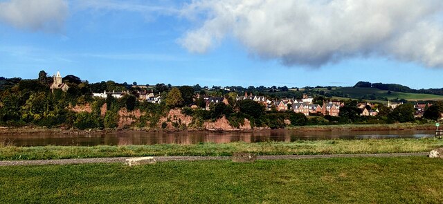
Grange Village is a picturesque settlement located in the county of Gloucestershire, England. Situated in the heart of the Cotswolds, this idyllic village offers a tranquil and charming atmosphere that attracts both locals and visitors alike.

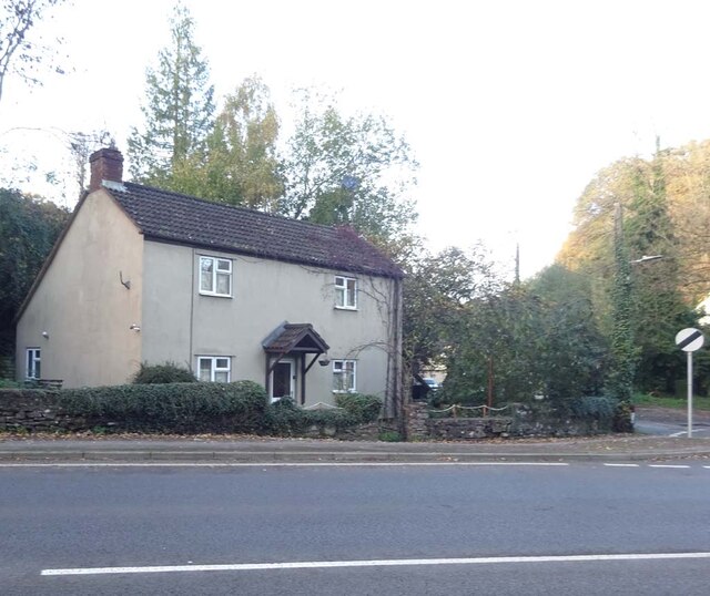
The village is characterized by its quintessentially English architecture, with rows of stone cottages adorned with colorful flowers and well-manicured gardens. The streets are lined with ancient trees, providing shade during the summer months and a vibrant display of colors during autumn. Grange Village is known for its well-preserved historic buildings, some of which date back to the medieval era.

The centerpiece of the village is the St. Mary's Church, an architectural gem that stands proudly at the village square. This 12th-century church features stunning stained glass windows and a striking tower, offering a glimpse into the village's rich heritage.

Despite its small size, Grange Village boasts a strong sense of community spirit. The village has a local pub, The Grange Inn, where residents and visitors gather to enjoy a traditional British pint and hearty pub food. The village also hosts regular events and festivals, such as the Grange Village Fete, which brings the community together for a day of fun-filled activities and entertainment.

Surrounded by rolling hills and picturesque countryside, Grange Village offers plenty of opportunities for outdoor activities. Nearby walking trails and cycling routes allow visitors to explore the breathtaking beauty of the Cotswolds. For those seeking a peaceful retreat away from the hustle and bustle of city life, Grange Village is an ideal destination.

If you have any feedback on the listing, please let us know in the comments section below.

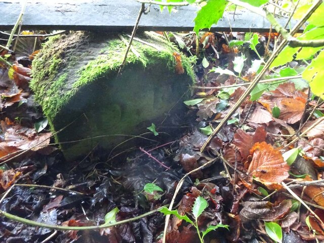
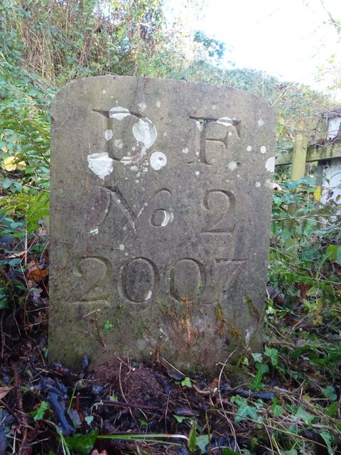
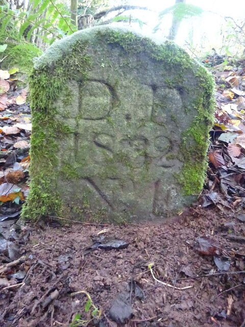
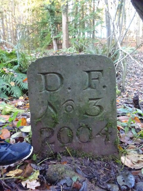
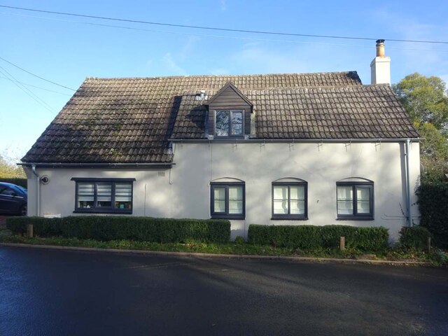
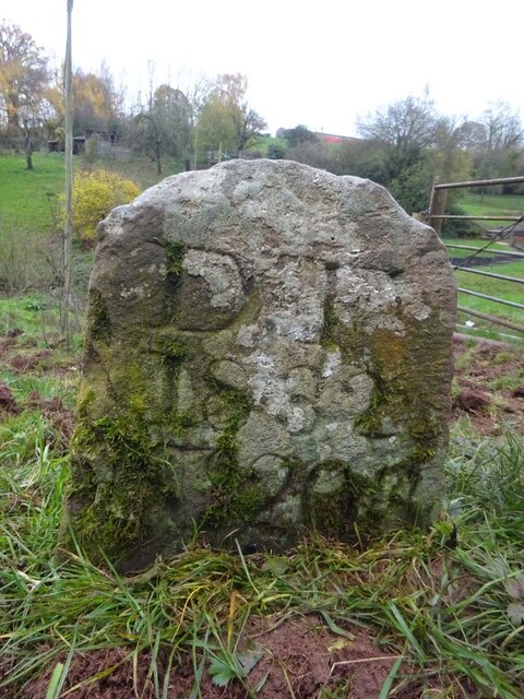
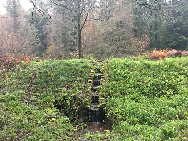
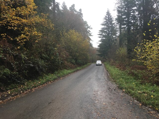
Grange Village Images

Images are sourced within 2km of 51.807496/-2.468602 or Grid Reference SO6712. Thanks to Geograph Open Source API. All images are credited.

Across the River Severn towards Newnham, Gloucestershire From Arlingham.
Across the River Severn towards Newnham, Gloucestershire
From Arlingham.
Grade II Listed old milestone, Arlingham Probably dating from the 18th century, the milestone is located outside the Old Passage Inn <a title="https://www.geograph.org.uk/photo/6972380" href="https://www.geograph.org.uk/photo/6972380">Link</a> on the east bank of the River Severn in Arlingham, Gloucestershire.
Grade II Listed old milestone, Arlingham
Probably dating from the 18th century, the milestone is located outside the Old Passage Inn Link on the east bank of the River Severn in Arlingham, Gloucestershire.
Marshfield Farm Real Dairy Ice Cream board, Arlingham On the east bank of the River Severn. 
The Old Passage Inn <a title="https://www.geograph.org.uk/photo/6972345" href="https://www.geograph.org.uk/photo/6972345">Link</a> is behind the camera. 
Newnham on the west bank of the Severn is in the background.
Marshfield Farm Real Dairy Ice Cream board, Arlingham
On the east bank of the River Severn. The Old Passage Inn Link is behind the camera. Newnham on the west bank of the Severn is in the background.
River cliff and the village of Newnham-on-Severn, Gloucestershire
Eastwards over Severn to Arlingham - Newnham on Severn, Gloucestershire On the track from Aram's to Tanhouse Farm at Newnham on Severn, looking eastwards across the River Severn to the Arlingham peninsula. Memory fails me as to whether this was Gloucester Ramblers or Stroud Rambling Club but no matter. The villages of Arlingham and Fretherne lie on this expanse of flat land enclosed by a loop of  the River Severn as it makes its way from Plynlimon to the Bristol Channel. Time photo taken not available.

<a href="https://www.geograph.org.uk/photo/7732417">SO6911 : Arlingham across the Severn – Newnham on Severn, Gloucestershire</a>
Eastwards over Severn to Arlingham - Newnham on Severn, Gloucestershire
On the track from Aram's to Tanhouse Farm at Newnham on Severn, looking eastwards across the River Severn to the Arlingham peninsula. Memory fails me as to whether this was Gloucester Ramblers or Stroud Rambling Club but no matter. The villages of Arlingham and Fretherne lie on this expanse of flat land enclosed by a loop of the River Severn as it makes its way from Plynlimon to the Bristol Channel. Time photo taken not available. SO6911 : Arlingham across the Severn – Newnham on Severn, Gloucestershire
Outfall Drip, Newnham On the base wall of the Old Drill Hall, facing the Severn. Drip ledge to a discontinued outfall on the side of a long forgotten quay, in the area of the old ferry and fording point.
Outfall Drip, Newnham
On the base wall of the Old Drill Hall, facing the Severn. Drip ledge to a discontinued outfall on the side of a long forgotten quay, in the area of the old ferry and fording point.
Boundary Stone, Denton's Corner In the junction of the A4151 Elton Road with the Slad and Greenway. In the parish of Littledean near Littledean Jail.

Inscription: D.F / 2011 / Nᴼ. 204

Milestone Society National ID: GL_DFLITT204em
Boundary Stone, Denton's Corner
In the junction of the A4151 Elton Road with the Slad and Greenway. In the parish of Littledean near Littledean Jail. Inscription: D.F / 2011 / Nᴼ. 204 Milestone Society National ID: GL_DFLITT204em
Denton's Corner, Littledean A4151 Former Toll House at Denton's Corner where Greenway and the Slad meet the A4151 Gloucester Road. This building served the Elton Turnpike Trust in the 19ᵗʰ Century.

Milestone Society National ID: GL.LIT03
Denton's Corner, Littledean A4151
Former Toll House at Denton's Corner where Greenway and the Slad meet the A4151 Gloucester Road. This building served the Elton Turnpike Trust in the 19ᵗʰ Century. Milestone Society National ID: GL.LIT03
Old Boundary Stone, Blaise Bailey Marking the boundary of the "Forest of Dean" seen from Forestry Commission land but actually just in the private field beyond. One of the few originals.

Inscription: D. F. / Nᴼ. 218 / 1832

Milestone Society National ID: GL_DFRUSU218em
Old Boundary Stone, Blaise Bailey
Marking the boundary of the "Forest of Dean" seen from Forestry Commission land but actually just in the private field beyond. One of the few originals. Inscription: D. F. / Nᴼ. 218 / 1832 Milestone Society National ID: GL_DFRUSU218em
Boundary Stone, Grange At the end of Gloucestershire bridleway ENE4, near Grange Village. Signposted to "Precious Pets" boarding kennels.

Inscription: D.F / Nᴼ. 2 / 2007

Milestone Society National ID: GL_DFNEWN2em
Boundary Stone, Grange
At the end of Gloucestershire bridleway ENE4, near Grange Village. Signposted to "Precious Pets" boarding kennels. Inscription: D.F / Nᴼ. 2 / 2007 Milestone Society National ID: GL_DFNEWN2em
Old Boundary Stone, Grange Just after the end of Gloucestershire footpath ENE34 marking the boundary of the "Forest of Dean". A modern companion stone, Nᴼ.3, can be seen 50m North at <a href="https://www.geograph.org.uk/photo/7352881">SO6711 : Boundary Stone, Blaise Bailey</a>.

Inscription: D. F. / 1832 / Nᴼ. 4

Milestone Society National ID: GL_DFNEWN4em
Old Boundary Stone, Grange
Just after the end of Gloucestershire footpath ENE34 marking the boundary of the "Forest of Dean". A modern companion stone, Nᴼ.3, can be seen 50m North at SO6711 : Boundary Stone, Blaise Bailey. Inscription: D. F. / 1832 / Nᴼ. 4 Milestone Society National ID: GL_DFNEWN4em
Boundary Stone, Blaise Bailey In the wood just past Gloucestershire footpath ENE34. A companion stone Nᴼ.4, an 1832 stone, can be seen 50m South, at <a href="https://www.geograph.org.uk/photo/7352856">SO6711 : Old Boundary Stone, Grange</a>.

Inscription: D. F. / Nᴼ. 3 / 2004

Milestone Society National ID: GL_DFNEWN3em
Boundary Stone, Blaise Bailey
In the wood just past Gloucestershire footpath ENE34. A companion stone Nᴼ.4, an 1832 stone, can be seen 50m South, at SO6711 : Old Boundary Stone, Grange. Inscription: D. F. / Nᴼ. 3 / 2004 Milestone Society National ID: GL_DFNEWN3em
Old Pike Cottage, Pleasant Stile On the road between Littldean and Newnham on Severn pleasantly known as Pleasant Stile becoming Dean Road to the SE and starting as Silver Street to the NW. Erected by the Forest of Dean Turnpike Trust.

Milestone Society National ID: GL.LIT02
Old Pike Cottage, Pleasant Stile
On the road between Littldean and Newnham on Severn pleasantly known as Pleasant Stile becoming Dean Road to the SE and starting as Silver Street to the NW. Erected by the Forest of Dean Turnpike Trust. Milestone Society National ID: GL.LIT02
Old Boundary Stone, In a field North of the A4151, just beyond the dead end of a Public Right of Way.
It marks the boundary of the "Forest of Dean", and is on the boundary of East Dean and Littledean (1950 parishes).

Inscription: D. F / 1832 / Nᴼ. 203

Milestone Society National ID: GL_DFLITT203em
Old Boundary Stone,
In a field North of the A4151, just beyond the dead end of a Public Right of Way. It marks the boundary of the "Forest of Dean", and is on the boundary of East Dean and Littledean (1950 parishes). Inscription: D. F / 1832 / Nᴼ. 203 Milestone Society National ID: GL_DFLITT203em
St Peter's Church Newnham A parish church was established in Newnham in the 14th century (although there had been a chapel of ease since 1018), and in 1366 a new church building was built on the high ground of the village as the old one faced erosion from the river. The new building has itself been damaged by a gunpowder explosion in 1644 during the English Civil War and a fire in 1881.
St Peter's Church Newnham
A parish church was established in Newnham in the 14th century (although there had been a chapel of ease since 1018), and in 1366 a new church building was built on the high ground of the village as the old one faced erosion from the river. The new building has itself been damaged by a gunpowder explosion in 1644 during the English Civil War and a fire in 1881.
Pond outflow near Upper Soudley
Minor road towards Littledean
View across River Severn to Newnham Parish Church
Show me another place!

Grange Village is located at Grid Ref: SO6712 (Lat: 51.807496, Lng: -2.468602)

Administrative County: Gloucestershire

District: Forest of Dean

Police Authority: Gloucestershire

What 3 Words

///smallest.ooze.mice. Near Cinderford, Gloucestershire

Nearby Locations

Dean Hill Grange Village

Related Wikis

Blaize Bailey

Blaize Bailey is a small hamlet and viewpoint on the eastern edge of the Forest of Dean, in Gloucestershire, England. The viewpoint was constructed using...

Littledean

Littledean is a village in the Forest of Dean, west Gloucestershire, England. The village has a long history and formerly had the status of a town. Littledean...

Littledean Hall

Littledean Hall (grid reference SO672130) is a country house in the village of Littledean, Gloucestershire, England. It has been described as one of the...

Newnham railway station

Newnham railway station was a station serving the village of Newnham on Severn, Gloucestershire. == History == The South Wales Railway was formed in 1845...

Nearby Amenities

Located within 500m of 51.807496,-2.468602
Grange Village
Place: hamlet
Lat/Long: 51.8072466/-2.4688903
Barrier: stile
Material: wood
Step Count: 1
Stile: stepover
Lat/Long: 51.8085285/-2.4687159
Noexit: yes
Lat/Long: 51.8073724/-2.4679365
Barrier: kissing_gate
Bicycle: no
Foot: yes
Horse: no
Motor Vehicle: no
Lat/Long: 51.8057596/-2.4641105
Barrier: kissing_gate
Bicycle: no
Foot: yes
Horse: no
Kissing Gate: triangular_profile
Motor Vehicle: no
Lat/Long: 51.8099602/-2.4723115
Design: triangle
Material: metal
Power: pole
Structure: lattice
Lat/Long: 51.8051635/-2.4637082
Design: triangle
Material: metal
Power: pole
Structure: lattice
Lat/Long: 51.8038052/-2.4656743
Post Box
Collection Times: Mo-Fr 09:00; Sa 07:00
Operator: Royal Mail
Post Box Type: lamp
Ref: GL14 39D
Royal Cypher: EIIR
Royal Cypher Wikidata: Q33102113
Lat/Long: 51.8075032/-2.468631
The data included in this document is from www.openstreetmap.org. The data is made available under ODbL.

Have you been to Grange Village?

Leave your review of Grange Village below (or comments, questions and feedback).