Babel

Settlement in Carmarthenshire

Wales

Babel

Babel village hall A new building it seems in this rural area.
Babel village hall Credit: Neil Owen

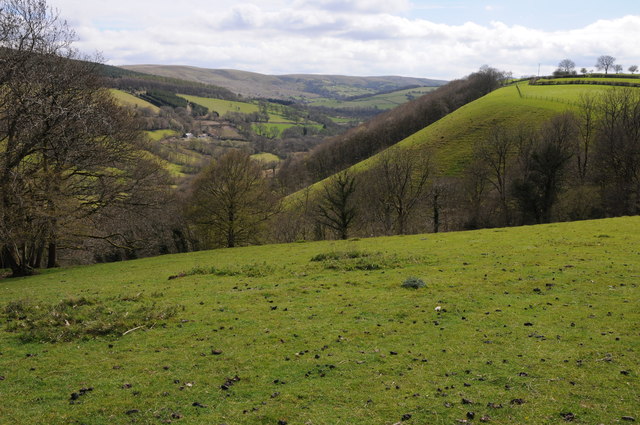
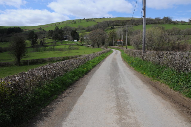
Babel is a small village located in the county of Carmarthenshire in Wales, United Kingdom. Situated in the beautiful countryside, Babel is surrounded by rolling hills and lush greenery, offering residents and visitors a peaceful and picturesque setting.

The village is known for its rich history, dating back to the medieval times. It is believed that Babel was originally established as a farming community, and remnants of its agricultural heritage can still be seen today in the surrounding farmlands and fields.

Despite its small size, Babel has a close-knit community that takes pride in preserving its traditional Welsh culture and heritage. The village hosts various events throughout the year, including local festivals, where residents come together to celebrate their traditions, music, and arts.

One of the notable attractions in Babel is the historic St. Mary's Church, which dates back to the 14th century. The church displays stunning architecture and is often visited by tourists interested in exploring the village's past. Additionally, Babel offers scenic walking trails, providing opportunities for nature enthusiasts to enjoy the breathtaking views of the countryside.

Although Babel does not have many commercial establishments, the nearby town of Carmarthen provides residents with a range of amenities, including shops, restaurants, and leisure facilities. Carmarthen also offers excellent transport links, making it easily accessible from Babel.

Overall, Babel, Carmarthenshire is a charming village that offers a tranquil escape from the hustle and bustle of city life. With its rich history, beautiful surroundings, and strong sense of community, it continues to attract locals and visitors alike.

If you have any feedback on the listing, please let us know in the comments section below.

Babel Images

Images are sourced within 2km of 52.006887/-3.705433 or Grid Reference SN8335. Thanks to Geograph Open Source API. All images are credited.

Babel village hall A new building it seems in this rural area.
Babel village hall
A new building it seems in this rural area.
Disused quarry in Crychan There are a number of small quarries in the forest, but most are no longer in use - as is this one at Craig Llywel. Instead the scars remain for Mother Nature to reclaim.
Disused quarry in Crychan
There are a number of small quarries in the forest, but most are no longer in use - as is this one at Craig Llywel. Instead the scars remain for Mother Nature to reclaim.
Road near Llwyn-y-berllan Country road approaching Llwyn-y-berllan above Pentre-ty-Gwyn.
Road near Llwyn-y-berllan
Country road approaching Llwyn-y-berllan above Pentre-ty-Gwyn.
Cwm Gwennol View across Cwm Gwennol above Halfway, viewed from a country road near Babel.
Cwm Gwennol
View across Cwm Gwennol above Halfway, viewed from a country road near Babel.
Farmland around Babel View across farmland at Babel with farms of Glyntywarch and Penrhiw in the middle distance.
Farmland around Babel
View across farmland at Babel with farms of Glyntywarch and Penrhiw in the middle distance.
Farm track at Babel Farm track at Babel providing access to farmland at Babel.
Farm track at Babel
Farm track at Babel providing access to farmland at Babel.
Village Hall at Babel
Field above Maes-y-gwaelod Field above Maes-y-gwaelod to the east of Babel.
Field above Maes-y-gwaelod
Field above Maes-y-gwaelod to the east of Babel.
Trees near Maes-y-gwaelod Tree tops beyond a field near Maes-y-gwaelod to the east of Babel.
Trees near Maes-y-gwaelod
Tree tops beyond a field near Maes-y-gwaelod to the east of Babel.
View to Gellyfelen View to Gellyfelen to the east of Pentre-ty-Gwyn.
View to Gellyfelen
View to Gellyfelen to the east of Pentre-ty-Gwyn.
Farmland near Cil-pentan Field with the Crychan Forest beyond.
Farmland near Cil-pentan
Field with the Crychan Forest beyond.
Track to Cil-pentan This track is at the end of a metalled road and leads to Cil-pentan.
Track to Cil-pentan
This track is at the end of a metalled road and leads to Cil-pentan.
View to Crychan Forest Sheep grazing in a field with Crychan Forest beyond.
View to Crychan Forest
Sheep grazing in a field with Crychan Forest beyond.
Farmland near  Gellyfelen Farmland near  Gellyfelen to the east of  Pentre-ty-Gwyn.
Farmland near Gellyfelen
Farmland near Gellyfelen to the east of Pentre-ty-Gwyn.
Country road near Pentre-ty-Gwyn
Farmland near Babel Farmland in a quiet rural Welsh valley near Babel.
Farmland near Babel
Farmland in a quiet rural Welsh valley near Babel.
Country road at Babel Country road in a wooded valley at Babel.
Country road at Babel
Country road in a wooded valley at Babel.
View to Troed-y-rhiw View across the valley to Troed-y-rhiw which is just visible through the bare trees.
View to Troed-y-rhiw
View across the valley to Troed-y-rhiw which is just visible through the bare trees.
Show me another place!

Babel is located at Grid Ref: SN8335 (Lat: 52.006887, Lng: -3.705433)

Unitary Authority: Carmarthenshire

Police Authority: Dyfed Powys

What 3 Words

///grief.maps.trumped. Near Llandovery, Carmarthenshire

Nearby Locations

Babel Allt Pen-y-rhiw

Related Wikis

Babel, Carmarthenshire

Babel is a village in Carmarthenshire, Wales.

Crychan Forest Tracks

Crychan Forest Tracks is a Site of Special Scientific Interest in Carmarthen & Dinefwr, Wales. It was chosen as a special stage in the British Rally from...

Trefawr Track

Trefawr Track, a forestry road north of Cwm-coed-Aeron Farm, Llandovery, Wales, is the location of the Global Boundary Stratotype Section and Point (GSSP...

Abercrychan

Abercrychan is a small village in the north-east of Carmarthenshire. It is located on the A483, 4 miles to the north of the town of Llandovery. The village...

Nearby Amenities

Located within 500m of 52.006887,-3.705433
Place: farm
Lat/Long: 52.0078698/-3.7038582
Direction: ENE
Generator Method: photovoltaic
Generator Output Electricity: yes
Generator Solar Modules: 16
Generator Source: solar
Generator Type: solar_photovoltaic_panel
Location: roof
Power: generator
Lat/Long: 52.006546/-3.700114
Direction: 170
Generator Method: photovoltaic
Generator Output Electricity: yes
Generator Solar Modules: 16
Generator Source: solar
Generator Type: solar_photovoltaic_panel
Location: roof
Power: generator
Lat/Long: 52.0060489/-3.7083541
Booth: K6
Covered: booth
Disused Amenity: telephone
Man Made: telephone_box
Lat/Long: 52.0067905/-3.7043882
Post Box
Post Box Type: wall
Lat/Long: 52.0067742/-3.7043036
The data included in this document is from www.openstreetmap.org. The data is made available under ODbL.

Have you been to Babel?

Leave your review of Babel below (or comments, questions and feedback).