Burnfoot Pool

Lake, Pool, Pond, Freshwater Marsh in Peeblesshire

Scotland

Burnfoot Pool

Farmland above Drumelzier
Farmland above Drumelzier Credit: Colin Park

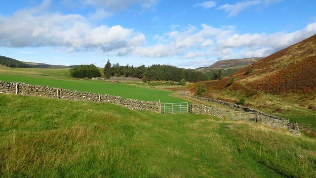
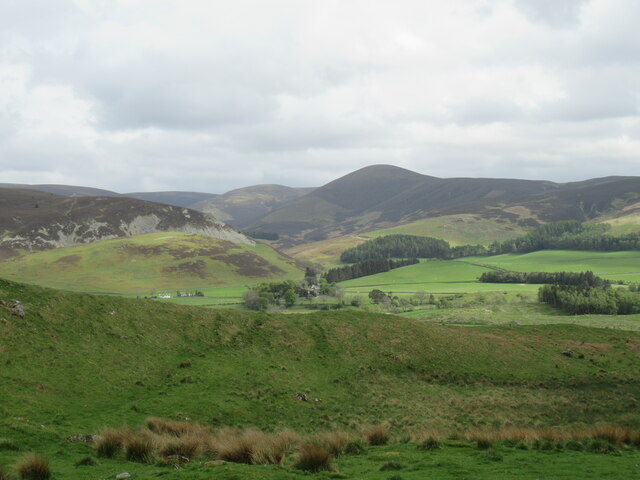
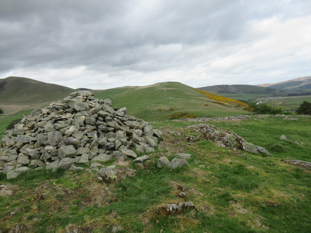
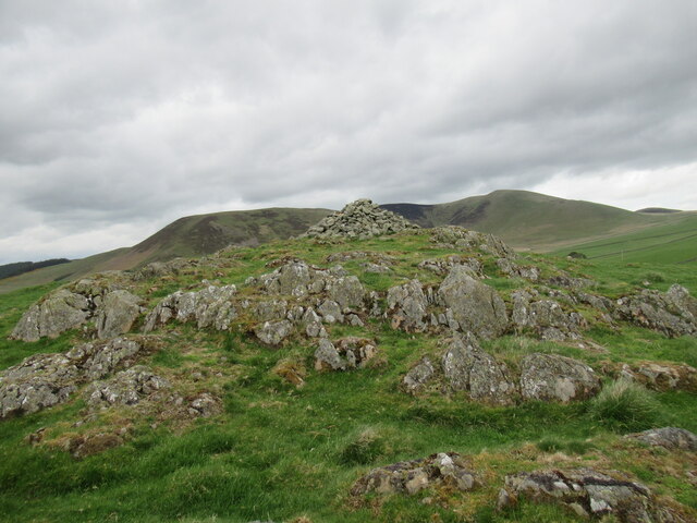
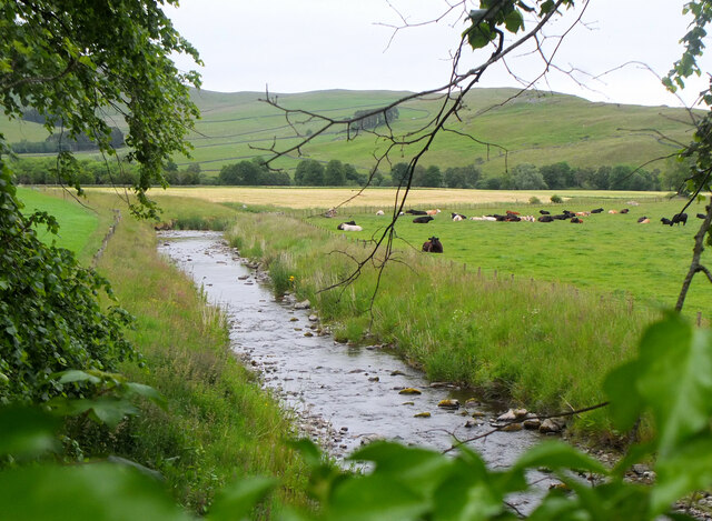
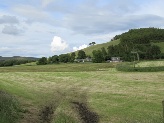
Burnfoot Pool is a picturesque freshwater marsh located in Peeblesshire, Scotland. Measuring approximately 2 acres, it is nestled amidst the rolling hills and lush greenery of the region. This natural water body is known for its tranquil and serene ambiance, offering a haven for both wildlife and visitors seeking solace in nature.

The pool is characterized by its calm, still waters, which reflect the surrounding landscape, creating a mesmerizing sight. Fed by a small stream originating from the nearby hills, the pool maintains a constant flow of freshwater throughout the year. The water is clear and inviting, making it an ideal habitat for various species of aquatic plants and animals.

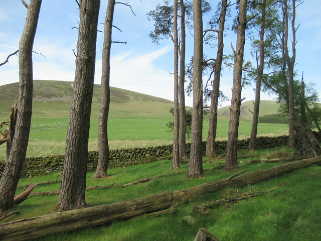
The pool is surrounded by a diverse range of vegetation, including reeds, rushes, and water lilies that thrive in the marshy conditions. These plants provide cover and nesting sites for a variety of bird species, such as ducks, herons, and swans, which can often be spotted gracefully gliding across the water's surface.

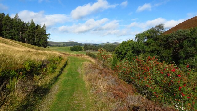
Visitors to Burnfoot Pool can enjoy a peaceful stroll along the well-maintained footpaths that encircle the pool, allowing for close-up views of the abundant flora and fauna. Wildlife enthusiasts will appreciate the opportunity to observe dragonflies, frogs, and other small creatures that call the pool home.

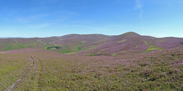
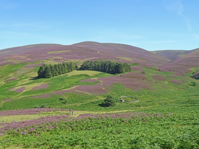
Overall, Burnfoot Pool is a hidden gem in Peeblesshire, providing a serene and natural haven for both wildlife and those seeking a moment of tranquility amidst Scotland's breathtaking scenery.

If you have any feedback on the listing, please let us know in the comments section below.

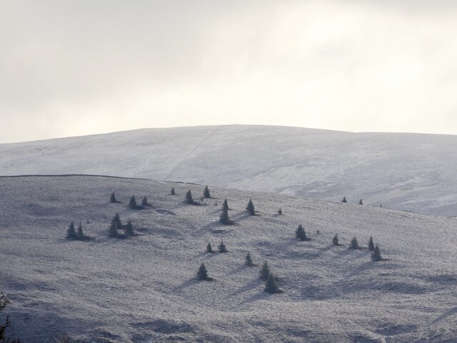
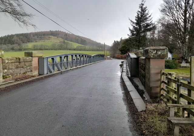
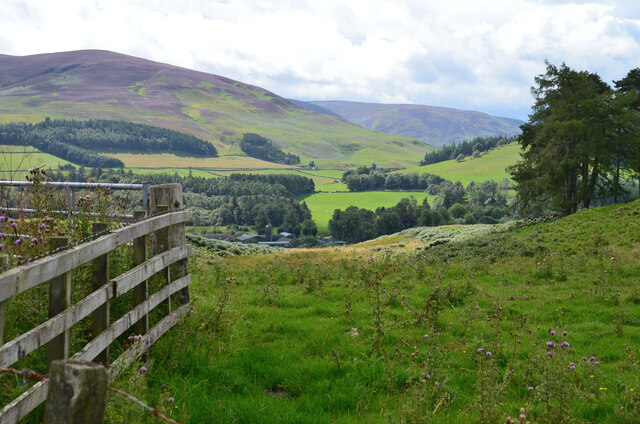
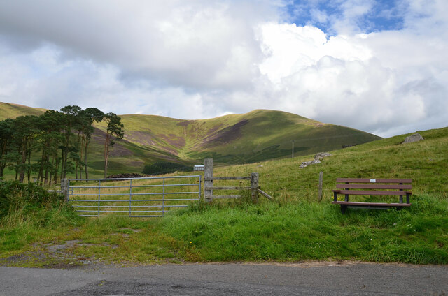
Burnfoot Pool Images

Images are sourced within 2km of 55.59515/-3.3776138 or Grid Reference NT1334. Thanks to Geograph Open Source API. All images are credited.

Farmland above Drumelzier
Track beside Drumelzier Burn, southeast of Drumelzier
Drumelzier Standing Stone The standing stone near Drumelzier.
Photo taken on the 2nd January 2022.
Drumelzier Standing Stone
The standing stone near Drumelzier. Photo taken on the 2nd January 2022.
Trig point on Rachan Hill The remains of a prehistoric hill fort can be traced on the summit of this small hill, but it seems they have been damaged by afforestation in the twentieth century.

More details can be found at <span class="nowrap"><a title="https://canmore.org.uk/site/49911/rachan-hill" rel="nofollow ugc noopener" href="https://canmore.org.uk/site/49911/rachan-hill">Link</a><img style="margin-left:2px;" alt="External link" title="External link - shift click to open in new window" src="https://s1.geograph.org.uk/img/external.png" width="10" height="10"/></span>
Trig point on Rachan Hill
The remains of a prehistoric hill fort can be traced on the summit of this small hill, but it seems they have been damaged by afforestation in the twentieth century. More details can be found at LinkExternal link
View towards Drumelzier Law from Dreva Craig Drumelzier Law rises above low-lying farmland by the River Tweed.
View towards Drumelzier Law from Dreva Craig
Drumelzier Law rises above low-lying farmland by the River Tweed.
Cairn at Dreva Craig Dreva Craig has the extensive remnants of a prehistoric fort, settlement and protective structures.  For more information see <span class="nowrap"><a title="https://canmore.org.uk/site/49881/dreva-craig" rel="nofollow ugc noopener" href="https://canmore.org.uk/site/49881/dreva-craig">Link</a><img style="margin-left:2px;" alt="External link" title="External link - shift click to open in new window" src="https://s1.geograph.org.uk/img/external.png" width="10" height="10"/></span>
Cairn at Dreva Craig
Dreva Craig has the extensive remnants of a prehistoric fort, settlement and protective structures. For more information see LinkExternal link
Dreva Craig Dreva Craig is the site of a prehistoric fort, settlement and defences. For more information, see <span class="nowrap"><a title="https://canmore.org.uk/site/49881/dreva-craig" rel="nofollow ugc noopener" href="https://canmore.org.uk/site/49881/dreva-craig">Link</a><img style="margin-left:2px;" alt="External link" title="External link - shift click to open in new window" src="https://s1.geograph.org.uk/img/external.png" width="10" height="10"/></span>
Dreva Craig
Dreva Craig is the site of a prehistoric fort, settlement and defences. For more information, see LinkExternal link
Small woodland of Scots pines, Dreva Muirburn Ratchill Hill and the Mere Cleuch are visible beyond the trees.
Small woodland of Scots pines, Dreva Muirburn
Ratchill Hill and the Mere Cleuch are visible beyond the trees.
Holms Water near Rachan Looking downstream from the bridge on the track from Rachan Home Farm.
Holms Water near Rachan
Looking downstream from the bridge on the track from Rachan Home Farm.
Hillside Cottages below Rachan Hill Viewed from the side of the Glenholm road.
Hillside Cottages below Rachan Hill
Viewed from the side of the Glenholm road.
All around the bloomin' heather Heather in full bloom on the hills south of Drumelzier. A grand day to be out in the bloomin' heather though not sure there is wild mountain thyme about.
Very different colours to this scene from October 2020 from about the same spot.
<a title="https://www.geograph.org.uk/photo/6627939" href="https://www.geograph.org.uk/photo/6627939">Link</a>
All around the bloomin' heather
Heather in full bloom on the hills south of Drumelzier. A grand day to be out in the bloomin' heather though not sure there is wild mountain thyme about. Very different colours to this scene from October 2020 from about the same spot. Link
Heather in Full Bloom Sheepfold above the Drumelzier Burn and the lower slopes of Pykestone Hill seen from Finglen Rig. Heather in full bloom and very different to the relatively drab colours seen here in October 2020:-
<a title="https://www.geograph.org.uk/photo/6627953" href="https://www.geograph.org.uk/photo/6627953">Link</a>
Heather in Full Bloom
Sheepfold above the Drumelzier Burn and the lower slopes of Pykestone Hill seen from Finglen Rig. Heather in full bloom and very different to the relatively drab colours seen here in October 2020:- Link
Scattered trees above Drumelzier
Merlindale Bridge Merlindale Bridge crosses the River Tweed on the B712 at Drumelzier . This minor road runs from Hallyn to Rachan. It is the first bridge to take a classified road over the Tweed downstream from the river's source
Merlindale Bridge
Merlindale Bridge crosses the River Tweed on the B712 at Drumelzier . This minor road runs from Hallyn to Rachan. It is the first bridge to take a classified road over the Tweed downstream from the river's source
Course of the Muir Burn The burn is out of sight, surrounded by the creamy flowers of meadowsweet.
Course of the Muir Burn
The burn is out of sight, surrounded by the creamy flowers of meadowsweet.
Farmland south of Broughton Looking from the Dreva road towards Glen Holm. The cottages at Nether Whitslade on the A701 are R of centre.
Farmland south of Broughton
Looking from the Dreva road towards Glen Holm. The cottages at Nether Whitslade on the A701 are R of centre.
From the summit of the Dreva road Looking over Rachan Home Farm to the heathery upper slopes of Logan Head.
From the summit of the Dreva road
Looking over Rachan Home Farm to the heathery upper slopes of Logan Head.
Summit of the Dreva road The road reaches 260m as it crosses the ridge of Dreva Hill. Trahenna Hill is in the background.
Summit of the Dreva road
The road reaches 260m as it crosses the ridge of Dreva Hill. Trahenna Hill is in the background.
Show me another place!

Burnfoot Pool is located at Grid Ref: NT1334 (Lat: 55.59515, Lng: -3.3776138)

Unitary Authority: The Scottish Borders

Police Authority: The Lothians and Scottish Borders

What 3 Words

///lofts.unlisted.starfish. Near Biggar, South Lanarkshire

Related Wikis

Drumelzier

Drumelzier (), is a village and civil parish on the B712 in the Tweed Valley in the Scottish Borders. The area of the village is extensive and includes...

Biggar Water

Biggar Water is a river in Lanarkshire and Peeblesshire, in the Southern Uplands of Scotland. It forms part of the River Tweed system. It rises, as Biggar...

Holms Water

The Holms Water is a river and a tributary of the Biggar Water, which is a tributary of the River Tweed, in the parish of Broughton, Glenholm and Kilbucho...

Dreva on Tweed

Dreva on Tweed (or simply Dreva) is a hamlet in the Scottish Borders. It was historically in Peebles-shire. It is noted for the historical presence of...

Nearby Amenities

Located within 500m of 55.59515,-3.3776138
Bus Stop
Thaines House
Bus: yes
Naptan AtcoCode: 69001403
Naptan Bearing: NE
Naptan CommonName: Thaines House
Naptan Indicator: opp
Naptan Landmark: Telephone Box
Naptan NaptanCode: 72725857
Naptan Street: B712
Operator: Scottish Borders Council
Public Transport: platform
Ref: 69001403
Source: NaPTAN
Lat/Long: 55.5938756/-3.3727543
Telephone
Booth: K6
Covered: booth
Lat/Long: 55.5937748/-3.3728948
Drumelzier
Name Sco: Drumelyer
Place: village
Wikidata: Q5309154
Lat/Long: 55.5938524/-3.3725879
Power: pole
Lat/Long: 55.5920816/-3.3795169
Power: pole
Lat/Long: 55.5913485/-3.3801765
Power: pole
Lat/Long: 55.5917481/-3.3808643
Power: pole
Lat/Long: 55.5936665/-3.3780996
Power: pole
Lat/Long: 55.5928295/-3.3788481
Power: pole
Lat/Long: 55.5929577/-3.3797199
Power: pole
Lat/Long: 55.5930271/-3.3802488
Power: pole
Lat/Long: 55.5944112/-3.3774312
Power: pole
Lat/Long: 55.5948487/-3.3770292
Power: pole
Lat/Long: 55.5953937/-3.3765406
Power: pole
Lat/Long: 55.5956566/-3.3758679
Power: pole
Lat/Long: 55.5947578/-3.3754703
Power: pole
Lat/Long: 55.5942164/-3.3745332
Power: pole
Lat/Long: 55.5939689/-3.3740974
Power: pole
Lat/Long: 55.593743/-3.3732597
Power: pole
Lat/Long: 55.596063/-3.3748737
Power: pole
Lat/Long: 55.5965985/-3.3735559
Power: pole
Lat/Long: 55.5971184/-3.3722634
Power: pole
Lat/Long: 55.5975917/-3.3711169
Power: pole
Lat/Long: 55.5963803/-3.3771445
Power: pole
Lat/Long: 55.5968273/-3.3779357
Power: pole
Lat/Long: 55.5972229/-3.379006
Power: pole
Lat/Long: 55.5976054/-3.3800721
Power: pole
Lat/Long: 55.5979914/-3.3811023
Power: pole
Lat/Long: 55.5984085/-3.3822277
Bus Stop
Thaines House
Bus: yes
Naptan AtcoCode: 69001404
Naptan Bearing: SW
Naptan CommonName: Thaines House
Naptan Indicator: o/s
Naptan Landmark: Thaines House
Naptan NaptanCode: 72725854
Naptan Street: B712
Operator: Scottish Borders Council
Public Transport: platform
Ref: 69001404
Source: NaPTAN
Lat/Long: 55.5935852/-3.3728802
Board Type: history:hiking
Direction: 85
Information: board
Tourism: information
Lat/Long: 55.5920683/-3.3720485
Historic: millstone
Lat/Long: 55.5929124/-3.3723532
The data included in this document is from www.openstreetmap.org. The data is made available under ODbL.

Have you been to Burnfoot Pool?

Leave your review of Burnfoot Pool below (or comments, questions and feedback).