Drumelzier

Settlement in Peeblesshire

Scotland

Drumelzier

Farmland above Drumelzier
Farmland above Drumelzier Credit: Colin Park

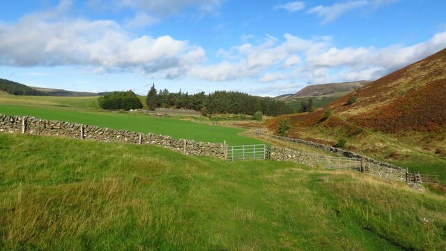
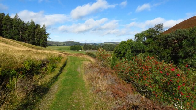
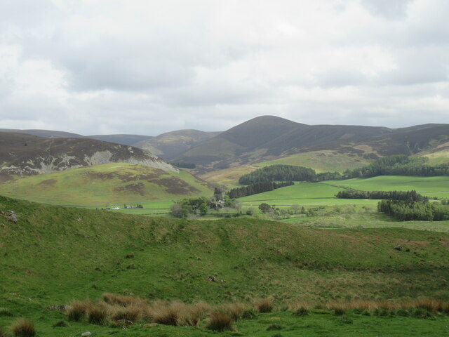
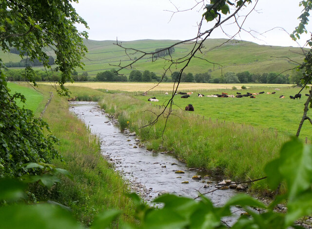
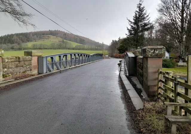
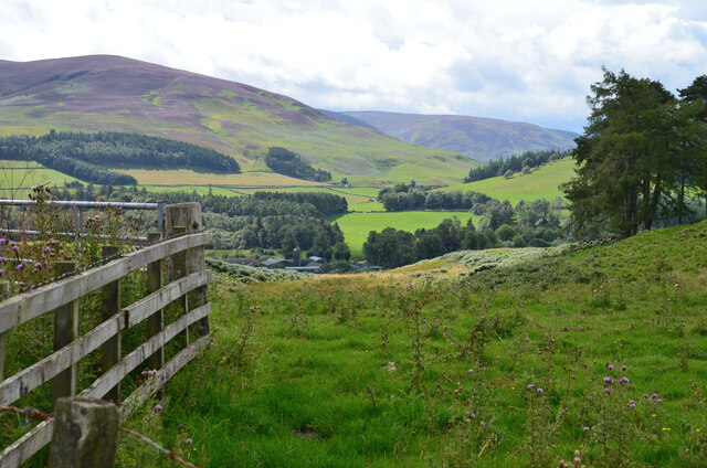
Drumelzier is a small village located in the historical county of Peeblesshire, in the Scottish Borders region of Scotland. Situated in a picturesque valley along the River Tweed, the village is surrounded by stunning natural beauty and is known for its tranquil atmosphere.

With a population of around 100 residents, Drumelzier is a close-knit community that exudes charm and character. The village is characterized by its traditional stone cottages and buildings, giving it a timeless feel. It is often described as a quintessential Scottish village, with its idyllic setting and friendly locals.

One of the notable features of Drumelzier is its historic church, which dates back to the 12th century. Stobo Kirk, as it is known, is a beautiful example of Romanesque architecture and is still in use for regular worship services. The churchyard surrounding it is a peaceful spot, offering a sense of serenity and history.

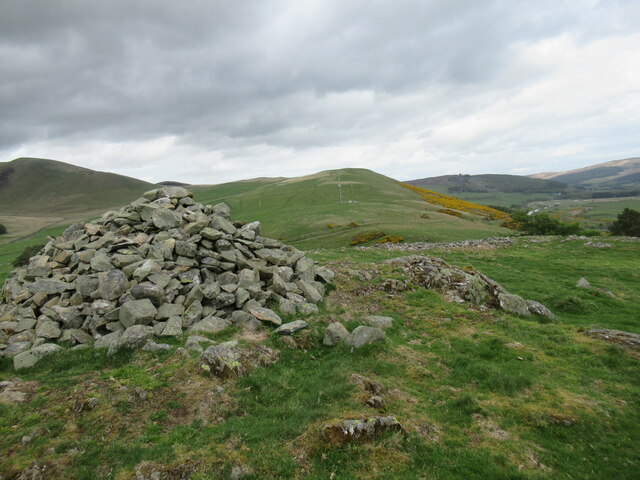
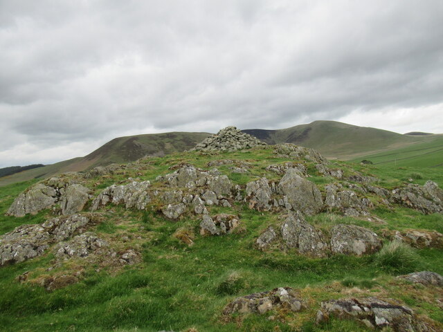
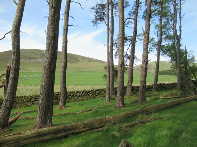
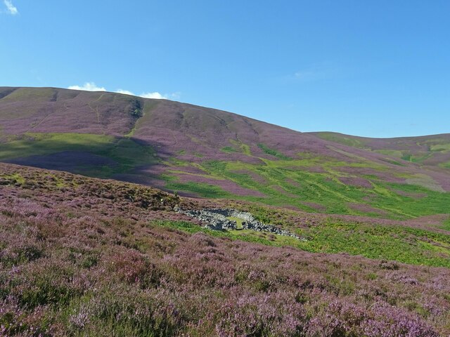
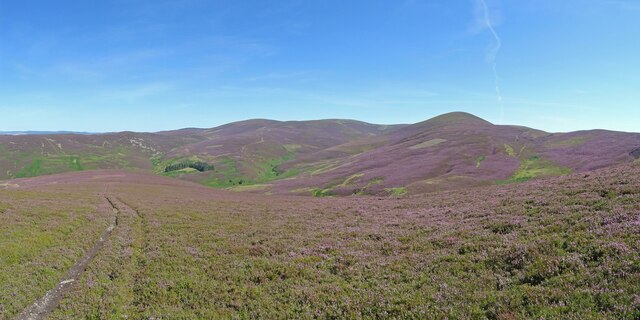
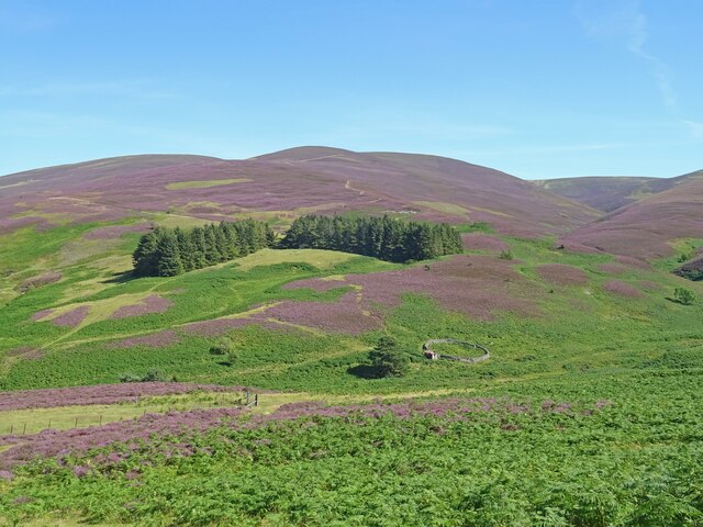
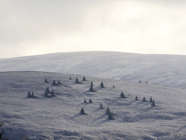
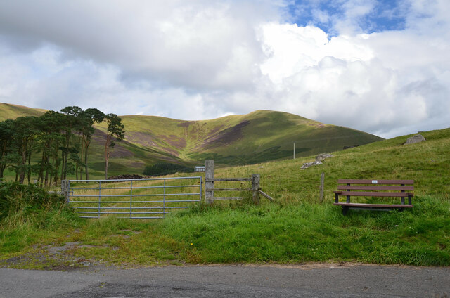
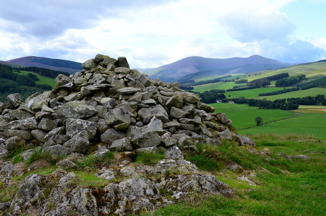
Drumelzier is also renowned for its outdoor activities and scenic trails. The nearby Tweed Valley Forest Park provides ample opportunities for walking, cycling, and exploring nature. The surrounding hills and glens offer breathtaking views and attract outdoor enthusiasts, while the river itself is popular among anglers for its salmon and trout fishing.

While Drumelzier may be small in size, it offers a wealth of natural beauty, historical significance, and a strong sense of community. It is a place where visitors can escape the hustle and bustle of modern life and immerse themselves in the tranquility of the Scottish countryside.

If you have any feedback on the listing, please let us know in the comments section below.

Drumelzier Images

Images are sourced within 2km of 55.593438/-3.3732057 or Grid Reference NT1334. Thanks to Geograph Open Source API. All images are credited.

Farmland above Drumelzier
Track beside Drumelzier Burn, southeast of Drumelzier
Drumelzier Standing Stone The standing stone near Drumelzier.
Photo taken on the 2nd January 2022.
Drumelzier Standing Stone
The standing stone near Drumelzier. Photo taken on the 2nd January 2022.
Trig point on Rachan Hill The remains of a prehistoric hill fort can be traced on the summit of this small hill, but it seems they have been damaged by afforestation in the twentieth century.

More details can be found at <span class="nowrap"><a title="https://canmore.org.uk/site/49911/rachan-hill" rel="nofollow ugc noopener" href="https://canmore.org.uk/site/49911/rachan-hill">Link</a><img style="margin-left:2px;" alt="External link" title="External link - shift click to open in new window" src="https://s1.geograph.org.uk/img/external.png" width="10" height="10"/></span>
Trig point on Rachan Hill
The remains of a prehistoric hill fort can be traced on the summit of this small hill, but it seems they have been damaged by afforestation in the twentieth century. More details can be found at LinkExternal link
View towards Drumelzier Law from Dreva Craig Drumelzier Law rises above low-lying farmland by the River Tweed.
View towards Drumelzier Law from Dreva Craig
Drumelzier Law rises above low-lying farmland by the River Tweed.
Cairn at Dreva Craig Dreva Craig has the extensive remnants of a prehistoric fort, settlement and protective structures.  For more information see <span class="nowrap"><a title="https://canmore.org.uk/site/49881/dreva-craig" rel="nofollow ugc noopener" href="https://canmore.org.uk/site/49881/dreva-craig">Link</a><img style="margin-left:2px;" alt="External link" title="External link - shift click to open in new window" src="https://s1.geograph.org.uk/img/external.png" width="10" height="10"/></span>
Cairn at Dreva Craig
Dreva Craig has the extensive remnants of a prehistoric fort, settlement and protective structures. For more information see LinkExternal link
Dreva Craig Dreva Craig is the site of a prehistoric fort, settlement and defences. For more information, see <span class="nowrap"><a title="https://canmore.org.uk/site/49881/dreva-craig" rel="nofollow ugc noopener" href="https://canmore.org.uk/site/49881/dreva-craig">Link</a><img style="margin-left:2px;" alt="External link" title="External link - shift click to open in new window" src="https://s1.geograph.org.uk/img/external.png" width="10" height="10"/></span>
Dreva Craig
Dreva Craig is the site of a prehistoric fort, settlement and defences. For more information, see LinkExternal link
Small woodland of Scots pines, Dreva Muirburn Ratchill Hill and the Mere Cleuch are visible beyond the trees.
Small woodland of Scots pines, Dreva Muirburn
Ratchill Hill and the Mere Cleuch are visible beyond the trees.
Holms Water near Rachan Looking downstream from the bridge on the track from Rachan Home Farm.
Holms Water near Rachan
Looking downstream from the bridge on the track from Rachan Home Farm.
Lower Slopes of Drumelzier Law Lovely early autumnal/late summer colours in the hills south of Drumelzier.
The differing shades of purple showing that both Common Heather and Bell Heather are in abundance on the hills here.
Lower Slopes of Drumelzier Law
Lovely early autumnal/late summer colours in the hills south of Drumelzier. The differing shades of purple showing that both Common Heather and Bell Heather are in abundance on the hills here.
All around the bloomin' heather Heather in full bloom on the hills south of Drumelzier. A grand day to be out in the bloomin' heather though not sure there is wild mountain thyme about.
Very different colours to this scene from October 2020 from about the same spot.
<a title="https://www.geograph.org.uk/photo/6627939" href="https://www.geograph.org.uk/photo/6627939">Link</a>
All around the bloomin' heather
Heather in full bloom on the hills south of Drumelzier. A grand day to be out in the bloomin' heather though not sure there is wild mountain thyme about. Very different colours to this scene from October 2020 from about the same spot. Link
Heather in Full Bloom Sheepfold above the Drumelzier Burn and the lower slopes of Pykestone Hill seen from Finglen Rig. Heather in full bloom and very different to the relatively drab colours seen here in October 2020:-
<a title="https://www.geograph.org.uk/photo/6627953" href="https://www.geograph.org.uk/photo/6627953">Link</a>
Heather in Full Bloom
Sheepfold above the Drumelzier Burn and the lower slopes of Pykestone Hill seen from Finglen Rig. Heather in full bloom and very different to the relatively drab colours seen here in October 2020:- Link
Scattered trees above Drumelzier
Merlindale Bridge Merlindale Bridge crosses the River Tweed on the B712 at Drumelzier . This minor road runs from Hallyn to Rachan. It is the first bridge to take a classified road over the Tweed downstream from the river's source
Merlindale Bridge
Merlindale Bridge crosses the River Tweed on the B712 at Drumelzier . This minor road runs from Hallyn to Rachan. It is the first bridge to take a classified road over the Tweed downstream from the river's source
Farmland south of Broughton Looking from the Dreva road towards Glen Holm. The cottages at Nether Whitslade on the A701 are R of centre.
Farmland south of Broughton
Looking from the Dreva road towards Glen Holm. The cottages at Nether Whitslade on the A701 are R of centre.
From the summit of the Dreva road Looking over Rachan Home Farm to the heathery upper slopes of Logan Head.
From the summit of the Dreva road
Looking over Rachan Home Farm to the heathery upper slopes of Logan Head.
Summit of the Dreva road The road reaches 260m as it crosses the ridge of Dreva Hill. Trahenna Hill is in the background.
Summit of the Dreva road
The road reaches 260m as it crosses the ridge of Dreva Hill. Trahenna Hill is in the background.
Dreva Craig summit cairn The cairn is within the area of the hill fort and settlement overlooking the junction of the Biggar Gap and the Tweed. Compare with <a href="https://www.geograph.org.uk/photo/1714667">NT1235 : Summit cairn, Dreva Craig</a> taken in 2010.
Dreva Craig summit cairn
The cairn is within the area of the hill fort and settlement overlooking the junction of the Biggar Gap and the Tweed. Compare with NT1235 : Summit cairn, Dreva Craig taken in 2010.
Show me another place!

Drumelzier is located at Grid Ref: NT1334 (Lat: 55.593438, Lng: -3.3732057)

Unitary Authority: The Scottish Borders

Police Authority: The Lothians and Scottish Borders

What 3 Words

///spades.rated.swimsuits. Near Biggar, South Lanarkshire

Related Wikis

Drumelzier

Drumelzier (), is a village and civil parish on the B712 in the Tweed Valley in the Scottish Borders. The area of the village is extensive and includes...

Biggar Water

Biggar Water is a river in Lanarkshire and Peeblesshire, in the Southern Uplands of Scotland. It forms part of the River Tweed system. It rises, as Biggar...

Dreva on Tweed

Dreva on Tweed (or simply Dreva) is a hamlet in the Scottish Borders. It was historically in Peebles-shire. It is noted for the historical presence of...

Holms Water

The Holms Water is a river and a tributary of the Biggar Water, which is a tributary of the River Tweed, in the parish of Broughton, Glenholm and Kilbucho...

Nearby Amenities

Located within 500m of 55.593438,-3.3732057
Bus Stop
Thaines House
Bus: yes
Naptan AtcoCode: 69001403
Naptan Bearing: NE
Naptan CommonName: Thaines House
Naptan Indicator: opp
Naptan Landmark: Telephone Box
Naptan NaptanCode: 72725857
Naptan Street: B712
Operator: Scottish Borders Council
Public Transport: platform
Ref: 69001403
Source: NaPTAN
Lat/Long: 55.5938756/-3.3727543
Telephone
Booth: K6
Covered: booth
Lat/Long: 55.5937748/-3.3728948
Drumelzier
Name Sco: Drumelyer
Place: village
Wikidata: Q5309154
Lat/Long: 55.5938524/-3.3725879
Power: pole
Lat/Long: 55.5920816/-3.3795169
Power: pole
Lat/Long: 55.5913485/-3.3801765
Power: pole
Lat/Long: 55.5936665/-3.3780996
Power: pole
Lat/Long: 55.5928295/-3.3788481
Power: pole
Lat/Long: 55.5929577/-3.3797199
Power: pole
Lat/Long: 55.5930271/-3.3802488
Power: pole
Lat/Long: 55.5944112/-3.3774312
Power: pole
Lat/Long: 55.5948487/-3.3770292
Power: pole
Lat/Long: 55.5953937/-3.3765406
Power: pole
Lat/Long: 55.5956566/-3.3758679
Power: pole
Lat/Long: 55.5947578/-3.3754703
Power: pole
Lat/Long: 55.5942164/-3.3745332
Power: pole
Lat/Long: 55.5939689/-3.3740974
Power: pole
Lat/Long: 55.593743/-3.3732597
Power: pole
Lat/Long: 55.596063/-3.3748737
Power: pole
Lat/Long: 55.5965985/-3.3735559
Power: pole
Lat/Long: 55.5971184/-3.3722634
Power: pole
Lat/Long: 55.5975917/-3.3711169
Power: pole
Lat/Long: 55.5963803/-3.3771445
Power: pole
Lat/Long: 55.5968273/-3.3779357
Bus Stop
Thaines House
Bus: yes
Naptan AtcoCode: 69001404
Naptan Bearing: SW
Naptan CommonName: Thaines House
Naptan Indicator: o/s
Naptan Landmark: Thaines House
Naptan NaptanCode: 72725854
Naptan Street: B712
Operator: Scottish Borders Council
Public Transport: platform
Ref: 69001404
Source: NaPTAN
Lat/Long: 55.5935852/-3.3728802
Board Type: history:hiking
Direction: 85
Information: board
Tourism: information
Lat/Long: 55.5920683/-3.3720485
Historic: millstone
Lat/Long: 55.5929124/-3.3723532
The data included in this document is from www.openstreetmap.org. The data is made available under ODbL.

Have you been to Drumelzier?

Leave your review of Drumelzier below (or comments, questions and feedback).