Grafham

Settlement in Surrey Waverley

England

Grafham

Downs Link near Cranleigh The Downs Link path follows a dismantled railway line for most of its length.  It also forms part of route 223 of the National Cycle Network.

Here, a bridge takes the route across Cranleigh Waters, a tributary of the River Wey.
Downs Link near Cranleigh Credit: Malc McDonald

Grafham is a small village located in the county of Surrey, England. Situated approximately 30 miles south-west of London, the village is nestled in the picturesque Surrey Hills Area of Outstanding Natural Beauty. Grafham is part of the borough of Guildford and falls within the civil parish of Bramley.

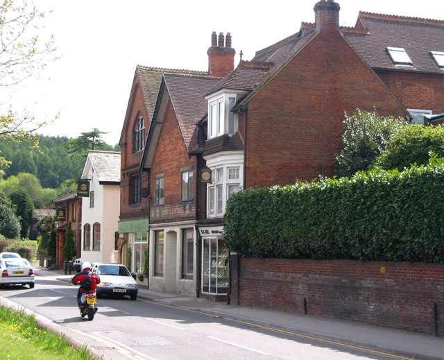
With a population of around 500 residents, Grafham is a quintessential English village known for its rural charm and tranquil surroundings. The village is characterized by its traditional architecture, consisting mainly of period cottages and stone-built houses. The village center features a few local amenities, including a village hall, a primary school, and a small community shop.

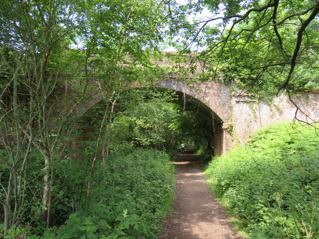
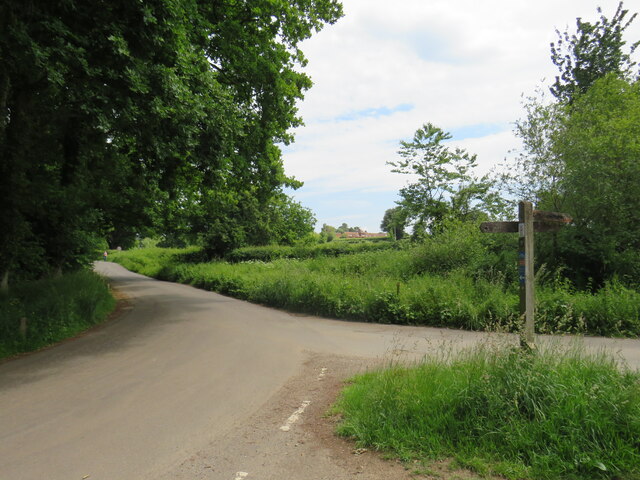
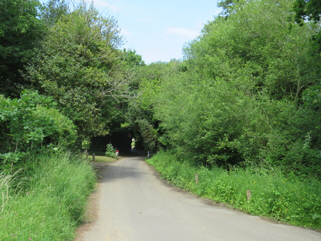
The surrounding landscape of Grafham is a major attraction for both residents and visitors alike. The village is surrounded by rolling hills, lush green fields, and dense woodlands, providing ample opportunities for outdoor activities such as hiking, cycling, and horse riding. Grafham is also in close proximity to several nature reserves and country parks, making it a popular destination for nature enthusiasts.

In terms of transportation, Grafham is well-connected to neighboring towns and cities. The A281 road passes through the village, offering convenient access to Guildford and Horsham. The nearest railway station is located in Shalford, approximately 5 miles away, providing regular services to London and other major cities.

Overall, Grafham offers a peaceful and idyllic setting for those seeking a rural retreat while still being within reach of urban amenities and transport links.

If you have any feedback on the listing, please let us know in the comments section below.
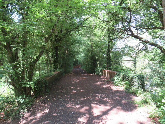
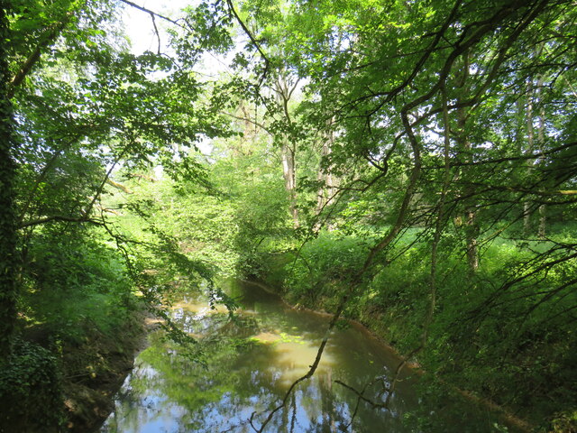
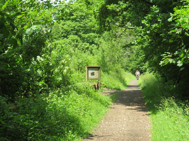
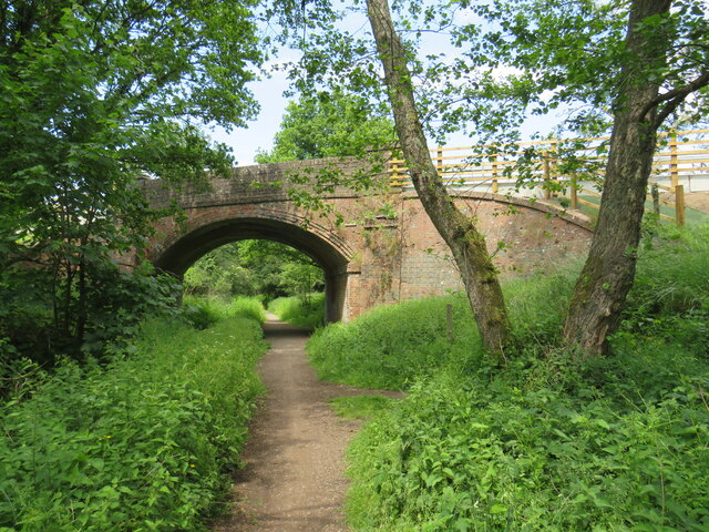
Grafham Images

Images are sourced within 2km of 51.165626/-0.538838 or Grid Reference TQ0241. Thanks to Geograph Open Source API. All images are credited.

Downs Link near Cranleigh The Downs Link path follows a dismantled railway line for most of its length.  It also forms part of route 223 of the National Cycle Network.

Here, a bridge takes the route across Cranleigh Waters, a tributary of the River Wey.
Downs Link near Cranleigh
The Downs Link path follows a dismantled railway line for most of its length. It also forms part of route 223 of the National Cycle Network. Here, a bridge takes the route across Cranleigh Waters, a tributary of the River Wey.
Cranleigh Waters, near Cranleigh Cranleigh Waters, also known as Bramley Way, is a tributary of the River Wey in Surrey.
Cranleigh Waters, near Cranleigh
Cranleigh Waters, also known as Bramley Way, is a tributary of the River Wey in Surrey.
Downs Link near Cranleigh The Downs Link path follows a dismantled railway line for most of its length.  It also forms part of route 223 of the National Cycle Network.

An information board alongside the path gives information about the Wey & Arun Canal, which passes beneath the path here.  The canal, opened in 1816, linked the Wey and Arun Navigations to provided a navigable route for barges between London and Portsmouth.
Downs Link near Cranleigh
The Downs Link path follows a dismantled railway line for most of its length. It also forms part of route 223 of the National Cycle Network. An information board alongside the path gives information about the Wey & Arun Canal, which passes beneath the path here. The canal, opened in 1816, linked the Wey and Arun Navigations to provided a navigable route for barges between London and Portsmouth.
Downs Link near Cranleigh The Downs Link path follows a dismantled railway line for most of its length.  It also forms part of route 223 of the National Cycle Network.

Here, a bridge carries a road across the former railway.
Downs Link near Cranleigh
The Downs Link path follows a dismantled railway line for most of its length. It also forms part of route 223 of the National Cycle Network. Here, a bridge carries a road across the former railway.
Downs Link near Cranleigh The Downs Link path follows a dismantled railway line for most of its length.  It also forms part of route 223 of the National Cycle Network.

Here, a bridge carries the path over a farm track.
Downs Link near Cranleigh
The Downs Link path follows a dismantled railway line for most of its length. It also forms part of route 223 of the National Cycle Network. Here, a bridge carries the path over a farm track.
Farm track near Cranleigh A farm track in Surrey countryside, near Cranleigh.
Farm track near Cranleigh
A farm track in Surrey countryside, near Cranleigh.
Downs Link near Cranleigh The Downs Link path follows a dismantled railway line for most of its length.  It also forms part of route 223 of the National Cycle Network.

The bridge ahead carries a farm track over the former railway route.
Downs Link near Cranleigh
The Downs Link path follows a dismantled railway line for most of its length. It also forms part of route 223 of the National Cycle Network. The bridge ahead carries a farm track over the former railway route.
Bridge over the Downs Link path near Cranleigh The Downs Link path follows a dismantled railway line for most of its length.  It also forms part of route 223 of the National Cycle Network.

The bridge was built to carry a farm track over the railway line.
Bridge over the Downs Link path near Cranleigh
The Downs Link path follows a dismantled railway line for most of its length. It also forms part of route 223 of the National Cycle Network. The bridge was built to carry a farm track over the railway line.
Downs Link near Bramley The Downs Link path follows a dismantled railway line for most of its length.  It also forms part of route 223 of the National Cycle Network.

From this point, near Bramley, into Guildford, the path is also on the route of National Cycle Network route 22.
Downs Link near Bramley
The Downs Link path follows a dismantled railway line for most of its length. It also forms part of route 223 of the National Cycle Network. From this point, near Bramley, into Guildford, the path is also on the route of National Cycle Network route 22.
National Cycle Network route 22 near Bramley This path, shared by pedestrians and cyclists, forms part of National Cycle Network route 22.  The bridge ahead carries the Downs Link path, on a former railway alignment, across the path.
National Cycle Network route 22 near Bramley
This path, shared by pedestrians and cyclists, forms part of National Cycle Network route 22. The bridge ahead carries the Downs Link path, on a former railway alignment, across the path.
Wey & Arun Canal near Bramley The Wey and Arun Canal is a 23-mile-long canal in the south of England, between the River Wey at Shalford, Surrey and the River Arun at Pallingham, in West Sussex.
Passing through a rural landscape, there was little freight traffic to justify its continued existence, and the canal was officially abandoned in 1871.
Without maintenance, the canal gradually became derelict over much of its length. However, since 1970, active restoration by The Wey & Arun Canal Trust has resulted in several miles of the waterway being restored to navigable standard. Work is continuing, with the ultimate aim of re-opening the entire canal to navigation.
 <span class="nowrap"><a title="http://www.weyandarun.co.uk/" rel="nofollow ugc noopener" href="http://www.weyandarun.co.uk/">Link</a><img style="margin-left:2px;" alt="External link" title="External link - shift click to open in new window" src="https://s1.geograph.org.uk/img/external.png" width="10" height="10"/></span> 
Part of the River Wey navigations. <span class="nowrap"><a title="http://www.weyandarun.co.uk/hist1.php" rel="nofollow ugc noopener" href="http://www.weyandarun.co.uk/hist1.php">Link</a><img style="margin-left:2px;" alt="External link" title="External link - shift click to open in new window" src="https://s1.geograph.org.uk/img/external.png" width="10" height="10"/></span>  <a title="https://www.geograph.org.uk/snippet/2588" href="https://www.geograph.org.uk/snippet/2588">Link</a>
Wey & Arun Canal near Bramley
The Wey and Arun Canal is a 23-mile-long canal in the south of England, between the River Wey at Shalford, Surrey and the River Arun at Pallingham, in West Sussex. Passing through a rural landscape, there was little freight traffic to justify its continued existence, and the canal was officially abandoned in 1871. Without maintenance, the canal gradually became derelict over much of its length. However, since 1970, active restoration by The Wey & Arun Canal Trust has resulted in several miles of the waterway being restored to navigable standard. Work is continuing, with the ultimate aim of re-opening the entire canal to navigation. LinkExternal link Part of the River Wey navigations. LinkExternal link Link
National Cycle Network route 22 near Bramley This path, shared by people walking and cycling, forms part of National Cycle Network route 22.  The bridge ahead carries another shared path, the Downs Link, which follows the course of a dismantled railway.
National Cycle Network route 22 near Bramley
This path, shared by people walking and cycling, forms part of National Cycle Network route 22. The bridge ahead carries another shared path, the Downs Link, which follows the course of a dismantled railway.
National Cycle Network route 22 near Bramley At this junction, the path to the right forms part of National Cycle Network route 22.  The path is shared by pedestrians and cyclists.  The path to the left is only for pedestrians.
National Cycle Network route 22 near Bramley
At this junction, the path to the right forms part of National Cycle Network route 22. The path is shared by pedestrians and cyclists. The path to the left is only for pedestrians.
Hullbrook Lane, Shamley Green Hullbrook Lane forms part of the route of National Cycle Network route 22 as it enters the village of Shamley Green.  The small blue route marker is just visible, attached to the wooden signpost.
Hullbrook Lane, Shamley Green
Hullbrook Lane forms part of the route of National Cycle Network route 22 as it enters the village of Shamley Green. The small blue route marker is just visible, attached to the wooden signpost.
Lordshill Road, Shamley Green Lordshill Road on the edge of the village of Shamley Green in Surrey.  This section of road forms part of route 22 of the National Cycle Network.
Lordshill Road, Shamley Green
Lordshill Road on the edge of the village of Shamley Green in Surrey. This section of road forms part of route 22 of the National Cycle Network.
Hullbrook Lane, Shamley Green Hullbrook Lane entering the village of Shamley Green in Surrey.  Here, the speed limit changes to 20 miles per hour.

Hullbrook Lane is on route 22 of the National Cycle Network.
Hullbrook Lane, Shamley Green
Hullbrook Lane entering the village of Shamley Green in Surrey. Here, the speed limit changes to 20 miles per hour. Hullbrook Lane is on route 22 of the National Cycle Network.
Hullbrook Lane, Shamley Green Hullbrook Lane in the village of Shamley Green in Surrey.  This road is on route 22 of the National Cycle Network.
Hullbrook Lane, Shamley Green
Hullbrook Lane in the village of Shamley Green in Surrey. This road is on route 22 of the National Cycle Network.
Bramley - Canal Restoration Works Excavation in progress by the Wey & Arun Canal Trust south of Bramley and adjacent to the Downslink footpath.
<span class="nowrap"><a title="www.weyarun.org.uk" rel="nofollow ugc noopener" href="http://www.weyarun.org.uk">Link</a><img style="margin-left:2px;" alt="External link" title="External link - shift click to open in new window" src="https://s1.geograph.org.uk/img/external.png" width="10" height="10"/></span>
Bramley - Canal Restoration Works
Excavation in progress by the Wey & Arun Canal Trust south of Bramley and adjacent to the Downslink footpath. LinkExternal link
Show me another place!

Grafham is located at Grid Ref: TQ0241 (Lat: 51.165626, Lng: -0.538838)

Administrative County: Surrey

District: Waverley

Police Authority: Surrey

What 3 Words

///brain.trickled.dignitary. Near Bramley, Surrey

Related Wikis

Christ Church, Shamley Green

Christ Church is a Church of England parish church in Shamley Green, Surrey, England. It was constructed in 1863 as a chapel of ease and became a parish...

Cucknell's Wood

Cucknell's Wood is a 11-hectare (27-acre) nature reserve south-east of Shamley Green in Surrey. It is managed by the Surrey Wildlife Trust.Birds in this...

Hascombe

Hascombe is a village and civil parish in Surrey, England. It is around 3 miles (4.8 km) southeast of Godalming in the Borough of Waverley. The settlement...

Winkworth Arboretum

Winkworth Arboretum is a National Trust-owned arboretum in the spread-out civil parish of Busbridge between Godalming and Hascombe, south-west Surrey,...

Bramley, Surrey

Bramley is a village and civil parish about three miles (5 km) south of Guildford in the Borough of Waverley in Surrey, south east England. Most of the...

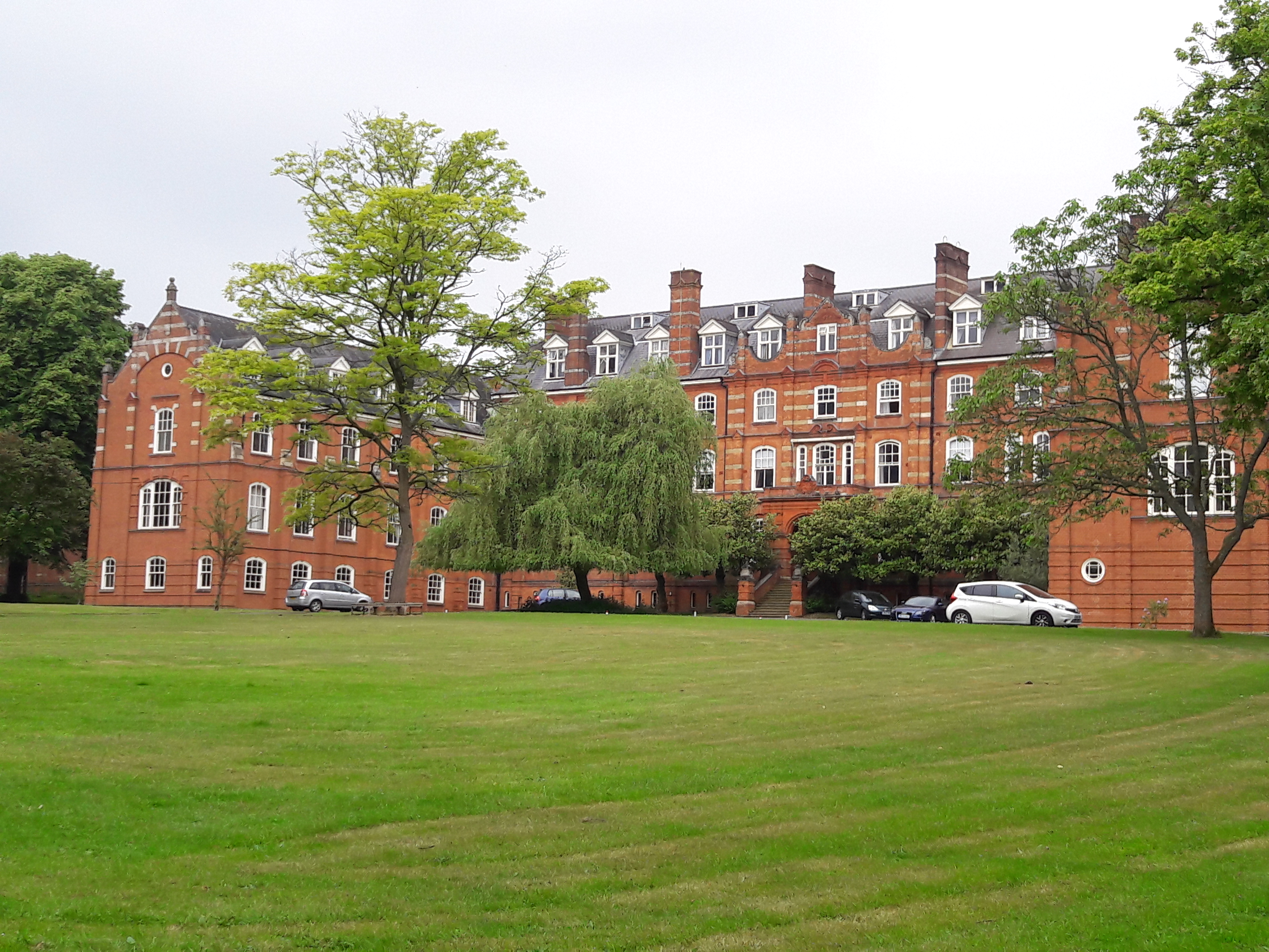
St John's Seminary, Wonersh

St John's Seminary was a Roman Catholic seminary located at Wonersh near Guildford in Surrey, in the Diocese of Arundel and Brighton, United Kingdom. St...

Orchards, Surrey

Orchards is an Arts and Crafts style house in Bramley in Surrey, England. It is on Bramley's boundary with Busbridge and 1 mile (1.6 km) south-east of...

Hascombe Court

Hascombe Court is a 172-acre (70 ha) estate in Hascombe, Surrey, best known for its vast garden designed by Gertrude Jekyll. Hascombe Court is listed Grade...

Nearby Amenities

Located within 500m of 51.165626,-0.538838
Grafham
Building: yes
Source: npe
Wikidata: Q26670448
Lat/Long: 51.166566/-0.5368105
Barrier: stile
Lat/Long: 51.1626445/-0.5338104
Grafham
Place: village
Lat/Long: 51.1656305/-0.5379546
Post Box
Brand: Royal Mail
Brand Wikidata: Q638098
Collection Times: Mo-Fr 16:30; Sa 07:15
Operator: Royal Mail
Operator Wikidata: Q638098
Post Box Mounting: pier
Post Box Type: lamp
Ref: GU5 208
Royal Cypher: EIIR
Royal Cypher Wikidata: Q33102113
Lat/Long: 51.167387/-0.5382748
Grafham
Place: hamlet
Lat/Long: 51.1687149/-0.5382904
Grafham Grange
Place: locality
Lat/Long: 51.1638343/-0.5441147
Grafham Farm
Place: farm
Lat/Long: 51.1679846/-0.5404555
Rushett Edge
Place: farm
Lat/Long: 51.1699943/-0.5396316
The data included in this document is from www.openstreetmap.org. The data is made available under ODbL.

Have you been to Grafham?

Leave your review of Grafham below (or comments, questions and feedback).