Grafham Orchard

Wood, Forest in Surrey Waverley

England

Grafham Orchard

Downs Link near Cranleigh The Downs Link path follows a dismantled railway line for most of its length.  It also forms part of route 223 of the National Cycle Network.

Here, a bridge takes the route across Cranleigh Waters, a tributary of the River Wey.
Downs Link near Cranleigh Credit: Malc McDonald

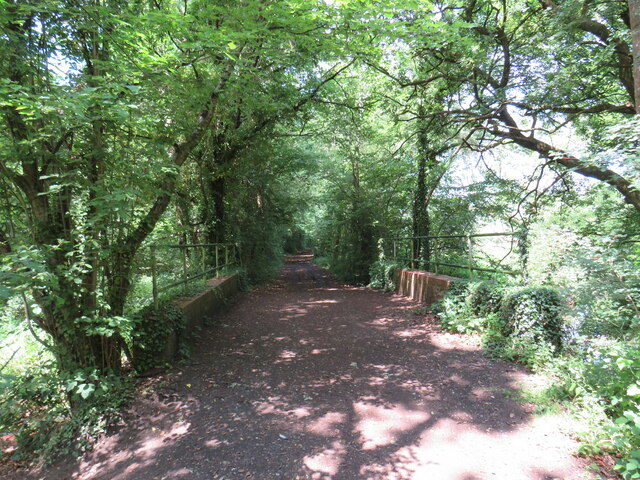
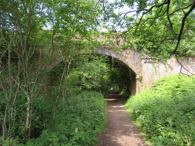
Grafham Orchard, located in Surrey, England, is a serene woodland area known for its picturesque beauty and rich biodiversity. Spanning over a vast area, this enchanting forest is home to a variety of trees, including oak, beech, and birch, creating a lush green canopy that stretches as far as the eye can see.

The orchard is famous for its apple and pear trees, which bloom in vibrant colors during the spring, offering a stunning spectacle of blossoms. As the seasons change, the orchard transforms, with the trees bearing fruit that attract a multitude of wildlife, including birds, squirrels, and insects.

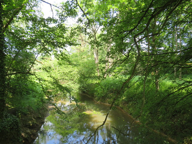
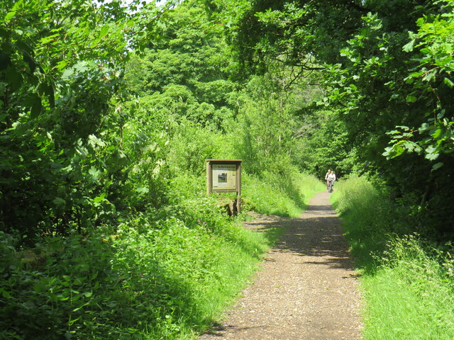
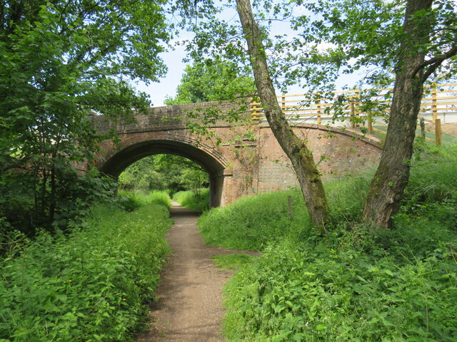
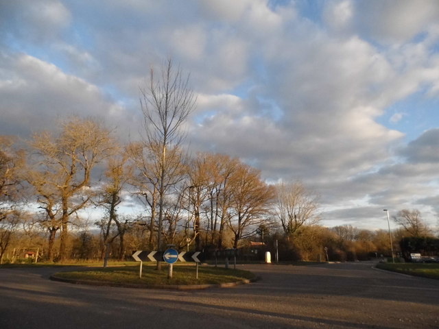
Walking through the woodland, visitors are greeted with a peaceful ambience and the sweet aroma of wildflowers that dot the forest floor. The forest is crisscrossed with well-maintained trails, allowing visitors to explore its natural wonders at their own pace. These paths lead to hidden clearings, babbling brooks, and secluded picnic spots, providing a perfect setting for outdoor enthusiasts and nature lovers.

The woodland is carefully preserved, with conservation efforts in place to protect its fragile ecosystem. It is a designated site of special scientific interest due to its unique flora and fauna. Grafham Orchard offers a haven for rare and endangered species, creating a vital habitat for their survival.

Whether it be a leisurely stroll, birdwatching, or simply basking in the tranquility of nature, Grafham Orchard offers a sanctuary away from the bustling city life. Its natural beauty and ecological significance make it a cherished destination for both locals and tourists seeking solace in Surrey's woodlands.

If you have any feedback on the listing, please let us know in the comments section below.

Grafham Orchard Images

Images are sourced within 2km of 51.16319/-0.53630953 or Grid Reference TQ0241. Thanks to Geograph Open Source API. All images are credited.

Downs Link near Cranleigh The Downs Link path follows a dismantled railway line for most of its length.  It also forms part of route 223 of the National Cycle Network.

Here, a bridge takes the route across Cranleigh Waters, a tributary of the River Wey.
Downs Link near Cranleigh
The Downs Link path follows a dismantled railway line for most of its length. It also forms part of route 223 of the National Cycle Network. Here, a bridge takes the route across Cranleigh Waters, a tributary of the River Wey.
Cranleigh Waters, near Cranleigh Cranleigh Waters, also known as Bramley Way, is a tributary of the River Wey in Surrey.
Cranleigh Waters, near Cranleigh
Cranleigh Waters, also known as Bramley Way, is a tributary of the River Wey in Surrey.
Downs Link near Cranleigh The Downs Link path follows a dismantled railway line for most of its length.  It also forms part of route 223 of the National Cycle Network.

An information board alongside the path gives information about the Wey & Arun Canal, which passes beneath the path here.  The canal, opened in 1816, linked the Wey and Arun Navigations to provided a navigable route for barges between London and Portsmouth.
Downs Link near Cranleigh
The Downs Link path follows a dismantled railway line for most of its length. It also forms part of route 223 of the National Cycle Network. An information board alongside the path gives information about the Wey & Arun Canal, which passes beneath the path here. The canal, opened in 1816, linked the Wey and Arun Navigations to provided a navigable route for barges between London and Portsmouth.
Downs Link near Cranleigh The Downs Link path follows a dismantled railway line for most of its length.  It also forms part of route 223 of the National Cycle Network.

Here, a bridge carries a road across the former railway.
Downs Link near Cranleigh
The Downs Link path follows a dismantled railway line for most of its length. It also forms part of route 223 of the National Cycle Network. Here, a bridge carries a road across the former railway.
Downs Link near Cranleigh The Downs Link path follows a dismantled railway line for most of its length.  It also forms part of route 223 of the National Cycle Network.

Here, a bridge carries the path over a farm track.
Downs Link near Cranleigh
The Downs Link path follows a dismantled railway line for most of its length. It also forms part of route 223 of the National Cycle Network. Here, a bridge carries the path over a farm track.
Farm track near Cranleigh A farm track in Surrey countryside, near Cranleigh.
Farm track near Cranleigh
A farm track in Surrey countryside, near Cranleigh.
Downs Link near Cranleigh The Downs Link path follows a dismantled railway line for most of its length.  It also forms part of route 223 of the National Cycle Network.

The bridge ahead carries a farm track over the former railway route.
Downs Link near Cranleigh
The Downs Link path follows a dismantled railway line for most of its length. It also forms part of route 223 of the National Cycle Network. The bridge ahead carries a farm track over the former railway route.
Bridge over the Downs Link path near Cranleigh The Downs Link path follows a dismantled railway line for most of its length.  It also forms part of route 223 of the National Cycle Network.

The bridge was built to carry a farm track over the railway line.
Bridge over the Downs Link path near Cranleigh
The Downs Link path follows a dismantled railway line for most of its length. It also forms part of route 223 of the National Cycle Network. The bridge was built to carry a farm track over the railway line.
Birtley Green - Greensand Way Wide path heading from the Downslink towards Rooks Hill Farm.
Birtley Green - Greensand Way
Wide path heading from the Downslink towards Rooks Hill Farm.
Shamley Green - Footbridge This substantial wooden footbridge is losing its supports on the Shamley Green bank of the brook.
Shamley Green - Footbridge
This substantial wooden footbridge is losing its supports on the Shamley Green bank of the brook.
Shamley Green - River Bank Erosion This substantial wooden footbridge is losing its concrete supports on the Shamley Green bank of the brook.
Shamley Green - River Bank Erosion
This substantial wooden footbridge is losing its concrete supports on the Shamley Green bank of the brook.
Shamley Green - Greensand Way Waymarkers for the Greensand Way (bridleway here) and for the Cranleigh Parish Boundary Challenge (footpath).
Shamley Green - Greensand Way
Waymarkers for the Greensand Way (bridleway here) and for the Cranleigh Parish Boundary Challenge (footpath).
Shamley Green - Greensand Way Wide bridleway crossing open ploughed fields south of the village of Shamley Green.
Shamley Green - Greensand Way
Wide bridleway crossing open ploughed fields south of the village of Shamley Green.
Roundabout on Guildford Road, Rowly
Thorncombe Street, Selhurst Common
Rushett Common at the junction of Rooks Hill
Pond on Rushett Common For some reason this hasn't been included on the OS map
Pond on Rushett Common
For some reason this hasn't been included on the OS map
Rushett Common The road name says this is the name of the road as well
Rushett Common
The road name says this is the name of the road as well
Show me another place!

Grafham Orchard is located at Grid Ref: TQ0241 (Lat: 51.16319, Lng: -0.53630953)

Administrative County: Surrey

District: Waverley

Police Authority: Surrey

What 3 Words

///nights.toward.lyrics. Near Bramley, Surrey

Related Wikis

Christ Church, Shamley Green

Christ Church is a Church of England parish church in Shamley Green, Surrey, England. It was constructed in 1863 as a chapel of ease and became a parish...

Cucknell's Wood

Cucknell's Wood is a 11-hectare (27-acre) nature reserve south-east of Shamley Green in Surrey. It is managed by the Surrey Wildlife Trust.Birds in this...

Hascombe

Hascombe is a village and civil parish in Surrey, England. It is around 3 miles (4.8 km) southeast of Godalming in the Borough of Waverley. The settlement...

Winkworth Arboretum

Winkworth Arboretum is a National Trust-owned arboretum in the spread-out civil parish of Busbridge between Godalming and Hascombe, south-west Surrey,...

Cranleigh School

Cranleigh School is a public school (English fee-charging boarding and day school) in the village of Cranleigh, Surrey. == History == It was opened on...

Hascombe Hill

Hascombe Hill or Hascombe Camp is the site of an Iron Age multivallate hill fort close to the village of Hascombe in Surrey, England. == History == The...

Hascombe Court

Hascombe Court is a 172-acre (70 ha) estate in Hascombe, Surrey, best known for its vast garden designed by Gertrude Jekyll. Hascombe Court is listed Grade...

St John's Seminary, Wonersh

St John's Seminary was a Roman Catholic seminary located at Wonersh near Guildford in Surrey, in the Diocese of Arundel and Brighton, United Kingdom. St...

Nearby Amenities

Located within 500m of 51.16319,-0.53630953
Grafham
Building: yes
Source: npe
Wikidata: Q26670448
Lat/Long: 51.166566/-0.5368105
Milestone
Lat/Long: 51.1600157/-0.5340623
Barrier: stile
Lat/Long: 51.1626445/-0.5338104
Grafham
Place: village
Lat/Long: 51.1656305/-0.5379546
Post Box
Brand: Royal Mail
Brand Wikidata: Q638098
Collection Times: Mo-Fr 16:30; Sa 07:15
Operator: Royal Mail
Operator Wikidata: Q638098
Post Box Mounting: pier
Post Box Type: lamp
Ref: GU5 208
Royal Cypher: EIIR
Royal Cypher Wikidata: Q33102113
Lat/Long: 51.167387/-0.5382748
The data included in this document is from www.openstreetmap.org. The data is made available under ODbL.

Have you been to Grafham Orchard?

Leave your review of Grafham Orchard below (or comments, questions and feedback).