Graffham

Settlement in Sussex Chichester

England

Graffham

Path junction A path junction near Upperbarn House. The public footpath leading off to the right passes through Brook’s Copse to join Norwood Lane.
Path junction Credit: Chris Thomas-Atkin

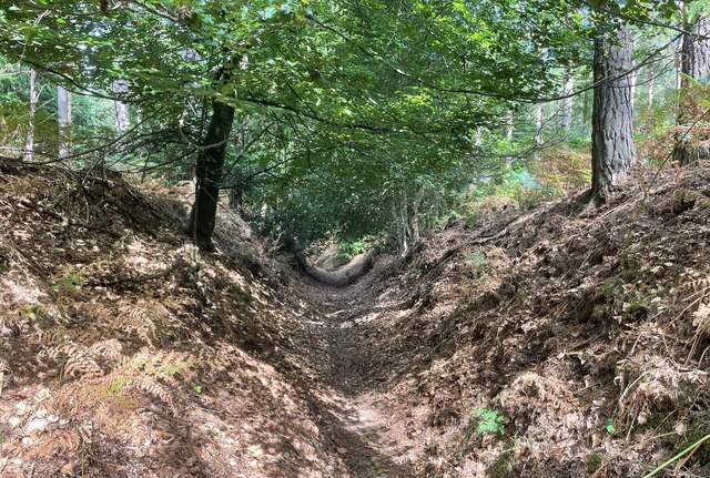
Graffham is a small village located in the district of Chichester in West Sussex, England. Situated within the South Downs National Park, Graffham is known for its picturesque countryside views and charming rural atmosphere. The village is surrounded by rolling hills, woodlands, and meadows, making it a popular destination for outdoor enthusiasts and nature lovers.

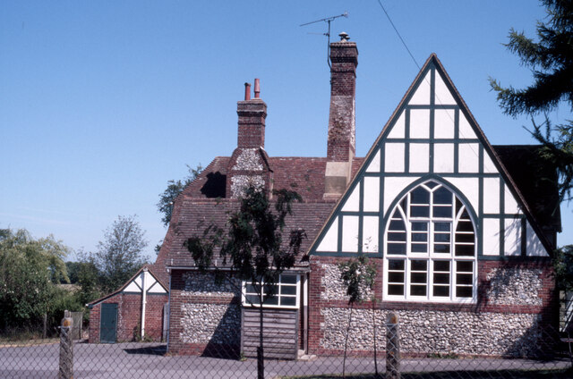
Graffham is home to a number of historic buildings, including the Grade I listed St. Giles Church, which dates back to the 12th century. The village also has a few local shops, a pub, and a community hall where various events and activities take place throughout the year.

The village is well-connected by road, with the A285 running through the area, providing easy access to nearby towns and cities such as Chichester and Midhurst. Graffham is also served by a few bus routes, making it accessible for those without a car.

Overall, Graffham offers a peaceful and idyllic setting for those looking to escape the hustle and bustle of city life and enjoy the tranquility of the Sussex countryside.

If you have any feedback on the listing, please let us know in the comments section below.
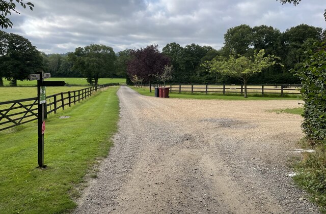
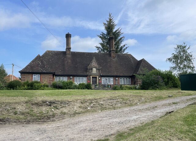
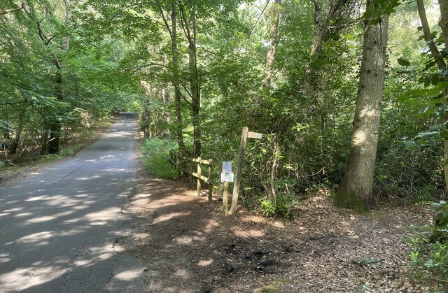
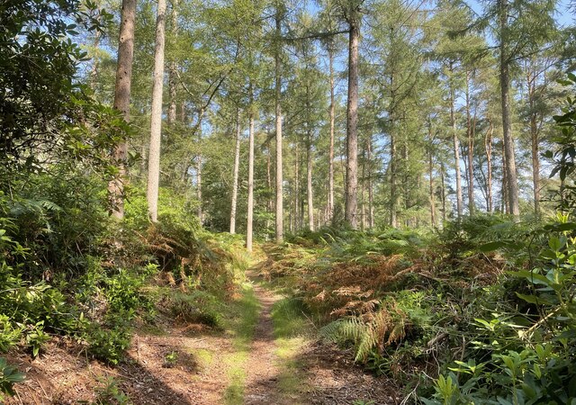
Graffham Images

Images are sourced within 2km of 50.949702/-0.680554 or Grid Reference SU9217. Thanks to Geograph Open Source API. All images are credited.

Path junction A path junction near Upperbarn House. The public footpath leading off to the right passes through Brook’s Copse to join Norwood Lane.
Path junction
A path junction near Upperbarn House. The public footpath leading off to the right passes through Brook’s Copse to join Norwood Lane.
Paths near Upper Norwood On the outskirts of Upper Norwood a bridleway heads towards the farm whilst a public footpath leads off to the left towards Seaford College.
Paths near Upper Norwood
On the outskirts of Upper Norwood a bridleway heads towards the farm whilst a public footpath leads off to the left towards Seaford College.
Gateway with a view An open gate to fields beside the public footpath. The spot provides a view of the wooded flanks of the South Downs ahead.
Gateway with a view
An open gate to fields beside the public footpath. The spot provides a view of the wooded flanks of the South Downs ahead.
Seaford College Looking towards the college from Wallace Square.
Seaford College
Looking towards the college from Wallace Square.
West Lodge West Lodge at an entrance to Seaford College.
West Lodge
West Lodge at an entrance to Seaford College.
The Parish Church of St Giles The church is a Grade II listed building. See <span class="nowrap"><a title="https://historicengland.org.uk/listing/the-list/list-entry/1276882" rel="nofollow ugc noopener" href="https://historicengland.org.uk/listing/the-list/list-entry/1276882">Link</a><img style="margin-left:2px;" alt="External link" title="External link - shift click to open in new window" src="https://s1.geograph.org.uk/img/external.png" width="10" height="10"/></span>
The Parish Church of St Giles
The church is a Grade II listed building. See LinkExternal link
Homes of Rest The almshouses in Graffham are a Grade II listed building. See <span class="nowrap"><a title="https://historicengland.org.uk/listing/the-list/list-entry/1396449" rel="nofollow ugc noopener" href="https://historicengland.org.uk/listing/the-list/list-entry/1396449">Link</a><img style="margin-left:2px;" alt="External link" title="External link - shift click to open in new window" src="https://s1.geograph.org.uk/img/external.png" width="10" height="10"/></span>
Homes of Rest
The almshouses in Graffham are a Grade II listed building. See LinkExternal link
Leaving Homeball Wood The stile ahead leads to fields beside Homeball Wood near to Graffham.
Leaving Homeball Wood
The stile ahead leads to fields beside Homeball Wood near to Graffham.
Bridleway at Birch Copse The bridleway leaves the roadside at Birch Copse and heads northwards to meet up with the Serpent Trail.
Bridleway at Birch Copse
The bridleway leaves the roadside at Birch Copse and heads northwards to meet up with the Serpent Trail.
Birch Copse Passing through Birch Copse on the bridleway heading northwards to join with the Serpent Trail.
Birch Copse
Passing through Birch Copse on the bridleway heading northwards to join with the Serpent Trail.
Sunken Path The way ahead is between steep banks at this point.
Sunken Path
The way ahead is between steep banks at this point.
Graffham School Next to the church, built in 1854 to designs of the  noted architect GE Street.
Graffham School
Next to the church, built in 1854 to designs of the noted architect GE Street.
Stable north of Upper Norwood
By a decrepit shed, Upper Norwood Possibly associated with Norwood Cottage, the house glimpsed in the distance.
By a decrepit shed, Upper Norwood
Possibly associated with Norwood Cottage, the house glimpsed in the distance.
Paddocks at edge of woodland, Upper Norwood
Woodland, Upper Norwood An area subject to a fire a few years earlier.
Woodland, Upper Norwood
An area subject to a fire a few years earlier.
East Lavington footpath 672/1
Oak in field, Graffham
Show me another place!

Graffham is located at Grid Ref: SU9217 (Lat: 50.949702, Lng: -0.680554)

Administrative County: West Sussex

District: Chichester

Police Authority: Sussex

What 3 Words

///pans.plank.crunched. Near Midhurst, West Sussex

Nearby Locations

Graffham

Related Wikis

Graffham

Graffham is a village, Anglican parish and civil parish in West Sussex, England, situated on the northern escarpment of the South Downs within the South...

Sussex Downs AONB

Sussex Downs Area of Outstanding Natural Beauty in England was designated in 1966. The designation was revoked in March 2010, together with the neighbouring...

Graffham Common

Graffham Common is a 38-hectare (94-acre) nature reserve between Midhurst and Petworth in West Sussex. It is owned and managed by the Sussex Wildlife...

East Lavington

East Lavington, formerly Woolavington, is a village and civil parish in the District of Chichester in West Sussex, England. It is located six kilometres...

Nearby Amenities

Located within 500m of 50.949702,-0.680554
Graffham
Is In: West Sussex, England, UK
Note: NPE shows location further south. Used local knowledge to place village centre
Place: village
Source: npe
Lat/Long: 50.9516303/-0.6769246
Pub
The White Horse
Addr City: Graffham
Addr Housename: The White Horse
Addr Postcode: GU28 0NT
Addr Street: Woodcote Lane
Fhrs Authority: Chichester
Fhrs Id: 989700
Fhrs Local Authority Id: 17/00165/FOOD
Phone: +44 1798 867331
Website: https://www.whitehorsegraffham.com/
Lat/Long: 50.9503827/-0.6837554
Pub
The Foresters Arms
Addr City: Petworth
Addr Hamlet: Graffham
Addr Postcode: GU28 0QA
Addr Street: The Street
Beer Garden: yes
Fhrs Authority: Chichester
Fhrs Id: 1042510
Fhrs Local Authority Id: 18/00039/FOOD
Phone: +44 1798 867202
Real Ale: yes
Real Fire: yes
Lat/Long: 50.9512245/-0.6769016
Barrier: stile
Lat/Long: 50.9467571/-0.682746
Barrier: stile
Lat/Long: 50.9491505/-0.6871364
Barrier: stile
Lat/Long: 50.9487484/-0.6832407
Barrier: stile
Lat/Long: 50.949257/-0.6833722
Barrier: stile
Lat/Long: 50.9507827/-0.6833534
Barrier: stile
Lat/Long: 50.9509469/-0.6834227
Historic: memorial
Lat/Long: 50.9506229/-0.677519
Bus Stop
Empire Hall
Bus: yes
Naptan AtcoCode: 4400MO0060
Naptan Bearing: S
Naptan CommonName: Empire Hall
Naptan Indicator: Nr Forester's Arms PH
Naptan Landmark: Empire Hall
Naptan NaptanCode: wsxdgtgt
Naptan Street: unnamed road
Naptan Verified: no
Public Transport: platform
Source: naptan_import
Lat/Long: 50.9523912/-0.6765127
Bus Stop
Graffham
Bus: yes
Naptan AtcoCode: 4400MO0061
Naptan Bearing: N
Naptan CommonName: Graffham
Naptan Indicator: opp unnamed road
Naptan Landmark: Guillods Cottages
Naptan NaptanCode: wsxdgtgw
Naptan Street: Guillods Cottages
Naptan Verified: no
Public Transport: platform
Source: naptan_import
Lat/Long: 50.9476624/-0.6814161
Graffham
Naptan AtcoCode: 4400MO0062
Naptan Bearing: S
Naptan BusStopType: CUS
Naptan CommonName: Graffham
Naptan Indicator: adj unnamed road
Naptan Landmark: Guillods Cottages
Naptan NaptanCode: wsxdgtja
Naptan Street: Gulloids Cottages
Naptan Verified: no
Source: naptan_import
Lat/Long: 50.9481073/-0.6809906
White Horse
Naptan AtcoCode: 4400MO0481
Naptan Bearing: SE
Naptan BusStopType: CUS
Naptan CommonName: White Horse
Naptan Indicator: opp
Naptan Landmark: Hail & Ride
Naptan NaptanCode: wsxgagjd
Naptan Street: Unnamed Road
Naptan Verified: no
Source: naptan_import
Lat/Long: 50.9506961/-0.6824834
White Horse
Naptan AtcoCode: 4400MO0482
Naptan Bearing: NW
Naptan BusStopType: CUS
Naptan CommonName: White Horse
Naptan Indicator: adj
Naptan Landmark: Hail & Ride
Naptan NaptanCode: wsxgagjg
Naptan Street: Unnamed Road
Naptan Verified: no
Source: naptan_import
Lat/Long: 50.9505804/-0.6825863
Bus Stop
Recreation Ground
Bus: yes
Naptan AtcoCode: 4400MO0483
Naptan Bearing: N
Naptan BusStopType: CUS
Naptan CommonName: Recreation Ground
Naptan Indicator: opp
Naptan Landmark: Hail & Ride
Naptan NaptanCode: wsxgagjm
Naptan Street: Unnamed Road
Naptan Verified: no
Public Transport: platform
Source: naptan_import
Lat/Long: 50.9507034/-0.6775572
Bus Stop
Recreation Ground
Bus: yes
Naptan AtcoCode: 4400MO0484
Naptan Bearing: S
Naptan BusStopType: CUS
Naptan CommonName: Recreation Ground
Naptan Indicator: adj
Naptan Landmark: Hail & Ride
Naptan NaptanCode: wsxgagjp
Naptan Street: Unnamed Road
Naptan Verified: no
Public Transport: platform
Source: naptan_import
Lat/Long: 50.950673/-0.6772591
Empire Hall
Naptan AtcoCode: 4400MO0615
Naptan Bearing: N
Naptan BusStopType: CUS
Naptan CommonName: Empire Hall
Naptan Indicator: Nr Forester's Arms PH
Naptan Landmark: Empire Hall
Naptan Street: Unnamed road
Naptan Verified: no
Source: naptan_import
Lat/Long: 50.9524733/-0.67661
Bench
Lat/Long: 50.949824/-0.680761
Barrier: kissing_gate
Lat/Long: 50.9538115/-0.6786268
Post Box
Collection Plate: CP5
Collection Times: Mo-Fr 16:45; Sa 09:30
Operator: Royal Mail
Post Box Type: wall
Ref: GU28 88
Royal Cypher: GR
Royal Cypher Wikidata: Q33102273
Lat/Long: 50.9475479/-0.6814414
Barrier: stile
Lat/Long: 50.9482753/-0.681189
Post Box
Collection Plate: CP1D
Collection Times: Mo-Fr 09:00; Sa 07:00
Operator: Royal Mail
Post Box Type: pillar
Ref: GU28 13D
Royal Cypher: GR
Royal Cypher Wikidata: Q33102273
Lat/Long: 50.9529606/-0.6761267
Board Type: notice
Information: board
Tourism: information
Lat/Long: 50.945409/-0.6810633
Barrier: stile
Lat/Long: 50.9497538/-0.6738127
Barrier: kissing_gate
Lat/Long: 50.9507348/-0.6740476
Post Office
Graffham Post Office
Addr Country: GB
Addr Postcode: GU28 0QB
Brand: Post Office
Brand Wikidata: Q1783168
Contact Website: https://www.postoffice.co.uk/branch-finder/2554704/graffham
Ref Pol Id: 96485
Lat/Long: 50.9529806/-0.6759983
Willow Barns
Addr Housename: Willow Barns
Addr Postcode: GU28 0NT
Addr Street: Woodcote Lane
Phone: +44 1798 867493
Tourism: guest_house
Lat/Long: 50.9500179/-0.6836453
Defibrillator
Emergency: defibrillator
Indoor: no
Ref: SECAS/000106/G555
Lat/Long: 50.9524673/-0.6764552
The data included in this document is from www.openstreetmap.org. The data is made available under ODbL.

Have you been to Graffham?

Leave your review of Graffham below (or comments, questions and feedback).