Roehillock Pool

Lake, Pool, Pond, Freshwater Marsh in Morayshire

Scotland

Roehillock Pool

Altyre House and Lake From the bank beside the road. There are few gaps in the vegetation, making it difficult to photograph well.
Altyre House and Lake Credit: Anne Burgess

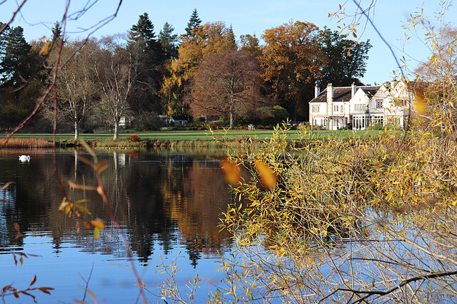
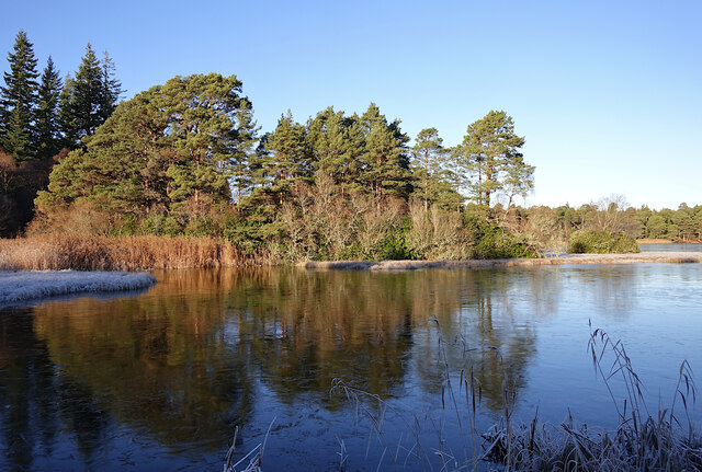
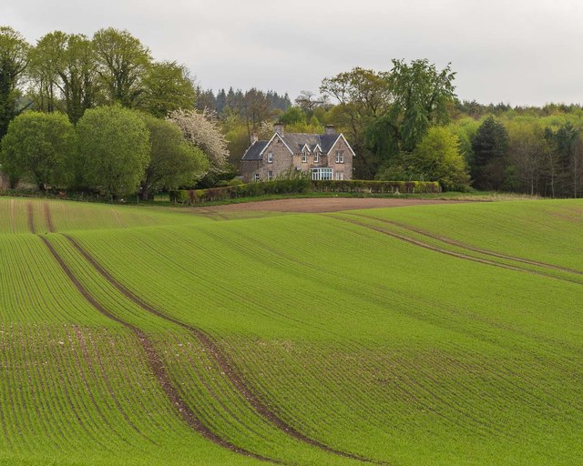
Roehillock Pool, located in Morayshire, is a picturesque freshwater marsh surrounded by a diverse ecosystem. Spanning across a modest area, this body of water offers a tranquil and serene environment for both wildlife and visitors alike.

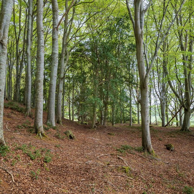
The pool is nestled amidst rolling hills and is fed by natural springs, ensuring a constant flow of fresh water. The surrounding vegetation, including reeds and water lilies, provides a lush habitat for a wide range of plant and animal species. The pool itself varies in depth, with some areas reaching up to three meters, providing ample space for aquatic life to thrive.

The diverse range of bird species that call Roehillock Pool home make it a popular spot for birdwatchers. Visitors can spot majestic herons gracefully wading through the water, while the haunting call of the curlew echoes through the marshes. Other notable bird species include teal, mallards, and coots, which can be seen nesting and foraging along the water's edge.

The pool is also home to a variety of fish, such as perch and pike, making it a favorite spot for anglers. Fishing enthusiasts can cast their lines from the banks or hire boats to explore the deeper parts of the pool.

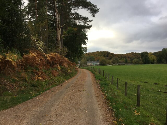
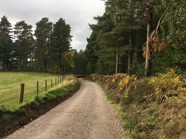
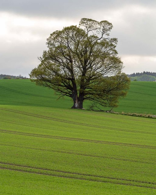
Roehillock Pool is easily accessible, with a well-maintained path leading to its shores. The surrounding area offers stunning views of the Morayshire countryside, making it a popular destination for nature lovers and photographers.

Overall, Roehillock Pool in Morayshire provides a haven for wildlife and visitors alike, offering a peaceful retreat where one can immerse themselves in the beauty of nature.

If you have any feedback on the listing, please let us know in the comments section below.

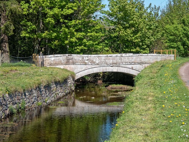
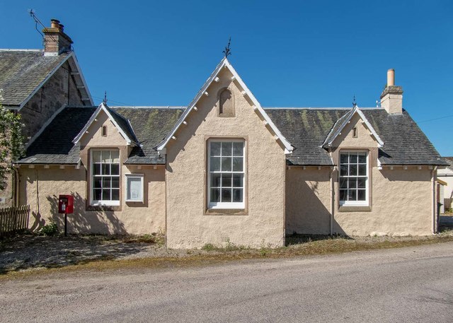
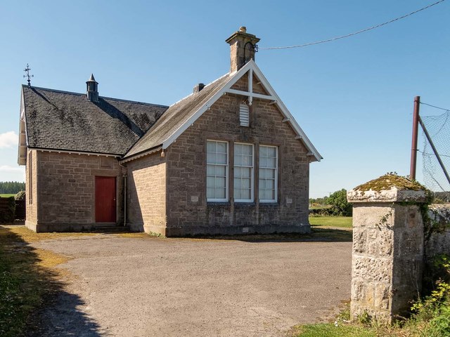
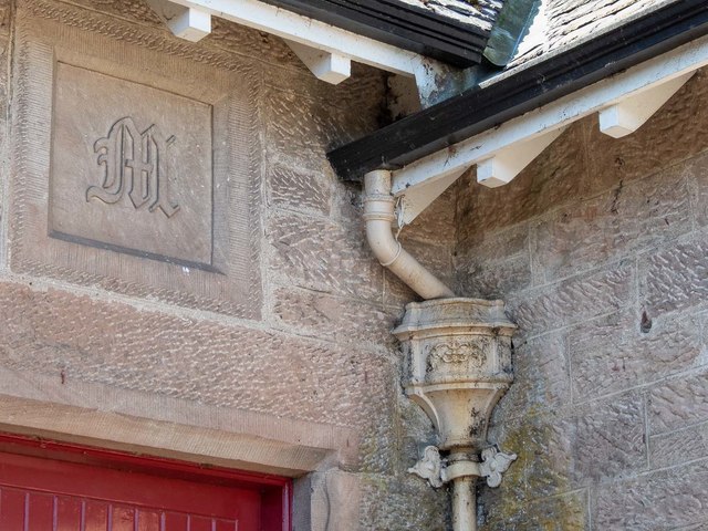
Roehillock Pool Images

Images are sourced within 2km of 57.564733/-3.6548847 or Grid Reference NJ0153. Thanks to Geograph Open Source API. All images are credited.

Altyre House and Lake From the bank beside the road. There are few gaps in the vegetation, making it difficult to photograph well.
Altyre House and Lake
From the bank beside the road. There are few gaps in the vegetation, making it difficult to photograph well.
Road to Mains of Sluie
Road to Mains of Sluie This gravel road appears to have been recently regraded.
Road to Mains of Sluie
This gravel road appears to have been recently regraded.
Loch of Blairs A mixture of trees along the shore, on a frosty afternoon.
Loch of Blairs
A mixture of trees along the shore, on a frosty afternoon.
Altyre Chapel A timber church, built circa 1900. It is part of the Scottish Episcopal Church, linked with St John's Church in Forres.

It is a Category C listed building. <span class="nowrap"><a title="https://portal.historicenvironment.scot/designation/LB15598" rel="nofollow ugc noopener" href="https://portal.historicenvironment.scot/designation/LB15598">Link</a><img style="margin-left:2px;" alt="External link" title="External link - shift click to open in new window" src="https://s1.geograph.org.uk/img/external.png" width="10" height="10"/></span>
Altyre Chapel
A timber church, built circa 1900. It is part of the Scottish Episcopal Church, linked with St John's Church in Forres. It is a Category C listed building. LinkExternal link
Loch Holly Only marked on my OS25k map, more of a lochan than a Loch.
Loch Holly
Only marked on my OS25k map, more of a lochan than a Loch.
In Darnaway Estate An open space with arable crops and occasional clumps of mature trees.
In Darnaway Estate
An open space with arable crops and occasional clumps of mature trees.
Darnaway Forest The path in the right of this image leads off the main track and provides a very pleasant walk through the beech and oak trees that form this part of the forest. The path is marked on the first edition OS 25" map of 1872
Darnaway Forest
The path in the right of this image leads off the main track and provides a very pleasant walk through the beech and oak trees that form this part of the forest. The path is marked on the first edition OS 25" map of 1872
Carving on a beech tree in Darnaway Forest Although most the carving on this beech tree trunk is illegible, the date 7.7.1942 is clear. The tree is on the edge of an old path unmarked path near the private burial ground in Darnaway Forest
Carving on a beech tree in Darnaway Forest
Although most the carving on this beech tree trunk is illegible, the date 7.7.1942 is clear. The tree is on the edge of an old path unmarked path near the private burial ground in Darnaway Forest
Unsafe bridge over the Speedie Burn Unfortunately, the centre of this fine old estate bridge over the Speedie Burn near Darnaway Castle has developed a dip in the centre near the keystone. It is now fenced off and marked as unsafe.
Unsafe bridge over the Speedie Burn
Unfortunately, the centre of this fine old estate bridge over the Speedie Burn near Darnaway Castle has developed a dip in the centre near the keystone. It is now fenced off and marked as unsafe.
Former Conicavel Post Office and School Originally the village school, the building seems then to have been used as the post office. Surprisingly, the building does not seem to have listed status.
<span class="nowrap"><a title="https://canmore.org.uk/site/192775/conicavel-post-office" rel="nofollow ugc noopener" href="https://canmore.org.uk/site/192775/conicavel-post-office">Link</a><img style="margin-left:2px;" alt="External link" title="External link - shift click to open in new window" src="https://s1.geograph.org.uk/img/external.png" width="10" height="10"/></span>
Former Conicavel Post Office and School
Originally the village school, the building seems then to have been used as the post office. Surprisingly, the building does not seem to have listed status. LinkExternal link
Former Hall Conicavel This building is marked on the map as a hall but seems to have seen little use in recent years. Part of the Darnaway Estate, the building is not listed. It features an armorial stone panel engraved with an 'M' above the front door, perhaps referring to the Earl of Moray?
A close view of the panel here <a href="https://www.geograph.org.uk/photo/6143527">NH9953 : Former Hall Conicavel</a>
Former Hall Conicavel
This building is marked on the map as a hall but seems to have seen little use in recent years. Part of the Darnaway Estate, the building is not listed. It features an armorial stone panel engraved with an 'M' above the front door, perhaps referring to the Earl of Moray? A close view of the panel here NH9953 : Former Hall Conicavel
Former Hall Conicavel An armorial plaque above the doorway into the former hall, the 'M' perhaps referring to the Earl of Moray?
Former Hall Conicavel
An armorial plaque above the doorway into the former hall, the 'M' perhaps referring to the Earl of Moray?
Path in Darnaway Forest Although marked on the Os maps, the path is rather vague in this part of the forest and is probably little used in recent times. There are some fine mature holly trees amongst the dominant beech trees.
Path in Darnaway Forest
Although marked on the Os maps, the path is rather vague in this part of the forest and is probably little used in recent times. There are some fine mature holly trees amongst the dominant beech trees.
Dry Stone Wall in Darnaway Forest An old dry stone wall covered in moss, probably part of the nearby Darnaway Castle policies
Dry Stone Wall in Darnaway Forest
An old dry stone wall covered in moss, probably part of the nearby Darnaway Castle policies
Dry Stone Wall in Darnaway Forest An old dry stone wall covered in moss, probably part of the nearby Darnaway Castle policies. The wall is not continuous and has either fallen down or become covered in vegetation along much of its length
Dry Stone Wall in Darnaway Forest
An old dry stone wall covered in moss, probably part of the nearby Darnaway Castle policies. The wall is not continuous and has either fallen down or become covered in vegetation along much of its length
Lone Tree A lone tree on the field boundary between Redstone and Cooperhill Farm, too far away to identify whether it might be an oak or elm.
Lone Tree
A lone tree on the field boundary between Redstone and Cooperhill Farm, too far away to identify whether it might be an oak or elm.
Cooperhill Farmhouse
Show me another place!

Roehillock Pool is located at Grid Ref: NJ0153 (Lat: 57.564733, Lng: -3.6548847)

Unitary Authority: Moray

Police Authority: North East

What 3 Words

///fidgeting.scared.perfected. Near Forres, Moray

Related Wikis

Darnaway Castle

Darnaway Castle, also known as Tarnaway Castle, is located in Darnaway Forest, 3 miles (4.8 km) southwest of Forres in Moray, Scotland. This was Comyn...

Dallas Dhu distillery

Dallas Dhu distillery was a producer of single malt Scotch whisky that operated between 1899 and 1983 in Forres, Moray, Scotland. Dallas Dhu means "Black...

RAF Forres

Royal Air Force Forres or more simply RAF Forres is a former Royal Air Force satellite station located near Forres, Moray, Scotland. The station was controlled...

Dalvey, Elgin

Dalvey is a place near to the town of Forres in Moray, Scotland. The name gave rise to the Baronets Grant of Dalvey, Elgin.

Balnageith

Balnageith, located on the western edge of the suburbs of Forres in Moray, Scotland, is the site of an excavated linear cropmark with a rounded corner...

Dalvey railway station

Dalvey railway station, also known as Dalvie railway station, served the burgh of Forres, Moray, Scotland, from 1863 to 1868 on the Strathspey Railway...

Rafford railway station

Rafford railway station at Rafford was opened with the Inverness and Perth Junction Railway in 1863. A full layout was provided (with a goods yard). The...

Doune of Relugas

The Doune of Relugas is a hill fort located 9.25 kilometres (5.75 mi) south south west of Forres in Moray, Scotland. It is situated on a rocky knoll rising...

Nearby Amenities

Located within 500m of 57.564733,-3.6548847
Bench
Lat/Long: 57.5684615/-3.6507661
The data included in this document is from www.openstreetmap.org. The data is made available under ODbL.

Have you been to Roehillock Pool?

Leave your review of Roehillock Pool below (or comments, questions and feedback).