Gospel Ash

Settlement in Staffordshire South Staffordshire

England

Gospel Ash

Highgate Path The view from near White House Lane of the footpath on Highgate Common Country Park.
Highgate Path Credit: Gordon Griffiths

Gospel Ash is a small village located in the county of Staffordshire, England. Situated approximately 5 miles west of the market town of Lichfield, Gospel Ash is known for its picturesque countryside and charming rural atmosphere.

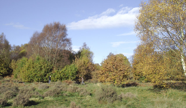
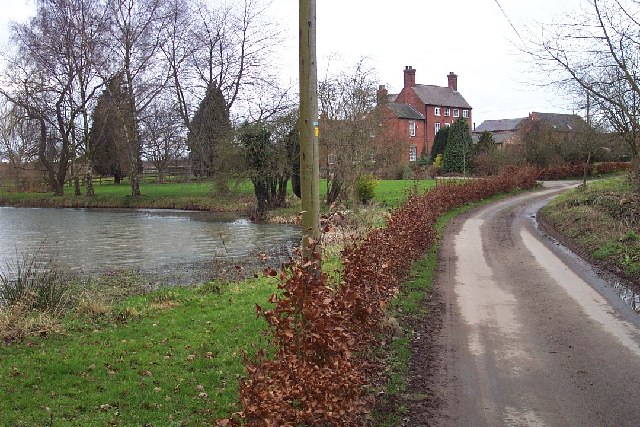
The village is surrounded by lush green fields and rolling hills, providing a tranquil setting for its residents. The area is dotted with traditional stone cottages and farmhouses, giving it a quaint and timeless feel. The peacefulness of the village makes it an ideal place for those seeking a quiet and idyllic lifestyle.

Despite its small size, Gospel Ash is well-connected to the nearby towns and cities. The A51 road runs just to the east of the village, allowing residents easy access to Lichfield and further afield. The village is also served by several bus routes, providing convenient transportation options for those who prefer not to drive.

Although Gospel Ash does not have many amenities of its own, the nearby town of Lichfield offers a wide range of shops, restaurants, and recreational facilities. Lichfield Cathedral, a stunning medieval cathedral, is a popular attraction for residents and visitors alike.

Overall, Gospel Ash is a charming and peaceful village in the heart of Staffordshire. Its beautiful natural surroundings, combined with its proximity to larger towns, make it an attractive place to live for those who appreciate the tranquility of rural living.

If you have any feedback on the listing, please let us know in the comments section below.
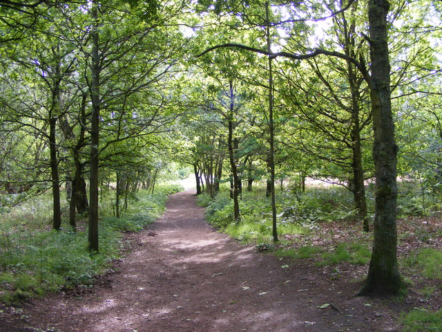
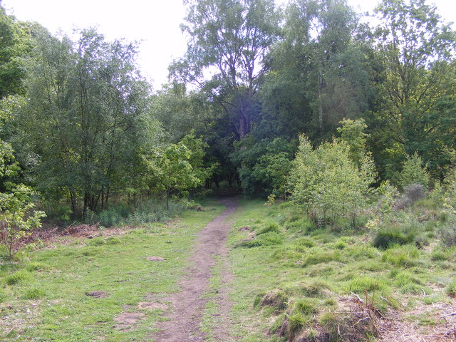
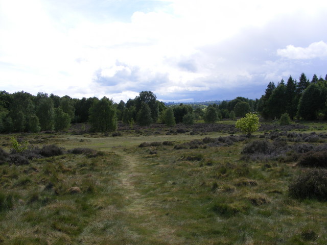
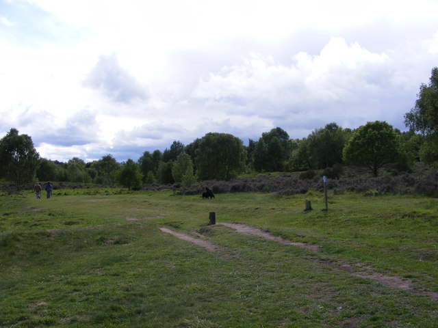
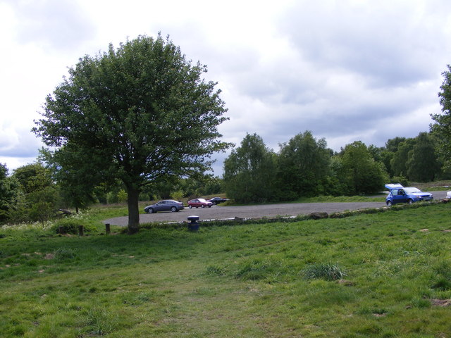
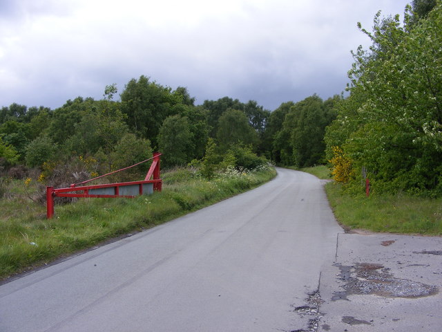
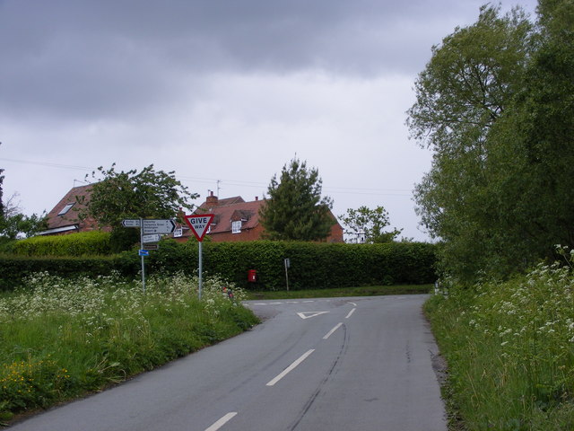
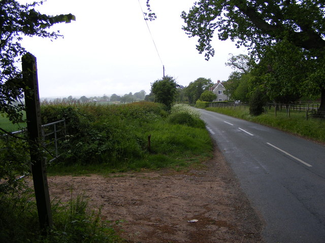
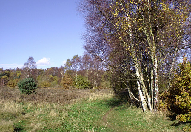
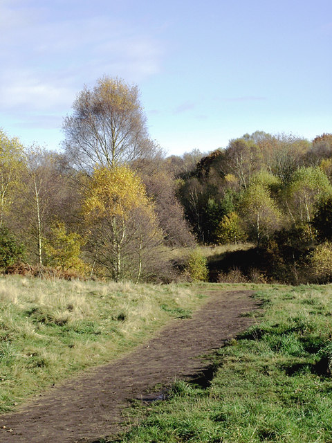
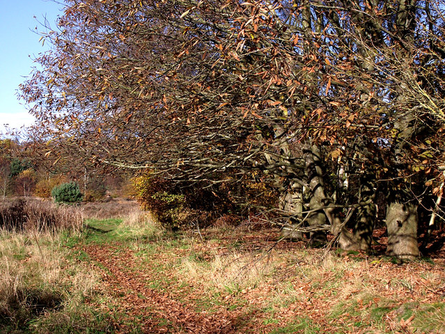
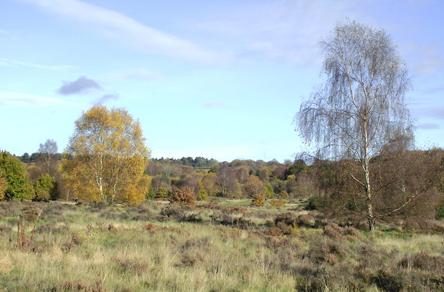
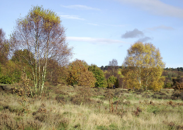
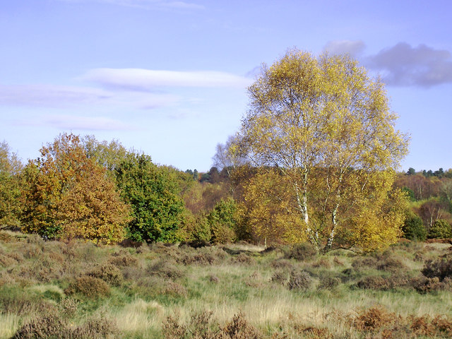
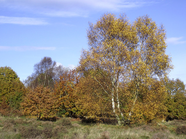
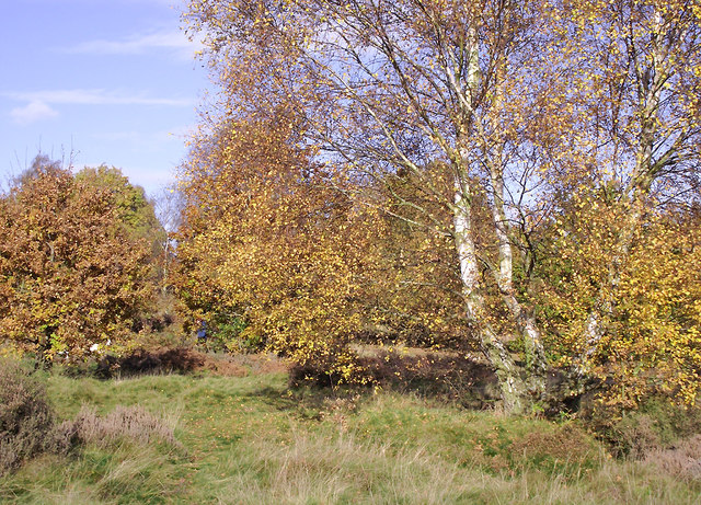
Gospel Ash Images

Images are sourced within 2km of 52.519459/-2.254191 or Grid Reference SO8291. Thanks to Geograph Open Source API. All images are credited.

Highgate Path The view from near White House Lane of the footpath on Highgate Common Country Park.
Highgate Path
The view from near White House Lane of the footpath on Highgate Common Country Park.
Highgate Clearing The view of the footpath on Highgate Common Country Park.
Highgate Clearing
The view of the footpath on Highgate Common Country Park.
Highgate View The view from Birches Coppice Car Park off White House Lane over Highgate Common Country Park.
Highgate View
The view from Birches Coppice Car Park off White House Lane over Highgate Common Country Park.
Highgate Common View The view over Highgate Common Country Park.
Highgate Common View
The view over Highgate Common Country Park.
Highgate Car Park View The view of the car park off Camp Hill Road from Highgate Common Country Park.
Highgate Car Park View
The view of the car park off Camp Hill Road from Highgate Common Country Park.
Highgate Road Gate The view of Camp Hill Road on Highgate Common Country Park.
Highgate Road Gate
The view of Camp Hill Road on Highgate Common Country Park.
Highgate Road Junction The view of Camp Hill Road and Highgate Road junction on Highgate Common Country Park.
Highgate Road Junction
The view of Camp Hill Road and Highgate Road junction on Highgate Common Country Park.
Staffordshire Way View The view of Crab Lane near Highgate Common Country Park.
Staffordshire Way View
The view of Crab Lane near Highgate Common Country Park.
Highgate Common south-west of Wombourne, Staffordshire Highgate Common is a Staffordshire Wildlife Trust reserve containing a mix of heathland and woodland. It is about 129 hectares or 320 acres in size and is a Site of Special Scientific Interest. (Wikipedia)

This is a very popular area for walkers (including dog-walkers) at any time of the year.

<span class="nowrap"><a title="http://en.wikipedia.org/wiki/Highgate_Common" rel="nofollow ugc noopener" href="http://en.wikipedia.org/wiki/Highgate_Common">Link</a><img style="margin-left:2px;" alt="External link" title="External link - shift click to open in new window" src="https://s1.geograph.org.uk/img/external.png" width="10" height="10"/></span>
Highgate Common south-west of Wombourne, Staffordshire
Highgate Common is a Staffordshire Wildlife Trust reserve containing a mix of heathland and woodland. It is about 129 hectares or 320 acres in size and is a Site of Special Scientific Interest. (Wikipedia) This is a very popular area for walkers (including dog-walkers) at any time of the year. LinkExternal link
Track on Highgate Common, Staffordshire Highgate Common is a Staffordshire Wildlife Trust reserve containing a mix of heathland and woodland. It is about 129 hectares or 320 acres in size and is a Site of Special Scientific Interest. (Wikipedia)

This is a very popular area for walkers (including dog-walkers) at any time of the year.

<span class="nowrap"><a title="http://en.wikipedia.org/wiki/Highgate_Common" rel="nofollow ugc noopener" href="http://en.wikipedia.org/wiki/Highgate_Common">Link</a><img style="margin-left:2px;" alt="External link" title="External link - shift click to open in new window" src="https://s1.geograph.org.uk/img/external.png" width="10" height="10"/></span>
Track on Highgate Common, Staffordshire
Highgate Common is a Staffordshire Wildlife Trust reserve containing a mix of heathland and woodland. It is about 129 hectares or 320 acres in size and is a Site of Special Scientific Interest. (Wikipedia) This is a very popular area for walkers (including dog-walkers) at any time of the year. LinkExternal link
Highgate Common south-west of Wombourne, Staffordshire A group of Spanish Chestnut trees has shed most of its leaves.

Highgate Common is a Staffordshire Wildlife Trust reserve containing a mix of heathland and woodland. It is about 129 hectares or 320 acres in size and is a Site of Special Scientific Interest. (Wikipedia)

This is a very popular area for walkers (including dog-walkers) at any time of the year.

<span class="nowrap"><a title="http://en.wikipedia.org/wiki/Highgate_Common" rel="nofollow ugc noopener" href="http://en.wikipedia.org/wiki/Highgate_Common">Link</a><img style="margin-left:2px;" alt="External link" title="External link - shift click to open in new window" src="https://s1.geograph.org.uk/img/external.png" width="10" height="10"/></span>
Highgate Common south-west of Wombourne, Staffordshire
A group of Spanish Chestnut trees has shed most of its leaves. Highgate Common is a Staffordshire Wildlife Trust reserve containing a mix of heathland and woodland. It is about 129 hectares or 320 acres in size and is a Site of Special Scientific Interest. (Wikipedia) This is a very popular area for walkers (including dog-walkers) at any time of the year. LinkExternal link
Highgate Common south-west of Wombourne, Staffordshire Highgate Common is a Staffordshire Wildlife Trust reserve containing a mix of heathland and woodland. It is about 129 hectares or 320 acres in size and is a Site of Special Scientific Interest. (Wikipedia)

This is a very popular area for walkers (including dog-walkers) at any time of the year.

<span class="nowrap"><a title="http://en.wikipedia.org/wiki/Highgate_Common" rel="nofollow ugc noopener" href="http://en.wikipedia.org/wiki/Highgate_Common">Link</a><img style="margin-left:2px;" alt="External link" title="External link - shift click to open in new window" src="https://s1.geograph.org.uk/img/external.png" width="10" height="10"/></span>
Highgate Common south-west of Wombourne, Staffordshire
Highgate Common is a Staffordshire Wildlife Trust reserve containing a mix of heathland and woodland. It is about 129 hectares or 320 acres in size and is a Site of Special Scientific Interest. (Wikipedia) This is a very popular area for walkers (including dog-walkers) at any time of the year. LinkExternal link
Birch trees on Highgate Common, Staffordshire Highgate Common is a Staffordshire Wildlife Trust reserve containing a mix of heathland and woodland. It is about 129 hectares or 320 acres in size and is a Site of Special Scientific Interest. (Wikipedia)

This is a very popular area for walkers (including dog-walkers) at any time of the year.

<span class="nowrap"><a title="http://en.wikipedia.org/wiki/Highgate_Common" rel="nofollow ugc noopener" href="http://en.wikipedia.org/wiki/Highgate_Common">Link</a><img style="margin-left:2px;" alt="External link" title="External link - shift click to open in new window" src="https://s1.geograph.org.uk/img/external.png" width="10" height="10"/></span>
Birch trees on Highgate Common, Staffordshire
Highgate Common is a Staffordshire Wildlife Trust reserve containing a mix of heathland and woodland. It is about 129 hectares or 320 acres in size and is a Site of Special Scientific Interest. (Wikipedia) This is a very popular area for walkers (including dog-walkers) at any time of the year. LinkExternal link
Autumn trees on Highgate Common, Staffordshire Highgate Common is a Staffordshire Wildlife Trust reserve containing a mix of heathland and woodland. It is about 129 hectares (320 acres) in size and is a Site of Special Scientific Interest. (Wikipedia)

This is a very popular area for walkers (including dog-walkers) at any time of the year.

<span class="nowrap"><a title="http://en.wikipedia.org/wiki/Highgate_Common" rel="nofollow ugc noopener" href="http://en.wikipedia.org/wiki/Highgate_Common">Link</a><img style="margin-left:2px;" alt="External link" title="External link - shift click to open in new window" src="https://s1.geograph.org.uk/img/external.png" width="10" height="10"/></span>
Autumn trees on Highgate Common, Staffordshire
Highgate Common is a Staffordshire Wildlife Trust reserve containing a mix of heathland and woodland. It is about 129 hectares (320 acres) in size and is a Site of Special Scientific Interest. (Wikipedia) This is a very popular area for walkers (including dog-walkers) at any time of the year. LinkExternal link
Birch tree and track on Highgate Common, Staffordshire The common is criss-crossed by many tracks and footpaths which walkers (especially those with canine companions) use regularly. Benches and small picnic areas are provided as are several car parking areas. 

Highgate Common is a Staffordshire Wildlife Trust reserve containing a mix of heathland and woodland. It is about 129 hectares (320 acres) in size and is a Site of Special Scientific Interest. (Wikipedia)

<span class="nowrap"><a title="http://en.wikipedia.org/wiki/Highgate_Common" rel="nofollow ugc noopener" href="http://en.wikipedia.org/wiki/Highgate_Common">Link</a><img style="margin-left:2px;" alt="External link" title="External link - shift click to open in new window" src="https://s1.geograph.org.uk/img/external.png" width="10" height="10"/></span>
Birch tree and track on Highgate Common, Staffordshire
The common is criss-crossed by many tracks and footpaths which walkers (especially those with canine companions) use regularly. Benches and small picnic areas are provided as are several car parking areas. Highgate Common is a Staffordshire Wildlife Trust reserve containing a mix of heathland and woodland. It is about 129 hectares (320 acres) in size and is a Site of Special Scientific Interest. (Wikipedia) LinkExternal link
Highgate Common south-west of Wombourne, Staffordshire Highgate Common is a Staffordshire Wildlife Trust reserve of about 129 hectares (320 acres) in area and is a Site of Special Scientific Interest. This is a very popular venue for walkers (including dog-walkers) at any time of the year. Several car parks are provided, as are picnic areas and benches, so the contemplative walker can admire the view.

There are areas of woodland, with silver birch and pedunculate oak as canopy and common bracken as ground cover, as well as coniferous plantation. There are roadside verges, areas of acidic grassland, patches of bare sand and earth, and small areas of wet heath, including two artificial ponds. The varied habitat results in a wide variety of animal life. Highgate Common also contains one of the few lowland heaths in Staffordshire, covered mainly with heather, broom and gorse.(Wikipedia - good article) <span class="nowrap"><a title="http://en.wikipedia.org/wiki/Highgate_Common" rel="nofollow ugc noopener" href="http://en.wikipedia.org/wiki/Highgate_Common">Link</a><img style="margin-left:2px;" alt="External link" title="External link - shift click to open in new window" src="https://s1.geograph.org.uk/img/external.png" width="10" height="10"/></span>
Highgate Common south-west of Wombourne, Staffordshire
Highgate Common is a Staffordshire Wildlife Trust reserve of about 129 hectares (320 acres) in area and is a Site of Special Scientific Interest. This is a very popular venue for walkers (including dog-walkers) at any time of the year. Several car parks are provided, as are picnic areas and benches, so the contemplative walker can admire the view. There are areas of woodland, with silver birch and pedunculate oak as canopy and common bracken as ground cover, as well as coniferous plantation. There are roadside verges, areas of acidic grassland, patches of bare sand and earth, and small areas of wet heath, including two artificial ponds. The varied habitat results in a wide variety of animal life. Highgate Common also contains one of the few lowland heaths in Staffordshire, covered mainly with heather, broom and gorse.(Wikipedia - good article) LinkExternal link
Oak and birch on Highgate Common, Staffordshire Highgate Common is a Staffordshire Wildlife Trust reserve of about 129 hectares (320 acres) in area and is a Site of Special Scientific Interest. This is a very popular venue for walkers (including dog-walkers) at any time of the year. Several car parks are provided, as are picnic areas and benches, so contemplative visitors can admire the view.

There are areas of woodland, with silver birch and pedunculate oak as canopy and common bracken as ground cover, as well as coniferous plantation. There are roadside verges, areas of acidic grassland, patches of bare sand and earth, and small areas of wet heath, including two artificial ponds. The varied habitat results in a wide variety of animal life. Highgate Common also contains one of the few lowland heaths in Staffordshire, covered mainly with heather, broom and gorse.(Wikipedia - good article) <span class="nowrap"><a title="http://en.wikipedia.org/wiki/Highgate_Common" rel="nofollow ugc noopener" href="http://en.wikipedia.org/wiki/Highgate_Common">Link</a><img style="margin-left:2px;" alt="External link" title="External link - shift click to open in new window" src="https://s1.geograph.org.uk/img/external.png" width="10" height="10"/></span>
Oak and birch on Highgate Common, Staffordshire
Highgate Common is a Staffordshire Wildlife Trust reserve of about 129 hectares (320 acres) in area and is a Site of Special Scientific Interest. This is a very popular venue for walkers (including dog-walkers) at any time of the year. Several car parks are provided, as are picnic areas and benches, so contemplative visitors can admire the view. There are areas of woodland, with silver birch and pedunculate oak as canopy and common bracken as ground cover, as well as coniferous plantation. There are roadside verges, areas of acidic grassland, patches of bare sand and earth, and small areas of wet heath, including two artificial ponds. The varied habitat results in a wide variety of animal life. Highgate Common also contains one of the few lowland heaths in Staffordshire, covered mainly with heather, broom and gorse.(Wikipedia - good article) LinkExternal link
Show me another place!

Gospel Ash is located at Grid Ref: SO8291 (Lat: 52.519459, Lng: -2.254191)

Administrative County: Staffordshire

District: South Staffordshire

Police Authority: Staffordshire

What 3 Words

///enhanced.saints.expiring. Near Wombourn, Staffordshire

Nearby Locations

Halfpenny Green Gospel Ash

Related Wikis

Wolverhampton Airport

Wolverhampton Halfpenny Green Airport (ICAO: EGBO), formerly Halfpenny Green Airport and Wolverhampton Business Airport, locally Bobbington Airport, is...

Highgate Common

Highgate Common is a Staffordshire Wildlife Trust reserve containing a mix of heathland and woodland. It is about 129 hectares or 320 acres in size. The...

Bobbington

Bobbington is a village and civil parish in the South Staffordshire district of Staffordshire, England, about 5 miles (8.0 km) west of Wombourne. According...

Swindon, Staffordshire

Swindon is a village and civil parish located in the West Midlands. The nearest major town is Dudley, approximately five miles eastwards. It stands halfway...

Mid Severn Sandstone Plateau

The Mid Severn Sandstone Plateau is a rural landscape and one of the natural regions of central England, straddling the border between the counties of...

Trysull and Seisdon

Trysull and Seisdon is a conjoined civil parish in the South Staffordshire non-metropolitan district, in the county of Staffordshire, England. The population...

Beobridge

Beobridge is a small, scattered hamlet in Shropshire, England. It is in the civil parish of Claverley. Its name probably comes from Old English beo, "bee...

Seisdon Rural District

Seisdon was a rural district in Staffordshire, England from 1894 to 1974. It lay to the west of Wolverhampton and was formed under the Local Government...

Nearby Amenities

Located within 500m of 52.519459,-2.254191
Gospelash
Created By: Potlatch 0.10f
Place: hamlet
Lat/Long: 52.5172429/-2.2523283
Aeroway: navigationaid
Navigationaid: papi
Lat/Long: 52.5192975/-2.2602654
The data included in this document is from www.openstreetmap.org. The data is made available under ODbL.

Have you been to Gospel Ash?

Leave your review of Gospel Ash below (or comments, questions and feedback).