Boat Pool

Lake, Pool, Pond, Freshwater Marsh in Kirkcudbrightshire

Scotland

Boat Pool

Grassland near Bellrigg Typical Galloway scenery with lush pastures near Bellrigg Farm.
Grassland near Bellrigg Credit: Gordon Hatton

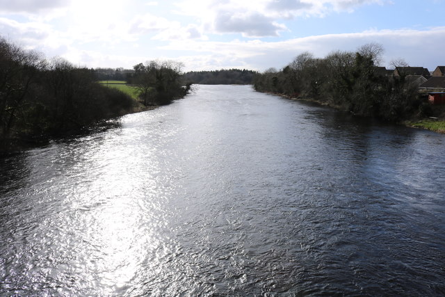
Boat Pool is a picturesque body of water located in Kirkcudbrightshire, a county in southwestern Scotland. Nestled amidst the verdant landscapes of the region, Boat Pool is a popular destination for both locals and tourists seeking a tranquil escape in nature.

This natural freshwater feature is often referred to as a lake, although its size is more akin to that of a pool or pond. It spans an area of approximately 10 hectares, with a maximum depth of around 4 meters. Surrounded by lush vegetation, the pool exudes a sense of serenity and offers breathtaking views of the surrounding hills and woodlands.

Boat Pool is home to a diverse range of flora and fauna, making it a haven for nature enthusiasts. The surrounding marshlands provide a habitat for numerous species of wetland plants, including reeds and water lilies. These plants, in turn, attract a variety of bird species, such as herons, grebes, and ducks, which can often be spotted gracefully gliding across the water's surface.

The pool is also a popular spot for recreational activities such as fishing and boating. Anglers can try their luck at catching trout, pike, and perch, among other freshwater fish species. Additionally, the calm and tranquil waters of Boat Pool make it an ideal location for kayaking and canoeing, allowing visitors to explore its scenic beauty from a different perspective.

Overall, Boat Pool in Kirkcudbrightshire offers a serene and idyllic setting, where visitors can immerse themselves in the beauty of nature and enjoy a range of outdoor activities in a peaceful environment.

If you have any feedback on the listing, please let us know in the comments section below.
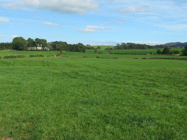
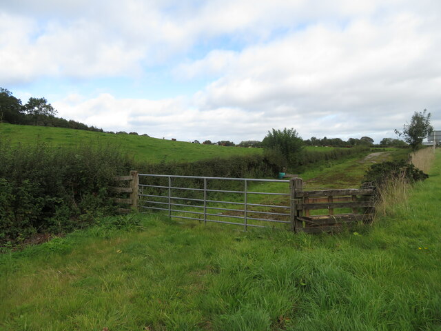
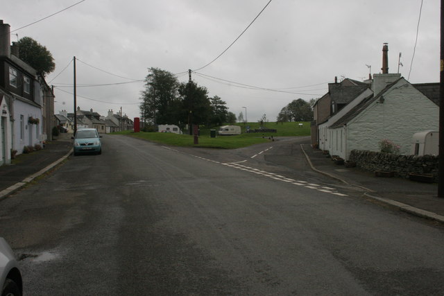
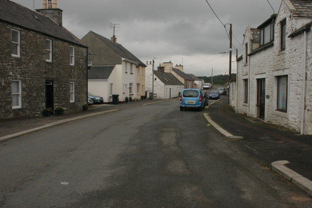
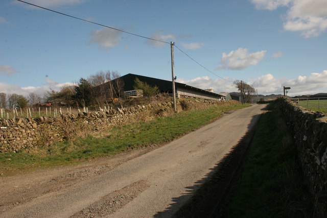
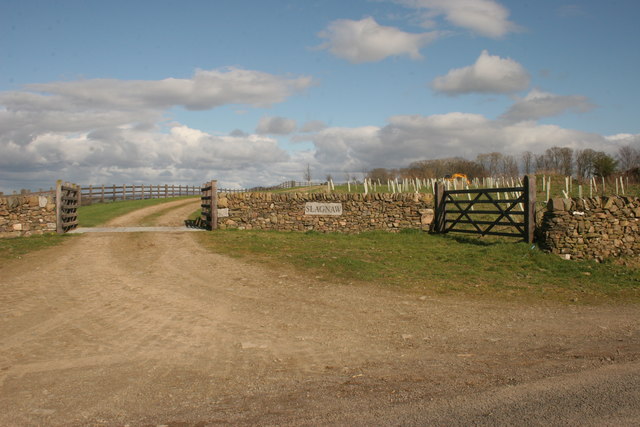
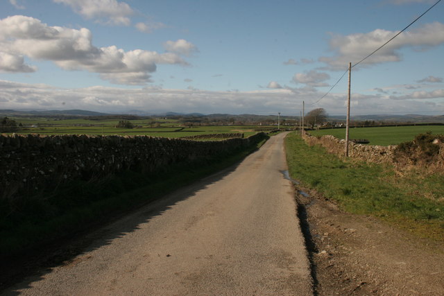
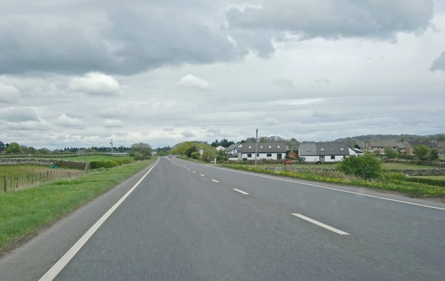
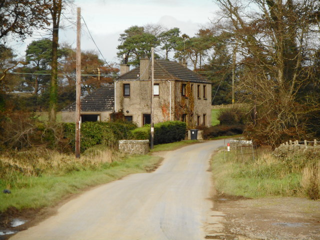
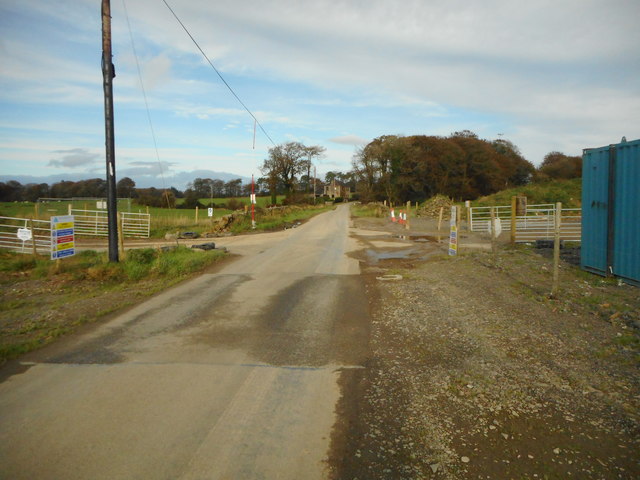
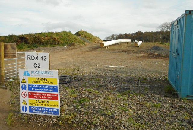
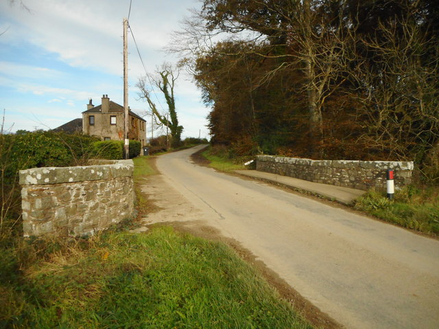
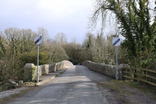
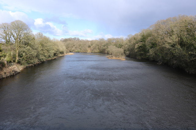
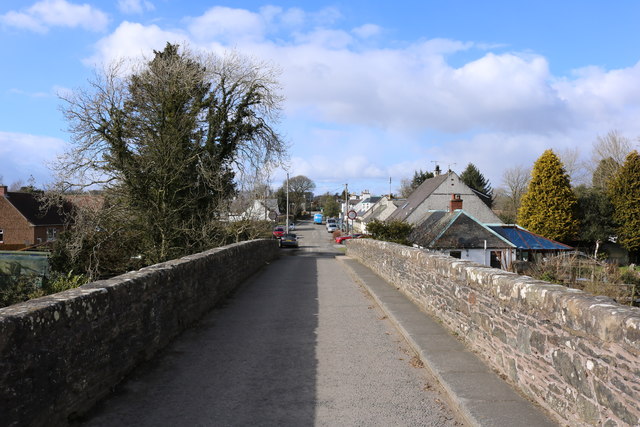
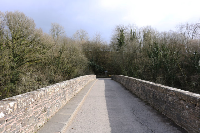
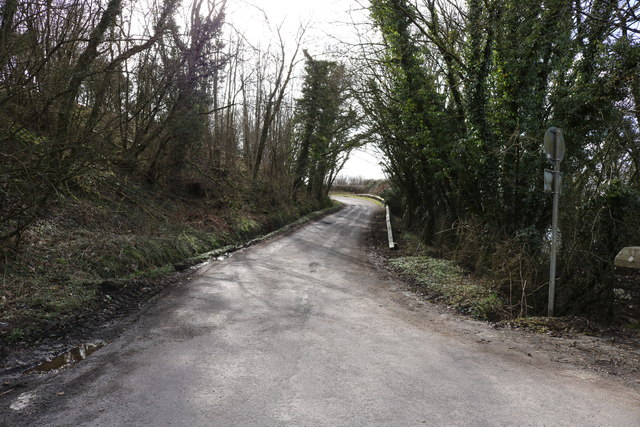
Boat Pool Images

Images are sourced within 2km of 54.917847/-3.9773859 or Grid Reference NX7359. Thanks to Geograph Open Source API. All images are credited.

Grassland near Bellrigg Typical Galloway scenery with lush pastures near Bellrigg Farm.
Grassland near Bellrigg
Typical Galloway scenery with lush pastures near Bellrigg Farm.
Old road alignment near Bridge of Dee A tidying up of the A75 through verdant fields.
Old road alignment near Bridge of Dee
A tidying up of the A75 through verdant fields.
Threave Road, Rhonehouse Rhonehouse is also known as Kelton Hill. The road to the right leads to Bridge of Dee.
Threave Road, Rhonehouse
Rhonehouse is also known as Kelton Hill. The road to the right leads to Bridge of Dee.
Threave Road, Rhonehouse Looking towards Threave.
Threave Road, Rhonehouse
Looking towards Threave.
Slagnaw Farm
Slagnaw Farm
New entrance to Slagnaw This new entrance does not yet appear on the map.
New entrance to Slagnaw
This new entrance does not yet appear on the map.
Road north of Slagnaw
A75, Stranraer to Dumfries Near Bridge of Dee
A75, Stranraer to Dumfries
Near Bridge of Dee
Kelterne Beside Arkland Bridge.
Kelterne
Beside Arkland Bridge.
Pipe works near Arkland Bridge A new gas pipeline is being constructed and will cross the road at this point.
Pipe works near Arkland Bridge
A new gas pipeline is being constructed and will cross the road at this point.
Pipeline construction work near Arkland Bridge Health and Safety warning signs beside the works.
Pipeline construction work near Arkland Bridge
Health and Safety warning signs beside the works.
Arkland Bridge The bridge crosses the Auchlane Burn. Kelterne is in the distance.
Arkland Bridge
The bridge crosses the Auchlane Burn. Kelterne is in the distance.
Old Bridge of Dee
Old Bridge of Dee
River Dee
River Dee
Old Bridge of Dee
Old Bridge of Dee
Old Bridge of Dee
Old Bridge of Dee
River Dee
River Dee
Road to Rhonehouse
Road to Rhonehouse
Show me another place!

Boat Pool is located at Grid Ref: NX7359 (Lat: 54.917847, Lng: -3.9773859)

Unitary Authority: Dumfries and Galloway

Police Authority: Dumfries and Galloway

What 3 Words

///heads.stealthier.amused. Near Castle Douglas, Dumfries & Galloway

Related Wikis

Bridge of Dee, Galloway

Bridge of Dee, Galloway is a settlement on the River Dee, Galloway. It lies on the A75 just west of Castle Douglas, and north-east of Kirkcudbright. The...

Bridge of Dee railway station

Bridge of Dee railway station served the settlement of Bridge of Dee, Dumfries and Galloway, Scotland from 1864 to 1949 on the Kirkcudbright Railway....

Threave Gardens

Threave Garden and Estate is a series of gardens owned and managed by the National Trust for Scotland, located near Castle Douglas in the historical county...

Threave Castle

Threave Castle is situated on an island in the River Dee, 2.5 kilometres (1.6 mi) west of Castle Douglas in the historical county of Kirkcudbrightshire...

Carlingwark Loch

Carlingwark Loch is a small freshwater loch in the historical county of Kirkcudbrightshire, Dumfries and Galloway, Scotland lying just south of Castle...

Threave Rovers F.C.

Threave Rovers Football Club are a football club from Castle Douglas in Dumfries and Galloway, Scotland. Formed in October 1953, the club plays its home...

The Fullarton

The Fullarton is a performing arts theatre and entertainment venue in the town of Castle Douglas in the historical county of Kirkcudbrightshire in Dumfries...

Airieland

Airieland is a farm in the historical county of Kirkcudbrightshire, in the Scottish council area of Dumfries and Galloway. It is found 3 miles (5 km) south...

Nearby Amenities

Located within 500m of 54.917847,-3.9773859
Bus Stop
Village
Naptan AtcoCode: 680000047501
Naptan Bearing: NE
Naptan CommonName: Village
Naptan Indicator: Shelter
Naptan Landmark: Shelter
Naptan NaptanCode: 34236485
Naptan Notes: none
Naptan Street: Park Road
Naptan Verified: no
Source: naptan_import
Lat/Long: 54.919686/-3.9784214
Village
Naptan AtcoCode: 680000047502
Naptan Bearing: SW
Naptan BusStopType: CUS
Naptan CommonName: Village
Naptan Indicator: Opp Shelter
Naptan NaptanCode: 34238959
Naptan Street: Park Road
Naptan Verified: no
Source: naptan_import
Lat/Long: 54.9196157/-3.9783243
Bridge of Dee
Abandoned Railway: station
Operator: Glasgow and South Western Railway
Railway: site
Lat/Long: 54.9210022/-3.9803556
Post Box
Lat/Long: 54.9191277/-3.9774541
Bridge of Dee
Name Sco: Brig o Dee
Place: village
Lat/Long: 54.9200218/-3.9767353
Source: OS OpenData Vectormap District
Lat/Long: 54.916577/-3.9797922
Source: OS OpenData Vectormap District
Lat/Long: 54.9165873/-3.9797498
Source: OS OpenData Vectormap District
Lat/Long: 54.9165834/-3.9797312
Source: OS OpenData Vectormap District
Lat/Long: 54.9165639/-3.9797092
Source: OS OpenData Vectormap District
Lat/Long: 54.9165287/-3.9797095
Source: OS OpenData Vectormap District
Lat/Long: 54.9165132/-3.9796949
Source: OS OpenData Vectormap District
Lat/Long: 54.9165119/-3.9796592
Source: OS OpenData Vectormap District
Lat/Long: 54.9166527/-3.9794416
Source: OS OpenData Vectormap District
Lat/Long: 54.9166984/-3.9794501
Source: OS OpenData Vectormap District
Lat/Long: 54.9168207/-3.979336
Source: OS OpenData Vectormap District
Lat/Long: 54.9169068/-3.9791826
Source: OS OpenData Vectormap District
Lat/Long: 54.9170222/-3.9790525
Source: OS OpenData Vectormap District
Lat/Long: 54.9171802/-3.978764
Source: OS OpenData Vectormap District
Lat/Long: 54.9172392/-3.9786748
Source: OS OpenData Vectormap District
Lat/Long: 54.9173088/-3.9783739
Source: OS OpenData Vectormap District
Lat/Long: 54.9173893/-3.9782312
Source: OS OpenData Vectormap District
Lat/Long: 54.9174474/-3.9780874
Source: OS OpenData Vectormap District
Lat/Long: 54.9174446/-3.9779812
Source: OS OpenData Vectormap District
Lat/Long: 54.9174546/-3.9779224
Source: OS OpenData Vectormap District
Lat/Long: 54.9174986/-3.9778153
Source: OS OpenData Vectormap District
Lat/Long: 54.9175123/-3.9778004
Source: OS OpenData Vectormap District
Lat/Long: 54.9175338/-3.9778045
Source: OS OpenData Vectormap District
Lat/Long: 54.9175486/-3.9777815
Source: OS OpenData Vectormap District
Lat/Long: 54.9175639/-3.9776373
Source: OS OpenData Vectormap District
Lat/Long: 54.917672/-3.9772948
Source: OS OpenData Vectormap District
Lat/Long: 54.9176878/-3.9770191
Source: OS OpenData Vectormap District
Lat/Long: 54.9177005/-3.9769748
Source: OS OpenData Vectormap District
Lat/Long: 54.9177576/-3.9768918
Source: OS OpenData Vectormap District
Lat/Long: 54.9177792/-3.9768336
Source: OS OpenData Vectormap District
Lat/Long: 54.9178/-3.9766614
Source: OS OpenData Vectormap District
Lat/Long: 54.9178344/-3.9765351
Source: OS OpenData Vectormap District
Lat/Long: 54.9178641/-3.9763649
Source: OS OpenData Vectormap District
Lat/Long: 54.9178675/-3.976323
Source: OS OpenData Vectormap District
Lat/Long: 54.9178595/-3.9762102
Source: OS OpenData Vectormap District
Lat/Long: 54.9179445/-3.9759392
Source: OS OpenData Vectormap District
Lat/Long: 54.9179716/-3.9758912
Source: OS OpenData Vectormap District
Lat/Long: 54.9179847/-3.9758591
Source: OS OpenData Vectormap District
Lat/Long: 54.9180153/-3.9758606
Source: OS OpenData Vectormap District
Lat/Long: 54.9180432/-3.9757995
Source: OS OpenData Vectormap District
Lat/Long: 54.9180492/-3.9757077
Source: OS OpenData Vectormap District
Lat/Long: 54.9181527/-3.9754803
Source: OS OpenData Vectormap District
Lat/Long: 54.9182576/-3.9751607
Source: OS OpenData Vectormap District
Lat/Long: 54.9182944/-3.9750936
Source: OS OpenData Vectormap District
Lat/Long: 54.9183337/-3.9749321
Source: OS OpenData Vectormap District
Lat/Long: 54.9183868/-3.97476
Source: OS OpenData Vectormap District
Lat/Long: 54.9184155/-3.9747083
Source: OS OpenData Vectormap District
Lat/Long: 54.9184717/-3.9745675
Source: OS OpenData Vectormap District
Lat/Long: 54.9184799/-3.9745648
Source: OS OpenData Vectormap District
Lat/Long: 54.9185495/-3.9743747
Source: OS OpenData Vectormap District
Lat/Long: 54.9185464/-3.9742341
Source: OS OpenData Vectormap District
Lat/Long: 54.9185579/-3.9741863
Source: OS OpenData Vectormap District
Lat/Long: 54.91857/-3.9741635
Source: OS OpenData Vectormap District
Lat/Long: 54.9185808/-3.9741625
Source: OS OpenData Vectormap District
Lat/Long: 54.9160311/-3.983039
Source: OS OpenData Vectormap District
Lat/Long: 54.9159563/-3.9831499
Source: OS OpenData Vectormap District
Lat/Long: 54.915924/-3.9831436
Source: OS OpenData Vectormap District
Lat/Long: 54.9158712/-3.9831863
Source: OS OpenData Vectormap District
Lat/Long: 54.9157856/-3.9833084
Source: OS OpenData Vectormap District
Lat/Long: 54.9157744/-3.9833375
Source: OS OpenData Vectormap District
Lat/Long: 54.9156487/-3.9834905
Source: OS OpenData Vectormap District
Lat/Long: 54.9156352/-3.9835476
Source: OS OpenData Vectormap District
Lat/Long: 54.9155688/-3.9836504
Source: OS OpenData Vectormap District
Lat/Long: 54.9155182/-3.983832
Source: OS OpenData Vectormap District
Lat/Long: 54.9154529/-3.9839802
Source: OS OpenData Vectormap District
Lat/Long: 54.915786/-3.9840012
Source: OS OpenData Vectormap District
Lat/Long: 54.9158401/-3.9839383
Source: OS OpenData Vectormap District
Lat/Long: 54.9159162/-3.9837892
Source: OS OpenData Vectormap District
Lat/Long: 54.9159284/-3.983704
Source: OS OpenData Vectormap District
Lat/Long: 54.9159415/-3.9836718
Source: OS OpenData Vectormap District
Lat/Long: 54.9159821/-3.9836629
Source: OS OpenData Vectormap District
Lat/Long: 54.9160214/-3.9836789
Source: OS OpenData Vectormap District
Lat/Long: 54.9160404/-3.9836673
Source: OS OpenData Vectormap District
Lat/Long: 54.9160481/-3.9835804
Source: OS OpenData Vectormap District
Lat/Long: 54.9160629/-3.9835546
Source: OS OpenData Vectormap District
Lat/Long: 54.9160993/-3.9835267
Source: OS OpenData Vectormap District
Lat/Long: 54.9161126/-3.9834837
Source: OS OpenData Vectormap District
Lat/Long: 54.9161113/-3.9834571
Source: OS OpenData Vectormap District
Lat/Long: 54.9160849/-3.9833668
Source: OS OpenData Vectormap District
Lat/Long: 54.9160241/-3.9833451
Source: OS OpenData Vectormap District
Lat/Long: 54.9160189/-3.9833324
Source: OS OpenData Vectormap District
Lat/Long: 54.9160301/-3.9833095
Source: OS OpenData Vectormap District
Lat/Long: 54.9160617/-3.9832986
Source: OS OpenData Vectormap District
Lat/Long: 54.9160656/-3.9832832
Source: OS OpenData Vectormap District
Lat/Long: 54.9160508/-3.9830427
Source: OS OpenData Vectormap District
Lat/Long: 54.9161371/-3.9837439
Source: OS OpenData Vectormap District
Lat/Long: 54.9160912/-3.9838025
Source: OS OpenData Vectormap District
Lat/Long: 54.916055/-3.9838179
Source: OS OpenData Vectormap District
Lat/Long: 54.9159967/-3.9838649
Source: OS OpenData Vectormap District
Lat/Long: 54.9159762/-3.9839154
Source: OS OpenData Vectormap District
Lat/Long: 54.9159551/-3.9839362
Source: OS OpenData Vectormap District
Lat/Long: 54.9159129/-3.9839388
Source: OS OpenData Vectormap District
Lat/Long: 54.9158878/-3.9839844
Source: OS OpenData Vectormap District
Lat/Long: 54.9158876/-3.9840515
Source: OS OpenData Vectormap District
Lat/Long: 54.9158781/-3.9840838
Source: OS OpenData Vectormap District
Lat/Long: 54.9157217/-3.9842493
Source: OS OpenData Vectormap District
Lat/Long: 54.916132/-3.984388
Source: OS OpenData Vectormap District
Lat/Long: 54.9161375/-3.984329
Source: OS OpenData Vectormap District
Lat/Long: 54.9161228/-3.9842393
Source: OS OpenData Vectormap District
Lat/Long: 54.9161369/-3.9841449
Source: OS OpenData Vectormap District
Lat/Long: 54.9161464/-3.9839503
Source: OS OpenData Vectormap District
Lat/Long: 54.9161384/-3.9838859
Source: OS OpenData Vectormap District
Lat/Long: 54.9161512/-3.9838163
Source: OS OpenData Vectormap District
Lat/Long: 54.9161495/-3.983757
Source: OS OpenData Vectormap District
Lat/Long: 54.9210195/-3.9720292
Source: OS OpenData Vectormap District
Lat/Long: 54.9208747/-3.9722031
Source: OS OpenData Vectormap District
Lat/Long: 54.9207932/-3.9722397
Source: OS OpenData Vectormap District
Lat/Long: 54.9207581/-3.9722411
Source: OS OpenData Vectormap District
Lat/Long: 54.9207207/-3.972272
Source: OS OpenData Vectormap District
Lat/Long: 54.9206797/-3.9723637
Source: OS OpenData Vectormap District
Lat/Long: 54.9206839/-3.972381
Source: OS OpenData Vectormap District
Lat/Long: 54.9206772/-3.9724088
Source: OS OpenData Vectormap District
Lat/Long: 54.9206587/-3.9724407
Source: OS OpenData Vectormap District
Lat/Long: 54.9206213/-3.9724763
Source: OS OpenData Vectormap District
Lat/Long: 54.9205565/-3.9725886
Source: OS OpenData Vectormap District
Lat/Long: 54.920558/-3.9726089
Source: OS OpenData Vectormap District
Lat/Long: 54.9205477/-3.9726365
Source: OS OpenData Vectormap District
Lat/Long: 54.9204779/-3.9726721
Source: OS OpenData Vectormap District
Lat/Long: 54.9204623/-3.9726917
Source: OS OpenData Vectormap District
Lat/Long: 54.9204308/-3.9726917
Source: OS OpenData Vectormap District
Lat/Long: 54.9204154/-3.9727338
Source: OS OpenData Vectormap District
Lat/Long: 54.9202563/-3.9728367
Source: OS OpenData Vectormap District
Lat/Long: 54.9202285/-3.9728406
Source: OS OpenData Vectormap District
Lat/Long: 54.9201862/-3.9728158
Source: OS OpenData Vectormap District
Lat/Long: 54.9201607/-3.9728234
Source: OS OpenData Vectormap District
Lat/Long: 54.9201121/-3.9728894
Source: OS OpenData Vectormap District
Lat/Long: 54.9200767/-3.9729161
Source: OS OpenData Vectormap District
Lat/Long: 54.9200311/-3.9730039
Source: OS OpenData Vectormap District
Lat/Long: 54.920002/-3.9730126
Source: OS OpenData Vectormap District
Lat/Long: 54.9199842/-3.9730993
Source: OS OpenData Vectormap District
Lat/Long: 54.9199711/-3.9731223
Source: OS OpenData Vectormap District
Lat/Long: 54.9198165/-3.9731856
Source: OS OpenData Vectormap District
Lat/Long: 54.9197293/-3.9732655
Source: OS OpenData Vectormap District
Lat/Long: 54.9197138/-3.973302
Source: OS OpenData Vectormap District
Lat/Long: 54.9196718/-3.9733435
Source: OS OpenData Vectormap District
Lat/Long: 54.9196217/-3.9734776
Source: OS OpenData Vectormap District
Lat/Long: 54.9196257/-3.9735121
Source: OS OpenData Vectormap District
Lat/Long: 54.9196417/-3.9735222
Source: OS OpenData Vectormap District
Lat/Long: 54.9196356/-3.9735625
Source: OS OpenData Vectormap District
Lat/Long: 54.9195977/-3.9736277
Source: OS OpenData Vectormap District
Lat/Long: 54.9195909/-3.9736602
Source: OS OpenData Vectormap District
Lat/Long: 54.919596/-3.9736776
Source: OS OpenData Vectormap District
Lat/Long: 54.9196286/-3.9736651
Source: OS OpenData Vectormap District
Lat/Long: 54.9196507/-3.9736834
Source: OS OpenData Vectormap District
Lat/Long: 54.9196583/-3.9737134
Source: OS OpenData Vectormap District
Lat/Long: 54.9196496/-3.9737551
Source: OS OpenData Vectormap District
Lat/Long: 54.9196238/-3.9737913
Source: OS OpenData Vectormap District
Lat/Long: 54.9195601/-3.9738397
Source: OS OpenData Vectormap District
Lat/Long: 54.9195242/-3.973891
Source: OS OpenData Vectormap District
Lat/Long: 54.9193161/-3.9744207
Source: OS OpenData Vectormap District
Lat/Long: 54.9192059/-3.9746228
Source: OS OpenData Vectormap District
Lat/Long: 54.9191848/-3.9746998
Source: OS OpenData Vectormap District
Lat/Long: 54.9191271/-3.9747656
Source: OS OpenData Vectormap District
Lat/Long: 54.9190612/-3.974895
Source: OS OpenData Vectormap District
Lat/Long: 54.9189552/-3.9752222
Source: OS OpenData Vectormap District
Lat/Long: 54.9189158/-3.9752718
Source: OS OpenData Vectormap District
Lat/Long: 54.9188465/-3.9753901
Source: OS OpenData Vectormap District
Lat/Long: 54.9188192/-3.9755167
Source: OS OpenData Vectormap District
Lat/Long: 54.9187732/-3.9755815
Source: OS OpenData Vectormap District
Lat/Long: 54.9187249/-3.9756937
Source: OS OpenData Vectormap District
Lat/Long: 54.9186161/-3.9759014
Source: OS OpenData Vectormap District
Lat/Long: 54.9185431/-3.976063
Source: OS OpenData Vectormap District
Lat/Long: 54.9184368/-3.9763524
Source: OS OpenData Vectormap District
Lat/Long: 54.9184184/-3.9764289
Source: OS OpenData Vectormap District
Lat/Long: 54.9183284/-3.9768775
Source: OS OpenData Vectormap District
Lat/Long: 54.918287/-3.9770198
Source: OS OpenData Vectormap District
Lat/Long: 54.9182413/-3.9772254
Source: OS OpenData Vectormap District
Lat/Long: 54.9181583/-3.9774154
Source: OS OpenData Vectormap District
Lat/Long: 54.918024/-3.9778504
Source: OS OpenData Vectormap District
Lat/Long: 54.917917/-3.9781292
Source: OS OpenData Vectormap District
Lat/Long: 54.9178874/-3.9782416
Source: OS OpenData Vectormap District
Lat/Long: 54.9178449/-3.9783328
Source: OS OpenData Vectormap District
Lat/Long: 54.9177402/-3.9786423
Source: OS OpenData Vectormap District
Lat/Long: 54.9174013/-3.9795529
Source: OS OpenData Vectormap District
Lat/Long: 54.9173059/-3.9798353
Source: OS OpenData Vectormap District
Lat/Long: 54.9171661/-3.9803743
Source: OS OpenData Vectormap District
Lat/Long: 54.917149/-3.9804731
Source: OS OpenData Vectormap District
Lat/Long: 54.9171325/-3.9807165
Source: OS OpenData Vectormap District
Lat/Long: 54.9170955/-3.9807734
Source: OS OpenData Vectormap District
Lat/Long: 54.9170904/-3.9808747
Source: OS OpenData Vectormap District
Lat/Long: 54.9170808/-3.9809118
Source: OS OpenData Vectormap District
Lat/Long: 54.9170177/-3.9809576
Source: OS OpenData Vectormap District
Lat/Long: 54.9169884/-3.9810004
Source: OS OpenData Vectormap District
Lat/Long: 54.9169538/-3.981107
Source: OS OpenData Vectormap District
Lat/Long: 54.9169588/-3.9811371
Source: OS OpenData Vectormap District
Lat/Long: 54.9169788/-3.9811552
Source: OS OpenData Vectormap District
Lat/Long: 54.9170304/-3.9811528
Source: OS OpenData Vectormap District
Lat/Long: 54.9170388/-3.9812086
Source: OS OpenData Vectormap District
Lat/Long: 54.9170311/-3.98128
Source: OS OpenData Vectormap District
Lat/Long: 54.9169589/-3.9814265
Source: OS OpenData Vectormap District
Lat/Long: 54.9169339/-3.9815545
Source: OS OpenData Vectormap District
Lat/Long: 54.9169361/-3.9816184
Source: OS OpenData Vectormap District
Lat/Long: 54.9169188/-3.9817062
Source: OS OpenData Vectormap District
Lat/Long: 54.9168716/-3.9818357
Source: OS OpenData Vectormap District
Lat/Long: 54.9168446/-3.9820656
Source: OS OpenData Vectormap District
Lat/Long: 54.9168291/-3.9821241
Source: OS OpenData Vectormap District
Lat/Long: 54.9167766/-3.9821935
Source: OS OpenData Vectormap District
Lat/Long: 54.916757/-3.9822414
Source: OS OpenData Vectormap District
Lat/Long: 54.9167114/-3.9824694
Source: OS OpenData Vectormap District
Lat/Long: 54.9166148/-3.9827151
Source: OS OpenData Vectormap District
Lat/Long: 54.9165774/-3.9828965
Source: OS OpenData Vectormap District
Lat/Long: 54.9165517/-3.9831007
Source: OS OpenData Vectormap District
Lat/Long: 54.9165329/-3.9834195
Source: OS OpenData Vectormap District
Lat/Long: 54.9165342/-3.9838636
Source: OS OpenData Vectormap District
Lat/Long: 54.9165143/-3.984334
Source: OS OpenData Vectormap District
Lat/Long: 54.9164929/-3.9845805
Source: OS OpenData Vectormap District
Lat/Long: 54.9151602/-3.9834103
Source: OS OpenData Vectormap District
Lat/Long: 54.9151829/-3.9833958
Source: OS OpenData Vectormap District
Lat/Long: 54.9152148/-3.9833116
Source: OS OpenData Vectormap District
Lat/Long: 54.9152766/-3.9832194
Source: OS OpenData Vectormap District
Lat/Long: 54.9153618/-3.9830645
Source: OS OpenData Vectormap District
Lat/Long: 54.9154267/-3.9828867
Source: OS OpenData Vectormap District
Lat/Long: 54.9154979/-3.9827886
Source: OS OpenData Vectormap District
Lat/Long: 54.9156401/-3.9826226
Source: OS OpenData Vectormap District
Lat/Long: 54.915679/-3.982548
Source: OS OpenData Vectormap District
Lat/Long: 54.9157242/-3.9824223
Source: OS OpenData Vectormap District
Lat/Long: 54.9157414/-3.9824169
Source: OS OpenData Vectormap District
Lat/Long: 54.9157791/-3.9822549
Source: OS OpenData Vectormap District
Lat/Long: 54.9158213/-3.982204
Source: OS OpenData Vectormap District
Lat/Long: 54.9158412/-3.9820833
Source: OS OpenData Vectormap District
Lat/Long: 54.9158974/-3.9818925
Source: OS OpenData Vectormap District
Lat/Long: 54.9159195/-3.9816362
Source: OS OpenData Vectormap District
Lat/Long: 54.9159388/-3.981556
Source: OS OpenData Vectormap District
Lat/Long: 54.9159706/-3.981478
Source: OS OpenData Vectormap District
Lat/Long: 54.9160688/-3.9813003
Source: OS OpenData Vectormap District
Lat/Long: 54.9160788/-3.9811837
Source: OS OpenData Vectormap District
Lat/Long: 54.9161494/-3.9808878
Source: OS OpenData Vectormap District
Lat/Long: 54.9161466/-3.9807639
Source: OS OpenData Vectormap District
Lat/Long: 54.916168/-3.9805908
Source: OS OpenData Vectormap District
Lat/Long: 54.9161847/-3.9805558
Source: OS OpenData Vectormap District
Lat/Long: 54.9162426/-3.9805048
Source: OS OpenData Vectormap District
Lat/Long: 54.9163084/-3.9803331
Source: OS OpenData Vectormap District
Lat/Long: 54.9163716/-3.9802496
Source: OS OpenData Vectormap District
Lat/Long: 54.9164242/-3.9800818
Source: OS OpenData Vectormap District
Lat/Long: 54.9164782/-3.9800122
Source: OS OpenData Vectormap District
Lat/Long: 54.9165017/-3.9799408
Source: OS OpenData Vectormap District
Lat/Long: 54.9185988/-3.9742149
Source: OS OpenData Vectormap District
Lat/Long: 54.9186531/-3.9741893
Source: OS OpenData Vectormap District
Lat/Long: 54.9186605/-3.9741155
Source: OS OpenData Vectormap District
Lat/Long: 54.9187047/-3.9740475
Source: OS OpenData Vectormap District
Lat/Long: 54.9187322/-3.9739614
Source: OS OpenData Vectormap District
Lat/Long: 54.918778/-3.9739059
Source: OS OpenData Vectormap District
Lat/Long: 54.9187894/-3.9738659
Source: OS OpenData Vectormap District
Lat/Long: 54.918819/-3.9738174
Source: OS OpenData Vectormap District
Lat/Long: 54.9188481/-3.9737955
Source: OS OpenData Vectormap District
Lat/Long: 54.9188629/-3.9737697
Source: OS OpenData Vectormap District
Lat/Long: 54.9188745/-3.9737187
Source: OS OpenData Vectormap District
Lat/Long: 54.9188856/-3.9735913
Source: OS OpenData Vectormap District
Lat/Long: 54.9188427/-3.9735221
Source: OS OpenData Vectormap District
Lat/Long: 54.9188509/-3.9734008
Source: OS OpenData Vectormap District
Lat/Long: 54.9188736/-3.9733333
Source: OS OpenData Vectormap District
Lat/Long: 54.9189385/-3.9732662
Source: OS OpenData Vectormap District
Lat/Long: 54.9189339/-3.9732176
Source: OS OpenData Vectormap District
Lat/Long: 54.9189427/-3.9731759
Source: OS OpenData Vectormap District
Lat/Long: 54.9189982/-3.9730226
Source: OS OpenData Vectormap District
Lat/Long: 54.9190731/-3.9728921
Source: OS OpenData Vectormap District
Lat/Long: 54.9191229/-3.9729242
Source: OS OpenData Vectormap District
Lat/Long: 54.9191449/-3.9729533
Source: OS OpenData Vectormap District
Lat/Long: 54.9191603/-3.9730009
Source: OS OpenData Vectormap District
Lat/Long: 54.919146/-3.9731079
Source: OS OpenData Vectormap District
Lat/Long: 54.9191509/-3.9731955
Source: OS OpenData Vectormap District
Lat/Long: 54.9191686/-3.973212
Source: OS OpenData Vectormap District
Lat/Long: 54.9191903/-3.9732005
Source: OS OpenData Vectormap District
Lat/Long: 54.9193278/-3.9728702
Source: OS OpenData Vectormap District
Lat/Long: 54.9194887/-3.9724271
Source: OS OpenData Vectormap District
Lat/Long: 54.9195906/-3.9722979
Source: OS OpenData Vectormap District
Lat/Long: 54.9196083/-3.9722582
Source: OS OpenData Vectormap District
Lat/Long: 54.9196342/-3.9721565
Source: OS OpenData Vectormap District
Lat/Long: 54.9196671/-3.9721222
Source: OS OpenData Vectormap District
Lat/Long: 54.9197747/-3.9720822
Source: OS OpenData Vectormap District
Lat/Long: 54.9198901/-3.9720629
Source: OS OpenData Vectormap District
Lat/Long: 54.9200418/-3.9720719
Source: OS OpenData Vectormap District
Lat/Long: 54.9201593/-3.9719746
Source: OS OpenData Vectormap District
Lat/Long: 54.9201989/-3.9719735
Source: OS OpenData Vectormap District
Lat/Long: 54.9202309/-3.9719953
Source: OS OpenData Vectormap District
Lat/Long: 54.920275/-3.9719928
Source: OS OpenData Vectormap District
Lat/Long: 54.9204153/-3.971931
Source: OS OpenData Vectormap District
Lat/Long: 54.920439/-3.9719134
Source: OS OpenData Vectormap District
Lat/Long: 54.9204877/-3.9718425
Source: OS OpenData Vectormap District
Lat/Long: 54.9206305/-3.9717386
Source: OS OpenData Vectormap District
Lat/Long: 54.9207706/-3.9715801
Power: pole
Lat/Long: 54.913912/-3.9745329
Power: pole
Lat/Long: 54.9149121/-3.9758373
Power: pole
Lat/Long: 54.9154066/-3.9765341
Power: pole
Lat/Long: 54.9161332/-3.977556
Power: pole
Lat/Long: 54.9168549/-3.9785779
Power: pole
Lat/Long: 54.9175399/-3.9795317
Power: pole
Lat/Long: 54.9179416/-3.9798674
Power: pole
Lat/Long: 54.9182456/-3.9801117
Power: pole
Lat/Long: 54.9142747/-3.9766212
Power: pole
Lat/Long: 54.9135969/-3.9774498
Power: pole
Lat/Long: 54.9191382/-3.9811718
Power: pole
Lat/Long: 54.9196864/-3.9819515
Power: pole
Lat/Long: 54.9200258/-3.9824465
Power: pole
Lat/Long: 54.9203897/-3.9829925
Power: pole
Lat/Long: 54.9200673/-3.9841779
Power: pole
Lat/Long: 54.9184727/-3.9697688
Power: pole
Lat/Long: 54.9185936/-3.9705442
Power: pole
Lat/Long: 54.9188195/-3.9720228
The data included in this document is from www.openstreetmap.org. The data is made available under ODbL.

Have you been to Boat Pool?

Leave your review of Boat Pool below (or comments, questions and feedback).