Aval Pool

Lake, Pool, Pond, Freshwater Marsh in Kirkcudbrightshire

Scotland

Aval Pool

Tongland Dam in 1988 A guided tour including the foot of the dam
Tongland Dam in 1988 Credit: Kevin Waterhouse

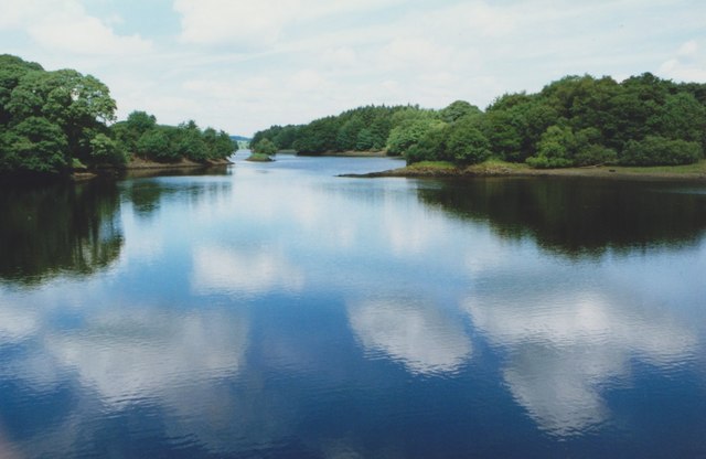
Aval Pool is a picturesque freshwater marsh located in Kirkcudbrightshire, Scotland. Nestled amidst rolling hills and lush greenery, this enchanting pool is a haven for both wildlife enthusiasts and nature lovers.

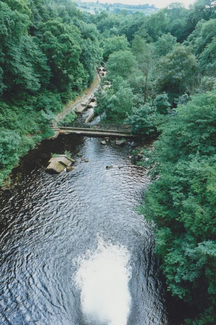
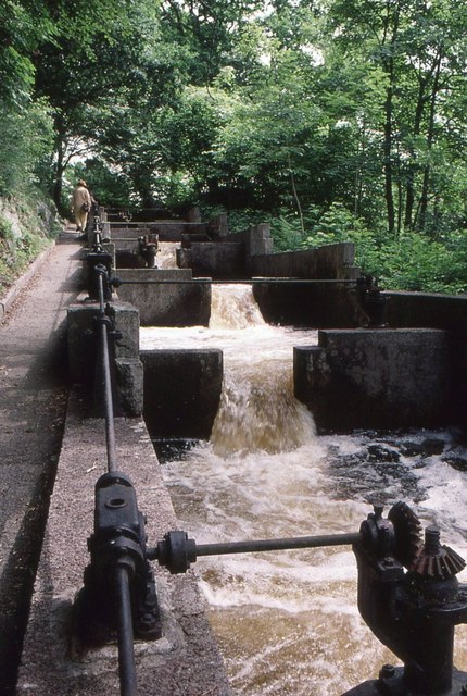
Stretching over a sprawling area, Aval Pool is a natural formation that serves as a habitat for various species of birds, aquatic plants, and small animals. The pool is renowned for its diverse ecosystem, which includes reed beds, open water, and marshy areas. These different habitats provide a rich and varied environment for a wide range of flora and fauna.

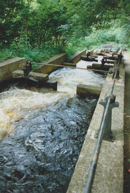
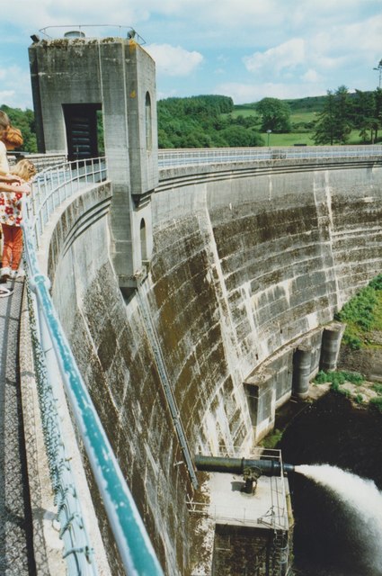
The pool itself is fed by several small streams and springs, ensuring a constant supply of fresh water. This abundance of water attracts numerous bird species, making Aval Pool a popular destination for birdwatchers. Visitors can spot a variety of waterbirds such as swans, ducks, and herons, as well as smaller passerines that dwell in the surrounding trees and shrubs.

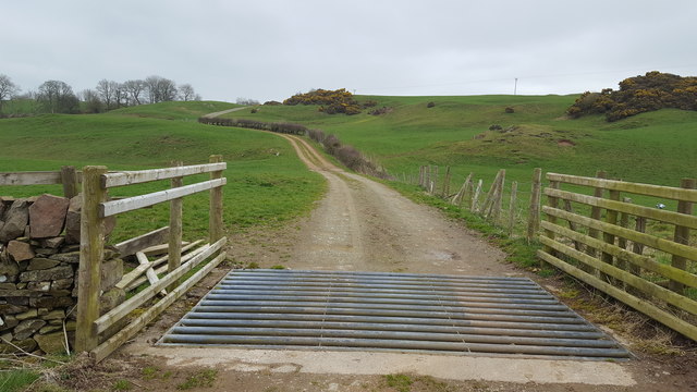
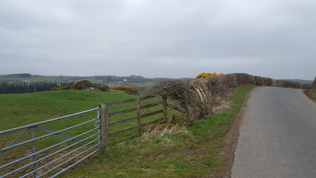
The surrounding landscape around Aval Pool offers stunning views and ample opportunities for recreational activities. There are well-maintained walking trails that allow visitors to explore the area and soak in the natural beauty. The peaceful atmosphere and tranquil surroundings make it an ideal spot for picnics, photography, and simply enjoying the serenity of nature.

Aval Pool is a true gem of Kirkcudbrightshire, offering a unique and immersive experience for those seeking a respite from the hustle and bustle of daily life. Whether you are a bird enthusiast, a nature lover, or simply seeking a peaceful retreat, Aval Pool is a destination that will leave you captivated by its beauty and biodiversity.

If you have any feedback on the listing, please let us know in the comments section below.
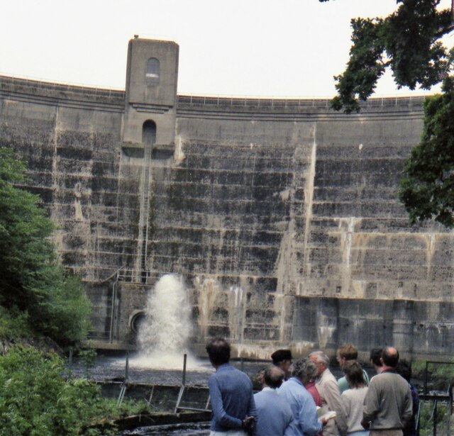
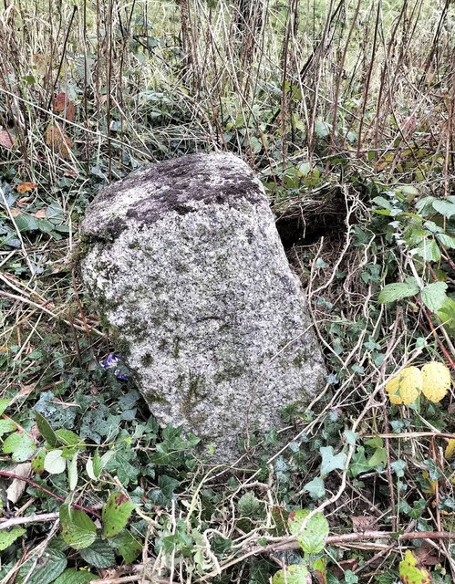
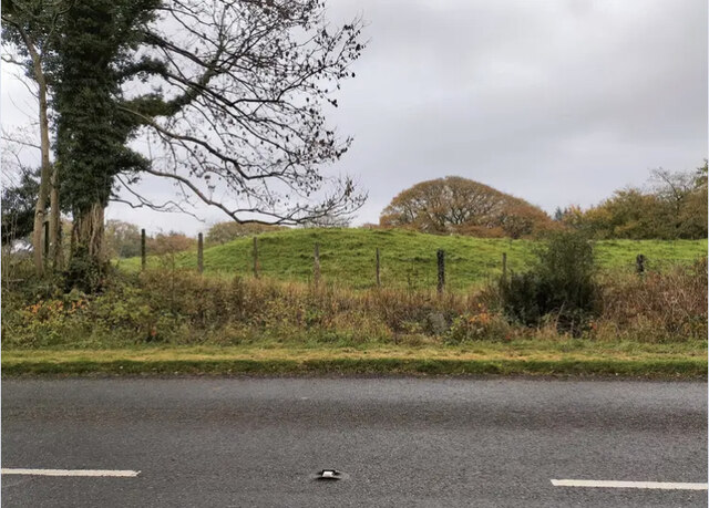
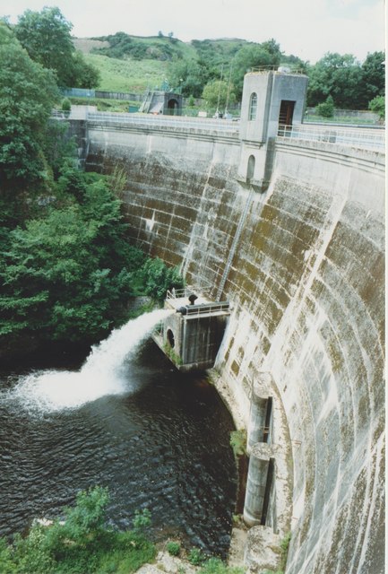
Aval Pool Images

Images are sourced within 2km of 54.880969/-4.0172648 or Grid Reference NX7055. Thanks to Geograph Open Source API. All images are credited.

Tongland Dam in 1988 A guided tour including the foot of the dam
Tongland Dam in 1988
A guided tour including the foot of the dam
Cattle near Netherthird Occupying a field in the NW corner of the grid square.
Cattle near Netherthird
Occupying a field in the NW corner of the grid square.
The road to Castle Douglas This is the minor road linking Tongland and Castle Douglas. Anyone in a hurry would be well advised to use the A711 on the other side of the Dee.
The road to Castle Douglas
This is the minor road linking Tongland and Castle Douglas. Anyone in a hurry would be well advised to use the A711 on the other side of the Dee.
Old Milestone, Kirkcudbright parish Square-shaped granite stone by the A711, in the parish of Kirkcudbright (Stewartry District). It may have been set up by the Tongland Trust.

Inscription reads:-
3

Milestone Society National ID: DG_DFKK24
Old Milestone, Kirkcudbright parish
Square-shaped granite stone by the A711, in the parish of Kirkcudbright (Stewartry District). It may have been set up by the Tongland Trust. Inscription reads:- 3 Milestone Society National ID: DG_DFKK24
Old Milestone, Kirkcudbright parish Square-shaped granite stone by the A711, in the parish of Kirkcudbright (Stewartry District). It may have been set up by the Tongland Trust. 

Inscription reads:-
3

Milestone Society National ID: DG_DFKK24
Old Milestone, Kirkcudbright parish
Square-shaped granite stone by the A711, in the parish of Kirkcudbright (Stewartry District). It may have been set up by the Tongland Trust. Inscription reads:- 3 Milestone Society National ID: DG_DFKK24
Tongland Dam The dam holds back 8.8 million cubic metres of water in Tongland Loch.
Tongland Dam
The dam holds back 8.8 million cubic metres of water in Tongland Loch.
View from Tongland Dam Looking downstream from the top of the dam wall. The water is coming out of one of the discharge pipes near the bottom of the dam.
View from Tongland Dam
Looking downstream from the top of the dam wall. The water is coming out of one of the discharge pipes near the bottom of the dam.
Tongland Loch The view from Tongland Dam looking up Tongland Loch, the narrow reservoir for the Tongland Hydro-electric scheme.
Tongland Loch
The view from Tongland Dam looking up Tongland Loch, the narrow reservoir for the Tongland Hydro-electric scheme.
Fish Pass, Tongland Dam The fish pass below the dam allows migratory fish from the River Dee to bypass the dam.
Fish Pass, Tongland Dam
The fish pass below the dam allows migratory fish from the River Dee to bypass the dam.
Tongland Dam
Tongland Dam
Fish Pass Tongland Dam A few of a series of 39 chambers making up the complete fish ladder, allowing migratory fish to ascend the River Dee.
Fish Pass Tongland Dam
A few of a series of 39 chambers making up the complete fish ladder, allowing migratory fish to ascend the River Dee.
Elvers, Fish Pass Tongland Dam Elvers (young eels) climbing up the edge of the fish pass, using the mossy walls as an easier route, rather than attempting to fight against the strong water current (seen on the right).
Elvers, Fish Pass Tongland Dam
Elvers (young eels) climbing up the edge of the fish pass, using the mossy walls as an easier route, rather than attempting to fight against the strong water current (seen on the right).
Track to Netherthird Farm The beginning of the long drive to Netherthird Farm.
Track to Netherthird Farm
The beginning of the long drive to Netherthird Farm.
Above Tongland Loch The open countryside to the east of Tongland Loch.
Above Tongland Loch
The open countryside to the east of Tongland Loch.
Netherthird Farm A track leads to open farmland at Netherthird Farm.
Netherthird Farm
A track leads to open farmland at Netherthird Farm.
Farmland near to Mayfield The track marks the edge of the field boundary and continues to the River Dee.
Farmland near to Mayfield
The track marks the edge of the field boundary and continues to the River Dee.
From Billies Bridge to Billies Farm The beginning of the track to Billies Farm.
From Billies Bridge to Billies Farm
The beginning of the track to Billies Farm.
The road at Mayfield The entrance to Mayfield farm is to the right from the main road.
The road at Mayfield
The entrance to Mayfield farm is to the right from the main road.
Show me another place!

Aval Pool is located at Grid Ref: NX7055 (Lat: 54.880969, Lng: -4.0172648)

Unitary Authority: Dumfries and Galloway

Police Authority: Dumfries and Galloway

What 3 Words

///chatters.rejoiced.compiled. Near Kirkcudbright, Dumfries & Galloway

Related Wikis

Tongland

Tongland is a small village about 2 miles (3 km) north of Kirkcudbright, in the historic county of Kirkcudbrightshire in Dumfries and Galloway, Scotland...

Tongland Abbey

Tungland or Tongland Abbey was a Premonstratensian monastic community located in Tongland in the historical county of Kirkcudbrightshire in Dumfries and...

Tarff railway station

Tarff railway station served the village of Ringford, Dumfries and Galloway, Scotland from 1864 to 1965 on the Kirkcudbright Railway. == History == The...

Ringford

Ringford is a village in the historical county of Kirkcudbrightshire in Dumfries and Galloway located at grid reference NX689578 beside the Tarff Water...

Twynholm

Twynholm () is a village in Scotland. It is located 2+1⁄4 miles (3.6 km) north-northwest of Kirkcudbright and 4+1⁄2 miles (7.2 km) east of Gatehouse of...

Bridge of Dee, Galloway

Bridge of Dee, Galloway is a settlement on the River Dee, Galloway. It lies on the A75 just west of Castle Douglas, and north-east of Kirkcudbright. The...

Bridge of Dee railway station

Bridge of Dee railway station served the settlement of Bridge of Dee, Dumfries and Galloway, Scotland from 1864 to 1949 on the Kirkcudbright Railway....

Kirkcudbright Railway

The Kirkcudbright Railway was a railway branch line linking Kirkcudbright to the Castle Douglas and Dumfries Railway at Castle Douglas. It opened in 1864...

Nearby Amenities

Located within 500m of 54.880969,-4.0172648
Park of Tongland
Naptan AtcoCode: 680000983111
Naptan Bearing: NE
Naptan BusStopType: CUS
Naptan CommonName: Park of Tongland
Naptan Indicator: Road End
Naptan Landmark: Park of Tongland
Naptan NaptanCode: 34236472
Naptan Notes: none
Naptan Street: A711
Naptan Verified: no
Source: naptan_import
Lat/Long: 54.8805273/-4.024019
Park of Tongland
Naptan AtcoCode: 680000983222
Naptan Bearing: SW
Naptan BusStopType: CUS
Naptan CommonName: Park of Tongland
Naptan Indicator: opp Road End
Naptan Landmark: Park of Tongland
Naptan NaptanCode: 34236473
Naptan Notes: none
Naptan Street: A711
Naptan Verified: no
Source: naptan_import
Lat/Long: 54.8807306/-4.0236862
Source: OS OpenData Vectormap District
Lat/Long: 54.8771522/-4.0203662
Source: OS OpenData Vectormap District
Lat/Long: 54.8771779/-4.0203878
Source: OS OpenData Vectormap District
Lat/Long: 54.8772817/-4.0204163
Source: OS OpenData Vectormap District
Lat/Long: 54.8773477/-4.0203916
Source: OS OpenData Vectormap District
Lat/Long: 54.8774879/-4.0202287
Source: OS OpenData Vectormap District
Lat/Long: 54.8775332/-4.0201577
Source: OS OpenData Vectormap District
Lat/Long: 54.8775968/-4.0200097
Source: OS OpenData Vectormap District
Lat/Long: 54.877607/-4.0199354
Source: OS OpenData Vectormap District
Lat/Long: 54.8775878/-4.0198985
Source: OS OpenData Vectormap District
Lat/Long: 54.8775547/-4.0198922
Source: OS OpenData Vectormap District
Lat/Long: 54.8774373/-4.0199206
Source: OS OpenData Vectormap District
Lat/Long: 54.8773266/-4.0199852
Source: OS OpenData Vectormap District
Lat/Long: 54.8772269/-4.0200878
Source: OS OpenData Vectormap District
Lat/Long: 54.8771433/-4.0201974
Source: OS OpenData Vectormap District
Lat/Long: 54.8771261/-4.0202605
Source: OS OpenData Vectormap District
Lat/Long: 54.8771322/-4.0203247
Source: OS OpenData Vectormap District
Lat/Long: 54.885148/-4.014466
Source: OS OpenData Vectormap District
Lat/Long: 54.8849758/-4.0147677
Source: OS OpenData Vectormap District
Lat/Long: 54.8848674/-4.0149104
Source: OS OpenData Vectormap District
Lat/Long: 54.8845193/-4.0153046
Source: OS OpenData Vectormap District
Lat/Long: 54.8844563/-4.0153622
Source: OS OpenData Vectormap District
Lat/Long: 54.8842722/-4.0154739
Source: OS OpenData Vectormap District
Lat/Long: 54.8841651/-4.015527
Source: OS OpenData Vectormap District
Lat/Long: 54.8840142/-4.0154633
Source: OS OpenData Vectormap District
Lat/Long: 54.8839718/-4.0154753
Source: OS OpenData Vectormap District
Lat/Long: 54.8838799/-4.0155408
Source: OS OpenData Vectormap District
Lat/Long: 54.8837386/-4.0157692
Source: OS OpenData Vectormap District
Lat/Long: 54.8836317/-4.0158777
Source: OS OpenData Vectormap District
Lat/Long: 54.8835018/-4.0159554
Source: OS OpenData Vectormap District
Lat/Long: 54.8833271/-4.0160838
Source: OS OpenData Vectormap District
Lat/Long: 54.8830623/-4.016225
Source: OS OpenData Vectormap District
Lat/Long: 54.8828908/-4.016271
Source: OS OpenData Vectormap District
Lat/Long: 54.8826555/-4.0163122
Source: OS OpenData Vectormap District
Lat/Long: 54.8825214/-4.0164349
Source: OS OpenData Vectormap District
Lat/Long: 54.8824045/-4.016599
Source: OS OpenData Vectormap District
Lat/Long: 54.8822745/-4.0167391
Source: OS OpenData Vectormap District
Lat/Long: 54.8821742/-4.0168806
Source: OS OpenData Vectormap District
Lat/Long: 54.8821043/-4.0170299
Source: OS OpenData Vectormap District
Lat/Long: 54.8819084/-4.0172477
Source: OS OpenData Vectormap District
Lat/Long: 54.8816888/-4.0173724
Source: OS OpenData Vectormap District
Lat/Long: 54.8814267/-4.0174606
Source: OS OpenData Vectormap District
Lat/Long: 54.8812672/-4.0175368
Source: OS OpenData Vectormap District
Lat/Long: 54.8810459/-4.0176567
Source: OS OpenData Vectormap District
Lat/Long: 54.8808652/-4.0177708
Source: OS OpenData Vectormap District
Lat/Long: 54.8806062/-4.0178842
Source: OS OpenData Vectormap District
Lat/Long: 54.8801884/-4.0182532
Source: OS OpenData Vectormap District
Lat/Long: 54.8801133/-4.0183412
Source: OS OpenData Vectormap District
Lat/Long: 54.8800915/-4.0184103
Source: OS OpenData Vectormap District
Lat/Long: 54.8800299/-4.0185101
Source: OS OpenData Vectormap District
Lat/Long: 54.8799798/-4.0186149
Source: OS OpenData Vectormap District
Lat/Long: 54.8799601/-4.0186692
Source: OS OpenData Vectormap District
Lat/Long: 54.8799315/-4.0188047
Source: OS OpenData Vectormap District
Lat/Long: 54.879937/-4.018874
Source: OS OpenData Vectormap District
Lat/Long: 54.8799661/-4.0189554
Source: OS OpenData Vectormap District
Lat/Long: 54.8800791/-4.0190378
Source: OS OpenData Vectormap District
Lat/Long: 54.8800909/-4.0191105
Source: OS OpenData Vectormap District
Lat/Long: 54.8800555/-4.0191162
Source: OS OpenData Vectormap District
Lat/Long: 54.8799111/-4.0190435
Source: OS OpenData Vectormap District
Lat/Long: 54.8798912/-4.0190457
Source: OS OpenData Vectormap District
Lat/Long: 54.8798576/-4.0190705
Source: OS OpenData Vectormap District
Lat/Long: 54.8797658/-4.0191875
Source: OS OpenData Vectormap District
Lat/Long: 54.8796955/-4.0192526
Source: OS OpenData Vectormap District
Lat/Long: 54.8795792/-4.0193231
Source: OS OpenData Vectormap District
Lat/Long: 54.8795269/-4.0193361
Source: OS OpenData Vectormap District
Lat/Long: 54.8794161/-4.0193508
Source: OS OpenData Vectormap District
Lat/Long: 54.8792468/-4.0194796
Source: OS OpenData Vectormap District
Lat/Long: 54.8791259/-4.0196154
Source: OS OpenData Vectormap District
Lat/Long: 54.8790293/-4.0197717
Source: OS OpenData Vectormap District
Lat/Long: 54.8788134/-4.0200269
Source: OS OpenData Vectormap District
Lat/Long: 54.8786287/-4.0202203
Source: OS OpenData Vectormap District
Lat/Long: 54.8783417/-4.0203945
Source: OS OpenData Vectormap District
Lat/Long: 54.8781351/-4.0205525
Source: OS OpenData Vectormap District
Lat/Long: 54.877991/-4.0206763
Source: OS OpenData Vectormap District
Lat/Long: 54.8779104/-4.0207689
Source: OS OpenData Vectormap District
Lat/Long: 54.8778/-4.0208678
Source: OS OpenData Vectormap District
Lat/Long: 54.8774745/-4.0210339
Source: OS OpenData Vectormap District
Lat/Long: 54.8774198/-4.0210265
Source: OS OpenData Vectormap District
Lat/Long: 54.8772682/-4.0209597
Source: OS OpenData Vectormap District
Lat/Long: 54.8770978/-4.0209886
Source: OS OpenData Vectormap District
Lat/Long: 54.8767587/-4.0191853
Source: OS OpenData Vectormap District
Lat/Long: 54.8767805/-4.0190601
Source: OS OpenData Vectormap District
Lat/Long: 54.8768149/-4.0189792
Source: OS OpenData Vectormap District
Lat/Long: 54.8768663/-4.0189132
Source: OS OpenData Vectormap District
Lat/Long: 54.876941/-4.018853
Source: OS OpenData Vectormap District
Lat/Long: 54.8771517/-4.0187186
Source: OS OpenData Vectormap District
Lat/Long: 54.877224/-4.0186988
Source: OS OpenData Vectormap District
Lat/Long: 54.8775621/-4.0187406
Source: OS OpenData Vectormap District
Lat/Long: 54.8777204/-4.018733
Source: OS OpenData Vectormap District
Lat/Long: 54.878114/-4.0185765
Source: OS OpenData Vectormap District
Lat/Long: 54.8781532/-4.0185457
Source: OS OpenData Vectormap District
Lat/Long: 54.8782453/-4.01841
Source: OS OpenData Vectormap District
Lat/Long: 54.8782604/-4.0183656
Source: OS OpenData Vectormap District
Lat/Long: 54.8784619/-4.0180873
Source: OS OpenData Vectormap District
Lat/Long: 54.878657/-4.0178679
Source: OS OpenData Vectormap District
Lat/Long: 54.8787656/-4.0177688
Source: OS OpenData Vectormap District
Lat/Long: 54.8791069/-4.0176207
Source: OS OpenData Vectormap District
Lat/Long: 54.879412/-4.0175455
Source: OS OpenData Vectormap District
Lat/Long: 54.8794656/-4.0175107
Source: OS OpenData Vectormap District
Lat/Long: 54.8796628/-4.0173273
Source: OS OpenData Vectormap District
Lat/Long: 54.8798177/-4.0172524
Source: OS OpenData Vectormap District
Lat/Long: 54.8804257/-4.0171191
Source: OS OpenData Vectormap District
Lat/Long: 54.8807349/-4.0169568
Source: OS OpenData Vectormap District
Lat/Long: 54.8808829/-4.016866
Source: OS OpenData Vectormap District
Lat/Long: 54.8811999/-4.0167228
Source: OS OpenData Vectormap District
Lat/Long: 54.8814451/-4.0165121
Source: OS OpenData Vectormap District
Lat/Long: 54.8816541/-4.0163745
Source: OS OpenData Vectormap District
Lat/Long: 54.8817543/-4.0162953
Source: OS OpenData Vectormap District
Lat/Long: 54.8818102/-4.0162342
Source: OS OpenData Vectormap District
Lat/Long: 54.8819622/-4.0160095
Source: OS OpenData Vectormap District
Lat/Long: 54.882061/-4.0159053
Source: OS OpenData Vectormap District
Lat/Long: 54.8821557/-4.0158289
Source: OS OpenData Vectormap District
Lat/Long: 54.8823448/-4.0156996
Source: OS OpenData Vectormap District
Lat/Long: 54.8826491/-4.0155651
Source: OS OpenData Vectormap District
Lat/Long: 54.8827068/-4.0155509
Source: OS OpenData Vectormap District
Lat/Long: 54.8828351/-4.0154606
Source: OS OpenData Vectormap District
Lat/Long: 54.8829281/-4.0153795
Source: OS OpenData Vectormap District
Lat/Long: 54.8831244/-4.0151368
Source: OS OpenData Vectormap District
Lat/Long: 54.8833172/-4.0149484
Source: OS OpenData Vectormap District
Lat/Long: 54.8834521/-4.0147291
Source: OS OpenData Vectormap District
Lat/Long: 54.8835684/-4.0144917
Source: OS OpenData Vectormap District
Lat/Long: 54.8836109/-4.0144221
Source: OS OpenData Vectormap District
Lat/Long: 54.883676/-4.0143442
Source: OS OpenData Vectormap District
Lat/Long: 54.8838124/-4.0142497
Source: OS OpenData Vectormap District
Lat/Long: 54.884109/-4.0140868
Source: OS OpenData Vectormap District
Lat/Long: 54.8841766/-4.0140169
Source: OS OpenData Vectormap District
Lat/Long: 54.8842977/-4.0139247
Source: OS OpenData Vectormap District
Lat/Long: 54.8847006/-4.013712
Source: OS OpenData Vectormap District
Lat/Long: 54.8847904/-4.0136421
Source: OS OpenData Vectormap District
Lat/Long: 54.8848547/-4.0135611
Power: pole
Lat/Long: 54.8770859/-4.0146682
Power: pole
Lat/Long: 54.87768/-4.0142326
Power: pole
Lat/Long: 54.8783253/-4.0137801
Power: pole
Lat/Long: 54.8788533/-4.0131619
Power: pole
Lat/Long: 54.87933/-4.0126053
Power: pole
Lat/Long: 54.8799288/-4.0119446
Power: pole
Lat/Long: 54.880656/-4.0111182
Power: pole
Lat/Long: 54.8813184/-4.0104022
Power: pole
Lat/Long: 54.8819316/-4.0096945
Power: pole
Lat/Long: 54.8770639/-4.0165823
Power: pole
Lat/Long: 54.8778767/-4.0182415
Power: pole
Lat/Long: 54.8789609/-4.0204446
Power: pole
Lat/Long: 54.8797015/-4.0219444
Power: pole
Lat/Long: 54.8804397/-4.0234315
Power: pole
Lat/Long: 54.8811424/-4.0248698
Power: pole
Lat/Long: 54.8816093/-4.0245681
The data included in this document is from www.openstreetmap.org. The data is made available under ODbL.

Have you been to Aval Pool?

Leave your review of Aval Pool below (or comments, questions and feedback).