Llyn Terfyn

Lake, Pool, Pond, Freshwater Marsh in Merionethshire

Wales

Llyn Terfyn

Cwmorthin Quarry Mine Adit There is a gate inside the entrance with a chilly breeze blowing through it.

Cwmorthin quarry was a slate quarry west of the village of Tanygrisiau, north Wales. Quarrying on the site started in 1810. In 1860 it was connected to the Ffestiniog Railway. In 1900 it was acquired by the nearby Oakeley quarry and the two were connected underground. In 1970 it closed along with Oakeley. There was small-scale working in the 1980s and 1990s, and the mine finally closed in 1997.

<span class="nowrap"><a title="https://en.wikipedia.org/wiki/Cwmorthin_quarry" rel="nofollow ugc noopener" href="https://en.wikipedia.org/wiki/Cwmorthin_quarry">Link</a><img style="margin-left:2px;" alt="External link" title="External link - shift click to open in new window" src="https://s1.geograph.org.uk/img/external.png" width="10" height="10"/></span>
Cwmorthin Quarry Mine Adit Credit: Brian Deegan

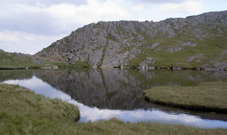
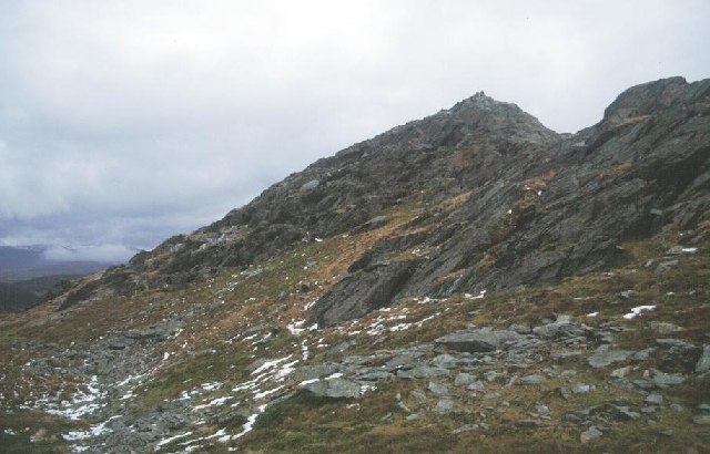
Llyn Terfyn, located in Merionethshire, is a picturesque freshwater lake nestled in the stunning landscape of Wales. With its tranquil surroundings and crystal-clear waters, Llyn Terfyn attracts nature enthusiasts and visitors seeking a peaceful retreat.

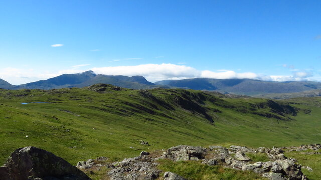
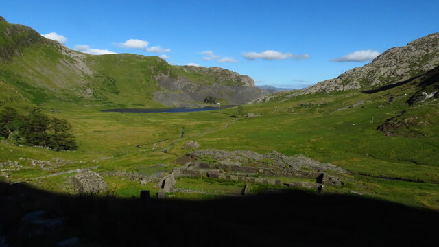
Spanning an area of approximately 10 acres, Llyn Terfyn is surrounded by lush vegetation and rolling hills, creating a truly idyllic setting. The lake is fed by small streams and springs, ensuring a constant flow of freshwater throughout the year.

The lake offers a variety of recreational activities for visitors to enjoy. Fishing enthusiasts can try their luck at catching brown trout and perch, which are abundant in the lake. Kayaking and canoeing are also popular, allowing visitors to explore the lake's hidden corners and admire its natural beauty up close.

Llyn Terfyn is not only a haven for water sports and angling but also a haven for wildlife. The lake attracts a diverse range of bird species, including herons, ducks, and swans, making it a birdwatcher's paradise. The surrounding marshland is home to an array of plant species, creating a vibrant ecosystem that supports a variety of insects, amphibians, and small mammals.

For those who prefer to observe nature from a distance, there are several walking trails that offer panoramic views of Llyn Terfyn and its surroundings. These trails provide an opportunity to immerse oneself in the tranquility of the area and appreciate the natural wonders of Merionethshire.

In conclusion, Llyn Terfyn is a hidden gem in Merionethshire, offering a peaceful retreat for nature lovers and outdoor enthusiasts alike. With its serene waters, diverse wildlife, and breathtaking views, it is a must-visit destination for anyone seeking a slice of natural beauty in Wales.

If you have any feedback on the listing, please let us know in the comments section below.
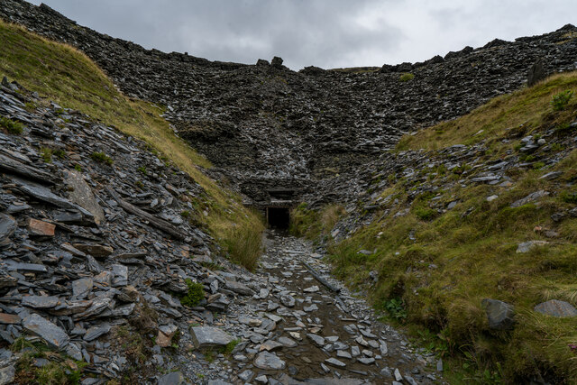
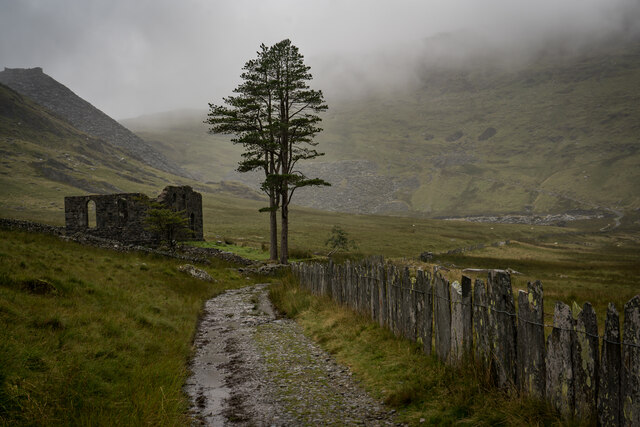
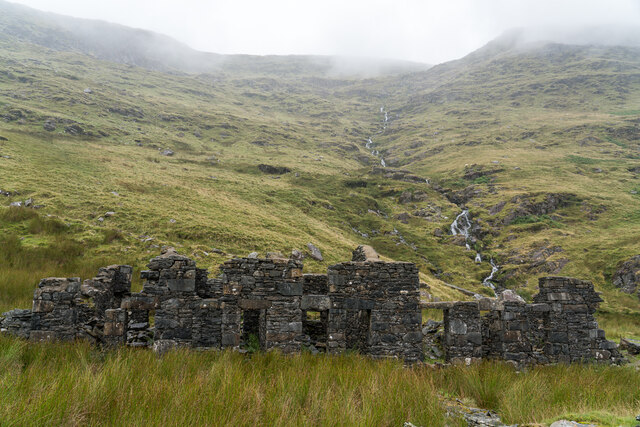
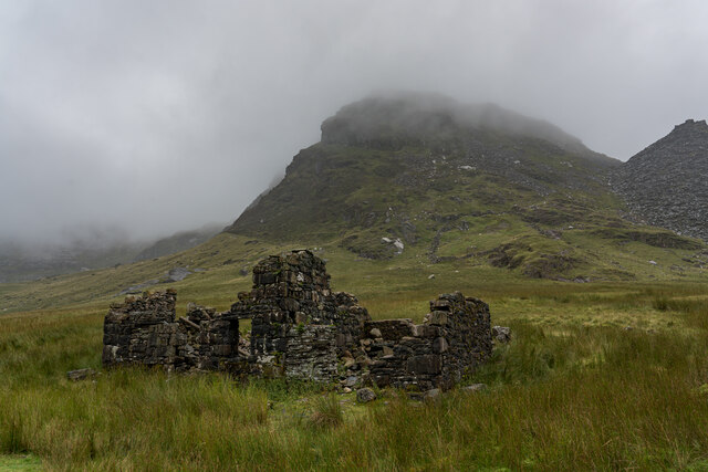
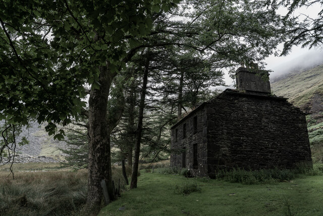
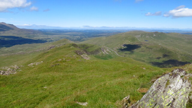
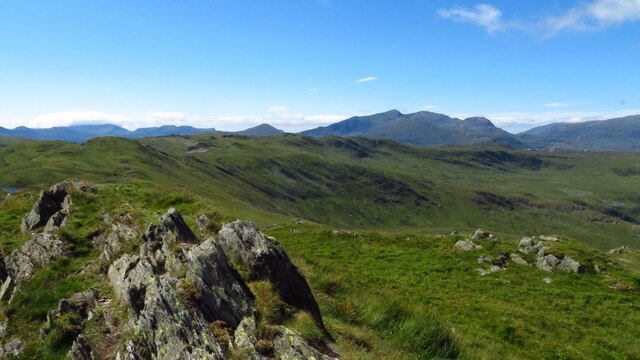
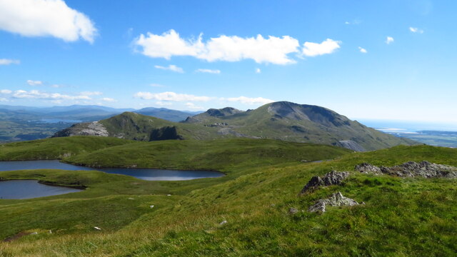
Llyn Terfyn Images

Images are sourced within 2km of 53.011756/-3.9864123 or Grid Reference SH6647. Thanks to Geograph Open Source API. All images are credited.

Cwmorthin Quarry Mine Adit There is a gate inside the entrance with a chilly breeze blowing through it.

Cwmorthin quarry was a slate quarry west of the village of Tanygrisiau, north Wales. Quarrying on the site started in 1810. In 1860 it was connected to the Ffestiniog Railway. In 1900 it was acquired by the nearby Oakeley quarry and the two were connected underground. In 1970 it closed along with Oakeley. There was small-scale working in the 1980s and 1990s, and the mine finally closed in 1997.

<span class="nowrap"><a title="https://en.wikipedia.org/wiki/Cwmorthin_quarry" rel="nofollow ugc noopener" href="https://en.wikipedia.org/wiki/Cwmorthin_quarry">Link</a><img style="margin-left:2px;" alt="External link" title="External link - shift click to open in new window" src="https://s1.geograph.org.uk/img/external.png" width="10" height="10"/></span>
Cwmorthin Quarry Mine Adit
There is a gate inside the entrance with a chilly breeze blowing through it. Cwmorthin quarry was a slate quarry west of the village of Tanygrisiau, north Wales. Quarrying on the site started in 1810. In 1860 it was connected to the Ffestiniog Railway. In 1900 it was acquired by the nearby Oakeley quarry and the two were connected underground. In 1970 it closed along with Oakeley. There was small-scale working in the 1980s and 1990s, and the mine finally closed in 1997. LinkExternal link
Capel y Gorlan & Tree's, Cwmorthin Quarry Was a former Methodist Chapel built around the 1860's. The pair of trees and the location make it an imposing focal point.

<span class="nowrap"><a title="http://www.cwmorthin.com/4._capel_y_gorlan.html" rel="nofollow ugc noopener" href="http://www.cwmorthin.com/4._capel_y_gorlan.html">Link</a><img style="margin-left:2px;" alt="External link" title="External link - shift click to open in new window" src="https://s1.geograph.org.uk/img/external.png" width="10" height="10"/></span>

<span class="nowrap"><a title="https://en.wikipedia.org/wiki/Cwmorthin_quarry" rel="nofollow ugc noopener" href="https://en.wikipedia.org/wiki/Cwmorthin_quarry">Link</a><img style="margin-left:2px;" alt="External link" title="External link - shift click to open in new window" src="https://s1.geograph.org.uk/img/external.png" width="10" height="10"/></span>
Capel y Gorlan & Tree's, Cwmorthin Quarry
Was a former Methodist Chapel built around the 1860's. The pair of trees and the location make it an imposing focal point. LinkExternal link LinkExternal link
Rhosydd Terrace, Cwmorthin Quarry This is a row of six cottages built 1860s. Some very good information on the linked page, including Census information from 1871 when there were 27 people living here and 1881 where there were 41 people! With 13 people living in No 1 alone. <span class="nowrap"><a title="http://www.cwmorthin.com/6._tai_conglog.html" rel="nofollow ugc noopener" href="http://www.cwmorthin.com/6._tai_conglog.html">Link</a><img style="margin-left:2px;" alt="External link" title="External link - shift click to open in new window" src="https://s1.geograph.org.uk/img/external.png" width="10" height="10"/></span>
Rhosydd Terrace, Cwmorthin Quarry
This is a row of six cottages built 1860s. Some very good information on the linked page, including Census information from 1871 when there were 27 people living here and 1881 where there were 41 people! With 13 people living in No 1 alone. LinkExternal link
Rhosydd Stables, Cwmorthin Quarry Built in the late 1850’s by Rhosydd Quarry to home the ponies used to carry its slates through the valley.

<span class="nowrap"><a title="http://www.cwmorthin.com/rhosydd_stables.html" rel="nofollow ugc noopener" href="http://www.cwmorthin.com/rhosydd_stables.html">Link</a><img style="margin-left:2px;" alt="External link" title="External link - shift click to open in new window" src="https://s1.geograph.org.uk/img/external.png" width="10" height="10"/></span>
Rhosydd Stables, Cwmorthin Quarry
Built in the late 1850’s by Rhosydd Quarry to home the ponies used to carry its slates through the valley. LinkExternal link
Plas Cwmorthin Quarry Plas Cwmorthin, the Rhosydd Quarry manager’s house, was built in 1860.

<span class="nowrap"><a title="http://www.cwmorthin.com/7._plas_cwmorthin.html" rel="nofollow ugc noopener" href="http://www.cwmorthin.com/7._plas_cwmorthin.html">Link</a><img style="margin-left:2px;" alt="External link" title="External link - shift click to open in new window" src="https://s1.geograph.org.uk/img/external.png" width="10" height="10"/></span>
Plas Cwmorthin Quarry
Plas Cwmorthin, the Rhosydd Quarry manager’s house, was built in 1860. LinkExternal link
On Allt-fawr, - view NE along ridge towards Crimea Pass
On Allt-fawr, - view towards Moel Druman
On Moel Druman, - view across Llyn Conglog to Moelwyn Mawr
Afternoon light on Ysgafell Wen
Uppermost lake on Llynnau'r Cwn
Llyn Cwm-y-foel from path near Llyn yr Adar
Slate quarry ruins above Bwlch Cwmorthin
Ruins at Plas-cwmorthin with Llyn Cwmorthin beyond
Foxgloves by track, Llyn Cwmorthin
A long-distance glimpse of Lyn Cwmorthin
Path along the ridge
Looking towards Llyn y Biswail
View towards Llyn yr Adar... ...with its tiny island.
View towards Llyn yr Adar...
...with its tiny island.
Show me another place!

Llyn Terfyn is located at Grid Ref: SH6647 (Lat: 53.011756, Lng: -3.9864123)

Unitary Authority: Gwynedd

Police Authority: North Wales

What 3 Words

///closer.clasping.starlight. Near Blaenau-Ffestiniog, Gwynedd

Related Wikis

Ysgafell Wen

Ysgafell Wen is a subsidiary summit of Allt-fawr in Snowdonia, North Wales. It is the highest point on a broad ridge that stretches to the north-west of...

Ysgafell Wen Far North Top

Ysgafell Wen Far North Top is a top of Ysgafell Wen North Top in Snowdonia, North Wales. It lies directly to the west of Ysgafell Wen North Top, and rises...

Ysgafell Wen North Top

Ysgafell Wen North Top is a peak on a ridge in Snowdonia, North Wales. It lies to the north of the highest summit on the ridge Ysgafell Wen. It is a subsidiary...

Moel Druman

Moel Druman is a mountain in Snowdonia, North Wales and forms part of the Moelwynion. It is a subsidiary summit of Allt-fawr. == References == == External... ==
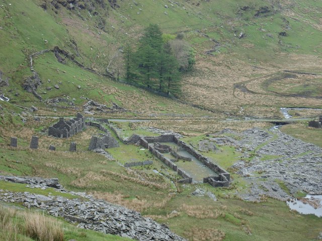
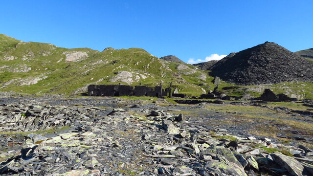
Conglog quarry

Conglog quarry was a small enterprise situated to the north-west of Tanygrisiau, near Blaenau Ffestiniog in Wales. It was overshadowed by the much bigger...

Allt-fawr

Allt-fawr is a mountain in Snowdonia, North Wales and forms part of the Moelwynion group. It is on the internal border of Snowdonia National Park, and...

North West Wales

North West Wales (Welsh: Gogledd-Orllewin Cymru) is an area or region of Wales, commonly defined as a grouping of the principal areas of Conwy County Borough...

Rhosydd quarry

Rhosydd quarry was a slate quarry in the Moelwyn mountains, northeast of Porthmadog in North Wales. Small-scale working of the site began in the 1830s...

Nearby Amenities

Located within 500m of 53.011756,-3.9864123
Moel Druman
Ele: 676
Natural: peak
Place: locality
Wikidata: Q3401767
Wikipedia: en:Moel Druman
Lat/Long: 53.0094993/-3.9811409
Ysgafell Wen
Description: Highest summit of Ysgafell Wen (2 subsidiary summits further north).
Ele: 672
Natural: peak
Wikidata: Q8059705
Wikipedia: en:Ysgafell Wen
Lat/Long: 53.013763/-3.9884935
The data included in this document is from www.openstreetmap.org. The data is made available under ODbL.

Have you been to Llyn Terfyn?

Leave your review of Llyn Terfyn below (or comments, questions and feedback).