Loch Fada Dubh

Lake, Pool, Pond, Freshwater Marsh in Inverness-shire

Scotland

Loch Fada Dubh

Track over the moor, by Boblainy Forest The track runs from the edge of Boblainy Forest to Loch Bruicheach. This is the view looking back towards the forest.
On the right is the wooded valley of the upper reaches of the Bruiach Burn.
Track over the moor, by Boblainy Forest Credit: Craig Wallace

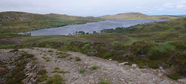
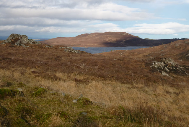
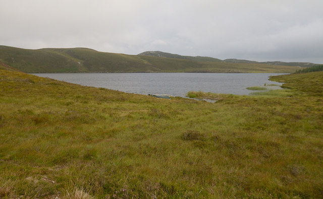
Loch Fada Dubh is a picturesque freshwater lake located in Inverness-shire, Scotland. Nestled amidst the breathtaking Scottish Highlands, this enchanting body of water stretches over an area of approximately 1 square kilometer. Its name, Loch Fada Dubh, translates to "long black loch" in Gaelic, highlighting the dark, mysterious beauty that characterizes the lake.

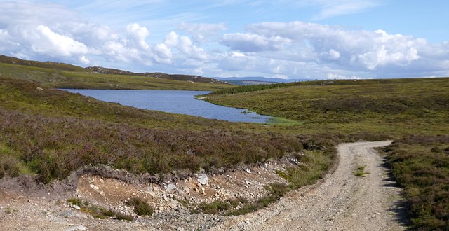
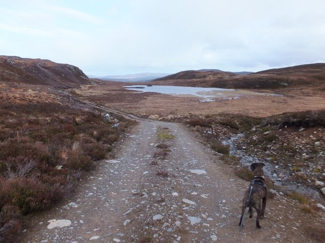
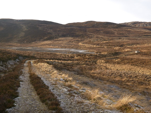
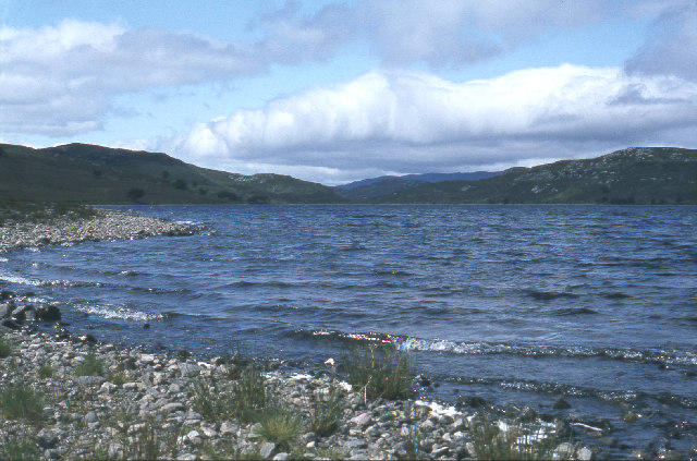
Surrounded by rolling hills and lush greenery, Loch Fada Dubh offers a serene and tranquil atmosphere for visitors. The still waters of the lake reflect the surrounding landscape, creating a captivating mirror-like effect. The shoreline is adorned with vibrant vegetation, including reeds, grasses, and wildflowers, adding a burst of color to the scenery.

The lake's water is crystal clear and teeming with life. It is home to several species of freshwater fish, such as trout and salmon, making it a popular spot for anglers. Additionally, Loch Fada Dubh provides a habitat for various bird species, including swans, ducks, and herons. Birdwatchers can often be seen observing these winged creatures in their natural habitat.

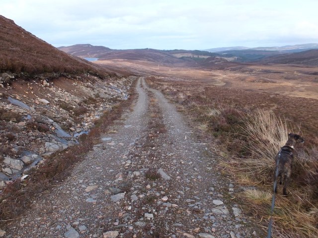
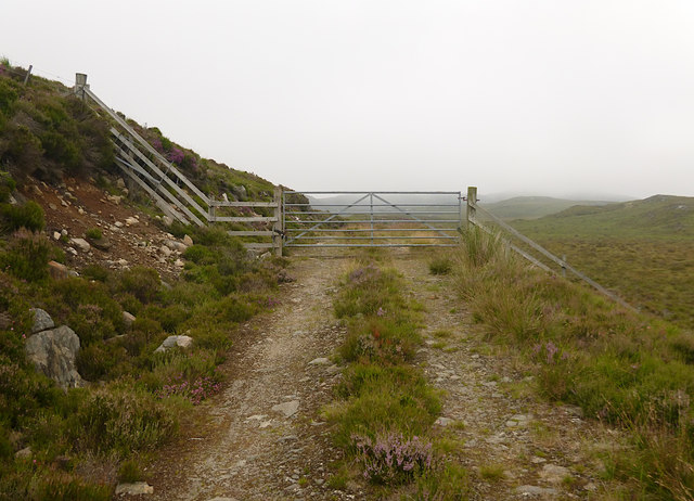
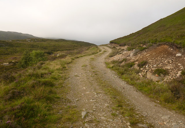
The surrounding area offers a multitude of outdoor activities for nature enthusiasts. Hiking trails wind through the nearby hills, providing breathtaking views of the lake and its surroundings. Visitors can also partake in boating and kayaking on the calm waters of Loch Fada Dubh, allowing them to fully immerse themselves in the idyllic scenery.

Overall, Loch Fada Dubh is a captivating freshwater lake that showcases the natural beauty of Inverness-shire. Its tranquil ambiance, diverse wildlife, and stunning surroundings make it a must-visit destination for those seeking a peaceful escape in the heart of the Scottish Highlands.

If you have any feedback on the listing, please let us know in the comments section below.

Loch Fada Dubh Images

Images are sourced within 2km of 57.372994/-4.570239 or Grid Reference NH4534. Thanks to Geograph Open Source API. All images are credited.

Track over the moor, by Boblainy Forest The track runs from the edge of Boblainy Forest to Loch Bruicheach. This is the view looking back towards the forest.
On the right is the wooded valley of the upper reaches of the Bruiach Burn.
Track over the moor, by Boblainy Forest
The track runs from the edge of Boblainy Forest to Loch Bruicheach. This is the view looking back towards the forest. On the right is the wooded valley of the upper reaches of the Bruiach Burn.
Track descending to Loch Bruicheach The track runs across moorland from Glenconvinth, and descends to the end of Loch Bruicheach.
Track descending to Loch Bruicheach
The track runs across moorland from Glenconvinth, and descends to the end of Loch Bruicheach.
Track over the moor, to Loch Bruicheach This track runs from Glenconvinth water treatment works to Loch Bruicheach.
It looks like it has been here for a number of years, but isn't marked on the OS maps. It is visible on Bing aerial imagery, and is now mapped on OpenStreetMap.
Track over the moor, to Loch Bruicheach
This track runs from Glenconvinth water treatment works to Loch Bruicheach. It looks like it has been here for a number of years, but isn't marked on the OS maps. It is visible on Bing aerial imagery, and is now mapped on OpenStreetMap.
Track past Lochan an Tairt The track descends across the moor towards Glen Urquhart.
Track past Lochan an Tairt
The track descends across the moor towards Glen Urquhart.
Poll an t-Searraich
Poll an t-Searraich
Estate track south of Loch Bruicheach
Old walls south of Loch Bruicheach I am not sure if these walls were built to protect the trees planted here or if they are the last remains of an isolated settlement.
Old walls south of Loch Bruicheach
I am not sure if these walls were built to protect the trees planted here or if they are the last remains of an isolated settlement.
Moorland track past Loch nam Breac Dearga The track runs along the side of Loch nam Breac Dearga. The hill behind is Meall nan Caorach.
On a rather cold day, some patches of ice on the loch and on the track.

Loch nam Breac Dearga is probably from the Gaelic for "Loch of the red trout".
Moorland track past Loch nam Breac Dearga
The track runs along the side of Loch nam Breac Dearga. The hill behind is Meall nan Caorach. On a rather cold day, some patches of ice on the loch and on the track. Loch nam Breac Dearga is probably from the Gaelic for "Loch of the red trout".
Moorland track, descending towards a lochan The track runs down past the end of the lochan, then swings round to climb up the hill opposite.
This looks like a fairly large lochan, on a tributary of the Allt Poll an t-Searraich. Though it seems the lochan isn't marked on any of the OS maps.

This was a rather cold day, with frost on the track, and patches of ice on the lochan.
Moorland track, descending towards a lochan
The track runs down past the end of the lochan, then swings round to climb up the hill opposite. This looks like a fairly large lochan, on a tributary of the Allt Poll an t-Searraich. Though it seems the lochan isn't marked on any of the OS maps. This was a rather cold day, with frost on the track, and patches of ice on the lochan.
On Meall nan Caorach Meall nan Caorach has a wide flat summit, covered by rough heather. There is a small stone cairn (on the right), which may mark the highest point.
On Meall nan Caorach
Meall nan Caorach has a wide flat summit, covered by rough heather. There is a small stone cairn (on the right), which may mark the highest point.
Lower slopes of Meall nan Caorach Heather covered slopes, on the northern side of Meall nan Caorach. There are a few rough paths along here, probably deer paths.
Lower slopes of Meall nan Caorach
Heather covered slopes, on the northern side of Meall nan Caorach. There are a few rough paths along here, probably deer paths.
Moorland track, from Loch Bruicheach Looking back along the track towards Meall nan Caorach. A bit of sunshine in between the snow showers.
Moorland track, from Loch Bruicheach
Looking back along the track towards Meall nan Caorach. A bit of sunshine in between the snow showers.
Moorland view to Loch Bruicheach A view from the track, looking across the rough moorland. A gap in the hills gives a view of Loch Bruicheach.
Moorland view to Loch Bruicheach
A view from the track, looking across the rough moorland. A gap in the hills gives a view of Loch Bruicheach.
Gate on the moorland track, above Lochan an Tairt This track runs up from Glen Urquhart, and across the moor. It is crossed by a fence, with a locked gate.
Gate on the moorland track, above Lochan an Tairt
This track runs up from Glen Urquhart, and across the moor. It is crossed by a fence, with a locked gate.
Moorland track, by Lochan an Tairt This track runs up from Glen Urquhart, and across the moor.
Moorland track, by Lochan an Tairt
This track runs up from Glen Urquhart, and across the moor.
Lochan an Tairt Looking across rough moorland to the loch. There is a small wooden jetty at the corner, with a boat moored.
Lochan an Tairt
Looking across rough moorland to the loch. There is a small wooden jetty at the corner, with a boat moored.
Loch nam Breac Dearga Looking across the loch on a misty morning. Some lilies and grass growing in the loch.
The track runs past on the left.
Loch nam Breac Dearga
Looking across the loch on a misty morning. Some lilies and grass growing in the loch. The track runs past on the left.
Loch Bruicheach on a breezy day This loch (pronounced Bree-ach) is relatively isolated; it lies between Glen Convinth and Strathglass. In its northern inlet there is - or rather was, some 5000 years ago - a crannog (a fortified dwelling) on a small island.
Loch Bruicheach on a breezy day
This loch (pronounced Bree-ach) is relatively isolated; it lies between Glen Convinth and Strathglass. In its northern inlet there is - or rather was, some 5000 years ago - a crannog (a fortified dwelling) on a small island.
Show me another place!

Loch Fada Dubh is located at Grid Ref: NH4534 (Lat: 57.372994, Lng: -4.570239)

Unitary Authority: Highland

Police Authority: Highlands and Islands

What 3 Words

///states.spout.worker. Near Drumnadrochit, Highland

Related Wikis

Loch Bruicheach

Loch Bruicheach is a remote mountain loch, situated on the edge of Boblainy Forest in the Highland council area of Scotland. The nearest settlement to...

Balbeg, Highland

Balbeg (Scottish Gaelic: Am Baile Beag) is a clachan (hamlet) about 0.5 miles (1 km) north-east of Balnain, 4 miles (6 km) west of Drumnadrochit, Inverness...

Culnaskiach Falls

Culnaskiach Falls is a waterfall in Boblainy Forest, to the south of the village of Kiltarlity, in the Highland council area of Scotland. It is on a small...

Glen Urquhart

Glenurquhart or Glen Urquhart (Scottish Gaelic: Gleann Urchadain) is a glen running to the west of the village of Drumnadrochit in the Highland council...

Have you been to Loch Fada Dubh?

Leave your review of Loch Fada Dubh below (or comments, questions and feedback).