Aylestone Hill

Settlement in Herefordshire

England

Aylestone Hill

Freight train approaching Hereford station A southbound freight train approaching Hereford station hauled by a Class 37 diesel electric locomotive No 37129. Photograph taken from the platform end.
Freight train approaching Hereford station Credit: Rob Newman

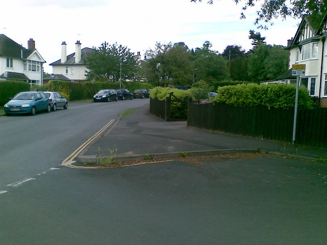
Aylestone Hill is a small residential area located in the city of Hereford, Herefordshire, England. Situated to the east of the city center, it is known for its charming ambiance and picturesque surroundings. The area is primarily residential, offering a peaceful and serene environment for its residents.

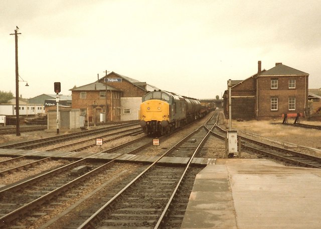
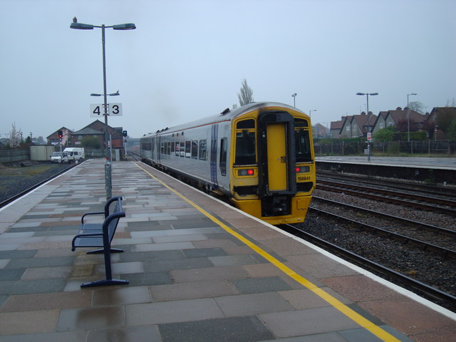
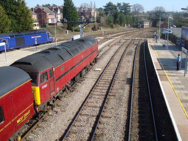
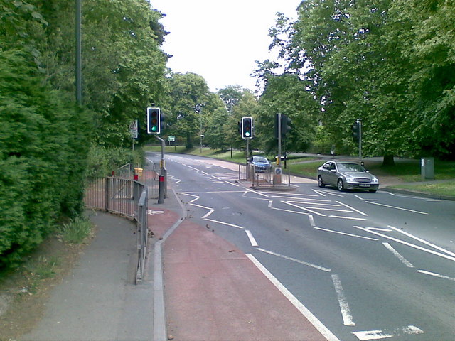
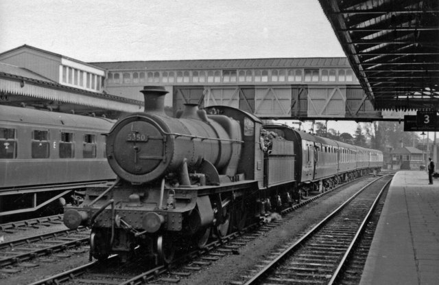
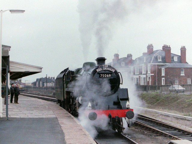
Aylestone Hill is well-connected to the rest of Hereford, with excellent transportation links. The A438 road runs through the area, providing easy access to the city center and other nearby towns. The Hereford railway station is also conveniently located nearby, offering regular train services to various destinations.

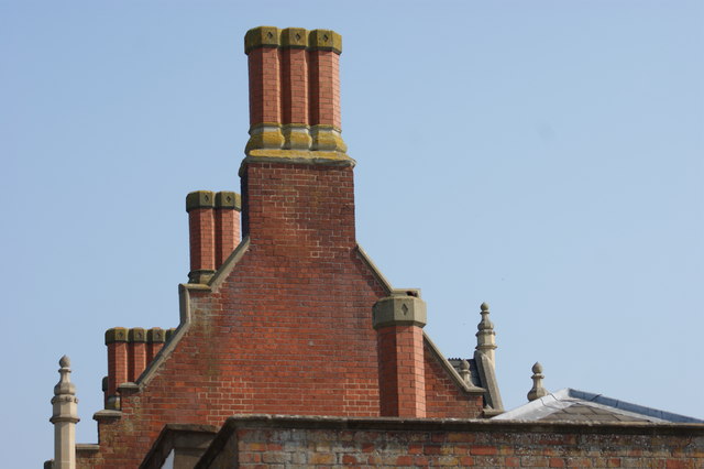
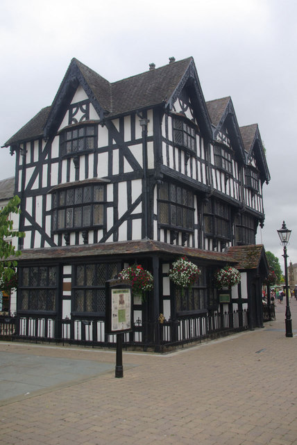
The neighborhood is characterized by a mix of architectural styles, ranging from traditional Victorian and Georgian buildings to more contemporary houses. Many of the properties in Aylestone Hill boast beautiful gardens and green spaces, enhancing the overall appeal of the area.

Residents of Aylestone Hill benefit from a range of amenities and facilities. There are several schools in the vicinity, including Aylestone School, providing excellent educational opportunities for children. Additionally, a variety of shops, restaurants, and cafes can be found within a short distance, ensuring that daily needs are easily met.

Nature enthusiasts will appreciate the proximity to open green spaces, such as Aylestone Park and Victoria Park, where they can enjoy leisurely walks and outdoor activities. The Hereford Cathedral, a stunning architectural masterpiece, is also within easy reach, showcasing the rich history of the city.

Overall, Aylestone Hill offers a tranquil and welcoming environment, making it an attractive place to live for individuals and families alike.

If you have any feedback on the listing, please let us know in the comments section below.

Aylestone Hill Images

Images are sourced within 2km of 52.064852/-2.7013249 or Grid Reference SO5240. Thanks to Geograph Open Source API. All images are credited.

Freight train approaching Hereford station A southbound freight train approaching Hereford station hauled by a Class 37 diesel electric locomotive No 37129. Photograph taken from the platform end.
Freight train approaching Hereford station
A southbound freight train approaching Hereford station hauled by a Class 37 diesel electric locomotive No 37129. Photograph taken from the platform end.
Hereford Station The north end of Hereford Station with Class 158 diesel multiple unit No 158841 departing with a train for the north. The platform on the left is a bay platform.
Hereford Station
The north end of Hereford Station with Class 158 diesel multiple unit No 158841 departing with a train for the north. The platform on the left is a bay platform.
Hereford Station, South End West Coast Railways Class 57 No 57601 waits for the signal to move off southwards from Hereford. View taken from the station footbridge
Hereford Station, South End
West Coast Railways Class 57 No 57601 waits for the signal to move off southwards from Hereford. View taken from the station footbridge
Lugg Bridge Mill Former water mill now converted to accommodation. Photographed from the eponymous bridge. I turned up at the same time as a group of scantily clad young men who I think were about to leap into the water, despite a warning notice forbidding such activity due to an underwater obstruction. I didn't hang around to find out if anybody succeeded in maiming or killing themselves (I've seen too many bodies dredged out of rivers, canals and lakes).
Lugg Bridge Mill
Former water mill now converted to accommodation. Photographed from the eponymous bridge. I turned up at the same time as a group of scantily clad young men who I think were about to leap into the water, despite a warning notice forbidding such activity due to an underwater obstruction. I didn't hang around to find out if anybody succeeded in maiming or killing themselves (I've seen too many bodies dredged out of rivers, canals and lakes).
Lugg Bridge Mill Former watermill converted to accommodation.
Lugg Bridge Mill
Former watermill converted to accommodation.
Edgar Street - Hereford United FC
Chimneys, Hereford Railway Station Ornate brick chimneys at Hereford railway station
Chimneys, Hereford Railway Station
Ornate brick chimneys at Hereford railway station
Penn Grove Road, Hereford
Aylestone Hill, Hereford
Outdoor seating at The Rose Gardens Inn
The Rose Gardens Inn
On to the roundabout, heading for Edgar Street
Hereford Station, with 2-6-0 on pilot duty View southward, towards Newport etc.; ex-GW & LNW Joint Shrewsbury - Hereford - Abergavenny - Newport main line, ex-GW main line from Worcester and Birmingham, also branch from Gloucester via Ross-on-Wye (closed 11/64) and ex-Midland line to Hay and Brecon (closed 12/62). The pilot on the Up centre road with coaches is Churchward 43XX 2-6-0 No. 5350 (built 7/18, withdrawn 12/59).
Hereford Station, with 2-6-0 on pilot duty
View southward, towards Newport etc.; ex-GW & LNW Joint Shrewsbury - Hereford - Abergavenny - Newport main line, ex-GW main line from Worcester and Birmingham, also branch from Gloucester via Ross-on-Wye (closed 11/64) and ex-Midland line to Hay and Brecon (closed 12/62). The pilot on the Up centre road with coaches is Churchward 43XX 2-6-0 No. 5350 (built 7/18, withdrawn 12/59).
High Town, Hereford This open pedestrianised space once lay outside the city's Saxon walls to the north of the cathedral but is now at the heart of the shopping area. The spire belongs to St Peter's Church.
High Town, Hereford
This open pedestrianised space once lay outside the city's Saxon walls to the north of the cathedral but is now at the heart of the shopping area. The spire belongs to St Peter's Church.
The Old House A Hereford icon. This half-timbered house dates from 1621 and is now a museum.
The Old House
A Hereford icon. This half-timbered house dates from 1621 and is now a museum.
Steam Locomotive at Hereford, 1985 BR Standard Class 4 4-6-0 No 75069, based on the Severn Valley Railway, waits at Hereford station to work 'The Red Dragon' charter train.
Steam Locomotive at Hereford, 1985
BR Standard Class 4 4-6-0 No 75069, based on the Severn Valley Railway, waits at Hereford station to work 'The Red Dragon' charter train.
Show me another place!

Aylestone Hill is located at Grid Ref: SO5240 (Lat: 52.064852, Lng: -2.7013249)

Unitary Authority: County of Herefordshire

Police Authority: West Mercia

What 3 Words

///stream.mock.hardly. Near Hereford, Herefordshire

Nearby Locations

Tupsley Aylestone Hill

Related Wikis

Hereford Sixth Form College

Hereford Sixth Form College is a co-educational state funded sixth form college in Hereford, England. It offers over 40 subjects at A-Level and 10 at GCSE...

Aylestone School

Aylestone School is a co-educational secondary school in Herefordshire, England. The school has an enrolment of 419, and caters for the Key Stage 3 and...

Herefordshire and Ludlow College

Herefordshire and Ludlow College is a college of further education (FE) based in Hereford, Herefordshire, and with a separate sixth form college campus...

Hereford College of Arts

Hereford College of Arts is an art school based in the West Midlands, UK, and is the only specialist college in the region dedicated to the Arts. ��2...

Royal National College for the Blind

The Royal National College for the Blind (RNC) is a co-educational specialist residential college of further education based in the English city of Hereford...

Hereford railway station

Hereford railway station serves the city of Hereford, in Herefordshire, England. Managed by Transport for Wales, it lies on the Welsh Marches Line between...

Freedom Church

Freedom Church is a global non-denominational evangelical Christian church whose vision is to "Connect Anyone Anywhere to a Life Changing relationship...

St Guthlac's Priory

Saint Guthlac's Priory (or the Benedictine Priory of Saints Peter, Paul and Guthlac) was a Benedictine priory in Hereford, England. It was originally founded...

Nearby Amenities

Located within 500m of 52.064852,-2.7013249
Turning Circle
Lat/Long: 52.0622322/-2.7070604
Turning Circle
Lat/Long: 52.0619282/-2.7000146
Mini Roundabout
Direction: clockwise
Lat/Long: 52.063019/-2.6997831
Parking
Parking: surface
Lat/Long: 52.0627548/-2.700826
Tourism: viewpoint
Lat/Long: 52.062401/-2.7020367
Hospital
Nuffield Health Hereford Hospital
Addr City: Hereford
Addr Housenumber: 2
Addr Postcode: HR1 1DF
Addr Street: Venns Lane
Fhrs Id: 489529
Healthcare: hospital
Operator: Nuffield Health
Operator Type: private
Source Addr: FHRS Open Data
Lat/Long: 52.0638103/-2.6999319
Turning Circle
Lat/Long: 52.0668569/-2.7067515
Tourism: viewpoint
Lat/Long: 52.0687426/-2.6991588
Bus Stop
Venn's Lane
Bus: yes
Naptan AtcoCode: 2090A068900
Naptan Bearing: N
Naptan CommonName: Venn's Lane
Naptan Indicator: opp Carfax House
Naptan Landmark: Hereford Colleges.Aylestone School
Naptan NaptanCode: heradgpg
Naptan PlusbusZoneRef: HEREFRD
Naptan Street: Aylestone Hill
Naptan Verified: no
Public Transport: platform
Source: naptan_import
Lat/Long: 52.063488/-2.6994582
Bus Stop
Venn's Lane Junction
Bus: yes
Naptan AtcoCode: 2090A068901
Naptan Bearing: S
Naptan CommonName: Venn's Lane Junction
Naptan Indicator: adj Carfax House
Naptan Landmark: Herefordshire Colleges.Aylestone School
Naptan NaptanCode: heradgpj
Naptan PlusbusZoneRef: HEREFRD
Naptan Street: Aylestone Hill
Naptan Verified: no
Public Transport: platform
Source: naptan_import
Lat/Long: 52.0633175/-2.6993972
Bus Stop
Hereford Folly Lane Colleges
Alt Name: Tech College
Bus: yes
Naptan AltCommonName: Tech College
Naptan AltStreet: Not Specified
Naptan AtcoCode: 2090A146700
Naptan Bearing: SE
Naptan CommonName: Hereford Colleges
Naptan Indicator: adj
Naptan Landmark: College of Technology
Naptan NaptanCode: heragjad
Naptan PlusbusZoneRef: HEREFRD
Naptan Street: Folly Lane
Naptan Verified: no
Public Transport: platform
Source: naptan_import
Lat/Long: 52.0610931/-2.6985018
Bus Stop
Hereford Colleges
Alt Name: Tech College
Bus: yes
Naptan AltCommonName: Tech College
Naptan AltStreet: Not Specified
Naptan AtcoCode: 2090A146701
Naptan Bearing: NW
Naptan CommonName: Hereford Colleges
Naptan Indicator: opp
Naptan Landmark: N/K
Naptan NaptanCode: heragjag
Naptan PlusbusZoneRef: HEREFRD
Naptan Street: Folly Lane
Naptan Verified: no
Public Transport: platform
Source: naptan_import
Lat/Long: 52.0616019/-2.6991224
Bus Stop
Bulmer Avenue
Bus: yes
Local Ref: NK
Naptan AtcoCode: 2090A151100
Naptan Bearing: SW
Naptan BusStopType: CUS
Naptan CommonName: Bulmer Avenue
Naptan Indicator: NK
Naptan Landmark: NK
Naptan NaptanCode: heragjpw
Naptan PlusbusZoneRef: HEREFRD
Naptan Street: Bulmer Avenue
Naptan Verified: no
Public Transport: platform
Source: naptan_import
Lat/Long: 52.0636102/-2.7075999
Bus Stop
Abbey Grange
Bus: yes
Naptan AtcoCode: 2090A18812
Naptan Bearing: NW
Naptan CommonName: Abbey Grange
Naptan Indicator: adj Abbey Grange
Naptan Landmark: opp Helmesdale Close
Naptan NaptanCode: herajdtj
Naptan PlusbusZoneRef: HEREFRD
Naptan Street: Venns Lane
Naptan Verified: no
Public Transport: platform
Source: naptan_import
Lat/Long: 52.0671315/-2.7051318
Bus Stop
Abbey Grange
Bus: yes
Naptan AtcoCode: 2090A18814
Naptan Bearing: SE
Naptan BusStopType: CUS
Naptan CommonName: Abbey Grange
Naptan Indicator: opp Abbey Grange
Naptan Landmark: Adj. Helmesdale Close
Naptan NaptanCode: herajdtm
Naptan PlusbusZoneRef: HEREFRD
Naptan Street: Venns Lane
Naptan Verified: no
Public Transport: platform
Source: naptan_import
Lat/Long: 52.0671867/-2.7049284
Bus Stop
Moreland Avenue
Bus: yes
Naptan AtcoCode: 2090A19209
Naptan Bearing: NE
Naptan CommonName: Moreland Avenue
Naptan Indicator: adj
Naptan Landmark: o/s No. 25 Aylestone Hill
Naptan NaptanCode: herajtmw
Naptan PlusbusZoneRef: HEREFRD
Naptan Street: Aylestone Hill
Naptan Verified: no
Public Transport: platform
Source: naptan_import
Lat/Long: 52.0609648/-2.7034301
Bus Stop
Moreland Avenue
Bus: yes
Naptan AtcoCode: 2090A19211
Naptan Bearing: SW
Naptan CommonName: Moreland Avenue
Naptan Indicator: opp
Naptan Landmark: End of Moreland Avenue
Naptan NaptanCode: herajtpa
Naptan PlusbusZoneRef: HEREFRD
Naptan Street: Aylestone Hill
Naptan Verified: no
Public Transport: platform
Source: naptan_import
Lat/Long: 52.061141/-2.7025431
Bus Stop
Churchill Gardens
Bus: yes
Naptan AtcoCode: 2090A19213
Naptan Bearing: S
Naptan CommonName: Churchill Gardens
Naptan Indicator: opp
Naptan Landmark: o/s Elmhurst
Naptan NaptanCode: herajtpd
Naptan PlusbusZoneRef: HEREFRD
Naptan Street: Venns Lane
Naptan Verified: no
Public Transport: platform
Source: naptan_import
Lat/Long: 52.0642534/-2.7007685
Bus Stop
Churchill Gardens
Bus: yes
Naptan AtcoCode: 2090A19215
Naptan Bearing: N
Naptan BusStopType: CUS
Naptan CommonName: Churchill Gardens
Naptan Indicator: adj
Naptan Landmark: opp Elmhurst
Naptan NaptanCode: herajtpg
Naptan PlusbusZoneRef: HEREFRD
Naptan Street: Venns Lane
Naptan Verified: no
Public Transport: platform
Source: naptan_import
Lat/Long: 52.0641895/-2.7009425
Bus Stop
Overbury Road
Bus: yes
Naptan AtcoCode: 2090A19217
Naptan Bearing: SE
Naptan CommonName: Overbury Road
Naptan Indicator: adj
Naptan Landmark: o/s No. 22 Venns Lane
Naptan NaptanCode: herajtpj
Naptan PlusbusZoneRef: HEREFRD
Naptan Street: Venns Lane
Naptan Verified: no
Public Transport: platform
Source: naptan_import
Lat/Long: 52.0660849/-2.7027374
Bus Stop
Overbury Road
Bus: yes
Naptan AtcoCode: 2090A19219
Naptan Bearing: NW
Naptan BusStopType: CUS
Naptan CommonName: Overbury Road
Naptan Indicator: opp
Naptan Landmark: Adj. Russell Close
Naptan NaptanCode: herajtpm
Naptan PlusbusZoneRef: HEREFRD
Naptan Street: Venns Lane
Naptan Verified: no
Public Transport: platform
Source: naptan_import
Lat/Long: 52.065985/-2.7028963
Bus Stop
Aylestone Hill
Bus: yes
Naptan AtcoCode: 2090A19492
Naptan Bearing: S
Naptan CommonName: Aylestone Hill
Naptan Indicator: o/s 'The Shires'
Naptan Landmark: o/s 'The Shire'
Naptan NaptanCode: heramdap
Naptan PlusbusZoneRef: HEREFRD
Naptan Street: Aylestone Hill. A465
Naptan Verified: no
Public Transport: platform
Source: naptan_import
Lat/Long: 52.0678676/-2.6971259
Bus Stop
Aylestone Hill
Bus: yes
Naptan AtcoCode: 2090A19494
Naptan Bearing: N
Naptan CommonName: Aylestone Hill
Naptan Indicator: opp 'The Shires'
Naptan Landmark: opp 'The Shires'
Naptan NaptanCode: heramdat
Naptan PlusbusZoneRef: HEREFRD
Naptan Street: Aylestone Hill. A465
Naptan Verified: no
Public Transport: platform
Source: naptan_import
Lat/Long: 52.0682079/-2.6971764
Turning Circle
Lat/Long: 52.0666646/-2.6984179
Bench
Lat/Long: 52.0631215/-2.6999266
Post Box
Lat/Long: 52.0650913/-2.6980281
Crossing
Crossing: traffic_signals
Crossing Ref: pelican
Lat/Long: 52.0621914/-2.6995216
Turning Circle
Lat/Long: 52.0640431/-2.7020516
Reception
Entrance: main
Lat/Long: 52.0623124/-2.6992796
Student entrance
Entrance: entrance
Lat/Long: 52.0625082/-2.6986431
Entrance: entrance
Lat/Long: 52.0625032/-2.6984996
Entrance: entrance
Lat/Long: 52.0624515/-2.6986895
Entrance: entrance
Lat/Long: 52.0627211/-2.6981295
Entrance: entrance
Lat/Long: 52.0628335/-2.6982644
Entrance: entrance
Lat/Long: 52.06286/-2.6983061
Entrance: entrance
Lat/Long: 52.062459/-2.6991618
Entrance: entrance
Lat/Long: 52.0626165/-2.6980145
Entrance: entrance
Lat/Long: 52.0629255/-2.6971782
Entrance: entrance
Lat/Long: 52.0629867/-2.6972319
Entrance: entrance
Lat/Long: 52.0626573/-2.696767
Entrance: entrance
Lat/Long: 52.0628725/-2.696661
Entrance: entrance
Lat/Long: 52.0621454/-2.6991366
Entrance: entrance
Lat/Long: 52.0623649/-2.6987737
Entrance: entrance
Lat/Long: 52.0623603/-2.6988734
Turning Circle
Lat/Long: 52.0649117/-2.7033865
Turning Circle
Lat/Long: 52.0654369/-2.7040816
Generator Method: photovoltaic
Generator Output Electricity: yes
Generator Source: solar
Generator Type: solar_photovoltaic_panel
Location: roof
Power: generator
Lat/Long: 52.0658783/-2.7020949
Generator Method: photovoltaic
Generator Output Electricity: yes
Generator Source: solar
Generator Type: solar_photovoltaic_panel
Location: roof
Power: generator
Lat/Long: 52.0606839/-2.6992384
Generator Method: photovoltaic
Generator Output Electricity: yes
Generator Source: solar
Generator Type: solar_photovoltaic_panel
Location: roof
Power: generator
Lat/Long: 52.0627997/-2.7044392
Generator Method: photovoltaic
Generator Output Electricity: yes
Generator Source: solar
Generator Type: solar_photovoltaic_panel
Location: roof
Power: generator
Lat/Long: 52.0638896/-2.7017784
Crossing
Lat/Long: 52.0613862/-2.6981748
Post Box
Operator: Royal Mail
Operator Wikidata: Q638098
Lat/Long: 52.0626559/-2.7060714
Generator Output Electricity: yes
Generator Source: solar
Location: roof
Power: generator
Lat/Long: 52.0613122/-2.7056864
Generator Method: photovoltaic
Generator Output Electricity: yes
Generator Source: solar
Generator Type: solar_photovoltaic_panel
Location: roof
Power: generator
Lat/Long: 52.0631938/-2.6985034
Generator Method: photovoltaic
Generator Output Electricity: yes
Generator Source: solar
Generator Type: solar_photovoltaic_panel
Location: roof
Power: generator
Lat/Long: 52.0631163/-2.6983747
Generator Method: photovoltaic
Generator Output Electricity: yes
Generator Source: solar
Generator Type: solar_photovoltaic_panel
Location: roof
Power: generator
Lat/Long: 52.0679987/-2.7000028
Generator Method: photovoltaic
Generator Output Electricity: yes
Generator Source: solar
Generator Type: solar_photovoltaic_panel
Location: roof
Power: generator
Lat/Long: 52.0687473/-2.698313
Generator Method: photovoltaic
Generator Output Electricity: yes
Generator Source: solar
Generator Type: solar_photovoltaic_panel
Location: roof
Power: generator
Lat/Long: 52.068866/-2.6985115
Generator Method: photovoltaic
Generator Output Electricity: yes
Generator Source: solar
Generator Type: solar_photovoltaic_panel
Location: roof
Power: generator
Lat/Long: 52.0665461/-2.7017891
Bicycle Rental
Brand: Beryl
Brand Wikidata: Q106575365
Capacity: 5
Name Signed: no
Network: Beryl
Network Wikidata: Q106575365
Official Name: thePoint4 Gym
Operator: Beryl
Operator Wikidata: Q106575369
Payment App: yes
Payment App Android: cc.beryl.basis
Payment App Ios: 1386768364
Payment Cash: no
Payment Credit Cards: no
Payment Cryptocurrencies: no
Payment Debit Cards: no
Payment Electronic Purses: no
Ref Gbfs: beryl_hereford:2356
Lat/Long: 52.0679779/-2.705225
Bicycle Rental
Brand: Beryl
Brand Wikidata: Q106575365
Capacity: 8
Name Signed: no
Network: Beryl
Network Wikidata: Q106575365
Official Name: H&L College
Operator: Beryl
Operator Wikidata: Q106575369
Payment App: yes
Payment App Android: cc.beryl.basis
Payment App Ios: 1386768364
Payment Cash: no
Payment Credit Cards: no
Payment Cryptocurrencies: no
Payment Debit Cards: no
Payment Electronic Purses: no
Ref Gbfs: beryl_hereford:342
Lat/Long: 52.061203/-2.6985049
Crossing
Crossing: traffic_signals
Crossing Markings: yes
Lat/Long: 52.0680622/-2.7062797
Mini Roundabout
Direction: clockwise
Lat/Long: 52.0625946/-2.6999973
Turning Circle
Lat/Long: 52.0665787/-2.7077402
Barrier: cycle_barrier
Lat/Long: 52.0681003/-2.7061971
Traffic Calming: hump
Lat/Long: 52.0671412/-2.7050013
Bicycle Parking
Lat/Long: 52.0679339/-2.7053666
Entrance: yes
Lat/Long: 52.068036/-2.7051094
Barrier: bollard
Lat/Long: 52.0680439/-2.7059878
Entrance: yes
Lat/Long: 52.068017/-2.7057419
Entrance: yes
Lat/Long: 52.0679118/-2.7057034
Barrier: bollard
Lat/Long: 52.0681978/-2.7061903
Artwork Type: installation
Tourism: artwork
Lat/Long: 52.0681929/-2.7060957
Entrance: yes
Lat/Long: 52.0638437/-2.700125
Crossing
Crossing: uncontrolled
Crossing Markings: zebra
Lat/Long: 52.0627808/-2.6998393
Crossing
Crossing: uncontrolled
Crossing Markings: zebra
Lat/Long: 52.0628558/-2.6999247
The data included in this document is from www.openstreetmap.org. The data is made available under ODbL.

Have you been to Aylestone Hill?

Leave your review of Aylestone Hill below (or comments, questions and feedback).