Linne Eilean Gainimh

Lake, Pool, Pond, Freshwater Marsh in Inverness-shire

Scotland

Linne Eilean Gainimh

The Well of the Seven Heads
The Well of the Seven Heads Credit: Tim Glover

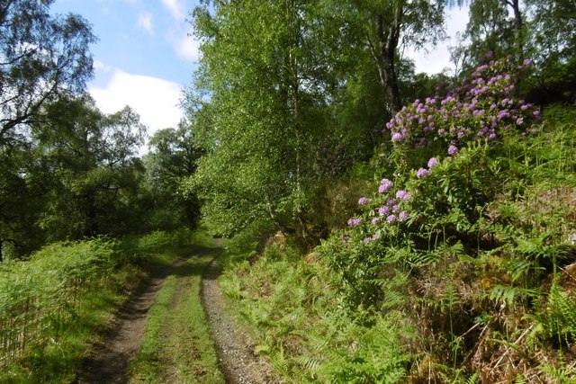
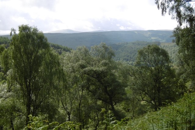
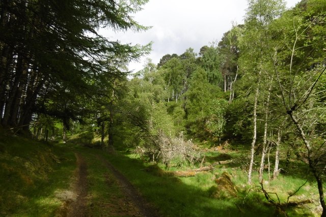
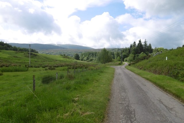
Linne Eilean Gainimh, located in Inverness-shire, Scotland, is a pristine freshwater ecosystem encompassing a lake, pool, pond, and freshwater marsh. This natural wonder is nestled amidst the breathtaking landscapes of the Scottish Highlands, providing a serene and captivating escape for nature enthusiasts.

The main feature of Linne Eilean Gainimh is the expansive lake that stretches across a significant portion of the area. The crystal-clear waters of the lake are fed by numerous small streams and springs, ensuring a constant flow of freshwater. The lake serves as a habitat for a diverse range of aquatic flora and fauna, including various species of fish, waterfowl, and plants.

Adjacent to the lake, there is a smaller pool that offers a more secluded and intimate setting. This pool is known for its tranquil atmosphere, attracting both locals and tourists seeking a peaceful spot to relax and enjoy the beauty of nature.

A pond can also be found within the vicinity of Linne Eilean Gainimh, featuring a shallow depth and supporting a vibrant ecosystem of amphibians, insects, and water plants. This pond serves as a vital breeding ground for many aquatic species, contributing to the overall biodiversity of the area.

Lastly, the freshwater marsh in Linne Eilean Gainimh adds another layer of natural wonder. This marshland comprises a variety of wetland vegetation, such as reeds, sedges, and grasses, providing a habitat for numerous bird species and wetland creatures. The marsh is also a crucial part of the water cycle, acting as a natural filtration system and helping to maintain the water quality in the entire ecosystem.

Overall, Linne Eilean Gainimh in Inverness-shire is a captivating blend of lake, pool, pond, and freshwater marsh, offering a haven for wildlife and a picturesque landscape for visitors to explore and appreciate the wonders of Scotland's natural beauty.

If you have any feedback on the listing, please let us know in the comments section below.

Linne Eilean Gainimh Images

Images are sourced within 2km of 57.066978/-4.8136468 or Grid Reference NH2900. Thanks to Geograph Open Source API. All images are credited.
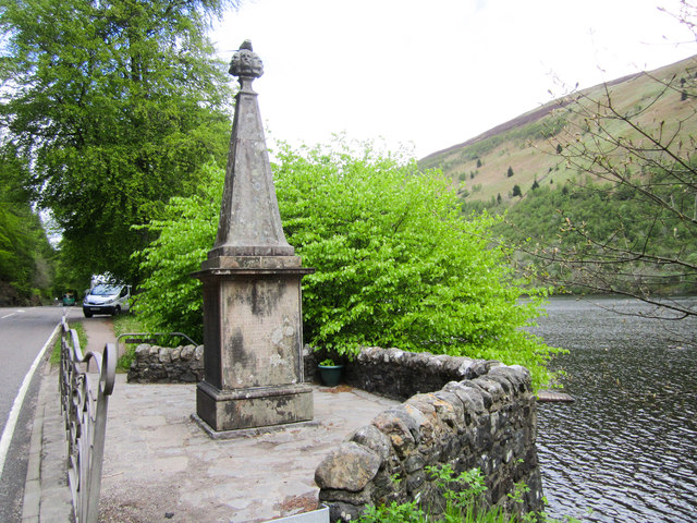
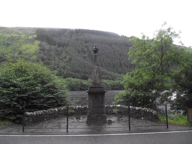
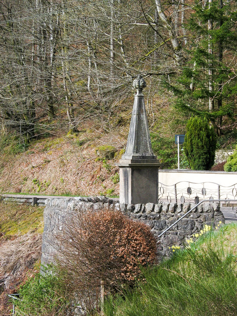
The Well of the Seven Heads
Highland cattle beside Loch Oich View southward on A82 just south of Invergarry.
Highland cattle beside Loch Oich
View southward on A82 just south of Invergarry.
Tobar nan Ceann Well of The Seven Heads Monument (Tobar nan Ceann)
<span class="nowrap"><a title="http://www.outdoorcapital.co.uk/see-and-do/well-of-the-seven-heads-toban-nan-ceann-p185021" rel="nofollow ugc noopener" href="http://www.outdoorcapital.co.uk/see-and-do/well-of-the-seven-heads-toban-nan-ceann-p185021">Link</a><img style="margin-left:2px;" alt="External link" title="External link - shift click to open in new window" src="https://s1.geograph.org.uk/img/external.png" width="10" height="10"/></span>
Tobar nan Ceann
Well of The Seven Heads Monument (Tobar nan Ceann) LinkExternal link
Well of the Seven Heads A Category B listed monument [<span class="nowrap"><a title="http://portal.historicenvironment.scot/designation/LB6825" rel="nofollow ugc noopener" href="http://portal.historicenvironment.scot/designation/LB6825">Link</a><img style="margin-left:2px;" alt="External link" title="External link - shift click to open in new window" src="https://s1.geograph.org.uk/img/external.png" width="10" height="10"/></span>], dating from 1812, which commemorates the murder of two sons of the 12th MacDonald of Keppoch in 1663. The murderers (seven in total) were found and executed in 1665 and their heads washed in the spring here before being shown to the clan chief.

The monument sits beside the A82 on the shore of Loch Oich.
Well of the Seven Heads
A Category B listed monument [LinkExternal link], dating from 1812, which commemorates the murder of two sons of the 12th MacDonald of Keppoch in 1663. The murderers (seven in total) were found and executed in 1665 and their heads washed in the spring here before being shown to the clan chief. The monument sits beside the A82 on the shore of Loch Oich.
Monument at Well of the Seven Heads Named on OS maps as  Tobar nan Ceann the monument is above an actual well which lies below the retaining wall. It's not obvious in the image from the distance at which it was recorded that the finial to the obelisk is a cluster of seven heads carved in stone, held by a hand which also holds a knife. The actual heads belonged to the (supposed?) murderers of two MacDonald brothers who were put to death in a revenge attack.
Monument at Well of the Seven Heads
Named on OS maps as Tobar nan Ceann the monument is above an actual well which lies below the retaining wall. It's not obvious in the image from the distance at which it was recorded that the finial to the obelisk is a cluster of seven heads carved in stone, held by a hand which also holds a knife. The actual heads belonged to the (supposed?) murderers of two MacDonald brothers who were put to death in a revenge attack.
Loch Oich The wooded shore of the loch near the A82.
Loch Oich
The wooded shore of the loch near the A82.
Old Milestone by the A82, Loch Oich, Kilmallie parish Highland granite by the A82, in parish of Kilmallie (Lochaber District), Loch Oich, near lay-by, 200m North of shop.

Inscription once read:-
: (Spean Bridge / 14) : : (Invergarry / 2) :

Surveyed

Milestone Society National ID: HI_FWFA23
Old Milestone by the A82, Loch Oich, Kilmallie parish
Highland granite by the A82, in parish of Kilmallie (Lochaber District), Loch Oich, near lay-by, 200m North of shop. Inscription once read:- : (Spean Bridge / 14) : : (Invergarry / 2) : Surveyed Milestone Society National ID: HI_FWFA23
Hillside on the way to Meall Nan Reitheachan trigpoint
The A82 passes the Well of the Seven Heads
Well of the Seven Heads Monument, Loch Oich Category B Listed monument erected in 1812 by Col. McDonnell of Glengarry. Seven murderers killed at Inverlair in 1665 had their heads presented to the Chief at Invergarry Castle. Previously the heads had reputedly been washed in the spring below the monument.
Well of the Seven Heads Monument, Loch Oich
Category B Listed monument erected in 1812 by Col. McDonnell of Glengarry. Seven murderers killed at Inverlair in 1665 had their heads presented to the Chief at Invergarry Castle. Previously the heads had reputedly been washed in the spring below the monument.
Phonebox beside the A82 at Well of the Seven Heads
Road to White Bridge car park
Coille Creag an t-Sagairt A scenic track, which leads to a familyphobic   campsite.  It gives very fine views over woodland around Invergarry.
Coille Creag an t-Sagairt
A scenic track, which leads to a familyphobic campsite. It gives very fine views over woodland around Invergarry.
Woodland, Invergarry A view over Glen Garry and the Great Glen from Coille Creag an t-Sagairt.
Woodland, Invergarry
A view over Glen Garry and the Great Glen from Coille Creag an t-Sagairt.
Coille Creag an t-Sagairt A very scenic track in fine woodland above Invergarry.
Coille Creag an t-Sagairt
A very scenic track in fine woodland above Invergarry.
Road, Faichem Single track road above Invergarry.
Road, Faichem
Single track road above Invergarry.
(Un)-welcome sign Families were still fair game in 2017.  There has been great progress during my lifetime but there is still a little way to go.
(Un)-welcome sign
Families were still fair game in 2017. There has been great progress during my lifetime but there is still a little way to go.
Meadow, Glen Garry
Meadow, Glen Garry
Show me another place!

Linne Eilean Gainimh is located at Grid Ref: NH2900 (Lat: 57.066978, Lng: -4.8136468)

Unitary Authority: Highland

Police Authority: Highlands and Islands

What 3 Words

///hoops.overt.breed. Near Gairlochy, Highland

Related Wikis

Invergarry

Invergarry (Scottish Gaelic: Inbhir Garadh) is a village in the Highlands of Scotland. It is in the Great Glen, near where the River Garry flows into Loch...

Loch Oich

Loch Oich (; Scottish Gaelic: Loch Omhaich) is a freshwater loch in the Highlands of Scotland which forms part of the Caledonian Canal, of which it is...
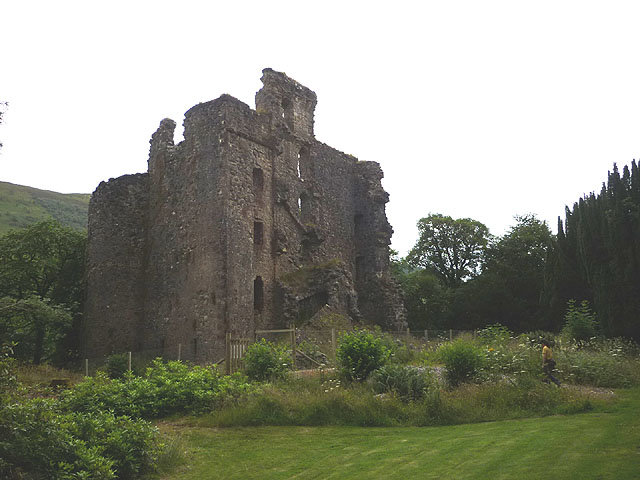
Invergarry Castle

Invergarry Castle in the Scottish Highlands was the seat of the Chiefs of the Clan MacDonell of Glengarry, a powerful branch of the Clan Donald. The castle...

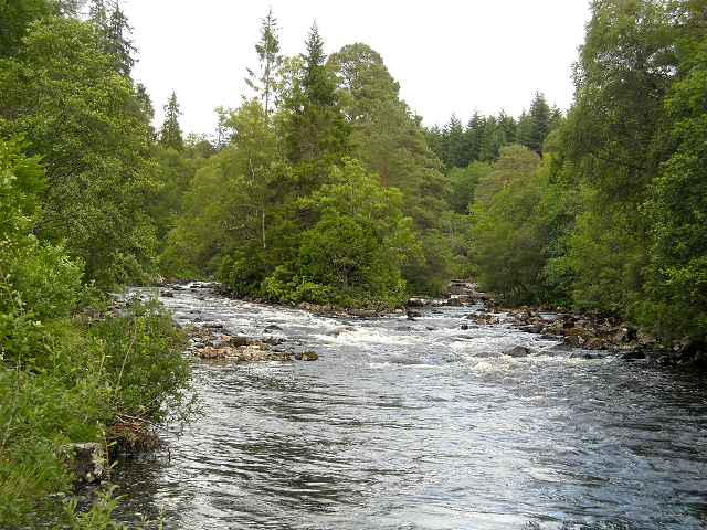
River Garry, Inverness-shire

The River Garry (Scottish Gaelic: Garadh / Abhainn Gharadh) in Inverness-shire is a Scottish river punctuated by two long Lochs, in the region of Lochaber...

Nearby Amenities

Located within 500m of 57.066978,-4.8136468
Mandally
Name Gd: Manndalaidh
Place: hamlet
Lat/Long: 57.065929/-4.8102859
Barrier: cattle_grid
Source: survey
Lat/Long: 57.0661917/-4.8062042
Parking
Lat/Long: 57.0689721/-4.8153958
Shinty Club
Whitewater: egress
Lat/Long: 57.0672111/-4.8163572
Toilets
Source: survey
Lat/Long: 57.0695859/-4.8115554
Bus Stop
Post Office
Naptan AtcoCode: 6700712787
Naptan Bearing: W
Naptan CommonName: Post Office
Naptan Indicator: o/s Post Office
Naptan Landmark: Post Office
Naptan NaptanCode: 45323796
Naptan Street: A87
Naptan Verified: no
Source: naptan_import
Lat/Long: 57.0685426/-4.8174269
Power: tower
Lat/Long: 57.0687588/-4.8106303
Post Box
Post Box Type: wall
Ref: PH35 57
Source: survey
Lat/Long: 57.0702635/-4.8108075
Cafe
Lat/Long: 57.0693144/-4.8122282
Power: tower
Lat/Long: 57.0646738/-4.8104722
Power: pole
Lat/Long: 57.0639624/-4.8087006
Power: pole
Lat/Long: 57.0644036/-4.8086871
Power: pole
Lat/Long: 57.0649702/-4.8086797
Power: pole
Lat/Long: 57.0655025/-4.8086737
Power: pole
Lat/Long: 57.0659754/-4.8086797
Power: pole
Lat/Long: 57.0691921/-4.8142581
Power: pole
Lat/Long: 57.068248/-4.8135604
Power: pole
Lat/Long: 57.0674633/-4.8125962
Power: pole
Lat/Long: 57.0671085/-4.8119405
Power: pole
Lat/Long: 57.0664117/-4.8108925
Power: pole
Lat/Long: 57.066428/-4.8102397
Power: pole
Lat/Long: 57.0662359/-4.8097067
Power: pole
Lat/Long: 57.0662229/-4.8078353
Power: pole
Lat/Long: 57.0663922/-4.8072708
Power: pole
Lat/Long: 57.0666982/-4.8061839
Power: pole
Lat/Long: 57.0671988/-4.8078832
Power: pole
Lat/Long: 57.0670645/-4.8066405
Power: pole
Lat/Long: 57.0693158/-4.807175
Power: pole
Lat/Long: 57.0685857/-4.8079011
Power: pole
Lat/Long: 57.0681031/-4.8075912
Power: pole
Lat/Long: 57.0675822/-4.8072828
Power: pole
Lat/Long: 57.0668659/-4.8083952
Power: pole
Lat/Long: 57.0691937/-4.8114284
Power: pole
Lat/Long: 57.0691937/-4.8127998
Power: pole
Lat/Long: 57.0690277/-4.8156415
Power: pole
Lat/Long: 57.0686712/-4.8169799
Power: pole
Lat/Long: 57.0683717/-4.8181926
Power: pole
Lat/Long: 57.0680705/-4.8196029
Power: pole
Lat/Long: 57.0678687/-4.8205012
Power: pole
Lat/Long: 57.0677441/-4.8217154
Power: pole
Lat/Long: 57.0693091/-4.8085678
Power: pole
Lat/Long: 57.0693044/-4.8101388
Power: pole
Lat/Long: 57.0654596/-4.8161328
Power: pole
Lat/Long: 57.0655661/-4.8159038
Power: pole
Lat/Long: 57.0659041/-4.8151366
Power: pole
Lat/Long: 57.0660282/-4.8147081
Power: pole
Lat/Long: 57.0661787/-4.812686
Drinking Water
Lat/Long: 57.069415/-4.8120218
Building: yes
Note: used to tag houses that need mapping as areas
Lat/Long: 57.06815/-4.8143772
Building: yes
Note: used to tag houses that need mapping as areas
Lat/Long: 57.0659299/-4.8139615
Building: yes
Note: used to tag houses that need mapping as areas
Lat/Long: 57.0658779/-4.8143846
Building: yes
Note: used to tag houses that need mapping as areas
Lat/Long: 57.0657439/-4.8149622
Building: yes
Note: used to tag houses that need mapping as areas
Lat/Long: 57.0656779/-4.8152161
Building: yes
Note: used to tag houses that need mapping as areas
Lat/Long: 57.0648938/-4.8184792
The data included in this document is from www.openstreetmap.org. The data is made available under ODbL.

Have you been to Linne Eilean Gainimh?

Leave your review of Linne Eilean Gainimh below (or comments, questions and feedback).