Mandally Wood

Wood, Forest in Inverness-shire

Scotland

Mandally Wood

The Well of the Seven Heads
The Well of the Seven Heads Credit: Tim Glover

Mandally Wood is a picturesque forest located in Inverness-shire, Scotland. Situated approximately 15 miles west of Inverness, it covers an area of around 500 acres and is a popular destination for nature enthusiasts and outdoor lovers.

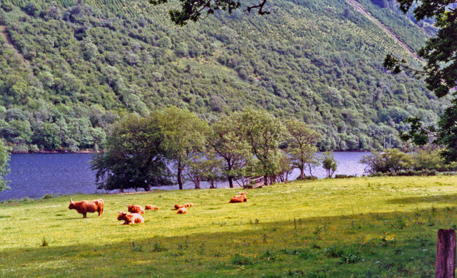
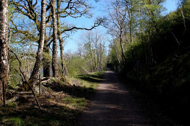
The wood is characterized by its diverse range of tree species, including oak, birch, and pine. These towering trees create a dense canopy, providing a habitat for a variety of wildlife, such as red squirrels, roe deer, and numerous bird species, making it a haven for birdwatchers and wildlife photographers.

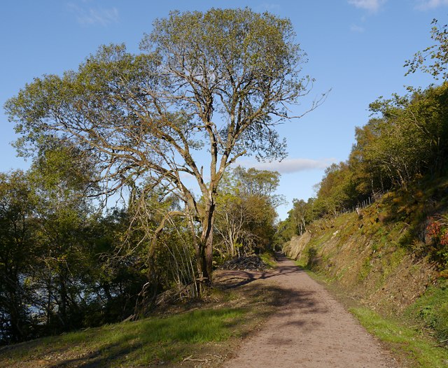
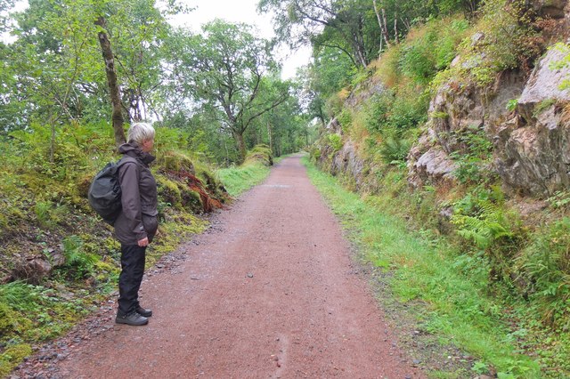
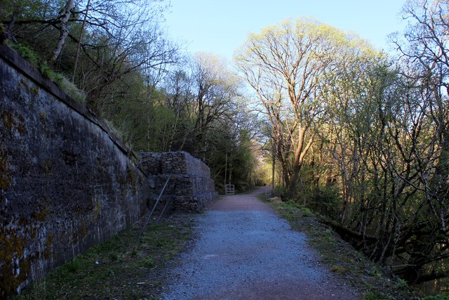
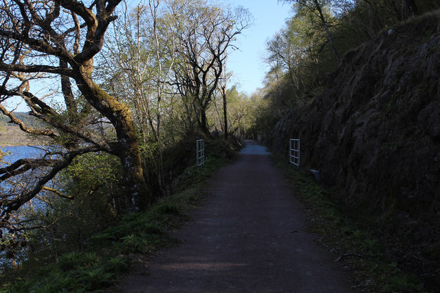
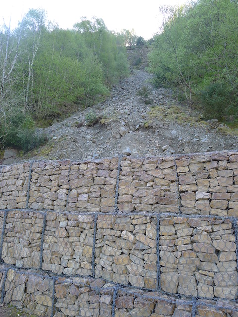
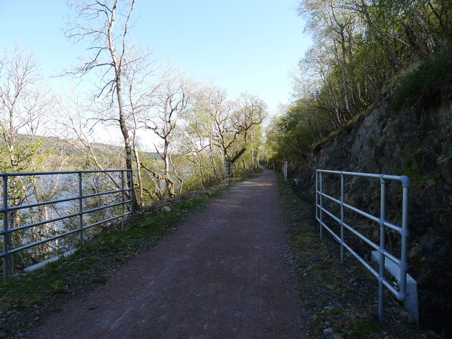
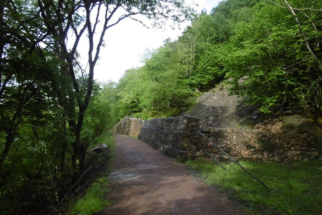
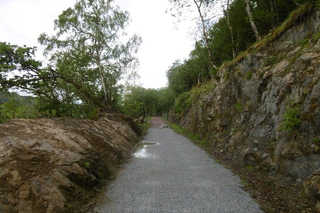
The wood boasts a network of well-maintained walking trails, making it an ideal spot for leisurely strolls and peaceful hikes. Visitors can explore the tranquil woodland, breathing in the fresh, earthy scent and enjoying the soothing sounds of nature. The trails offer stunning views of the surrounding countryside and the nearby River Beauly, adding to the charm of the experience.

Mandally Wood is also renowned for its ancient history. It is believed to have been an important site during the Bronze Age, with remains of settlements and burial grounds discovered in the area. Archaeologists have uncovered artifacts and evidence of human activity, providing valuable insights into the lives of ancient inhabitants.

Overall, Mandally Wood offers a captivating blend of natural beauty, abundant wildlife, and historical significance. Whether one seeks relaxation, adventure, or a journey into the past, this enchanting forest provides a truly memorable experience for all who visit.

If you have any feedback on the listing, please let us know in the comments section below.

Mandally Wood Images

Images are sourced within 2km of 57.063568/-4.8057998 or Grid Reference NH2900. Thanks to Geograph Open Source API. All images are credited.
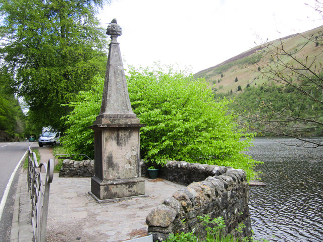
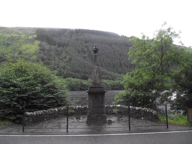
The Well of the Seven Heads
Loch Oich
Loch Oich
Old railway line, by Loch Oich This was the route of the Invergarry and Fort Augustus Railway. The line closed in 1947, and since then it had been largely disused and overgrown.

It has now been cleared and resurfaced - it opened earlier this year as part of National Cycle Network Route 78 and the Great Glen Way. It is a fairly smooth, compacted gravel path, so easy to cycle along.

This part is in a bit of a cutting, with steep rocks to the right. Also some  mixed woodland on either side.
Old railway line, by Loch Oich
This was the route of the Invergarry and Fort Augustus Railway. The line closed in 1947, and since then it had been largely disused and overgrown. It has now been cleared and resurfaced - it opened earlier this year as part of National Cycle Network Route 78 and the Great Glen Way. It is a fairly smooth, compacted gravel path, so easy to cycle along. This part is in a bit of a cutting, with steep rocks to the right. Also some mixed woodland on either side.
Highland cattle beside Loch Oich View southward on A82 just south of Invergarry.
Highland cattle beside Loch Oich
View southward on A82 just south of Invergarry.
Tobar nan Ceann Well of The Seven Heads Monument (Tobar nan Ceann)
<span class="nowrap"><a title="http://www.outdoorcapital.co.uk/see-and-do/well-of-the-seven-heads-toban-nan-ceann-p185021" rel="nofollow ugc noopener" href="http://www.outdoorcapital.co.uk/see-and-do/well-of-the-seven-heads-toban-nan-ceann-p185021">Link</a><img style="margin-left:2px;" alt="External link" title="External link - shift click to open in new window" src="https://s1.geograph.org.uk/img/external.png" width="10" height="10"/></span>
Tobar nan Ceann
Well of The Seven Heads Monument (Tobar nan Ceann) LinkExternal link
Resting Kayaks Kayaks on the banks of Loch Oich.
Resting Kayaks
Kayaks on the banks of Loch Oich.
South end of Loch Oich Seen from the track to the Great Glen Water Park.
South end of Loch Oich
Seen from the track to the Great Glen Water Park.
Former railway route by Loch Oich The Great Glen Way now follows much of the former railway as far as Aberchalder. Quite a bit of work has been done to stabilise the cutting sides in places.
Former railway route by Loch Oich
The Great Glen Way now follows much of the former railway as far as Aberchalder. Quite a bit of work has been done to stabilise the cutting sides in places.
On the Great Glen Way by Loch Oich Easy walking on the old railway route on the E side of the loch.
On the Great Glen Way by Loch Oich
Easy walking on the old railway route on the E side of the loch.
Railway Trackbed above Loch Oich Section of the course of the former railway between Fort Augustus and Spean Bridge.
It has been recently upgraded and refurbished to accommodate the Great Glen Way National Trail.
Railway Trackbed above Loch Oich
Section of the course of the former railway between Fort Augustus and Spean Bridge. It has been recently upgraded and refurbished to accommodate the Great Glen Way National Trail.
Course of the Old Railway above Loch Oich (1) Now adopted by the Great Glen Way National Trail - a new lease of life for the former railway that ran between Spean Bridge and Fort Augustus
Course of the Old Railway above Loch Oich (1)
Now adopted by the Great Glen Way National Trail - a new lease of life for the former railway that ran between Spean Bridge and Fort Augustus
Course of the Old Railway above Loch Oich (2)
Landslide protection from stone-filled gabions Alongside the old Invergarry to Fort Augustus railway track, and the route of the Great Glen Way
Landslide protection from stone-filled gabions
Alongside the old Invergarry to Fort Augustus railway track, and the route of the Great Glen Way
'Health and Safety' gone mad? I count eleven pairs of railings visible in this picture of part of the restored trackbed of the Invergarry to Fort Augustus railway. The railings align with concrete drainage culverts. But the likelihood of injury from falling off the track at these points is surely no greater than at any other (non-railinged) part of the track.
'Health and Safety' gone mad?
I count eleven pairs of railings visible in this picture of part of the restored trackbed of the Invergarry to Fort Augustus railway. The railings align with concrete drainage culverts. But the likelihood of injury from falling off the track at these points is surely no greater than at any other (non-railinged) part of the track.
Invergarry and Fort Augustus Railway The trackbed along the shores of Loch Oich. Here gabions are being used to protect the trackbed from landslides on the steep slopes above.  The trackbed has recently been cleared and used as the Great Glen Way.
Invergarry and Fort Augustus Railway
The trackbed along the shores of Loch Oich. Here gabions are being used to protect the trackbed from landslides on the steep slopes above. The trackbed has recently been cleared and used as the Great Glen Way.
Invergarry and Fort Augustus Railway The railway, over engineered in an area of limited population was a financial disaster.  More over engineering is apparent in the conversion to a path - every culvert has railings, yet you are just as likely to come to grief on any other part of the track.   The rails to trails conversion is very welcome, taking out a long stretch of hostile A82.
Invergarry and Fort Augustus Railway
The railway, over engineered in an area of limited population was a financial disaster. More over engineering is apparent in the conversion to a path - every culvert has railings, yet you are just as likely to come to grief on any other part of the track. The rails to trails conversion is very welcome, taking out a long stretch of hostile A82.
Loch Oich View from the Great Glen Way on the trackbed of the Invergarry and Fort Augustus Railway.
Loch Oich
View from the Great Glen Way on the trackbed of the Invergarry and Fort Augustus Railway.
Well of the Seven Heads A Category B listed monument [<span class="nowrap"><a title="http://portal.historicenvironment.scot/designation/LB6825" rel="nofollow ugc noopener" href="http://portal.historicenvironment.scot/designation/LB6825">Link</a><img style="margin-left:2px;" alt="External link" title="External link - shift click to open in new window" src="https://s1.geograph.org.uk/img/external.png" width="10" height="10"/></span>], dating from 1812, which commemorates the murder of two sons of the 12th MacDonald of Keppoch in 1663. The murderers (seven in total) were found and executed in 1665 and their heads washed in the spring here before being shown to the clan chief.

The monument sits beside the A82 on the shore of Loch Oich.
Well of the Seven Heads
A Category B listed monument [LinkExternal link], dating from 1812, which commemorates the murder of two sons of the 12th MacDonald of Keppoch in 1663. The murderers (seven in total) were found and executed in 1665 and their heads washed in the spring here before being shown to the clan chief. The monument sits beside the A82 on the shore of Loch Oich.
Show me another place!

Mandally Wood is located at Grid Ref: NH2900 (Lat: 57.063568, Lng: -4.8057998)

Unitary Authority: Highland

Police Authority: Highlands and Islands

What 3 Words

///heaven.motivates.replenish. Near Gairlochy, Highland

Related Wikis

Invergarry

Invergarry (Scottish Gaelic: Inbhir Garadh) is a village in the Highlands of Scotland. It is in the Great Glen, near where the River Garry flows into Loch...
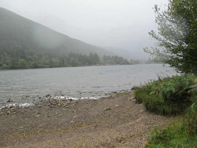
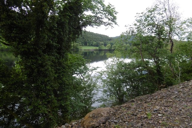
Loch Oich

Loch Oich (; Scottish Gaelic: Loch Omhaich) is a freshwater loch in the Highlands of Scotland which forms part of the Caledonian Canal, of which it is...
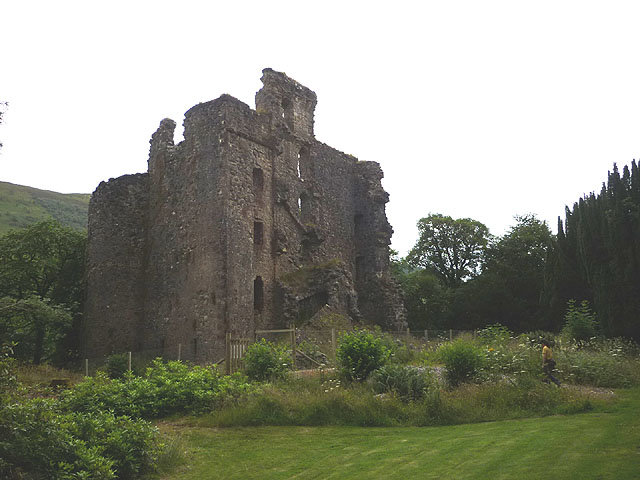
Invergarry Castle

Invergarry Castle in the Scottish Highlands was the seat of the Chiefs of the Clan MacDonell of Glengarry, a powerful branch of the Clan Donald. The castle...

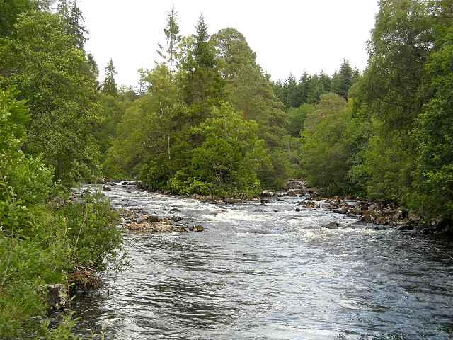
River Garry, Inverness-shire

The River Garry (Scottish Gaelic: Garadh / Abhainn Gharadh) in Inverness-shire is a Scottish river punctuated by two long Lochs, in the region of Lochaber...

Nearby Amenities

Located within 500m of 57.063568,-4.8057998
Mandally
Name Gd: Manndalaidh
Place: hamlet
Lat/Long: 57.065929/-4.8102859
Barrier: cattle_grid
Source: survey
Lat/Long: 57.0661917/-4.8062042
Power: tower
Lat/Long: 57.0598397/-4.810253
Power: tower
Lat/Long: 57.0627402/-4.8103975
Power: tower
Lat/Long: 57.0646738/-4.8104722
Power: pole
Lat/Long: 57.0597253/-4.8088189
Power: pole
Lat/Long: 57.0602886/-4.8088129
Power: pole
Lat/Long: 57.0608968/-4.808777
Power: pole
Lat/Long: 57.0612704/-4.808762
Power: pole
Lat/Long: 57.0618981/-4.808747
Power: pole
Lat/Long: 57.0625566/-4.8087171
Power: pole
Lat/Long: 57.0632811/-4.8087126
Power: pole
Lat/Long: 57.0639624/-4.8087006
Power: pole
Lat/Long: 57.0644036/-4.8086871
Power: pole
Lat/Long: 57.0649702/-4.8086797
Power: pole
Lat/Long: 57.0655025/-4.8086737
Power: pole
Lat/Long: 57.0659754/-4.8086797
Power: pole
Lat/Long: 57.0664117/-4.8108925
Power: pole
Lat/Long: 57.066428/-4.8102397
Power: pole
Lat/Long: 57.0662359/-4.8097067
Power: pole
Lat/Long: 57.0662229/-4.8078353
Power: pole
Lat/Long: 57.0663922/-4.8072708
Power: pole
Lat/Long: 57.0666982/-4.8061839
Power: pole
Lat/Long: 57.0668089/-4.804823
Power: pole
Lat/Long: 57.0668871/-4.8037286
Power: pole
Lat/Long: 57.0669994/-4.80245
Power: pole
Lat/Long: 57.0671394/-4.8012433
Power: pole
Lat/Long: 57.0671988/-4.8078832
Power: pole
Lat/Long: 57.0670645/-4.8066405
Power: pole
Lat/Long: 57.0675822/-4.8072828
Power: pole
Lat/Long: 57.0668659/-4.8083952
The data included in this document is from www.openstreetmap.org. The data is made available under ODbL.

Have you been to Mandally Wood?

Leave your review of Mandally Wood below (or comments, questions and feedback).