River Brahan

Lake, Pool, Pond, Freshwater Marsh in Ross-shire

Scotland

River Brahan

Approaching Loch Gowan on the train to Kyle of Lochalsh This part of the journey is mainly open wet moorland with lochs.
Approaching Loch Gowan on the train to Kyle of Lochalsh Credit: Julian Paren

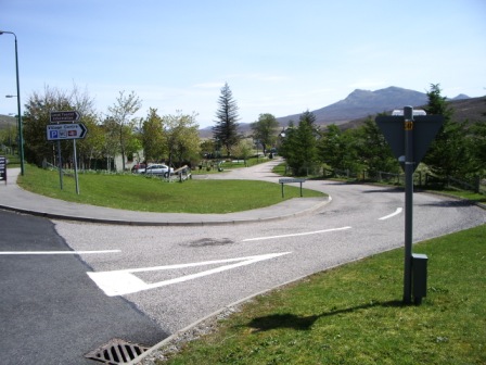
River Brahan is a freshwater river located in Ross-shire, Scotland. It flows through the picturesque countryside, surrounded by lush greenery and rolling hills. The river begins its journey in the mountains of the Scottish Highlands, meandering through the landscape for approximately 20 kilometers before emptying into the nearby sea.

As a freshwater body, River Brahan provides a vital habitat for various aquatic species. Its crystal-clear waters are home to a diverse range of fish, including salmon, trout, and pike. These fish attract anglers from far and wide, who come to test their skills and enjoy the tranquility of the surroundings.

Alongside the river, there are several pools and ponds that enhance the beauty of the landscape. These water features provide a peaceful retreat for visitors, who can sit by the water's edge and enjoy the gentle sounds of nature. The pools and ponds are also important for the local wildlife, acting as watering holes for birds, deer, and other animals.

In addition to its natural beauty, River Brahan is surrounded by a freshwater marsh, which further enhances the biodiversity of the area. The marsh is filled with various species of water-loving plants, creating a vibrant ecosystem. It also serves as a nesting ground for numerous bird species, including ducks, swans, and herons.

Overall, River Brahan and its surrounding freshwater habitats offer a peaceful and picturesque setting for both wildlife and human visitors. Its clear waters, diverse fish population, and abundant birdlife make it an ideal destination for nature enthusiasts and those seeking a tranquil escape.

If you have any feedback on the listing, please let us know in the comments section below.

River Brahan Images

Images are sourced within 2km of 57.577595/-5.0798354 or Grid Reference NH1558. Thanks to Geograph Open Source API. All images are credited.

Approaching Loch Gowan on the train to Kyle of Lochalsh This part of the journey is mainly open wet moorland with lochs.
Approaching Loch Gowan on the train to Kyle of Lochalsh
This part of the journey is mainly open wet moorland with lochs.
A890 Eastbound The A890 is a non-primary cross-country route in sparsely populated, mountainous terrain from Lochalsh and Skye on the west coast of the Highlands to Achnasheen where it joins the A832 to Inverness. Like many Highland roads, the A890 was entirely single track until the 1960s, but road improvements in recent years (along with improvements on the A832) have made it increasingly popular as an alternative route between Inverness and the Isle of Skye, avoiding the A82 along Loch Ness. It is also an important route for residents of the Lochalsh, Applecross and Strathcarron areas, connecting them to the services of  Kyle of Lochalsh , as well as the High School in Plockton.
A890 Eastbound
The A890 is a non-primary cross-country route in sparsely populated, mountainous terrain from Lochalsh and Skye on the west coast of the Highlands to Achnasheen where it joins the A832 to Inverness. Like many Highland roads, the A890 was entirely single track until the 1960s, but road improvements in recent years (along with improvements on the A832) have made it increasingly popular as an alternative route between Inverness and the Isle of Skye, avoiding the A82 along Loch Ness. It is also an important route for residents of the Lochalsh, Applecross and Strathcarron areas, connecting them to the services of Kyle of Lochalsh , as well as the High School in Plockton.
A890 towards the A832 Junction at Achnasheen The A890 is a non-primary cross-country route in sparsely populated, mountainous terrain from Lochalsh and Skye on the west coast of the Highlands to Achnasheen where it joins the A832 to Inverness. Like many Highland roads, the A890 was entirely single track until the 1960s, but road improvements in recent years (along with improvements on the A832) have made it increasingly popular as an alternative route between Inverness and the Isle of Skye, avoiding the A82 along Loch Ness. It is also an important route for residents of the Lochalsh, Applecross and Strathcarron areas, connecting them to the services of  Kyle of Lochalsh , as well as the High School in Plockton.
A890 towards the A832 Junction at Achnasheen
The A890 is a non-primary cross-country route in sparsely populated, mountainous terrain from Lochalsh and Skye on the west coast of the Highlands to Achnasheen where it joins the A832 to Inverness. Like many Highland roads, the A890 was entirely single track until the 1960s, but road improvements in recent years (along with improvements on the A832) have made it increasingly popular as an alternative route between Inverness and the Isle of Skye, avoiding the A82 along Loch Ness. It is also an important route for residents of the Lochalsh, Applecross and Strathcarron areas, connecting them to the services of Kyle of Lochalsh , as well as the High School in Plockton.
Bridge over River Bran near Achnasheen
A890 near Ledgowan Lodge Approaching the junction with the A832 at a roundabout near Achnasheen.
A890 near Ledgowan Lodge
Approaching the junction with the A832 at a roundabout near Achnasheen.
A832 at Achnasheen The A832 is a road in the Scottish Highlands, linking Cromarty, on the east coast, to Gairloch on the west coast, and beyond Gairloch to Braemore Junction. It is 126 miles long and runs entirely in the former county of Ross and Cromarty. The road forms part of the Wester Ross Coastal Trail <span class="nowrap"><a title="https://en.wikipedia.org/wiki/A832_road" rel="nofollow ugc noopener" href="https://en.wikipedia.org/wiki/A832_road">Link</a><img style="margin-left:2px;" alt="External link" title="External link - shift click to open in new window" src="https://s1.geograph.org.uk/img/external.png" width="10" height="10"/></span>  (Wikipedia).
A832 at Achnasheen
The A832 is a road in the Scottish Highlands, linking Cromarty, on the east coast, to Gairloch on the west coast, and beyond Gairloch to Braemore Junction. It is 126 miles long and runs entirely in the former county of Ross and Cromarty. The road forms part of the Wester Ross Coastal Trail LinkExternal link (Wikipedia).
A832 near Achnasheen The A832 is a road in the Scottish Highlands, linking Cromarty, on the east coast, to Gairloch on the west coast, and beyond Gairloch to Braemore Junction. It is 126 miles long and runs entirely in the former county of Ross and Cromarty. The road forms part of the Wester Ross Coastal Trail <span class="nowrap"><a title="https://en.wikipedia.org/wiki/A832_road" rel="nofollow ugc noopener" href="https://en.wikipedia.org/wiki/A832_road">Link</a><img style="margin-left:2px;" alt="External link" title="External link - shift click to open in new window" src="https://s1.geograph.org.uk/img/external.png" width="10" height="10"/></span>  (Wikipedia).
A832 near Achnasheen
The A832 is a road in the Scottish Highlands, linking Cromarty, on the east coast, to Gairloch on the west coast, and beyond Gairloch to Braemore Junction. It is 126 miles long and runs entirely in the former county of Ross and Cromarty. The road forms part of the Wester Ross Coastal Trail LinkExternal link (Wikipedia).
A832 east of Achnasheen The A832 is a road in the Scottish Highlands, linking Cromarty, on the east coast, to Gairloch on the west coast, and beyond Gairloch to Braemore Junction. It is 126 miles long and runs entirely in the former county of Ross and Cromarty. The road forms part of the Wester Ross Coastal Trail <span class="nowrap"><a title="https://en.wikipedia.org/wiki/A832_road" rel="nofollow ugc noopener" href="https://en.wikipedia.org/wiki/A832_road">Link</a><img style="margin-left:2px;" alt="External link" title="External link - shift click to open in new window" src="https://s1.geograph.org.uk/img/external.png" width="10" height="10"/></span>  (Wikipedia).
A832 east of Achnasheen
The A832 is a road in the Scottish Highlands, linking Cromarty, on the east coast, to Gairloch on the west coast, and beyond Gairloch to Braemore Junction. It is 126 miles long and runs entirely in the former county of Ross and Cromarty. The road forms part of the Wester Ross Coastal Trail LinkExternal link (Wikipedia).
A832, eastbound The A832 runs 127 miles from the Black Isle to Braemore Junction <a href="https://www.geograph.org.uk/photo/7232275">NH2077 : Braemore Junction</a>.
<span class="nowrap"><a title="https://www.sabre-roads.org.uk/wiki/index.php?title=A832" rel="nofollow ugc noopener" href="https://www.sabre-roads.org.uk/wiki/index.php?title=A832">Link</a><img style="margin-left:2px;" alt="External link" title="External link - shift click to open in new window" src="https://s1.geograph.org.uk/img/external.png" width="10" height="10"/></span>
A832, eastbound
The A832 runs 127 miles from the Black Isle to Braemore Junction NH2077 : Braemore Junction. LinkExternal link
A890 The A890 runs 32 miles from Achnasheen to Auchtertyre.
<span class="nowrap"><a title="https://www.sabre-roads.org.uk/wiki/index.php?title=A890" rel="nofollow ugc noopener" href="https://www.sabre-roads.org.uk/wiki/index.php?title=A890">Link</a><img style="margin-left:2px;" alt="External link" title="External link - shift click to open in new window" src="https://s1.geograph.org.uk/img/external.png" width="10" height="10"/></span>
A890
The A890 runs 32 miles from Achnasheen to Auchtertyre. LinkExternal link
A890 crossing the River Bran The A890 runs 32 miles from Achnasheen to Auchtertyre.
<span class="nowrap"><a title="https://www.sabre-roads.org.uk/wiki/index.php?title=A890" rel="nofollow ugc noopener" href="https://www.sabre-roads.org.uk/wiki/index.php?title=A890">Link</a><img style="margin-left:2px;" alt="External link" title="External link - shift click to open in new window" src="https://s1.geograph.org.uk/img/external.png" width="10" height="10"/></span>
A890 crossing the River Bran
The A890 runs 32 miles from Achnasheen to Auchtertyre. LinkExternal link
A890 The A890 runs 32 miles from Achnasheen to Auchtertyre.
<span class="nowrap"><a title="https://www.sabre-roads.org.uk/wiki/index.php?title=A890" rel="nofollow ugc noopener" href="https://www.sabre-roads.org.uk/wiki/index.php?title=A890">Link</a><img style="margin-left:2px;" alt="External link" title="External link - shift click to open in new window" src="https://s1.geograph.org.uk/img/external.png" width="10" height="10"/></span>
A890
The A890 runs 32 miles from Achnasheen to Auchtertyre. LinkExternal link
NC500 The North Coast 500 is a 516 mile scenic route around the north coast of Scotland, starting and ending at Inverness Castle. The route is also known as the NC500 and was launched in 2015, linking many features in the north Highlands of Scotland in one touring route.
The route has increased visitor numbers to parts of the north of Scotland, which has brought economic benefits to some areas. The increase in traffic has also led to more instances of bad and dangerous driving, as well as damage to the roads and concerns about the environmental impact. 
Apparently the route was amended in 2022 with detours etc being removed.
Wikipedia: <span class="nowrap"><a title="https://en.wikipedia.org/wiki/North_Coast_500" rel="nofollow ugc noopener" href="https://en.wikipedia.org/wiki/North_Coast_500">Link</a><img style="margin-left:2px;" alt="External link" title="External link - shift click to open in new window" src="https://s1.geograph.org.uk/img/external.png" width="10" height="10"/></span> 
Original route map: <span class="nowrap"><a title="https://en.wikipedia.org/wiki/North_Coast_500#/media/File:North_Coast_500,_Scotland.svg" rel="nofollow ugc noopener" href="https://en.wikipedia.org/wiki/North_Coast_500#/media/File:North_Coast_500,_Scotland.svg">Link</a><img style="margin-left:2px;" alt="External link" title="External link - shift click to open in new window" src="https://s1.geograph.org.uk/img/external.png" width="10" height="10"/></span> 
Latest route map: <span class="nowrap"><a title="https://www.northcoast500.com/explore-the-route/" rel="nofollow ugc noopener" href="https://www.northcoast500.com/explore-the-route/">Link</a><img style="margin-left:2px;" alt="External link" title="External link - shift click to open in new window" src="https://s1.geograph.org.uk/img/external.png" width="10" height="10"/></span>
NC500
The North Coast 500 is a 516 mile scenic route around the north coast of Scotland, starting and ending at Inverness Castle. The route is also known as the NC500 and was launched in 2015, linking many features in the north Highlands of Scotland in one touring route. The route has increased visitor numbers to parts of the north of Scotland, which has brought economic benefits to some areas. The increase in traffic has also led to more instances of bad and dangerous driving, as well as damage to the roads and concerns about the environmental impact. Apparently the route was amended in 2022 with detours etc being removed. Wikipedia: LinkExternal link Original route map: LinkExternal link Latest route map: LinkExternal link
A890, westbound The A890 runs 32 miles from Achnasheen to Auchtertyre.
<span class="nowrap"><a title="https://www.sabre-roads.org.uk/wiki/index.php?title=A890" rel="nofollow ugc noopener" href="https://www.sabre-roads.org.uk/wiki/index.php?title=A890">Link</a><img style="margin-left:2px;" alt="External link" title="External link - shift click to open in new window" src="https://s1.geograph.org.uk/img/external.png" width="10" height="10"/></span>
A890, westbound
The A890 runs 32 miles from Achnasheen to Auchtertyre. LinkExternal link
Telephone box in Achnasheen
Small hydro scheme above Achnasheen
View south from Achnasheen main road across the River Bran
Show me another place!

River Brahan is located at Grid Ref: NH1558 (Lat: 57.577595, Lng: -5.0798354)

Unitary Authority: Highland

Police Authority: Highlands and Islands

What 3 Words

///public.gossip.announced. Near Achnasheen, Highland

Related Wikis

Achnasheen railway station

Achnasheen railway station is a remote railway station on the Kyle of Lochalsh Line, serving the village of Achnasheen in the north of Scotland. The station...

Achnasheen

Achnasheen (Gaelic Achadh na Sìne) is a small village in Ross-shire in the Highland council area of Scotland. The village is situated on the River Bran...

Fionn Bheinn

Fionn Bheinn is a Scottish mountain located south of Loch Fannich in the north western highlands. It has a height of 933 m (3061 ft) and is listed as...

Ledgowan Forest

Ledgowan Forest is a deer forest in the Northwest Highlands of Scotland. It stands in Wester Ross to the southwest of Achnasheen. Ledgowan Forest is the...

Loch Scaven

Loch Scaven (Gaelic: Loch Sgamhain) is a small freshwater loch at the head of Glen Carron near the source of the River Carron, Wester Ross, Scotland. It...

Loch Fannich

Loch Fannich is a remote loch in Ross-shire, in Scotland. The loch is located 19 kilometres (12 mi) west of Strathpeffer. == Etymology == The name Fannich...

Northwest Highlands

The Northwest Highlands are located in the northern third of Scotland that is separated from the Grampian Mountains by the Great Glen (Glen More). The...

Highland (council area)

Highland (Scottish Gaelic: Gàidhealtachd, pronounced [ˈkɛːəl̪ˠt̪əxk]; Scots: Hieland) is a council area in the Scottish Highlands and is the largest local...

Nearby Amenities

Located within 500m of 57.577595,-5.0798354
Achnasheen
Name Gd: Achadh na Sìne
Naptan AtcoCode: 9100ACHNSHN
Network: National Rail
Network Website: https://www.nationalrail.co.uk/stations/acn/
Network Wikidata: Q26334
Operator: ScotRail
Operator Website: https://www.scotrail.co.uk/plan-your-journey/stations-and-facilities/acn
Operator Wikidata: Q18356161
Public Transport: station
Railway: station
Ref Crs: ACN
Source: NPE
Train: yes
Uic Ref: 7000023
Wheelchair: no
Wikidata: Q2148366
Wikipedia: en:Achnasheen railway station
Lat/Long: 57.5793199/-5.0721994
Railway: switch
Lat/Long: 57.5786276/-5.0734217
Post Office
Achnasheen Post Office
Opening Hours: Tu 14:30-16:30
Lat/Long: 57.5793879/-5.0724004
Disused Amenity: cafe
Old Name: The Studio
Lat/Long: 57.5792537/-5.0728995
Barrier: cattle_grid
Lat/Long: 57.5759218/-5.0814707
Telephone
Booth: K6
Covered: booth
Source: survey
Lat/Long: 57.5794846/-5.0757379
Barrier: kissing_gate
Lat/Long: 57.578836/-5.0797432
Toilets
Access: yes
Changing Table: no
Fee: no
Source: survey
Toilets Disposal: flush
Wheelchair: yes
Lat/Long: 57.5793197/-5.0725481
Barrier: kissing_gate
Lat/Long: 57.5782708/-5.0812564
Man Made: mast
Source: survey
Lat/Long: 57.5779686/-5.0815761
Bus Stop
Station
Bench: no
Bin: yes
Bus: yes
Lit: yes
Naptan AtcoCode: 6700712326
Naptan Bearing: E
Naptan CommonName: Station
Naptan Indicator: o/s
Naptan Landmark: Railway Station
Naptan NaptanCode: 45327657
Naptan Street: Station Road
Naptan Verified: no
Public Transport: platform
Shelter: yes
Source: naptan_import
Tactile Paving: no
Lat/Long: 57.5794061/-5.0725676
Material: wood
Power: pole
Lat/Long: 57.5799806/-5.0829145
Material: wood
Power: pole
Lat/Long: 57.5799662/-5.0823592
Material: wood
Power: pole
Lat/Long: 57.5798555/-5.0796832
Material: wood
Power: pole
Lat/Long: 57.5799303/-5.0815932
Material: wood
Power: pole
Lat/Long: 57.5800251/-5.0846384
Material: wood
Power: pole
Lat/Long: 57.5793742/-5.0816164
Material: wood
Power: pole
Lat/Long: 57.5789221/-5.0814937
Material: wood
Power: pole
Transformer: yes
Lat/Long: 57.5780019/-5.0812493
Material: wood
Power: pole
Lat/Long: 57.5771826/-5.0797775
Bicycle Parking
Access: yes
Bicycle Parking: stands
Capacity: 6
Covered: no
Fee: no
Lat/Long: 57.5794441/-5.0724696
Barrier: cattle_grid
Lat/Long: 57.580005/-5.0742337
Material: wood
Power: pole
Lat/Long: 57.5800825/-5.0856668
Material: wood
Power: pole
Lat/Long: 57.5804034/-5.0786394
Material: wood
Power: pole
Lat/Long: 57.5809021/-5.0776218
Material: wood
Power: pole
Lat/Long: 57.5812648/-5.0769067
Material: wood
Power: pole
Lat/Long: 57.5815489/-5.0763605
Material: wood
Power: pole
Lat/Long: 57.5797218/-5.0824267
Material: wood
Power: pole
Lat/Long: 57.5765868/-5.0803265
Material: wood
Power: pole
Lat/Long: 57.5758606/-5.0811043
Material: wood
Power: pole
Lat/Long: 57.5745259/-5.0826412
Give Way
Direction: backward
Lat/Long: 57.579448/-5.0752644
Material: wood
Power: pole
Lat/Long: 57.5797508/-5.0836896
Material: wood
Power: pole
Lat/Long: 57.5798873/-5.085174
Material: wood
Power: pole
Lat/Long: 57.5799878/-5.0865774
Material: wood
Power: pole
Lat/Long: 57.5799896/-5.0833562
Material: wood
Power: pole
Transformer: yes
Lat/Long: 57.5807463/-5.0740052
Material: wood
Power: pole
Lat/Long: 57.5779304/-5.0813149
Material: wood
Power: pole
Lat/Long: 57.5776387/-5.0813343
Ice Ages
Board Type: nature
Information: board
Tourism: information
Lat/Long: 57.5780433/-5.0815024
Ledgowan Bridge
Board Type: history
Information: board
Tourism: information
Lat/Long: 57.5780493/-5.0814433
Barrier: stile
Material: wood
Step Count: 6
Stile: ladder
Lat/Long: 57.5782342/-5.0814703
Give Way
Direction: forward
Lat/Long: 57.5793713/-5.0758542
Crossing
Crossing: unmarked
Crossing Island: no
Tactile Paving: no
Lat/Long: 57.5795802/-5.0748949
Man Made: monitoring_station
Monitoring Traffic: yes
Monitoring Weather: yes
Lat/Long: 57.5788656/-5.078191
Material: wood
Power: pole
Lat/Long: 57.5807878/-5.0775114
Material: wood
Power: pole
Lat/Long: 57.580655/-5.0773685
Barrier: cattle_grid
Lat/Long: 57.580271/-5.0731485
Barrier: kerb
Kerb: lowered
Tactile Paving: no
Lat/Long: 57.579369/-5.0760219
Generator Output Electricity: 800 kW
Generator Source: hydro
Power: generator
Lat/Long: 57.5807112/-5.0769207
Power: substation
Lat/Long: 57.5806933/-5.0770562
Information: guidepost
Tourism: information
Lat/Long: 57.5795284/-5.0766616
Board Type: public_transport
Information: board
Tourism: information
Lat/Long: 57.5793065/-5.0726795
Defibrillator
Defibrillator Location: On right hand wall of entrance porch of station building/village hall. Outside the front door and accessible when the building is closed.
Emergency: defibrillator
Indoor: no
Lat/Long: 57.5793856/-5.0725026
Achnasheen Terraces
Board Type: geology
Information: board
Tourism: information
Lat/Long: 57.5794248/-5.0734357
Man Made: street_cabinet
Lat/Long: 57.5788625/-5.0782176
Material: wood
Power: pole
Lat/Long: 57.577552/-5.0802542
Material: wood
Power: pole
Lat/Long: 57.5751154/-5.0819522
Material: wood
Power: pole
Lat/Long: 57.5734931/-5.0824816
Give Way
Direction: forward
Lat/Long: 57.5753347/-5.0797464
Achnasheen
Public Transport: stop_position
Railway: stop
Ref: 1
Train: yes
Lat/Long: 57.5790301/-5.0727895
The data included in this document is from www.openstreetmap.org. The data is made available under ODbL.

Have you been to River Brahan?

Leave your review of River Brahan below (or comments, questions and feedback).