Axtown

Settlement in Devon West Devon

England

Axtown

Meavy Lane bridge over a stream, east of Yelverton Crossing the stream seen in <a href="https://www.geograph.org.uk/photo/5823077">SX5367 : Tributary stream of the River Meavy</a>
Meavy Lane bridge over a stream, east of Yelverton Credit: David Smith

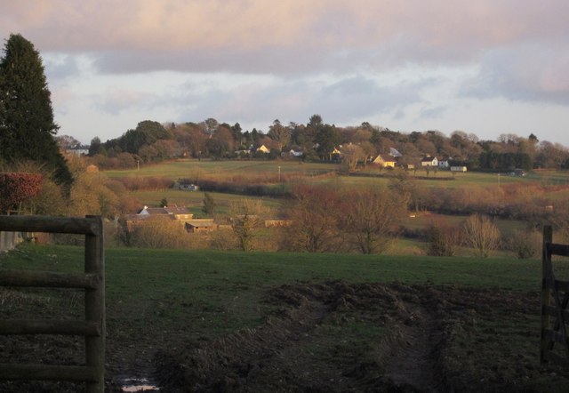
Axtown is a small village located in the county of Devon, England. Situated in the southwestern part of the county, it is nestled within the picturesque countryside and surrounded by rolling hills and lush green landscapes. The village is situated approximately 10 miles northeast of the popular coastal town of Exmouth.

Despite its small size, Axtown boasts a rich history that dates back centuries. It is believed that the village was first established in the medieval period, and remnants of this era can still be seen today, including some well-preserved historic buildings and landmarks.

Axtown is primarily a residential area, with a close-knit community that takes pride in its village. The village center features a quaint cluster of houses, a local pub, a village hall, and a small shop for basic amenities. The residents often come together for community events and celebrations, fostering a strong sense of belonging and camaraderie.

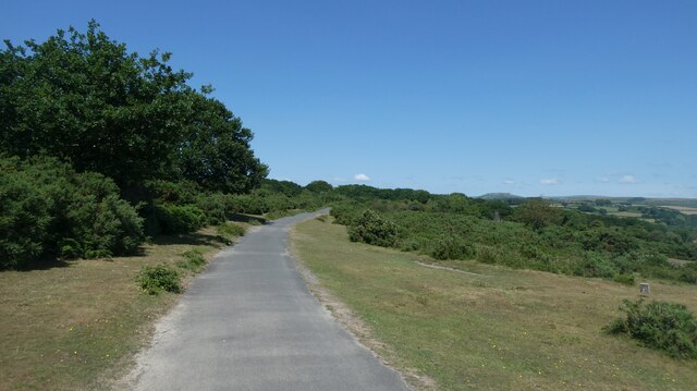
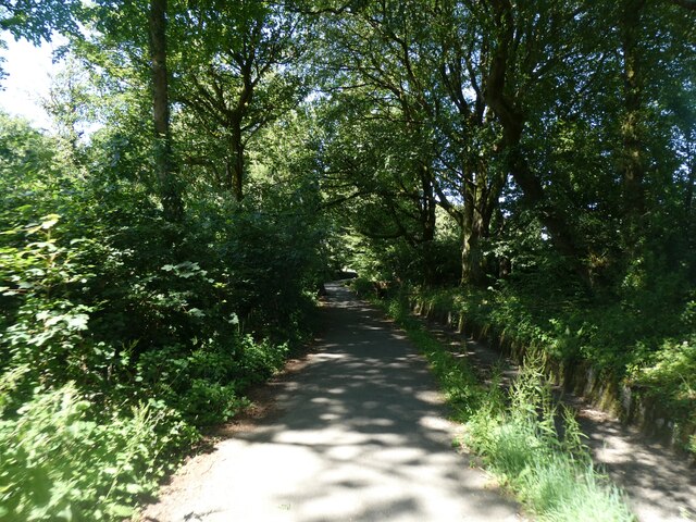
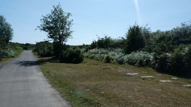
Surrounding the village, the countryside offers ample opportunities for outdoor activities. Axtown is blessed with beautiful walking trails, bridleways, and cycling routes that allow visitors and locals to explore the stunning natural surroundings. The nearby River Exe is also a popular spot for fishing and boating enthusiasts.

Although Axtown may be small, it offers a peaceful and idyllic lifestyle in the heart of the Devonshire countryside. Its charm, community spirit, and proximity to both rural and coastal attractions make it an appealing destination for those seeking a slower pace of life away from the hustle and bustle of larger towns and cities.

If you have any feedback on the listing, please let us know in the comments section below.
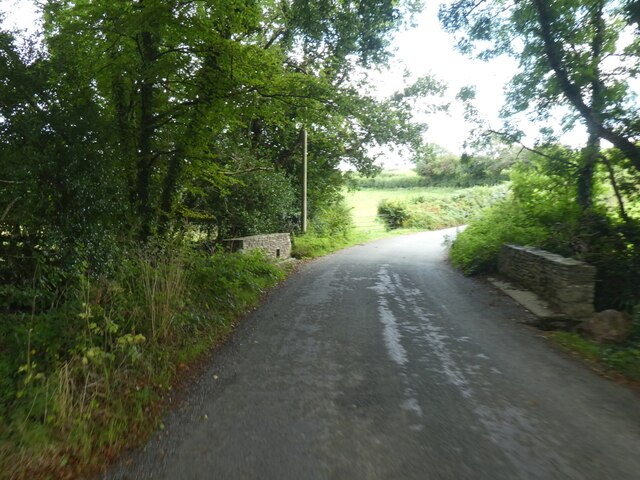
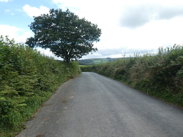
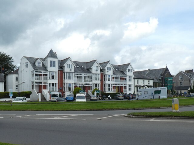
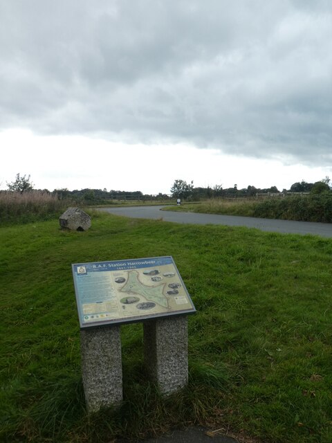
Axtown Images

Images are sourced within 2km of 50.486515/-4.0972872 or Grid Reference SX5167. Thanks to Geograph Open Source API. All images are credited.

Meavy Lane bridge over a stream, east of Yelverton Crossing the stream seen in <a href="https://www.geograph.org.uk/photo/5823077">SX5367 : Tributary stream of the River Meavy</a>
Meavy Lane bridge over a stream, east of Yelverton
Crossing the stream seen in SX5367 : Tributary stream of the River Meavy
Lone tree, Meavy Lane
Field gate on Meavy Lane
Meavy Lane with bridge over small stream
Meavy Lane; view from a small bridge
Field entrance off Meavy Lane
Yelverton Tennis Club
Terraced building in Yelverton, now a bar and restaurant
Board describing RAF Harrowbeer, a WW2 airfield A detailed picture is at <a href="https://www.geograph.org.uk/photo/6157158">SX5167 : RAF Harrowbeer: a tour of a WW2 airfield (1)</a>
Board describing RAF Harrowbeer, a WW2 airfield
Old Tramway Milestone, Clearbrook On the Western side of the Drakes Trail which follows the old Plymouth Tramway at this point. The stone marks 13 miles to Plymouth.

Inscription: not visible
Old Tramway Milestone, Clearbrook
On the Western side of the Drakes Trail which follows the old Plymouth Tramway at this point. The stone marks 13 miles to Plymouth. Inscription: not visible
The Skylark inn, Clearbrook National Cycle Network Route 27 is a 99 miles long route between Ilfracombe and Plymouth, of which 71 miles are traffic-free. The route combines the beaches and estuaries of North Devon with the lush green valleys of the Torridge, the Tavy, the Walkham and other evocative West Country rivers. The route also skirts round the western flank of Dartmoor offering superb views of Cornwall and the surrounding area. There is also many local links and spurs to explore. Largely tracing the course of former railway lines, the route takes you through tunnels and across the breathtaking viaducts and bridges bequeathed by Victorian railway engineers.
The Skylark inn, Clearbrook
National Cycle Network Route 27 is a 99 miles long route between Ilfracombe and Plymouth, of which 71 miles are traffic-free. The route combines the beaches and estuaries of North Devon with the lush green valleys of the Torridge, the Tavy, the Walkham and other evocative West Country rivers. The route also skirts round the western flank of Dartmoor offering superb views of Cornwall and the surrounding area. There is also many local links and spurs to explore. Largely tracing the course of former railway lines, the route takes you through tunnels and across the breathtaking viaducts and bridges bequeathed by Victorian railway engineers.
NCN27 crossing moorland west of Clearbrook
NCN27 beside Drake's Leat south of Yelverton National Cycle Network Route 27 is a 99 miles long route between Ilfracombe and Plymouth, of which 71 miles are traffic-free. The route combines the beaches and estuaries of North Devon with the lush green valleys of the Torridge, the Tavy, the Walkham and other evocative West Country rivers. The route also skirts round the western flank of Dartmoor offering superb views of Cornwall and the surrounding area. There is also many local links and spurs to explore. Largely tracing the course of former railway lines, the route takes you through tunnels and across the breathtaking viaducts and bridges bequeathed by Victorian railway engineers.
NCN27 beside Drake's Leat south of Yelverton
National Cycle Network Route 27 is a 99 miles long route between Ilfracombe and Plymouth, of which 71 miles are traffic-free. The route combines the beaches and estuaries of North Devon with the lush green valleys of the Torridge, the Tavy, the Walkham and other evocative West Country rivers. The route also skirts round the western flank of Dartmoor offering superb views of Cornwall and the surrounding area. There is also many local links and spurs to explore. Largely tracing the course of former railway lines, the route takes you through tunnels and across the breathtaking viaducts and bridges bequeathed by Victorian railway engineers.
Yelverton Methodist church Yelverton is a large village in south west Devon. It is located on the A386 between Plymouth and Tavistock.
Wikipedia: <span class="nowrap"><a title="https://en.wikipedia.org/wiki/Yelverton,_Devon" rel="nofollow ugc noopener" href="https://en.wikipedia.org/wiki/Yelverton,_Devon">Link</a><img style="margin-left:2px;" alt="External link" title="External link - shift click to open in new window" src="https://s1.geograph.org.uk/img/external.png" width="10" height="10"/></span>
Yelverton Methodist church
Yelverton is a large village in south west Devon. It is located on the A386 between Plymouth and Tavistock. Wikipedia: LinkExternal link
The supports for the railings of a bridge over Drake's Leat, Yelverton Four uprights to support handrails, but the rest of the bridge has vanished.
The supports for the railings of a bridge over Drake's Leat, Yelverton
Four uprights to support handrails, but the rest of the bridge has vanished.
Yelverton Golf Club
Yelverton Golf Club
Remains (sleepers) for moorland tramway, Chub Tor Beside the cycle route NCN27
Remains (sleepers) for moorland tramway, Chub Tor
Beside the cycle route NCN27
NCN27 adjacent to the sleepers of a moorland tramway
Show me another place!

Axtown is located at Grid Ref: SX5167 (Lat: 50.486515, Lng: -4.0972872)

Administrative County: Devon

District: West Devon

Police Authority: Devon and Cornwall

What 3 Words

///palm.announced.spooned. Near Yelverton, Devon

Nearby Locations

Axtown

Related Wikis

Axtown

Axtown is a village in Devon, England.

Roborough Rock

Yelverton Rock (also known as The Rock) is a tor-like igneous rock outcrop immediately south-west of Yelverton, Devon. It is located at the southern end...
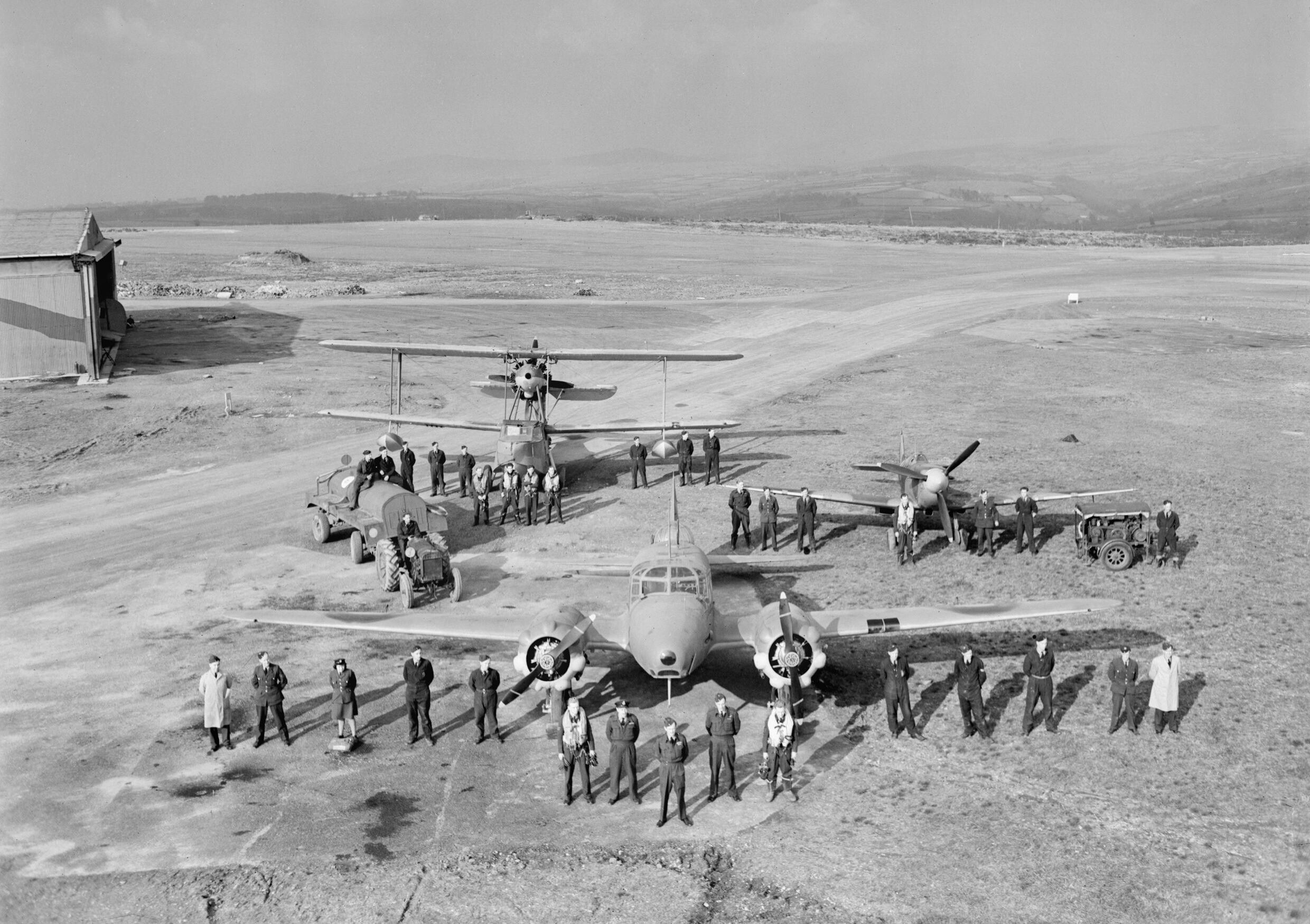
RAF Harrowbeer

Royal Air Force Harrowbeer or more simply RAF Harrowbeer is a former Royal Air Force station situated next to Yelverton in the parish of Buckland Monachorum...

Yelverton Paperweight Centre

Yelverton Paperweight Centre was a paperweight museum and supplier in Leg O'Mutton, a small hamlet near Yelverton, in the English county of Devon. The...

Yelverton, Devon

Yelverton is a large village on the south-western edge of Dartmoor, Devon, in England. When Yelverton railway station (on the Great Western Railway (GWR...

Crapstone

Crapstone is a village in the county of Devon. The village is located on the edge of Dartmoor, in the parish of Buckland Monachorum and is approximately...

Dousland

Dousland is a small settlement in Devon, England. It is near the A386 road and is 10 kilometres (6 mi) northeast of the city of Plymouth - 10 kilometres...

The Garden House

The Garden House is an open garden located in Buckland Monachorum, Devon, England. The first house built in 1305 was intended to be a home for the vicars...

Nearby Amenities

Located within 500m of 50.486515,-4.0972872
Barrier: cattle_grid
Bicycle: yes
Foot: yes
Motorcar: yes
Motorcycle: yes
Source: bing
Lat/Long: 50.4850157/-4.0931639
Axtown
Place: hamlet
Source: OS_Opendata_Streetview
Lat/Long: 50.4886767/-4.0979648
Parking
Parking: street_side
Lat/Long: 50.4858697/-4.0944491
Roborough Rock
Place: locality
Wikidata: Q7353306
Wikipedia: en:Roborough Rock
Lat/Long: 50.4854672/-4.0937056
Barrier: cattle_grid
Bicycle: yes
Foot: yes
Motorcar: yes
Motorcycle: yes
Source: bing
Lat/Long: 50.4855304/-4.0924788
Tourism: information
Lat/Long: 50.485959/-4.0945492
Restaurant
Knightstone Tea Rooms
Addr Postcode: PL20 6BT
Addr Street: Crapstone Road
Fhrs Id: 808805
Source Addr: FHRS Open Data
Lat/Long: 50.4869818/-4.0965763
Power: pole
Lat/Long: 50.4865214/-4.1029751
Power: pole
Lat/Long: 50.4860982/-4.1009286
Location Transition: yes
Power: pole
Lat/Long: 50.4858353/-4.0994319
Location Transition: yes
Poles: bipole
Power: pole
Source: bing
Lat/Long: 50.4852363/-4.0985568
Power: pole
Lat/Long: 50.4846364/-4.1008911
Power: pole
Lat/Long: 50.4843429/-4.1027995
Generator Method: photovoltaic
Generator Output Electricity: yes
Generator Source: solar
Generator Type: solar_photovoltaic_panel
Location: roof
Power: generator
Lat/Long: 50.4831679/-4.0994419
Generator Method: photovoltaic
Generator Output Electricity: yes
Generator Source: solar
Generator Type: solar_photovoltaic_panel
Location: roof
Power: generator
Lat/Long: 50.4831884/-4.0993802
Generator Method: photovoltaic
Generator Output Electricity: yes
Generator Source: solar
Generator Type: solar_photovoltaic_panel
Location: roof
Power: generator
Lat/Long: 50.4832336/-4.0992354
Generator Method: photovoltaic
Generator Output Electricity: yes
Generator Source: solar
Generator Type: solar_photovoltaic_panel
Location: roof
Power: generator
Lat/Long: 50.4832473/-4.0992072
Generator Method: photovoltaic
Generator Output Electricity: yes
Generator Source: solar
Generator Type: solar_photovoltaic_panel
Location: roof
Power: generator
Lat/Long: 50.4833446/-4.0990208
Generator Method: photovoltaic
Generator Output Electricity: yes
Generator Source: solar
Generator Type: solar_photovoltaic_panel
Location: roof
Power: generator
Lat/Long: 50.4834333/-4.0987177
Generator Method: photovoltaic
Generator Output Electricity: yes
Generator Source: solar
Generator Type: solar_photovoltaic_panel
Location: roof
Power: generator
Lat/Long: 50.486496/-4.0982842
Generator Method: photovoltaic
Generator Output Electricity: yes
Generator Source: solar
Generator Type: solar_photovoltaic_panel
Location: roof
Power: generator
Lat/Long: 50.4864696/-4.0983338
Power: pole
Source: bing
Lat/Long: 50.4849547/-4.0996465
Post Box
Brand: Royal Mail
Brand Wikidata: Q638098
Brand Wikipedia: en:Royal Mail
Collection Times: Mo-Sa 10:00; Su off
Operator: Royal Mail
Operator Wikidata: Q638098
Post Box Design: type_c
Post Box Mounting: brick_pillar
Post Box Type: wall
Ref: PL20 439
Royal Cypher: VR
Royal Cypher Wikidata: Q33102356
Source: survey;streetlevel imagery;aerial imagery
Lat/Long: 50.4885245/-4.0965949
The data included in this document is from www.openstreetmap.org. The data is made available under ODbL.

Have you been to Axtown?

Leave your review of Axtown below (or comments, questions and feedback).