Axton

Settlement in Flintshire

Wales

Axton

North Lodge, Gyrn Castle
North Lodge, Gyrn Castle Credit: Chris Andrews

Axton is a small village located in the county of Flintshire, Wales. Situated in the northeastern part of the country, it lies approximately 5 miles southwest of the town of Holywell and 10 miles northwest of the city of Chester, England. With a population of around 500 residents, Axton presents a tranquil and close-knit community atmosphere.

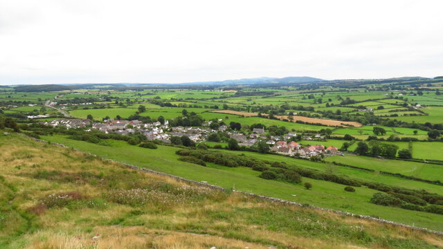
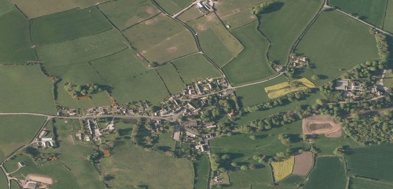
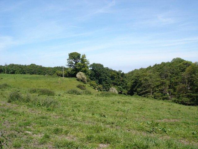
The village is nestled in a picturesque rural setting, surrounded by lush green fields and rolling hills. It benefits from its proximity to the River Dee, which flows nearby, providing beautiful scenic views and recreational opportunities for locals and visitors alike.

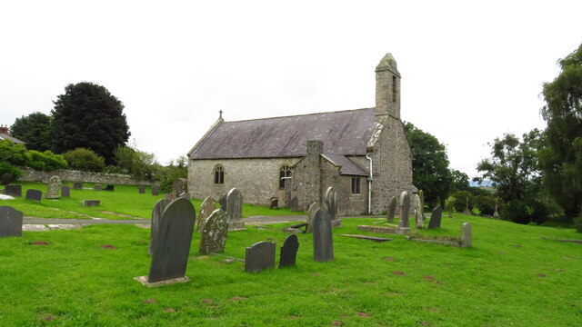
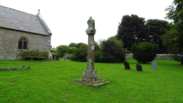
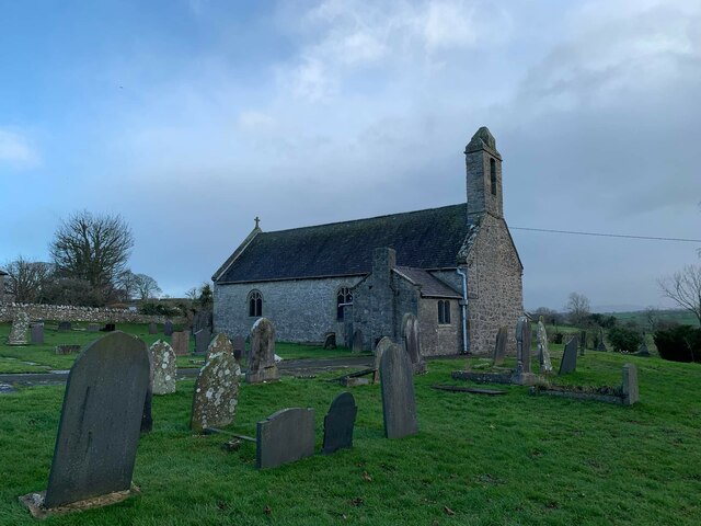
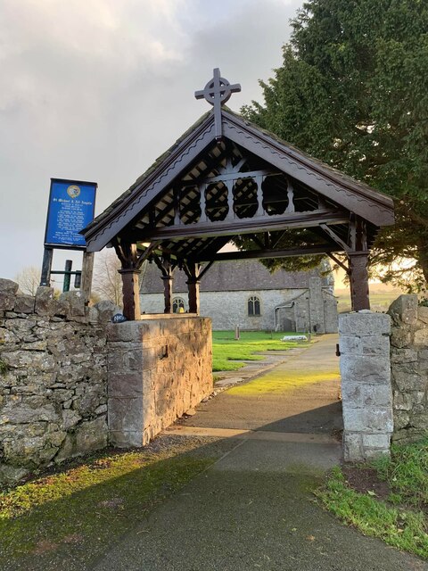
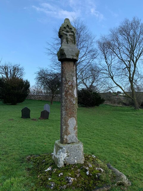
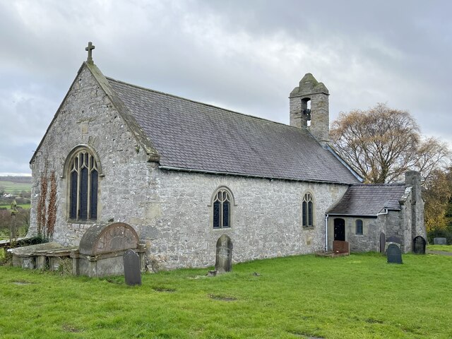
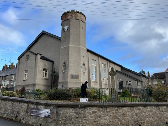
Axton boasts a rich history that dates back centuries. The St. Mary and St. Cilfael Church, a Grade II listed building, stands as a prominent landmark in the village. This historic church, with its distinctive architecture and charming interior, serves as a focal point for religious and cultural activities.

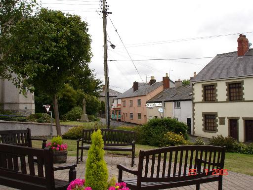
Despite its small size, Axton offers a range of amenities to cater to the needs of its residents. These include a community hall, a primary school, and a local pub, where villagers can socialize and enjoy traditional Welsh hospitality.

The village's location provides easy access to surrounding areas via a well-connected road network. The nearby A55 expressway connects Axton to other major towns and cities in North Wales, making it an ideal location for commuting to work or exploring the region's attractions.

Overall, Axton's idyllic countryside setting, rich history, and community spirit make it an appealing place to live or visit for those seeking a peaceful rural retreat.

If you have any feedback on the listing, please let us know in the comments section below.

Axton Images

Images are sourced within 2km of 53.311145/-3.344042 or Grid Reference SJ1080. Thanks to Geograph Open Source API. All images are credited.

North Lodge, Gyrn Castle
Guidepost at road junction, Trelogan WHITFORD
HOLYWELL
GLANRAFON
Guidepost at road junction, Trelogan
WHITFORD HOLYWELL GLANRAFON
Damaged benchmark on derelict building, Trelogan For more details see: <span class="nowrap"><a title="https://www.bench-marks.org.uk/bm180728" rel="nofollow ugc noopener" href="https://www.bench-marks.org.uk/bm180728">Link</a><img style="margin-left:2px;" alt="External link" title="External link - shift click to open in new window" src="https://s1.geograph.org.uk/img/external.png" width="10" height="10"/></span>
Damaged benchmark on derelict building, Trelogan
For more details see: LinkExternal link
Approaching Gop Hill Cairn from the east Gop Hill is the second largest pre-historic man made mound in the United Kingdom after Silbury Hill in Wiltshire.
Approaching Gop Hill Cairn from the east
Gop Hill is the second largest pre-historic man made mound in the United Kingdom after Silbury Hill in Wiltshire.
Gop Cave above Trelawnyd
Trelawnyd - St Michael's Church
Ancient cross at St Michael's Church, Trelawnyd
Trelawnyd as seen from Gop Hill Cairn
Benchmark at Angorfa, Marian For more details see: <span class="nowrap"><a title="https://www.bench-marks.org.uk/bm180729" rel="nofollow ugc noopener" href="https://www.bench-marks.org.uk/bm180729">Link</a><img style="margin-left:2px;" alt="External link" title="External link - shift click to open in new window" src="https://s1.geograph.org.uk/img/external.png" width="10" height="10"/></span>
Benchmark at Angorfa, Marian
For more details see: LinkExternal link
Rivet benchmark on St Michael and All Angels church, Trelawnyd For more info see: <span class="nowrap"><a title="https://www.bench-marks.org.uk/bm81733" rel="nofollow ugc noopener" href="https://www.bench-marks.org.uk/bm81733">Link</a><img style="margin-left:2px;" alt="External link" title="External link - shift click to open in new window" src="https://s1.geograph.org.uk/img/external.png" width="10" height="10"/></span>
Rivet benchmark on St Michael and All Angels church, Trelawnyd
For more info see: LinkExternal link
St Michael and All Angels church, Trelawnyd
Lychgate at St Michael and All Angels church, Trelawnyd
Cross at St Michael and All Angels church, Trelawnyd
Bougonvillea bloom Sometimes called the 'paper flower'. Apparently it requires little watering so is ideally suited to drier climates.
Seen at Jackson's nursery.
Bougonvillea bloom
Sometimes called the 'paper flower'. Apparently it requires little watering so is ideally suited to drier climates. Seen at Jackson's nursery.
The countdown to Christmas has started At the time of the photograph 62 days remained.
The countdown to Christmas has started
At the time of the photograph 62 days remained.
Church of St Michael and All Angels, Trelawnyd
Trelawnyd Village Hall
Study of a Gasoline Station Texaco, Trelawnyd.

This photograph is part of a series taken in homage to the American artist Ed Ruscha's 1963 publication of 'Twentysix Gasoline Stations'.
More properly known as filling stations in the UK, I am attempting to photograph as many as possible to mark the sixty year anniversary.
Study of a Gasoline Station
Texaco, Trelawnyd. This photograph is part of a series taken in homage to the American artist Ed Ruscha's 1963 publication of 'Twentysix Gasoline Stations'. More properly known as filling stations in the UK, I am attempting to photograph as many as possible to mark the sixty year anniversary.
Show me another place!

Axton is located at Grid Ref: SJ1080 (Lat: 53.311145, Lng: -3.344042)

Unitary Authority: Flintshire

Police Authority: North Wales

What 3 Words

///lighters.innovator.remarks. Near Gronant, Flintshire

Nearby Locations

Axton

Related Wikis

Llanasa

Llanasa is a village and community in the county of Flintshire, north-east Wales. Llanasa is described as one of the ancient parishes of Flintshire. It...

Trelawnyd

Trelawnyd (formerly Newmarket from 1710 to 1954) is a village in Flintshire, Wales. The village had a population taken at the 2011 census of 584. It is...

Trelogan

Trelogan is a village in Flintshire, north east Wales. It is located between Mostyn and Trelawnyd and is almost contiguous with Berthengam. Trelogan had...
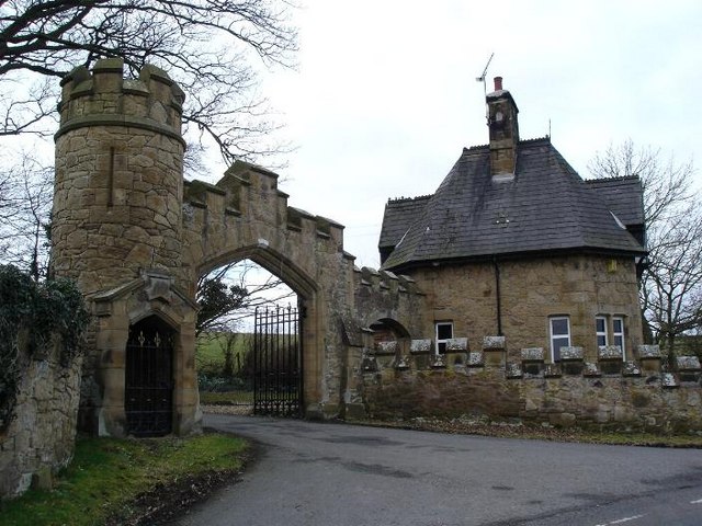
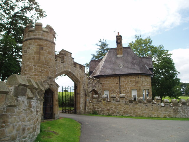
Gyrn Castle

Gyrn Castle is a Grade II-listed castellated mansion in Llanasa in Flintshire. == History == It was built between 1817 and 1824 by John Douglas, who incorporated...

Nearby Amenities

Located within 500m of 53.311145,-3.344042
Axton Hill
Ele: 229
Natural: peak
Lat/Long: 53.3123258/-3.3434431
Acstyn
Name En: Axton
Place: hamlet
Lat/Long: 53.3092043/-3.3419925
Axton Tumulus IV
Archaeological Site: tumulus
Historic: archaeological_site
Historic Civilization: prehistoric
Lat/Long: 53.3122319/-3.3460251
Axton Tumulus III
Historic: archaeological_site
Historic Civilization: prehistoric
Lat/Long: 53.3122076/-3.344923
Pen-y-gorseddau Mound Axton Tumulus A
Historic: archaeological_site
Lat/Long: 53.3107594/-3.3401874
Power: pole
Lat/Long: 53.3144458/-3.3489795
Power: pole
Lat/Long: 53.3105406/-3.3401232
Power: pole
Lat/Long: 53.3079335/-3.3389959
Power: pole
Lat/Long: 53.309197/-3.3398421
Power: pole
Lat/Long: 53.3098866/-3.3399871
Power: pole
Lat/Long: 53.3083676/-3.339461
Power: pole
Lat/Long: 53.3144359/-3.3475611
Power: pole
Lat/Long: 53.3144298/-3.3464543
Power: pole
Lat/Long: 53.3144178/-3.3453059
Power: pole
Lat/Long: 53.3144175/-3.344664
Power: pole
Lat/Long: 53.3144191/-3.3439089
Direction: 170
Generator Method: photovoltaic
Generator Output Electricity: yes
Generator Solar Modules: 16
Generator Source: solar
Generator Type: solar_photovoltaic_panel
Location: roof
Power: generator
Lat/Long: 53.308381/-3.3451867
Man Made: mineshaft
Lat/Long: 53.3123252/-3.3380306
Man Made: mineshaft
Lat/Long: 53.313037/-3.3433066
Man Made: mineshaft
Lat/Long: 53.313281/-3.346082
Man Made: mineshaft
Lat/Long: 53.3133826/-3.3454963
Man Made: mineshaft
Lat/Long: 53.3132503/-3.3452437
Man Made: mineshaft
Lat/Long: 53.3133973/-3.345094
Man Made: mineshaft
Lat/Long: 53.3134625/-3.3451994
Man Made: mineshaft
Lat/Long: 53.313376/-3.3446406
Man Made: mineshaft
Lat/Long: 53.3133464/-3.3443825
Man Made: mineshaft
Lat/Long: 53.3133118/-3.3441835
Man Made: mineshaft
Lat/Long: 53.3134019/-3.3438302
Man Made: mineshaft
Lat/Long: 53.3129401/-3.3453289
Man Made: mineshaft
Lat/Long: 53.3127261/-3.3453532
Man Made: mineshaft
Lat/Long: 53.3125214/-3.3483093
Man Made: mineshaft
Lat/Long: 53.3137811/-3.3382721
Man Made: mineshaft
Lat/Long: 53.3145562/-3.3393597
Man Made: mineshaft
Lat/Long: 53.3136877/-3.3405931
Man Made: mineshaft
Lat/Long: 53.3140247/-3.3403376
Man Made: mineshaft
Lat/Long: 53.314064/-3.3398752
Man Made: mineshaft
Lat/Long: 53.3125878/-3.3401186
Man Made: mineshaft
Lat/Long: 53.3126058/-3.3398959
Man Made: mineshaft
Lat/Long: 53.3126251/-3.339641
Man Made: mineshaft
Lat/Long: 53.3126437/-3.3393798
Man Made: mineshaft
Lat/Long: 53.312571/-3.3395783
Man Made: mineshaft
Lat/Long: 53.3125151/-3.3398006
Man Made: mineshaft
Lat/Long: 53.3124692/-3.3399751
Man Made: mineshaft
Lat/Long: 53.3123897/-3.3402204
Man Made: mineshaft
Lat/Long: 53.3125817/-3.3405989
Man Made: mineshaft
Lat/Long: 53.3125761/-3.3403481
Man Made: mineshaft
Lat/Long: 53.3123252/-3.3405115
Man Made: mineshaft
Lat/Long: 53.3122639/-3.3404394
Man Made: mineshaft
Lat/Long: 53.3135229/-3.3413397
Man Made: mineshaft
Lat/Long: 53.3144696/-3.3413683
Man Made: mineshaft
Lat/Long: 53.3141717/-3.3414272
Man Made: mineshaft
Lat/Long: 53.3139963/-3.3411791
Power: pole
Lat/Long: 53.3124526/-3.3424255
Power: pole
Lat/Long: 53.3123064/-3.3418507
Power: pole
Lat/Long: 53.313085/-3.3428892
Power: pole
Lat/Long: 53.3084051/-3.3437042
Power: pole
Lat/Long: 53.3090642/-3.3438662
Power: pole
Lat/Long: 53.3096681/-3.3440209
Power: pole
Lat/Long: 53.3097674/-3.3439265
Power: pole
Lat/Long: 53.3100247/-3.3433283
Power: pole
Lat/Long: 53.310267/-3.3428859
Power: pole
Lat/Long: 53.310535/-3.3421585
Power: pole
Lat/Long: 53.3107377/-3.3416162
Power: pole
Lat/Long: 53.3110607/-3.3407303
Power: pole
Lat/Long: 53.3112876/-3.340177
Power: pole
Lat/Long: 53.3082414/-3.3435642
Power: pole
Lat/Long: 53.3103215/-3.3440735
Power: pole
Lat/Long: 53.3107902/-3.3444321
Power: pole
Lat/Long: 53.3110815/-3.3446625
Power: pole
Lat/Long: 53.3121749/-3.3412059
Power: pole
Lat/Long: 53.3119219/-3.3408001
Man Made: mineshaft
Lat/Long: 53.3121372/-3.3405285
Man Made: mineshaft
Lat/Long: 53.3121516/-3.3403811
Man Made: mineshaft
Lat/Long: 53.3120636/-3.340402
Man Made: mineshaft
Lat/Long: 53.3120138/-3.3402562
Man Made: mineshaft
Lat/Long: 53.3120435/-3.3401617
Man Made: mineshaft
Lat/Long: 53.312142/-3.3402114
Man Made: mineshaft
Lat/Long: 53.3121593/-3.3402786
Man Made: mineshaft
Lat/Long: 53.3123632/-3.3409423
Man Made: mineshaft
Lat/Long: 53.3123983/-3.3408465
Bench
Backrest: yes
Lat/Long: 53.3097139/-3.3377646
The data included in this document is from www.openstreetmap.org. The data is made available under ODbL.

Have you been to Axton?

Leave your review of Axton below (or comments, questions and feedback).