Axmouth

Settlement in Devon East Devon

England

Axmouth

A hotel with a moat Flood defences outside Seaton's Premier Inn.
A hotel with a moat Credit: Anthony Vosper

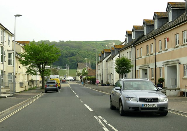
Axmouth is a picturesque village located on the south coast of Devon, England. Situated at the mouth of the River Axe, it is nestled between the towns of Seaton and Lyme Regis. With a population of around 500 residents, Axmouth exudes a charming and tranquil atmosphere.

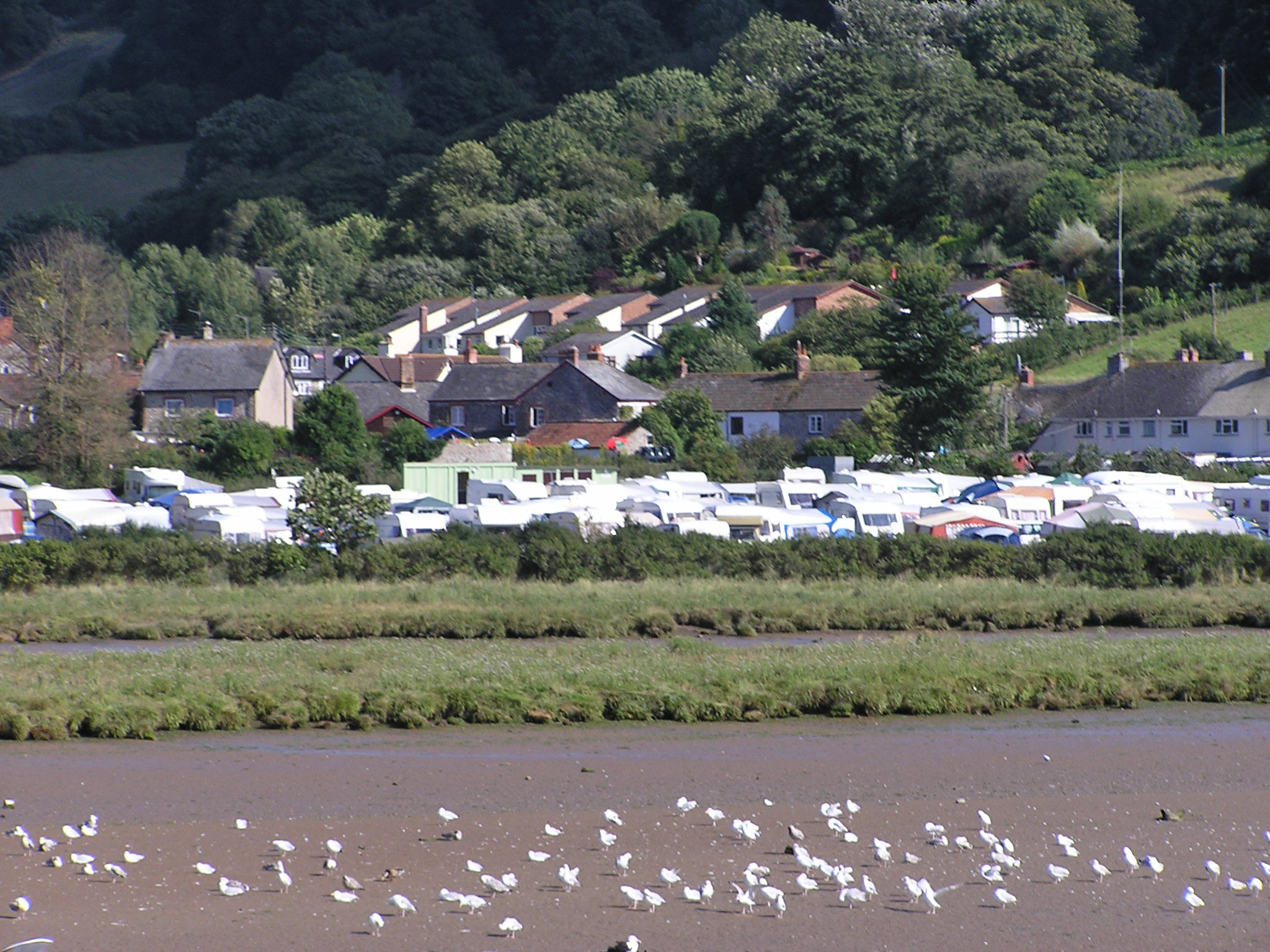
The village boasts a rich history, dating back to Roman times. Evidence of Roman settlements can still be seen in the area, including the remains of a Roman fort. In the Middle Ages, Axmouth was a thriving port and fishing community, and remnants of its maritime heritage can be found in the quaint old harbor.

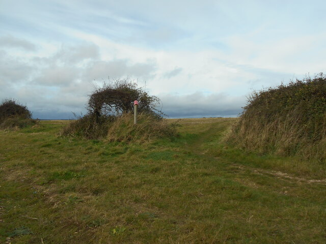
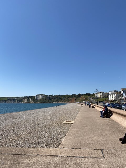
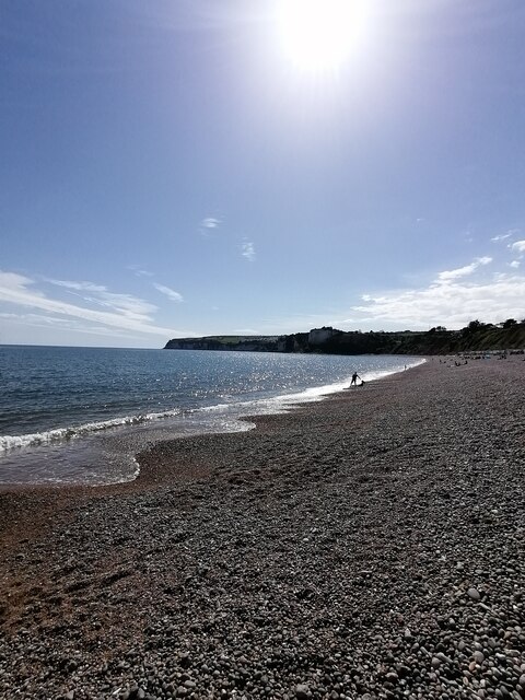
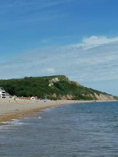
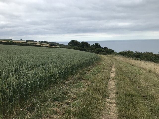
The village is renowned for its stunning natural beauty, with the dramatic Jurassic Coastline on its doorstep. Visitors and locals can enjoy breathtaking coastal walks, taking in the awe-inspiring cliffs and pristine beaches. The Axmouth to Lyme Regis Undercliffs National Nature Reserve is a paradise for nature enthusiasts, offering a diverse range of flora and fauna.

Axmouth is home to a 14th-century church, St. Michael's, which is a prominent landmark in the village. The church features a striking tower and beautiful stained glass windows, adding to the village's architectural charm.

Amenities in Axmouth include a welcoming local pub, The Ship Inn, which serves delicious food and beverages. The village also boasts a well-regarded primary school, ensuring a strong sense of community.

Overall, Axmouth is a hidden gem on the Devon coast, offering a delightful blend of history, natural beauty, and tranquility.

If you have any feedback on the listing, please let us know in the comments section below.

Axmouth Images

Images are sourced within 2km of 50.71431/-3.051025 or Grid Reference SY2591. Thanks to Geograph Open Source API. All images are credited.

A hotel with a moat Flood defences outside Seaton's Premier Inn.
A hotel with a moat
Flood defences outside Seaton's Premier Inn.
An incoming tide The River Axe joins the sea at Seaton.
Recent heavy rains have swelled the outgoing river.
An incoming tide
The River Axe joins the sea at Seaton. Recent heavy rains have swelled the outgoing river.
Gone fishing A lone angler stands at the mouth of the River Axe.
Gone fishing
A lone angler stands at the mouth of the River Axe.
Anyone lost a pink hat? A pink hat adorns a marker post for the South West Coast Path.
A geocache is currently located in the small windswept tree.
Anyone lost a pink hat?
A pink hat adorns a marker post for the South West Coast Path. A geocache is currently located in the small windswept tree.
A South East view Looking South East along the South West Coast path.
A South East view
Looking South East along the South West Coast path.
Seaton on a lovely sunny day
Seaton Seafront and Esplanade (East Devon) Seaton Seafront and Esplanade on this glorious and fantastic Sunday afternoon and a quiet gem on the Jurassic coast similar to Lyme Regis when I visited in October.
Seaton Seafront and Esplanade (East Devon)
Seaton Seafront and Esplanade on this glorious and fantastic Sunday afternoon and a quiet gem on the Jurassic coast similar to Lyme Regis when I visited in October.
Seaton Beach Seaton pebble beach on this glorious and fantastic Sunday afternoon and very peaceful and cool waters of the English Channel
Seaton Beach
Seaton pebble beach on this glorious and fantastic Sunday afternoon and very peaceful and cool waters of the English Channel
Seaton cliffs (East Devon) Seaton cliffs on the Jurassic Coast looking from the town beach
Seaton cliffs (East Devon)
Seaton cliffs on the Jurassic Coast looking from the town beach
Axmouth Harbour
Axmouth Harbour
Wheat field on the South West Coast Path
Sea Hill in Seaton
Sea Hill in Seaton
Harbour Road in Seaton
The beach at Seaton
The beach at Seaton
The beach at Seaton
The beach at Seaton
The promenade by the beach
No entry on the Esplanade
Beach Road runs down to Harbour Road
Show me another place!

Axmouth is located at Grid Ref: SY2591 (Lat: 50.71431, Lng: -3.051025)

Administrative County: Devon

District: East Devon

Police Authority: Devon and Cornwall

What 3 Words

///laptops.chum.cosmetic. Near Colyton, Devon

Related Wikis

Axmouth

Axmouth is a village, civil parish and former manor in the East Devon district of Devon, England, near the mouth of the River Axe. The village itself...

Hawkesdown Hill

Hawkesdown Hill is an Iron Age Hill fort close to Axmouth in Devon situated on a prominent hillside above the Axe Estuary. It is approximately 130 metres...

Seaton Tramway

The Seaton Tramway is a 2 ft 9 in (838 mm) narrow gauge electric tramway in the East Devon district of South West England. The 3-mile (4.8 km) route runs...

Stedcombe House

Stedcombe House is a country house in the civil parish of Axmouth, in the East Devon district, in the county of Devon, England. It is recorded in the National...

Nearby Amenities

Located within 500m of 50.71431,-3.051025
Axmouth
Is In: Devon, England, United Kingdom
Place: village
Wikidata: Q1242448
Wikipedia: en:Axmouth
Lat/Long: 50.7146116/-3.0519522
Pub
The Ship Inn
Wikidata: Q79837550
Lat/Long: 50.7147387/-3.0526843
Pub
The Harbour Inn
Addr Country: GB
Brand: Hall & Woodhouse
Brand Wikidata: Q5642555
Brand Wikipedia: en:Hall & Woodhouse
Wikidata: Q26462591
Lat/Long: 50.7144922/-3.054801
Leisure: playground
Lat/Long: 50.7138996/-3.0479429
Tourism: guest_house
Lat/Long: 50.7134322/-3.0486295
Bus Stop
Bus: yes
Public Transport: platform
Lat/Long: 50.7140604/-3.0487786
Post Box
Ref: EX12 65
Lat/Long: 50.7141147/-3.0495269
Tourism: picnic_site
Lat/Long: 50.7143212/-3.055988
Public Bookcase
Booth: K6
Disused Amenity: telephone
Man Made: telephone_box
Public Bookcase Type: phone_box
Lat/Long: 50.7144027/-3.0512721
Bus Stop
Lat/Long: 50.7148321/-3.0520656
Stepps Cross
Place: locality
Lat/Long: 50.713933/-3.0489341
The Old Vicarage
Building: yes
Source: survey;OS
Wikidata: Q26593325
Lat/Long: 50.7160562/-3.0508429
Addr City: Axbridge
Addr Housename: 1 Southcoombe Terrace
Lat/Long: 50.7140317/-3.0471321
Addr City: Axbridge
Addr Housename: 2 Southcoombe Terrace
Lat/Long: 50.7140622/-3.0472179
Addr City: Axbridge
Addr Housename: 13 Southcoombe Terrace
Lat/Long: 50.7141979/-3.0484732
Barrier: stile
Lat/Long: 50.7148687/-3.0488377
Addr City: Axbridge
Addr Housename: Coombe House
Lat/Long: 50.7140214/-3.0469227
Tourism: viewpoint
Lat/Long: 50.7144955/-3.0560953
Barrier: stile
Lat/Long: 50.7140614/-3.048718
Barrier: stile
Lat/Long: 50.7109472/-3.0467315
Give Way
Direction: forward
Lat/Long: 50.7161658/-3.0520898
Direction: forward
Traffic Calming: choker
Lat/Long: 50.7161326/-3.0520865
Addr City: Seaton
Addr Postcode: EX12 4BT
Lat/Long: 50.7136922/-3.0504495
Generator Method: photovoltaic
Generator Output Electricity: yes
Generator Source: solar
Generator Type: solar_photovoltaic_panel
Location: roof
Power: generator
Lat/Long: 50.7143493/-3.0515146
Generator Method: photovoltaic
Generator Output Electricity: yes
Generator Source: solar
Generator Type: solar_photovoltaic_panel
Location: roof
Power: generator
Lat/Long: 50.7144869/-3.0517238
Generator Method: photovoltaic
Generator Output Electricity: yes
Generator Source: solar
Generator Type: solar_photovoltaic_panel
Location: roof
Power: generator
Lat/Long: 50.7144359/-3.0516782
Generator Method: photovoltaic
Generator Output Electricity: yes
Generator Source: solar
Generator Type: solar_photovoltaic_panel
Location: roof
Power: generator
Lat/Long: 50.7147883/-3.0516984
Generator Method: photovoltaic
Generator Output Electricity: yes
Generator Source: solar
Generator Type: solar_photovoltaic_panel
Location: roof
Power: generator
Lat/Long: 50.7149492/-3.0494761
Generator Method: photovoltaic
Generator Output Electricity: yes
Generator Source: solar
Generator Type: solar_photovoltaic_panel
Location: roof
Power: generator
Lat/Long: 50.7147182/-3.0494198
Generator Method: photovoltaic
Generator Output Electricity: yes
Generator Source: solar
Generator Type: solar_photovoltaic_panel
Location: roof
Power: generator
Lat/Long: 50.7142019/-3.0504753
Generator Method: photovoltaic
Generator Output Electricity: yes
Generator Source: solar
Generator Type: solar_photovoltaic_panel
Location: roof
Power: generator
Lat/Long: 50.713858/-3.0511633
Generator Method: photovoltaic
Generator Output Electricity: yes
Generator Source: solar
Generator Type: solar_photovoltaic_panel
Location: roof
Power: generator
Lat/Long: 50.7135773/-3.045599
Generator Method: photovoltaic
Generator Output Electricity: yes
Generator Source: solar
Generator Type: solar_photovoltaic_panel
Location: roof
Power: generator
Lat/Long: 50.7130117/-3.0445449
Generator Method: photovoltaic
Generator Output Electricity: yes
Generator Source: solar
Generator Type: solar_photovoltaic_panel
Location: roof
Power: generator
Lat/Long: 50.7120433/-3.0470645
Generator Method: photovoltaic
Generator Output Electricity: yes
Generator Source: solar
Generator Type: solar_photovoltaic_panel
Location: roof
Power: generator
Lat/Long: 50.7146329/-3.0532739
Generator Method: photovoltaic
Generator Output Electricity: yes
Generator Source: solar
Generator Type: solar_photovoltaic_panel
Location: roof
Power: generator
Lat/Long: 50.7142248/-3.0529808
The data included in this document is from www.openstreetmap.org. The data is made available under ODbL.

Have you been to Axmouth?

Leave your review of Axmouth below (or comments, questions and feedback).