Gilling West

Settlement in Yorkshire Richmondshire

England

Gilling West

Sedbury Home Farm
Sedbury Home Farm Credit: N Chadwick

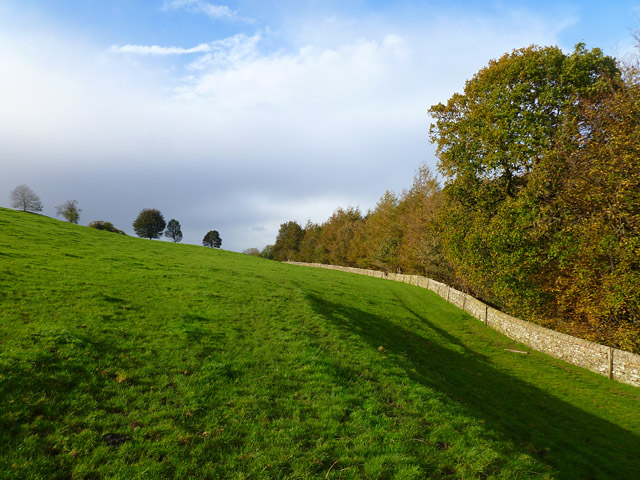
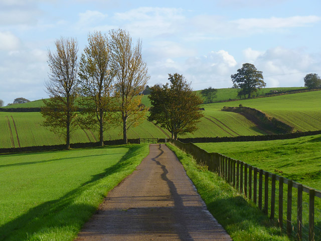
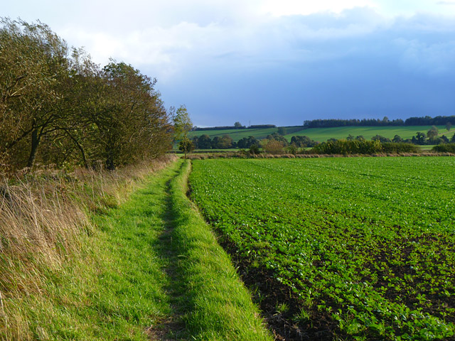
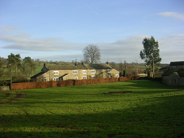
Gilling West is a small village located in the district of Richmondshire, Yorkshire, England. Situated approximately 6 miles west of the market town of Richmond, it is nestled in the picturesque countryside of the Yorkshire Dales. Gilling West is blessed with stunning natural beauty, with rolling hills, green meadows, and charming stone-built houses dotting the landscape.

The village itself is steeped in history, with its origins dating back to the Roman times. It is believed that a Roman fort once stood in the area, and remnants of this ancient settlement can still be seen today. Gilling West boasts a rich architectural heritage, with many buildings displaying a mix of architectural styles from different eras, including Georgian and Victorian.

The heart of the village is centered around St. Agatha's Church, an ancient place of worship that dates back to the 12th century. The church's stunning stained glass windows and intricate stone carvings are a testament to its historical significance. Nearby, the village green provides a peaceful spot for residents and visitors to relax and enjoy the tranquility of the surroundings.

Despite its small size, Gilling West is a close-knit community with a strong sense of community spirit. The village has a primary school, a village hall, and a local pub, which serves as a social hub for residents. The surrounding countryside offers ample opportunities for outdoor activities, such as hiking, cycling, and horse riding, making Gilling West an ideal destination for nature lovers and outdoor enthusiasts.

In summary, Gilling West is a charming village in Yorkshire, known for its natural beauty, rich history, and strong community spirit. Whether you are seeking a peaceful retreat or an active countryside experience, Gilling West has something to offer everyone.

If you have any feedback on the listing, please let us know in the comments section below.

Gilling West Images

Images are sourced within 2km of 54.441856/-1.718904 or Grid Reference NZ1805. Thanks to Geograph Open Source API. All images are credited.

Sedbury Home Farm
Sedbury Home Farm
Middleton Tyas : A66 Heading along the A66.
Middleton Tyas : A66
Heading along the A66.
Layby on the A66
Layby on the A66
Jagger Lane An ancient pannierway linking the lead smelting mills with Melsonby and beyond. The name derives from the local name of the sturdy German horses used to carry the smelted ore to the Tees ports of Yarm and Worsall for shipment to London.

Lead has been quarried and smelted in these parts since the Roman times.
Jagger Lane
An ancient pannierway linking the lead smelting mills with Melsonby and beyond. The name derives from the local name of the sturdy German horses used to carry the smelted ore to the Tees ports of Yarm and Worsall for shipment to London. Lead has been quarried and smelted in these parts since the Roman times.
Fish Pond near Lambert Wood
View of Hartforth Hall From across the meadows of Hatforth Beck.
View of Hartforth Hall
From across the meadows of Hatforth Beck.
Hartforth Hall Now a hotel.
Hartforth Hall
Now a hotel.
Jagger Lane An ancient pannierway linking the lead smelting mills with Melsonby and beyond. The name derives from the local name of the sturdy German horses used to carry the smelted ore to the Tees ports of Yarm and Worsall for shipment to London.

Lead has been quarried and smelted in these parts since the Roman times.
Jagger Lane
An ancient pannierway linking the lead smelting mills with Melsonby and beyond. The name derives from the local name of the sturdy German horses used to carry the smelted ore to the Tees ports of Yarm and Worsall for shipment to London. Lead has been quarried and smelted in these parts since the Roman times.
Bridge over Hartforth Beck Carrying the ancient track, Jagger Lane.
Bridge over Hartforth Beck
Carrying the ancient track, Jagger Lane.
Home Farm A new build architecturally designed to blend in with the adjacent listed Georgian farm buildings, apparently. The architects were Francis Johnson and Partners and the design won a prestigious architectural award in 2009. Local opinion is somewhat divided.

In the foreground a JCB is working on Hartforth Beck and producing much exhaust fumes.
Home Farm
A new build architecturally designed to blend in with the adjacent listed Georgian farm buildings, apparently. The architects were Francis Johnson and Partners and the design won a prestigious architectural award in 2009. Local opinion is somewhat divided. In the foreground a JCB is working on Hartforth Beck and producing much exhaust fumes.
Pasture and woodland, Gilling The public bridleway follows the edge of The Ashes to the west of Gillingwood Hall.
Pasture and woodland, Gilling
The public bridleway follows the edge of The Ashes to the west of Gillingwood Hall.
Farmland, Hartforth A cereal crop and the edge of Hartforth Wood.
Farmland, Hartforth
A cereal crop and the edge of Hartforth Wood.
Farm road and farmland, Gilling The public bridleway heading away from Gillingwood Hall.
Farm road and farmland, Gilling
The public bridleway heading away from Gillingwood Hall.
Pasture, Gilling Cattle and a view across the valley of Gilling Beck from the footpath between Gilling and Hartforth.
Pasture, Gilling
Cattle and a view across the valley of Gilling Beck from the footpath between Gilling and Hartforth.
Farmland, Hartforth A view across arable fields separated by Hartforth Lane. Moor End Plantation is to the right of picture.
Farmland, Hartforth
A view across arable fields separated by Hartforth Lane. Moor End Plantation is to the right of picture.
Farmland, Gilling The footpath heading towards Skeeby beside a crop of oil-seed rape.
Farmland, Gilling
The footpath heading towards Skeeby beside a crop of oil-seed rape.
Farmland, Gilling A view across arable fields towards farm buildings at Rock Castle from the footpath between Gilling and Hartforth.
Farmland, Gilling
A view across arable fields towards farm buildings at Rock Castle from the footpath between Gilling and Hartforth.
Gatherley Moor Looking down the A66 towards Scotch Corner.
Gatherley Moor
Looking down the A66 towards Scotch Corner.
Show me another place!

Gilling West is located at Grid Ref: NZ1805 (Lat: 54.441856, Lng: -1.718904)

Division: North Riding

Administrative County: North Yorkshire

District: Richmondshire

Police Authority: North Yorkshire

What 3 Words

///blues.dices.lawns. Near Richmond, North Yorkshire

Related Wikis

Gilling West

Gilling West is a village about 3.5 miles (5.6 km) north of Richmond in the Richmondshire district of North Yorkshire, England. It is located in the civil...

Scot's Dyke

Scot’s Dyke, also known as the Scots Dyke or the Scots Dike, is a linear earthwork in the district of Richmondshire in the county of North Yorkshire, England...

Hartforth

Hartforth is a small village in the Richmondshire district of North Yorkshire, England. The village is situated approximately 9 miles (14 km) south-west...

Aske Hall

Aske Hall is a Georgian country house, with parkland attributed to Capability Brown, 1.5 miles (2.4 km) north of Richmond, North Yorkshire, England. It...

Nearby Amenities

Located within 500m of 54.441856,-1.718904
Gilling West
Is In: UK,England,Yorkshire,North Yorkshire
Place: village
Wikidata: Q5562355
Wikipedia: en:Gilling West
Lat/Long: 54.4415296/-1.7189712
Created By: Merkaartor 0.12
Lat/Long: 54.4376789/-1.719769
Created By: Merkaartor 0.12
Lat/Long: 54.439848/-1.719708
Telephone
Booth: K6
Covered: booth
Lat/Long: 54.4394423/-1.7196384
Historic: memorial
Lat/Long: 54.4402659/-1.7198422
Post Box
Post Box Type: wall
Lat/Long: 54.4406715/-1.7194131
Bench
Lat/Long: 54.4403128/-1.7198852
Barrier: stile
Lat/Long: 54.4448709/-1.722641
The data included in this document is from www.openstreetmap.org. The data is made available under ODbL.

Have you been to Gilling West?

Leave your review of Gilling West below (or comments, questions and feedback).