Gilling East

Settlement in Yorkshire Ryedale

England

Gilling East

Location of Gilling East Surface Block <span class="nowrap"><a title="http://trigpointing.uk/trig/160" rel="nofollow ugc noopener" href="http://trigpointing.uk/trig/160">Link</a><img style="margin-left:2px;" alt="External link" title="External link - shift click to open in new window" src="https://s1.geograph.org.uk/img/external.png" width="10" height="10"/></span>
Location of Gilling East Surface Block Credit: thejackrustles

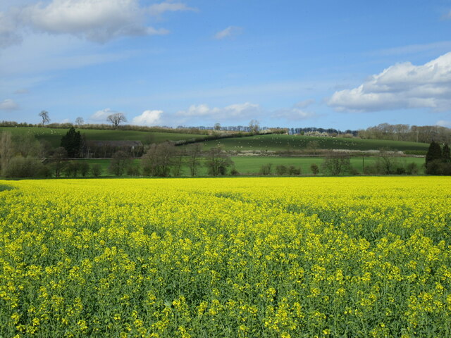
Gilling East is a small village located in the Ryedale district of North Yorkshire, England. Situated in the picturesque Howardian Hills Area of Outstanding Natural Beauty, it is surrounded by stunning countryside and offers a tranquil and idyllic setting.

The village itself is home to a close-knit community, with a population of around 200 people. It retains a traditional charm, characterized by its attractive stone-built houses, well-maintained gardens, and narrow winding lanes. Gilling East is known for its beautiful village green, which serves as a focal point for community events and gatherings.

The village benefits from various amenities, including a local pub, The Fairfax Arms, which offers a warm and welcoming atmosphere, and a primary school that strives to provide quality education to the village's younger residents. Additionally, the village hall hosts a range of activities and events, fostering a strong sense of community spirit.

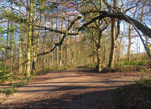
For outdoor enthusiasts, Gilling East provides an excellent base for exploring the surrounding countryside. The area offers a wealth of walking and cycling routes, allowing visitors to immerse themselves in the natural beauty of the Howardian Hills. Notably, the historic Castle Howard, a magnificent stately home and gardens, is just a short distance away, attracting tourists from near and far.

Overall, Gilling East epitomizes the charm and tranquility of rural Yorkshire. Its stunning natural surroundings, strong community spirit, and proximity to notable attractions make it a desirable place to live or visit for those seeking a peaceful retreat in the heart of the English countryside.

If you have any feedback on the listing, please let us know in the comments section below.

Gilling East Images

Images are sourced within 2km of 54.185517/-1.0571 or Grid Reference SE6177. Thanks to Geograph Open Source API. All images are credited.

Location of Gilling East Surface Block <span class="nowrap"><a title="http://trigpointing.uk/trig/160" rel="nofollow ugc noopener" href="http://trigpointing.uk/trig/160">Link</a><img style="margin-left:2px;" alt="External link" title="External link - shift click to open in new window" src="https://s1.geograph.org.uk/img/external.png" width="10" height="10"/></span>
Location of Gilling East Surface Block
Gilling East, Holy Cross church The benchmark is cut into the west facing wall of the church tower.
Gilling East, Holy Cross church
The benchmark is cut into the west facing wall of the church tower.
Gilling East, Holy Cross church There is a benchmark cut into the west facing wall of the church tower.
Gilling East, Holy Cross church
There is a benchmark cut into the west facing wall of the church tower.
Cawton, farm building The benchmark is cut into a left cornerstone of this roadside farm building, and is about 4ft from ground level.
Cawton, farm building
The benchmark is cut into a left cornerstone of this roadside farm building, and is about 4ft from ground level.
Cawton, farm building There is a benchmark cut into a left cornerstone of this roadside farm building, and is about 4ft from ground level.
Cawton, farm building
There is a benchmark cut into a left cornerstone of this roadside farm building, and is about 4ft from ground level.
Church of the Holy Cross, Gilling East Holy Cross Church is a parish church which serves the village and parish of Gilling East. The parish contains the villages of Gilling, Cawton, and Grimston. It is Grade I-listed (List Entry Number 1296322 <span class="nowrap"><a title="https://historicengland.org.uk/listing/the-list/list-entry/1296322?section=official-list-entry" rel="nofollow ugc noopener" href="https://historicengland.org.uk/listing/the-list/list-entry/1296322?section=official-list-entry">Link</a><img style="margin-left:2px;" alt="External link" title="External link - shift click to open in new window" src="https://s1.geograph.org.uk/img/external.png" width="10" height="10"/></span> Historic England).

The oldest part of the church, the arcade dates from around the year 1200. The chancel was added early in the 14th century, and the southern arcade was added slightly later. The tower was added in the late 15th century.
Church of the Holy Cross, Gilling East
Holy Cross Church is a parish church which serves the village and parish of Gilling East. The parish contains the villages of Gilling, Cawton, and Grimston. It is Grade I-listed (List Entry Number 1296322 LinkExternal link Historic England). The oldest part of the church, the arcade dates from around the year 1200. The chancel was added early in the 14th century, and the southern arcade was added slightly later. The tower was added in the late 15th century.
Holy Cross Church, Gilling East Holy Cross Church is a parish church which serves the village and parish of Gilling East. The parish contains the villages of Gilling, Cawton, and Grimston. It is Grade I-listed (List Entry Number 1296322 <span class="nowrap"><a title="https://historicengland.org.uk/listing/the-list/list-entry/1296322?section=official-list-entry" rel="nofollow ugc noopener" href="https://historicengland.org.uk/listing/the-list/list-entry/1296322?section=official-list-entry">Link</a><img style="margin-left:2px;" alt="External link" title="External link - shift click to open in new window" src="https://s1.geograph.org.uk/img/external.png" width="10" height="10"/></span> Historic England).

The oldest part of the church, the arcade dates from around the year 1200. The chancel was added early in the 14th century, and the southern arcade was added slightly later. The tower was added in the late 15th century.
Holy Cross Church, Gilling East
Holy Cross Church is a parish church which serves the village and parish of Gilling East. The parish contains the villages of Gilling, Cawton, and Grimston. It is Grade I-listed (List Entry Number 1296322 LinkExternal link Historic England). The oldest part of the church, the arcade dates from around the year 1200. The chancel was added early in the 14th century, and the southern arcade was added slightly later. The tower was added in the late 15th century.
Gilling East War Memorial Arch at Holy Cross Church The War memorial at Gilling East forms the entrance archway to the Parish Church of the Holy Cross. It commemorates the residents of Gilling East, Grimstone and Cawton who were killed or missing in the First World War. The names of 13 men are shown on 2 bronze plaques fixed to the pillars on either side of the archway. Of these 13 names, 7 were from the Yorkshire Regiment.

Wide buttressed pillars support a Tudor arch topped with a stone slate hipped roof. A form of Fleury cross in stone rises from the centre. The lintel carries a raised inscription, in white outlined in gold paint and on a red background, in Gothic lettering and reading: 
In Memory of the men of Gilling East, Grimstone and Cawton who gave their lives in the Great War 1914 1919. 

The memorial is Grade II-listed (List Entry Number: 1392270 <span class="nowrap"><a title="https://historicengland.org.uk/listing/the-list/list-entry/1392270?section=official-list-entry" rel="nofollow ugc noopener" href="https://historicengland.org.uk/listing/the-list/list-entry/1392270?section=official-list-entry">Link</a><img style="margin-left:2px;" alt="External link" title="External link - shift click to open in new window" src="https://s1.geograph.org.uk/img/external.png" width="10" height="10"/></span> Historic England).
Gilling East War Memorial Arch at Holy Cross Church
The War memorial at Gilling East forms the entrance archway to the Parish Church of the Holy Cross. It commemorates the residents of Gilling East, Grimstone and Cawton who were killed or missing in the First World War. The names of 13 men are shown on 2 bronze plaques fixed to the pillars on either side of the archway. Of these 13 names, 7 were from the Yorkshire Regiment. Wide buttressed pillars support a Tudor arch topped with a stone slate hipped roof. A form of Fleury cross in stone rises from the centre. The lintel carries a raised inscription, in white outlined in gold paint and on a red background, in Gothic lettering and reading: In Memory of the men of Gilling East, Grimstone and Cawton who gave their lives in the Great War 1914 1919. The memorial is Grade II-listed (List Entry Number: 1392270 LinkExternal link Historic England).
Station Road, Gilling East
Fairfax Arms, Gilling East
Track junction, North Side A crossing of tracks on the edge of woodland at Gilling Park. None of the tracks here are on a public right of way, but there is access and there's also a waymark on the post to the right of the track.
Track junction, North Side
A crossing of tracks on the edge of woodland at Gilling Park. None of the tracks here are on a public right of way, but there is access and there's also a waymark on the post to the right of the track.
New milepost This is one of several replacement mileposts set up by Ryedale Urban District Council about 2010/11.  They were cast at Cleveland Corrosion in Staithes.   Authentic, as they have the hands pointing the wrong way as the original was cast by Mattison's of Bedale.
New milepost
This is one of several replacement mileposts set up by Ryedale Urban District Council about 2010/11. They were cast at Cleveland Corrosion in Staithes. Authentic, as they have the hands pointing the wrong way as the original was cast by Mattison's of Bedale.
Old milepost This is one of the original late 19thC castings with the hands pointing the wrong way.   Ryedale HD stands for Ryedale Highways District.   Highways Districts were responsible for road maintenance before and just after County Councils were set up in the 1880s.   The name of the foundry, Mattison's of Bedale, is cast inside the left hand side.
Old milepost
This is one of the original late 19thC castings with the hands pointing the wrong way. Ryedale HD stands for Ryedale Highways District. Highways Districts were responsible for road maintenance before and just after County Councils were set up in the 1880s. The name of the foundry, Mattison's of Bedale, is cast inside the left hand side.
Old milestone One of four remaining stepstone milestones set up by the York to Oswaldkirk Bank turnpike trust first enacted in 1768.   It was agreed in the Minutes of 1772 to set up stones at 3 mile intervals with wooden posts in the intervening miles.  Each stone had the mileage to York and Helmsley inscribed but most of the legends are illegible now. This one is York 18/Helmsley 5.
Old milestone
One of four remaining stepstone milestones set up by the York to Oswaldkirk Bank turnpike trust first enacted in 1768. It was agreed in the Minutes of 1772 to set up stones at 3 mile intervals with wooden posts in the intervening miles. Each stone had the mileage to York and Helmsley inscribed but most of the legends are illegible now. This one is York 18/Helmsley 5.
Old milestone A view across the small stream by the milestone showing a stone to commemorate the Queen's Sapphire jubilee.  The front face of the milestone has the remnants of the legend YORK/18.   HELMSLEY/5, once inscribed on the left face, has completely eroded away.
Old milestone
A view across the small stream by the milestone showing a stone to commemorate the Queen's Sapphire jubilee. The front face of the milestone has the remnants of the legend YORK/18. HELMSLEY/5, once inscribed on the left face, has completely eroded away.
Grimston view Looking west.
Grimston view
Looking west.
Near Gilling East Looking north from the road.
Near Gilling East
Looking north from the road.
Halfway between Gilling and Cawton Looking NE from the road.
Halfway between Gilling and Cawton
Looking NE from the road.
Show me another place!

Gilling East is located at Grid Ref: SE6177 (Lat: 54.185517, Lng: -1.0571)

Division: North Riding

Administrative County: North Yorkshire

District: Ryedale

Police Authority: North Yorkshire

What 3 Words

///resonated.towels.stages. Near Helmsley, North Yorkshire

Nearby Locations

Gilling East

Related Wikis

Holy Cross Church, Gilling

Holy Cross Church is a parish church which serves the village and parish of Gilling East in North Yorkshire, England. The parish contains the villages...

Gilling East

Gilling East is a village and civil parish in North Yorkshire, England, on the main B1363 road between York and Helmsley, 2 miles (3.2 km) south of Oswaldkirk...

Gilling railway station

Gilling railway station is a disused railway station in North Yorkshire, England that served the village of Gilling East. East of it, the Gilling and Pickering...

St Martin's Ampleforth

St Martin's Ampleforth (SMA) was a private school and the preparatory school for Ampleforth College, which closed in July 2020. Until 2018 it was at Gilling...

Nearby Amenities

Located within 500m of 54.185517,-1.0571
Gilling
Historic Railway: station
Railway: site
Wikidata: Q5562353
Wikipedia: en:Gilling railway station
Lat/Long: 54.1874605/-1.0588143
Pub;guesthouse
The Fairfax Arms
Accommodation: yes
Addr City: York
Addr Postcode: YO62 4JH
Addr Street: Main Street
Addr Suburb: Gilling East
Floor Material: rough_wood
Food: yes
Outdoor Seating: yes
Parking: yes
Phone: +441439788212
Real Ale: 3 from Black sheep + Tetley
Website: http://www.thefairfaxarms-gilling.co.uk/
Wifi: yes
Wikidata: Q111368223
Lat/Long: 54.1849331/-1.0592723
Telephone
Booth: K6
Covered: booth
Lat/Long: 54.1843962/-1.0587339
Gilling
Alt Name: Gilling East
Place: village
Wikidata: Q2246191
Wikipedia: en:Gilling East
Lat/Long: 54.1853162/-1.0591295
Post Box
Collection Times: Mo-Fr 17:30; Sa 09:00
Post Box Type: lamp
Ref: YO62 296
Royal Cypher: EIIR
Royal Cypher Wikidata: Q33102113
Lat/Long: 54.1849605/-1.0596786
Crossing: uncontrolled
Railway: crossing
Lat/Long: 54.184814/-1.062592
Direction West: Ampleforth College
Guide Type: destination
Guidepost Type: PROW
Information: guidepost
Tourism: information
Lat/Long: 54.1870298/-1.0598101
Passing Place
Lat/Long: 54.1843853/-1.0628752
Note: Not a place
Source: survey
Lat/Long: 54.1860712/-1.060288
Station Cottages
Place: locality
Lat/Long: 54.1875968/-1.058346
Village Farm
Place: farm
Lat/Long: 54.1825107/-1.0577674
Grange Farm
Place: farm
Lat/Long: 54.1824857/-1.0537902
Barrier: kissing_gate
Lat/Long: 54.1848726/-1.0626831
Crossing: uncontrolled
Railway: crossing
Lat/Long: 54.184669/-1.0623411
Power: pole
Lat/Long: 54.1844813/-1.0499115
Defibrillator
Access: yes
Defibrillator Location: outside Fairfax Arms pub, Gilling East - facing Pottergate
Emergency: defibrillator
Indoor: no
Lat/Long: 54.1850192/-1.0592816
The data included in this document is from www.openstreetmap.org. The data is made available under ODbL.

Have you been to Gilling East?

Leave your review of Gilling East below (or comments, questions and feedback).