Gilbert's End

Settlement in Worcestershire Malvern Hills

England

Gilbert's End

Hook Bank Mobile Home  Park The mobile home park has 37 residential homes and caters for the retired and semi-retired.
Viewed from the footpath near the Anchor Inn. 
<span class="nowrap"><a title="http://barrparks.co.uk/hook-bank-park/" rel="nofollow ugc noopener" href="http://barrparks.co.uk/hook-bank-park/">Link</a><img style="margin-left:2px;" alt="External link" title="External link - shift click to open in new window" src="https://s1.geograph.org.uk/img/external.png" width="10" height="10"/></span>
Hook Bank Mobile Home Park Credit: Bob Embleton

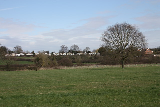
Gilbert's End is a small village located in the county of Worcestershire, England. Situated in the district of Malvern Hills, it is surrounded by picturesque countryside and offers a tranquil and rural setting for its residents. The village is nestled between the towns of Malvern and Upton upon Severn, with the River Severn flowing nearby.

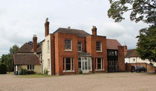
With a population of around 400 people, Gilbert's End has a close-knit community that takes pride in its local heritage. The village is named after the Gilbert family, who were significant landowners in the area during the medieval period. The Gilbert's End Manor House, a historic Grade II listed building, is a notable landmark that adds character to the village.

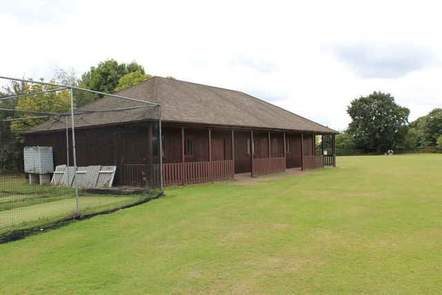
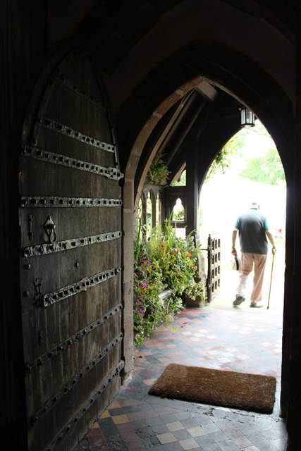
Gilbert's End boasts a traditional English village atmosphere, with charming cottages and well-maintained gardens. The village is primarily residential, with a scattering of small businesses and farms contributing to the local economy. The community is served by St. James Church, a beautiful 12th-century church that holds regular services and events.

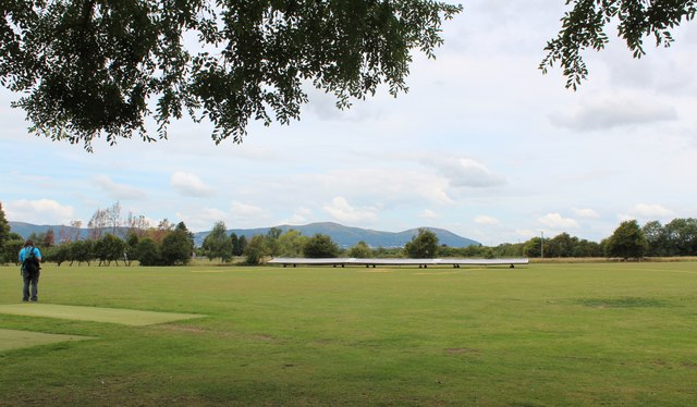
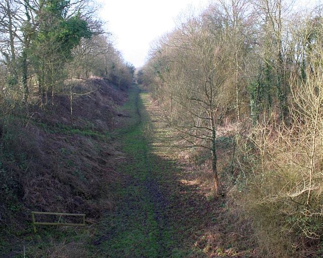
Nature lovers and outdoor enthusiasts are drawn to Gilbert's End for its proximity to the Malvern Hills Area of Outstanding Natural Beauty. The rolling hills and idyllic countryside provide ample opportunities for hiking, cycling, and exploring the great outdoors. Additionally, the nearby River Severn offers fishing and boating activities for those seeking water-based recreation.

Overall, Gilbert's End offers a peaceful and picturesque living environment, making it an attractive place for those seeking a rural lifestyle in the heart of Worcestershire.

If you have any feedback on the listing, please let us know in the comments section below.

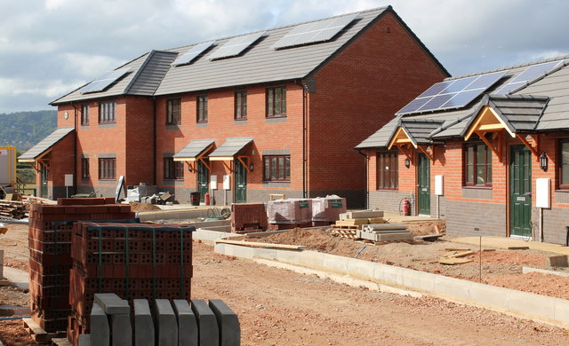
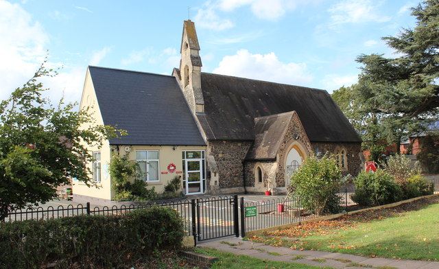
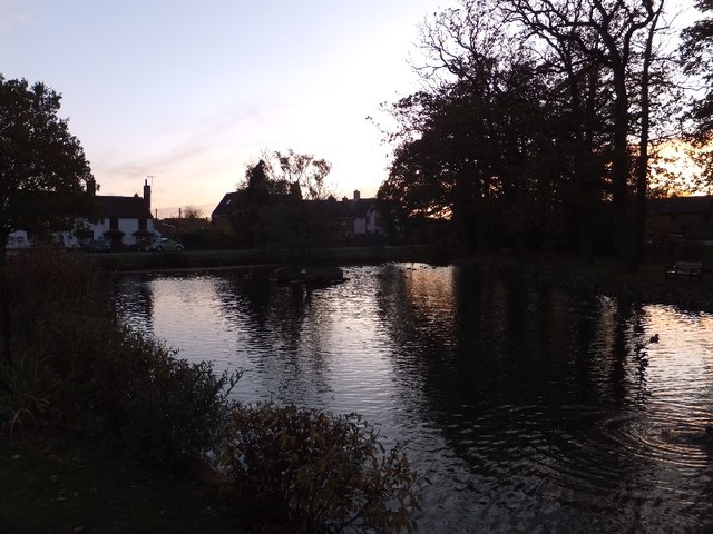
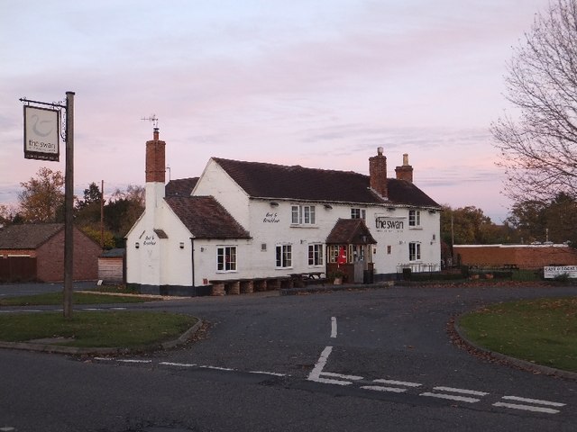
Gilbert's End Images

Images are sourced within 2km of 52.079177/-2.263357 or Grid Reference SO8242. Thanks to Geograph Open Source API. All images are credited.

Hook Bank Mobile Home  Park The mobile home park has 37 residential homes and caters for the retired and semi-retired.
Viewed from the footpath near the Anchor Inn. 
<span class="nowrap"><a title="http://barrparks.co.uk/hook-bank-park/" rel="nofollow ugc noopener" href="http://barrparks.co.uk/hook-bank-park/">Link</a><img style="margin-left:2px;" alt="External link" title="External link - shift click to open in new window" src="https://s1.geograph.org.uk/img/external.png" width="10" height="10"/></span>
Hook Bank Mobile Home Park
The mobile home park has 37 residential homes and caters for the retired and semi-retired. Viewed from the footpath near the Anchor Inn. LinkExternal link
Cricket Pavilion, Hanley Castle The practice nets are on the left.
These allow the batsman to practice hitting the ball hard without all the inconvenience of finding the ball afterwards.
Cricket Pavilion, Hanley Castle
The practice nets are on the left. These allow the batsman to practice hitting the ball hard without all the inconvenience of finding the ball afterwards.
Hanley Castle school - sixth form centre The origins of the school date back to the 16th century if not earlier.
The buildings are of many styles as the school has grown and evolved.
They range from timber-framed to ultra-modern.
Hanley Castle school - sixth form centre
The origins of the school date back to the 16th century if not earlier. The buildings are of many styles as the school has grown and evolved. They range from timber-framed to ultra-modern.
Hanley Castle school Some of the newer buildings. 
The school dates back to at least the sixteenth century.
The school grounds were being used this day for the "Village Day".
This included many vehicles hence the combined harvester and tractor.
Hanley Castle school
Some of the newer buildings. The school dates back to at least the sixteenth century. The school grounds were being used this day for the "Village Day". This included many vehicles hence the combined harvester and tractor.
Hanley Castle cricket ground In Church End, Hanley Castle.
The Malvern hills provide the perfect backdrop.
Hanley Castle cricket ground
In Church End, Hanley Castle. The Malvern hills provide the perfect backdrop.
Doorway,St Mary's Church, Hanley Castle The north door and porch taken from just inside the church.
Doorway,St Mary's Church, Hanley Castle
The north door and porch taken from just inside the church.
Lechmere window, Hanley Castle church To the glory of God and in memory of Sir Edmund Hungerford Lechmere, baronet who died April 2nd 1856.
Edmund was born in 1792 and became 2nd Baronet of the Rhydd.
In 1852 he became the High Sheriff of Worcestershire.
Lechmere window, Hanley Castle church
To the glory of God and in memory of Sir Edmund Hungerford Lechmere, baronet who died April 2nd 1856. Edmund was born in 1792 and became 2nd Baronet of the Rhydd. In 1852 he became the High Sheriff of Worcestershire.
The Handmaids window, Hanley Castle Church "Ave Maria" "Ecce Ancilla Domini"
"Hail Mary" "Behold the Handmaid of the Lord"
The Handmaids window, Hanley Castle Church
"Ave Maria" "Ecce Ancilla Domini" "Hail Mary" "Behold the Handmaid of the Lord"
Housing development, Hanley Swan On the Welland road on what was a meadow between the school and the limit of residential land.
There will be 11 new homes for rent or "HomeBuy": 
4 three bedroomed houses, 3 two bedroomed houses, 
2 two bedroomed bungalows and 2 two bedroomed apartments.

Under the "HomeBuy" scheme the occupier initially buys between 25% and 75% of the house with the option of buying more shares in the house later.

<span class="nowrap"><a title="http://www.homebuy.org.uk/homebuy_schemes.html" rel="nofollow ugc noopener" href="http://www.homebuy.org.uk/homebuy_schemes.html">Link</a><img style="margin-left:2px;" alt="External link" title="External link - shift click to open in new window" src="https://s1.geograph.org.uk/img/external.png" width="10" height="10"/></span>

How the meadow looked in 2007:
<a href="https://www.geograph.org.uk/photo/446149">SO8142 : Horse Jumps in Meadow</a>
<a href="https://www.geograph.org.uk/photo/2595342">SO8142 : Building site (right), Hanley Swan</a>
<a href="https://www.geograph.org.uk/photo/2595324">SO8142 : Building site (left), Hanley Swan</a>
<a href="https://www.geograph.org.uk/photo/2595317">SO8142 : Building site (centre), Hanley Swan</a>
Housing development, Hanley Swan
On the Welland road on what was a meadow between the school and the limit of residential land. There will be 11 new homes for rent or "HomeBuy": 4 three bedroomed houses, 3 two bedroomed houses, 2 two bedroomed bungalows and 2 two bedroomed apartments. Under the "HomeBuy" scheme the occupier initially buys between 25% and 75% of the house with the option of buying more shares in the house later. LinkExternal link How the meadow looked in 2007: SO8142 : Horse Jumps in Meadow SO8142 : Building site (right), Hanley Swan SO8142 : Building site (left), Hanley Swan SO8142 : Building site (centre), Hanley Swan
Building site (centre), Hanley Swan On the Welland road on what was a meadow between the school and the limit of residential land.
How the meadow looked in 2007:
<a href="https://www.geograph.org.uk/photo/446149">SO8142 : Horse Jumps in Meadow</a>
<a href="https://www.geograph.org.uk/photo/2595342">SO8142 : Building site (right), Hanley Swan</a>
<a href="https://www.geograph.org.uk/photo/2595324">SO8142 : Building site (left), Hanley Swan</a>
<a href="https://www.geograph.org.uk/photo/2595302">SO8142 : Housing development, Hanley Swan</a>
Building site (centre), Hanley Swan
On the Welland road on what was a meadow between the school and the limit of residential land. How the meadow looked in 2007: SO8142 : Horse Jumps in Meadow SO8142 : Building site (right), Hanley Swan SO8142 : Building site (left), Hanley Swan SO8142 : Housing development, Hanley Swan
Building site (left), Hanley Swan On the Welland road on what was a meadow between the school and the limit of residential land.
<a href="https://www.geograph.org.uk/photo/2595342">SO8142 : Building site (right), Hanley Swan</a>
<a href="https://www.geograph.org.uk/photo/2595317">SO8142 : Building site (centre), Hanley Swan</a>
<a href="https://www.geograph.org.uk/photo/2595302">SO8142 : Housing development, Hanley Swan</a>
Building site (left), Hanley Swan
On the Welland road on what was a meadow between the school and the limit of residential land. SO8142 : Building site (right), Hanley Swan SO8142 : Building site (centre), Hanley Swan SO8142 : Housing development, Hanley Swan
Building site (right), Hanley Swan On the Welland road on what was a meadow between the school and the limit of residential land.
Note the photo-voltaic solar panels already fitted to the south facing roofs.
<a href="https://www.geograph.org.uk/photo/2595324">SO8142 : Building site (left), Hanley Swan</a>
<a href="https://www.geograph.org.uk/photo/2595317">SO8142 : Building site (centre), Hanley Swan</a>
<a href="https://www.geograph.org.uk/photo/2595302">SO8142 : Housing development, Hanley Swan</a>
Building site (right), Hanley Swan
On the Welland road on what was a meadow between the school and the limit of residential land. Note the photo-voltaic solar panels already fitted to the south facing roofs. SO8142 : Building site (left), Hanley Swan SO8142 : Building site (centre), Hanley Swan SO8142 : Housing development, Hanley Swan
Hanley Swan C of E primary school A Church of England "controlled" school on the Welland Road next to the village hall.
It was built around 1861 as a "school for the education of children and adults or children only of the Labouring, Manufacturing or other poorer classes."
In 1947 it became solely a primary school.
Notice how the older part of the school, with Malvern granite walls, looks just like a chapel - for indeed it was also used as a chapel of ease for the inhabitants of the Swan Green area (now called Hanley Swan) until St Gabriel's church was built.
Hanley Swan C of E primary school
A Church of England "controlled" school on the Welland Road next to the village hall. It was built around 1861 as a "school for the education of children and adults or children only of the Labouring, Manufacturing or other poorer classes." In 1947 it became solely a primary school. Notice how the older part of the school, with Malvern granite walls, looks just like a chapel - for indeed it was also used as a chapel of ease for the inhabitants of the Swan Green area (now called Hanley Swan) until St Gabriel's church was built.
Annual Honey Show, Hanley Swan Village Hall An annual event in September for members of the Upton & Malvern Beekeepers.
Many classes of honey, mead, beeswax, full frames of unextracted honey, cakes, biscuits and "interesting bee keeping-related exhibits".
After the judges have made their decisions the show is open to the members and public for free.
The hire of the hall is paid for by the car boot sale outside the hall, a raffle and the sale of refreshments inside.
The show ends with the raffle draw and presentation of the many prize cups, shields, etc.
It is good preparation for the Worcestershire County competition a few weeks later at the Autumn Show held at the Three Counties Showground.
Annual Honey Show, Hanley Swan Village Hall
An annual event in September for members of the Upton & Malvern Beekeepers. Many classes of honey, mead, beeswax, full frames of unextracted honey, cakes, biscuits and "interesting bee keeping-related exhibits". After the judges have made their decisions the show is open to the members and public for free. The hire of the hall is paid for by the car boot sale outside the hall, a raffle and the sale of refreshments inside. The show ends with the raffle draw and presentation of the many prize cups, shields, etc. It is good preparation for the Worcestershire County competition a few weeks later at the Autumn Show held at the Three Counties Showground.
The Swan Pool (village pond) at sunset
The Swan Inn at Hanley Swan Perhaps the title should be "the swan" as the signs use lower case only.  Hanley Swan has the traditional English village centre: a cross roads with a village green, overlooked by an inn in one corner; a village pond in the next corner; the post office and shop next, and houses in the fourth.  When I grew up here, I almost believed that every village should have this layout.
The Swan Inn at Hanley Swan
Perhaps the title should be "the swan" as the signs use lower case only. Hanley Swan has the traditional English village centre: a cross roads with a village green, overlooked by an inn in one corner; a village pond in the next corner; the post office and shop next, and houses in the fourth. When I grew up here, I almost believed that every village should have this layout.
A second oak tree on the village green The centre of the green is site for an oak planted in the 19th century.
A second oak tree on the village green
The centre of the green is site for an oak planted in the 19th century.
The old pump house and Gilbert's End
Show me another place!

Gilbert's End is located at Grid Ref: SO8242 (Lat: 52.079177, Lng: -2.263357)

Administrative County: Worcestershire

District: Malvern Hills

Police Authority: West Mercia

What 3 Words

///equality.sunroof.latitudes. Near Upton upon Severn, Worcestershire

Nearby Locations

Gilbert's End

Related Wikis

Hanley Swan

Hanley Swan is a small village in the English county of Worcestershire. It lies in the Malvern Hills district, between the towns of Malvern (two miles...

British National Fencing Museum

The British National Fencing Museum is the national museum for Great Britain for the sport and martial art of fencing.The museum opened during the year...

Brotheridge Green Nature Reserve

Brotheridge Green Nature Reserve is a nature reserve of the Worcestershire Wildlife Trust at Brotheridge Green, about 2.5 miles (4.0 km) west of Upton...

Hanley Castle (castle)

Hanley Castle was a Norman castle that stood to the south of the present-day site of the village of Hanley Castle, which lies 2 km north of Upton-upon...

Hanley Castle

Hanley Castle is a village and civil parish in Worcestershire, England, between the towns of Malvern and Upton upon Severn and a short distance from the...

Hanley Castle High School

Hanley Castle High School is a non-selective mixed secondary school and sixth form centre located in the village of Hanley Castle, 1.4 miles (2.2 km) from...

Guarlford

Guarlford is a village and civil parish in the Malvern Hills district in the county of Worcestershire, England. The parish population was 261 in 2021.It...

The Rhydd

The Rhydd (formerly Rhydd Court) is an English country house alongside the River Severn, near the village of Hanley Castle, Worcestershire, about halfway...

Nearby Amenities

Located within 500m of 52.079177,-2.263357
Barrier: kissing_gate
Source: survey;gps
Lat/Long: 52.0811057/-2.2698081
Gilberts End
Place: hamlet
Lat/Long: 52.0788167/-2.2607759
Post Box
Collection Times: Mo-Fr 15:45; Sa 07:45
Hanleys Tag: B
Note: Lamp box embedded into a house's ("The Villa") gatepost
Post Box Type: wall
Ref: WR8 112
Lat/Long: 52.0784106/-2.2603941
Post Box
Collection Times: Mo-Fr 17:00; Sa 07:00
Post Box Type: wall
Ref: WR8 186
Royal Cypher: EVIIR
Royal Cypher Wikidata: Q33102324
Source: GPS Survey
Lat/Long: 52.0831694/-2.260199
Barrier: stile
Source: survey;gps
Lat/Long: 52.0783998/-2.2618417
Power: pole
Lat/Long: 52.0794269/-2.2704162
Power: pole
Lat/Long: 52.0793177/-2.2694767
Power: pole
Lat/Long: 52.0822826/-2.2582872
Power: pole
Lat/Long: 52.0822587/-2.2592112
Power: pole
Lat/Long: 52.0822147/-2.2608072
Horton Manor
Power: pole
Transformer: distribution
Voltage Primary: 11000
Lat/Long: 52.083092/-2.2604182
Power: pole
Lat/Long: 52.0826704/-2.2606771
Power: pole
Lat/Long: 52.0821034/-2.2612209
Power: pole
Lat/Long: 52.0818092/-2.2622824
Power: pole
Lat/Long: 52.0814371/-2.2636302
Power: pole
Lat/Long: 52.0810921/-2.2649264
Power: pole
Lat/Long: 52.0811189/-2.2661515
Power: pole
Lat/Long: 52.0811564/-2.2673846
Power: pole
Lat/Long: 52.0814263/-2.2694398
Power: pole
Lat/Long: 52.0818887/-2.2687197
Power: pole
Lat/Long: 52.081189/-2.268599
Power: pole
Lat/Long: 52.0810291/-2.2685641
Power: pole
Lat/Long: 52.0805428/-2.2685024
Power: pole
Lat/Long: 52.0798382/-2.2684635
Power: pole
Lat/Long: 52.0791829/-2.2684354
Power: pole
Lat/Long: 52.0784576/-2.2684005
Power: pole
Lat/Long: 52.0777735/-2.268367
Location Transition: yes
Power: pole
Lat/Long: 52.0770787/-2.2683361
Hanley Halls
Location Transition: yes
Power: pole
Transformer: distribution
Voltage Primary: 11000
Lat/Long: 52.0763665/-2.2682852
The data included in this document is from www.openstreetmap.org. The data is made available under ODbL.

Have you been to Gilbert's End?

Leave your review of Gilbert's End below (or comments, questions and feedback).