Lochanan Àird na Faoghalach

Lake, Pool, Pond, Freshwater Marsh in Ross-shire

Scotland

Lochanan Àird na Faoghalach

Loch Griomarstadh (Loch Grimersta) Loch Griomarstadh is a long narrow inlet of Loch Ceann Hulabhaig. It is tidal, and this view shows the sea a foot or so below high tide. In the distant, at left is Calanais (Callanish).
Loch Griomarstadh (Loch Grimersta) Credit: Anne Burgess

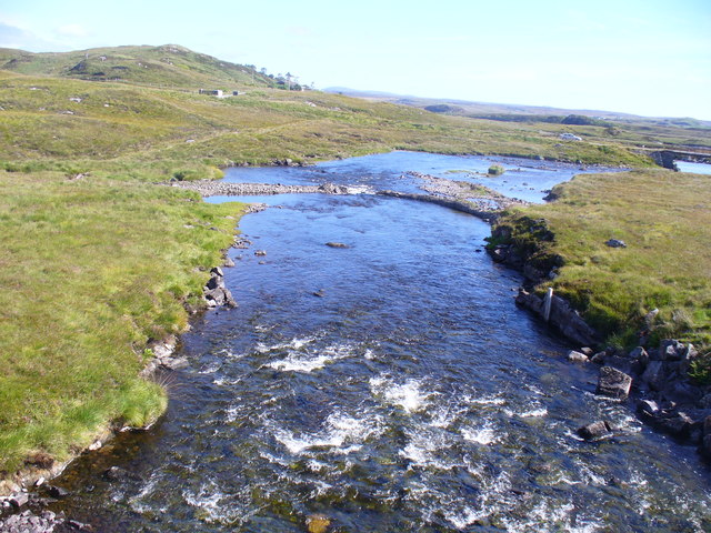
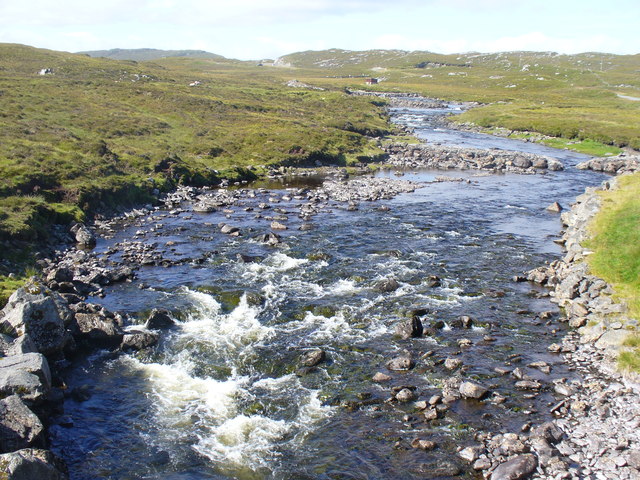
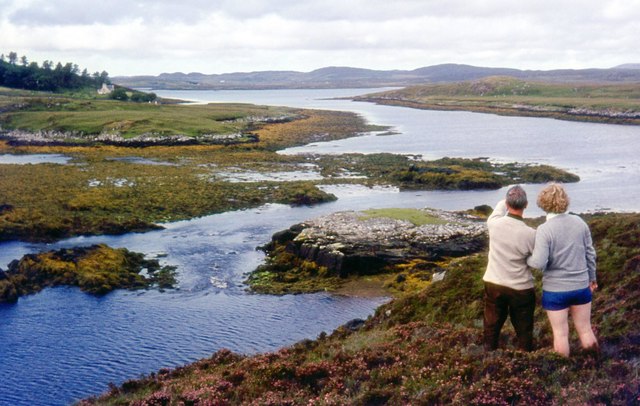
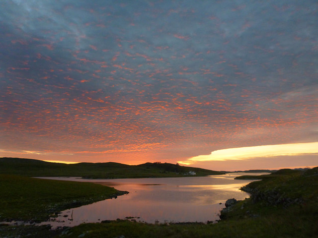
Lochanan Àird na Faoghalach is a picturesque freshwater marsh located in Ross-shire, Scotland. Nestled amidst the breathtaking Scottish Highlands, this tranquil landscape offers a serene retreat for nature enthusiasts and wildlife lovers.

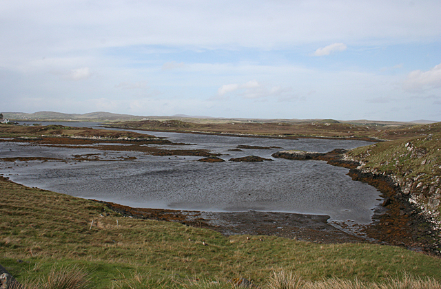
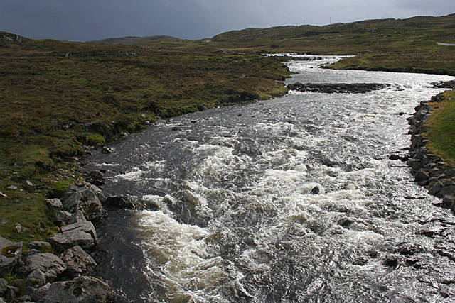
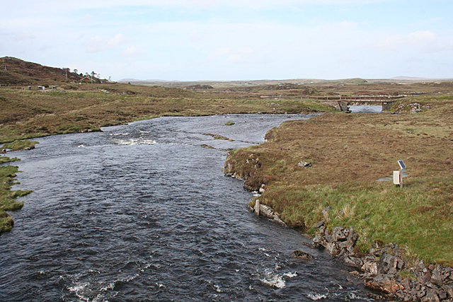
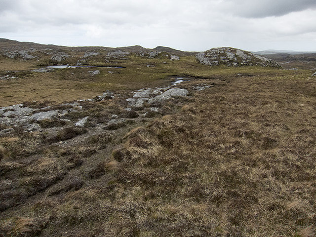
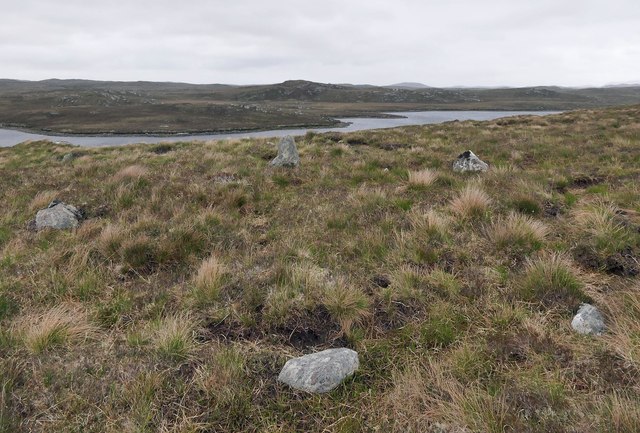
Covering an area of approximately 20 hectares, Lochanan Àird na Faoghalach comprises of several small interconnected lochs, pools, ponds, and marshy areas. The marshlands are characterized by their lush vegetation, including reeds, sedges, and various aquatic plants that thrive in the nutrient-rich waters.

The area is home to a diverse range of wildlife, making it a haven for birdwatchers and nature photographers. Visitors may spot a variety of waterfowl species such as mallards, teal, wigeons, and grebes, among others. The marshlands also attract wading birds like curlews, lapwings, and snipes, which can be seen foraging along the water's edge.

In addition to its avian inhabitants, Lochanan Àird na Faoghalach supports a rich array of amphibians, including frogs, toads, and newts. These creatures find refuge in the marshy areas, benefiting from the abundant insect life and shallow waters.

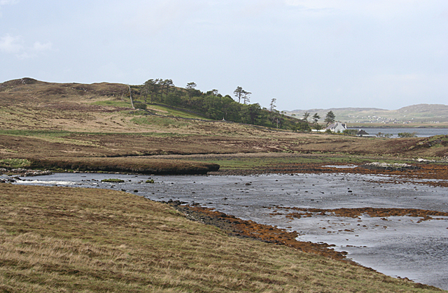
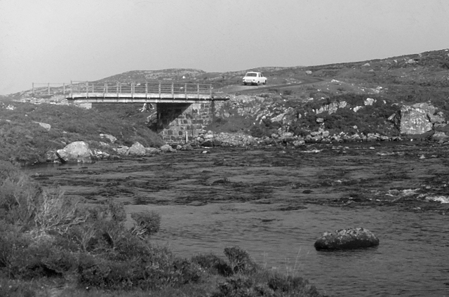
The surrounding landscape of Lochanan Àird na Faoghalach is equally captivating, with rolling hills and rugged mountains providing a breathtaking backdrop. The area is also rich in archaeological remains, with ancient settlements and standing stones dotting the landscape, adding a sense of historical significance to the site.

Whether it's for a leisurely stroll, birdwatching, or simply immersing oneself in the beauty of nature, Lochanan Àird na Faoghalach offers a peaceful and enchanting experience for visitors seeking solace in the heart of the Scottish Highlands.

If you have any feedback on the listing, please let us know in the comments section below.

Lochanan Àird na Faoghalach Images

Images are sourced within 2km of 58.159786/-6.7571017 or Grid Reference NB2028. Thanks to Geograph Open Source API. All images are credited.

Loch Griomarstadh (Loch Grimersta) Loch Griomarstadh is a long narrow inlet of Loch Ceann Hulabhaig. It is tidal, and this view shows the sea a foot or so below high tide. In the distant, at left is Calanais (Callanish).
Loch Griomarstadh (Loch Grimersta)
Loch Griomarstadh is a long narrow inlet of Loch Ceann Hulabhaig. It is tidal, and this view shows the sea a foot or so below high tide. In the distant, at left is Calanais (Callanish).
Griomarstadh Abhainn Ghriomarstaidh (River Grimersta) enters the sea here from the left. The house at Griomarstadh is in the next square, and in the distance are the crofting communities of Calanais and Breascleit.
Griomarstadh
Abhainn Ghriomarstaidh (River Grimersta) enters the sea here from the left. The house at Griomarstadh is in the next square, and in the distance are the crofting communities of Calanais and Breascleit.
Abhainn Ghriomarstaidh (Grimersta River) Dramatic lighting as storm clouds gather to the south-west. This river is possibly the best salmon fishing river in the Western Isles, and drains a large tract of southern Lewis. There was a lot of water today following a week of unsettled weather with frequent rain showers.
Abhainn Ghriomarstaidh (Grimersta River)
Dramatic lighting as storm clouds gather to the south-west. This river is possibly the best salmon fishing river in the Western Isles, and drains a large tract of southern Lewis. There was a lot of water today following a week of unsettled weather with frequent rain showers.
Abhainn Ghriomarstaidh (Grimersta River) Looking downstream from the new bridge which carries the B8011 over the river. The next bridge is the private access to Griomarstadh House and jetty.
Abhainn Ghriomarstaidh (Grimersta River)
Looking downstream from the new bridge which carries the B8011 over the river. The next bridge is the private access to Griomarstadh House and jetty.
Grimersta River Abhainn Ghriomarstaidh tumbling down to the sea at Loch Ceann Hulabhig. The old road and bridge are visible in mid distance.
Grimersta River
Abhainn Ghriomarstaidh tumbling down to the sea at Loch Ceann Hulabhig. The old road and bridge are visible in mid distance.
Grimersta River from the Bridge View upstream of a tumbling, Highland river (Abhainn Ghriomarstaidh) from the new B8011 road bridge.
Grimersta River from the Bridge
View upstream of a tumbling, Highland river (Abhainn Ghriomarstaidh) from the new B8011 road bridge.
Lewis style bus shelter (i)
Old road bridge over the Abhainn Ghriomarstaidh/Grimersta River When this photo was taken in 1975, the bridge seen carried the B road to west Lewis over the river. Since then, a replacement has been constructed a short distance downstream. Fairly recent imagery seen online suggests that the bridge is still standing, although it no longer lies on a public road.
Old road bridge over the Abhainn Ghriomarstaidh/Grimersta River
When this photo was taken in 1975, the bridge seen carried the B road to west Lewis over the river. Since then, a replacement has been constructed a short distance downstream. Fairly recent imagery seen online suggests that the bridge is still standing, although it no longer lies on a public road.
Loch Faoghail am Tuim Looking south towards the hills of West Lewis. The little house highlighted by a ray of sunshine is a boathouse, in the next square. The nearest hill on the left is Ciorabhal, and on the right is Geure Dubh Mhòr. On the distant skyline is Roineabhal.
Loch Faoghail am Tuim
Looking south towards the hills of West Lewis. The little house highlighted by a ray of sunshine is a boathouse, in the next square. The nearest hill on the left is Ciorabhal, and on the right is Geure Dubh Mhòr. On the distant skyline is Roineabhal.
Up above the old road This is not country in which to venture without navigations skills. It's boggy, and many of the ups and downs are not pronounced enough to generate contours. We were able to park on the old road - visible on the 1:25000 OS map - and it was a slightly boggy walk up onto rock. One of little lochans in the square can be seen, as can a typical "knock" of Lewisian gneiss. The (somewhat dilapidated) fence to my west could not be seen from where I took the photo.
Up above the old road
This is not country in which to venture without navigations skills. It's boggy, and many of the ups and downs are not pronounced enough to generate contours. We were able to park on the old road - visible on the 1:25000 OS map - and it was a slightly boggy walk up onto rock. One of little lochans in the square can be seen, as can a typical "knock" of Lewisian gneiss. The (somewhat dilapidated) fence to my west could not be seen from where I took the photo.
Cycling the B8059 The hills of Harris on the skyline
Cycling the B8059
The hills of Harris on the skyline
B8059 and the lochs leading in to the Lewis-Harris borderlands This string of linked lochs have 'Faoghail' in their names; this is the Gaelic word for ford.
B8059 and the lochs leading in to the Lewis-Harris borderlands
This string of linked lochs have 'Faoghail' in their names; this is the Gaelic word for ford.
Looking south east from the old Ardroil road A short spur which has been bypassed by new road construction forms a convenient parking place to admire the view.
Looking south east from the old Ardroil road
A short spur which has been bypassed by new road construction forms a convenient parking place to admire the view.
Loch Griomarstadh (Loch Grimersta) Part of the intricate coastline of west Lewis.
Loch Griomarstadh (Loch Grimersta)
Part of the intricate coastline of west Lewis.
Allt na Muilne drains into Loch Griomarstadh Underlit clouds illuminate the southern tip of Loch Griomarstadh during a summer sunset. The view is barely west of due north, but this far north, the sun stays above the horizon late - it is almost half past ten - and the earth has time to rotate much further before the light finally fades.
Allt na Muilne drains into Loch Griomarstadh
Underlit clouds illuminate the southern tip of Loch Griomarstadh during a summer sunset. The view is barely west of due north, but this far north, the sun stays above the horizon late - it is almost half past ten - and the earth has time to rotate much further before the light finally fades.
Stone setting, Druim Cam, Isle of Lewis Looking towards Loch Faoghail Charrasan, most of which lies within the grid square.

From Discovery and Excavation in Scotland, 1991: "Possible kerb cairn or hut circle.  There is a sub-circular setting of 7 stones on edge set firmly into the ground, now under 20cm to 40cm of peat. The largest stone is 0.5m high. The internal dimensions are approximately 5.5m by 4.0m.  It is located on near-level ground on a gently sloping rock and heather ridge overlooking land on the shore of the loch."
Stone setting, Druim Cam, Isle of Lewis
Looking towards Loch Faoghail Charrasan, most of which lies within the grid square. From Discovery and Excavation in Scotland, 1991: "Possible kerb cairn or hut circle. There is a sub-circular setting of 7 stones on edge set firmly into the ground, now under 20cm to 40cm of peat. The largest stone is 0.5m high. The internal dimensions are approximately 5.5m by 4.0m. It is located on near-level ground on a gently sloping rock and heather ridge overlooking land on the shore of the loch."
Causeway and fishing bothy, Loch Faoghail an Tuim, Isle of Lewis Loch Faoghail an Tuim is part of the Grimersta salmon system (<span class="nowrap"><a title="https://www.grimersta.com/guide.htm" rel="nofollow ugc noopener" href="https://www.grimersta.com/guide.htm">Link</a><img style="margin-left:2px;" alt="External link" title="External link - shift click to open in new window" src="https://s1.geograph.org.uk/img/external.png" width="10" height="10"/></span> ).
Causeway and fishing bothy, Loch Faoghail an Tuim, Isle of Lewis
Loch Faoghail an Tuim is part of the Grimersta salmon system (LinkExternal link ).
Lewis bus shelter
Lewis bus shelter
Show me another place!

Lochanan Àird na Faoghalach is located at Grid Ref: NB2028 (Lat: 58.159786, Lng: -6.7571017)

Unitary Authority: Na h-Eileanan an Iar

Police Authority: Highlands and Islands

What 3 Words

///shrubbery.chins.horses. Near Carloway, Na h-Eileanan Siar

Related Wikis

Callanish IV

The Callanish IV stone circle (Scottish Gaelic: Ceann Hulavig) is one of many megalithic structures around the better-known (and larger) Calanais I on...

Callanish II

The Callanish II stone circle (Scottish Gaelic: Cnoc Ceann a' Gharaidh) is one of many megalithic structures around the better-known (and larger) Calanais...

Callanish Stones

The Callanish Stones (or "Callanish I": Scottish Gaelic: Clachan Chalanais or Tursachan Chalanais) are an arrangement of standing stones placed in a cruciform...

Callanish III

The Callanish III stone circle (Scottish Gaelic: Cnoc Fillibhir Bheag) is one of many megalithic structures around the better-known (and larger) Calanais...

Nearby Amenities

Located within 500m of 58.159786,-6.7571017
Bus Stop
Bernera
Naptan AtcoCode: 6010731558
Naptan Bearing: E
Naptan CommonName: Bernera
Naptan Indicator: Junction
Naptan Landmark: bus shelter at main road junction
Naptan NaptanCode: 94723769
Naptan Street: Junction
Naptan Verified: no
Source: naptan_import
Lat/Long: 58.1596937/-6.7551413
Power: pole
Lat/Long: 58.161607/-6.7496959
Power: pole
Lat/Long: 58.1610653/-6.7510569
Power: pole
Lat/Long: 58.1605795/-6.7522622
Power: pole
Lat/Long: 58.1601017/-6.7533319
Power: pole
Lat/Long: 58.1599784/-6.7540684
Power: pole
Lat/Long: 58.1598055/-6.7549782
Power: pole
Lat/Long: 58.1595716/-6.7562746
Power: pole
Lat/Long: 58.1593649/-6.7575279
Power: pole
Lat/Long: 58.1591423/-6.7587738
Power: pole
Lat/Long: 58.1585302/-6.760031
Power: pole
Lat/Long: 58.1579337/-6.761226
Power: pole
Lat/Long: 58.1572842/-6.7625603
Passing Place
Lat/Long: 58.1612545/-6.7617246
Passing Place
Lat/Long: 58.1617077/-6.7643767
Noexit: yes
Lat/Long: 58.1595495/-6.7537633
Power: pole
Lat/Long: 58.1616635/-6.750019
Power: pole
Lat/Long: 58.161215/-6.7511696
Power: pole
Lat/Long: 58.1607679/-6.7523337
Power: pole
Lat/Long: 58.1603221/-6.7534173
Power: pole
Lat/Long: 58.1601622/-6.75423
Power: pole
Lat/Long: 58.1604467/-6.7557991
Power: pole
Lat/Long: 58.157225/-6.7623164
Power: pole
Lat/Long: 58.1568481/-6.7631655
Power: pole
Lat/Long: 58.1575788/-6.7615037
Power: pole
Lat/Long: 58.1579821/-6.760573
Power: pole
Lat/Long: 58.1584179/-6.7595189
Power: pole
Lat/Long: 58.1591522/-6.7574714
Power: pole
Lat/Long: 58.1588674/-6.7585189
Power: pole
Lat/Long: 58.1594087/-6.7564346
Passing Place
Lat/Long: 58.1606506/-6.7580431
The data included in this document is from www.openstreetmap.org. The data is made available under ODbL.

Have you been to Lochanan Àird na Faoghalach?

Leave your review of Lochanan Àird na Faoghalach below (or comments, questions and feedback).