Geisiadar

Settlement in Ross-shire

Scotland

Geisiadar

B8011 at Leathad Mòr
B8011 at Leathad Mòr Credit: Sandy Gerrard

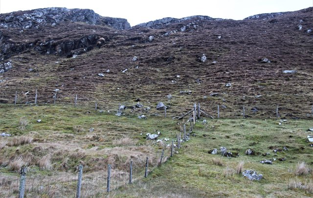
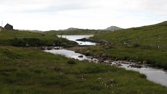
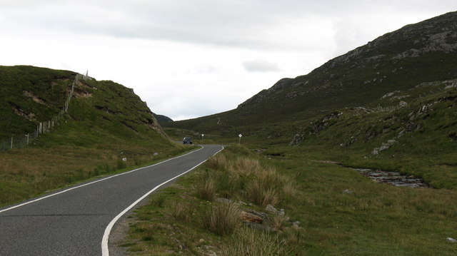
Geisiadar is a small village located in the county of Ross-shire, in the Scottish Highlands. Situated in the northern part of Scotland, Geisiadar is surrounded by picturesque landscapes and is known for its natural beauty. The village is situated on the eastern bank of the River Conon, which adds to its charm.

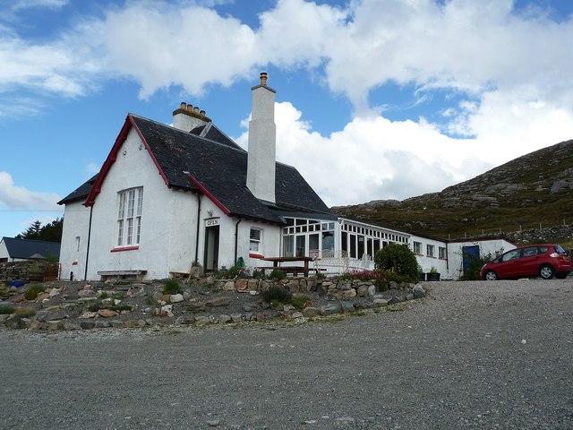
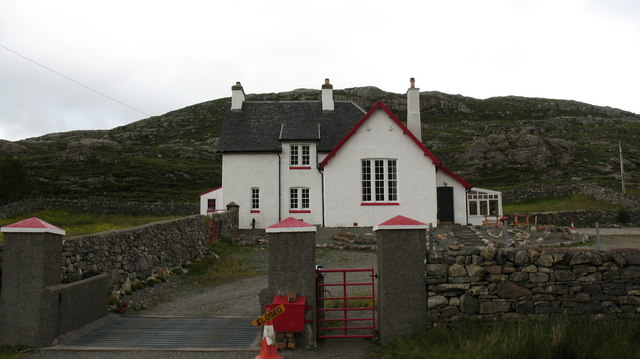
Geisiadar is a close-knit community with a population of approximately 300 residents. The village primarily consists of traditional stone cottages and houses, which reflect the area's rich history and heritage. The village is well-preserved and exudes a sense of tranquility and peace.

The local economy of Geisiadar is mainly driven by agriculture, with farming being the primary occupation of the residents. The fertile lands surrounding the village are suitable for cultivating crops, and sheep farming is also prevalent in the area. The village has a small number of local businesses, including a convenience store and a pub, which serve the needs of the community.

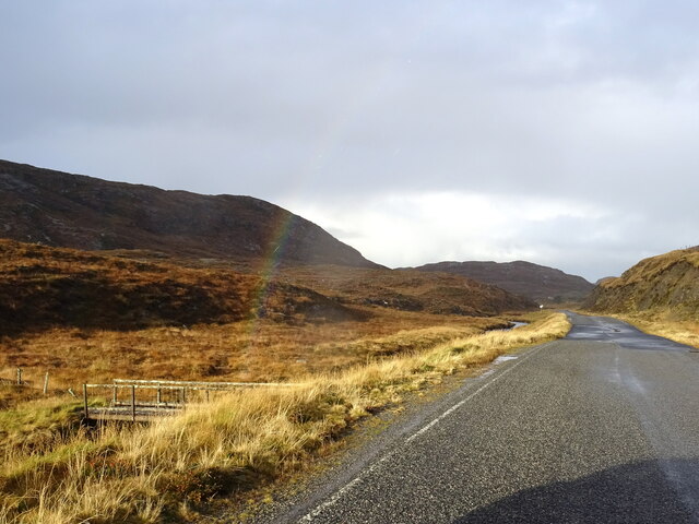
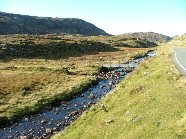
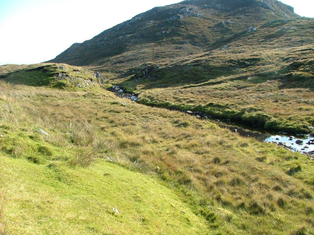
Geisiadar is a haven for nature lovers and outdoor enthusiasts. The surrounding area offers numerous walking and hiking trails, providing stunning views of the Scottish countryside. Nearby attractions include the beautiful Strathconon Glen, which is home to a variety of wildlife and offers opportunities for fishing and birdwatching.

The village also hosts an annual community event, where locals and visitors come together to celebrate the area's heritage through music, dance, and traditional food. Geisiadar truly embodies the charm and tranquility of the Scottish Highlands, making it an ideal destination for those seeking a peaceful retreat amidst nature.

If you have any feedback on the listing, please let us know in the comments section below.

Geisiadar Images

Images are sourced within 2km of 58.183611/-6.9107813 or Grid Reference NB1132. Thanks to Geograph Open Source API. All images are credited.

B8011 at Leathad Mòr
Café in old school An excellently positioned little café in a former school building, provided us with welcome sustenance as we were beginning to wonder where we'd find to get a bite to eat. Once inside, it is obvious that this used to be a school, but I don't know how long ago it ceased to be one.
The hill rising up behind is Seabhal.
Café in old school
An excellently positioned little café in a former school building, provided us with welcome sustenance as we were beginning to wonder where we'd find to get a bite to eat. Once inside, it is obvious that this used to be a school, but I don't know how long ago it ceased to be one. The hill rising up behind is Seabhal.
Derelict house on slope of Beinn a' Ghlinne Ruaidh
Geisiadar On Croft Number 8 - The Crofting Commission are looking to evict the tenant of this croft and destroy the woods.
Geisiadar
On Croft Number 8 - The Crofting Commission are looking to evict the tenant of this croft and destroy the woods.
Cerishader: postbox № HS2 158 A small postbox on the B8011, with its back to Loch Ròg. It is emptied at 9 o'clock each morning, except Sunday.
Cerishader: postbox № HS2 158
A small postbox on the B8011, with its back to Loch Ròg. It is emptied at 9 o'clock each morning, except Sunday.
Carishader postbox The sea inlet is part of Loch Ròg.
Carishader postbox
The sea inlet is part of Loch Ròg.
Old black house walls, Cairisiadar Looking up An Gleann Ruadh.
Old black house walls, Cairisiadar
Looking up An Gleann Ruadh.
Abhainn Mhòr a' Ghlinne Ruaidh
Bridge over the Abhainn Mhor a' Ghlinne Ruaidh
A hint of a rainbow by Abhainn Mhòr a Ghlinne Ruaidh Just cross the footbridge and you are at the end of the rainbow (now where's my shovel!).
A hint of a rainbow by Abhainn Mhòr a Ghlinne Ruaidh
Just cross the footbridge and you are at the end of the rainbow (now where's my shovel!).
Cairisiadar: croft boundaries and common grazings
Approaching Cairisiadar on the B8011
Looking across to Flodaigh Flodaigh is a small island in Loch Rog, separated from mainland Lewis by the narrowest of channels at its southernmost point. There seem to be a number of Flodaigh [Flodday] islands around the west coast of Scotland, so presumably the name has some significance.
Looking across to Flodaigh
Flodaigh is a small island in Loch Rog, separated from mainland Lewis by the narrowest of channels at its southernmost point. There seem to be a number of Flodaigh [Flodday] islands around the west coast of Scotland, so presumably the name has some significance.
Where the burn meets the sea The Abhainn Mhor a Ghlinna Ruaidh is an insignificant little stream with a very long name, that runs northwards to join a corner of Loch Rog near Cairisiadar.
Where the burn meets the sea
The Abhainn Mhor a Ghlinna Ruaidh is an insignificant little stream with a very long name, that runs northwards to join a corner of Loch Rog near Cairisiadar.
The B8011 in West Lewis For much of its length, the B8011 has been rebuilt and regraded, though this section is still single track with passing places.
The B8011 in West Lewis
For much of its length, the B8011 has been rebuilt and regraded, though this section is still single track with passing places.
Former school, West Lewis. Centrally situated between the crofting communities of Cairisaidar, Geisiadar and Einacleite, this building once served as the local school. Teas and refreshments are now served here, but not on Sundays.
Former school, West Lewis.
Centrally situated between the crofting communities of Cairisaidar, Geisiadar and Einacleite, this building once served as the local school. Teas and refreshments are now served here, but not on Sundays.
Bridge on the Abhainn Mhor à  Ghlinne Ruaidh Looking north.
Bridge on the Abhainn Mhor à Ghlinne Ruaidh
Looking north.
Abhainn Mhor à  Ghlinne Ruaidh Looking south.The slopes of Oileasail in the background.
Abhainn Mhor à Ghlinne Ruaidh
Looking south.The slopes of Oileasail in the background.
Show me another place!

Geisiadar is located at Grid Ref: NB1132 (Lat: 58.183611, Lng: -6.9107813)

Unitary Authority: Na h-Eileanan an Iar

Police Authority: Highlands and Islands

Also known as: Geshader

What 3 Words

///beards.ridge.community. Near Carloway, Na h-Eileanan Siar

Related Wikis

Flodaigh, Lewis

Flodaigh is a small island in Loch Roag on the west coast of Lewis in the Outer Hebrides of Scotland. It is about 33 hectares (82 acres) in extent and...

Fuaigh Beag

Fuaigh Beag or Vuia Be(a)g is an island in the Outer Hebrides. It is off the west coast of Lewis near Great Bernera in Loch Roag. Its name means "little...

Loch Ròg

Loch Ròg or Loch Roag is a large sea loch on the west coast of Lewis, Outer Hebrides. It is broadly divided into East Loch Roag and West Loch Roag with...

Fuaigh Mòr

Fuaigh Mòr (sometimes anglicised as Vuia Mor) is an island in the Outer Hebrides of Scotland. It is off the west coast of Lewis near Great Bernera in...

Loch na Berie

Loch Na Berie is a broch in the Outer Hebrides of Scotland, located approximately 400 yards from the shore, and is thought to have been located on an island...

Kneep

Kneep (Scottish Gaelic: Cnìp) is a village on the Isle of Lewis, in the Outer Hebrides, Scotland. Kneep is within the parish of Uig.Various archaeological...

Vacsay

Vacsay (Scottish Gaelic: Bhacsaigh from Old Norse "bakkiey" meaning "peat bank island") is one of the Outer Hebrides. It is off the west coast of Lewis...

Cliff, Lewis

Cliff (Scottish Gaelic: Cliobh) is a small settlement on the Isle of Lewis, in the Outer Hebrides, Scotland. Cliff is within the parish of Uig. The settlement...

Nearby Amenities

Located within 500m of 58.183611,-6.9107813
Bus Stop
Geshader
Naptan AtcoCode: 6010731661
Naptan Bearing: N
Naptan CommonName: Geshader
Naptan Indicator: Geshader
Naptan Landmark: Geshader
Naptan NaptanCode: 94723796
Naptan Street: Geshader
Naptan Verified: no
Source: naptan_import
Lat/Long: 58.1808837/-6.9059543
Passing Place
Lat/Long: 58.1816931/-6.9071857
Grasabhaig
Place: locality
Lat/Long: 58.185929/-6.9135524
Geisiadar
Name En: Geshader
Name Gd: Geisiadar
Place: village
Lat/Long: 58.181678/-6.9074655
Power: pole
Lat/Long: 58.1838538/-6.9117621
Power: pole
Lat/Long: 58.1834061/-6.9114092
Power: pole
Lat/Long: 58.1829361/-6.9110458
Power: pole
Lat/Long: 58.1828111/-6.9098992
Power: pole
Lat/Long: 58.1821872/-6.9096403
Power: pole
Lat/Long: 58.181746/-6.9081316
Power: pole
Lat/Long: 58.1817758/-6.9067167
Power: pole
Lat/Long: 58.1814124/-6.9092783
Power: pole
Lat/Long: 58.1807544/-6.9088904
Power: pole
Lat/Long: 58.1801241/-6.90841
Power: pole
Lat/Long: 58.1794677/-6.9079181
Power: pole
Lat/Long: 58.1820428/-6.9071244
Passing Place
Lat/Long: 58.1806348/-6.9056476
Passing Place
Lat/Long: 58.1800963/-6.9082702
Toma Dubh
Place: locality
Lat/Long: 58.1835351/-6.9087574
Tom Dhomhnuill
Place: locality
Lat/Long: 58.182336/-6.9044444
The data included in this document is from www.openstreetmap.org. The data is made available under ODbL.

Have you been to Geisiadar?

Leave your review of Geisiadar below (or comments, questions and feedback).