Grasabhaig

Coastal Feature, Headland, Point in Ross-shire

Scotland

Grasabhaig

B8011 at Leathad Mòr
B8011 at Leathad Mòr Credit: Sandy Gerrard

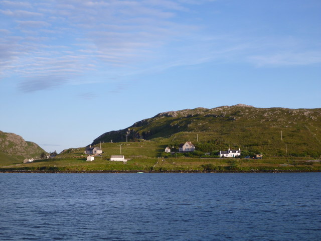
Grasabhaig is a stunning coastal feature located in Ross-shire, a county in the Highlands of Scotland. It is specifically categorized as a headland or point, jutting out into the North Atlantic Ocean. The name "Grasabhaig" originates from Scottish Gaelic, meaning "grassy bay," which aptly describes the picturesque landscape that can be found in this area.

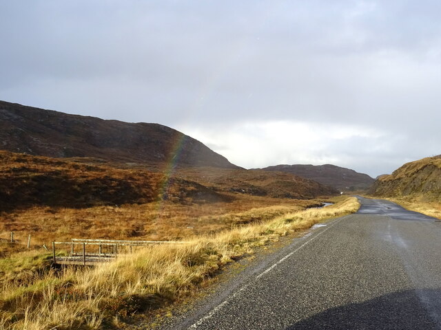
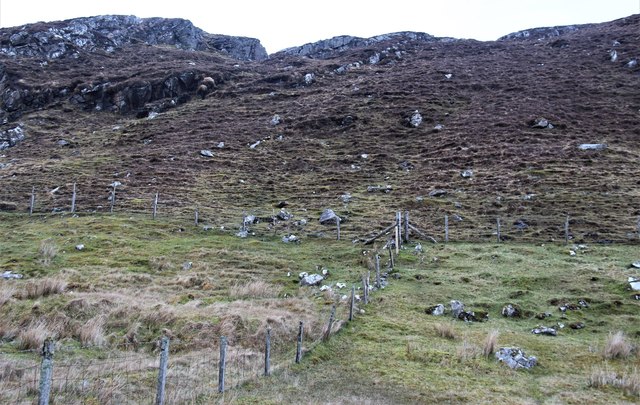
The headland of Grasabhaig is characterized by rugged cliffs, which offer breathtaking views of the surrounding coastal scenery. The cliffs are composed of various types of rock, including sandstone and limestone, exhibiting fascinating geological formations. Many visitors are captivated by the unique rock formations, which have been shaped by centuries of erosion caused by the relentless waves crashing against the shore.

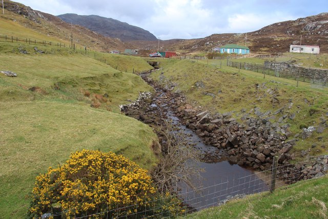
In addition to its geological features, Grasabhaig is also home to a diverse range of flora and fauna. The grassy slopes and cliff edges support a variety of plant life, including wildflowers and mosses, adding vibrant colors to the landscape. Birdwatchers will be delighted by the numerous species of seabirds that inhabit the area, such as puffins, gannets, and guillemots, making it a popular spot for birdwatching enthusiasts.

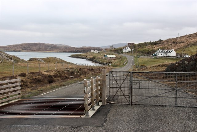
Access to Grasabhaig is relatively easy, with a well-maintained footpath leading to the headland. This allows visitors to enjoy leisurely walks along the cliff tops, taking in the panoramic views of the ocean and surrounding coastline. It is important to note that caution should be exercised near the cliff edges due to their steep drop-offs.

Overall, Grasabhaig in Ross-shire is a remarkable coastal feature, offering visitors a chance to immerse themselves in the raw beauty of the Scottish Highlands. Whether it's the dramatic cliffs, diverse wildlife, or stunning vistas, Grasabhaig is a must-visit destination for nature lovers and those seeking a peaceful retreat by the sea.

If you have any feedback on the listing, please let us know in the comments section below.

Grasabhaig Images

Images are sourced within 2km of 58.187469/-6.9152495 or Grid Reference NB1132. Thanks to Geograph Open Source API. All images are credited.

B8011 at Leathad Mòr
Derelict house on slope of Beinn a' Ghlinne Ruaidh
Geisiadar On Croft Number 8 - The Crofting Commission are looking to evict the tenant of this croft and destroy the woods.
Geisiadar
On Croft Number 8 - The Crofting Commission are looking to evict the tenant of this croft and destroy the woods.
Cerishader: postbox № HS2 158 A small postbox on the B8011, with its back to Loch Ròg. It is emptied at 9 o'clock each morning, except Sunday.
Cerishader: postbox № HS2 158
A small postbox on the B8011, with its back to Loch Ròg. It is emptied at 9 o'clock each morning, except Sunday.
Carishader postbox The sea inlet is part of Loch Ròg.
Carishader postbox
The sea inlet is part of Loch Ròg.
Old black house walls, Cairisiadar Looking up An Gleann Ruadh.
Old black house walls, Cairisiadar
Looking up An Gleann Ruadh.
Abhainn Mhòr a' Ghlinne Ruaidh
Bridge over the Abhainn Mhor a' Ghlinne Ruaidh
A hint of a rainbow by Abhainn Mhòr a Ghlinne Ruaidh Just cross the footbridge and you are at the end of the rainbow (now where's my shovel!).
A hint of a rainbow by Abhainn Mhòr a Ghlinne Ruaidh
Just cross the footbridge and you are at the end of the rainbow (now where's my shovel!).
Cairisiadar from Loch Rog The northwest end of this small community strung out along the B8011 catches the evening light as we return by boat to Miabhaig.
Cairisiadar from Loch Rog
The northwest end of this small community strung out along the B8011 catches the evening light as we return by boat to Miabhaig.
Abhainn Uasaig A short river at Carishader.
Abhainn Uasaig
A short river at Carishader.
Northwest boundary of Cairisiadar
Cairisiadar: croft boundaries and common grazings
Approaching Cairisiadar on the B8011
Crofting in Cairisiadar Uigean across the water, Loch Ròg.
Crofting in Cairisiadar
Uigean across the water, Loch Ròg.
Name That Tune This cheerful accordionist stands just inside a field by the cattle grid on the B8011 north of Cairisiadar. The label at his feet reads 'Name That Tune'.
Name That Tune
This cheerful accordionist stands just inside a field by the cattle grid on the B8011 north of Cairisiadar. The label at his feet reads 'Name That Tune'.
Cairisiadar (Carishader) Though the B8011 has been much improved, there are still some single-track stretches, notably where it crosses narrow bridges which have not been rebuilt, as here at Cairisiadar.
Cairisiadar (Carishader)
Though the B8011 has been much improved, there are still some single-track stretches, notably where it crosses narrow bridges which have not been rebuilt, as here at Cairisiadar.
Sheep Pens at Carishader One of many roadside pens on Lewis where sheep farming is a major agricultural industry.
Sheep Pens at Carishader
One of many roadside pens on Lewis where sheep farming is a major agricultural industry.
Show me another place!

Grasabhaig is located at Grid Ref: NB1132 (Lat: 58.187469, Lng: -6.9152495)

Unitary Authority: Na h-Eileanan an Iar

Police Authority: Highlands and Islands

What 3 Words

///hike.automatic.wager. Near Carloway, Na h-Eileanan Siar

Related Wikis

Flodaigh, Lewis

Flodaigh is a small island in Loch Roag on the west coast of Lewis in the Outer Hebrides of Scotland. It is about 33 hectares (82 acres) in extent and...

Fuaigh Beag

Fuaigh Beag or Vuia Be(a)g is an island in the Outer Hebrides. It is off the west coast of Lewis near Great Bernera in Loch Roag. Its name means "little...

Loch Ròg

Loch Ròg or Loch Roag is a large sea loch on the west coast of Lewis, Outer Hebrides. It is broadly divided into East Loch Roag and West Loch Roag with...

Loch na Berie

Loch Na Berie is a broch in the Outer Hebrides of Scotland, located approximately 400 yards from the shore, and is thought to have been located on an island...

Nearby Amenities

Located within 500m of 58.187469,-6.9152495
Grasabhaig
Place: locality
Lat/Long: 58.185929/-6.9135524
Power: pole
Lat/Long: 58.1838538/-6.9117621
The data included in this document is from www.openstreetmap.org. The data is made available under ODbL.

Have you been to Grasabhaig?

Leave your review of Grasabhaig below (or comments, questions and feedback).