Gedney

Settlement in Lincolnshire South Holland

England

Gedney

Gedney railway station (site), Lincolnshire Opened in 1862 by the Norwich & Spalding Railway on what became part of the Midland & Great Northern Joint Railway line from Leicester to Yarmouth, this station closed to passengers in 1959 and completely in 1965.
View east across the former level crossing towards Long Sutton and ultimately Yarmouth. There used to be two parallel platforms here. For many years, the station was derelict (for example, see <a href="https://www.geograph.org.uk/photo/28557">TF4123 : Gedney Station</a>) but was undergoing renovation when this image was taken.
Gedney railway station (site), Lincolnshire Credit: Nigel Thompson

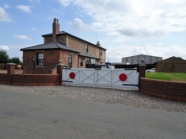
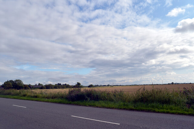
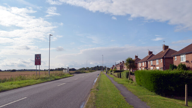
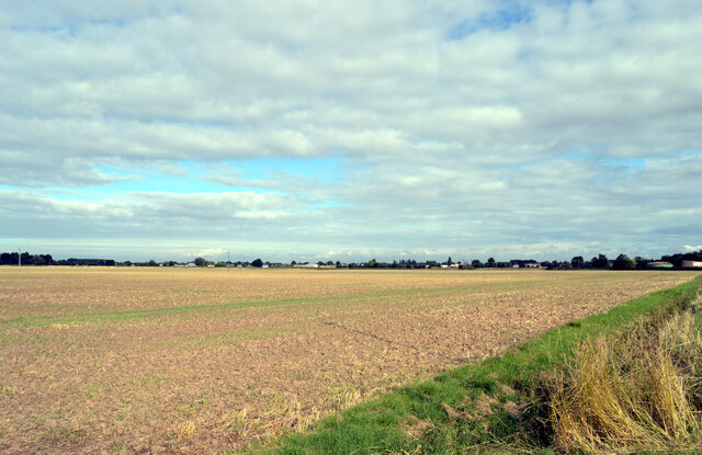
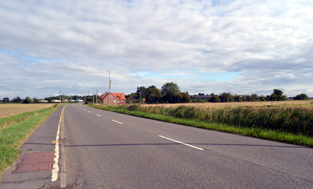
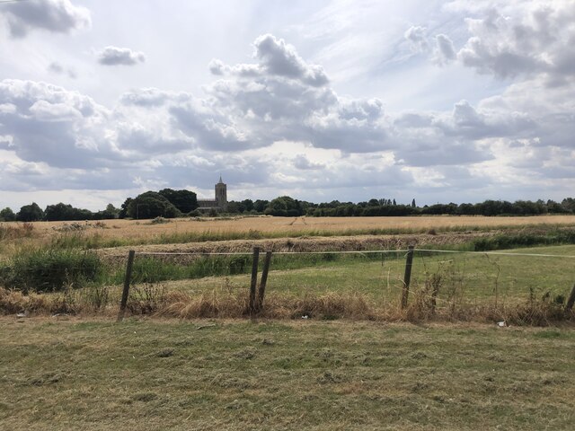
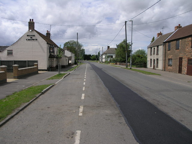
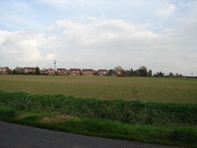
Gedney is a small village located in the South Holland district of Lincolnshire, England. Situated approximately 10 miles east of Spalding, it is a rural community with a population of around 1,200 residents. The village is nestled in the heart of the Lincolnshire Fens, surrounded by beautiful flat landscapes and farmland.

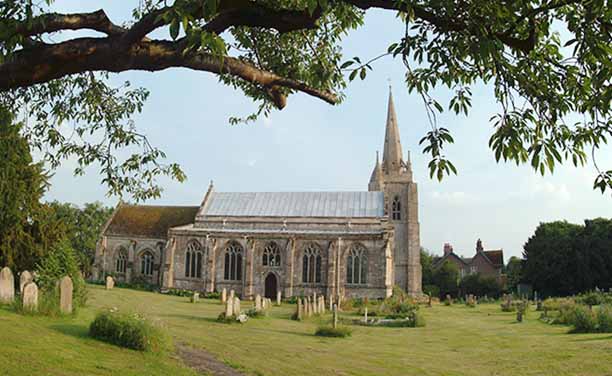
Gedney has a rich history dating back centuries, with evidence of settlement in the area since Roman times. The village is known for its charming historic buildings, including St. Mary Magdalene Church which dates back to the 13th century. The church features an impressive tower and holds regular services for the local community.

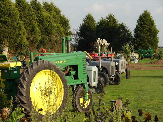
Agriculture plays a significant role in Gedney's economy, with many residents involved in farming and related industries. The fertile soil in the area allows for the cultivation of various crops, including vegetables, cereals, and flowers. This agricultural heritage is celebrated annually with the Gedney Hill and District Agricultural Show, which showcases local produce, animal displays, and traditional crafts.

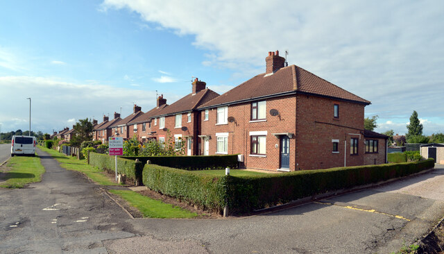
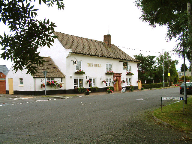
The village also boasts a primary school, providing education for children within the local area. Additionally, there are several community facilities, including a village hall, a post office, and a local pub, which serves as a social hub for residents.

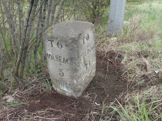
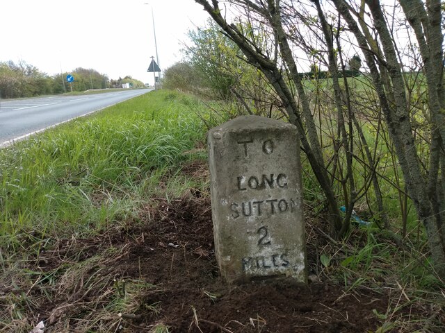
Gedney's location offers easy access to nearby towns and cities, with good transport links to Spalding, Peterborough, and Kings Lynn. The village provides a peaceful and picturesque setting, making it a desirable place to live for those seeking a rural lifestyle in Lincolnshire.

If you have any feedback on the listing, please let us know in the comments section below.

Gedney Images

Images are sourced within 2km of 52.798025/0.075848 or Grid Reference TF4024. Thanks to Geograph Open Source API. All images are credited.

Gedney railway station (site), Lincolnshire Opened in 1862 by the Norwich & Spalding Railway on what became part of the Midland & Great Northern Joint Railway line from Leicester to Yarmouth, this station closed to passengers in 1959 and completely in 1965.
View east across the former level crossing towards Long Sutton and ultimately Yarmouth. There used to be two parallel platforms here. For many years, the station was derelict (for example, see <a href="https://www.geograph.org.uk/photo/28557">TF4123 : Gedney Station</a>) but was undergoing renovation when this image was taken.
Gedney railway station (site), Lincolnshire
Opened in 1862 by the Norwich & Spalding Railway on what became part of the Midland & Great Northern Joint Railway line from Leicester to Yarmouth, this station closed to passengers in 1959 and completely in 1965. View east across the former level crossing towards Long Sutton and ultimately Yarmouth. There used to be two parallel platforms here. For many years, the station was derelict (for example, see TF4123 : Gedney Station) but was undergoing renovation when this image was taken.
View from Main Road, Gedney
Main Road (B1359), Gedney
View from Main Road, Gedney
Main Road (B1359), Gedney
Gedney Station in 1998 View from Station Road of the east bound platform station buildings
Gedney Station in 1998
View from Station Road of the east bound platform station buildings
Gedney Station in 1998 The west bound railway platform & sign from Station Road
Gedney Station in 1998
The west bound railway platform & sign from Station Road
View over the fields to Gedney St Mary Magdalene Church on the horizon
View over the fields to Gedney
St Mary Magdalene Church on the horizon
Old Milestone by A17, Long Sutton Road, beyond end of dual carriageway The Milestone is located on the verge on the South of the road.  Parish of Gedney (South Holland District). Carved stone post, erected by the Holbeach turnpike trust in the 19th Century. An earlier photograph can be found here: <a title="https://www.geograph.org.uk/photo/2730276" href="https://www.geograph.org.uk/photo/2730276">Link</a> 

Inscription reads:-  
TO / SPALDING / 11 / : : TO / HOLBEACH / 3  : : TO / LONG / SUTTON / 2 / MILES 

Grade II listed. List Entry Number: 1064581 <span class="nowrap"><a title="https://historicengland.org.uk/listing/the-list/list-entry/1064581" rel="nofollow ugc noopener" href="https://historicengland.org.uk/listing/the-list/list-entry/1064581">Link</a><img style="margin-left:2px;" alt="External link" title="External link - shift click to open in new window" src="https://s1.geograph.org.uk/img/external.png" width="10" height="10"/></span> 

Milestone Society National ID: LI_HBSU03
Old Milestone by A17, Long Sutton Road, beyond end of dual carriageway
The Milestone is located on the verge on the South of the road.  Parish of Gedney (South Holland District). Carved stone post, erected by the Holbeach turnpike trust in the 19th Century. An earlier photograph can be found here: Link  Inscription reads:- TO / SPALDING / 11 / : : TO / HOLBEACH / 3 : : TO / LONG / SUTTON / 2 / MILES Grade II listed. List Entry Number: 1064581 LinkExternal link Milestone Society National ID: LI_HBSU03
The Bull at Fleet Hargate The village of Fleet Hargate formerly Fleet Harbourgate a small port
The Bull at Fleet Hargate
The village of Fleet Hargate formerly Fleet Harbourgate a small port
Fleet parish church The steeple is detached from the body of the church, a feature of several other churches in the area.
Fleet parish church
The steeple is detached from the body of the church, a feature of several other churches in the area.
Two Pubs The Bull and The Rose and Crown cluster together on the main street through Fleet Hargate.  The road repair doesn't quite match colour.
Two Pubs
The Bull and The Rose and Crown cluster together on the main street through Fleet Hargate. The road repair doesn't quite match colour.
Windbreaks and Potatoes The black windbreaks are clearly in place to protect the greenhouses next to them.  The field in the foreground was growing potatoes.
Windbreaks and Potatoes
The black windbreaks are clearly in place to protect the greenhouses next to them. The field in the foreground was growing potatoes.
Field and Cafe The cafe is beyond the busy A17.  The field is protected by this unusual one bar gate.
Field and Cafe
The cafe is beyond the busy A17. The field is protected by this unusual one bar gate.
Haven Close from Hockle's Gate
Tractor Garden A collection of tractors old and new adorn the garden of this roadside house.
Tractor Garden
A collection of tractors old and new adorn the garden of this roadside house.
Show me another place!

Gedney is located at Grid Ref: TF4024 (Lat: 52.798025, Lng: 0.075848)

Division: Parts of Holland

Administrative County: Lincolnshire

District: South Holland

Police Authority: Lincolnshire

What 3 Words

///clues.billiard.nurture. Near Fleet, Lincolnshire

Nearby Locations

Gedney

Related Wikis

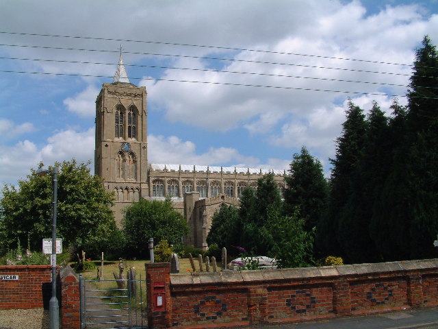
St Mary Magdalene Church, Gedney

St Mary Magdalene Church is an Anglican parish church of medieval origin in Gedney, Lincolnshire. Renowned for its large size in the surrounding low-lying...

Gedney, Lincolnshire

Gedney is a village, civil parish and electoral ward in the South Holland district of Lincolnshire, England. It is just to the south of the A17 Boston...

Fleet Hargate

Fleet Hargate is a village in the South Holland district of Lincolnshire, England. It is situated 2 miles (3.2 km) east from Holbeach, and just south from...

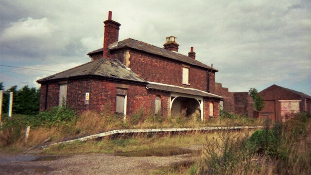
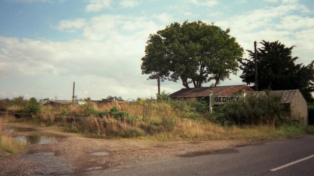
Fleet railway station (Lincolnshire)

Fleet railway station was a station in Fleet, Lincolnshire. It opened in 1862 and closed to passengers in 1959, with the goods yard closing on 3 February...

Nearby Amenities

Located within 500m of 52.798025,0.075848
Gedney
Is In: Lincolnshire, England, UK
Is In County: Lincolnshire
Is In District: South Holland
Place: village
Lat/Long: 52.7980271/0.081399
Bus Stop
St Mary Magdalene Church, opp
Bus: yes
Naptan AtcoCode: 270000009617
Naptan Bearing: W
Naptan CommonName: St Mary Magdalene Church
Naptan Indicator: opp
Naptan Landmark: St Mary Magdalene Church
Naptan NaptanCode: linjdmag
Naptan Street: Church End
Naptan Verified: no
Public Transport: platform
Source: naptan_import
Lat/Long: 52.7978493/0.0788234
Bus Stop
Topsgate House, adj
Bus: yes
Naptan AtcoCode: 270002701072
Naptan Bearing: N
Naptan CommonName: Topsgate House
Naptan Indicator: adj
Naptan Landmark: Topsgate House
Naptan Street: Topsgate
Naptan Verified: no
Public Transport: platform
Source: naptan_import
Lat/Long: 52.7994043/0.0754964
Bus Stop
Topsgate House, opp
Bus: yes
Naptan AtcoCode: 270002701073
Naptan Bearing: S
Naptan CommonName: Topsgate House
Naptan Indicator: opp
Naptan Landmark: Topsgate House
Naptan Street: Topsgate
Naptan Verified: no
Public Transport: platform
Source: naptan_import
Lat/Long: 52.7994823/0.0756633
Bus Stop
St Mary Magdalene Church, adj
Bus: yes
Naptan AtcoCode: 2700LGC00446
Naptan Bearing: E
Naptan CommonName: St Mary Magdalene Church
Naptan Indicator: adj
Naptan Landmark: St Mary Magdalene Church
Naptan NaptanCode: linadpta
Naptan Street: Church End
Naptan Verified: no
Public Transport: platform
Source: naptan_import
Lat/Long: 52.7979084/0.079282
Courtyard Farm
Place: farm
Source: Bing
Lat/Long: 52.7970125/0.0771397
Rectory Farm
Place: farm
Source: Bing
Lat/Long: 52.7964869/0.0791576
Turning Loop
Lat/Long: 52.7970444/0.0789573
The Chestnuts
Addr City: Spalding
Addr Country: GB
Addr Postcode: PE12 0BS
Addr Street: Topsgate
Addr Suburb: Fleet Hargate
Shop: garden_centre
Lat/Long: 52.8023885/0.0760782
Generator Method: photovoltaic
Generator Output Electricity: yes
Generator Source: solar
Generator Type: solar_photovoltaic_panel
Location: roof
Power: generator
Lat/Long: 52.7974898/0.0749539
Generator Method: photovoltaic
Generator Output Electricity: yes
Generator Source: solar
Generator Type: solar_photovoltaic_panel
Location: roof
Power: generator
Lat/Long: 52.7977282/0.0757612
Generator Method: photovoltaic
Generator Output Electricity: yes
Generator Source: solar
Generator Type: solar_photovoltaic_panel
Location: roof
Power: generator
Lat/Long: 52.7975336/0.0795217
Generator Method: photovoltaic
Generator Output Electricity: yes
Generator Source: solar
Generator Type: solar_photovoltaic_panel
Location: roof
Power: generator
Lat/Long: 52.7967908/0.0800581
Generator Method: photovoltaic
Generator Output Electricity: yes
Generator Source: solar
Generator Type: solar_photovoltaic_panel
Location: roof
Power: generator
Lat/Long: 52.7967827/0.0801708
Generator Method: photovoltaic
Generator Output Electricity: yes
Generator Source: solar
Generator Type: solar_photovoltaic_panel
Location: roof
Power: generator
Lat/Long: 52.7972709/0.0813483
Generator Method: photovoltaic
Generator Output Electricity: yes
Generator Source: solar
Generator Type: solar_photovoltaic_panel
Location: roof
Power: generator
Lat/Long: 52.797253/0.0815602
Generator Method: photovoltaic
Generator Output Electricity: yes
Generator Source: solar
Generator Type: solar_photovoltaic_panel
Location: roof
Power: generator
Lat/Long: 52.7978888/0.0814609
Generator Method: photovoltaic
Generator Output Electricity: yes
Generator Source: solar
Generator Type: solar_photovoltaic_panel
Location: roof
Power: generator
Lat/Long: 52.7977736/0.0816943
Direction: SSW
Generator Method: photovoltaic
Generator Output Electricity: yes
Generator Source: solar
Generator Type: solar_photovoltaic_panel
Location: roof
Power: generator
Lat/Long: 52.7981061/0.0830139
Direction: SSW
Generator Method: photovoltaic
Generator Output Electricity: yes
Generator Source: solar
Generator Type: solar_photovoltaic_panel
Location: roof
Power: generator
Lat/Long: 52.7980866/0.0831105
Direction: SSW
Generator Method: photovoltaic
Generator Output Electricity: yes
Generator Source: solar
Generator Type: solar_photovoltaic_panel
Location: roof
Power: generator
Lat/Long: 52.7984369/0.0831936
Power: pole
Lat/Long: 52.7937738/0.0754023
Power: pole
Lat/Long: 52.7940917/0.0734603
Power: pole
Lat/Long: 52.7943577/0.0718617
Note: End of Public Highway
Lat/Long: 52.7942831/0.0751072
Give Way
Direction: forward
Lat/Long: 52.7980303/0.0757469
Note: End of Public Highway
Lat/Long: 52.797311/0.0782588
Post Box
Collection Times: Mo-Fr 09:00; Sa 07:00
Location: In right gatepost of the footpath.
Just E of the little car park reserved for church staff.
10m W of main entrance to church of Saint Mary Magdalene./Church End
Post Box Type: wall
Ref: PE12 40
Royal Cypher: EIIR
Lat/Long: 52.7979227/0.0788055
The data included in this document is from www.openstreetmap.org. The data is made available under ODbL.

Have you been to Gedney?

Leave your review of Gedney below (or comments, questions and feedback).