Gedling

Settlement in Nottinghamshire Gedling

England

Gedling

Path in Gedling Country Park The park is on the grounds of the former Gedling Colliery, which closed in 1991.  The site was converted into the present country park in 2015.
Path in Gedling Country Park Credit: Graham Hogg

Gedling is a small suburban district located in Nottinghamshire, England. It is situated approximately 4 miles northeast of the city center of Nottingham. The district covers an area of about 4 square miles and has a population of around 120,000 people.

Gedling is predominantly a residential area, offering a mix of housing options including detached houses, semi-detached houses, and flats. The district is known for its quiet and family-friendly atmosphere, making it an attractive place for young professionals and families to settle.

The area is well-served by public transportation, with several bus routes connecting Gedling to Nottingham and other nearby towns. Gedling also benefits from good road links, making it easily accessible to commuters.

In terms of amenities, Gedling boasts a range of local shops, supermarkets, and services, providing residents with convenient access to everyday essentials. The district is also home to several schools, both primary and secondary, ensuring that families have educational options for their children.

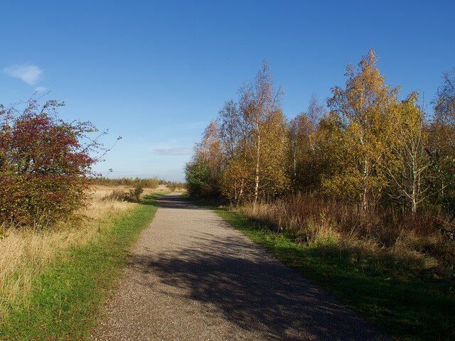
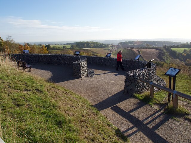
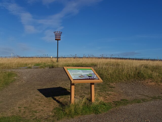
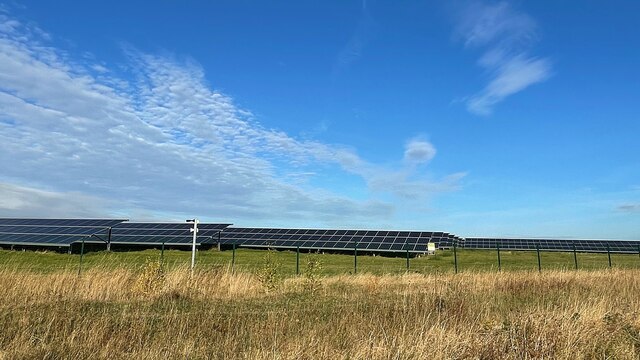
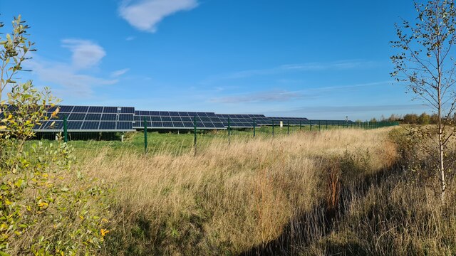
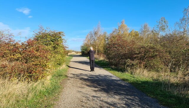
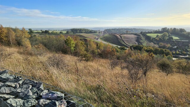
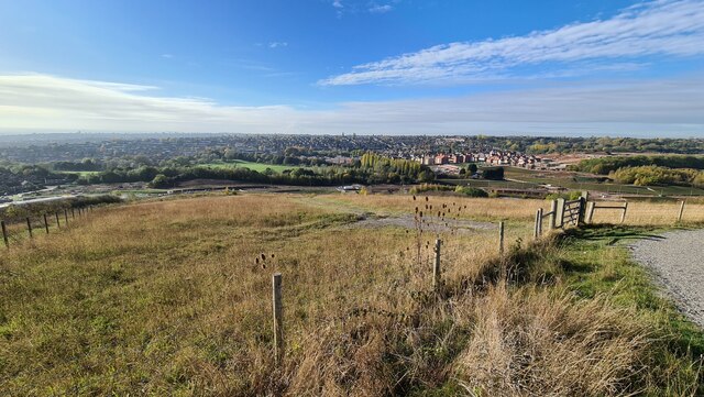
For recreational activities, Gedling offers several green spaces and parks, such as Gedling Country Park and the nearby Colwick Park, which provide opportunities for leisurely walks, picnics, and outdoor sports. Additionally, the district is located close to the picturesque countryside of Nottinghamshire, providing residents with easy access to rural landscapes and nature trails.

Overall, Gedling offers a peaceful and well-connected living environment, combining the convenience of urban amenities with the tranquility of suburban living.

If you have any feedback on the listing, please let us know in the comments section below.
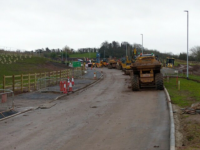
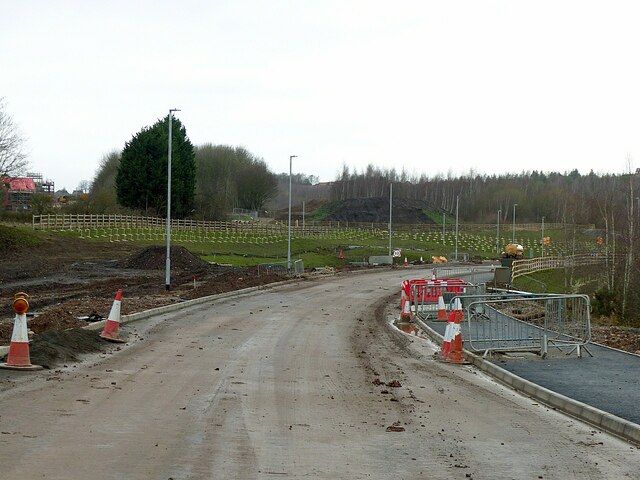
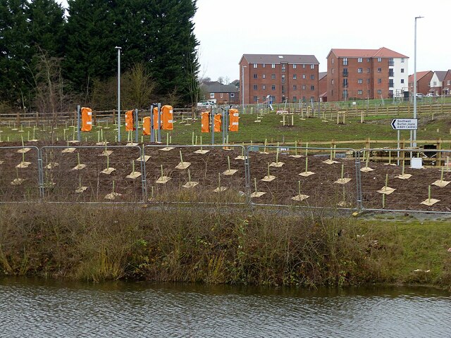
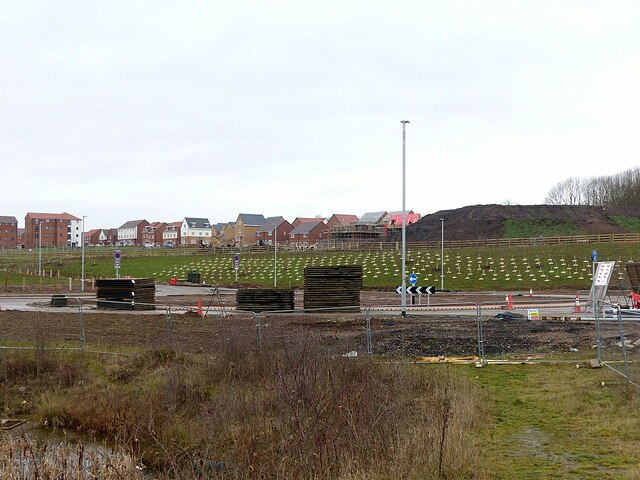
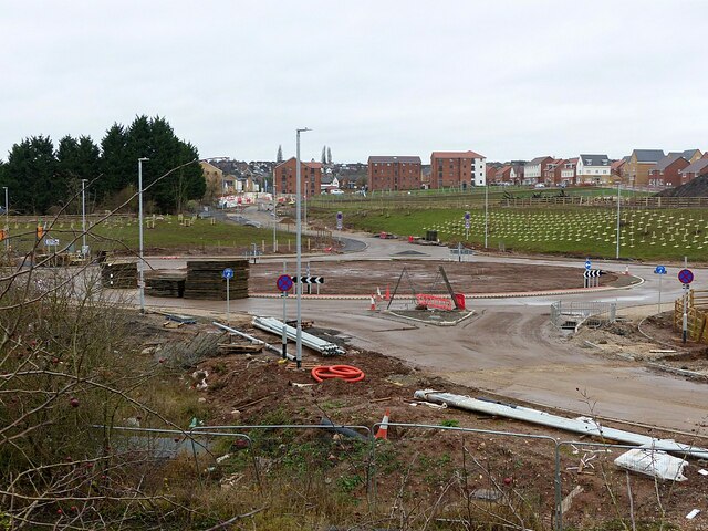
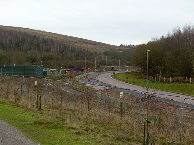
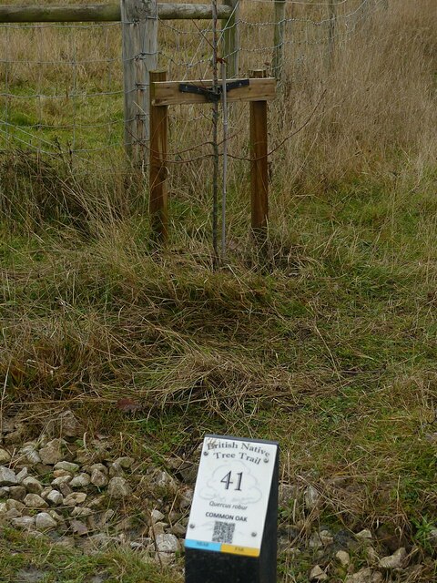
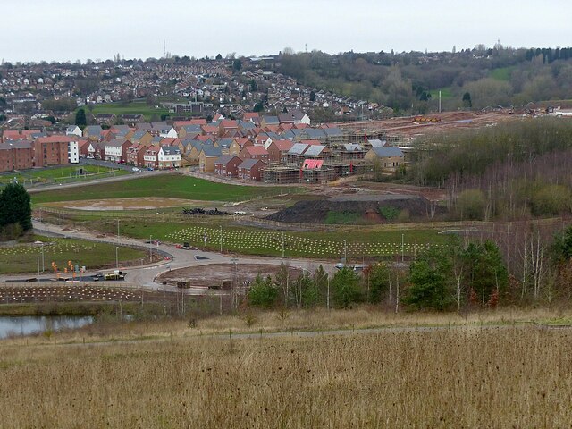
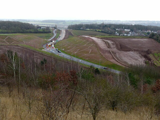
Gedling Images

Images are sourced within 2km of 52.973573/-1.0804 or Grid Reference SK6142. Thanks to Geograph Open Source API. All images are credited.

Path in Gedling Country Park The park is on the grounds of the former Gedling Colliery, which closed in 1991.  The site was converted into the present country park in 2015.
Path in Gedling Country Park
The park is on the grounds of the former Gedling Colliery, which closed in 1991. The site was converted into the present country park in 2015.
The South Viewing Platform in Gedling Country Park Providing extensive views to the south and west over Nottingham and the Trent Valley.
The South Viewing Platform in Gedling Country Park
Providing extensive views to the south and west over Nottingham and the Trent Valley.
Exposition Board in Gedling Country Park Giving details of the solar power installation and the extraction of methane gas from the abandioned mine workings.
Exposition Board in Gedling Country Park
Giving details of the solar power installation and the extraction of methane gas from the abandioned mine workings.
From coal power to solar power This solar farm in Gedling Country Park on the site of  the former Gedling Colliery is capable of generating 5.7 MW, enough to power 1,700 homes.
From coal power to solar power
This solar farm in Gedling Country Park on the site of the former Gedling Colliery is capable of generating 5.7 MW, enough to power 1,700 homes.
Solar Farm in Gedling Country Park Site of old coal workings and now providing clean energy
Solar Farm in Gedling Country Park
Site of old coal workings and now providing clean energy
Path through Gedling Country Park
Gedling Access Road construction
Gedling Access Road and new housing
Christmas Day holiday No work taking place on the Gedling Access Road.
Christmas Day holiday
No work taking place on the Gedling Access Road.
Gedling Access Road construction – 251221 – 1 Moving towards completion, with opening due in the New Year.
Gedling Access Road construction – 251221 – 1
Moving towards completion, with opening due in the New Year.
Gedling Access Road construction – 251221 – 2 Direction signs and traffic lights in place and newly planted trees, adjacent to the Waldrom Road roundabout.
Gedling Access Road construction – 251221 – 2
Direction signs and traffic lights in place and newly planted trees, adjacent to the Waldrom Road roundabout.
Gedling Access Road construction – 251221 – 3 The roundabout at Chase Farm (Waldrom Road) is complete. In the background the development of housing continues.
Gedling Access Road construction – 251221 – 3
The roundabout at Chase Farm (Waldrom Road) is complete. In the background the development of housing continues.
Gedling Access Road construction – 251221 – 4 The roundabout at Waldrom Road looking towards the Chase Farm development. The road in the foreground will give access to a small business/industrial development on the site of the former Gedling Colliery.
Gedling Access Road construction – 251221 – 4
The roundabout at Waldrom Road looking towards the Chase Farm development. The road in the foreground will give access to a small business/industrial development on the site of the former Gedling Colliery.
Gedling Country Park at Christmas 2021 – 1 Gorse can be relied on to provide some colour even at this time of year.
Gedling Country Park at Christmas 2021 – 1
Gorse can be relied on to provide some colour even at this time of year.
Gedling Access Road construction – 251221 – 6 The northern section of the road past Gedling Country Park nearing completion, looking south.
Gedling Access Road construction – 251221 – 6
The northern section of the road past Gedling Country Park nearing completion, looking south.
Gedling Country Park at Christmas 2021 – 5 No.41 on the Native Tree Trail. The trail features specimens of native British Trees along two circuits – 'Near' and 'Far' – the names related to early coal seams in the area. There are 50 different species, 25 of them duplicated along the divergent sections of the two circuits. This is on both circuits.
Gedling Country Park at Christmas 2021 – 5
No.41 on the Native Tree Trail. The trail features specimens of native British Trees along two circuits – 'Near' and 'Far' – the names related to early coal seams in the area. There are 50 different species, 25 of them duplicated along the divergent sections of the two circuits. This is on both circuits.
Gedling Country Park at Christmas 2021 – 6 View towards the Chase Farm housing development with the roundabout at the connection to the Gedling Access Road.
Gedling Country Park at Christmas 2021 – 6
View towards the Chase Farm housing development with the roundabout at the connection to the Gedling Access Road.
Gedling Access Road construction – 251221 – 7 The section between the two links with Lambley Lane is now open to traffic. The road at various stages of construction from the same viewpoint can be seen here <a title="https://www.geograph.org.uk/search.php?i=149328936&page=1&displayclass=slide" href="https://www.geograph.org.uk/search.php?i=149328936&page=1&displayclass=slide">Link</a>
Gedling Access Road construction – 251221 – 7
The section between the two links with Lambley Lane is now open to traffic. The road at various stages of construction from the same viewpoint can be seen here Link
Show me another place!

Gedling is located at Grid Ref: SK6142 (Lat: 52.973573, Lng: -1.0804)

Administrative County: Nottinghamshire

District: Gedling

Police Authority: Nottinghamshire

What 3 Words

///mint.patio.judge. Near Burton Joyce, Nottinghamshire

Nearby Locations

Gedling

Related Wikis

Gedling

Gedling is a village and former civil parish which gives its name to the larger Borough of Gedling in Nottinghamshire, England. It lies 4 miles (6.4 km...

Borough of Gedling

Gedling is a local government district with borough status in Nottinghamshire, England. The council is based in Arnold. The borough also includes Carlton...

Gedling and Carlton railway station

Gedling and Carlton railway station was a former railway station built to serve the villages of Gedling and Carlton in Nottinghamshire. == History... ==

Mary Hardstaff Homes

The Mary Hardstaff Homes, are 10 almshouses on Arnold Lane in Gedling, Nottingham. These were built as Almshouses in 1936 for the widows and orphans of...

Nearby Amenities

Located within 500m of 52.973573,-1.0804
Traffic Signals
Lat/Long: 52.9720533/-1.0816949
Mini Roundabout
Lat/Long: 52.9758685/-1.0793324
Gedling
Old Name: Ghellinge
Old Name1: Gedlinga
Old Name2: Geddlinges
Old Name3: Getling
Place: suburb
Source Location: See https://www.openstreetmap.org/user/alexkemp/diary/41050
Wikidata: Q15221505
Wikipedia: en:Gedling
Lat/Long: 52.9779836/-1.0789314
Turning Circle
Lat/Long: 52.9715103/-1.0840164
Turning Circle
Lat/Long: 52.9738199/-1.0830788
Bus Stop
Ramsdale Road
Bench: no
Bin: no
Bus: yes
Lit: yes
Local Ref: GE0191
Naptan AtcoCode: 3300GE0191
Naptan Bearing: NW
Naptan CommonName: Ramsdale Road
Naptan Crossing: Ramsdale Road
Naptan Indicator: adj
Naptan Landmark: Westdale Tavern
Naptan NaptanCode: ntsawtad
Naptan Notes: (This stop renumbered from 3300GE15)
Naptan PlusbusZoneRef: NTNG
Naptan Street: Westdale Lane East
Naptan Verified: yes
Public Transport: platform
Shelter: no
Source: naptan_import
Tactile Paving: no
Lat/Long: 52.973908/-1.0878245
Bus Stop
Redland Grove
Bus: yes
Local Ref: GE0204
Naptan AtcoCode: 3300GE0204
Naptan Bearing: N
Naptan CommonName: Redland Grove
Naptan Crossing: Redland Grove
Naptan Indicator: adj
Naptan NaptanCode: ntsatmpd
Naptan Notes: (This stop renumbered from 3300GE12)
Naptan PlusbusZoneRef: NTNG
Naptan Street: Gedling Road
Naptan Verified: yes
Public Transport: platform
Shelter: no
Source: naptan_import;survey
Lat/Long: 52.9693056/-1.0820351
Bus Stop
Westdale Lane East
Bus: yes
Local Ref: GE0205
Naptan AtcoCode: 3300GE0205
Naptan Bearing: NE
Naptan CommonName: Westdale Lane East
Naptan Crossing: Westdale Lane East
Naptan Indicator: adj
Naptan NaptanCode: ntsatmpg
Naptan Notes: (This stop renumbered from 3300GE13)
Naptan PlusbusZoneRef: NTNG
Naptan Street: Gedling Road
Naptan Verified: yes
Public Transport: platform
Shelter: yes
Source: naptan_import
Lat/Long: 52.9715799/-1.0820167
Post Box
Collection Times: Mo-Fr 16:30; Sa 10:00
Image: https://www.mapillary.com/map/im/viuHvhwrfqWiBZrMXb11cQ
Phone: +44 345 774 0740
Post Box Type: lamp
Ref: NG4 437
Royal Cypher: EIIR
Royal Cypher Wikidata: Q33102113
Source: survey
Website: https://www.royalmail.com/
Lat/Long: 52.9776365/-1.0817226
Entrance: main
Lat/Long: 52.9747986/-1.0807318
Post Box
Collection Times: Mo-Fr 16:00; Sa 11:00
Phone: +44 345 774 0740
Post Box Type: pillar
Ref: NG4 435
Royal Cypher: GR
Royal Cypher Wikidata: Q33102273
Source: survey
Website: https://www.royalmail.com/
Lat/Long: 52.9723637/-1.081643
Bus Stop
Westdale Lane East
Bus: yes
Ele: 34.733154
Local Ref: GE0206
Naptan AtcoCode: 3300GE0206
Naptan Bearing: SW
Naptan CommonName: Westdale Lane East
Naptan Crossing: Westdale Lane East
Naptan Indicator: opp
Naptan NaptanCode: ntsatmpj
Naptan Notes: (This stop renumbered from 3300GE43)
Naptan PlusbusZoneRef: NTNG
Naptan Street: Gedling Road
Naptan Verified: yes
Old Ref: GE43
Public Transport: platform
Shelter: yes
Source: naptan_import;GPS
Lat/Long: 52.9725732/-1.081354
Bus Stop
Ramsdale Road
Bench: yes
Bin: yes
Bus: yes
Lit: yes
Naptan AtcoCode: 3300GE0192
Naptan Bearing: SE
Naptan CommonName: Ramsdale Road
Naptan Crossing: Ramsdale Road
Naptan Indicator: opp
Naptan Landmark: Westdale Tavern
Naptan NaptanCode: ntsawtag
Naptan Notes: (This stop renumbered from 3300GE09)
Naptan PlusbusZoneRef: NTNG
Naptan Street: Westdale Lane East
Naptan Verified: yes
Public Transport: platform
Shelter: yes
Source: naptan_import
Tactile Paving: no
Lat/Long: 52.9737954/-1.0872119
Entrance: main
Lat/Long: 52.9717427/-1.0820866
Entrance: main
Lat/Long: 52.972398/-1.0825861
Entrance: main
Lat/Long: 52.9721725/-1.0826866
Entrance: main
Lat/Long: 52.9729293/-1.0852654
Bus Stop
Ousebridge Drive
Bus: yes
Local Ref: GE0057
Naptan AtcoCode: 3300GE0057
Naptan Bearing: NE
Naptan CommonName: Ouse Bridge Drive
Naptan Crossing: Ouse Bridge Drive
Naptan Indicator: opp
Naptan NaptanCode: ntsawdad
Naptan Notes: (This stop renumbered from 3300GE72)
Naptan PlusbusZoneRef: NTNG
Naptan Street: Burton Road
Naptan Verified: yes
Public Transport: platform
Shelter: no
Source: naptan_import
Lat/Long: 52.9701305/-1.0778465
Bus Stop
Ousebridge Drive
Bus: yes
Local Ref: GE0058
Naptan AtcoCode: 3300GE0058
Naptan Bearing: SW
Naptan CommonName: Ouse Bridge Drive
Naptan Crossing: Ouse Bridge Drive
Naptan Indicator: adj
Naptan NaptanCode: ntsawdag
Naptan Notes: (This stop renumbered from 3300GE75)
Naptan PlusbusZoneRef: NTNG
Naptan Street: Burton Road
Naptan Verified: yes
Public Transport: platform
Shelter: yes
Source: naptan_import
Lat/Long: 52.9701695/-1.0775048
Bus Stop
Burton Close
Bus: yes
Naptan AtcoCode: 3300GE0059
Naptan Bearing: NE
Naptan CommonName: Burton Close
Naptan Crossing: Burton Close
Naptan Indicator: adj
Naptan Landmark: Inn for a Penny
Naptan NaptanCode: ntsawdaj
Naptan Notes: (This stop renumbered from 3300GE73)
Naptan PlusbusZoneRef: NTNG
Naptan Street: Burton Road
Naptan Verified: no
Public Transport: platform
Source: naptan_import
Lat/Long: 52.9710291/-1.0759081
Bus Stop
Burton Close
Bench: no
Bus: yes
Local Ref: GE0079
Naptan AtcoCode: 3300GE0079
Naptan Bearing: SW
Naptan CommonName: Burton Close
Naptan Crossing: Burton Close
Naptan Indicator: opp
Naptan Landmark: Inn for a Penny
Naptan NaptanCode: ntsatgdm
Naptan Notes: (This stop renumbered from 3300GE74)
Naptan PlusbusZoneRef: NTNG
Naptan Street: Burton Road
Naptan Verified: yes
Public Transport: platform
Shelter: no
Source: naptan_import
Lat/Long: 52.9709646/-1.075701
Bus Stop
Wykes Avenue
Bus: yes
Local Ref: GE0135
Naptan AtcoCode: 3300GE0135
Naptan Bearing: SE
Naptan CommonName: Wykes Avenue
Naptan Crossing: Wykes Avenue
Naptan Indicator: adj
Naptan NaptanCode: ntsawpgt
Naptan Notes: (This stop renumbered from 3300GE40)
Naptan PlusbusZoneRef: NTNG
Naptan Street: Arnold Lane
Naptan Verified: yes
Public Transport: platform
Shelter: yes
Source: naptan_import
Lat/Long: 52.9778194/-1.082093
Bus Stop
Station Avenue
Bus: yes
Naptan AtcoCode: 3300GE0172
Naptan Bearing: S
Naptan CommonName: Station Avenue
Naptan Crossing: Station Avenue
Naptan Indicator: opp
Naptan NaptanCode: ntsawpda
Naptan Notes: (This stop renumbered from 3300GE66)
Naptan PlusbusZoneRef: NTNG
Naptan Street: Shearing Hill
Naptan Verified: no
Public Transport: platform
Source: naptan_import
Lat/Long: 52.9745165/-1.074672
Bus Stop
Station Avenue
Bus: yes
Local Ref: GE0174
Naptan AtcoCode: 3300GE0174
Naptan Bearing: N
Naptan CommonName: Station Avenue
Naptan Crossing: Station Avenue
Naptan Indicator: adj
Naptan NaptanCode: ntsawpdj
Naptan Notes: (This stop renumbered from 3300GE67)
Naptan PlusbusZoneRef: NTNG
Naptan Street: Shearing Hill
Naptan Verified: yes
Note: No services displayed
Public Transport: platform
Shelter: no
Source: naptan_import
Lat/Long: 52.9737382/-1.0744143
Bus Stop
Victoria Street
Bench: yes
Bus: yes
Naptan AtcoCode: 3300GE0193
Naptan Bearing: NW
Naptan CommonName: Victoria Street
Naptan Crossing: Victoria Street
Naptan Indicator: opp
Naptan NaptanCode: ntsawtaj
Naptan Notes: (This stop renumbered from 3300GE14)
Naptan PlusbusZoneRef: NTNG
Naptan Street: Westdale Lane East
Naptan Verified: yes
Public Transport: platform
Shelter: yes
Source: naptan_import
Lat/Long: 52.9724192/-1.0836073
Bus Stop
Victoria Street
Bench: yes
Bin: yes
Bus: yes
Local Ref: GE0202
Naptan AtcoCode: 3300GE0202
Naptan Bearing: SE
Naptan CommonName: Victoria Street
Naptan Crossing: Victoria Street
Naptan Indicator: adj
Naptan NaptanCode: ntsdmgmg
Naptan Notes: (This stop renumbered from 3300GE10)
Naptan PlusbusZoneRef: NTNG
Naptan Street: Westdale Lane East
Naptan Verified: yes
Public Transport: platform
Shelter: yes
Source: naptan_import
Lat/Long: 52.972313/-1.0826564
Bus Stop
Redland Grove
Bench: yes
Bus: yes
Naptan AtcoCode: 3300GE0203
Naptan Bearing: S
Naptan CommonName: Redland Grove
Naptan Crossing: Redland Grove
Naptan Indicator: opp
Naptan NaptanCode: ntsatmpa
Naptan Notes: (This stop renumbered from 3300GE11)
Naptan PlusbusZoneRef: NTNG
Naptan Street: Gedling Road
Naptan Verified: no
Public Transport: platform
Shelter: no
Source: naptan_import
Lat/Long: 52.9692057/-1.0819144
Bus Stop
Tennyson Avenue
Bus: yes
Naptan AtcoCode: 3300GE0207
Naptan Bearing: N
Naptan CommonName: Tennyson Avenue
Naptan Crossing: Tennyson Avenue
Naptan Indicator: opp
Naptan NaptanCode: ntsatmpm
Naptan Notes: (This stop renumbered from 3300GE29)
Naptan PlusbusZoneRef: NTNG
Naptan Street: Main Road
Naptan Verified: no
Public Transport: platform
Source: naptan_import
Lat/Long: 52.9742689/-1.0809917
Bus Stop
Tennyson Avenue
Bus: yes
Naptan AtcoCode: 3300GE0208
Naptan Bearing: S
Naptan CommonName: Tennyson Avenue
Naptan Crossing: Tennyson Avenue
Naptan Indicator: adj
Naptan NaptanCode: ntsatmpt
Naptan Notes: (This stop renumbered from 3300GE42)
Naptan PlusbusZoneRef: NTNG
Naptan Street: Main Road
Naptan Verified: no
Public Transport: platform
Source: naptan_import
Lat/Long: 52.9742681/-1.0808875
Bus Stop
Church View
Bus: yes
Local Ref: GE0209
Naptan AtcoCode: 3300GE0209
Naptan Bearing: NE
Naptan CommonName: Church View
Naptan Crossing: Church View
Naptan Indicator: adj
Naptan NaptanCode: ntsatmpw
Naptan Notes: (This stop renumbered from 3300GE30)
Naptan PlusbusZoneRef: NTNG
Naptan Street: Main Road
Naptan Verified: yes
Public Transport: platform
Shelter: no
Source: naptan_import
Lat/Long: 52.9753699/-1.0803876
Bus Stop
Church View
Bus: yes
Local Ref: GE0210
Naptan AtcoCode: 3300GE0210
Naptan Bearing: SW
Naptan CommonName: Church View
Naptan Crossing: Church View
Naptan Indicator: opp
Naptan NaptanCode: ntsatmta
Naptan Notes: (This stop renumbered from 3300GE41)
Naptan PlusbusZoneRef: NTNG
Naptan Street: Main Road
Naptan Verified: yes
Public Transport: platform
Shelter: yes
Source: naptan_import
Lat/Long: 52.9754301/-1.0800289
Bus Stop
Carnarvon Grove
Bus: yes
Local Ref: GE0535
Naptan AtcoCode: 3300GE0535
Naptan Bearing: SE
Naptan CommonName: Carnarvon Grove
Naptan Crossing: Carnarvon Grove
Naptan Indicator: opp
Naptan NaptanCode: ntsdmamg
Naptan Notes: (This stop renumbered from 3300GE44)
Naptan PlusbusZoneRef: NTNG
Naptan Street: Main Road
Naptan Verified: yes
Public Transport: platform
Shelter: no
Source: naptan_import
Lat/Long: 52.9756146/-1.0783122
Bus Stop
Carnarvon Grove
Bus: yes
Naptan AtcoCode: 3300GE0536
Naptan Bearing: NW
Naptan CommonName: Carnarvon Grove
Naptan Crossing: Carnarvon Grove
Naptan Indicator: adj
Naptan NaptanCode: ntsdmamj
Naptan Notes: (This stop renumbered from 3300GE45)
Naptan PlusbusZoneRef: NTNG
Naptan Street: Main Road
Naptan Verified: no
Public Transport: platform
Source: naptan_import
Lat/Long: 52.9754144/-1.0780038
Bus Stop
Newcastle Avenue
Bus: yes
Naptan AtcoCode: 3300GE0537
Naptan Bearing: N
Naptan CommonName: Newcastle Avenue
Naptan Crossing: Newcastle Avenue
Naptan Indicator: adj
Naptan NaptanCode: ntsdmamp
Naptan Notes: (This stop renumbered from 3300GE50)
Naptan PlusbusZoneRef: NTNG
Naptan Street: Phoenix Avenue
Naptan Verified: no
Public Transport: platform
Source: naptan_import
Lat/Long: 52.9758446/-1.0859773
Bus Stop
Main Road
Both Ways: yes
Bus: yes
Local Ref: GE0547
Naptan AtcoCode: 3300GE0547
Naptan Bearing: SW
Naptan CommonName: Main Road
Naptan Crossing: Main Road
Naptan Indicator: SW-bound
Naptan NaptanCode: ntsapdtg
Naptan Notes: (This stop renumbered from 3300GE63)-BW--3300GE0746
Naptan PlusbusZoneRef: NTNG
Naptan Street: Willow lane
Naptan Verified: yes
Public Transport: platform
Shelter: no
Source: naptan_import
Lat/Long: 52.9763076/-1.0784166
Bus Stop
Barons Close
Bench: no
Bin: no
Bus: yes
Lit: no
Naptan AtcoCode: 3300GE0548
Naptan Bearing: NE
Naptan CommonName: Barons Close
Naptan Crossing: Barons Close
Naptan Indicator: opp
Naptan Landmark: Westdale Tavern
Naptan NaptanCode: ntsapdtj
Naptan Notes: (This stop renumbered from 3300GE85)
Naptan PlusbusZoneRef: NTNG
Naptan Street: Adbolton Avenue
Naptan Verified: no
Public Transport: platform
Shelter: no
Source: naptan_import
Tactile Paving: no
Lat/Long: 52.9741852/-1.0876355
Main Road
Naptan AtcoCode: 3300GE0746
Naptan Bearing: NE
Naptan BusStopType: CUS
Naptan CommonName: Main Road
Naptan Crossing: Main Road
Naptan Indicator: NE-bound
Naptan NaptanCode: ntsgjtgm
Naptan Notes: CUS--3300GE0547
Naptan PlusbusZoneRef: NTNG
Naptan Street: Willow Lane
Naptan Verified: no
Source: naptan_import
Lat/Long: 52.9764606/-1.0784432
Barrier: bollard
Bicycle: yes
Bollard: fixed
Foot: yes
Material: wood
Lat/Long: 52.9760011/-1.0819813
Image: https://www.mapillary.com/map/im/zcweNh-X1RMsQCr3W1JDwA
Lat/Long: 52.9706065/-1.0839535
Turning Circle
Lat/Long: 52.9725985/-1.0747534
Turning Circle
Lat/Long: 52.9745683/-1.0813473
Turning Circle
Lat/Long: 52.970023/-1.0830901
Image: https://www.mapillary.com/map/im/aQ9FpCZkNUypKPCQhHhB7g
Lat/Long: 52.9710235/-1.0837831
Image: https://www.mapillary.com/map/im/AamdglmwKnL9K2jA3Df4zg
Lat/Long: 52.975847/-1.0821822
Turning Circle
Lat/Long: 52.9746346/-1.0820548
Turning Circle
Lat/Long: 52.9704393/-1.0846588
Turning Circle
Lat/Long: 52.9742233/-1.0814891
Turning Circle
Lat/Long: 52.9774325/-1.0829505
Image: https://www.mapillary.com/map/im/hn4tPvajLgZGuqL5Mm1Utw
Lat/Long: 52.9763933/-1.0838537
Fuel
Walkers Garage
Addr City: Nottingham
Addr Housenumber: 136
Addr Postcode: NG4 3GP
Addr Street: Burton Road
Brand: Texaco
Brand Wikidata: Q775060
Brand Wikipedia: en:Texaco
Compressed Air: yes
Note: Petrol, Diesel, LPG Autogas, CarWash, Jetwash, Vac, Londis Convenience Store, Off-Licence, ATM
Phone: +44 115 9617111
Lat/Long: 52.9706089/-1.0761733
Morrisons Daily
Addr City: Nottingham
Addr Housename: Walkers Garage
Addr Housenumber: 136
Addr Postcode: NG4 3GP
Addr Street: Burton Road
Addr Suburb: Carlton
Branch: Walkers of Carlton
Brand: Morrisons Daily
Brand Wikidata: Q99752411
Opening Hours: Mo-Su 06:30-23:00
Shop: convenience
Website: https://my.morrisons.com/storefinder/30107/morrisons-daily-carlton
Lat/Long: 52.9705239/-1.0760505
Atm
NoteMachine
Brand: NoteMachine
Brand Wikidata: Q104368525
Fee: no
Operator: NoteMachine
Operator Short: NMATM
Operator Wikidata: Q104368525
Short Name: NMATM
Lat/Long: 52.9706147/-1.0759606
Image: https://www.mapillary.com/map/im/rU1-y6TkSqgvCXITj6BCTw
Lat/Long: 52.9728632/-1.0761794
Image: https://www.mapillary.com/map/im/0g15EIYudpX3V6QHdnqt6w
Lat/Long: 52.9755746/-1.0745319
Entrance: main
Lat/Long: 52.9710544/-1.0754356
Car Wash
CarWash, JetWash & Vac
Automated: yes
Opening Hours: 06:30 - 23:00
Operator: Walkers Garage
Self Service: yes
Source: Survey
Lat/Long: 52.9704543/-1.0762294
Entrance: main
Step Count: 1
Lat/Long: 52.9700363/-1.0775561
Post Box
Collection Times: Mo-Fr 17:00; Sa 10:00
Image: https://www.mapillary.com/map/im/yAPYw4GoRGfyUDw6Y3sMuw
Phone: +44 345 774 0740
Post Box Type: lamp
Ref: NG4 442
Royal Cypher: EIIR
Royal Cypher Wikidata: Q33102113
Source: survey
Lat/Long: 52.9701208/-1.077892
Image: https://www.mapillary.com/map/im/zX_a1txK1ZG4S7O0auf3gA
Lat/Long: 52.9713811/-1.0751882
Image: https://www.mapillary.com/map/im/61Cr9ftCksyJHfhhbdes1g
Traffic Calming: island
Lat/Long: 52.9730639/-1.0737981
Traffic Calming: island
Lat/Long: 52.9757964/-1.0794021
Gedling Miners' Memorial
Historic: memorial
Image: https://www.mapillary.com/map/im/ViS8s973WqSIorAbQqeD2Q
Inscription: Dedicated to the 128 miners who lost their lives and to all those who worked at Gedling Colliery 1899-1991
Mapillary: 226183359278154
Memorial: coal_mining
Source: survey
Start Date: 2010-10-24
Lat/Long: 52.9757898/-1.0785907
Crossing
Crossing: uncontrolled
Crossing Ref: zebra
Source: survey
Lat/Long: 52.974233/-1.080934
Give Way
Lat/Long: 52.9755578/-1.079715
Historic: memorial
Image: https://www.mapillary.com/map/im/tNWoE_MRQmRxek4KKYhTng
Memorial: war_memorial
Source: survey
Lat/Long: 52.9756557/-1.078811
Bench
Lat/Long: 52.9757724/-1.0785527
Traffic Calming: island
Lat/Long: 52.9758541/-1.0791996
Image: https://www.mapillary.com/map/im/SWhAFxvgJFuATw6377B5DQ
Lat/Long: 52.9767642/-1.0854099
Entrance: main
Lat/Long: 52.9768539/-1.0805449
Entrance: service
Lat/Long: 52.9769229/-1.0807009
Image: https://www.mapillary.com/map/im/lHImDIn8dtdlq70CGsClOw
Lat/Long: 52.9769347/-1.0840227
Hair & Beauty By Suzanne's
Addr City: Nottingham
Addr Housenumber: 63a
Addr Postcode: NG4 3FG
Addr Street: Gedling Road
Addr Suburb: Carlton
Entrance: main
Female: yes
Image: https://www.mapillary.com/map/im/Dj2Tx6b5npc7Mg7c2Hep6Q
Level: 1
Opening Hours: We-Fr 09:00-19:00; Sa 08:30-14:30
Phone: +44 115 961 4468
Shop: hairdresser
Source: survey
Lat/Long: 52.9716061/-1.0821577
Dojo
OMAC-UK
Alt Name: Oriental Martial Arts College
Email: masterjuliet@omac-uk.co.uk
Image: https://www.mapillary.com/map/im/ZJkIlUPpu3MK5wgT9YfLeQ
Leisure: sports_centre
Level: 1
Phone: +44 115 987 4857
Sport: martial_arts
Website: https://www.omac-uk.co.uk/
Lat/Long: 52.9720487/-1.0821083
Vanity Nails & Beauty
Addr City: Nottingham
Addr Housename: Vanity Nails & Beauty
Addr Housenumber: 17a
Addr Postcode: NG4 3HQ
Addr Street: Main Road
Addr Suburb: Gedling
Email: vanitynotts@aol.co.uk
Entrance: main
Image: https://www.mapillary.com/map/im/rjRAAbVNG94SYWLPuiM2oQ
Level: 1
Opening Hours: Tu-We 10:30-20:00; Th 09:00-17:00; Fr 09:00-17:00; Sa 10:00-16:00
Phone: +44 115 837 0204
Ref: Floor 1
Shop: beauty
Website: https://vanity.vpweb.co.uk/
Lat/Long: 52.9728995/-1.0814946
Atm
Source: survey
Lat/Long: 52.9716744/-1.0821221
Entrance: main
Lat/Long: 52.9716987/-1.0821095
Entrance: main
Lat/Long: 52.9719196/-1.081995
Entrance: main
Lat/Long: 52.9719664/-1.0819706
Crossing
Crossing: traffic_signals
Crossing Island: no
Source: survey
Tactile Paving: yes
Lat/Long: 52.9721125/-1.0819457
Entrance: main
Lat/Long: 52.9721215/-1.0824391
Entrance: main
Lat/Long: 52.9721409/-1.0825243
Entrance: main
Lat/Long: 52.9721496/-1.0825708
Entrance: main
Lat/Long: 52.9721668/-1.0826569
Crossing
Crossing: traffic_signals
Source: survey
Lat/Long: 52.9721857/-1.0816235
Entrance: main
Lat/Long: 52.9722586/-1.0820966
Entrance: main
Lat/Long: 52.972272/-1.0821733
Entrance: main
Lat/Long: 52.9723079/-1.0823016
Old Phone: +44 115 940 2926
Removed Amenity: telephone
Source: survey
Lat/Long: 52.9723119/-1.0813472
Entrance: main
Lat/Long: 52.9723245/-1.0823888
Entrance: main
Lat/Long: 52.9723356/-1.0824467
Entrance: main
Lat/Long: 52.9723853/-1.0825119
Entrance: main
Lat/Long: 52.9723942/-1.0817064
Entrance: main
Lat/Long: 52.9724371/-1.0816854
Entrance: main
Lat/Long: 52.972481/-1.0813038
Entrance: main
Lat/Long: 52.9725144/-1.081637
Entrance: main
Lat/Long: 52.9725361/-1.0816261
Entrance: main
Lat/Long: 52.9725449/-1.0812704
Entrance: main
Lat/Long: 52.9726767/-1.0816142
Entrance: main
Lat/Long: 52.9728366/-1.0814849
Entrance: main
Lat/Long: 52.9729084/-1.0814477
Entrance: main
Lat/Long: 52.9729915/-1.0810562
Entrance: main
Lat/Long: 52.9730225/-1.0810458
Image: https://www.mapillary.com/map/im/L1BB-VBpC8DOp1oQY-hTgw
Lat/Long: 52.9730549/-1.0763684
Entrance: main
Lat/Long: 52.9730977/-1.0810195
Entrance: main
Lat/Long: 52.9731589/-1.0810026
Entrance: main
Lat/Long: 52.9732128/-1.0813471
Entrance: main
Lat/Long: 52.9733316/-1.0809529
Entrance: main
Lat/Long: 52.9734126/-1.0809127
Addr City: Nottingham
Addr Country: GB
Addr Housenumber: 96b
Addr Postcode: NG4 3HE
Addr Street: Main Road
Addr Suburb: Gedling
Entrance: yes
Ref: 96b
Residential: flat
Lat/Long: 52.9748984/-1.0767714
Addr City: Nottingham
Addr Country: GB
Addr Housenumber: 96c
Addr Postcode: NG4 3HE
Addr Street: Main Road
Addr Suburb: Gedling
Entrance: yes
Ref: 96c
Residential: flat
Lat/Long: 52.974993/-1.0767213
Entrance: main
Lat/Long: 52.9750997/-1.0771743
Crossing
Crossing: traffic_signals
Crossing Island: no
Source: survey
Lat/Long: 52.9751723/-1.0767466
Entrance: main
Lat/Long: 52.9707365/-1.082569
Note: Enquiry Office window
Lat/Long: 52.9723671/-1.0837949
Addr City: Nottingham
Addr Housenumber: 41a
Addr Postcode: NG4 3JN
Addr Street: Westdale Lane East
Entrance: yes
Level: 1
Ref: 41a
Lat/Long: 52.9728417/-1.0852907
Addr City: Nottingham
Addr Housenumber: 43a
Addr Postcode: NG4 3JN
Addr Street: Westdale Lane East
Entrance: yes
Level: 1
Ref: 43a
Lat/Long: 52.9728653/-1.0853557
Addr City: Nottingham
Addr Housenumber: 45a
Addr Postcode: NG4 3JN
Addr Street: Westdale Lane East
Entrance: yes
Level: 1
Ref: 45a
Lat/Long: 52.9728782/-1.0853915
Addr City: Nottingham
Addr Housenumber: 47a
Addr Postcode: NG4 3JN
Addr Street: Westdale Lane East
Entrance: yes
Level: 1
Ref: 47a
Lat/Long: 52.9729027/-1.085456
Entrance: main
Lat/Long: 52.9729111/-1.0852148
Crossing
Crossing: uncontrolled
Crossing Island: no
Crossing Ref: zebra
Source: survey
Tactile Paving: yes
Lat/Long: 52.9729232/-1.084976
Entrance: main
Lat/Long: 52.9729622/-1.0853572
Image: https://www.mapillary.com/map/im/U3vDJGxS4TQ9sNbDvdNwcw
Lat/Long: 52.9764021/-1.0838839
Image Hair Fashions
Shop: hairdresser
Source: survey
Lat/Long: 52.9695061/-1.0782555
The Salon
Shop: hairdresser
Source: survey
Lat/Long: 52.9693119/-1.0783764
Bench
Lat/Long: 52.9691311/-1.0792219
Entrance: main
Step Count: 1
Lat/Long: 52.9700796/-1.0774679
Entrance: main
Lat/Long: 52.9701018/-1.077417
Entrance: main
Lat/Long: 52.9701352/-1.0773424
Entrance: main
Step Count: 1
Lat/Long: 52.9701597/-1.0772885
Barrier: cycle_barrier
Image: https://www.mapillary.com/map/im/JgoAtfDgJMEWPirBMGUB1g
Lat/Long: 52.9701893/-1.0777475
Entrance: main
Lat/Long: 52.9702623/-1.0770313
Entrance: main
Lat/Long: 52.9705298/-1.0771267
Entrance: main
Lat/Long: 52.9705788/-1.0760325
Barrier: bollard
Bicycle: yes
Foot: yes
Image: https://www.mapillary.com/map/im/QmDmwiy2y4UqusJg7dM0EQ
Material: concrete
Lat/Long: 52.9776263/-1.0827904
Image: https://www.mapillary.com/map/im/AcZdH6F-vMy_adFa87uSQg
Lat/Long: 52.9766533/-1.0845634
Image: https://www.mapillary.com/map/im/aAtdvt4ca9HSOQszr6T8qQ
Lat/Long: 52.9768155/-1.0833376
Image: https://www.mapillary.com/map/im/Q32-1MWTXCL4OLLz0Q6gvQ
Lat/Long: 52.9774051/-1.0828373
Image: https://www.mapillary.com/map/im/ignlbJQmc7w3ZUUnrW265A
Lat/Long: 52.9772524/-1.082545
Image: https://www.mapillary.com/map/im/XCa_3Tjrr47hXfQlDA8tgw
Lat/Long: 52.9771386/-1.0827743
Barrier: bollard
Bicycle: yes
Foot: yes
Image: https://www.mapillary.com/map/im/wcfAEmwJtO6j2U1fD1eeMg
Material: concrete
Lat/Long: 52.9774842/-1.0829621
Turning Circle
Lat/Long: 52.9720347/-1.0866508
Grit Bin
Email: waste@gedling.gov.uk
Image: https://www.mapillary.com/map/im/DjZLz-c0ojaoHNgNjTGx0A
Note: 2015-10-01: tel 0300 500 80 80 for refills (although this one is likely to be a private bin)
Phone: +44 115 901 3621
Website: http://www.gedling.gov.uk/wasterecyclingenvironment/winteradverseweather/roadgrittinggrittingbins/
Lat/Long: 52.9708608/-1.0859711
Grit Bin
Email: waste@gedling.gov.uk
Image: https://www.mapillary.com/map/im/F9yQNXdiBHt44P0hO1pzrg
Note: 2015-10-01: tel 0300 500 80 80 for refills (although this one is likely to be a private bin)
Phone: +44 115 901 3621
Website: http://www.gedling.gov.uk/wasterecyclingenvironment/winteradverseweather/roadgrittinggrittingbins/
Lat/Long: 52.971641/-1.0839541
Addr City: Nottingham
Addr Housenumber: 9a
Addr Postcode: NG4 3JF
Addr Street: Westdale Lane East
Entrance: yes
Level: 1
Ref: 9a
Residential: flat
Lat/Long: 52.9721252/-1.0827602
Hinge: horizontal
Image: https://www.mapillary.com/map/im/09xsjiDs0IWmrVvQrIsReA
Man Made: street_cabinet
Operator: Virgin Media
Operator Previous: Diamond Cable
Operator Wikidata: Q1199764
Ref: 772
Ref Virgin Tel: 0870 888 3116
Utility: telecom
Lat/Long: 52.9722737/-1.0830462
Addr City: Nottingham
Addr Housenumber: 37
Addr Postcode: NG4 3FD
Addr Street: Gedling Road
Addr Suburb: Carlton
Entrance: staircase
Level: 1
Lat/Long: 52.9708134/-1.0826249
Give Way
Lat/Long: 52.9704025/-1.082346
Turning Circle
Lat/Long: 52.9710664/-1.083954
Hinge: horizontal
Image: https://www.mapillary.com/map/im/FulimM-pcNCZcTurmXNZEw
Man Made: street_cabinet
Operator: Virgin Media
Operator Previous: Diamond Cable
Operator Wikidata: Q1199764
Ref: 771
Ref Virgin Tel: 0870 888 3116
Utility: telecom
Lat/Long: 52.9704001/-1.0830179
Addr City: Nottingham
Addr Housenumber: 7a
Addr Postcode: NG4 3EX
Addr Street: Gedling Road
Entrance: staircase
Level: 1
Ref: 7a
Residential: flat
Lat/Long: 52.9693454/-1.0823775
Hinge: horizontal
Image: https://www.mapillary.com/map/im/kuJI59cYx6RSdDjs3amVAA
Man Made: street_cabinet
Operator: Virgin Media
Operator Previous: Diamond Cable
Operator Wikidata: Q1199764
Ref Virgin Tel: 0870 888 3116
Utility: telecom
Lat/Long: 52.9734958/-1.0863761
Image: https://www.mapillary.com/map/im/nS4XxfSRl9MhXogb_1P0CQ
Operator: STW
Pipeline: valve
Substance: sewage
Lat/Long: 52.9729644/-1.0847439
Image: https://www.mapillary.com/map/im/YgE8skZrOONnFmZdT8uk3Q
Operator: STW
Pipeline: valve
Substance: sewage
Lat/Long: 52.9733965/-1.0861011
Entrance: main
Lat/Long: 52.9722455/-1.0820214
Image: https://www.mapillary.com/map/im/zdHYJhdsN-_p3SgET5aYZA
Lat/Long: 52.9754721/-1.0867697
Image: https://www.mapillary.com/map/im/6tQttbbdzfBq_qiye3YqVQ
Lat/Long: 52.9755508/-1.0870983
Give Way
Lat/Long: 52.9753659/-1.0863969
Image: https://www.mapillary.com/map/im/Ui1rjrFt0TZi8XwPPE0xEg
Operator: STW
Pipeline: valve
Substance: sewage
Lat/Long: 52.9753279/-1.0865436
Hinge: horizontal
Image: https://www.mapillary.com/map/im/Ui1rjrFt0TZi8XwPPE0xEg
Man Made: street_cabinet
Operator: BT plc
Ref: 36
Street Cabinet: telephone
Lat/Long: 52.9753408/-1.0865624
Grit Bin
Email: waste@gedling.gov.uk
Image: https://www.mapillary.com/map/im/EguH0opywZW4TRlMC18jCA
Note: 2015-10-01: tel 0300 500 80 80 for refills
Phone: +44 115 901 3621
Website: http://www.gedling.gov.uk/wasterecyclingenvironment/winteradverseweather/roadgrittinggrittingbins/
Lat/Long: 52.9753198/-1.0865235
Hinge: horizontal
Image: https://www.mapillary.com/map/im/zUwDbBZf9PPbaPhdLkA6Lw
Man Made: street_cabinet
Operator: Virgin Media
Operator Previous: Diamond Cable
Operator Wikidata: Q1199764
Ref: 266
Ref Virgin Tel: 0870 888 3116
Utility: telecom
Lat/Long: 52.9755039/-1.0868119
Hinge: horizontal
Image: https://www.mapillary.com/map/im/_GgMkTxL1HSBaCFpOHSipA
Man Made: street_cabinet
Operator: Openreach
Operator Wikidata: Q7096543
Utility: telecom
Lat/Long: 52.9752891/-1.0865262
Hinge: horizontal
Image: https://www.mapillary.com/map/im/02cP49snNuwqK-HSU1woTw
Man Made: street_cabinet
Operator: Virgin Media
Operator Previous: Diamond Cable
Operator Wikidata: Q1199764
Ref: 267
Ref Virgin Tel: 0870 888 3116
Utility: telecom
Lat/Long: 52.9741949/-1.0876192
Hinge: horizontal
Image: https://www.mapillary.com/map/im/SbFd6YQr298W6h56D3wVDA
Man Made: street_cabinet
Operator: Virgin Media
Operator Previous: Diamond Cable
Operator Wikidata: Q1199764
Ref: 0042
Ref Virgin Tel: 0870 888 3116
Utility: telecom
Lat/Long: 52.9740737/-1.0877453
Image: https://www.mapillary.com/map/im/8GgWlPok9blXGuK6leMrgQ
Operator: STW
Pipeline: valve
Substance: sewage
Lat/Long: 52.97406/-1.0877533
Give Way
Lat/Long: 52.9739704/-1.0877547
Waste Basket
Image: https://www.mapillary.com/map/im/KU9lji8e0D_2Rm2nQcu6GA
Waste: dog_excrement
Lat/Long: 52.9756945/-1.086148
Image: https://www.mapillary.com/map/im/NDivqgkeGAdten-wyxaJyQ
Man Made: street_cabinet
Note: is used for postman to store mail bags in while delivering
Old Operator: Post Office
Operator: Royal Mail
Post Box Type: lamp
Street Cabinet: postal_service
Lat/Long: 52.9759137/-1.082244
Waste Basket
Image: https://www.mapillary.com/map/im/MFdMJ3KnIXPlR1PHoGlTIA
Waste: dog_excrement
Lat/Long: 52.9763003/-1.0834627
Grit Bin
Email: waste@gedling.gov.uk
Image: https://www.mapillary.com/map/im/rrG1jSLB3NoyatRa4zxfIw
Note: 2015-10-01: tel 0300 500 80 80 for refills
Phone: +44 115 901 3621
Website: http://www.gedling.gov.uk/wasterecyclingenvironment/winteradverseweather/roadgrittinggrittingbins/
Lat/Long: 52.9765273/-1.0844319
Grit Bin
Email: waste@gedling.gov.uk
Image: https://www.mapillary.com/map/im/CWMCw8OYlJLH7p_jQ8EQBg
Note: 2015-10-01: tel 0300 500 80 80 for refills
Phone: +44 115 901 3621
Website: http://www.gedling.gov.uk/wasterecyclingenvironment/winteradverseweather/roadgrittinggrittingbins/
Lat/Long: 52.9760776/-1.0856129
Fire Hydrant
Emergency: fire_hydrant
Fire Hydrant Type: pillar
Image: https://www.mapillary.com/map/im/LCQmWtXK8MmhiiCdd6ISfg
Operator: STW
Lat/Long: 52.9751566/-1.0864448
Fire Hydrant
Emergency: fire_hydrant
Fire Hydrant Type: pillar
Image: https://www.mapillary.com/map/im/V-B1WVUI-XNhVx2VxEgA9A
Operator: NCWW
Lat/Long: 52.9743712/-1.0871917
Image: https://www.mapillary.com/map/im/H1v1V_DD5lzdoVeL9NNk1A
Lat/Long: 52.9773297/-1.0830385
Image: https://www.mapillary.com/map/im/T1JW4w0qpVfMmGz43yrfVg
Lat/Long: 52.97706/-1.0835387
Image: https://www.mapillary.com/map/im/cBCgOediqDUZRFrhMmg4Rw
Lat/Long: 52.9769244/-1.0843702
Hinge: horizontal
Image: https://www.mapillary.com/map/im/CwWt2l4TZV2ZN9jfi0PPcA
Man Made: street_cabinet
Operator: Virgin Media
Operator Previous: Diamond Cable
Operator Wikidata: Q1199764
Ref Virgin Tel: 0870 888 3116
Utility: telecom
Lat/Long: 52.977035/-1.0847175
Image: https://www.mapillary.com/map/im/KMgdkKAZE06n87LNQ2W2DQ
Lat/Long: 52.9778912/-1.0824215
Image: https://www.mapillary.com/map/im/cBjVL9ENBgMTYNWhKuf-cw
Lat/Long: 52.9778056/-1.0827795
Image: https://www.mapillary.com/map/im/rTKKI0naGP7jL0_fLW7-lg
Lat/Long: 52.9777079/-1.0826751
Fire Hydrant
Emergency: fire_hydrant
Fire Hydrant Type: pillar
Image: https://www.mapillary.com/map/im/N6M0D_FubeimsLn2XeOWgg
Operator: STW
Lat/Long: 52.9769021/-1.0810575
Fire Hydrant
Emergency: fire_hydrant
Fire Hydrant Type: pillar
Image: https://www.mapillary.com/map/im/2yX98rnHaZumnidns4xNYw
Operator: STW
Ref: 16877
Lat/Long: 52.9774529/-1.0817646
Give Way
Lat/Long: 52.9774989/-1.0816465
Traffic Calming: island
Lat/Long: 52.9776403/-1.081924
Fire Hydrant
Emergency: fire_hydrant
Fire Hydrant Type: pillar
Image: https://www.mapillary.com/map/im/dWd4A18YOWe557yOBSYdVQ
Operator: STW
Lat/Long: 52.9778796/-1.0824183
Image: https://www.mapillary.com/map/im/zE6Zr69VgA9g-Jw2_MIR-w
Lat/Long: 52.9757165/-1.079576
Hinge: horizontal
Image: https://www.mapillary.com/map/im/xdOhBag6_LvEnyXojUnXzA
Man Made: street_cabinet
Operator: BT plc
Ref: 15
Street Cabinet: telephone
Lat/Long: 52.9758181/-1.0795233
Image: https://www.mapillary.com/map/im/F6h1lP_6drmCVXdy354JoQ
Operator: NCWW
Pipeline: valve
Ref: 10
Substance: sewage
Lat/Long: 52.9758706/-1.0795411
Fire Hydrant
Emergency: fire_hydrant
Fire Hydrant Type: pillar
Image: https://www.mapillary.com/map/im/F6h1lP_6drmCVXdy354JoQ
Operator: STW
Ref: 16895
Lat/Long: 52.9758786/-1.0795532
Image: https://www.mapillary.com/map/im/DqpwnRRP0QKKmuTTSZcvxA
Traffic Calming: island
Lat/Long: 52.9761368/-1.0797768
Hinge: horizontal
Image: https://www.mapillary.com/map/im/OfxgHhklp7xAemJfq0kJDA
Man Made: street_cabinet
Operator: Openreach
Operator Wikidata: Q7096543
Utility: telecom
Lat/Long: 52.9760815/-1.0798194
Image: https://www.mapillary.com/map/im/xW2vRAx474RFc04BnEw4QA
Traffic Calming: island
Lat/Long: 52.976586/-1.0804589
Hinge: horizontal
Image: https://www.mapillary.com/map/im/AIeTf0ho5zFg6sPqaGfPVg
Man Made: street_cabinet
Operator: Virgin Media
Operator Previous: Diamond Cable
Operator Wikidata: Q1199764
Ref Virgin Tel: 0870 888 3116
Utility: telecom
Lat/Long: 52.976662/-1.080676
Hinge: horizontal
Image: https://www.mapillary.com/map/im/AIeTf0ho5zFg6sPqaGfPVg
Man Made: street_cabinet
Operator: Virgin Media
Operator Previous: Diamond Cable
Operator Wikidata: Q1199764
Ref Virgin Tel: 0870 888 3116
Utility: telecom
Lat/Long: 52.9766668/-1.0806841
Operator: STW
Pipeline: valve
Substance: sewage
Lat/Long: 52.9767225/-1.0808383
Image: https://www.mapillary.com/map/im/76qNTvizyxO2wt4V7CEERA
Lat/Long: 52.9757788/-1.0821397
Image: https://www.mapillary.com/map/im/9H-aM7ASwl71mqn6HtlHww
Lat/Long: 52.9752455/-1.0806799
Traffic Calming: island
Lat/Long: 52.9759272/-1.0794258
Image: https://www.mapillary.com/map/im/FCgOjGrnKlq5MxIBOH_L_w
Maxspeed: 30 mph
Traffic Sign: maxspeed
Lat/Long: 52.9742862/-1.0808645
Image: https://www.mapillary.com/map/im/2dtUOKxmWQNeWPjWsTXm_A
Maxspeed: 20 mph
Traffic Sign: maxspeed
Lat/Long: 52.9742926/-1.0810013
Crossing
Crossing Ref: zebra
Lat/Long: 52.9744801/-1.0808977
Fire Hydrant
Emergency: fire_hydrant
Fire Hydrant Type: pillar
Image: https://www.mapillary.com/map/im/PC-BFEoTZkPpiSH7utYLwA
Operator: STW
Lat/Long: 52.9736039/-1.0811546
Fire Hydrant
Emergency: fire_hydrant
Fire Hydrant Type: pillar
Image: https://www.mapillary.com/map/im/Qy3ZjwTEkgcPp1PadKZxiw
Operator: STW
Lat/Long: 52.9755285/-1.0783747
Bench
Backrest: yes
Colour: black
Image: https://www.mapillary.com/map/im/f6i47ki2gN7ZdNx23VgaeQ
Material: wood
Lat/Long: 52.97564/-1.0786456
Image: https://www.mapillary.com/map/im/H9n9PmAVY37FM_qidedvWw
Traffic Calming: island
Lat/Long: 52.9756927/-1.0786483
Hinge: horizontal
Image: https://www.mapillary.com/map/im/jSyxPR9TfA9TOUDJ5VSdOQ
Man Made: street_cabinet
Operator: Virgin Media
Operator Previous: Diamond Cable
Operator Wikidata: Q1199764
Ref: 775
Ref Virgin Tel: 0870 888 3116
Utility: telecom
Lat/Long: 52.9753969/-1.0793792
Give Way
Lat/Long: 52.9755649/-1.0784055
Image: https://www.mapillary.com/map/im/0VQeE-mg7_p4r2QpXcKtrA
Operator: NCWW
Pipeline: valve
Ref: 27
Substance: sewage
Lat/Long: 52.9757554/-1.0792357
Access: private
Entrance: yes
Lat/Long: 52.9747685/-1.0791843
Access: private
Entrance: yes
Lat/Long: 52.9745732/-1.0787381
Access: private
Addr City: Nottingham
Addr Flats: 1-12;14-39
Addr Housename: Bramble Court
Addr Postcode: NG4 3HX
Addr Street: Bramble Court
Addr Suburb: Gedling
Entrance: main
Ref: 1-12;14-39
Lat/Long: 52.9748608/-1.0797126
Hinge: horizontal
Image: https://www.mapillary.com/map/im/4hM00Czq1eHgDzxpRttHfQ
Man Made: street_cabinet
Operator: Virgin Media
Operator Previous: Diamond Cable
Operator Wikidata: Q1199764
Ref Virgin Tel: 0870 888 3116
Utility: telecom
Lat/Long: 52.9749358/-1.079473
Grit Bin
Email: waste@gedling.gov.uk
Image: https://www.mapillary.com/map/im/q6FWDEaJJa4_09FieYij0A
Note: 2015-10-01: tel 0300 500 80 80 for refills
Phone: +44 115 901 3621
Source: survey
Website: http://www.gedling.gov.uk/wasterecyclingenvironment/winteradverseweather/roadgrittinggrittingbins/
Lat/Long: 52.974876/-1.0792866
Addr City: Nottingham
Addr Country: GB
Addr Housenumber: 42a
Addr Postcode: NG4 3HL
Addr Street: Main Road
Addr Suburb: Gedling
Entrance: yes
Lat/Long: 52.9742404/-1.0807736
Addr City: Nottingham
Addr Housenumber: 60b
Addr Postcode: NG4 3HL
Addr Street: Main Road
Entrance: yes
Ref: 60b
Lat/Long: 52.9751658/-1.0802607
Addr City: Nottingham
Addr Housenumber: 64b
Addr Postcode: NG4 3HL
Addr Street: Main Road
Entrance: yes
Ref: 64b
Lat/Long: 52.9752511/-1.0802305
Addr City: Nottingham
Addr Country: GB
Addr Housenumber: 62b
Addr Postcode: NG4 3HL
Addr Street: Main Road
Addr Suburb: Gedling
Entrance: yes
Ref: 62b
Lat/Long: 52.9752036/-1.0802762
Addr City: Nottingham
Addr Housenumber: 64d
Addr Postcode: NG4 3HL
Addr Street: Main Road
Entrance: yes
Ref: 64d
Lat/Long: 52.9752505/-1.0801688
Give Way
Lat/Long: 52.9741245/-1.080894
Hinge: horizontal
Image: https://www.mapillary.com/map/im/PuaD38g9vXbVGQzEi97pwQ
Man Made: street_cabinet
Operator: Virgin Media
Operator Previous: Diamond Cable
Operator Wikidata: Q1199764
Ref: CSA 144
Ref Virgin Tel: 0870 888 3116
Utility: telecom
Lat/Long: 52.9750185/-1.0770753
Hinge: horizontal
Image: https://www.mapillary.com/map/im/PuaD38g9vXbVGQzEi97pwQ
Man Made: street_cabinet
Operator: Virgin Media
Operator Previous: Diamond Cable
Operator Wikidata: Q1199764
Ref Virgin Tel: 0870 888 3116
Utility: telecom
Lat/Long: 52.975008/-1.0770753
Image: https://www.mapillary.com/map/im/PuaD38g9vXbVGQzEi97pwQ
Man Made: street_cabinet
Note: is used for postman to store mail bags in while delivering
Old Operator: Post Office
Operator: Royal Mail
Post Box Type: wall
Street Cabinet: postal_service
Lat/Long: 52.9749999/-1.0770699
Give Way
Lat/Long: 52.9751582/-1.0769861
Image: https://www.mapillary.com/map/im/Z59SXiD-lSN31sxBCqivMw
Lat/Long: 52.973875/-1.0768506
Waste Basket
Image: https://www.mapillary.com/map/im/WciKbgP2WoJvRDDLQbPhzw
Waste: dog_excrement
Lat/Long: 52.9738758/-1.0768332
Give Way
Lat/Long: 52.970968/-1.0792497
Give Way
Lat/Long: 52.9717522/-1.0788111
Give Way
Lat/Long: 52.9729176/-1.0779461
Image: https://www.mapillary.com/map/im/-JcHFrCysiDIr0YuvoMJSg
Man Made: street_cabinet
Note: is used for postman to store mail bags in while delivering
Old Operator: Post Office
Operator: Royal Mail
Post Box Type: wall
Street Cabinet: postal_service
Lat/Long: 52.9738415/-1.0773762
Give Way
Lat/Long: 52.9738851/-1.0774472
Image: https://www.mapillary.com/map/im/OWTxD1nLW9_fyBehXAm2Mg
Lat/Long: 52.9703251/-1.0780656
Image: https://www.mapillary.com/map/im/Zgs-p_eDN3iYBxJhm6kSug
Lat/Long: 52.9706538/-1.0777652
Image: https://www.mapillary.com/map/im/auRG5vNp61E-cX1BLMSnSw
Lat/Long: 52.9706377/-1.0778524
Give Way
Lat/Long: 52.9716472/-1.0818261
Hinge: horizontal
Image: https://www.mapillary.com/map/im/p-O71CfFhHyUEDsHWdPJxQ
Man Made: street_cabinet
Operator: Virgin Media
Operator Previous: Diamond Cable
Operator Wikidata: Q1199764
Ref Virgin Tel: 0870 888 3116
Utility: telecom
Lat/Long: 52.9716736/-1.0817178
Fire Hydrant
Emergency: fire_hydrant
Fire Hydrant Type: pillar
Image: https://www.mapillary.com/map/im/hR38ajIQHiCo1fTJgqH3WQ
Operator: STW
Ref: 16896
Lat/Long: 52.9716755/-1.0817437
Image: https://www.mapillary.com/map/im/hR38ajIQHiCo1fTJgqH3WQ
Operator: STW
Pipeline: valve
Substance: sewage
Lat/Long: 52.9716803/-1.0817665
Hinge: horizontal
Image: https://www.mapillary.com/map/im/ZUUf5__7X1SIOBIyNYqL7A
Man Made: street_cabinet
Operator: Virgin Media
Operator Previous: Diamond Cable
Operator Wikidata: Q1199764
Ref: 775
Ref Virgin Tel: 0870 888 3116
Utility: telecom
Lat/Long: 52.971364/-1.079067
Hinge: horizontal
Image: https://www.mapillary.com/map/im/eZxSBd2WSEOXgrja72JxXQ
Man Made: street_cabinet
Operator: Openreach
Operator Wikidata: Q7096543
Utility: telecom
Lat/Long: 52.9723189/-1.0813889
Give Way
Lat/Long: 52.9723787/-1.0814546
Fire Hydrant
Emergency: fire_hydrant
Fire Hydrant Type: pillar
Image: https://www.mapillary.com/map/im/zkf__PcWPAAawR_Lv6PKhg
Operator: STW
Lat/Long: 52.9718023/-1.0788132
Image: https://www.mapillary.com/map/im/zkf__PcWPAAawR_Lv6PKhg
Operator: STW
Pipeline: valve
Substance: sewage
Lat/Long: 52.9718071/-1.078836
Image: https://www.mapillary.com/map/im/WsCpz3M-Ux90CsHiBeJ2Dw
Lat/Long: 52.9719913/-1.079682
Hinge: horizontal
Image: https://www.mapillary.com/map/im/ZmRtZmLByLNVgHEi38AD6g
Man Made: street_cabinet
Operator: Virgin Media
Operator Previous: Diamond Cable
Operator Wikidata: Q1199764
Ref Virgin Tel: 0870 888 3116
Utility: telecom
Lat/Long: 52.9718653/-1.0787553
Hinge: horizontal
Image: https://www.mapillary.com/map/im/ZmRtZmLByLNVgHEi38AD6g
Man Made: street_cabinet
Operator: Virgin Media
Operator Previous: Diamond Cable
Operator Wikidata: Q1199764
Ref: 143
Ref Virgin Tel: 0870 888 3116
Utility: telecom
Lat/Long: 52.9718572/-1.078758
Fire Hydrant
Emergency: fire_hydrant
Fire Hydrant Type: pillar
Operator: STW
Lat/Long: 52.9729663/-1.0779421
Fire Hydrant
Emergency: fire_hydrant
Fire Hydrant Type: pillar
Image: https://www.mapillary.com/map/im/u5wc50eGZOTzVTCol8qlVg
Operator: NCWW
Lat/Long: 52.9732975/-1.0809446
Give Way
Lat/Long: 52.9732611/-1.08108
Fire Hydrant
Emergency: fire_hydrant
Fire Hydrant Type: pillar
Image: https://www.mapillary.com/map/im/aay6XFd0UfcSt2GIKlRTog
Operator: NCWW
Lat/Long: 52.9738347/-1.0775448
Image: https://www.mapillary.com/map/im/aay6XFd0UfcSt2GIKlRTog
Operator: NCWW
Pipeline: valve
Substance: sewage
Lat/Long: 52.9738492/-1.0775448
Hinge: horizontal
Image: https://www.mapillary.com/map/im/YYN5gTS9rfGO1RSTSztaqA
Man Made: street_cabinet
Operator: Virgin Media
Operator Previous: Diamond Cable
Operator Wikidata: Q1199764
Ref: 00777
Ref Virgin Tel: 0870 888 3116
Utility: telecom
Lat/Long: 52.9731103/-1.0777776
Hinge: horizontal
Image: https://www.mapillary.com/map/im/5Bou4AwVS_2fTGl5PuOzxA
Man Made: street_cabinet
Operator: Virgin Media
Operator Previous: Diamond Cable
Operator Wikidata: Q1199764
Ref: 778
Ref Virgin Tel: 0870 888 3116
Utility: telecom
Lat/Long: 52.9740732/-1.0805284
Give Way
Lat/Long: 52.9729205/-1.0848476
Give Way
Lat/Long: 52.9737814/-1.0843929
Image: https://www.mapillary.com/map/im/cEThuVXfOr1gRzwGOShTUQ
Maxspeed: 30 mph
Traffic Sign: maxspeed
Lat/Long: 52.9738857/-1.0841965
Image: https://www.mapillary.com/map/im/cEThuVXfOr1gRzwGOShTUQ
Maxspeed: 20 mph
Traffic Sign: maxspeed
Lat/Long: 52.9739116/-1.084348
Give Way
Lat/Long: 52.9745173/-1.0839671
Grit Bin
Email: waste@gedling.gov.uk
Image: https://www.mapillary.com/map/im/cNTyxmG26OoZT8yroTMqtw
Note: 2015-10-01: tel 0300 500 80 80 for refills
Phone: +44 115 901 3621
Website: http://www.gedling.gov.uk/wasterecyclingenvironment/winteradverseweather/roadgrittinggrittingbins/
Lat/Long: 52.9756262/-1.0834225
Barrier: bollard
Bicycle: yes
Foot: yes
Material: concrete
Lat/Long: 52.9756747/-1.0835794
Barrier: bollard
Bicycle: yes
Bollard: fixed
Foot: yes
Image: https://www.mapillary.com/map/im/cNTyxmG26OoZT8yroTMqtw
Material: concrete
Lat/Long: 52.9756174/-1.0834332
Barrier: bollard
Bicycle: yes
Foot: yes
Image: https://www.mapillary.com/map/im/XXf4ws1CX8Ki2MlmJeXJ9w
Material: concrete
Lat/Long: 52.9758096/-1.0841172
Priory Junior Playground
Leisure: playground
Lat/Long: 52.9754837/-1.0838672
Hinge: horizontal
Image: https://www.mapillary.com/map/im/l2vQaF2IC23Vqbx9AEHBLw
Man Made: street_cabinet
Operator: Virgin Media
Operator Previous: Diamond Cable
Operator Wikidata: Q1199764
Ref: 529
Ref Virgin Tel: 0870 888 3116
Utility: telecom
Lat/Long: 52.975575/-1.0836694
Hinge: horizontal
Image: https://www.mapillary.com/map/im/r3JpdjbtKmQtFj_TSbaw5Q
Man Made: street_cabinet
Operator: Virgin Media
Operator Previous: Diamond Cable
Operator Wikidata: Q1199764
Ref: 272
Ref Virgin Tel: 0870 888 3116
Utility: telecom
Lat/Long: 52.9745946/-1.0838706
Give Way
Lat/Long: 52.9753529/-1.0828218
Image: https://www.mapillary.com/map/im/VdZuK8hxYxdzDQ4T2pygkw
Lat/Long: 52.9746749/-1.084193
Image: https://www.mapillary.com/map/im/DbU9xNmQXISYI9OEWQbPnQ
Operator: EMGB
Pipeline: marker
Substance: gas
Lat/Long: 52.9745212/-1.082139
Fire Hydrant
Emergency: fire_hydrant
Fire Hydrant Type: pillar
Image: https://www.mapillary.com/map/im/DGWgCtTUquWxsW3mUlyyVA
Operator: STW
Ref: 17457
Lat/Long: 52.9746949/-1.0820276
Give Way
Lat/Long: 52.9737395/-1.0873827
Give Way
Lat/Long: 52.9733381/-1.0862803
Give Way
Lat/Long: 52.9747724/-1.0834707
Image: https://www.mapillary.com/map/im/S8-wvCCuJJ_6Whe5H3gArg
Lat/Long: 52.9753692/-1.0826647
Image: https://www.mapillary.com/map/im/XysujJWLPt1HhbMbfxoTuQ
Operator: STW
Pipeline: valve
Substance: sewage
Lat/Long: 52.9744889/-1.0838261
Fire Hydrant
Emergency: fire_hydrant
Fire Hydrant Type: pillar
Image: https://www.mapillary.com/map/im/aTvy5Gy0IFdZvUaqQ_CkYw
Operator: STW
Lat/Long: 52.9744994/-1.0838167
Operator: STW
Pipeline: valve
Substance: sewage
Lat/Long: 52.9725885/-1.0837184
Give Way
Lat/Long: 52.9725247/-1.0836768
Give Way
Lat/Long: 52.9729204/-1.0850957
Give Way
Lat/Long: 52.9723325/-1.0832074
Give Way
Lat/Long: 52.9726208/-1.0842857
Grit Bin
Email: waste@gedling.gov.uk
Image: https://www.mapillary.com/map/im/FvjPBZDmvR03KvVrw0yPDg
Note: 2015-10-01: tel 0300 500 80 80 for refills
Phone: +44 115 901 3621
Website: http://www.gedling.gov.uk/wasterecyclingenvironment/winteradverseweather/roadgrittinggrittingbins/
Lat/Long: 52.9725445/-1.0822597
Image: https://www.mapillary.com/map/im/gqV29mqs0rwqQAkKo37dMg
Lat/Long: 52.9740603/-1.084116
Image: https://www.mapillary.com/map/im/NqLvn7nEqCniF5kEim_qUA
Lat/Long: 52.9757127/-1.0840449
Addr City: Nottingham
Addr Country: GB
Addr Housenumber: 5a
Addr Postcode: NG4 3HQ
Addr Street: Main Road
Addr Suburb: Gedling
Entrance: yes
Ref: 5a
Lat/Long: 52.9724184/-1.0816946
Accommodation and Business Services
Addr City: Nottingham
Addr Housename: Sovereign House
Addr Housenumber: 15
Addr Postcode: NG4 3HQ
Addr Street: Main Road
Addr Suburb: Gedling
Entrance: yes
Fax: +44 (0) 115 940 1742
Image: https://www.mapillary.com/map/im/G6sYn2YlH_XLYag972oIZg
Level: 2
Office: estate_agent
Phone: +44 115 940 1742
Ref: Floor 2
Lat/Long: 52.9728841/-1.081502
Nevaeh Hair Salon
Addr City: Nottingham
Addr Housenumber: 9
Addr Postcode: NG4 3HQ
Addr Street: Main Road
Addr Suburb: Gedling
Entrance: staircase
Female: yes
Image: https://www.mapillary.com/map/im/gFOcbeVbJLVHLFCjtD1_Kg
Level: 1
Phone: +44 115 987 7548
Ref: Floor 1
Shop: hairdresser
Source: survey
Source Addr: interpolation
Website: http://www.nevaeh-salon.co.uk/
Lat/Long: 52.9724875/-1.0816506
Fire Hydrant
Emergency: fire_hydrant
Fire Hydrant Type: pillar
Image: https://www.mapillary.com/map/im/2ZeIQYKtCGofmgYHal5cew
Operator: NCWW
Lat/Long: 52.9732673/-1.0827509
Fire Hydrant
Emergency: fire_hydrant
Fire Hydrant Type: pillar
Image: https://www.mapillary.com/map/im/9l8KJkIJ4FbxLt57kp-a5w
Operator: NCWW
Ref: 16593
Lat/Long: 52.9729907/-1.0813151
Hinge: horizontal
Image: https://www.mapillary.com/map/im/BIQBKxGn2y6rEn1H0kmzlg
Man Made: street_cabinet
Operator: Openreach
Operator Wikidata: Q7096543
Utility: telecom
Lat/Long: 52.9693845/-1.0818955
Hinge: horizontal
Image: https://www.mapillary.com/map/im/YYiPt12MN5H_082UatysQw
Man Made: street_cabinet
Operator: BT plc
Street Cabinet: telephone
Lat/Long: 52.969193/-1.0818673
Image: https://www.mapillary.com/map/im/d6kfoMseSH6t-ARwY57Wrw
Lat/Long: 52.9694237/-1.081523
Image: https://www.mapillary.com/map/im/d6kfoMseSH6t-ARwY57Wrw
Lat/Long: 52.9694301/-1.081452
Image: https://www.mapillary.com/map/im/8NdZgozsrSy4DXcjBItTEg
Lat/Long: 52.9693143/-1.0808916
Image: https://www.mapillary.com/map/im/LNspd6KZ9Pgei2oUblyzzA
Lat/Long: 52.9694429/-1.0819406
Give Way
Lat/Long: 52.969933/-1.078191
Give Way
Lat/Long: 52.9708311/-1.0822539
Fire Hydrant
Emergency: fire_hydrant
Fire Hydrant Type: pillar
Image: https://www.mapillary.com/map/im/ZTymkSSG_tls5sZeOFiocw
Operator: STW
Ref: 16843
Lat/Long: 52.9708817/-1.0821091
Hinge: horizontal
Image: https://www.mapillary.com/map/im/7o3TxD1KN47Tg1X3Ds5Wog
Man Made: street_cabinet
Operator: Virgin Media
Operator Previous: Diamond Cable
Operator Wikidata: Q1199764
Ref: 774
Ref Virgin Tel: 0870 888 3116
Utility: telecom
Lat/Long: 52.9702849/-1.0797486
Image: https://www.mapillary.com/map/im/lisb0CQ6VdSSDmEovGggIQ
Operator: STW
Pipeline: valve
Substance: sewage
Lat/Long: 52.9699964/-1.0781723
Fire Hydrant
Emergency: fire_hydrant
Fire Hydrant Type: pillar
Image: https://www.mapillary.com/map/im/lisb0CQ6VdSSDmEovGggIQ
Operator: STW
Ref: 16841
Lat/Long: 52.9699964/-1.0781937
Entrance: main
Lat/Long: 52.9713585/-1.0819353
Addr City: Nottingham
Addr Country: GB
Addr Housenumber: 46a
Addr Postcode: NG4 3FH
Addr Street: Gedling Road
Addr Suburb: Gedling
Entrance: staircase
Level: 1
Lat/Long: 52.9714068/-1.0818914
Entrance: main
Lat/Long: 52.9713916/-1.0819176
Addr City: Nottingham
Addr Country: GB
Addr Housenumber: 44
Addr Postcode: NG4 3FH
Addr Street: Gedling Road
Addr Suburb: Gedling
Entrance: staircase
Level: 1
Lat/Long: 52.9713145/-1.0819394
Hinge: horizontal
Image: https://www.mapillary.com/map/im/LU0XD-mYVe2BB4XJGjW9jQ
Man Made: street_cabinet
Operator: BT plc
Ref: 16
Street Cabinet: telephone
Lat/Long: 52.9719263/-1.0816458
Addr City: Nottingham
Addr Housenumber: 52a
Addr Postcode: NG4 3FU
Addr Street: Gedling Road
Entrance: staircase
Level: 1
Ref: 52a
Lat/Long: 52.9717609/-1.0816685
Give Way
Lat/Long: 52.9700229/-1.0777831
Give Way
Lat/Long: 52.9706329/-1.076635
Fire Hydrant
Emergency: fire_hydrant
Fire Hydrant Type: underground
Image: https://www.mapillary.com/map/im/D0ONoYPR3-SXisJHm-cevA
Operator: STW
Lat/Long: 52.9711356/-1.0778242
Hinge: horizontal
Image: https://www.mapillary.com/map/im/s8B_8XSJPy9Aepr9_zbo-g
Man Made: street_cabinet
Operator: Virgin Media
Operator Previous: Diamond Cable
Operator Wikidata: Q1199764
Ref Virgin Tel: 0870 888 3116
Utility: telecom
Lat/Long: 52.9714183/-1.0774496
Fire Hydrant
Emergency: fire_hydrant
Fire Hydrant Type: underground
Image: https://www.mapillary.com/map/im/5tVcq4-cMsioWQZ2U0js5w
Operator: STW
Lat/Long: 52.9706775/-1.0765866
Give Way
Lat/Long: 52.9710745/-1.0757911
Image: https://www.mapillary.com/map/im/7k-UG2Hv7OLV2HO8c1ubQA
Operator: STW
Pipeline: valve
Substance: sewage
Lat/Long: 52.9710575/-1.0758984
Fire Hydrant
Emergency: fire_hydrant
Fire Hydrant Type: underground
Image: https://www.mapillary.com/map/im/zDIF5L6ikBErQ7QjSKaaRg
Operator: STW
Lat/Long: 52.9710777/-1.0758903
Addr City: Nottingham
Addr Country: GB
Addr Housenumber: 161
Addr Postcode: NG4 2QF
Addr Street: Burton Road
Addr Suburb: Gedling
Entrance: staircase
Ref: 161
Use: flat
Lat/Long: 52.9713098/-1.0755663
Image: https://www.mapillary.com/map/im/HGbbdriw0bcwY4IMe0V4ZA
Lat/Long: 52.9713751/-1.0761165
Image: https://www.mapillary.com/map/im/hXlZB_e3W0yzODB7b-m11A
Operator: National Grid
Pipeline: valve
Substance: gas
Lat/Long: 52.9714643/-1.0748866
Waste Basket
Image: https://www.mapillary.com/map/im/9wFajwBT19eoTDro50b3Ag
Waste: dog_excrement
Lat/Long: 52.9713827/-1.0750743
Image: https://www.mapillary.com/map/im/9wFajwBT19eoTDro50b3Ag
Man Made: street_cabinet
Note: is used for postman to store mail bags in while delivering
Old Operator: Post Office
Operator: Royal Mail
Post Box Type: lamp
Street Cabinet: postal_service
Lat/Long: 52.9713827/-1.0750568
Give Way
Lat/Long: 52.9718043/-1.0751225
Give Way
Lat/Long: 52.9713197/-1.0747336
Give Way
Lat/Long: 52.9734914/-1.0742127
Fire Hydrant
Emergency: fire_hydrant
Fire Hydrant Type: underground
Image: https://www.mapillary.com/map/im/WBqj_xr9sOBlUPQrOAuSTA
Operator: NCWW
Lat/Long: 52.9734934/-1.0743977
Image: https://www.mapillary.com/map/im/WBqj_xr9sOBlUPQrOAuSTA
Operator: NCWW
Pipeline: valve
Substance: sewage
Lat/Long: 52.9734974/-1.0743777
Hinge: horizontal
Image: https://www.mapillary.com/map/im/w6izidozK_4cIrSZA6v4ZQ
Man Made: street_cabinet
Operator: Virgin Media
Operator Previous: Diamond Cable
Operator Wikidata: Q1199764
Ref: 13#2-143
Ref Virgin Tel: 0870 888 3116
Utility: telecom
Lat/Long: 52.9726224/-1.0759159
Hinge: horizontal
Image: https://www.mapillary.com/map/im/w6izidozK_4cIrSZA6v4ZQ
Man Made: street_cabinet
Operator: Virgin Media
Operator Previous: Diamond Cable
Operator Wikidata: Q1199764
Ref: 783
Ref Virgin Tel: 0870 888 3116
Utility: telecom
Lat/Long: 52.9726345/-1.0759239
Give Way
Lat/Long: 52.9752471/-1.0752756
Image: https://www.mapillary.com/map/im/mqwA1jHhzQ0TO3kud1PPYQ
Operator: NCWW
Pipeline: valve
Substance: sewage
Lat/Long: 52.9751898/-1.0754445
Image: https://www.mapillary.com/map/im/z5VXu-CzGargiO0upi1JVg
Traffic Calming: island
Lat/Long: 52.9752825/-1.0752418
Give Way
Lat/Long: 52.9744815/-1.0747603
Give Way
Lat/Long: 52.9735586/-1.0741677
Hinge: horizontal
Image: https://www.mapillary.com/map/im/ZjyL4n-GhOHJo2F9PYagVg
Man Made: street_cabinet
Operator: Openreach
Operator Wikidata: Q7096543
Utility: telecom
Lat/Long: 52.9735728/-1.0743146
Hinge: horizontal
Image: https://www.mapillary.com/map/im/RUruyh5mUN6MBJdyAoyd4g
Man Made: street_cabinet
Operator: BT plc
Rev: 34
Street Cabinet: telephone
Lat/Long: 52.9735331/-1.0742877
Fire Hydrant
Emergency: fire_hydrant
Fire Hydrant Type: underground
Image: https://www.mapillary.com/map/im/6If0Be7t9LM4fHlTnCjiow
Operator: NCWW
Lat/Long: 52.9737845/-1.0744789
Fire Hydrant
Emergency: fire_hydrant
Fire Hydrant Type: underground
Image: https://www.mapillary.com/map/im/wxJnv-gcxGivSQoWDVCllg
Operator: STW
Ref: 16774
Lat/Long: 52.9776584/-1.0795638
Hinge: horizontal
Image: https://www.mapillary.com/map/im/GiQ4pqkll5kI7nX8Aeo_dw
Man Made: street_cabinet
Operator: BT plc
Ref: 28
Street Cabinet: telephone
Lat/Long: 52.9774992/-1.0814825
Give Way
Lat/Long: 52.9778974/-1.0822504
Bench
Backrest: yes
Colour: brown
Image: https://www.mapillary.com/map/im/x4b_neZcD3J6kOuEXeysbw
Material: wood
Seats: 4
Lat/Long: 52.9766256/-1.080194
Hinge: horizontal
Image: https://www.mapillary.com/map/im/fWs5L62lRi5XTBV_6S5QvQ
Man Made: street_cabinet
Operator: Openreach
Operator Wikidata: Q7096543
Utility: telecom
Lat/Long: 52.9773968/-1.0814868
Traffic Calming: island
Lat/Long: 52.9758366/-1.078877
Image: https://www.mapillary.com/map/im/CuA4TAmFtW9JvWGhUAXeTQ
Maxspeed: 20 mph
Traffic Sign: maxspeed
Lat/Long: 52.9759343/-1.0789561
Give Way
Lat/Long: 52.9758184/-1.078877
Gedling Village
Board Type: history
Description: A map of 17 nearby interesting locations
Image: https://www.mapillary.com/map/im/CmYYD72SQyUJbvRKdqmjSw
Information: board
Mapillary: 467420851256646
Tourism: information
Lat/Long: 52.9759398/-1.0786949
Give Way
Lat/Long: 52.9768606/-1.0777974
Grit Bin
Email: waste@gedling.gov.uk
Image: https://www.mapillary.com/map/im/fmilEL6vXx84ARDv-TCRjQ
Note: 2015-10-01: tel 0300 500 80 80 for refills
Phone: +44 115 901 3621
Source: survey
Website: http://www.gedling.gov.uk/wasterecyclingenvironment/winteradverseweather/roadgrittinggrittingbins/
Lat/Long: 52.9768089/-1.0778806
Hinge: horizontal
Image: https://www.mapillary.com/map/im/fmilEL6vXx84ARDv-TCRjQ
Man Made: street_cabinet
Operator: Virgin Media
Operator Previous: Diamond Cable
Operator Wikidata: Q1199764
Ref: 780
Ref Virgin Tel: 0870 888 3116
Utility: telecom
Lat/Long: 52.976762/-1.0779141
Image: https://www.mapillary.com/map/im/jTm6v8t12cuYjC8e-KDbJQ
Operator: NCWW
Pipeline: valve
Ref: 3
Substance: sewage
Lat/Long: 52.9760167/-1.078653
Fire Hydrant
Emergency: fire_hydrant
Fire Hydrant Type: pillar
Image: https://www.mapillary.com/map/im/lwI-iHOTalra5UwjLI60Sg
Operator: NCWW
Lat/Long: 52.977098/-1.0772114
Give Way
Lat/Long: 52.9771989/-1.0772315
Image: https://www.mapillary.com/map/im/CuA4TAmFtW9JvWGhUAXeTQ
Maxspeed: 30 mph
Traffic Sign: maxspeed
Lat/Long: 52.9758899/-1.0787094
Historic: yes
Image: https://www.mapillary.com/map/im/6dIxP4t24DxXw8GWw-YGIQ
Man Made: water_well
Pump: manual
Lat/Long: 52.9754772/-1.0774809
Waste Basket
Waste: dog_excrement
Lat/Long: 52.9754445/-1.0768774
Waste Basket
Waste: dog_excrement
Lat/Long: 52.9753723/-1.0772744
Bench
Backrest: yes
Colour: brown
Material: wood
Lat/Long: 52.9754409/-1.0768861
Bench
Backrest: yes
Colour: brown
Material: wood
Lat/Long: 52.9753763/-1.0772683
Bench
Backrest: yes
Colour: brown
Material: wood
Lat/Long: 52.9753161/-1.0769632
Willow Gardens
Description: Information Board, contact details, etc.
Email: leisure@gedling.gov.uk
Image: https://www.mapillary.com/map/im/Yd45gVK2HI1gIs-TYD6FHg
Information: board
Operator: Gedling Borough Council
Phone: +44 115 901 3901
Tourism: information
Website: http://www.gedling.gov.uk/leisure/parksopenspaces/
Lat/Long: 52.9752459/-1.0770162
Image: https://www.mapillary.com/map/im/Pc2y_Bqd9LBthIDBPsUcjA
Lat/Long: 52.9753876/-1.0752976
Image: https://www.mapillary.com/map/im/gbx8XO2M3FwDuUX97Pgfkg
Maxspeed: 30 mph
Traffic Sign: maxspeed
Lat/Long: 52.9754764/-1.0749677
Image: https://www.mapillary.com/map/im/gbx8XO2M3FwDuUX97Pgfkg
Maxspeed: 20 mph
Traffic Sign: maxspeed
Lat/Long: 52.975558/-1.0750133
Hinge: horizontal
Image: https://www.mapillary.com/map/im/PTe3TZPjp4XK4hzjyclsHg
Man Made: street_cabinet
Operator: Virgin Media
Operator Previous: Diamond Cable
Operator Wikidata: Q1199764
Ref Virgin Tel: 0870 888 3116
Utility: telecom
Lat/Long: 52.9756186/-1.0745908
Waste Basket
Image: https://www.mapillary.com/map/im/jwMxCrdq9e_29aj16NEPKA
Waste: dog_excrement
Lat/Long: 52.9743527/-1.073461
Waste Basket
Image: https://www.mapillary.com/map/im/BInKaRKPsi_TeJcYAeauRw
Waste: dog_excrement
Lat/Long: 52.9754502/-1.0744192
Hinge: horizontal
Image: https://www.mapillary.com/map/im/EwFEaSoSBjCCla0x3Ny27w
Man Made: street_cabinet
Operator: Virgin Media
Operator Previous: Diamond Cable
Operator Wikidata: Q1199764
Ref: 144
Ref Virgin Tel: 0870 888 3116
Utility: telecom
Lat/Long: 52.9754837/-1.0748953
Image: https://www.mapillary.com/map/im/GSwYflOqojLYBH85iy0OrQ
Man Made: street_cabinet
Note: is used for postman to store mail bags in while delivering
Old Operator: Post Office
Operator: Royal Mail
Post Box Type: lamp
Street Cabinet: postal_service
Lat/Long: 52.9754522/-1.0749744
Hinge: horizontal
Man Made: street_cabinet
Operator: Virgin Media
Operator Previous: Diamond Cable
Operator Wikidata: Q1199764
Ref: 784
Ref Virgin Tel: 0870 888 3116
Utility: telecom
Lat/Long: 52.9736481/-1.0741885
Hinge: horizontal
Man Made: street_cabinet
Operator: Virgin Media
Operator Previous: Diamond Cable
Operator Wikidata: Q1199764
Ref: 782
Ref Virgin Tel: 0870 888 3116
Utility: telecom
Lat/Long: 52.9736554/-1.0741979
Speed Camera
Image: https://www.mapillary.com/map/im/5G2_cWCYT1QL620rI34Nlw
Lat/Long: 52.9735197/-1.0740745
Fire Hydrant
Emergency: fire_hydrant
Fire Hydrant Type: underground
Image: https://www.mapillary.com/map/im/1faSWzOTf_GWcpXyAojFtg
Operator: NCWW
Ref: 016828
Lat/Long: 52.9754352/-1.073646
Grit Bin
Email: waste@gedling.gov.uk
Image: https://www.mapillary.com/map/im/lzOhQSCOIpitUYQulCdnyg
Note: 2015-10-01: tel 0300 500 80 80 for refills
Phone: +44 115 901 3621
Source: survey
Website: http://www.gedling.gov.uk/wasterecyclingenvironment/winteradverseweather/roadgrittinggrittingbins/
Lat/Long: 52.9754393/-1.073648
Barrier: bollard
Bollard: fixed
Lat/Long: 52.9767403/-1.0853017
Generator Method: photovoltaic
Generator Output Electricity: yes
Generator Source: solar
Generator Type: solar_photovoltaic_panel
Location: roof
Power: generator
Lat/Long: 52.9775479/-1.0810331
Camera Mount: pole
Camera Type: dome
Man Made: surveillance
Surveillance: public
Surveillance Type: camera
Surveillance Zone: town
Lat/Long: 52.9720009/-1.0816277
Gedling and Carlton
Abandoned Railway: station
Railway: site
Wikidata: Q5529710
Wikipedia: en:Gedling and Carlton railway station
Lat/Long: 52.9748142/-1.0742007
Gedling Colonics (Main Road)
Addr City: Nottingham
Addr Housename: Gedling Colonics (Above Vanity)
Addr Housenumber: 17a
Addr Postcode: NG4 3HQ
Addr Street: Main Road
Check Date: 2023-04-27
Currency XBT: yes
Email: sarah@gedlingcolonics.co.uk
Healthcare: alternative
Healthcare Speciality: colonics;b12_injection;health_test;allergy_test
Operator: Gedling Colonics
Payment Lightning: yes
Payment Onchain: yes
Phone: +44 115 882 0292
Website: https://www.gedlingcolonics.co.uk/
Lat/Long: 52.9729031/-1.0815202
WeBoost Internet Marketing
Addr City: Nottingham
Addr Housenumber: 5a
Addr Postcode: NG4 3LS
Addr Street: Hanselin Court
Check Date: 2023-05-01
Currency XBT: yes
Email: hello@weboost.co.uk
Office: internet_marketing_company_office
Payment Lightning: yes
Payment Onchain: yes
Website: https://weboost.co.uk/
Lat/Long: 52.9737524/-1.0754755
Carlton Car Centre
Addr City: Nottingham
Addr Housename: Carlton Car Centre
Addr Housenumber: 136
Addr Postcode: NG4 3GP
Addr Street: Burton Road
Brand: Carlton Car Centre
Opening Hours: Mo-Sa 09:00-18:00
Phone: 01145 9615389
Second Hand: only
Service Vehicle Air Conditioning: yes
Service Vehicle Batteries: yes
Service Vehicle Brakes: yes
Service Vehicle Car Repair: yes
Service Vehicle Diagnostics: yes
Service Vehicle Inspection: yes
Service Vehicle Oil Change: yes
Service Vehicle Repairs: yes
Service Vehicle Tyres: yes
Service Vehicle Used Car Sales: yes
Shop: car
Website: https://www.carltoncarcentre.co.uk/
Lat/Long: 52.9704043/-1.0758877
Fire Hydrant
Emergency: fire_hydrant
Fire Hydrant Type: underground
Lat/Long: 52.9742351/-1.0758622
The data included in this document is from www.openstreetmap.org. The data is made available under ODbL.

Have you been to Gedling?

Leave your review of Gedling below (or comments, questions and feedback).