Loch an Fhithich

Lake, Pool, Pond, Freshwater Marsh in Inverness-shire

Scotland

Loch an Fhithich

Ruined buildings at Buaile-mhòr
Ruined buildings at Buaile-mhòr Credit: Toby Speight

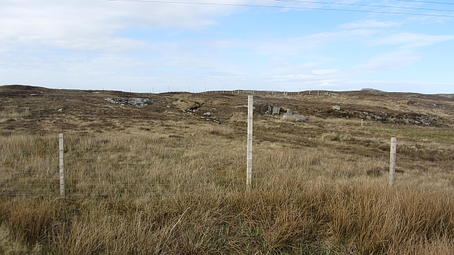
Loch an Fhithich is a picturesque freshwater loch located in Inverness-shire, Scotland. With an area of approximately 100 acres, it is nestled in a serene and tranquil setting, surrounded by rolling hills and lush greenery. The loch is situated about 10 miles southwest of Inverness, making it easily accessible to visitors.

The name "Loch an Fhithich" translates to "Loch of the Raven" in English, and it is believed to have derived from the presence of ravens in the area. The loch is known for its abundant wildlife, offering a haven for various bird species, including ravens, ducks, swans, and herons. It is therefore a popular destination for birdwatchers who can observe these fascinating creatures in their natural habitat.

The water in Loch an Fhithich is crystal clear, and it is fed by several small streams that flow into the loch from the surrounding hills. The loch also boasts a diverse range of aquatic plant life, including lily pads and reeds, creating a vibrant ecosystem. This makes it an ideal spot for nature enthusiasts and photographers.

Visitors to Loch an Fhithich can enjoy activities such as fishing, as the loch is home to a variety of fish species, including trout and pike. Additionally, the tranquil surroundings make it a perfect location for peaceful walks and picnics.

In conclusion, Loch an Fhithich in Inverness-shire offers visitors a breathtaking natural setting, rich in wildlife and plant life. Whether you are interested in birdwatching, fishing, or simply enjoying the beauty of nature, Loch an Fhithich provides a captivating experience for all who visit.

If you have any feedback on the listing, please let us know in the comments section below.

Loch an Fhithich Images

Images are sourced within 2km of 57.480176/-7.211166 or Grid Reference NF8755. Thanks to Geograph Open Source API. All images are credited.

Ruined buildings at Buaile-mhòr
Loch na Faoileag on Grimsay One of many small islets on Loch na Faoileag on the Isle of Grimsay
Loch na Faoileag on Grimsay
One of many small islets on Loch na Faoileag on the Isle of Grimsay
Loch na Faoileag Shoreline A view along the shoreline to north west finger on Loch na Faoileag (Isle of Grimsay) .Taken on the opposite bank from the roadside.
Loch na Faoileag Shoreline
A view along the shoreline to north west finger on Loch na Faoileag (Isle of Grimsay) .Taken on the opposite bank from the roadside.
Loch na Faoileag Cairn A small cairn situated at the south-eastern end of Loch na Faoileag.
Loch na Faoileag Cairn
A small cairn situated at the south-eastern end of Loch na Faoileag.
Bagh Sgotbheinn Not all Hebridean buildings fall into disrepair. I note that Dave Fergusson's 2007 photograph includes this small building, but now, twelve years later it has a new roof and is looking well cared for.
Bagh Sgotbheinn
Not all Hebridean buildings fall into disrepair. I note that Dave Fergusson's 2007 photograph includes this small building, but now, twelve years later it has a new roof and is looking well cared for.
Kallin Harbour, Grimsay
Old harbour, Grimsay A crofthouse sitting on a reclaimed piece of land at Baymore (Bagh mor) which was the main harbour on the island before the Kallin (Ceallan) development.  The harbour is littered with lots of old creels and other flotsam and there are many old stone piers.
Old harbour, Grimsay
A crofthouse sitting on a reclaimed piece of land at Baymore (Bagh mor) which was the main harbour on the island before the Kallin (Ceallan) development. The harbour is littered with lots of old creels and other flotsam and there are many old stone piers.
Kallin Harbour The smaller vessels in the harbour are inshore lobster boats which use creels to trap crabs and lobsters.  The larger vessels are offshore prawn boats which use trawl nets to catch the shellfish.
Kallin Harbour
The smaller vessels in the harbour are inshore lobster boats which use creels to trap crabs and lobsters. The larger vessels are offshore prawn boats which use trawl nets to catch the shellfish.
Cottage on Ronay Ronay
Cottage on Ronay
Ronay
Isle of Ronay View towards North Uist
Isle of Ronay
View towards North Uist
Vallastrome, Kallin The view along the Vallastrome channel towards the biggest hill on the island of Ronaigh. The trig point at 115m can just be seen.
Vallastrome, Kallin
The view along the Vallastrome channel towards the biggest hill on the island of Ronaigh. The trig point at 115m can just be seen.
Coming in to harbour Small fishing boat entering Kallin harbour on a summer evening. This little boat has a 'FY' registration for Fowey in Cornwall, but arrived at Kallin on the back of a lorry. The 'Stelimar'is a local boat based here.
Coming in to harbour
Small fishing boat entering Kallin harbour on a summer evening. This little boat has a 'FY' registration for Fowey in Cornwall, but arrived at Kallin on the back of a lorry. The 'Stelimar'is a local boat based here.
Baymore: postbox № HS6 15 One of four postboxes on the island of Grimsay. Apart from the one on the main road close to the post office, they are emptied at 11:45am on weekdays and at 9:30am on Saturdays.
Baymore: postbox № HS6 15
One of four postboxes on the island of Grimsay. Apart from the one on the main road close to the post office, they are emptied at 11:45am on weekdays and at 9:30am on Saturdays.
Kallin: postbox № HS6 25 One of four postboxes on the island of Grimsay. Apart from the one on the main road close to the post office, they are emptied at 11:45am on weekdays and at 9:30am on Saturdays.
Kallin: postbox № HS6 25
One of four postboxes on the island of Grimsay. Apart from the one on the main road close to the post office, they are emptied at 11:45am on weekdays and at 9:30am on Saturdays.
Kallin: a deer He spotted me as soon as I spotted him!
Kallin: a deer
He spotted me as soon as I spotted him!
Kallin: the harbour Looking across the harbour from the road above.
Kallin: the harbour
Looking across the harbour from the road above.
Kallin: open-air phone box This telephone box is missing two glass panels and also its roof panel, which is leaning against the wall behind the box.
Kallin: open-air phone box
This telephone box is missing two glass panels and also its roof panel, which is leaning against the wall behind the box.
Field, Ceannaraigh The highest ground on Grimsay is out there somewhere.
Field, Ceannaraigh
The highest ground on Grimsay is out there somewhere.
Show me another place!

Loch an Fhithich is located at Grid Ref: NF8755 (Lat: 57.480176, Lng: -7.211166)

Unitary Authority: Na h-Eileanan an Iar

Police Authority: Highlands and Islands

What 3 Words

///scary.breathing.advancing. Near Balivanich, Na h-Eileanan Siar

Related Wikis

Ronay

Ronay (Scottish Gaelic: Rònaigh) is an island in the Outer Hebrides of Scotland, which lies a short distance off the east coast of Grimsay. == Geography... ==

Grimsay

Grimsay (Scottish Gaelic: Griomasaigh) is a tidal island in the Outer Hebrides of Scotland. == Geography == Grimsay is the largest of the low-lying stepping...

Flodaigh

Flodaigh is a tidal island lying to the north of Benbecula and south of Grimsay in the Outer Hebrides, Scotland. It is connected to Benbecula by a causeway...

Fraoch-Eilean

Fraoch-eilean is a small island with an uncertain population north of Benbecula in the Outer Hebrides of Scotland. It is about 55 hectares (140 acres...

Nearby Amenities

Located within 500m of 57.480176,-7.211166
Created By: dmgroom_coastlines
Lat/Long: 57.48047/-7.20645
Bus Stop
Grimsay Island
Naptan AtcoCode: 6010731676
Naptan Bearing: NW
Naptan CommonName: Grimsay Island
Naptan Indicator: Kallin
Naptan Landmark: Kallin
Naptan NaptanCode: 94723498
Naptan Street: Kallin
Naptan Verified: no
Source: naptan_import
Lat/Long: 57.4810779/-7.2060117
Passing Place
Lat/Long: 57.4786823/-7.2187946
Passing Place
Lat/Long: 57.4785401/-7.2080637
Seamark Light Category: vertical
Seamark Light Character: F
Seamark Light Colour: red
Seamark Light Height: 6
Seamark Light Multiple: 2
Seamark Light Range: 5
Seamark Light Reference: A 3999.5
Seamark Type: light_minor
Source: US NGA Pub. 114. 2011-05-26.
Lat/Long: 57.4814369/-7.2048776
Barrier: cattle_grid
Lat/Long: 57.478156/-7.2117571
Passing Place
Lat/Long: 57.481967/-7.2074424
Turning Circle
Turning Circle: knuckle
Lat/Long: 57.4824202/-7.2061075
Passing Place
Lat/Long: 57.4827553/-7.2081865
Barrier: cattle_grid
Lat/Long: 57.4827723/-7.2080232
Ceallan
Alt Name: Na Ceallan
Name En: Kallin
Name Gd: Ceallan
Place: village
Source Name: OS OpenData StreetView
Lat/Long: 57.4810147/-7.2062588
Kallin Harbour
Addr City: Uibhist a Tuath
Addr City En: Isle of North Uist
Addr Country: GB
Addr Postcode: HS6 5HY
Addr Suburb: Grimsay
Alt Name: Calla nan Ceallan
Harbour: yes
Name En: Kallin Harbour
Name Gd: Cala na Ceallan
Seamark Harbour Category: fishing
Seamark Type: harbour
Website: https://www.cne-siar.gov.uk/roads-travel-and-parking/ports-piers-and-harbours
Lat/Long: 57.4820211/-7.2043329
Lady Anne Boat Trips
Facebook: https://www.facebook.com/Lady-Anne-Boat-Trips-150460248330309/
Information: board
Opening Hours: "Dates in April- September by appointment"
Tourism: information
Website: http://www.uistboattrips.com/
Lat/Long: 57.4811676/-7.2045609
Historic: memorial
Memorial: blue_plaque
Lat/Long: 57.4807688/-7.2046404
Kallin Shellfish Shop
Addr City: Uibhist a Tuath
Addr City En: Isle of North Uist
Addr Country: GB
Addr Housenumber: 8
Addr Postcode: HS6 5HY
Addr Suburb: Grimsay
Opening Hours: Mo-Fr 09:00-16:00; Sa 10:00-15:00
Shop: seafood
Website: http://www.kallinshellfish.co.uk
Lat/Long: 57.4783071/-7.2053153
Board Type: notice
Description: Local Notices
Information: board
Tourism: information
Lat/Long: 57.4810003/-7.2053602
Telephone
Booth: KX100
Covered: booth
Mapillary: 426170049394145
Survey Date: 2022-06-20
Lat/Long: 57.4809963/-7.2053254
Cafe
Seafood Cafe
Fhrs Id: 1025638
Lat/Long: 57.4808195/-7.204158
Power: pole
Lat/Long: 57.4776054/-7.2047432
Power: pole
Lat/Long: 57.4774598/-7.2058596
Power: pole
Lat/Long: 57.4773041/-7.2069452
Power: pole
Lat/Long: 57.4779275/-7.2079651
Power: pole
Lat/Long: 57.4783691/-7.2087266
Power: pole
Lat/Long: 57.4788848/-7.2095993
Power: pole
Lat/Long: 57.4794559/-7.2105345
Power: pole
Lat/Long: 57.4768993/-7.2076452
Power: pole
Lat/Long: 57.4766145/-7.2081254
Power: pole
Lat/Long: 57.4786586/-7.2108264
Power: pole
Lat/Long: 57.4800889/-7.2102391
Power: pole
Lat/Long: 57.4807326/-7.2099707
Power: pole
Lat/Long: 57.4821504/-7.2092717
Power: pole
Lat/Long: 57.477369/-7.2175996
Power: pole
Lat/Long: 57.4771157/-7.2170104
Power: pole
Lat/Long: 57.4766813/-7.2159713
Power: pole
Lat/Long: 57.476338/-7.2151305
Power: pole
Lat/Long: 57.4816399/-7.2059877
Power: pole
Lat/Long: 57.4818922/-7.2075259
Power: pole
Lat/Long: 57.4823264/-7.2104986
Power: pole
Lat/Long: 57.4842145/-7.2141156
Power: pole
Lat/Long: 57.4839711/-7.2134614
Power: pole
Lat/Long: 57.4837012/-7.2127536
Power: pole
Lat/Long: 57.4833967/-7.2119677
Power: pole
Lat/Long: 57.4828817/-7.2112592
Passing Place
Lat/Long: 57.4836804/-7.210288
Barrier: cattle_grid
Lat/Long: 57.4825134/-7.2077184
Power: pole
Lat/Long: 57.4840712/-7.211173
Power: pole
Lat/Long: 57.4839566/-7.2122485
Booth: K6
Covered: booth
Disused Amenity: telephone
Man Made: telephone_box
Lat/Long: 57.4785807/-7.2183525
Passing Place
Lat/Long: 57.4841655/-7.2124514
Power: pole
Lat/Long: 57.4838953/-7.2105109
Power: pole
Lat/Long: 57.4842074/-7.2117032
Power: pole
Lat/Long: 57.4784351/-7.2120303
Barrier: cattle_grid
Lat/Long: 57.4781427/-7.2126253
Passing Place
Lat/Long: 57.4785153/-7.208948
Generator Method: photovoltaic
Generator Output Electricity: small_installation
Generator Source: solar
Generator Type: solar_photovoltaic_panel
Power: generator
Lat/Long: 57.4778105/-7.2063548
Power: pole
Lat/Long: 57.4772232/-7.2168883
Power: pole
Lat/Long: 57.4777798/-7.2162929
Power: pole
Lat/Long: 57.4783213/-7.2157055
Power: pole
Lat/Long: 57.4783766/-7.2188141
Power: pole
Lat/Long: 57.4785518/-7.2184775
Passing Place
Lat/Long: 57.4784034/-7.2152049
Turning Circle
Turning Circle: knuckle
Lat/Long: 57.476268/-7.2075604
The data included in this document is from www.openstreetmap.org. The data is made available under ODbL.

Have you been to Loch an Fhithich?

Leave your review of Loch an Fhithich below (or comments, questions and feedback).